Carn Nore

Coastal Feature, Headland, Point in Cornwall

England

Carn Nore

Church Point
Church Point Credit: David Lally

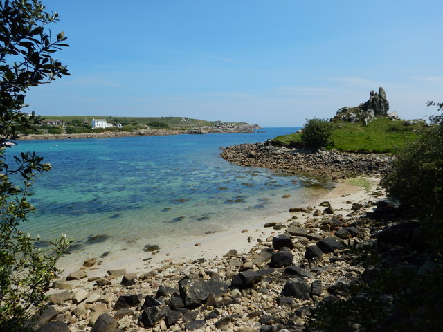
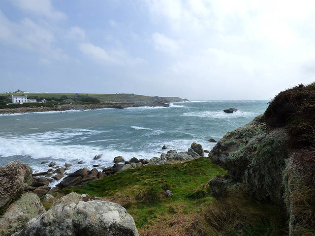
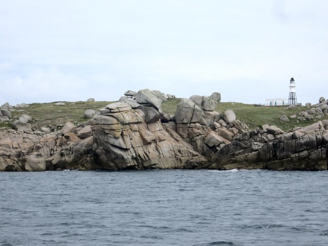
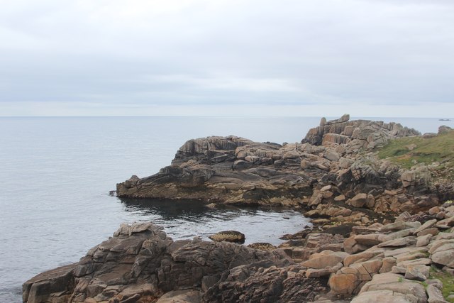
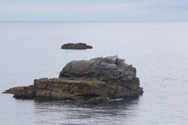
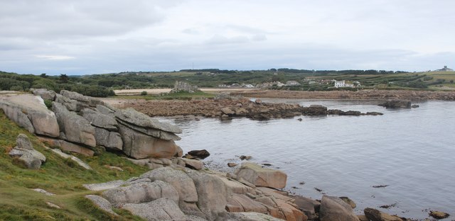
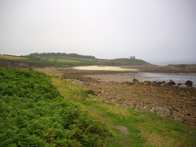
Carn Nore is a prominent headland located in Cornwall, England. Situated on the southwestern coast of the county, it stands as a notable coastal feature that attracts visitors from near and far. The headland is positioned between two popular beaches, offering stunning views of the surrounding landscape and the vast expanse of the Atlantic Ocean.

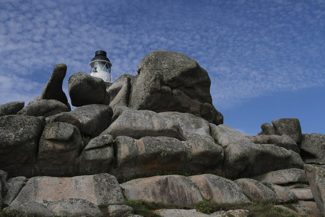
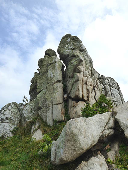
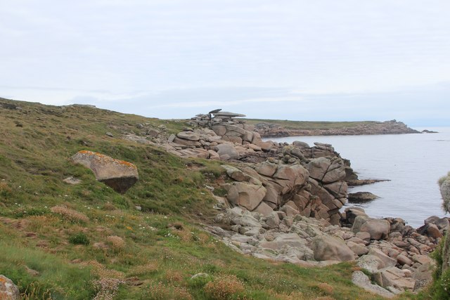
Carn Nore is characterized by its rugged cliffs and rocky outcrops, which make it a scenic and dramatic location. The headland is known for its diverse and abundant wildlife, making it a popular spot for birdwatching enthusiasts. Visitors can often spot various seabirds, including gulls, cormorants, and even the occasional sighting of a peregrine falcon.

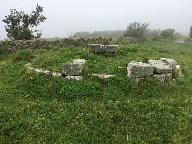
In addition to its natural beauty, Carn Nore holds historical significance. The headland is dotted with remnants of ancient settlements, including Iron Age hillforts and burial mounds. These archaeological sites offer a glimpse into the area's rich past and provide a fascinating backdrop for exploration.

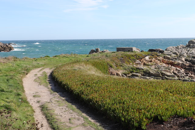
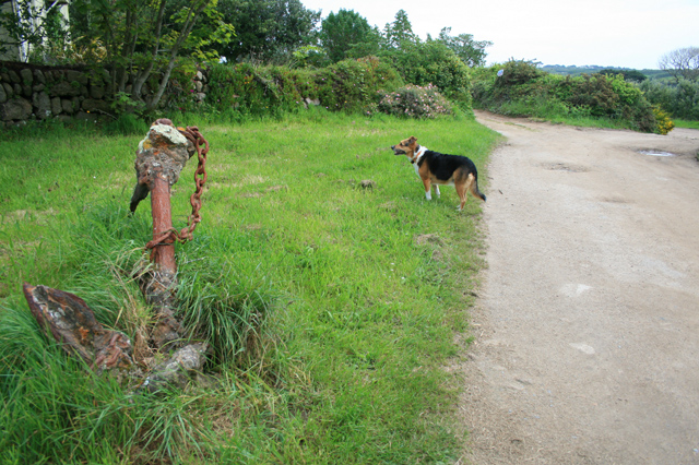
Access to Carn Nore is relatively easy, with a well-maintained footpath leading to the headland from nearby villages. The path offers breathtaking vistas along the way, rewarding hikers with panoramic views of the coastline and the surrounding countryside.

Overall, Carn Nore is a captivating coastal feature that encapsulates the beauty and history of Cornwall. With its stunning cliffs, diverse wildlife, and historical sites, it is a must-visit destination for nature lovers, history enthusiasts, and anyone seeking to experience the charm of the Cornish coast.

If you have any feedback on the listing, please let us know in the comments section below.

Carn Nore Images

Images are sourced within 2km of 49.915915/-6.2828297 or Grid Reference SV9210. Thanks to Geograph Open Source API. All images are credited.

Church Point
Church Point
Pillbox entrance On Tolman Point.
Pillbox entrance
On Tolman Point.
Footpath Passing End of Scilly Isles Runway Wikipedia : <span class="nowrap"><a title="https://en.wikipedia.org/wiki/St_Mary%27s_Airport_(Isles_of_Scilly)" rel="nofollow ugc noopener" href="https://en.wikipedia.org/wiki/St_Mary%27s_Airport_(Isles_of_Scilly)">Link</a><img style="margin-left:2px;" alt="External link" title="External link - shift click to open in new window" src="https://s1.geograph.org.uk/img/external.png" width="10" height="10"/></span>
Footpath Passing End of Scilly Isles Runway
Wikipedia : LinkExternal link
Old Town Bay
Old Town Bay
The turning circle At the end of the runway at Church Point on St Mary's, Isles of Scilly
The turning circle
At the end of the runway at Church Point on St Mary's, Isles of Scilly
Pill box on Tolman Point Near Old Town, St Mary's.
Pill box on Tolman Point
Near Old Town, St Mary's.
Peninnis Head Lighthouse An unusual view of Peninnis Head Lighthouse from the rocks immediately to the south of the building.
Peninnis Head Lighthouse
An unusual view of Peninnis Head Lighthouse from the rocks immediately to the south of the building.
Peninnis Mill Now disused
Peninnis Mill
Now disused
Entrance to Old Town Bay in strong easterly gale with heavy seas
Carn Leh Believed to be the site of an old battery to defend Old Town, St. Marys
Carn Leh
Believed to be the site of an old battery to defend Old Town, St. Marys
Outer Head Peninnis Head Lighthouse Grade II listed <span class="nowrap"><a title="https://www.historicengland.org.uk/listing/the-list/list-entry/1328857" rel="nofollow ugc noopener" href="https://www.historicengland.org.uk/listing/the-list/list-entry/1328857">Link</a><img style="margin-left:2px;" alt="External link" title="External link - shift click to open in new window" src="https://s1.geograph.org.uk/img/external.png" width="10" height="10"/></span>
Outer Head
Peninnis Head Lighthouse Grade II listed LinkExternal link
Stacked pebbles at Old Town Bay
Pulpit Rock
Pulpit Rock
Carrickstarne
Carrickstarne
Piper's Hole
Piper's Hole
Pulpit Rock
Pulpit Rock
Penninis Head Lighthouse Grade II listed <span class="nowrap"><a title="https://www.historicengland.org.uk/listing/the-list/list-entry/1328857" rel="nofollow ugc noopener" href="https://www.historicengland.org.uk/listing/the-list/list-entry/1328857">Link</a><img style="margin-left:2px;" alt="External link" title="External link - shift click to open in new window" src="https://s1.geograph.org.uk/img/external.png" width="10" height="10"/></span>
Penninis Head Lighthouse
Grade II listed LinkExternal link
Show me another place!

Carn Nore is located at Grid Ref: SV9210 (Lat: 49.915915, Lng: -6.2828297)

Division: Isles of Scilly

Unitary Authority: Isles of Scilly

Police Authority: Devon and Cornwall

What 3 Words

///handyman.divisions.cost. Near St Mary's, Isles of Scilly

Related Wikis

Porth Hellick

Porth Hellick (Cornish: Porth Helyk, meaning Willow Cove) is a tidal inlet on the south coast of St Mary’s, the largest island in the Isles of Scilly....

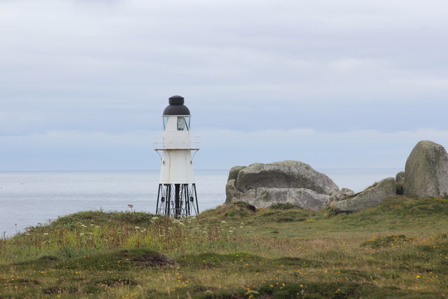
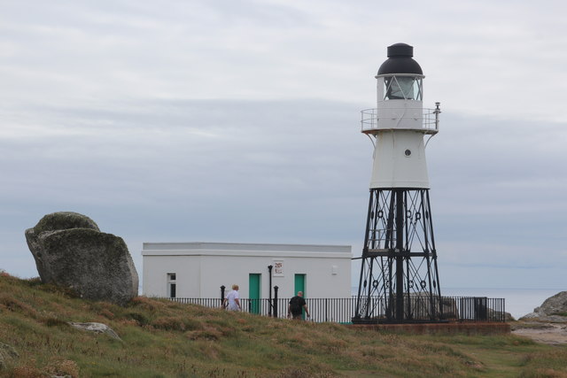
Giant's Castle, Isles of Scilly

The Giant's Castle is a promontory fort of the Iron Age, on St Mary's, Isles of Scilly, England. It is a scheduled monument. == Description == The fort...
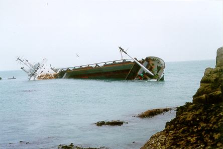
MV Cita

On 26 March 1997, the 300-ft merchant vessel MV Cita pierced its hull when running aground on rocks off the south coast of the Isles of Scilly in gale...

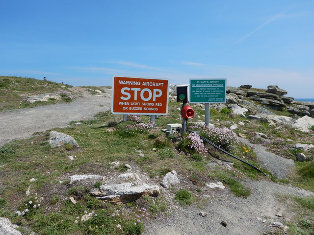
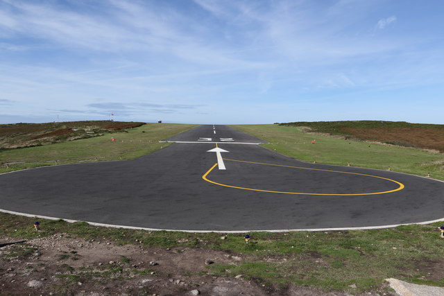
St Mary's Airport, Isles of Scilly

St Mary's Airport or Isles of Scilly Airport (IATA: ISC, ICAO: EGHE) is an airport located 1 nautical mile (1.9 km; 1.2 mi) east of Hugh Town on St Mary...

Normandy, Isles of Scilly

Normandy is a small settlement on the island of St Mary's, the largest of the Isles of Scilly, England. It is located in the east of the island, between...

Longstone, Isles of Scilly

Longstone is small settlement on the island of St Mary's, the largest of the Isles of Scilly, England. Nearby is Holy Vale and Rocky Hill. Longstone is...

Holy Vale

Holy Vale (Cornish: Hal an Val) is a minor valley and small settlement within, on the island of St Mary's, the largest of the Isles of Scilly, England...

Pelistry

Pelistry (Cornish: Porth Lystry "cove for ships") is a small settlement, situated east of Maypole and north of Normandy, in the east of the island of St...

Nearby Amenities

Located within 500m of 49.915915,-6.2828297
Source: PGS
Lat/Long: 49.9162423/-6.2829784
Source: PGS
Lat/Long: 49.9159144/-6.2821365
Source: PGS
Lat/Long: 49.9169328/-6.2834201
Source: PGS
Lat/Long: 49.9166181/-6.2836098
Source: PGS
Lat/Long: 49.9164524/-6.2835598
MV Cita
Historic: wreck
Seamark Type: wreck
Wikidata: Q6719379
Wikipedia: en:MV Cita
Wreck Visible At Low Tide: no
Lat/Long: 49.912676/-6.279583
Porth Hellick Down Burial Chamber
Alt Name: Porth Hellick Down
Archaeological Site: megalith
Heritage: 2
Heritage Operator: he
Heritage Website: https://historicengland.org.uk/listing/the-list/list-entry/1011950
Historic: archaeological_site
Historic Civilization: prehistoric
Historic Period: bronze-age
Material: stone
Megalith Type: dolmen
Ref He: 1011950
Website: https://www.english-heritage.org.uk/visit/places/porth-hellick-down-burial-chamber
Wikidata: Q17675904
Lat/Long: 49.9186812/-6.280577
Post Box
Ref: TR21 178
Lat/Long: 49.9199372/-6.2859196
Porth Hellick
Natural: bay
Wikidata: Q7231737
Wikipedia: en:Porth Hellick
Lat/Long: 49.9161679/-6.2847408
Salakee Down
Place: locality
Lat/Long: 49.9126221/-6.2870477
Jacky's Point
Place: locality
Lat/Long: 49.9180462/-6.2777868
Porth Hellick Down
Place: locality
Wikidata: Q7231738
Wikipedia: en:Porth Hellick Down
Lat/Long: 49.9177423/-6.2812201
Porth Hellick Point
Place: locality
Lat/Long: 49.9151447/-6.2794176
Carn Friars
Place: isolated_dwelling
Lat/Long: 49.9197781/-6.284875
Porth Loggos
Natural: bay
Source: OS Open Names
Lat/Long: 49.9133442/-6.2826535
The data included in this document is from www.openstreetmap.org. The data is made available under ODbL.

Have you been to Carn Nore?

Leave your review of Carn Nore below (or comments, questions and feedback).