Craig of Ness

Cliff, Slope in Orkney

Scotland

Craig of Ness

Heatherhouse New bungalow on the Tankerness peninsula. The waters of Deer Sound can be seen beyond.
Heatherhouse Credit: Oliver Dixon

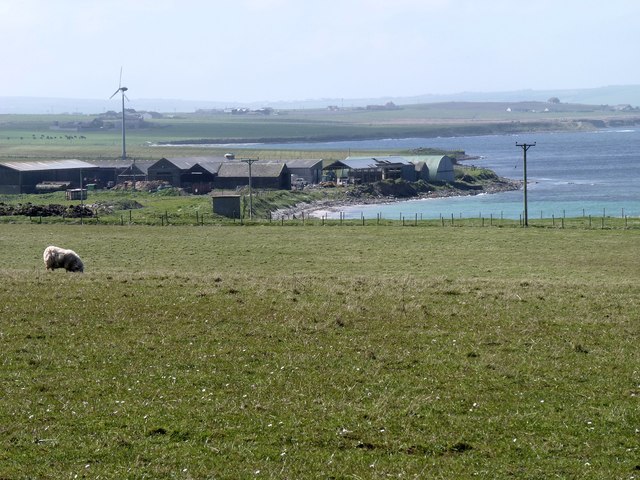
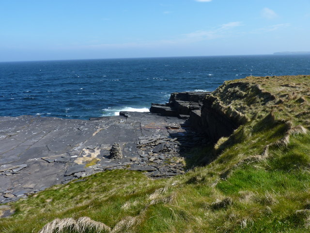
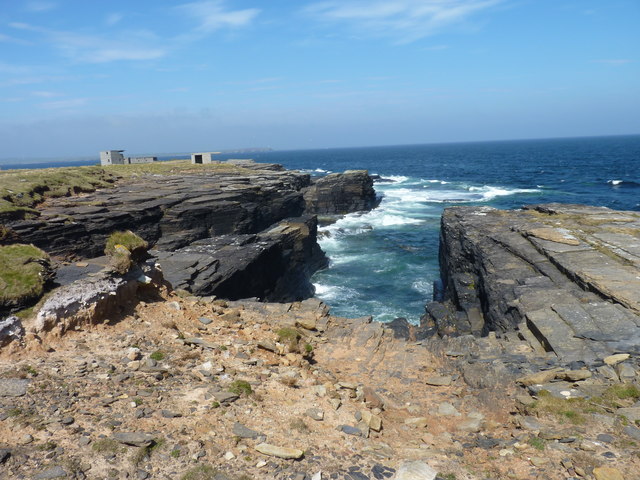
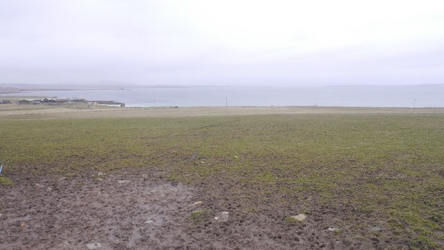
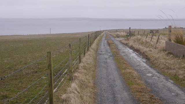
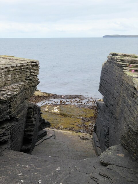
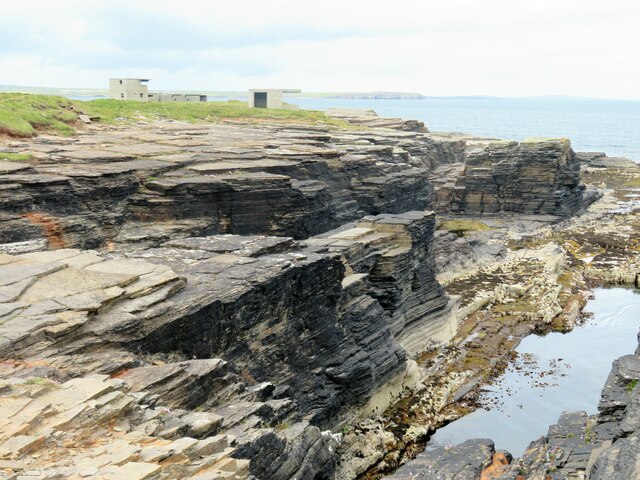
Craig of Ness is a prominent cliff located on the island of Orkney, situated off the northeastern coast of Scotland. Rising majestically from the rugged coastline, it is a prominent landmark that offers breathtaking views of the surrounding landscape. The cliff is known for its steep slopes, which are covered in lush vegetation, creating a striking contrast against the gray rock formations.

Standing at an impressive height of around 100 meters, Craig of Ness is composed of layers of Old Red Sandstone, dating back millions of years. These sedimentary rocks display a rich array of colors, ranging from deep reds to vibrant oranges, adding to the visual appeal of the cliff.

The cliff face is home to a diverse range of bird species, making it a popular spot for birdwatching enthusiasts. Fulmars, kittiwakes, and razorbills can be spotted nesting in the crevices of the rocks, while seabirds like gulls and shags can be seen soaring above the crashing waves.

For those seeking adventure, Craig of Ness offers opportunities for rock climbing and abseiling, attracting thrill-seekers from near and far. However, caution is advised as the cliffs can be treacherous, and only experienced climbers should attempt to scale its heights.

Overall, Craig of Ness is a natural wonder that showcases the rugged beauty of Orkney. Whether you are an avid nature lover, a thrill-seeker, or simply someone seeking solace in the midst of stunning scenery, this cliff is a must-visit destination that will leave you in awe of its grandeur.

If you have any feedback on the listing, please let us know in the comments section below.

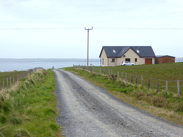
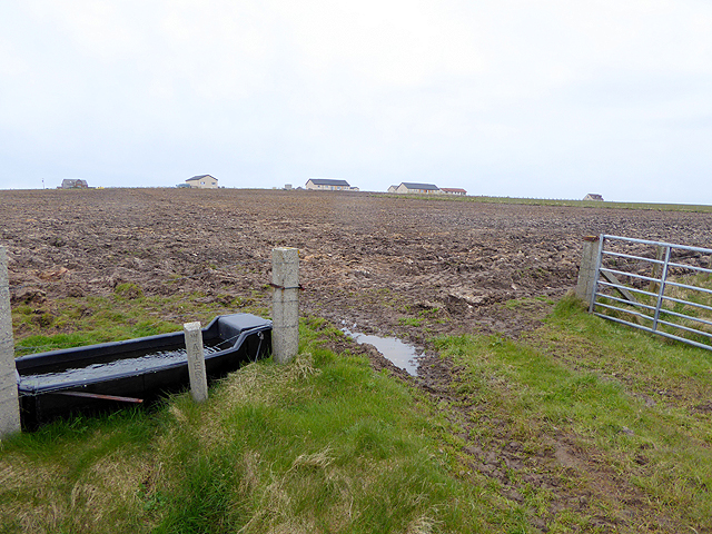
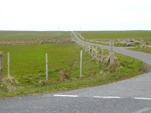
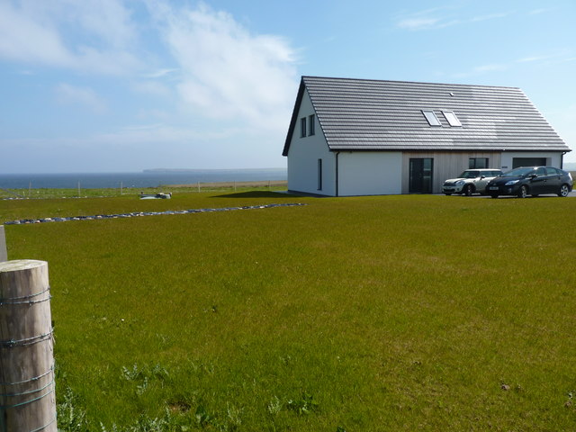
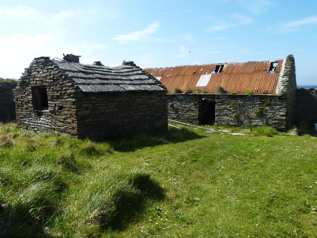
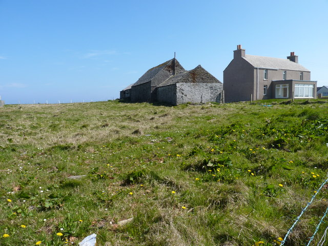
Craig of Ness Images

Images are sourced within 2km of 58.97304/-2.7932223 or Grid Reference HY5409. Thanks to Geograph Open Source API. All images are credited.

Heatherhouse New bungalow on the Tankerness peninsula. The waters of Deer Sound can be seen beyond.
Heatherhouse
New bungalow on the Tankerness peninsula. The waters of Deer Sound can be seen beyond.
Ploughed field on Skibbowick Hill The houses on the skyline are off the Tankerness Hall Road <a href="https://www.geograph.org.uk/gridref/HY5309">HY5309</a>. The bungalow with the red roof can be seen in closeup in <a href="https://www.geograph.org.uk/photo/4524566">HY5309 : Modern bungalow on Fea Hill</a>.
Ploughed field on Skibbowick Hill
The houses on the skyline are off the Tankerness Hall Road HY5309. The bungalow with the red roof can be seen in closeup in HY5309 : Modern bungalow on Fea Hill.
Tankerness Hall Road The eastern end of the road is a cul de sac leading to Holland and Boondatoon only.
Tankerness Hall Road
The eastern end of the road is a cul de sac leading to Holland and Boondatoon only.
Disused enclosure The walls that remain are of substantial looking dry stone construction.
Disused enclosure
The walls that remain are of substantial looking dry stone construction.
Modern house On the road towards Rerwick Head. The island on the horizon is Stronsay.
Modern house
On the road towards Rerwick Head. The island on the horizon is Stronsay.
Farm buildings at Heatherhouse Seen from the road to Rerwick Head.
Farm buildings at Heatherhouse
Seen from the road to Rerwick Head.
Rock platform Someone has taken the trouble to build a small cairn of broken laminar rock fragments.
Rock platform
Someone has taken the trouble to build a small cairn of broken laminar rock fragments.
Coastal rocks Looking towards Rerwick head and the remains of WW1 and WW2 defences.
Coastal rocks
Looking towards Rerwick head and the remains of WW1 and WW2 defences.
Room with a view The room may have vanished but the view (of Shapinsay Sound) is still there.
Room with a view
The room may have vanished but the view (of Shapinsay Sound) is still there.
Abandoned croft Buildings at Rerwick.
Abandoned croft
Buildings at Rerwick.
Grunkeys farm On the OS map it is named Boondatoon but there is a signeboard in the garden beside it with the name Grunkeys.
Grunkeys farm
On the OS map it is named Boondatoon but there is a signeboard in the garden beside it with the name Grunkeys.
Ditch, Tankerness
Ditch, Tankerness
Ditch digging, Tankerness
Boondatoon Pasture on the northern end of Tankerness.
Boondatoon
Pasture on the northern end of Tankerness.
Road to Rerwick Head Leaving the tar at Boondatoon.
Road to Rerwick Head
Leaving the tar at Boondatoon.
Coastal rock architecture The ubiquitous Orkney flagstones of Devonian age dipping gently into the sea at this point. A natural arch is shown on the map close by, but if it does exist it must be more of a tunnel under some rather loose looking rocks.
Coastal rock architecture
The ubiquitous Orkney flagstones of Devonian age dipping gently into the sea at this point. A natural arch is shown on the map close by, but if it does exist it must be more of a tunnel under some rather loose looking rocks.
Coastline at Rerwick Head Low cliffs of Orkney flagstone with old WW2 defences in the distance.
Coastline at Rerwick Head
Low cliffs of Orkney flagstone with old WW2 defences in the distance.
Holland One of the many places in the Northern Isles named Holland or Houlland.
Holland
One of the many places in the Northern Isles named Holland or Houlland.
Show me another place!

Craig of Ness is located at Grid Ref: HY5409 (Lat: 58.97304, Lng: -2.7932223)

Unitary Authority: Orkney Islands

Police Authority: Highlands and Islands

What 3 Words

///embarks.retailing.economics. Near Tankerness, Orkney Islands

Related Wikis

Loch of Tankerness

Loch of Tankerness is a large, lowland, freshwater loch on the Orkney mainland in Scotland. The loch is roughly triangular in shape and is shallow with...

Deerness

Deerness (, locally , Old Norse: Dyrnes) is a quoad sacra parish (i.e. one created and functioning for ecclesiastical purposes only) and peninsula in Mainland...

Tankerness

Tankerness is a district in the St Andrews parish in Mainland, Orkney, Scotland. Essentially a peninsula, it is about 13 kilometres (8 mi) south-east of...

St Andrews, Orkney

St Andrews is a parish on Mainland, Orkney in Scotland. It is located east of the town of Kirkwall and the parish of St Ola and lies north of Holm and...

Toab, Orkney

Toab is a parish on the Orkney Mainland, situated in the East Mainland. Toab is located off the A960 road at the head of Deer Sound on the Mainland, Orkney...

The Gloup

The Gloup () is a collapsed sea cave in the Mull Head Nature Reserve in the islands of Orkney, Scotland. The name derives from the Old Norse "gluppa",...

Mine Howe

Mine Howe is an Iron Age subterranean man-made chamber dug 6 meters (20 feet) deep inside a large mound. It is located in the Tankerness area of Orkney...

St Peter's Pool, Orkney

St Peter's Pool is a bay in the East Mainland of Orkney, Scotland. This bay was the site of significant coastal defences during World War II, when a German...

Nearby Amenities

Located within 500m of 58.97304,-2.7932223
Long Geo
Place: locality
Lat/Long: 58.9702187/-2.7916025
Castle of Bothege
Place: locality
Lat/Long: 58.9686259/-2.7916454
The Brough
Place: locality
Lat/Long: 58.9752732/-2.7925252
Murton
Place: locality
Lat/Long: 58.9722871/-2.792375
Craig of Ness
Place: locality
Lat/Long: 58.9736032/-2.7935122
Castle of Hoss
Place: locality
Lat/Long: 58.9746429/-2.7925681
The Churn
Place: locality
Lat/Long: 58.9714796/-2.7922462
Long Kist
Place: locality
Lat/Long: 58.9769321/-2.7934049
Castle of Hangie Bay
Place: locality
Lat/Long: 58.9765561/-2.7934908
Hangie Bay
Natural: bay
Lat/Long: 58.9771988/-2.7935261
Power: pole
Lat/Long: 58.9690442/-2.7943162
Power: pole
Lat/Long: 58.9697128/-2.795857
Power: pole
Lat/Long: 58.9704773/-2.797717
Power: pole
Lat/Long: 58.9712041/-2.7994638
Power: pole
Lat/Long: 58.9718208/-2.8009619
The data included in this document is from www.openstreetmap.org. The data is made available under ODbL.

Have you been to Craig of Ness?

Leave your review of Craig of Ness below (or comments, questions and feedback).