Sand of Ness

Beach in Orkney

Scotland

Sand of Ness

Heatherhouse New bungalow on the Tankerness peninsula. The waters of Deer Sound can be seen beyond.
Heatherhouse Credit: Oliver Dixon

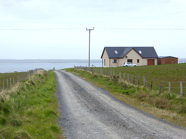
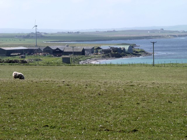
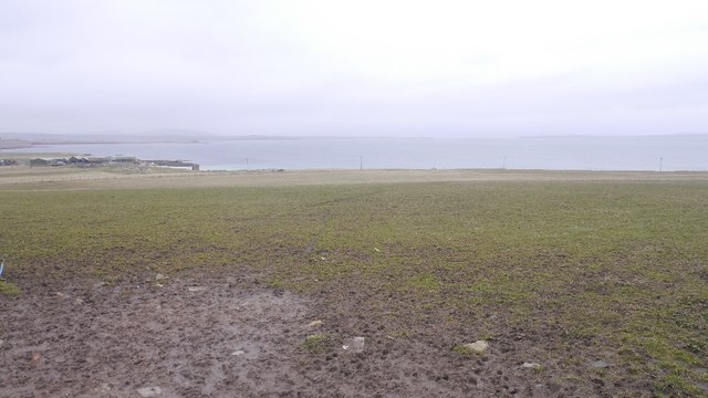
Sand of Ness is a picturesque beach located on the Orkney Islands, situated off the northeastern coast of Scotland. Nestled on the rugged coastline, it provides visitors with a stunning panoramic view of the North Sea. The beach is known for its soft, golden sand and crystal-clear turquoise waters, making it a popular destination for locals and tourists alike.

Measuring approximately half a mile in length, Sand of Ness offers ample space for sunbathing, picnicking, and leisurely walks. The beach is backed by gentle sand dunes, adorned with tufts of grass and wildflowers, adding to its natural beauty. With its remote location, Sand of Ness offers a peaceful and tranquil atmosphere, perfect for relaxation and unwinding.

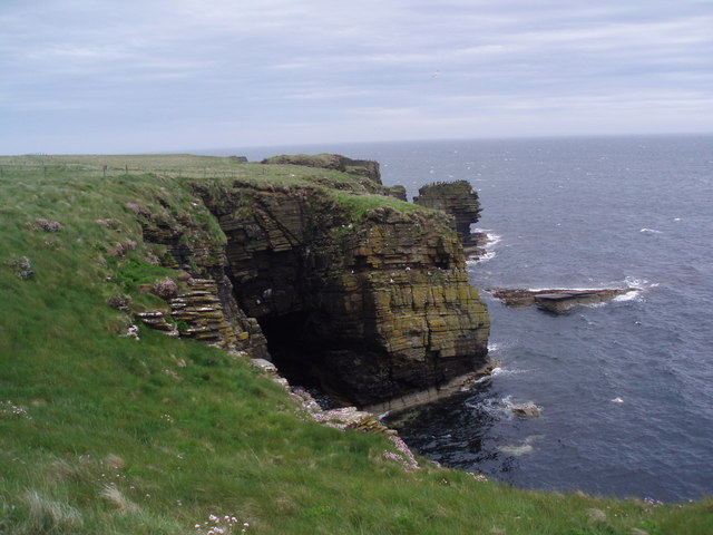
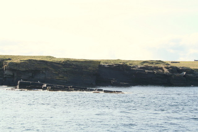
The beach is not only visually appealing, but also offers a range of activities for visitors to enjoy. The calm waters make it a great spot for swimming, while the coastal breeze provides ideal conditions for kite flying and windsurfing. Nature enthusiasts can explore the nearby sandstone cliffs, which are home to various bird species, including puffins and guillemots.

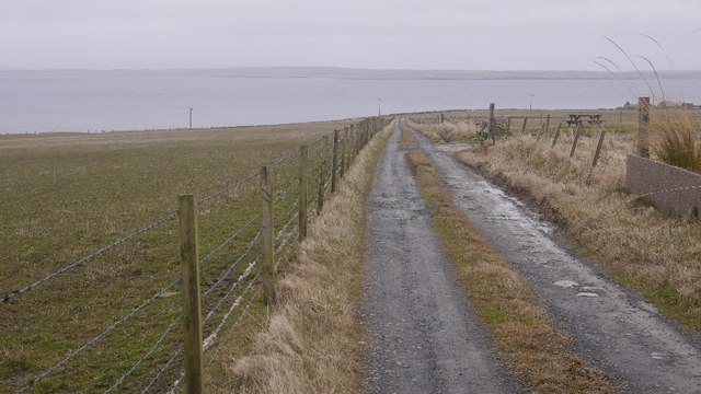
Sand of Ness is easily accessible by car, with a car park conveniently located nearby. Facilities such as toilets and a café can also be found in close proximity, ensuring that visitors have all the amenities they need for a pleasant day at the beach.

Overall, Sand of Ness is a hidden gem on the Orkney Islands, offering a serene and picturesque setting for beachgoers to enjoy the beauty of nature and the tranquility of the North Sea.

If you have any feedback on the listing, please let us know in the comments section below.

Sand of Ness Images

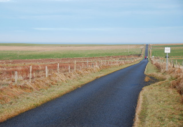
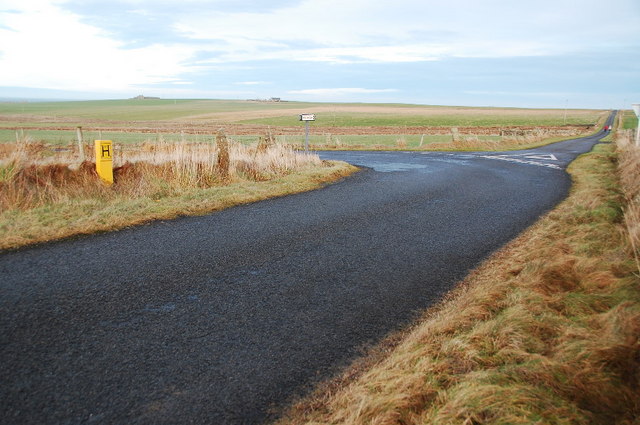
Images are sourced within 2km of 58.968234/-2.799181 or Grid Reference HY5409. Thanks to Geograph Open Source API. All images are credited.

Heatherhouse New bungalow on the Tankerness peninsula. The waters of Deer Sound can be seen beyond.
Heatherhouse
New bungalow on the Tankerness peninsula. The waters of Deer Sound can be seen beyond.
Ploughed field on Skibbowick Hill The houses on the skyline are off the Tankerness Hall Road <a href="https://www.geograph.org.uk/gridref/HY5309">HY5309</a>. The bungalow with the red roof can be seen in closeup in <a href="https://www.geograph.org.uk/photo/4524566">HY5309 : Modern bungalow on Fea Hill</a>.
Ploughed field on Skibbowick Hill
The houses on the skyline are off the Tankerness Hall Road HY5309. The bungalow with the red roof can be seen in closeup in HY5309 : Modern bungalow on Fea Hill.
Tankerness Hall Road The eastern end of the road is a cul de sac leading to Holland and Boondatoon only.
Tankerness Hall Road
The eastern end of the road is a cul de sac leading to Holland and Boondatoon only.
Disused enclosure The walls that remain are of substantial looking dry stone construction.
Disused enclosure
The walls that remain are of substantial looking dry stone construction.
Modern house On the road towards Rerwick Head. The island on the horizon is Stronsay.
Modern house
On the road towards Rerwick Head. The island on the horizon is Stronsay.
Farm buildings at Heatherhouse Seen from the road to Rerwick Head.
Farm buildings at Heatherhouse
Seen from the road to Rerwick Head.
Grunkeys farm On the OS map it is named Boondatoon but there is a signeboard in the garden beside it with the name Grunkeys.
Grunkeys farm
On the OS map it is named Boondatoon but there is a signeboard in the garden beside it with the name Grunkeys.
Ditch, Tankerness
Ditch, Tankerness
Ditch digging, Tankerness
Boondatoon Pasture on the northern end of Tankerness.
Boondatoon
Pasture on the northern end of Tankerness.
Road to Rerwick Head Leaving the tar at Boondatoon.
Road to Rerwick Head
Leaving the tar at Boondatoon.
Holland One of the many places in the Northern Isles named Holland or Houlland.
Holland
One of the many places in the Northern Isles named Holland or Houlland.
Hangie Bay , Tankerness Dramatic coastline east mainland , Orkney - Cormorants and Fulmars both nesting and perching on the cliffs.
Hangie Bay , Tankerness
Dramatic coastline east mainland , Orkney - Cormorants and Fulmars both nesting and perching on the cliffs.
Heatherhoose and farm Island of Shapinsay in the background.
Heatherhoose and farm
Island of Shapinsay in the background.
Skerry to the south of  Lee Taing
Skerry to the south of Lee Taing
The Auskerry Protocol (#1) Heading along Tankerness Hall Road, which makes it sound very urban. Single track road, with passing places. Follow the line of the road and there is a lighthouse, way off in the distance...
The Auskerry Protocol (#1)
Heading along Tankerness Hall Road, which makes it sound very urban. Single track road, with passing places. Follow the line of the road and there is a lighthouse, way off in the distance...
Passing Place (for optimists) I wouldn't like to try and get my car in there.
Passing Place (for optimists)
I wouldn't like to try and get my car in there.
Straight on to Rerwick Head The road bends sharply left and loops around this part of Tankerness. The minor lane continues straight on and would have been busy during the war, leading to the defences at Rerwick Head.
Straight on to Rerwick Head
The road bends sharply left and loops around this part of Tankerness. The minor lane continues straight on and would have been busy during the war, leading to the defences at Rerwick Head.
Show me another place!

Sand of Ness is located at Grid Ref: HY5409 (Lat: 58.968234, Lng: -2.799181)

Unitary Authority: Orkney Islands

Police Authority: Highlands and Islands

What 3 Words

///knots.apartment.skewing. Near Tankerness, Orkney Islands

Related Wikis

Loch of Tankerness

Loch of Tankerness is a large, lowland, freshwater loch on the Orkney mainland in Scotland. The loch is roughly triangular in shape and is shallow with...

Tankerness

Tankerness is a district in the St Andrews parish in Mainland, Orkney, Scotland. Essentially a peninsula, it is about 13 kilometres (8 mi) south-east of...

Deerness

Deerness (, locally , Old Norse: Dyrnes) is a quoad sacra parish (i.e. one created and functioning for ecclesiastical purposes only) and peninsula in Mainland...

St Andrews, Orkney

St Andrews is a parish on Mainland, Orkney in Scotland. It is located east of the town of Kirkwall and the parish of St Ola and lies north of Holm and...

Toab, Orkney

Toab is a parish on the Orkney Mainland, situated in the East Mainland. Toab is located off the A960 road at the head of Deer Sound on the Mainland, Orkney...

Mine Howe

Mine Howe is an Iron Age subterranean man-made chamber dug 6 meters (20 feet) deep inside a large mound. It is located in the Tankerness area of Orkney...

St Peter's Pool, Orkney

St Peter's Pool is a bay in the East Mainland of Orkney, Scotland. This bay was the site of significant coastal defences during World War II, when a German...

The Gloup

The Gloup () is a collapsed sea cave in the Mull Head Nature Reserve in the islands of Orkney, Scotland. The name derives from the Old Norse "gluppa",...

Nearby Amenities

Located within 500m of 58.968234,-2.799181
The Ness
Place: locality
Lat/Long: 58.9673648/-2.7942203
Long Geo
Place: locality
Lat/Long: 58.9702187/-2.7916025
Castle of Bothege
Place: locality
Lat/Long: 58.9686259/-2.7916454
Bothe Geo
Place: locality
Lat/Long: 58.9683383/-2.7907227
Castle of Suckrow
Place: locality
Lat/Long: 58.9673538/-2.7927827
Sand of Ness
Place: locality
Lat/Long: 58.9686369/-2.800722
Power: pole
Lat/Long: 58.9690442/-2.7943162
Power: pole
Lat/Long: 58.9697128/-2.795857
Power: pole
Lat/Long: 58.9704773/-2.797717
Power: pole
Lat/Long: 58.9712041/-2.7994638
Power: pole
Lat/Long: 58.9718208/-2.8009619
The data included in this document is from www.openstreetmap.org. The data is made available under ODbL.

Have you been to Sand of Ness?

Leave your review of Sand of Ness below (or comments, questions and feedback).