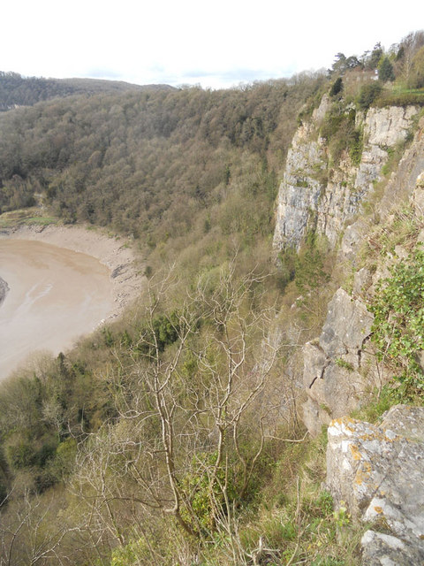
Ban-y-gor Rocks

Cliff, Slope in Gloucestershire Forest of Dean

England

Ban-y-gor Rocks

Part of the Wye Valley Walk in Wyndcliff wood If there is one criticism of the WVW in this section it is that you don't get to see much of the River Wye, but, you do get to see varied woodlands, and an  appreciation of the valley's history, geology, ecology and industrial heritage.
Part of the Wye Valley Walk in Wyndcliff wood Credit: Jeremy Bolwell

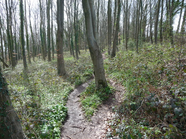
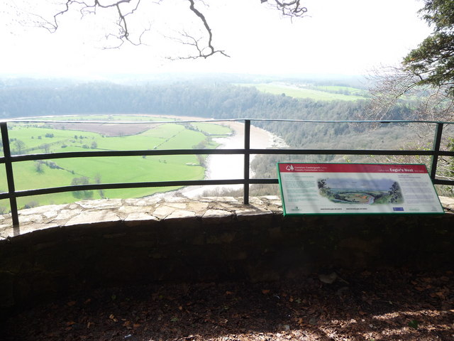
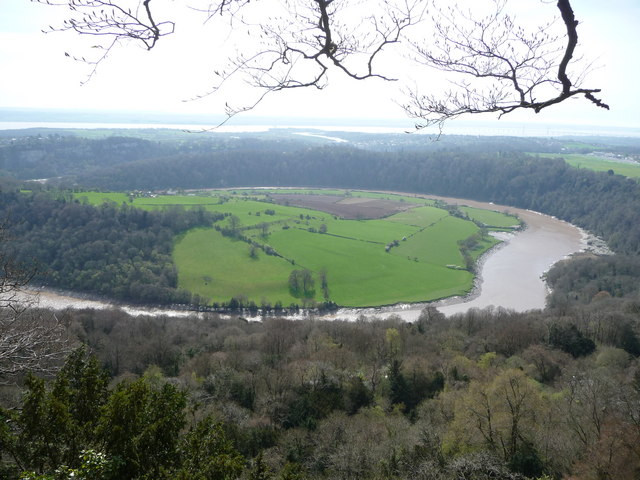
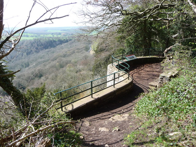
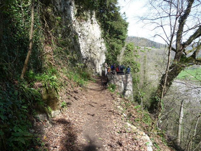
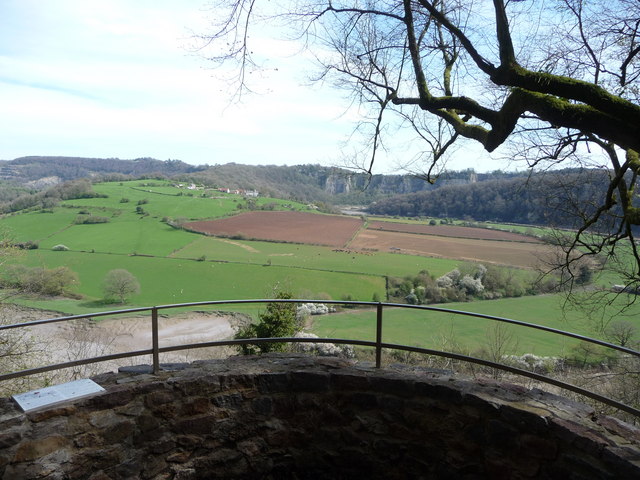
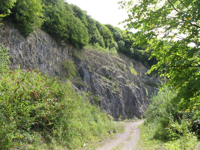
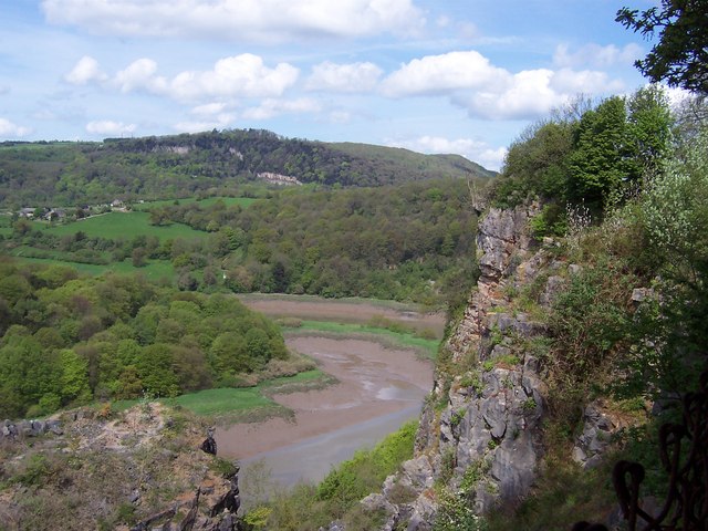
Ban-y-gor Rocks, located in Gloucestershire, England, is a prominent and picturesque cliff formation that attracts nature enthusiasts and outdoor adventurers alike. Rising majestically over the surrounding landscape, the rocks provide breathtaking views of the countryside and are known for their geological significance.

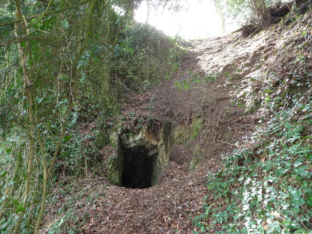
Situated on a sloping hillside, Ban-y-gor Rocks offer a unique combination of natural beauty and historical charm. Composed primarily of limestone, the cliffs showcase fascinating rock formations, featuring intricate patterns and textures that have developed over millions of years. These formations are the result of various geological processes such as erosion and weathering, giving the rocks their distinctive appearance.

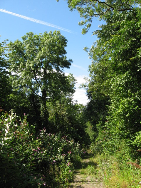
The site is a haven for wildlife, with numerous plant and animal species calling it home. The cliff face provides nesting grounds for various birds, including peregrine falcons and kestrels, while the surrounding slopes are adorned with a rich variety of wildflowers and grasses. Exploring the area, visitors may also encounter small mammals such as rabbits and foxes, adding to the overall biodiversity of the location.

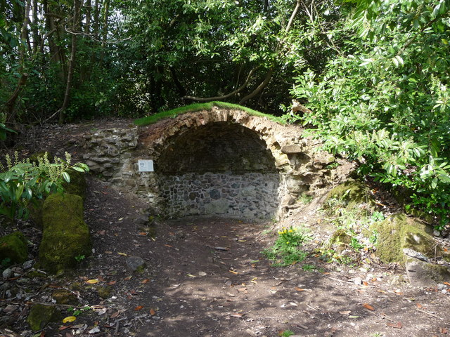
Aside from its natural beauty, Ban-y-gor Rocks also have historical significance. The cliffs have been used as a reference point for centuries, with their distinctive shape and strategic location making them a prominent landmark for travelers and local communities. Additionally, the rocks have featured in folklore and local legends, adding an element of mystery and intrigue to the site's allure.

Overall, Ban-y-gor Rocks in Gloucestershire offer a captivating blend of geological wonders, stunning vistas, and historical importance. Whether one is interested in nature, photography, or simply enjoying the outdoors, this cliff formation provides an enriching experience for visitors of all ages.

If you have any feedback on the listing, please let us know in the comments section below.

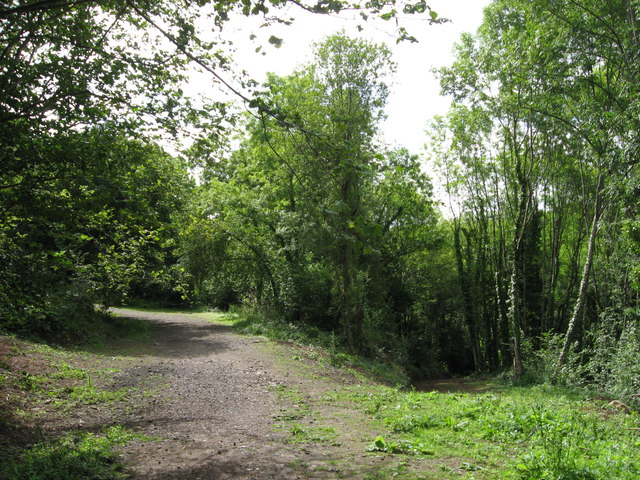
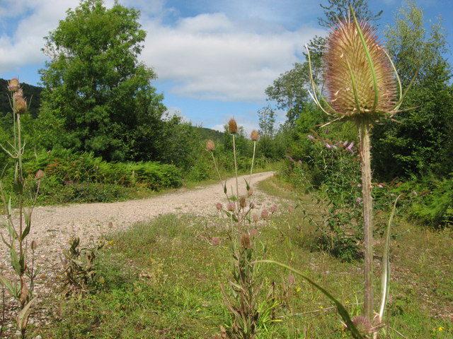
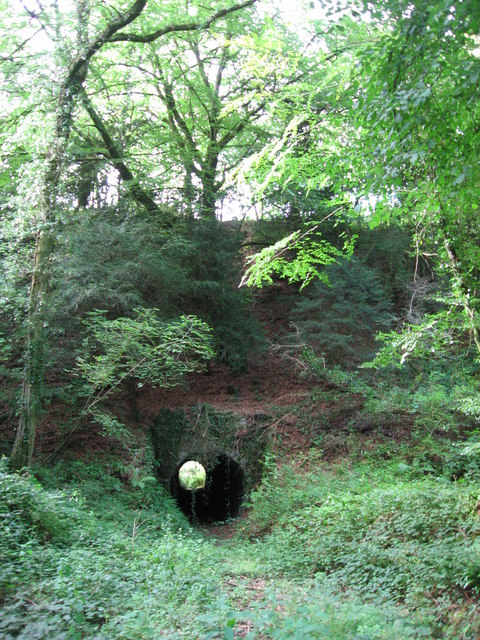
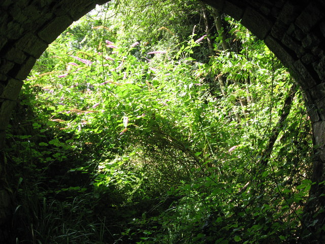
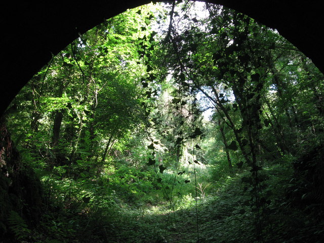
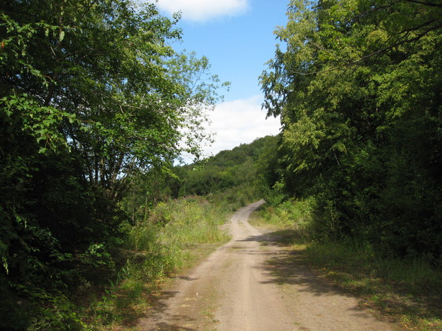
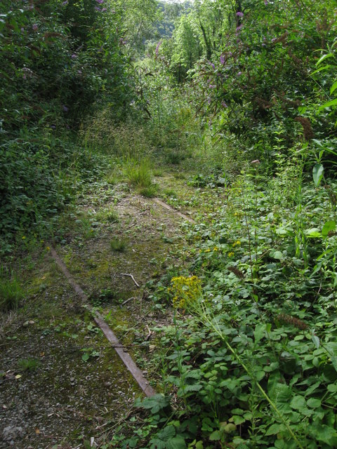
Ban-y-gor Rocks Images

Images are sourced within 2km of 51.669144/-2.6614455 or Grid Reference ST5496. Thanks to Geograph Open Source API. All images are credited.

Part of the Wye Valley Walk in Wyndcliff wood If there is one criticism of the WVW in this section it is that you don't get to see much of the River Wye, but, you do get to see varied woodlands, and an  appreciation of the valley's history, geology, ecology and industrial heritage.
Part of the Wye Valley Walk in Wyndcliff wood
If there is one criticism of the WVW in this section it is that you don't get to see much of the River Wye, but, you do get to see varied woodlands, and an appreciation of the valley's history, geology, ecology and industrial heritage.
The Eagle's Nest viewpoint on the Wynd Cliff The information board fitted by the Forestry Commission tells of how this viewpoint got its name and what can be viewed. A beautiful spot that I never tire of revisiting.
The Eagle's Nest viewpoint on the Wynd Cliff
The information board fitted by the Forestry Commission tells of how this viewpoint got its name and what can be viewed. A beautiful spot that I never tire of revisiting.
The Lancaut peninsula from the Eagle's Nest The huge curve in the Wye is a well-known view with Chepstow and the Severn Bridges beyond.
The Lancaut peninsula from the Eagle's Nest
The huge curve in the Wye is a well-known view with Chepstow and the Severn Bridges beyond.
The Eagle's Nest An excellent spot for a rest, a brew and some lunch.
The Eagle's Nest
An excellent spot for a rest, a brew and some lunch.
A group of walkers at the Giant's Cave in the Wye Valley This group of retired walkers were enjoying the viewing platform just outside the Giant's Cave as I approached and was spotted by their little dog. They were a mix of local and not so local fellers who were enjoying their firm friendships, relaxed banter, outdoor exercise and the good weather. Not a bad way to spend some of your retirement.
A group of walkers at the Giant's Cave in the Wye Valley
This group of retired walkers were enjoying the viewing platform just outside the Giant's Cave as I approached and was spotted by their little dog. They were a mix of local and not so local fellers who were enjoying their firm friendships, relaxed banter, outdoor exercise and the good weather. Not a bad way to spend some of your retirement.
The northern entrance to the Giant's Cave on the Wye Valley Walk Yes, you are expected to enter or exit through this aperture. It's easier and more fun than it looks. One of many interesting features on this section of the WVW.
The northern entrance to the Giant's Cave on the Wye Valley Walk
Yes, you are expected to enter or exit through this aperture. It's easier and more fun than it looks. One of many interesting features on this section of the WVW.
View from the Giant's Cave viewing platform The view across the graceful curve of the River Wye onto the Lancaut peninsula and above that up to Wintour's Leap and the great cliffs near Woodcroft.
View from the Giant's Cave viewing platform
The view across the graceful curve of the River Wye onto the Lancaut peninsula and above that up to Wintour's Leap and the great cliffs near Woodcroft.
The Grotto in Piercefield Woods This feature, along with several others on a similar 'Romantic' theme, was installed in Piercefield Park and woods and comprised part of a tour through this area between around 1760 and maybe the 1820's. Gentry came from various parts of the country and toured the Wye Valley inspecting folly's, caves, walks, viewpoints and landscapes and often recording their opinions and thoughts in journals and publications. Originally this grotto was of course larger, more complete and lined inside with 'glittering crystalline minerals, glass fragments and iron and copper slag'. This would have created an elaborate decorated effect intended to mimic naturally occurring outcrops. I'm glad to see the Piercefield Walks features receiving some improvement.
The Grotto in Piercefield Woods
This feature, along with several others on a similar 'Romantic' theme, was installed in Piercefield Park and woods and comprised part of a tour through this area between around 1760 and maybe the 1820's. Gentry came from various parts of the country and toured the Wye Valley inspecting folly's, caves, walks, viewpoints and landscapes and often recording their opinions and thoughts in journals and publications. Originally this grotto was of course larger, more complete and lined inside with 'glittering crystalline minerals, glass fragments and iron and copper slag'. This would have created an elaborate decorated effect intended to mimic naturally occurring outcrops. I'm glad to see the Piercefield Walks features receiving some improvement.
Cliff by the River Wye
Path along course of Wye Valley Railway near Tintern The railway line carried on straight ahead at this point, through the trees. Walkers now have a choice and can drop down right, or go up to the left.
Path along course of Wye Valley Railway near Tintern
The railway line carried on straight ahead at this point, through the trees. Walkers now have a choice and can drop down right, or go up to the left.
Path junction in woods near River Wye
Tunnel beneath disused railway line near Tintern Quarry
(No) light at the end of the tunnel The path at the western end of the tunnel (<a href="https://www.geograph.org.uk/photo/2544718">ST5498 : Tunnel beneath disused railway line near Tintern Quarry</a>) is very overgrown and currently impassable.
(No) light at the end of the tunnel
The path at the western end of the tunnel (ST5498 : Tunnel beneath disused railway line near Tintern Quarry) is very overgrown and currently impassable.
Path from tunnel under railway near Tintern Quarry The view from the eastern portal of <a href="https://www.geograph.org.uk/photo/2544718">ST5498 : Tunnel beneath disused railway line near Tintern Quarry</a> shows an overgrown, but still passable path.
Path from tunnel under railway near Tintern Quarry
The view from the eastern portal of ST5498 : Tunnel beneath disused railway line near Tintern Quarry shows an overgrown, but still passable path.
Path near Tintern Quarry
Disused railway near Tintern Quarry The rails are still in place, though obviously have not seen a train for many years!
Disused railway near Tintern Quarry
The rails are still in place, though obviously have not seen a train for many years!
Part of Tintern Quarry
Footpath near Tintern Quarry
Show me another place!

Ban-y-gor Rocks is located at Grid Ref: ST5496 (Lat: 51.669144, Lng: -2.6614455)

Administrative County: Gloucestershire

District: Forest of Dean

Police Authority: Gloucestershire

What 3 Words

///agree.solving.blown. Near Chepstow, Monmouthshire

Related Wikis

Lower Wye Gorge SSSI

Lower Wye Gorge (grid reference ST548983, ST537967) is a 65-hectare (160-acre) biological and geological Site of Special Scientific Interest in Gloucestershire...

Caerwood and Ashberry Goose House

Caerwood And Ashberry Goose House (ST54719655 ST54649657) is a 0.01-hectare (0.025-acre) biological Site of Special Scientific Interest in Gloucestershire...

Wintour's Leap

Wintour's Leap is a noted rock climbing location and viewpoint. It is located near the village of Woodcroft in Gloucestershire, on the English side of...

Lancaut

Lancaut (Welsh: Llan Cewydd) is a deserted village and former civil parish, now in the parish of Tidenham, in the Forest of Dean district, in Gloucestershire...

Netherhope Halt railway station

Netherhope Halt was a railway station on the former Wye Valley Railway. It was opened in 1932 and closed in 1959; it was demolished soon afterwards....

Woodcroft, Gloucestershire

Woodcroft is a small village in the Forest of Dean district of Gloucestershire, England. It is located on the eastern bank of the River Wye, opposite...

Tintern Quarry

Tintern Quarry was a quarry in the Forest of Dean, Gloucestershire, England. It was served by the Wye Valley Railway from 1876 until it closed in 1981...

Boughspring

Boughspring is a hamlet in Gloucestershire, England. == History == Settlement at Boughspring dates back to Roman times when a villa was built nearby. Boughspring...

Nearby Amenities

Located within 500m of 51.669144,-2.6614455
Source: PGS
Lat/Long: 51.6717285/-2.6596819
Source: PGS
Lat/Long: 51.6721674/-2.6588954
Source: PGS
Lat/Long: 51.6728902/-2.6580567
Source: PGS
Lat/Long: 51.6723928/-2.6570031
Source: PGS
Lat/Long: 51.6720124/-2.657303
Source: PGS
Lat/Long: 51.671709/-2.65766
Source: PGS
Lat/Long: 51.671582/-2.658074
Source: PGS
Lat/Long: 51.6697229/-2.6685154
Source: PGS
Lat/Long: 51.6699235/-2.6677097
Source: PGS
Lat/Long: 51.6703799/-2.6678336
Source: PGS
Lat/Long: 51.6701948/-2.6666551
Source: PGS
Lat/Long: 51.6705429/-2.665469
Source: PGS
Lat/Long: 51.6706935/-2.664438
Source: PGS
Lat/Long: 51.6709407/-2.6633055
Source: PGS
Lat/Long: 51.6708958/-2.6630295
Source: PGS
Lat/Long: 51.6711767/-2.6616069
Source: PGS
Lat/Long: 51.6713497/-2.6607341
Source: PGS
Lat/Long: 51.6711198/-2.6589825
Source: PGS
Lat/Long: 51.6707172/-2.659956
Source: PGS
Lat/Long: 51.670438/-2.660967
Source: PGS
Lat/Long: 51.67031/-2.66138
Source: PGS
Lat/Long: 51.670183/-2.661588
Source: PGS
Lat/Long: 51.670055/-2.661794
Source: PGS
Lat/Long: 51.669805/-2.663857
Source: PGS
Lat/Long: 51.669806/-2.664269
Source: PGS
Lat/Long: 51.6694941/-2.665036
Source: PGS
Lat/Long: 51.6694482/-2.6654112
Source: PGS
Lat/Long: 51.6692043/-2.6659545
Source: PGS
Lat/Long: 51.6690199/-2.6669113
Source: PGS
Lat/Long: 51.6688364/-2.6679812
Post Box
Collection Times: Mo-Fr 09:00; Sa 07:00
Operator: Royal Mail
Operator Wikidata: Q638098
Post Box Type: lamp
Ref: NP16 430D
Royal Cypher: EIIR
Royal Cypher Wikidata: Q33102113
Lat/Long: 51.6661695/-2.659767
Barrier: kissing_gate
Lat/Long: 51.6666306/-2.658514
Barrier: kissing_gate
Lat/Long: 51.6689424/-2.6564145
Bus Stop
Netherhope Ln
Bus: yes
Naptan AtcoCode: 1600GLF757
Naptan Bearing: S
Naptan CommonName: Netherhope Ln
Naptan NaptanCode: gloadawt
Naptan Street: B4228
Naptan Verified: no
Public Transport: platform
Source: naptan_import
Lat/Long: 51.6661937/-2.6597482
Bus Stop
Netherhope Ln
Bus: yes
Naptan AtcoCode: 1600GLF758
Naptan Bearing: N
Naptan CommonName: Netherhope Ln
Naptan Indicator: Opp
Naptan NaptanCode: gloadawp
Naptan Street: B4228
Naptan Verified: no
Public Transport: platform
Source: naptan_import
Lat/Long: 51.6661746/-2.6599503
Bus Stop
Lancaut Ln
Bus: yes
Naptan AtcoCode: 1600GLF760
Naptan Bearing: NE
Naptan CommonName: Lancaut Ln
Naptan NaptanCode: gloadatp
Naptan Street: B4228
Naptan Verified: no
Public Transport: platform
Source: naptan_import
Lat/Long: 51.6649871/-2.6616537
Barrier: stile
Lat/Long: 51.666578/-2.6596169
The data included in this document is from www.openstreetmap.org. The data is made available under ODbL.

Have you been to Ban-y-gor Rocks?

Leave your review of Ban-y-gor Rocks below (or comments, questions and feedback).