Wintour's Leap

Cliff, Slope in Gloucestershire Forest of Dean

England

Wintour's Leap

Part of the Wye Valley Walk in Wyndcliff wood If there is one criticism of the WVW in this section it is that you don't get to see much of the River Wye, but, you do get to see varied woodlands, and an  appreciation of the valley's history, geology, ecology and industrial heritage.
Part of the Wye Valley Walk in Wyndcliff wood Credit: Jeremy Bolwell

Wintour's Leap is a renowned natural landmark located in the Forest of Dean, Gloucestershire, England. This stunning cliff and slope formation has captivated visitors for centuries with its awe-inspiring beauty and dramatic views.

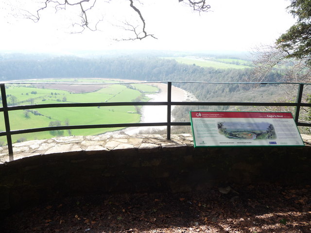
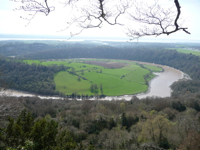
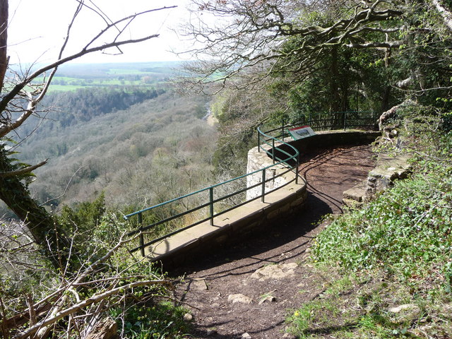
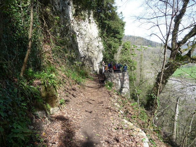
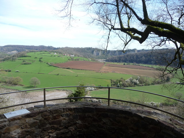
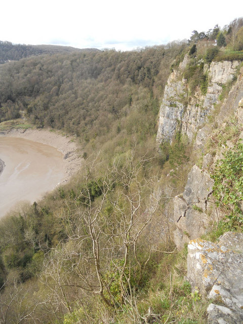
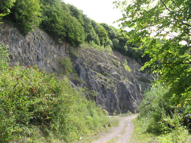
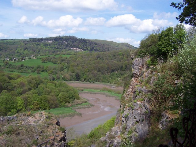
Situated high above the Wye Valley, Wintour's Leap offers a breathtaking panorama of the surrounding countryside. The cliff, named after Sir Ralph Wintour, a Royalist commander who is said to have leaped across the gorge to make his escape during the English Civil War, stands at an impressive height of approximately 100 feet. Its sheer rock face is a haven for rock climbers, who are attracted to the challenging routes and exhilarating climbs it provides.

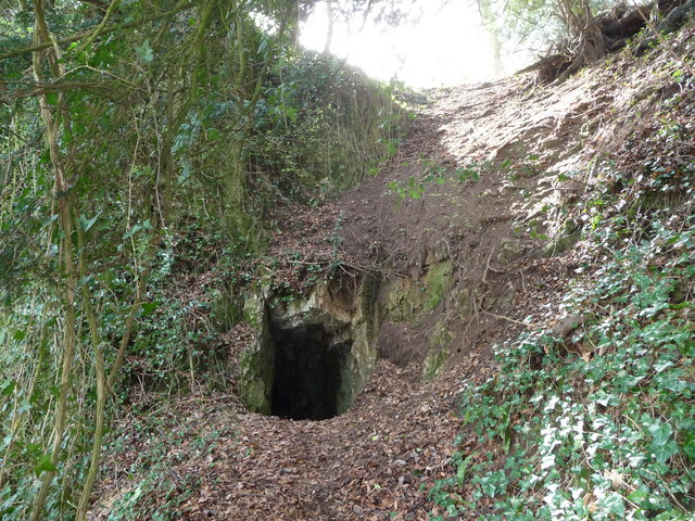
The area surrounding Wintour's Leap is rich in biodiversity, with a diverse range of flora and fauna. The cliff's limestone composition supports a variety of plant species, including rare orchids and ferns. Peregrine falcons, ravens, and other birds of prey can often be spotted soaring above the gorge.

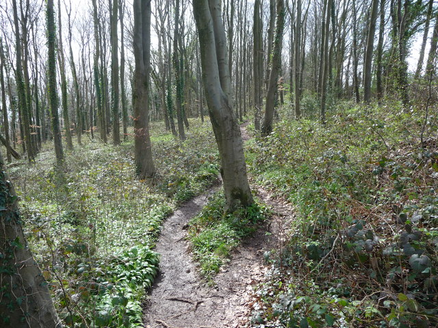
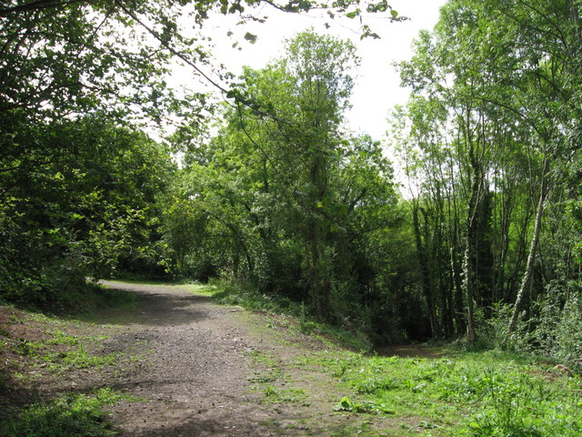
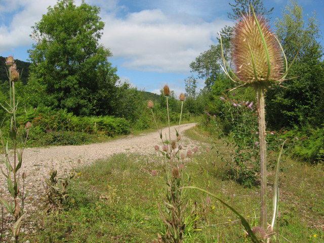
Visitors to Wintour's Leap can explore the surrounding woodland and enjoy picturesque walks along the Wye Valley Footpath. The site is also a popular spot for picnics, offering ample space and benches for visitors to relax and take in the breathtaking vistas.

Wintour's Leap has become a well-loved destination for outdoor enthusiasts, nature lovers, and those seeking an escape from the hustle and bustle of everyday life. Its rugged beauty and historical significance make it a must-visit location in Gloucestershire.

If you have any feedback on the listing, please let us know in the comments section below.

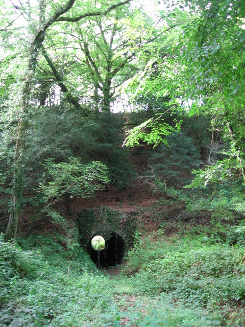
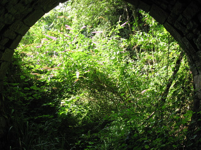
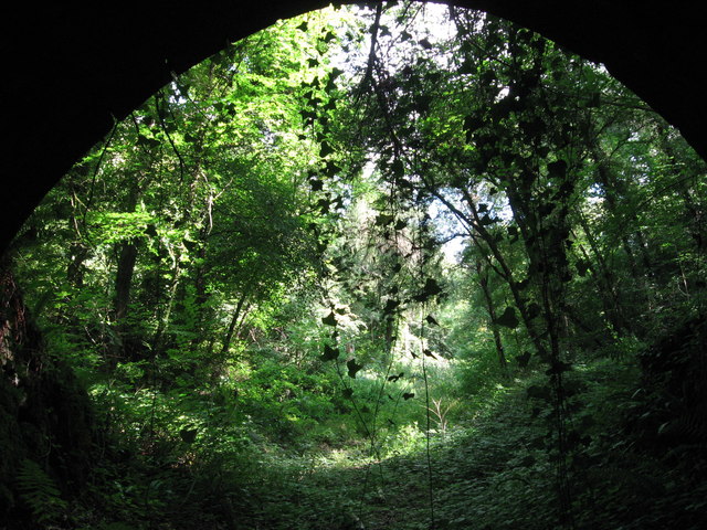
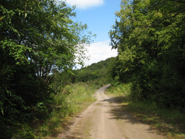
Wintour's Leap Images

Images are sourced within 2km of 51.664671/-2.6638383 or Grid Reference ST5496. Thanks to Geograph Open Source API. All images are credited.

Part of the Wye Valley Walk in Wyndcliff wood If there is one criticism of the WVW in this section it is that you don't get to see much of the River Wye, but, you do get to see varied woodlands, and an  appreciation of the valley's history, geology, ecology and industrial heritage.
Part of the Wye Valley Walk in Wyndcliff wood
If there is one criticism of the WVW in this section it is that you don't get to see much of the River Wye, but, you do get to see varied woodlands, and an appreciation of the valley's history, geology, ecology and industrial heritage.
The Eagle's Nest viewpoint on the Wynd Cliff The information board fitted by the Forestry Commission tells of how this viewpoint got its name and what can be viewed. A beautiful spot that I never tire of revisiting.
The Eagle's Nest viewpoint on the Wynd Cliff
The information board fitted by the Forestry Commission tells of how this viewpoint got its name and what can be viewed. A beautiful spot that I never tire of revisiting.
The Lancaut peninsula from the Eagle's Nest The huge curve in the Wye is a well-known view with Chepstow and the Severn Bridges beyond.
The Lancaut peninsula from the Eagle's Nest
The huge curve in the Wye is a well-known view with Chepstow and the Severn Bridges beyond.
The Eagle's Nest An excellent spot for a rest, a brew and some lunch.
The Eagle's Nest
An excellent spot for a rest, a brew and some lunch.
A group of walkers at the Giant's Cave in the Wye Valley This group of retired walkers were enjoying the viewing platform just outside the Giant's Cave as I approached and was spotted by their little dog. They were a mix of local and not so local fellers who were enjoying their firm friendships, relaxed banter, outdoor exercise and the good weather. Not a bad way to spend some of your retirement.
A group of walkers at the Giant's Cave in the Wye Valley
This group of retired walkers were enjoying the viewing platform just outside the Giant's Cave as I approached and was spotted by their little dog. They were a mix of local and not so local fellers who were enjoying their firm friendships, relaxed banter, outdoor exercise and the good weather. Not a bad way to spend some of your retirement.
The northern entrance to the Giant's Cave on the Wye Valley Walk Yes, you are expected to enter or exit through this aperture. It's easier and more fun than it looks. One of many interesting features on this section of the WVW.
The northern entrance to the Giant's Cave on the Wye Valley Walk
Yes, you are expected to enter or exit through this aperture. It's easier and more fun than it looks. One of many interesting features on this section of the WVW.
View from the Giant's Cave viewing platform The view across the graceful curve of the River Wye onto the Lancaut peninsula and above that up to Wintour's Leap and the great cliffs near Woodcroft.
View from the Giant's Cave viewing platform
The view across the graceful curve of the River Wye onto the Lancaut peninsula and above that up to Wintour's Leap and the great cliffs near Woodcroft.
The Grotto in Piercefield Woods This feature, along with several others on a similar 'Romantic' theme, was installed in Piercefield Park and woods and comprised part of a tour through this area between around 1760 and maybe the 1820's. Gentry came from various parts of the country and toured the Wye Valley inspecting folly's, caves, walks, viewpoints and landscapes and often recording their opinions and thoughts in journals and publications. Originally this grotto was of course larger, more complete and lined inside with 'glittering crystalline minerals, glass fragments and iron and copper slag'. This would have created an elaborate decorated effect intended to mimic naturally occurring outcrops. I'm glad to see the Piercefield Walks features receiving some improvement.
The Grotto in Piercefield Woods
This feature, along with several others on a similar 'Romantic' theme, was installed in Piercefield Park and woods and comprised part of a tour through this area between around 1760 and maybe the 1820's. Gentry came from various parts of the country and toured the Wye Valley inspecting folly's, caves, walks, viewpoints and landscapes and often recording their opinions and thoughts in journals and publications. Originally this grotto was of course larger, more complete and lined inside with 'glittering crystalline minerals, glass fragments and iron and copper slag'. This would have created an elaborate decorated effect intended to mimic naturally occurring outcrops. I'm glad to see the Piercefield Walks features receiving some improvement.
General view, Chepstow Racecourse
Cliff by the River Wye
Path along course of Wye Valley Railway near Tintern The railway line carried on straight ahead at this point, through the trees. Walkers now have a choice and can drop down right, or go up to the left.
Path along course of Wye Valley Railway near Tintern
The railway line carried on straight ahead at this point, through the trees. Walkers now have a choice and can drop down right, or go up to the left.
Path junction in woods near River Wye
Tunnel beneath disused railway line near Tintern Quarry
(No) light at the end of the tunnel The path at the western end of the tunnel (<a href="https://www.geograph.org.uk/photo/2544718">ST5498 : Tunnel beneath disused railway line near Tintern Quarry</a>) is very overgrown and currently impassable.
(No) light at the end of the tunnel
The path at the western end of the tunnel (ST5498 : Tunnel beneath disused railway line near Tintern Quarry) is very overgrown and currently impassable.
Path from tunnel under railway near Tintern Quarry The view from the eastern portal of <a href="https://www.geograph.org.uk/photo/2544718">ST5498 : Tunnel beneath disused railway line near Tintern Quarry</a> shows an overgrown, but still passable path.
Path from tunnel under railway near Tintern Quarry
The view from the eastern portal of ST5498 : Tunnel beneath disused railway line near Tintern Quarry shows an overgrown, but still passable path.
Path near Tintern Quarry
Disused railway near Tintern Quarry The rails are still in place, though obviously have not seen a train for many years!
Disused railway near Tintern Quarry
The rails are still in place, though obviously have not seen a train for many years!
Part of Tintern Quarry
Show me another place!

Wintour's Leap is located at Grid Ref: ST5496 (Lat: 51.664671, Lng: -2.6638383)

Administrative County: Gloucestershire

District: Forest of Dean

Police Authority: Gloucestershire

What 3 Words

///boast.shunted.rising. Near Chepstow, Monmouthshire

Related Wikis

Lower Wye Gorge SSSI

Lower Wye Gorge (grid reference ST548983, ST537967) is a 65-hectare (160-acre) biological and geological Site of Special Scientific Interest in Gloucestershire...

Wintour's Leap

Wintour's Leap is a noted rock climbing location and viewpoint. It is located near the village of Woodcroft in Gloucestershire, on the English side of...

Woodcroft, Gloucestershire

Woodcroft is a small village in the Forest of Dean district of Gloucestershire, England. It is located on the eastern bank of the River Wye, opposite...

Caerwood and Ashberry Goose House

Caerwood And Ashberry Goose House (ST54719655 ST54649657) is a 0.01-hectare (0.025-acre) biological Site of Special Scientific Interest in Gloucestershire...

Lancaut

Lancaut (Welsh: Llan Cewydd) is a deserted village and former civil parish, now in the parish of Tidenham, in the Forest of Dean district, in Gloucestershire...

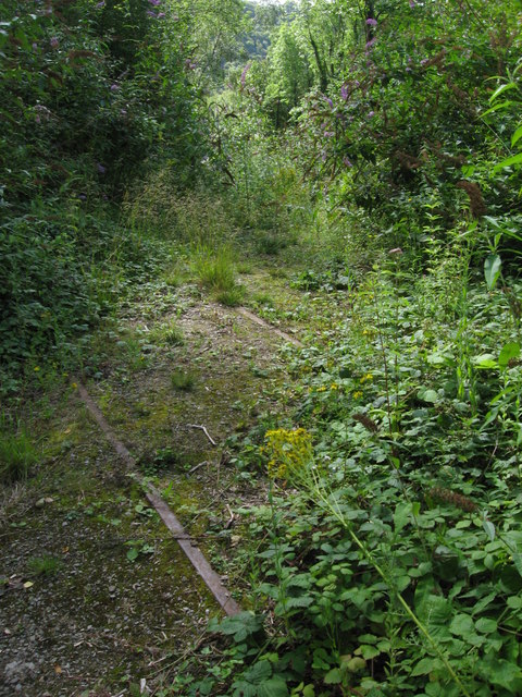
Netherhope Halt railway station

Netherhope Halt was a railway station on the former Wye Valley Railway. It was opened in 1932 and closed in 1959; it was demolished soon afterwards....

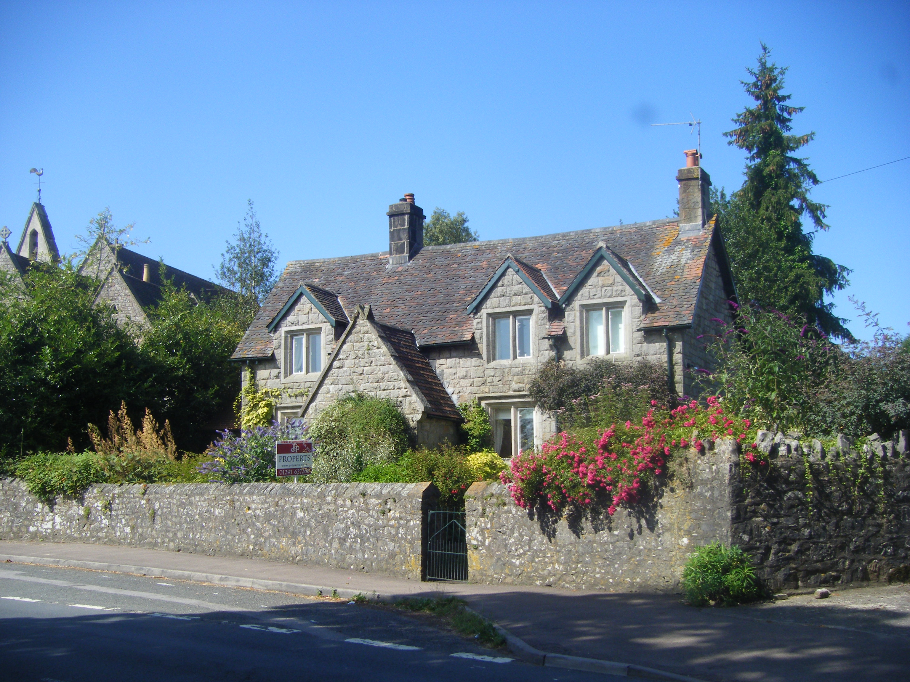
Church Cottage, Tutshill

Church Cottage in the village of Tutshill, Gloucestershire, England, is a Grade II listed building, thought to have been designed by the architect Henry...

Tidenham railway station

Tidenham Station was the station for the village of Tidenham on the former Wye Valley Railway in the Forest of Dean, Gloucestershire, England. It was opened...

Nearby Amenities

Located within 500m of 51.664671,-2.6638383
Source: PGS
Lat/Long: 51.6612512/-2.6674487
Source: PGS
Lat/Long: 51.6619895/-2.6670882
Source: PGS
Lat/Long: 51.6623879/-2.6669431
Source: PGS
Lat/Long: 51.6627248/-2.6667768
Source: PGS
Lat/Long: 51.6628944/-2.667192
Source: PGS
Lat/Long: 51.6633274/-2.6670156
Source: PGS
Lat/Long: 51.6634095/-2.6674123
Source: PGS
Lat/Long: 51.6636755/-2.6679838
Source: PGS
Lat/Long: 51.6638891/-2.6684347
Source: PGS
Lat/Long: 51.6643493/-2.6677124
Source: PGS
Lat/Long: 51.6639552/-2.6666022
Source: PGS
Lat/Long: 51.6644744/-2.6669665
Source: PGS
Lat/Long: 51.6646258/-2.6673935
Source: PGS
Lat/Long: 51.664628/-2.6678607
Source: PGS
Lat/Long: 51.6645406/-2.6683618
Source: PGS
Lat/Long: 51.664378/-2.668843
Source: PGS
Lat/Long: 51.663975/-2.6694548
Source: PGS
Lat/Long: 51.663672/-2.6701607
Source: PGS
Lat/Long: 51.66329/-2.670705
Source: PGS
Lat/Long: 51.6645228/-2.6710877
Source: PGS
Lat/Long: 51.6648584/-2.6707476
Source: PGS
Lat/Long: 51.6653753/-2.6696184
Source: PGS
Lat/Long: 51.6655679/-2.6689167
Source: PGS
Lat/Long: 51.6655681/-2.6683384
Source: PGS
Lat/Long: 51.6657476/-2.6677432
Source: PGS
Lat/Long: 51.6656488/-2.6669767
Source: PGS
Lat/Long: 51.6654159/-2.6663241
Source: PGS
Lat/Long: 51.6650905/-2.6657917
Source: PGS
Lat/Long: 51.6648173/-2.6655352
Source: PGS
Lat/Long: 51.6637866/-2.665266
Source: PGS
Lat/Long: 51.6630072/-2.6650538
Source: PGS
Lat/Long: 51.661994/-2.665357
Source: PGS
Lat/Long: 51.66097/-2.665777
Source: PGS
Lat/Long: 51.660459/-2.666193
Post Box
Collection Times: Mo-Fr 09:00; Sa 07:00
Operator: Royal Mail
Operator Wikidata: Q638098
Post Box Type: lamp
Ref: NP16 430D
Royal Cypher: EIIR
Royal Cypher Wikidata: Q33102113
Lat/Long: 51.6661695/-2.659767
Barrier: kissing_gate
Lat/Long: 51.6666306/-2.658514
Bus Stop
Netherhope Ln
Bus: yes
Naptan AtcoCode: 1600GLF757
Naptan Bearing: S
Naptan CommonName: Netherhope Ln
Naptan NaptanCode: gloadawt
Naptan Street: B4228
Naptan Verified: no
Public Transport: platform
Source: naptan_import
Lat/Long: 51.6661937/-2.6597482
Bus Stop
Netherhope Ln
Bus: yes
Naptan AtcoCode: 1600GLF758
Naptan Bearing: N
Naptan CommonName: Netherhope Ln
Naptan Indicator: Opp
Naptan NaptanCode: gloadawp
Naptan Street: B4228
Naptan Verified: no
Public Transport: platform
Source: naptan_import
Lat/Long: 51.6661746/-2.6599503
Bus Stop
Lancaut Ln
Bus: yes
Naptan AtcoCode: 1600GLF759
Naptan Bearing: SW
Naptan CommonName: Lancaut Ln
Naptan Indicator: Opp
Naptan NaptanCode: gloadatg
Naptan Street: B4228
Naptan Verified: no
Public Transport: platform
Source: naptan_import
Lat/Long: 51.6646133/-2.6625736
Bus Stop
Lancaut Ln
Bus: yes
Naptan AtcoCode: 1600GLF760
Naptan Bearing: NE
Naptan CommonName: Lancaut Ln
Naptan NaptanCode: gloadatp
Naptan Street: B4228
Naptan Verified: no
Public Transport: platform
Source: naptan_import
Lat/Long: 51.6649871/-2.6616537
Barrier: stile
Lat/Long: 51.666578/-2.6596169
Barrier: kissing_gate
Lat/Long: 51.6618626/-2.6638928
Lancaut Quarry
Landuse: quarry
Lat/Long: 51.6660211/-2.6683483
old lime kiln
Historic: ruins
Lat/Long: 51.6667595/-2.6696801
Wintour's Leap
Source: survey
Survey Date: 2019-06-30
Tourism: viewpoint
Lat/Long: 51.663092/-2.6636562
Source: PGS
Lat/Long: 51.6659348/-2.6681993
Source: PGS
Lat/Long: 51.6655744/-2.6694105
Source: PGS
Lat/Long: 51.6649813/-2.6704791
Entrance: yes
Lat/Long: 51.6651538/-2.670888
The data included in this document is from www.openstreetmap.org. The data is made available under ODbL.

Have you been to Wintour's Leap?

Leave your review of Wintour's Leap below (or comments, questions and feedback).