Ewens' Rock

Cliff, Slope in Gloucestershire Forest of Dean

England

Ewens' Rock

Wye Bridge, Beachley This carries the M48 over the Wye from Wales to England.  The old Severn Bridge is in England.  The Forest of Dean lies beyond.
Wye Bridge, Beachley Credit: Mike Penny

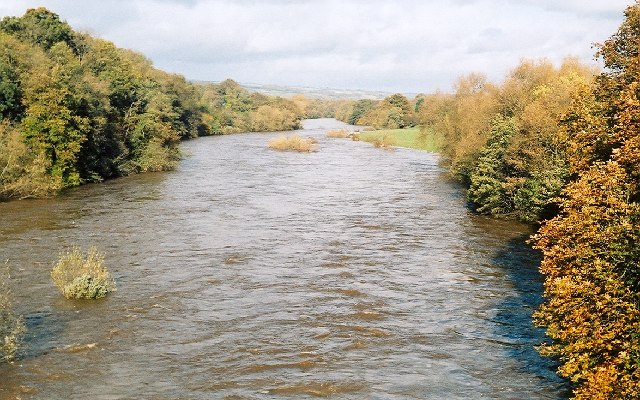
Ewens' Rock is a prominent geological feature located in Gloucestershire, England. Situated on the western side of the River Severn, it is a cliff-like slope that rises steeply from the riverbank. The rock is named after the Ewens family who owned the nearby Ewens' Farm.

The slope of Ewens' Rock is formed by layers of sedimentary rock, primarily composed of limestone and shale. These rock layers have been shaped over millions of years through various geological processes, including erosion and tectonic activity.

The rock face is approximately 30 meters high, making it a significant landmark in the area. Its distinctive shape and rugged appearance make it a popular destination for hikers, climbers, and nature enthusiasts. The slope offers a challenging climb for experienced climbers, with multiple routes available for different skill levels.

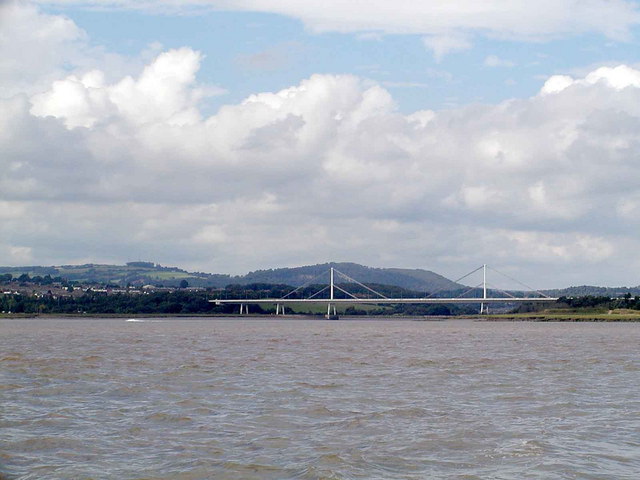
Ewens' Rock offers stunning panoramic views of the surrounding countryside, including the picturesque River Severn. Additionally, the rock is home to a variety of plant and animal species, adding to its ecological significance.

Due to its location near the river, Ewens' Rock is also subject to occasional flooding during periods of heavy rainfall. This natural phenomenon has contributed to the erosion of the rock face over time, creating unique formations and adding to its geological interest.

Overall, Ewens' Rock is a fascinating and visually striking geological formation in Gloucestershire, offering both natural beauty and recreational opportunities for visitors.

If you have any feedback on the listing, please let us know in the comments section below.
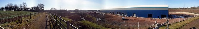
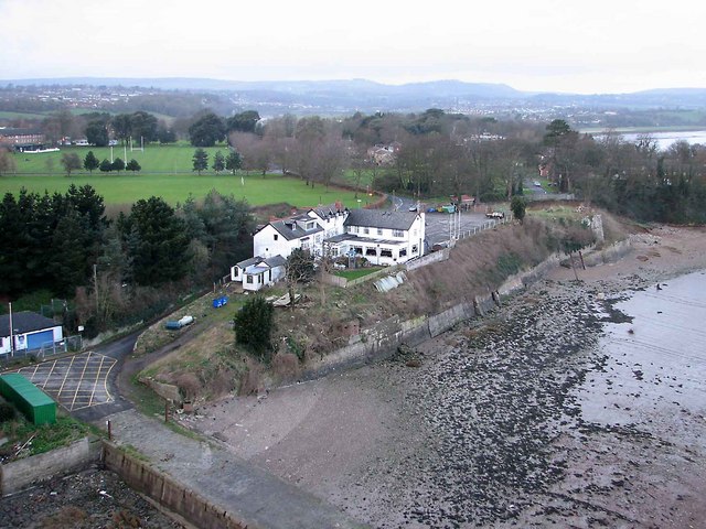
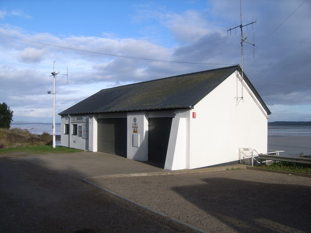
Ewens' Rock Images

Images are sourced within 2km of 51.618047/-2.6581166 or Grid Reference ST5491. Thanks to Geograph Open Source API. All images are credited.

Wye Bridge, Beachley This carries the M48 over the Wye from Wales to England.  The old Severn Bridge is in England.  The Forest of Dean lies beyond.
Wye Bridge, Beachley
This carries the M48 over the Wye from Wales to England. The old Severn Bridge is in England. The Forest of Dean lies beyond.
St Twrog's Chapel ruins on Chapel Rock The Beachley Point light is right next to the ruins.
St Twrog's Chapel ruins on Chapel Rock
The Beachley Point light is right next to the ruins.
Open space on the Beachley peninsula
Modern housing estate
Bus stop with no one waiting
The Old Ferry Inn
The Old Ferry Inn
Church of St John the Evangelist
Warren slade woods The footpath through Warren slade woods at the top of bluebell drive in Bulwark.
Warren slade woods
The footpath through Warren slade woods at the top of bluebell drive in Bulwark.
Winters day A snowy field near Mathern and a short distance from the M48. Taken on 07/01/2010 at 11:15 am.
Winters day
A snowy field near Mathern and a short distance from the M48. Taken on 07/01/2010 at 11:15 am.
Local snow Snow at Warren slade woods, bulwark, Chepstow. Taken on 06/01/2010 at 10:33am.
Local snow
Snow at Warren slade woods, bulwark, Chepstow. Taken on 06/01/2010 at 10:33am.
Snow on Bluebell drive A snowy scene looking down Bluebell drive in bulwark, Chepstow on 06/01/2010
Snow on Bluebell drive
A snowy scene looking down Bluebell drive in bulwark, Chepstow on 06/01/2010
Railway slippage Part of the 3000 tons of rock and stone to stop the railway embankment slipping into the river Wye at bulwark, Chepstow.
Railway slippage
Part of the 3000 tons of rock and stone to stop the railway embankment slipping into the river Wye at bulwark, Chepstow.
River of ice Ice floes on the River Wye at Bulwark, Chepstow.
River of ice
Ice floes on the River Wye at Bulwark, Chepstow.
Newhouse roundabout Panorama of junction 2 newhouse roundabout at Chepstow.
Newhouse roundabout
Panorama of junction 2 newhouse roundabout at Chepstow.
Wind turbine factory A panorama of the now completed Fairfield Mabey wind turbine manufacturing facility at Newhouse, Chepstow
Wind turbine factory
A panorama of the now completed Fairfield Mabey wind turbine manufacturing facility at Newhouse, Chepstow
Spring has sprung A mass of Dandelions, buttercups and daises in this field and in the distance is the river Wye, old Severn crossing and Beachley barracks.
Spring has sprung
A mass of Dandelions, buttercups and daises in this field and in the distance is the river Wye, old Severn crossing and Beachley barracks.
Ghost town The now disused Tesco distribution centre on the Newhouse estate near Mathern..the estate is rapidly turning into a ghost estate now that Tesco have gone.
Ghost town
The now disused Tesco distribution centre on the Newhouse estate near Mathern..the estate is rapidly turning into a ghost estate now that Tesco have gone.
Pylons everywhere Looking across to Beachley with electricity pylons as far as the eye can see. This area has a large number of pylons.
Pylons everywhere
Looking across to Beachley with electricity pylons as far as the eye can see. This area has a large number of pylons.
Show me another place!

Ewens' Rock is located at Grid Ref: ST5491 (Lat: 51.618047, Lng: -2.6581166)

Administrative County: Gloucestershire

District: Forest of Dean

Police Authority: Gloucestershire

What 3 Words

///slopes.mutual.creamed. Near Chepstow, Monmouthshire

Nearby Locations

Ewens' Rock

Related Wikis

Beachley Barracks

Beachley Barracks is a British Army base at Beachley in Gloucestershire, England, close to the England–Wales border at Chepstow. The barracks is the home...

Beachley

Beachley is a village in Gloucestershire, England, near the border with Monmouthshire, Wales. It is located on a peninsula at the confluence of the rivers...

Severn Area Rescue Association

Severn Area Rescue Association (SARA) or Severn Rescue is an independent, marine and land based, search and rescue organisation covering the Severn Estuary...

River Wye

The River Wye (; Welsh: Afon Gwy [ɡʊɨ̯]) is the fourth-longest river in the UK, stretching some 250 kilometres (155 miles) from its source on Plynlimon...

Nearby Amenities

Located within 500m of 51.618047,-2.6581166
Source: PGS
Lat/Long: 51.6184774/-2.6621824
Source: PGS
Lat/Long: 51.6186145/-2.6620105
Source: PGS
Lat/Long: 51.6189492/-2.6615133
Source: PGS
Lat/Long: 51.6193091/-2.6610471
Source: PGS
Lat/Long: 51.6197692/-2.6605057
Source: PGS
Lat/Long: 51.61828/-2.658063
Source: PGS
Lat/Long: 51.6176832/-2.6586255
Source: PGS
Lat/Long: 51.6172777/-2.6589572
Source: PGS
Lat/Long: 51.6171858/-2.6632803
Source: PGS
Lat/Long: 51.6178771/-2.6627678
Source: PGS
Lat/Long: 51.6179595/-2.6628088
Source: PGS
Lat/Long: 51.6153086/-2.6588899
Source: Landsat photo
Lat/Long: 51.6181642/-2.6644066
Source: Landsat photo
Lat/Long: 51.6195161/-2.6626364
Source: Landsat photo
Lat/Long: 51.6207568/-2.6617352
Families Office
Naptan AtcoCode: 1600GLA06421
Naptan Bearing: NW
Naptan BusStopType: CUS
Naptan CommonName: Families Office
Naptan NaptanCode: glogptdt
Naptan Street: Beachley Barracks
Naptan Verified: no
Source: naptan_import
Lat/Long: 51.61515/-2.6529994
Bus Stop
Beachley Barracks South Gate
Naptan AtcoCode: 1600GLF769
Naptan Bearing: NE
Naptan CommonName: Beachley Barracks South Gate
Naptan NaptanCode: gloadgpd
Naptan Street: Beachley Rd
Naptan Verified: no
Source: naptan_import
Lat/Long: 51.6176419/-2.6511575
Bus Stop
Beachley Barracks South Gate
Naptan AtcoCode: 1600GLF770
Naptan Bearing: SW
Naptan CommonName: Beachley Barracks South Gate
Naptan Indicator: Opp
Naptan NaptanCode: gloadgpj
Naptan Street: Beachley Rd
Naptan Verified: no
Source: naptan_import
Lat/Long: 51.6175438/-2.6510117
The data included in this document is from www.openstreetmap.org. The data is made available under ODbL.

Have you been to Ewens' Rock?

Leave your review of Ewens' Rock below (or comments, questions and feedback).