West Cliff

Cliff, Slope in Dorset

England

West Cliff

Cliff edge
Cliff edge Credit: don cload

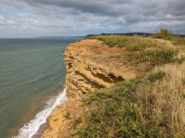
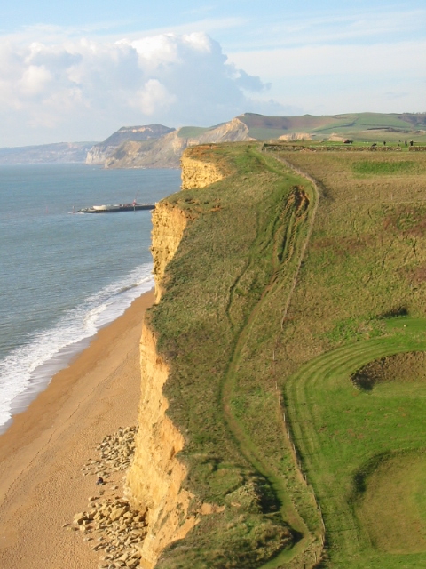
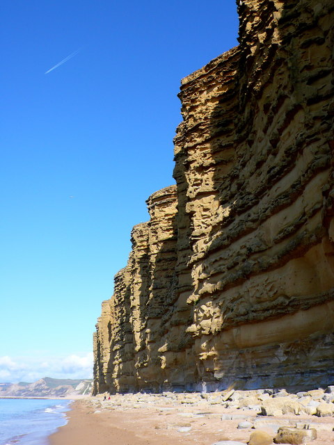
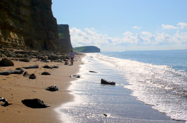
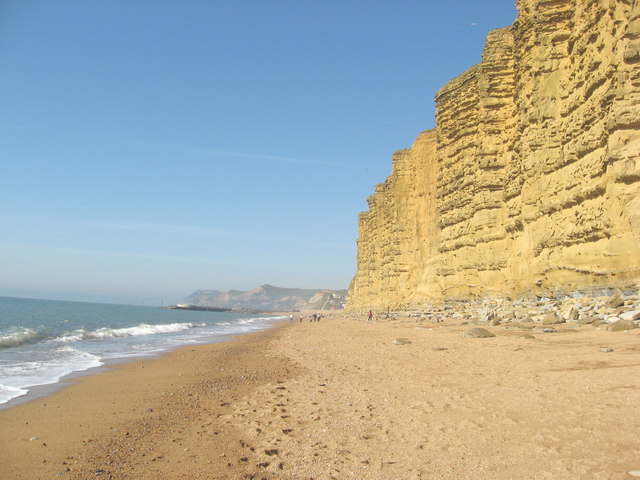
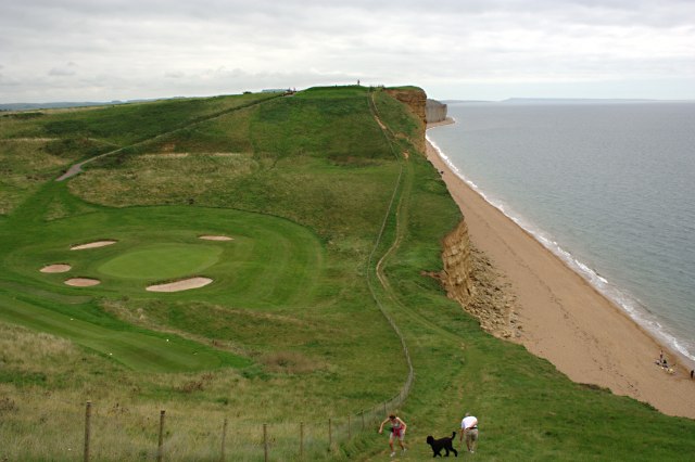
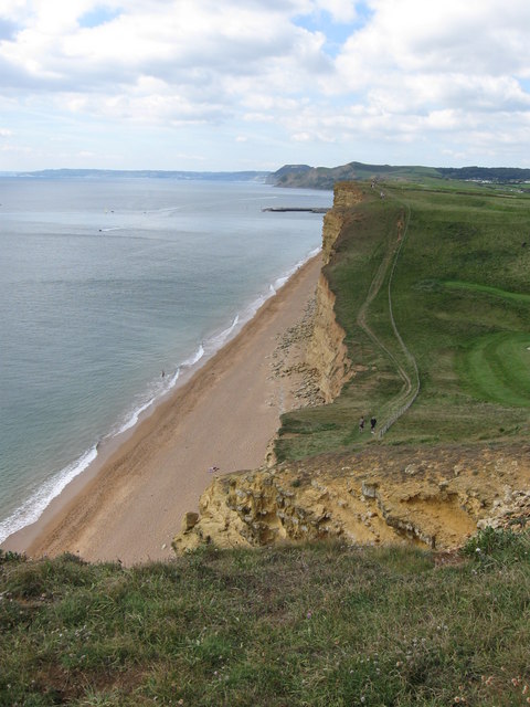
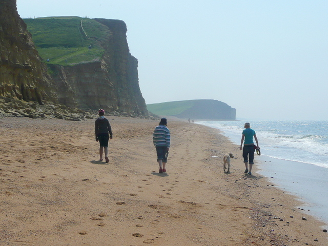
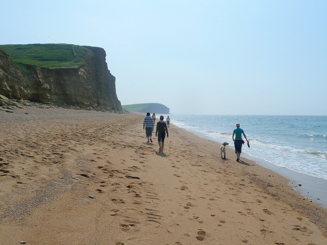
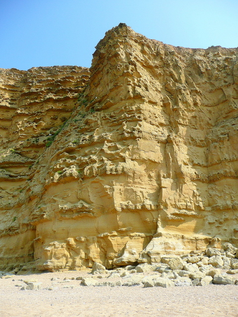
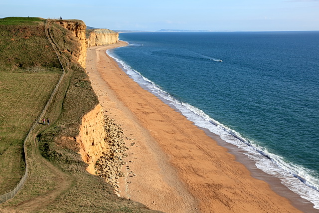
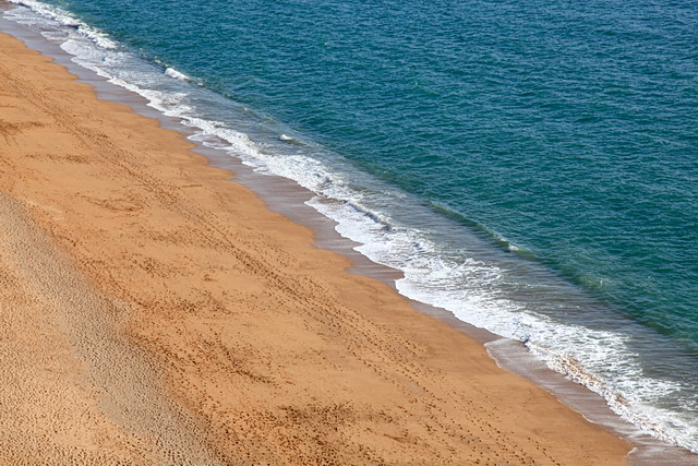
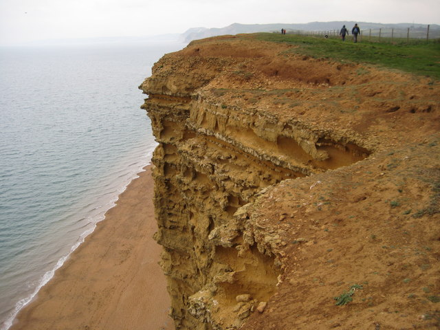
West Cliff is a picturesque cliff located in the coastal town of West Bay, Dorset, England. It is a prominent feature in the region, attracting tourists and locals alike. Rising to a height of approximately 50 meters, the cliff provides stunning panoramic views of the surrounding area, including the English Channel.

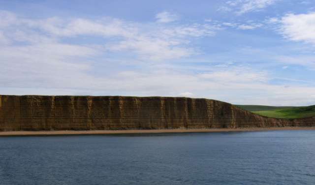
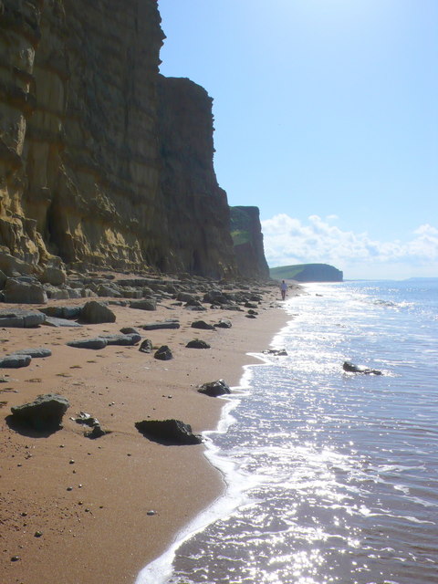
The cliff is composed of layers of sandstone and clay, giving it a distinct and striking appearance. Over the years, erosion has sculpted the cliff, creating unique formations and exposing different geological layers. This makes it a popular destination for geology enthusiasts and researchers interested in studying the region's natural history.

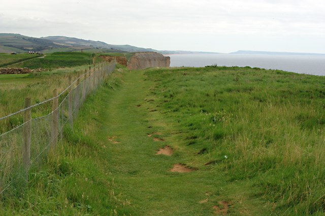
Visitors can access West Cliff through a well-maintained path that winds its way up the slope. The path offers visitors the opportunity to appreciate the cliff's beauty up close and take in the breathtaking vistas. Additionally, there are several viewing points strategically placed along the path, providing visitors with perfect spots to capture memorable photographs or simply enjoy the tranquil surroundings.

West Cliff is also known for its vibrant wildlife. The cliff's rugged terrain and proximity to the sea make it an ideal habitat for various bird species, including gulls and cormorants. Birdwatchers can often be seen perched on the cliff, armed with binoculars and cameras, observing the diverse avian population.

Furthermore, West Cliff is a popular spot for recreational activities such as rock climbing and abseiling. Adventurous individuals can be seen scaling the cliff's vertical faces or descending down its steep slopes, adding an element of thrill to their visit.

Overall, West Cliff in Dorset is a captivating natural wonder that offers visitors a blend of breathtaking views, geological marvels, and opportunities for adventure.

If you have any feedback on the listing, please let us know in the comments section below.

West Cliff Images

Images are sourced within 2km of 50.713831/-2.7746851 or Grid Reference SY4590. Thanks to Geograph Open Source API. All images are credited.

Cliff edge
Cliff edge
Coast west of Burton Freshwater Some steps have since been built on the very eroded section of the coast path.
Coast west of Burton Freshwater
Some steps have since been built on the very eroded section of the coast path.
Cliffs between West Bay and Burton Freshwater The cliffs along this coastline are part of the World Heritage Jurassic Coast. They date back to Jurassic times and are very popular with fossil hunters. 
To see some 360°Panoramas of Dorset please visit this <span class="nowrap"><a title="www.360panoramas.co.uk" rel="nofollow ugc noopener" href="http://www.360panoramas.co.uk">Link</a><img style="margin-left:2px;" alt="External link" title="External link - shift click to open in new window" src="https://s1.geograph.org.uk/img/external.png" width="10" height="10"/></span>
Cliffs between West Bay and Burton Freshwater
The cliffs along this coastline are part of the World Heritage Jurassic Coast. They date back to Jurassic times and are very popular with fossil hunters. To see some 360°Panoramas of Dorset please visit this LinkExternal link
East Cliffs, West Bay, Dorset Looking SE along the small bit of coast in this square. A real danger of falling rocks here and a much lesser danger of falling golf balls from the golf course on top of the cliffs
East Cliffs, West Bay, Dorset
Looking SE along the small bit of coast in this square. A real danger of falling rocks here and a much lesser danger of falling golf balls from the golf course on top of the cliffs
East Cliffs, West Bay, Dorset Looking NW. The two people in the middle distance are on the northern side of the E-W grid line. The cliffs are made of Bridport Sands which erodes in distinct bands because some layers are harder than others.
East Cliffs, West Bay, Dorset
Looking NW. The two people in the middle distance are on the northern side of the E-W grid line. The cliffs are made of Bridport Sands which erodes in distinct bands because some layers are harder than others.
East Cliffs, West Bay, Dorset Looking SE with Portland in the distance. The beach is littered with rocks that fell from the cliff
East Cliffs, West Bay, Dorset
Looking SE with Portland in the distance. The beach is littered with rocks that fell from the cliff
The lovely golden East Cliff at West Bay These spectacular cliffs are at West Bay, South of Bridport, Dorset
The lovely golden East Cliff at West Bay
These spectacular cliffs are at West Bay, South of Bridport, Dorset
The Top of East Cliff The coast path runs just a few feet from the cliff edge.
The Top of East Cliff
The coast path runs just a few feet from the cliff edge.
A Dip in the Clifftop The flat clifftop walk between West Bay and Burton Freshwater is interrupted by this little coombe. One of the greens of the adjacent golf course lurks in the bottom of the valley.
A Dip in the Clifftop
The flat clifftop walk between West Bay and Burton Freshwater is interrupted by this little coombe. One of the greens of the adjacent golf course lurks in the bottom of the valley.
View across the dip in the East Cliff at West Bay, Dorset. West Bay's harbour wall can be seen jutting out into the sea.
View across the dip in the East Cliff at West Bay, Dorset.
West Bay's harbour wall can be seen jutting out into the sea.
Retrieved! A water-loving dog brings a rubber ring back to the beach. And then does it again. And again. And again.....
Retrieved!
A water-loving dog brings a rubber ring back to the beach. And then does it again. And again. And again.....
Morning beach walk These folks and their dog are probably heading for the holiday park at Burton Bradstock.
Every so often the man on the right throws the rubber ring into the sea for the Retriever to do his thing.
See <a href="https://www.geograph.org.uk/photo/1903326">SY4689 : Retrieved!</a>.
Morning beach walk
These folks and their dog are probably heading for the holiday park at Burton Bradstock. Every so often the man on the right throws the rubber ring into the sea for the Retriever to do his thing. See SY4689 : Retrieved!.
Strolling along the beach The folks and dog in <a href="https://www.geograph.org.uk/photo/1903332">SY4689 : Morning beach walk</a>, a little further along towards Burton Bradstock.
Strolling along the beach
The folks and dog in SY4689 : Morning beach walk, a little further along towards Burton Bradstock.
Section of East Cliff The easily-eroded sandstone is a golden colour in summer morning light.
Section of East Cliff
The easily-eroded sandstone is a golden colour in summer morning light.
Coast Path towards Burton Freshwater from East Cliff Coast path, cliffs and beach viewed from East Cliff. In the far distance the outline of the Isle of Portland can just be seen.
Coast Path towards Burton Freshwater from East Cliff
Coast path, cliffs and beach viewed from East Cliff. In the far distance the outline of the Isle of Portland can just be seen.
Beach below East Cliff Looking down on the beach from East Cliff midway between West Bay and Burton Freshwater.
Beach below East Cliff
Looking down on the beach from East Cliff midway between West Bay and Burton Freshwater.
A challenging round of golf It was hard enough in the blustery wind on the cliff top to stand still in one place, let alone strike a golf ball accurately. And then the ball is at the will of the wind...  The Bridport and West Dorset Golf Club.
A challenging round of golf
It was hard enough in the blustery wind on the cliff top to stand still in one place, let alone strike a golf ball accurately. And then the ball is at the will of the wind... The Bridport and West Dorset Golf Club.
East Cliff View of East Cliff from above on the South West Coast Path to the east of West Bay.
East Cliff
View of East Cliff from above on the South West Coast Path to the east of West Bay.
Show me another place!

West Cliff is located at Grid Ref: SY4590 (Lat: 50.713831, Lng: -2.7746851)

Unitary Authority: Dorset

Police Authority: Dorset

What 3 Words

///dabble.cluttered.decency. Near Bridport, Dorset

Nearby Locations

West Cliff Black Rock

Related Wikis

Eype Mouth

Eype Mouth is a natural break in a line of sea cliffs on the Jurassic Coast World Heritage Site in west Dorset on the south coast of England. The small...
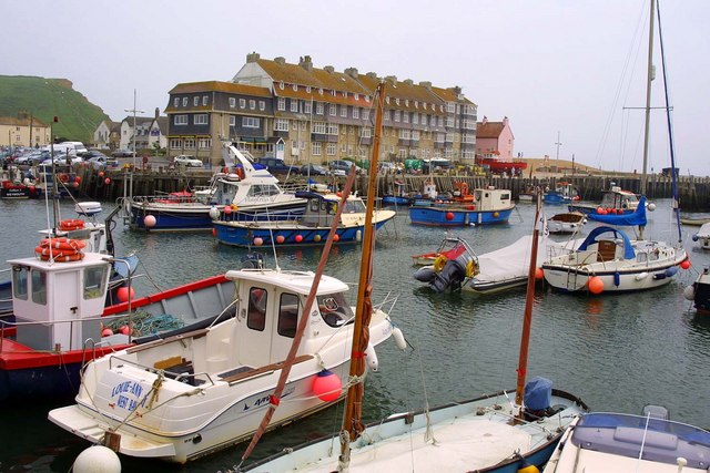
West Bay, Dorset

West Bay, originally known as Bridport Harbour, is a small harbour settlement and resort on the English Channel coast in Dorset, England, sited at the...

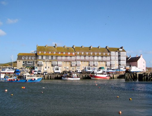
Pier Terrace, West Bay

The Pier Terrace in West Bay, Dorset, was designed by the English Arts and Crafts architect Edward Schroeder Prior in 1884–85. It is a Grade II listed...

Riverside Restaurant

The Riverside Restaurant was a seafood restaurant in West Bay, England. The building is situated on a causeway and as such the dining area was on two levels...

Nearby Amenities

Located within 500m of 50.713831,-2.7746851
Black Rock
Place: locality
Source: OS OpenData StreetView
Lat/Long: 50.7113234/-2.7710552
Coast View point
Tourism: viewpoint
Lat/Long: 50.7125667/-2.7721001
Barrier: kissing_gate
Lat/Long: 50.7128613/-2.7710243
Bench
Lat/Long: 50.7118887/-2.768793
Bench
Lat/Long: 50.7121719/-2.7696035
Bench
Lat/Long: 50.7159875/-2.7803623
Bench
Lat/Long: 50.7158742/-2.7785085
Barrier: kissing_gate
Lat/Long: 50.7150856/-2.7739602
Bench
Lat/Long: 50.7126134/-2.7706645
Access: no
Barrier: block
Lat/Long: 50.7151114/-2.7756025
Bench
Backrest: yes
Lat/Long: 50.7122208/-2.7712144
Post Box
Collection Times: Mo-Fr 09:00; Sa 07:00
Operator: Royal Mail
Post Box Type: lamp
Ref: DT6 3D
Ref GB Uprn: 10015282222
Royal Cypher: EIIR
Royal Cypher Wikidata: Q33102113
Source: survey
Survey Date: 2022-12-04
Lat/Long: 50.7138767/-2.7693218
Sanitary Dump Station
Fee: no
Water Point: yes
Lat/Long: 50.7180963/-2.7766989
The data included in this document is from www.openstreetmap.org. The data is made available under ODbL.

Have you been to West Cliff?

Leave your review of West Cliff below (or comments, questions and feedback).