Wall End

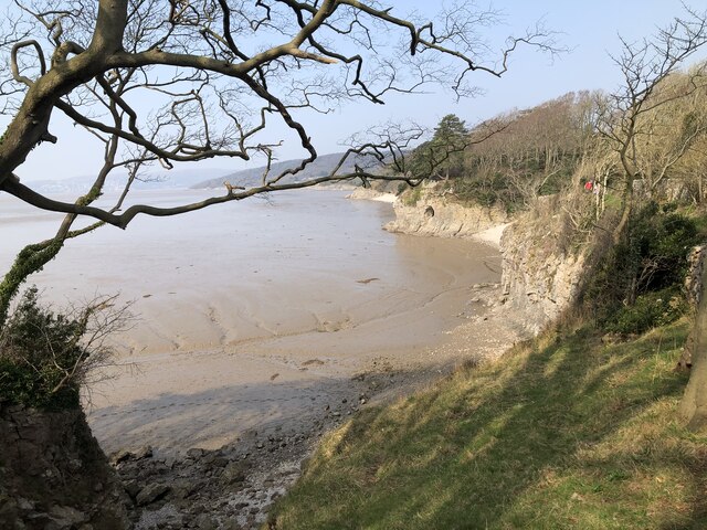
Cliff, Slope in Westmorland South Lakeland

England

Wall End

Potter Hill area of Silverdale
Potter Hill area of Silverdale Credit: Colin Park

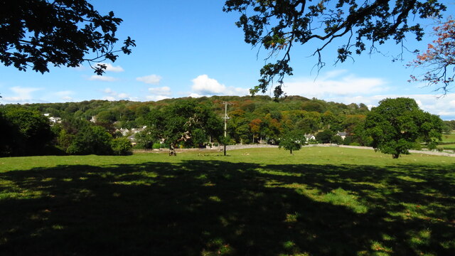
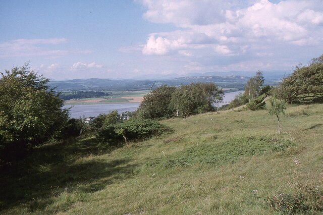
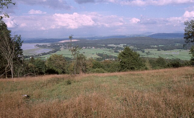
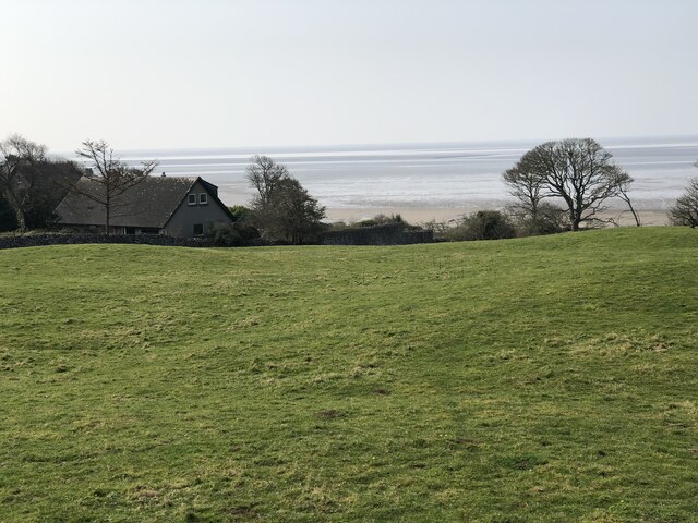
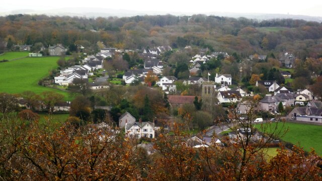
Wall End is a small village located in the county of Westmorland, nestled in the picturesque landscape of the Lake District National Park in Northwest England. Situated on a cliff, the village offers breathtaking views of the surrounding countryside and is known for its sloping terrain.

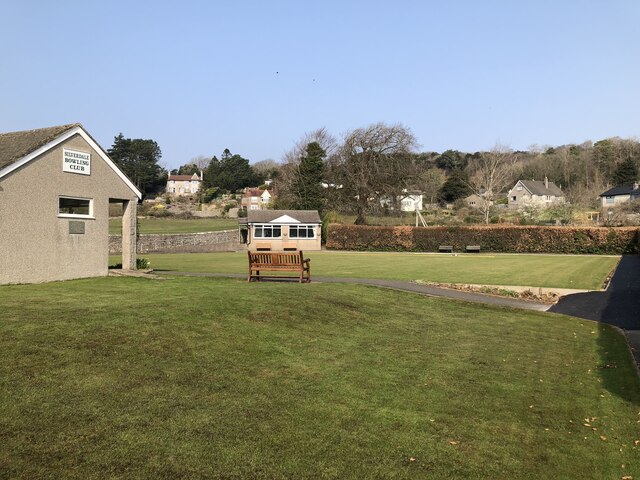
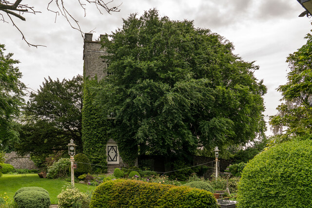
The village itself is characterized by its charming stone cottages, which are beautifully preserved and reflect the area's rich history. The sloping nature of Wall End is evident in its layout, with houses and streets following the contours of the land, creating a unique and quaint atmosphere.

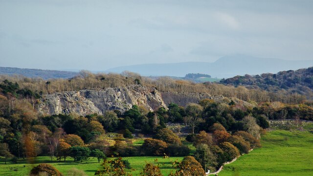
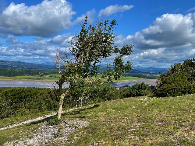
The cliff on which Wall End is situated adds to the village's allure. This natural feature not only provides stunning vistas but also serves as a protective barrier against harsh weather conditions. The cliff face is composed of rugged rock formations, adding a touch of ruggedness to the village's aesthetic.

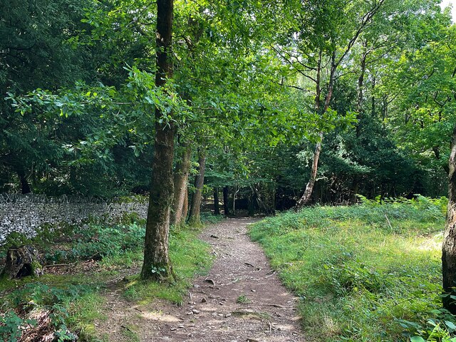
Nature enthusiasts are drawn to Wall End due to its proximity to the rolling hills and idyllic countryside. The surrounding area offers ample opportunities for hiking, walking, and exploring the region's diverse flora and fauna. Additionally, the village is located near several popular tourist destinations, including the famous Lake Windermere, making it an ideal base for visitors looking to explore the wider area.

Overall, Wall End, Westmorland, with its cliff and sloping terrain, embodies the beauty and tranquility of the Lake District. Its picturesque setting, charming architecture, and proximity to natural wonders make it an attractive destination for both residents and tourists alike.

If you have any feedback on the listing, please let us know in the comments section below.
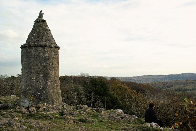
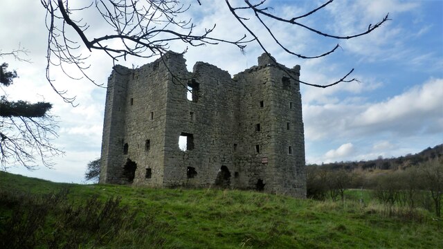
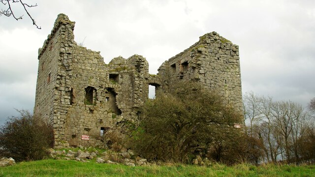
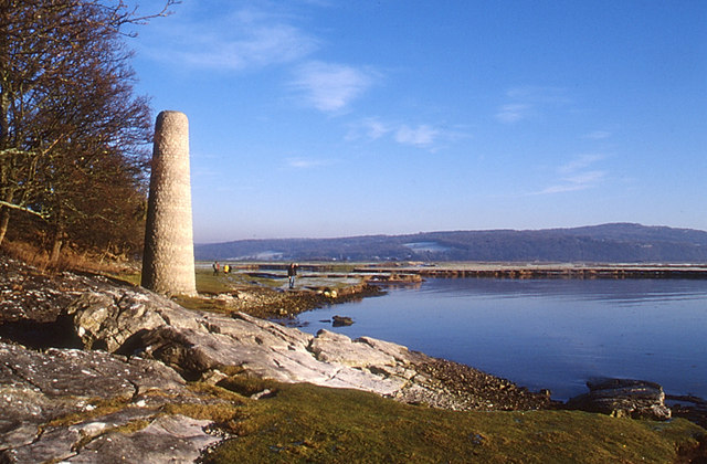
Wall End Images

Images are sourced within 2km of 54.174438/-2.8380474 or Grid Reference SD4575. Thanks to Geograph Open Source API. All images are credited.

Potter Hill area of Silverdale
Arnside Knott Looking north-northeast over the Kent Estuary. Part of the Kent Viaduct is visible behind the trees in the centre.

Arnside Knott is a National Trust property renowned for its wildlife on this important limestone outcrop.

Position within the square uncertain.
Arnside Knott
Looking north-northeast over the Kent Estuary. Part of the Kent Viaduct is visible behind the trees in the centre. Arnside Knott is a National Trust property renowned for its wildlife on this important limestone outcrop. Position within the square uncertain.
Arnside Knott Looking northeast towards Storth and Sandside Quarry.

Arnside Knott is a National Trust property renowned for its wildlife on this important limestone outcrop.

Position within the square uncertain.
Arnside Knott
Looking northeast towards Storth and Sandside Quarry. Arnside Knott is a National Trust property renowned for its wildlife on this important limestone outcrop. Position within the square uncertain.
The Pepper Pot Stone folly tower built to commemorate the Golden Jubilee of Queen Victoria in 1887.
The Pepper Pot
Stone folly tower built to commemorate the Golden Jubilee of Queen Victoria in 1887.
Silverdale Bowling Club
Silverdale Cove
Silverdale Cove
Coastal houses, Silverdale
Woodwell The stone lined well is served by a spring in the outcrop behind.
Woodwell
The stone lined well is served by a spring in the outcrop behind.
Middlebarrow Quarry From Eaves Wood
Middlebarrow Quarry
From Eaves Wood
Jubilee Memorial (The Pepper Pot) On Castlebarrow Head
Jubilee Memorial (The Pepper Pot)
On Castlebarrow Head
Silverdale Panorama From Castlebarrow Head the view to Church of St John
Silverdale Panorama
From Castlebarrow Head the view to Church of St John
Arnside Tower View from east of the fortified house
Arnside Tower
View from east of the fortified house
Arnside Tower View from west of the fortified house
Arnside Tower
View from west of the fortified house
Lindeth Tower, Silverdale Lancashire Lindeth Tower is a Victorian folly in Silverdale, Lancashire, England. It is an embattled square tower of three storeys. It was built in 1842 by the Preston banker Hesketh Fleetwood. Elizabeth Gaskell stayed in the tower in the 1840s and 1850s and her novel Ruth was written there. Lindeth Tower is a Grade II listed building.

<span class="nowrap"><a title="https://en.wikipedia.org/wiki/Lindeth_Tower" rel="nofollow ugc noopener" href="https://en.wikipedia.org/wiki/Lindeth_Tower">Link</a><img style="margin-left:2px;" alt="External link" title="External link - shift click to open in new window" src="https://s1.geograph.org.uk/img/external.png" width="10" height="10"/></span>
Lindeth Tower, Silverdale Lancashire
Lindeth Tower is a Victorian folly in Silverdale, Lancashire, England. It is an embattled square tower of three storeys. It was built in 1842 by the Preston banker Hesketh Fleetwood. Elizabeth Gaskell stayed in the tower in the 1840s and 1850s and her novel Ruth was written there. Lindeth Tower is a Grade II listed building. LinkExternal link
Car park at Shore Road, Silverdale
Beach at Silverdale, looking across the bay to Grange-over-Sands
Path through Copridding Wood
Windblown tree on Arnside Knott
Show me another place!

Wall End is located at Grid Ref: SD4575 (Lat: 54.174438, Lng: -2.8380474)

Administrative County: Cumbria

District: South Lakeland

Police Authority: Cumbria

What 3 Words

///intend.shuts.alike. Near Silverdale, Lancashire

Nearby Locations

Wall End Red Rake

Related Wikis

Silverdale Hoard

The Silverdale Hoard is a collection of over 200 pieces of silver jewellery and coins discovered near Silverdale, Lancashire, England, in September 2011...

Far Arnside

Far Arnside is a hamlet in Arnside civil parish in the South Lakeland district, Cumbria, England. == Location == It is located near the large villages...

St John's Church, Silverdale

St John's Church is in Emesgate Lane, Silverdale, Lancashire, England. It is an active Anglican parish church in the deanery of Tunstall, the archdeaconry...

Silverdale, Lancashire

Silverdale is a village and civil parish within the City of Lancaster district of Lancashire, England. The village stands on Morecambe Bay, near the border...

Nearby Amenities

Located within 500m of 54.174438,-2.8380474
Source: PGS
Lat/Long: 54.1742156/-2.8378805
Source: PGS
Lat/Long: 54.173675/-2.8367216
Source: PGS
Lat/Long: 54.173389/-2.8361831
Source: PGS
Lat/Long: 54.1729829/-2.8356422
Source: PGS
Lat/Long: 54.1726437/-2.8352317
Source: PGS
Lat/Long: 54.1723955/-2.8349506
Source: PGS
Lat/Long: 54.1721785/-2.8346278
Source: PGS
Lat/Long: 54.1716176/-2.834028
Source: PGS
Lat/Long: 54.1710599/-2.8341578
Note: road crosses county boundary (Lancashire - Cumbria) here
Lat/Long: 54.1759296/-2.8342578
Post Box
Collection Times: Mo-Fr 16:00; Sa 11:00
Drive Through: no
Post Box Type: wall
Ref: LA5 34
Royal Cypher: GVIR
Lat/Long: 54.1746133/-2.8309831
Leisure: playground
Lat/Long: 54.1782209/-2.8349541
Holgates Holiday Park: Silverdale
Tourism: caravan_site
Lat/Long: 54.1764944/-2.835581
Bus Stop
Holgate Caravan Park
Bus: yes
Naptan AtcoCode: 090079042335
Naptan Bearing: E
Naptan BusStopType: CUS
Naptan CommonName: Holgate Caravan Park
Naptan Indicator: o/s
Naptan Landmark: Holgate Caravan Park
Naptan NaptanCode: cumdgpaw
Naptan Street: Silverdale Road
Naptan Verified: no
Public Transport: platform
Source: naptan_import
Lat/Long: 54.1762653/-2.8361813
Bus Stop
Childrens Holiday Camp
Bus: yes
Naptan AtcoCode: 090079042360
Naptan Bearing: W
Naptan BusStopType: CUS
Naptan CommonName: Childrens Holiday Camp
Naptan Indicator: o/s
Naptan Landmark: Leeds Childrens Holiday Camp
Naptan NaptanCode: cumdgpda
Naptan Street: Silverdale Road
Naptan Verified: no
Public Transport: platform
Source: naptan_import
Lat/Long: 54.1760246/-2.8357635
Description: Excellent views across Morecambe Bay.
Source: GPS, photo and recent walk
Tourism: viewpoint
Lat/Long: 54.1723583/-2.8341047
Barrier: kissing_gate
Lat/Long: 54.1709384/-2.8332173
Barrier: lift_gate
Lat/Long: 54.1768676/-2.8358823
Bench
Source: survey;gps
Lat/Long: 54.1718483/-2.8337793
Bench
Source: survey;gps
Lat/Long: 54.1718789/-2.8338128
Generator Method: photovoltaic
Generator Orientation: south_west
Generator Output Electricity: yes
Generator Solar Modules: 14
Generator Source: solar
Generator Type: solar_photovoltaic_panel
Location: roof
Power: generator
Lat/Long: 54.1734442/-2.8337481
Natural: spring
Lat/Long: 54.1718205/-2.8339962
Holgate Caravan Park
Bus: yes
Public Transport: stop_position
Lat/Long: 54.1762568/-2.836108
Childrens Holiday Camp
Bus: yes
Public Transport: stop_position
Lat/Long: 54.1760741/-2.835746
Noexit: yes
Lat/Long: 54.1767377/-2.8323688
Leisure: sports_centre
Sport: swimming
Lat/Long: 54.1767491/-2.8355194
Leisure: amusement_arcade
Lat/Long: 54.1764767/-2.8350713
Pub
Lat/Long: 54.1766072/-2.8353407
Shop: yes
Lat/Long: 54.1764013/-2.8352605
Power: pole
Lat/Long: 54.178008/-2.8424593
Power: pole
Lat/Long: 54.1774977/-2.8418679
The data included in this document is from www.openstreetmap.org. The data is made available under ODbL.

Have you been to Wall End?

Leave your review of Wall End below (or comments, questions and feedback).