Black Rock
Island in Dorset
England
Black Rock
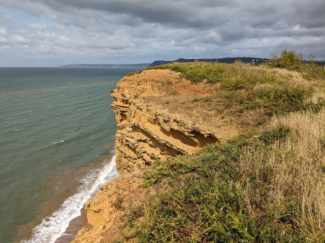
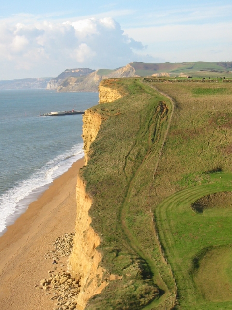
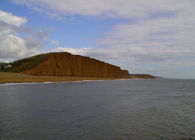
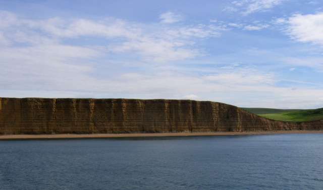
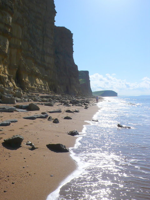
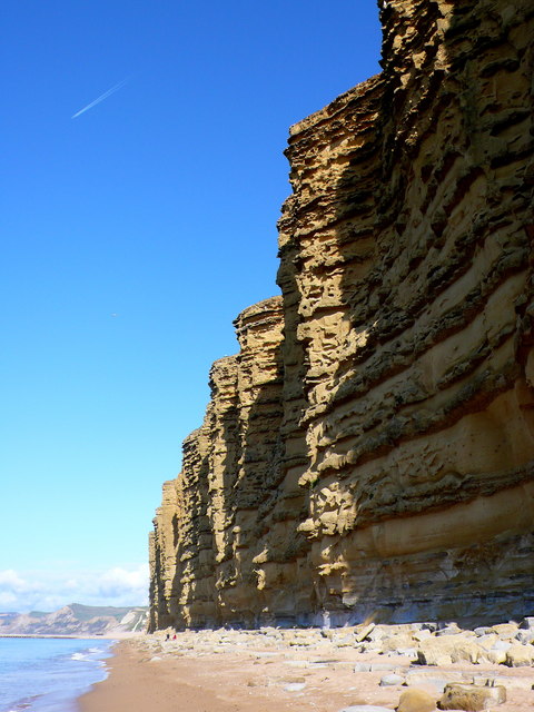
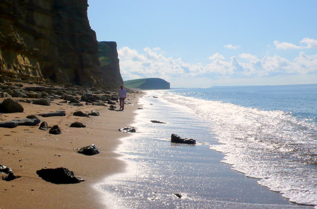
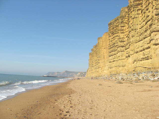
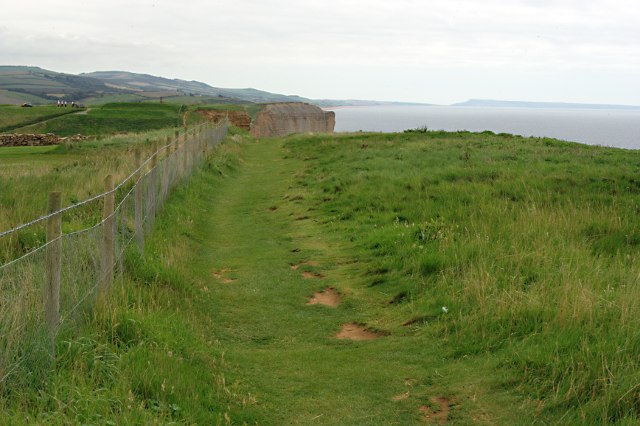
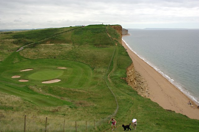
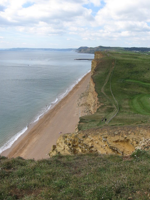
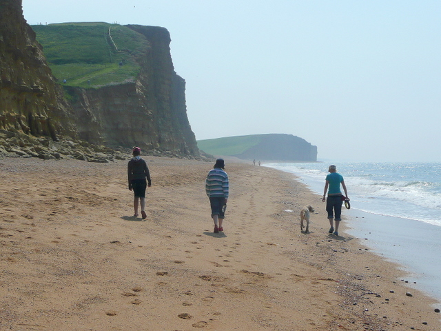
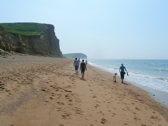
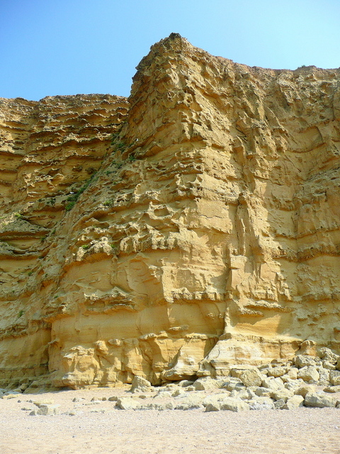
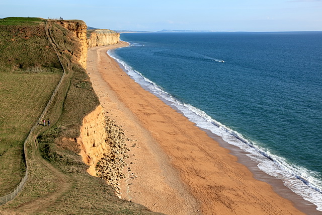
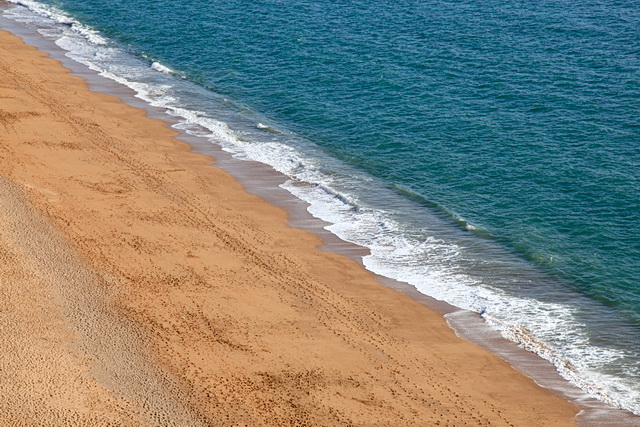
Black Rock is a small island located off the coast of Dorset, England. It is situated in the English Channel, approximately 1.5 kilometers south of the town of Poole. With an area of around 0.6 hectares, Black Rock is a rocky outcrop characterized by steep cliffs and jagged formations.
The island is uninhabited and is primarily visited by tourists and local residents for recreational purposes. It is accessible by boat, and there are regular ferry services operating to and from the mainland. The journey takes approximately 10 minutes.
Black Rock offers stunning natural beauty, with its rugged coastline and panoramic views of the surrounding sea. It is a popular spot for birdwatching, as it serves as a habitat for various seabird species, including gulls and cormorants. Rock pooling enthusiasts also frequent the island, as the tidal pools are teeming with marine life.
The island is a designated Site of Special Scientific Interest (SSSI) due to its geological significance. It is composed mainly of Purbeck limestone, a type of sedimentary rock formed during the Jurassic period. Fossils can occasionally be found on the island, attracting amateur paleontologists.
Due to its small size and lack of facilities, Black Rock does not support any permanent infrastructure. Visitors are advised to bring their own provisions and adhere to the Leave No Trace principles to preserve the island's natural environment.
Overall, Black Rock is a hidden gem in Dorset, offering a unique and tranquil experience for nature lovers and adventurers alike.
If you have any feedback on the listing, please let us know in the comments section below.
Black Rock Images
Images are sourced within 2km of 50.711456/-2.7706944 or Grid Reference SY4590. Thanks to Geograph Open Source API. All images are credited.

Black Rock is located at Grid Ref: SY4590 (Lat: 50.711456, Lng: -2.7706944)
Unitary Authority: Dorset
Police Authority: Dorset
What 3 Words
///dribble.sang.unionists. Near Bridport, Dorset
Nearby Locations
Related Wikis
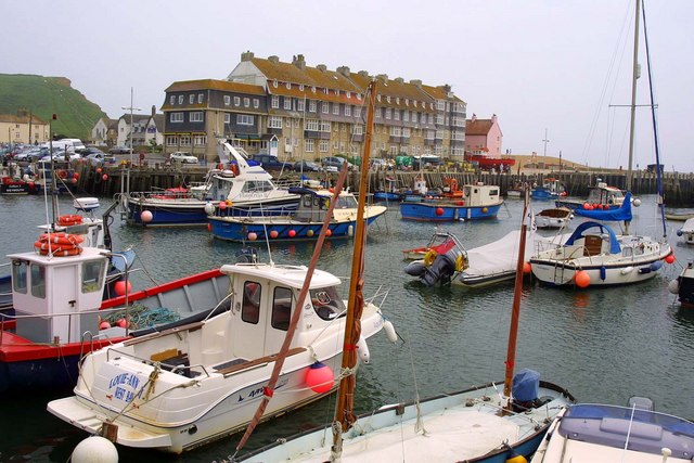
West Bay, Dorset
West Bay, originally known as Bridport Harbour, is a small harbour settlement and resort on the English Channel coast in Dorset, England, sited at the...
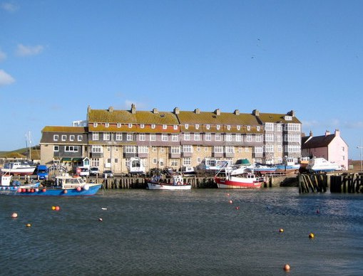
Pier Terrace, West Bay
The Pier Terrace in West Bay, Dorset, was designed by the English Arts and Crafts architect Edward Schroeder Prior in 1884–85. It is a Grade II listed...
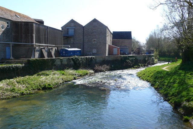
River Brit
The River Brit is a river in west Dorset in south-west England, which rises just to the north of Beaminster. It then flows south to Netherbury and Bridport...

Riverside Restaurant
The Riverside Restaurant was a seafood restaurant in West Bay, England. The building is situated on a causeway and as such the dining area was on two levels...
Related Videos

Discover local attractions & more at West Bay Holiday Park
Take a look at all the amazing things that you can discover in Dorset whilst staying at our West Bay Holiday Park. While holidaying ...

West Bay Holiday Park - Parkdean Resort. UK. 4K
Przyjedź na wakacje do West Bay Holiday Park, idealnego miejsca do odkrywania niesamowitego Wybrzeża Jurajskiego.

Highlands End | Day 1 Arriving At Highlands End Holiday Park Dorset.
Day 1 We arrive at Highland End Holiday Park Dorset where we take you for a full site arrival and walk around this amazing site ...

Highlands End Holiday Park Dorset | Drone Fly Over 4K | DJI Mini 3 Pro.
We reach for the skies once again for a stunning fly over the amazing Highlands End Holiday Park in Dorset this is one of the best ...
Nearby Amenities
Located within 500m of 50.711456,-2.7706944Have you been to Black Rock?
Leave your review of Black Rock below (or comments, questions and feedback).