Creag Raonailt

Cliff, Slope in Ross-shire

Scotland

Creag Raonailt

Aird Mhór peninsula
Aird Mhór peninsula Credit: David Brown

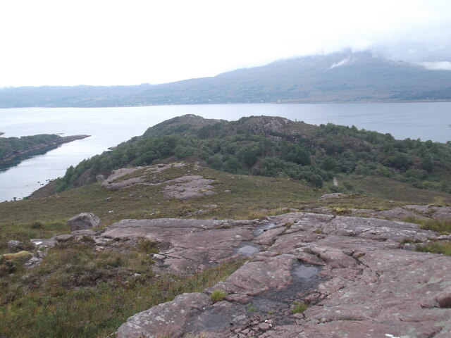
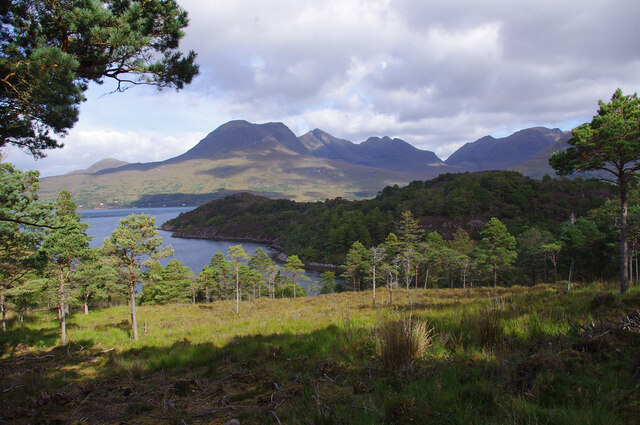
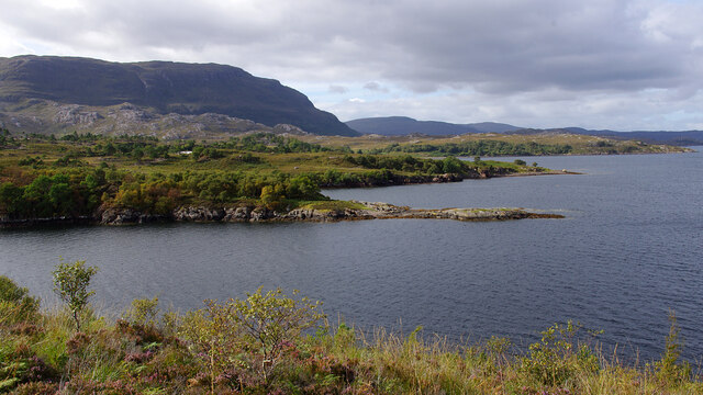
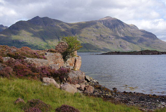
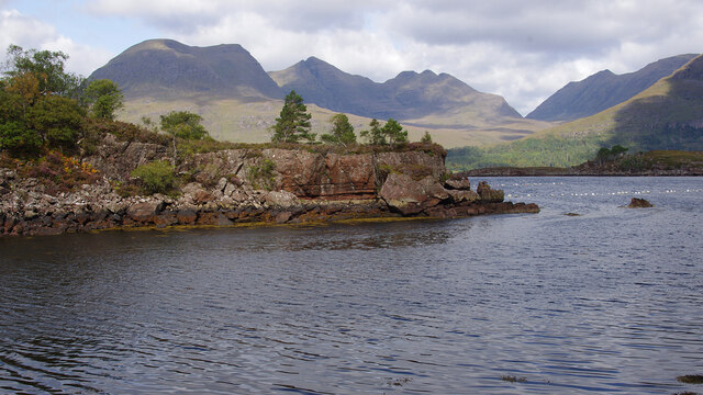
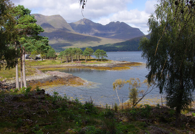
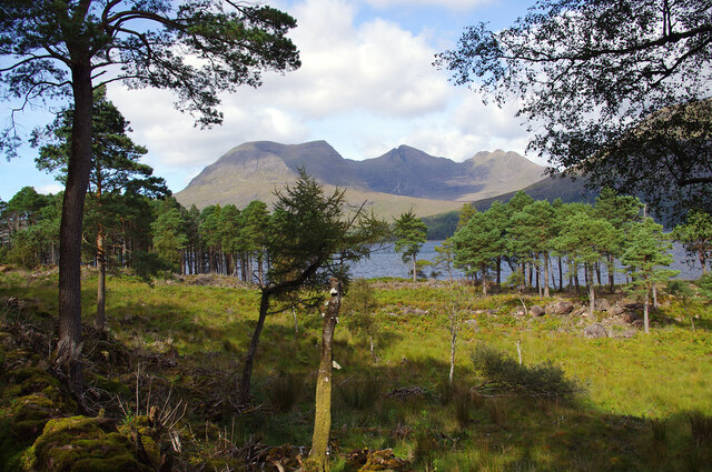
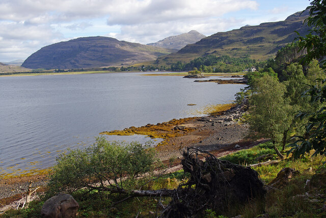
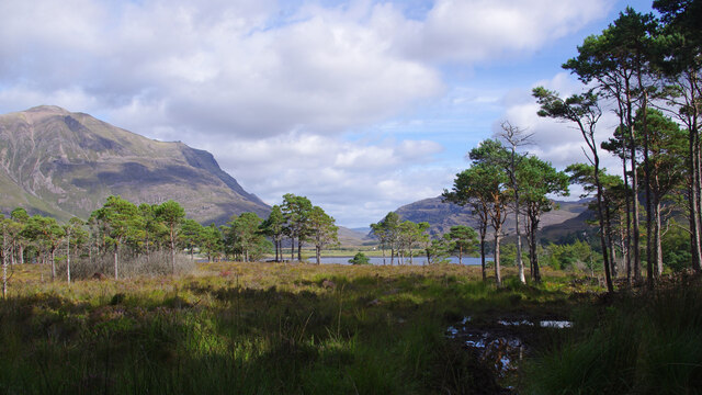
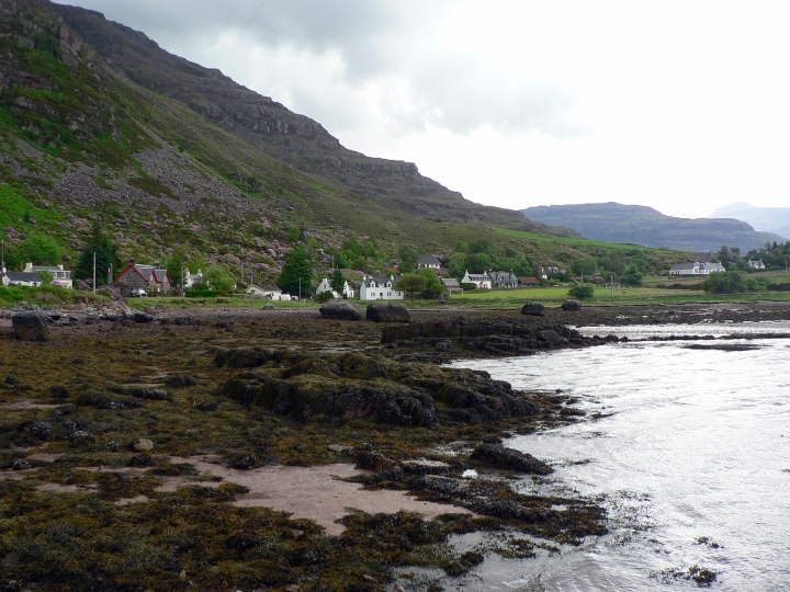
Creag Raonailt is a prominent cliff located in Ross-shire, Scotland. It is known for its steep slopes and rugged terrain, making it a popular destination for hikers and rock climbers looking for a challenging ascent. The cliff stands at an impressive height, providing breathtaking views of the surrounding landscape and the nearby coast.

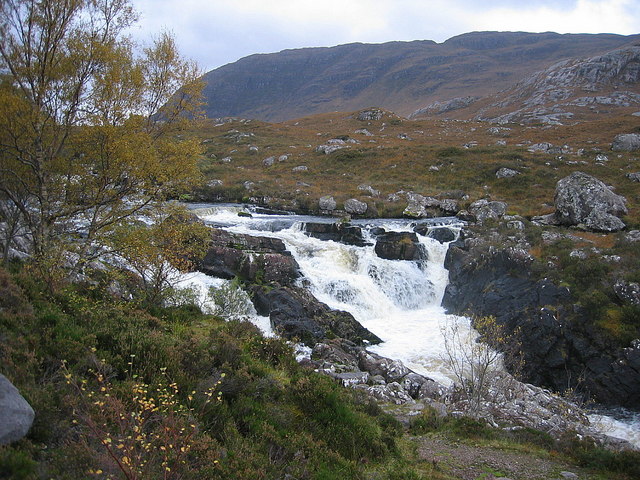
The slopes of Creag Raonailt are characterized by rocky outcrops and scree, creating a dramatic and picturesque backdrop. The area is home to a variety of plant and animal species, adding to its natural beauty and appeal to nature enthusiasts.

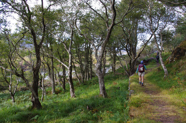
Visitors to Creag Raonailt can enjoy a range of outdoor activities, including hiking, climbing, and birdwatching. The cliff is also a popular spot for photography, with its striking features and stunning vistas attracting photographers from near and far.

Overall, Creag Raonailt is a unique and striking natural landmark in Ross-shire, offering visitors the opportunity to experience the beauty and ruggedness of the Scottish countryside.

If you have any feedback on the listing, please let us know in the comments section below.

Creag Raonailt Images

Images are sourced within 2km of 57.532009/-5.5595794 or Grid Reference NG8754. Thanks to Geograph Open Source API. All images are credited.

Aird Mhór peninsula
Aird Mhór peninsula
Upper Loch Torridon Scots pines are in the foreground. The deciduous wooded peninsula of Aird Mhòr is in the mid distance. Beinn Alligin (centre) and Beinn Dearg (right) are beyond.
Upper Loch Torridon
Scots pines are in the foreground. The deciduous wooded peninsula of Aird Mhòr is in the mid distance. Beinn Alligin (centre) and Beinn Dearg (right) are beyond.
Aird Mhòr Footpath around the deciduous (mostly birch) wooded peninsula of Aird Mhòr.
Aird Mhòr
Footpath around the deciduous (mostly birch) wooded peninsula of Aird Mhòr.
Upper Loch Torridon Looking west from the peninsula of Aird Mhòr, across Ob Gorm Beag to Rubha Maolach Beag. Ben Shieldaig is in the background.
Upper Loch Torridon
Looking west from the peninsula of Aird Mhòr, across Ob Gorm Beag to Rubha Maolach Beag. Ben Shieldaig is in the background.
Upper Loch Torridon Looking east from Port an Aird Mhòir, across Ob Gorm Mòr to Eilean Cnapach. Liathach is in the background.
Upper Loch Torridon
Looking east from Port an Aird Mhòir, across Ob Gorm Mòr to Eilean Cnapach. Liathach is in the background.
Cottage at Port an Aird Mhòir
Aird Mhòr The eastern point of Aird Mhòr peninsula, viewed across Ob na Caillich. Beinn Alligin (centre) and Beinn Dearg (right) form the background. The white floats are mussel lines.
Aird Mhòr
The eastern point of Aird Mhòr peninsula, viewed across Ob na Caillich. Beinn Alligin (centre) and Beinn Dearg (right) form the background. The white floats are mussel lines.
Lùb Dubh-Àird Bay on the east side of Dubh-aird peninsula. Beinn Alligin forms the background.
Lùb Dubh-Àird
Bay on the east side of Dubh-aird peninsula. Beinn Alligin forms the background.
Woods by Upper Loch Torridon On the south side of the loch at Camas Dubh. Beinn Alligin is in the background.
Woods by Upper Loch Torridon
On the south side of the loch at Camas Dubh. Beinn Alligin is in the background.
Upper Loch Torridon The head (east end) of the loch from the south side. A windblown birch tree is in the foreground. Seana Mheallan (left) and Sgorr nan Lochan Uaine (centre) are in the background.
Upper Loch Torridon
The head (east end) of the loch from the south side. A windblown birch tree is in the foreground. Seana Mheallan (left) and Sgorr nan Lochan Uaine (centre) are in the background.
Woods by Upper Loch Torridon On the south side of the loch near the Loch Torridon Hotel. Liathach (left) and Seana Mheallan (centre right) are in the background.
Woods by Upper Loch Torridon
On the south side of the loch near the Loch Torridon Hotel. Liathach (left) and Seana Mheallan (centre right) are in the background.
Allt Coire Rooill
Allt Coire Rooill
Ob Gorm Mor From Loch Torridon viewpoint on the A896. Mussel nets are strung across the bay
Ob Gorm Mor
From Loch Torridon viewpoint on the A896. Mussel nets are strung across the bay
Mussel nets across Ob Gorm Beag
Upper Loch Torridon From Loch Torridon viewpoint on the A896.
Upper Loch Torridon
From Loch Torridon viewpoint on the A896.
Bo and Muc Bo & Muc was the old buttery and dairy to the farm at The Torridon Resort. Now a restaurant
Bo and Muc
Bo & Muc was the old buttery and dairy to the farm at The Torridon Resort. Now a restaurant
Woodland above the Torridon Hotel The path diverges higher up for a range of possible walks.
Woodland above the Torridon Hotel
The path diverges higher up for a range of possible walks.
Path leading from the woodland above The Torridon Hotel This is the point where you reach the open moorland.
Path leading from the woodland above The Torridon Hotel
This is the point where you reach the open moorland.
Show me another place!

Creag Raonailt is located at Grid Ref: NG8754 (Lat: 57.532009, Lng: -5.5595794)

Unitary Authority: Highland

Police Authority: Highlands and Islands

What 3 Words

///hesitate.eyepieces.lasts. Near Lochcarron, Highland

Related Wikis

Annat, Highland

Annat (Scottish Gaelic: An Annaid) is a small village at the eastern end of Upper Loch Torridon in Wester Ross, in the Highland council area of Scotland...

Falls of Balgy

Falls of Balgy is a waterfall near Torridon in Scotland. == See also == Waterfalls of Scotland == References ==

Torridon Hills

The Torridon Hills surround Torridon village in the Northwest Highlands of Scotland. The name is usually applied to the mountains to the north of Glen...

Torridon

Torridon (Scottish Gaelic: Toirbheartan) is a small village in the Northwest Highlands of Scotland. However the name is also applied to the area surrounding...

Nearby Amenities

Located within 500m of 57.532009,-5.5595794
Òb Gorm Mor
Natural: bay
Lat/Long: 57.534902/-5.5640173
The data included in this document is from www.openstreetmap.org. The data is made available under ODbL.

Have you been to Creag Raonailt?

Leave your review of Creag Raonailt below (or comments, questions and feedback).