Rubha an t-Salainn

Coastal Feature, Headland, Point in Ross-shire

Scotland

Rubha an t-Salainn

Aird Mhór peninsula
Aird Mhór peninsula Credit: David Brown

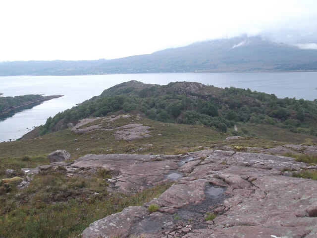
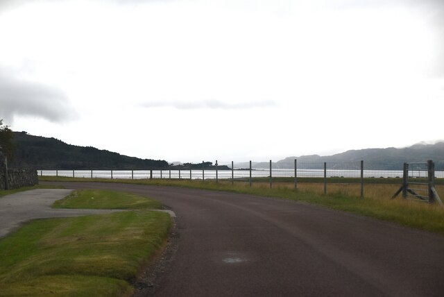
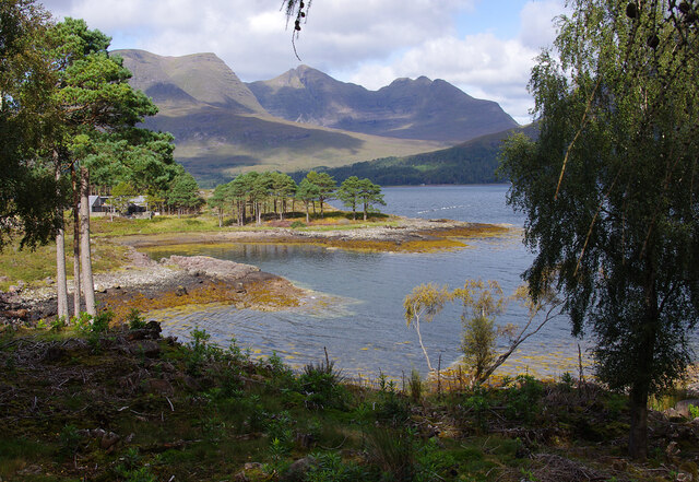
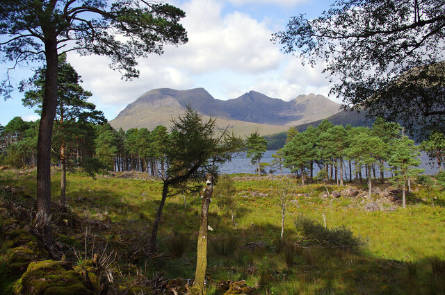
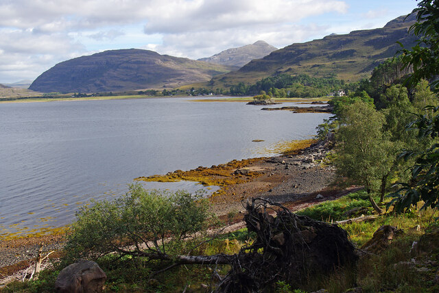
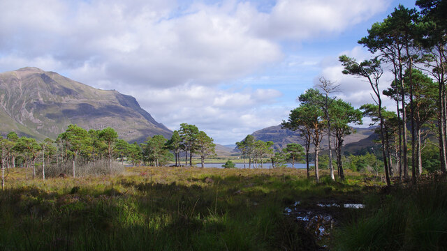
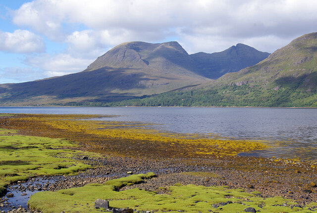
Rubha an t-Salainn is a prominent coastal feature located in Ross-shire, Scotland. Situated on the western coast of the region, it is a headland that juts out into the North Atlantic Ocean. The name "Rubha an t-Salainn" translates to "Salt Point" in English, which aptly describes the area's maritime environment.

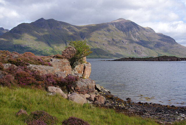
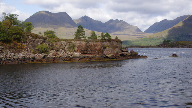
The headland is characterized by its rugged and rocky coastline, offering breathtaking views of the surrounding landscape. The cliffs that line the edge of Rubha an t-Salainn provide nesting grounds for various seabirds, including guillemots and kittiwakes. These avian species can often be observed soaring above the crashing waves or diving into the water in search of food.

The point itself is marked by a tall lighthouse, built in the 19th century to guide ships navigating the treacherous waters of the Moray Firth. The lighthouse stands as a testament to the area's maritime history and serves as a prominent landmark for sailors and visitors alike.

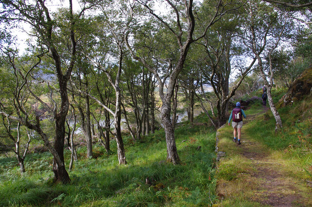
Rubha an t-Salainn is also a popular spot for outdoor enthusiasts and nature lovers. The headland offers numerous hiking trails that meander along the coastline, allowing visitors to explore the diverse flora and fauna that inhabit the area. From wildflowers and heather to seabirds and seals, the headland is teeming with biodiversity.

In conclusion, Rubha an t-Salainn is a captivating headland located in Ross-shire, Scotland. With its dramatic cliffs, abundant wildlife, and historic lighthouse, it is a must-visit destination for those seeking a true coastal experience.

If you have any feedback on the listing, please let us know in the comments section below.

Rubha an t-Salainn Images

Images are sourced within 2km of 57.533384/-5.545239 or Grid Reference NG8754. Thanks to Geograph Open Source API. All images are credited.

Aird Mhór peninsula
Aird Mhór peninsula
OS Bench Mark OS rivet bench mark on wall of old graveyard, Annat. The whole thing was covered by moss; the cut arrow is very weathered and doesn't show up well on this photo. 17.6 feet above old datum; re-levelled to 5.924 m in 1975.
OS Bench Mark
OS rivet bench mark on wall of old graveyard, Annat. The whole thing was covered by moss; the cut arrow is very weathered and doesn't show up well on this photo. 17.6 feet above old datum; re-levelled to 5.924 m in 1975.
OS Bench Mark OS cut bench mark on house, formerly a general store (see <a href="https://www.geograph.org.uk/photo/1678346">NG8954 : DJ MacKenzie's General Store, Annat, Torridon, April 1981</a>), close to main road. 4.470 m above datum. This bench mark replaces a 19th-century one at NG89455449 that was destroyed when the road was re-aligned.
OS Bench Mark
OS cut bench mark on house, formerly a general store (see NG8954 : DJ MacKenzie's General Store, Annat, Torridon, April 1981), close to main road. 4.470 m above datum. This bench mark replaces a 19th-century one at NG89455449 that was destroyed when the road was re-aligned.
A896 The A896 runs 32 miles from Strathcarron to Kinlochewe.
<span class="nowrap"><a title="https://www.sabre-roads.org.uk/wiki/index.php?title=A896" rel="nofollow ugc noopener" href="https://www.sabre-roads.org.uk/wiki/index.php?title=A896">Link</a><img style="margin-left:2px;" alt="External link" title="External link - shift click to open in new window" src="https://s1.geograph.org.uk/img/external.png" width="10" height="10"/></span>
A896
The A896 runs 32 miles from Strathcarron to Kinlochewe. LinkExternal link
A896, Annat The North Coast 500 is a 516 mile scenic route around the north coast of Scotland, starting and ending at Inverness Castle. The route is also known as the NC500 and was launched in 2015, linking many features in the north Highlands of Scotland in one touring route.
The route has increased visitor numbers to parts of the north of Scotland, which has brought economic benefits to some areas. The increase in traffic has also led to more instances of bad and dangerous driving, as well as damage to the roads and concerns about the environmental impact. 
Apparently the route was amended in 2022 with detours etc being removed.
Wikipedia: <span class="nowrap"><a title="https://en.wikipedia.org/wiki/North_Coast_500" rel="nofollow ugc noopener" href="https://en.wikipedia.org/wiki/North_Coast_500">Link</a><img style="margin-left:2px;" alt="External link" title="External link - shift click to open in new window" src="https://s1.geograph.org.uk/img/external.png" width="10" height="10"/></span> 
Original route map: <span class="nowrap"><a title="https://en.wikipedia.org/wiki/North_Coast_500#/media/File:North_Coast_500,_Scotland.svg" rel="nofollow ugc noopener" href="https://en.wikipedia.org/wiki/North_Coast_500#/media/File:North_Coast_500,_Scotland.svg">Link</a><img style="margin-left:2px;" alt="External link" title="External link - shift click to open in new window" src="https://s1.geograph.org.uk/img/external.png" width="10" height="10"/></span> 
Latest route map: <span class="nowrap"><a title="https://www.northcoast500.com/explore-the-route/" rel="nofollow ugc noopener" href="https://www.northcoast500.com/explore-the-route/">Link</a><img style="margin-left:2px;" alt="External link" title="External link - shift click to open in new window" src="https://s1.geograph.org.uk/img/external.png" width="10" height="10"/></span>
A896, Annat
The North Coast 500 is a 516 mile scenic route around the north coast of Scotland, starting and ending at Inverness Castle. The route is also known as the NC500 and was launched in 2015, linking many features in the north Highlands of Scotland in one touring route. The route has increased visitor numbers to parts of the north of Scotland, which has brought economic benefits to some areas. The increase in traffic has also led to more instances of bad and dangerous driving, as well as damage to the roads and concerns about the environmental impact. Apparently the route was amended in 2022 with detours etc being removed. Wikipedia: LinkExternal link Original route map: LinkExternal link Latest route map: LinkExternal link
Barnfield, Annat Liathach is in the background.
Barnfield, Annat
Liathach is in the background.
Upper Loch Torridon Scots pines are in the foreground. The deciduous wooded peninsula of Aird Mhòr is in the mid distance. Beinn Alligin (centre) and Beinn Dearg (right) are beyond.
Upper Loch Torridon
Scots pines are in the foreground. The deciduous wooded peninsula of Aird Mhòr is in the mid distance. Beinn Alligin (centre) and Beinn Dearg (right) are beyond.
Salt marsh, Annat At the head of Upper Loch Torridon. Beinn Alligin is in cloud and partly sunlit in the background.
Salt marsh, Annat
At the head of Upper Loch Torridon. Beinn Alligin is in cloud and partly sunlit in the background.
Aird Mhòr Footpath around the deciduous (mostly birch) wooded peninsula of Aird Mhòr.
Aird Mhòr
Footpath around the deciduous (mostly birch) wooded peninsula of Aird Mhòr.
Upper Loch Torridon Looking east from Port an Aird Mhòir, across Ob Gorm Mòr to Eilean Cnapach. Liathach is in the background.
Upper Loch Torridon
Looking east from Port an Aird Mhòir, across Ob Gorm Mòr to Eilean Cnapach. Liathach is in the background.
Cottage at Port an Aird Mhòir
Aird Mhòr The eastern point of Aird Mhòr peninsula, viewed across Ob na Caillich. Beinn Alligin (centre) and Beinn Dearg (right) form the background. The white floats are mussel lines.
Aird Mhòr
The eastern point of Aird Mhòr peninsula, viewed across Ob na Caillich. Beinn Alligin (centre) and Beinn Dearg (right) form the background. The white floats are mussel lines.
Lùb Dubh-Àird Bay on the east side of Dubh-aird peninsula. Beinn Alligin forms the background.
Lùb Dubh-Àird
Bay on the east side of Dubh-aird peninsula. Beinn Alligin forms the background.
Woods by Upper Loch Torridon On the south side of the loch at Camas Dubh. Beinn Alligin is in the background.
Woods by Upper Loch Torridon
On the south side of the loch at Camas Dubh. Beinn Alligin is in the background.
Upper Loch Torridon The head (east end) of the loch from the south side. A windblown birch tree is in the foreground. Seana Mheallan (left) and Sgorr nan Lochan Uaine (centre) are in the background.
Upper Loch Torridon
The head (east end) of the loch from the south side. A windblown birch tree is in the foreground. Seana Mheallan (left) and Sgorr nan Lochan Uaine (centre) are in the background.
Woods by Upper Loch Torridon On the south side of the loch near the Loch Torridon Hotel. Liathach (left) and Seana Mheallan (centre right) are in the background.
Woods by Upper Loch Torridon
On the south side of the loch near the Loch Torridon Hotel. Liathach (left) and Seana Mheallan (centre right) are in the background.
Upper Loch Torridon The head (east end) of the loch from the south side. Beinn Alligin is in the background.
Upper Loch Torridon
The head (east end) of the loch from the south side. Beinn Alligin is in the background.
Hill Path to Coulags - 10 miles So says this wood-carved sign.  Additionally there are two Scotways signs advertising the start of the routes from Annat to Coulags (Scottish Hill Track 299 and from Annat to Achnashellach (Scottish Hill Track 300) which start as the same path.
Hill Path to Coulags - 10 miles
So says this wood-carved sign. Additionally there are two Scotways signs advertising the start of the routes from Annat to Coulags (Scottish Hill Track 299 and from Annat to Achnashellach (Scottish Hill Track 300) which start as the same path.
Show me another place!

Rubha an t-Salainn is located at Grid Ref: NG8754 (Lat: 57.533384, Lng: -5.545239)

Unitary Authority: Highland

Police Authority: Highlands and Islands

What 3 Words

///dishing.bucked.glossed. Near Lochcarron, Highland

Related Wikis

Annat, Highland

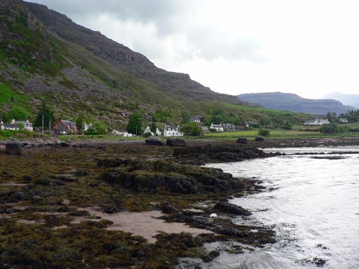
Annat (Scottish Gaelic: An Annaid) is a small village at the eastern end of Upper Loch Torridon in Wester Ross, in the Highland council area of Scotland...

Torridon Hills

The Torridon Hills surround Torridon village in the Northwest Highlands of Scotland. The name is usually applied to the mountains to the north of Glen...

Torridon

Torridon (Scottish Gaelic: Toirbheartan) is a small village in the Northwest Highlands of Scotland. However the name is also applied to the area surrounding...
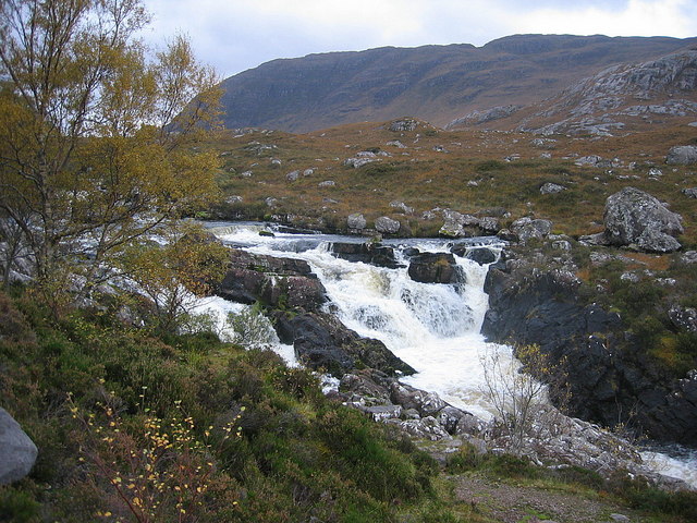
Falls of Balgy

Falls of Balgy is a waterfall near Torridon in Scotland. == See also == Waterfalls of Scotland == References ==

Have you been to Rubha an t-Salainn?

Leave your review of Rubha an t-Salainn below (or comments, questions and feedback).