Creag Froise Mòire

Cliff, Slope in Argyllshire

Scotland

Creag Froise Mòire

Garden doorway At Glen Gorm Castle.
Garden doorway Credit: Andrew Abbott

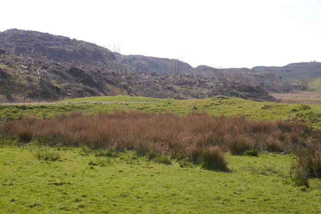
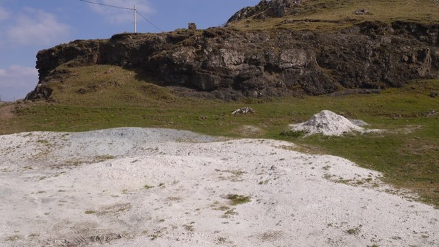
Creag Froise Mòire is a prominent geographical feature located in Argyllshire, Scotland. Also known as a cliff or slope, it is situated in a remote and rugged area, surrounded by stunning natural beauty.

Rising majestically from the ground, Creag Froise Mòire stands at an impressive height, providing a spectacular view of the surrounding landscape. Its sheer vertical face is composed of sturdy rock formations, exhibiting a variety of colors and textures. The cliff has been shaped over thousands of years by the forces of nature, including erosion and weathering.

The location of Creag Froise Mòire adds to its allure, as it is nestled amidst rolling hills and expansive moorland. The surrounding area boasts a diverse range of flora and fauna, with heather, wildflowers, and mosses covering the slopes, and bird species soaring overhead.

The cliff offers a challenging terrain for those who enjoy outdoor activities such as rock climbing and hiking. Adventurers can test their skills and endurance against its steep incline, while being rewarded with breathtaking panoramic vistas at the top.

Creag Froise Mòire also holds historical significance, with ancient ruins and archaeological sites scattered in its vicinity. These remnants provide a glimpse into the rich cultural heritage of the area, adding an additional layer of intrigue to the already captivating landscape.

Overall, Creag Froise Mòire is a natural wonder that showcases the raw beauty of Argyllshire. Its imposing presence, surrounded by untouched wilderness, makes it a must-visit destination for nature enthusiasts and adventurers seeking an unforgettable experience in the Scottish Highlands.

If you have any feedback on the listing, please let us know in the comments section below.

Creag Froise Mòire Images

Images are sourced within 2km of 56.645617/-6.1607914 or Grid Reference NM4558. Thanks to Geograph Open Source API. All images are credited.

Garden doorway At Glen Gorm Castle.
Garden doorway
At Glen Gorm Castle.
Garden Cottage At Glen Gorm Castle.
Garden Cottage
At Glen Gorm Castle.
Glengorm Castle Category B listed. Listing number LB11014. 
Dating from 1860. Architects Kinnear and Peddie. Scots Baronial style. Built for James Forsyth of Quinish who acquired Mishnish 1856 and cleared away the township on the estate.
Glengorm Castle
Category B listed. Listing number LB11014. Dating from 1860. Architects Kinnear and Peddie. Scots Baronial style. Built for James Forsyth of Quinish who acquired Mishnish 1856 and cleared away the township on the estate.
Glengorm coffee shop Formerly the kennels for Glengorm Castle.
Glengorm coffee shop
Formerly the kennels for Glengorm Castle.
Towards Port Chill Near Glengorm Castle.
Towards Port Chill
Near Glengorm Castle.
Glengorm Castle Every time I see a castle like this that has been turned into a hotel I think of Christopher Brookmyre's Be My Enemy...
Glengorm Castle
Every time I see a castle like this that has been turned into a hotel I think of Christopher Brookmyre's Be My Enemy...
Wee bridge on the road to Glengorm Castle
Glengorm stone row Three standing stones represent the remains of a prehistoric stone row.
<span class="nowrap"><a title="https://stonerows.wordpress.com/gazetteer/region/argyll-and-isles/glengorm/" rel="nofollow ugc noopener" href="https://stonerows.wordpress.com/gazetteer/region/argyll-and-isles/glengorm/">Link</a><img style="margin-left:2px;" alt="External link" title="External link - shift click to open in new window" src="https://s1.geograph.org.uk/img/external.png" width="10" height="10"/></span>
Glengorm stone row
Three standing stones represent the remains of a prehistoric stone row. LinkExternal link
Rhododendron clearance, Glengorm Castle Big houses in the Highlands are often surrounded by a Rhododendron ponticum infestation. There has been a lot of clearing work here recently.
Rhododendron clearance, Glengorm Castle
Big houses in the Highlands are often surrounded by a Rhododendron ponticum infestation. There has been a lot of clearing work here recently.
Track in front of Glengorm Castle One of the very popular walks from the cafe and visitor centre.
Track in front of Glengorm Castle
One of the very popular walks from the cafe and visitor centre.
Lambing, Glengorm Castle The quadbike is doing the rounds, Ardnamurchan forms the background.
Lambing, Glengorm Castle
The quadbike is doing the rounds, Ardnamurchan forms the background.
Tracks, Glengorm Castle Looking towards the standing stones.
Tracks, Glengorm Castle
Looking towards the standing stones.
Standing stones, Glengorm Castle A much altered site, two of the stones have been reerected and a modern enclosure of stones built around them.
Standing stones, Glengorm Castle
A much altered site, two of the stones have been reerected and a modern enclosure of stones built around them.
Felled area, Glengorm Castle A conifer plantation has been recently felled.
Felled area, Glengorm Castle
A conifer plantation has been recently felled.
Standing stones, Glengorm Castle A much altered site, two of the stones had fallen and the stone enclosure is modern.
Standing stones, Glengorm Castle
A much altered site, two of the stones had fallen and the stone enclosure is modern.
Torr a' Mhuclaich View eastwards from Dùn Ara with a group looking for seabirds and whales off the north coast of Mull. The hill in the background is Ben Hiant on Ardnamurchan.
Torr a' Mhuclaich
View eastwards from Dùn Ara with a group looking for seabirds and whales off the north coast of Mull. The hill in the background is Ben Hiant on Ardnamurchan.
Crushed shells, Sorne There must be a problem with acid soils here as crushed scallop shells are spread on the land as a source of carbonate to raise the pH.
Crushed shells, Sorne
There must be a problem with acid soils here as crushed scallop shells are spread on the land as a source of carbonate to raise the pH.
Crags, Sorne
Crags, Sorne
Show me another place!

Creag Froise Mòire is located at Grid Ref: NM4558 (Lat: 56.645617, Lng: -6.1607914)

Unitary Authority: Argyll and Bute

Police Authority: Argyll and West Dunbartonshire

What 3 Words

///straddled.allies.dating. Near Tobermory, Argyll & Bute

Related Wikis

Glengorm Castle

Glengorm Castle, also known as Castle Sorne, is a 19th-century country house on the Isle of Mull, Scotland. Located in Mishnish, 6 kilometres (4 mi) northwest...

Battle of Bloody Bay

The Battle of Bloody Bay, or Blàr Bàgh na Fala in Scottish Gaelic, was a naval battle fought near Tobermory, Scotland. It was fought on the coast of Mull...

Rubha nan Gall

Rubha nan Gall lighthouse is located north of Tobermory on the Isle of Mull beside the Sound of Mull. The name means "Stranger's Point" in Scottish Gaelic...

Tobermory High School

Tobermory High School (Scottish Gaelic: Àrd-sgoil Thobar Mhoire) is the only secondary school on the Isle of Mull. It is located in Tobermory, at the northern...

Nearby Amenities

Located within 500m of 56.645617,-6.1607914
Created By: dmgroom_coastlines
Source: PGS
Lat/Long: 56.64505/-6.16389
Created By: dmgroom_coastlines
Source: PGS
Lat/Long: 56.64506/-6.16435
Created By: dmgroom_coastlines
Source: PGS
Lat/Long: 56.64532/-6.16433
Created By: dmgroom_coastlines
Source: PGS
Lat/Long: 56.64522/-6.16403
The data included in this document is from www.openstreetmap.org. The data is made available under ODbL.

Have you been to Creag Froise Mòire?

Leave your review of Creag Froise Mòire below (or comments, questions and feedback).