Aigeann Charraig

Coastal Feature, Headland, Point in Argyllshire

Scotland

Aigeann Charraig

Towards Port Chill Near Glengorm Castle.
Towards Port Chill Credit: Andrew Abbott

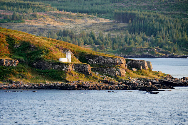
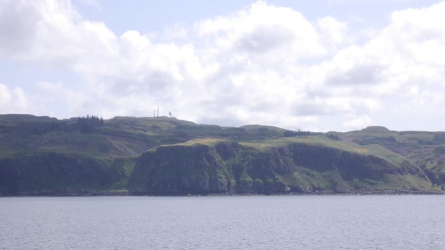
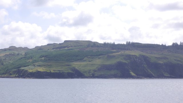
Aigeann Charraig is a captivating coastal feature located in Argyllshire, Scotland. It is commonly referred to as a headland or point due to its prominent and elevated position, jutting out into the sea.

Situated in a picturesque setting, Aigeann Charraig offers breathtaking views of the surrounding landscape. Its rocky cliffs, which are characteristic of the area, provide a stunning contrast against the deep blue waters of the ocean. The headland is known for its rugged beauty, with its rocky outcrops and steep slopes adding to its dramatic appeal.

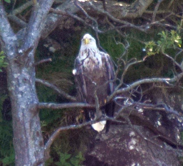
Aigeann Charraig is also a haven for wildlife enthusiasts, as it is home to a diverse range of flora and fauna. The headland provides a nesting site for various seabirds such as gulls, kittiwakes, and fulmars, making it a popular spot for birdwatching. The surrounding waters are teeming with marine life, and lucky visitors may even catch a glimpse of seals, dolphins, or porpoises swimming in the nearby sea.

With its captivating natural beauty and abundant wildlife, Aigeann Charraig is a popular destination for outdoor activities such as hiking, photography, and nature exploration. Visitors can take leisurely walks along the cliff paths, allowing them to fully immerse themselves in the mesmerizing scenery.

Overall, Aigeann Charraig in Argyllshire is a must-visit coastal feature for nature lovers and those seeking a tranquil escape. Its majestic cliffs, abundant wildlife, and stunning views make it a truly remarkable and unforgettable destination.

If you have any feedback on the listing, please let us know in the comments section below.

Aigeann Charraig Images

Images are sourced within 2km of 56.651592/-6.1501858 or Grid Reference NM4558. Thanks to Geograph Open Source API. All images are credited.

Towards Port Chill Near Glengorm Castle.
Towards Port Chill
Near Glengorm Castle.
Ardmore Point The most northerly point on the Island of Mull. 
Ardmore Point Lighthouse was established in 1958 but is now a modern aluminium and glass fibre structure similar to the Ardtornish lighthouse; it was placed on the point in 2003 (<span class="nowrap"><a title="https://mull-historical-society.co.uk/agricultural-industrial-sites-2/lighthouses-sue/lismore-lighthouse/3579-2/" rel="nofollow ugc noopener" href="https://mull-historical-society.co.uk/agricultural-industrial-sites-2/lighthouses-sue/lismore-lighthouse/3579-2/">Link</a><img style="margin-left:2px;" alt="External link" title="External link - shift click to open in new window" src="https://s1.geograph.org.uk/img/external.png" width="10" height="10"/></span> Mull Historical and Archaeological Society).
Ardmore Point
The most northerly point on the Island of Mull. Ardmore Point Lighthouse was established in 1958 but is now a modern aluminium and glass fibre structure similar to the Ardtornish lighthouse; it was placed on the point in 2003 (LinkExternal link Mull Historical and Archaeological Society).
Ardmore Point Lighthouse Ardmore Point Lighthouse was established in 1958 but is now a modern aluminium and glass fibre structure similar to the Ardtornish lighthouse; it was placed on the point in 2003 (<span class="nowrap"><a title="https://mull-historical-society.co.uk/agricultural-industrial-sites-2/lighthouses-sue/lismore-lighthouse/3579-2/" rel="nofollow ugc noopener" href="https://mull-historical-society.co.uk/agricultural-industrial-sites-2/lighthouses-sue/lismore-lighthouse/3579-2/">Link</a><img style="margin-left:2px;" alt="External link" title="External link - shift click to open in new window" src="https://s1.geograph.org.uk/img/external.png" width="10" height="10"/></span> Mull Historical and Archaeological Society).
Ardmore Point Lighthouse
Ardmore Point Lighthouse was established in 1958 but is now a modern aluminium and glass fibre structure similar to the Ardtornish lighthouse; it was placed on the point in 2003 (LinkExternal link Mull Historical and Archaeological Society).
Light at Ardmore Point
Sea stack at Ardmore Point This wall-like stack on the coast of Mull at Ardmore Point is host to an almost fully grown White Tailed Sea Eagle (Haliaeetus albicilla) chick. Closer view <a href="https://www.geograph.org.uk/photo/5836729">NM4759 : White Tailed Sea Eagle (Haliaeetus albicilla) chick</a>
Adult bird on nearby tree: <a href="https://www.geograph.org.uk/photo/5836732">NM4759 : White Tailed Sea Eagle (Haliaeetus albicilla) adult</a>
and see shared description below:
Sea stack at Ardmore Point
This wall-like stack on the coast of Mull at Ardmore Point is host to an almost fully grown White Tailed Sea Eagle (Haliaeetus albicilla) chick. Closer view NM4759 : White Tailed Sea Eagle (Haliaeetus albicilla) chick Adult bird on nearby tree: NM4759 : White Tailed Sea Eagle (Haliaeetus albicilla) adult and see shared description below:
White Tailed Sea Eagle (Haliaeetus albicilla) chick A closer view of the White Tailed Sea Eagle (Haliaeetus albicilla) chick on the stack seen in  <a href="https://www.geograph.org.uk/photo/5836727">NM4759 : Sea stack at Ardmore Point</a>.
This "chick" is nearly fully grown.
See also
<a href="https://www.geograph.org.uk/photo/5836732">NM4759 : White Tailed Sea Eagle (Haliaeetus albicilla) adult</a>
and shared description below:
White Tailed Sea Eagle (Haliaeetus albicilla) chick
A closer view of the White Tailed Sea Eagle (Haliaeetus albicilla) chick on the stack seen in NM4759 : Sea stack at Ardmore Point. This "chick" is nearly fully grown. See also NM4759 : White Tailed Sea Eagle (Haliaeetus albicilla) adult and shared description below:
White Tailed Sea Eagle (Haliaeetus albicilla) adult One of the parents of <a href="https://www.geograph.org.uk/photo/5836729">NM4759 : White Tailed Sea Eagle (Haliaeetus albicilla) chick</a> seen sitting in a nearby tree.
(see also <a href="https://www.geograph.org.uk/photo/5836727">NM4759 : Sea stack at Ardmore Point</a> and shared description below).
White Tailed Sea Eagle (Haliaeetus albicilla) adult
One of the parents of NM4759 : White Tailed Sea Eagle (Haliaeetus albicilla) chick seen sitting in a nearby tree. (see also NM4759 : Sea stack at Ardmore Point and shared description below).
Creag an t-Siol-chrainn Basalt crags on the north coast of Mull, seen from the Coll/Tiree ferry.
Creag an t-Siol-chrainn
Basalt crags on the north coast of Mull, seen from the Coll/Tiree ferry.
North end of Mull Basalt crags and forestry west of Ardmore Point
North end of Mull
Basalt crags and forestry west of Ardmore Point
The light, Ardmore Point Navigation light at the northern entrance to the Sound of Mull.
The light, Ardmore Point
Navigation light at the northern entrance to the Sound of Mull.
Western side of Ardmore Point The light to the left of this picture and the high ground immediately behind it are in the adjacent square, but the low ground and rocks in the centre left of the picture are in NM4659.
Western side of Ardmore Point
The light to the left of this picture and the high ground immediately behind it are in the adjacent square, but the low ground and rocks in the centre left of the picture are in NM4659.
Ardmore Bay and Ardmore Point A view from the MV Clansman en route to Tiree.
Ardmore Bay and Ardmore Point
A view from the MV Clansman en route to Tiree.
Ardmore Point Looking south from the ferry to Tiree. The radio masts are on Meall an Inbhire in <a href="https://www.geograph.org.uk/gridref/NM4656">NM4656</a>. For a reciprocal view see <a href="https://www.geograph.org.uk/photo/21073">NM4656 : View North East towards Ardnamurchan from Meall an Inbhire</a>.
Ardmore Point
Looking south from the ferry to Tiree. The radio masts are on Meall an Inbhire in NM4656. For a reciprocal view see NM4656 : View North East towards Ardnamurchan from Meall an Inbhire.
Rubha na Sealbhaig The northernmost tip of Mull, seen from the Tiree ferry.
Rubha na Sealbhaig
The northernmost tip of Mull, seen from the Tiree ferry.
Ardmore Point and lighthouse At the northern tip of Mull. Seen from the Oban-Tiree ferry.
Ardmore Point and lighthouse
At the northern tip of Mull. Seen from the Oban-Tiree ferry.
Ardmore A ruined house exposed after tree felling. Overlooks Bloody Bay
Ardmore
A ruined house exposed after tree felling. Overlooks Bloody Bay
Track through Ardmore Forest This is an excellent Cycle Trail and Forest Walk.
Track through Ardmore Forest
This is an excellent Cycle Trail and Forest Walk.
Logging Just to the north of the main track is the few ruined remains of houses at Penalbanach. This area is currently the centre of a major tree felling expedition.
Logging
Just to the north of the main track is the few ruined remains of houses at Penalbanach. This area is currently the centre of a major tree felling expedition.
Show me another place!

Aigeann Charraig is located at Grid Ref: NM4558 (Lat: 56.651592, Lng: -6.1501858)

Unitary Authority: Argyll and Bute

Police Authority: Argyll and West Dunbartonshire

What 3 Words

///deflect.shadowed.shuffles. Near Kilchoan, Highland

Related Wikis

Battle of Bloody Bay

The Battle of Bloody Bay, or Blàr Bàgh na Fala in Scottish Gaelic, was a naval battle fought near Tobermory, Scotland. It was fought on the coast of Mull...

Glengorm Castle

Glengorm Castle, also known as Castle Sorn, is a 19th-century country house on the Isle of Mull, Scotland. Located in Mishnish, 6 kilometres (4 mi) northwest...

Rubha nan Gall

Rubha nan Gall lighthouse is located north of Tobermory on the Isle of Mull beside the Sound of Mull. The name means "Stranger's Point" in Scottish Gaelic...

Tobermory High School

Tobermory High School (Scottish Gaelic: Àrd-sgoil Thobar Mhoire) is the only secondary school on the Isle of Mull. It is located in Tobermory, at the northern...

Kilchoan

Kilchoan (Scottish Gaelic: Cille Chòmhain) is a village on the Scottish peninsula of Ardnamurchan, beside the Sound of Mull in Lochaber, Highland. It is...

Tobermory distillery

Tobermory distillery is a Scotch whisky distillery situated on the Hebridean island of Mull, Scotland in the town of Tobermory. The distillery, which...
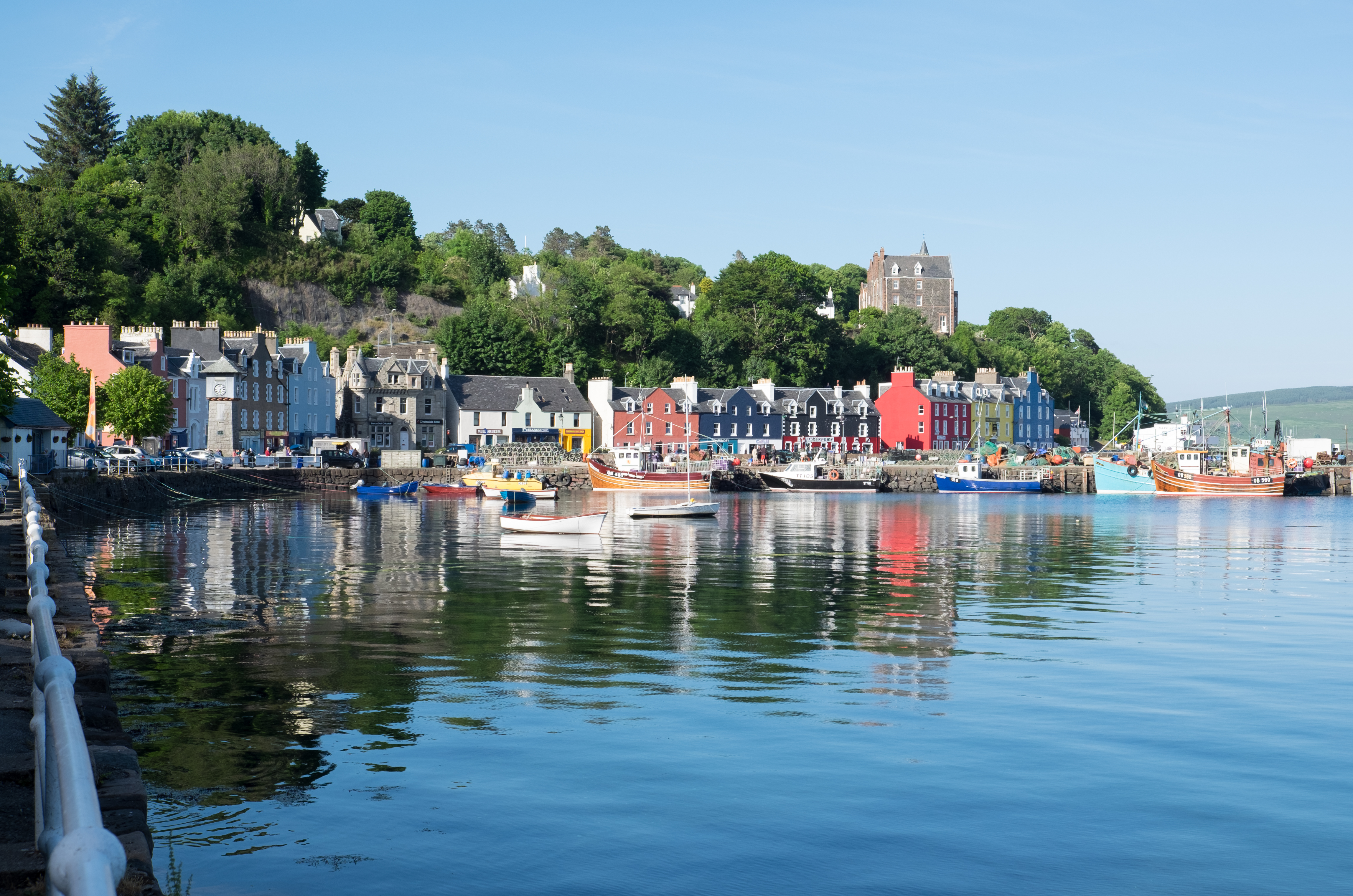
Tobermory, Mull

Tobermory (; Scottish Gaelic: Tobar Mhoire) is the capital of, and until 1973 the only burgh on, the Isle of Mull in the Scottish Inner Hebrides. It is...

Mingary Castle

Mingary Castle (Scottish Gaelic: Caisteal Mhìogharraidh), also known as Mingarry Castle, is a castle situated one mile (1.5 kilometres) southeast of the...

Nearby Amenities

Located within 500m of 56.651592,-6.1501858
Created By: dmgroom_coastlines
Source: PGS
Lat/Long: 56.6488/-6.15477
Created By: dmgroom_coastlines
Source: PGS
Lat/Long: 56.64915/-6.15288
The data included in this document is from www.openstreetmap.org. The data is made available under ODbL.

Have you been to Aigeann Charraig?

Leave your review of Aigeann Charraig below (or comments, questions and feedback).