Creag an t-Seol-chrainn
Coastal Feature, Headland, Point in Argyllshire
Scotland
Creag an t-Seol-chrainn

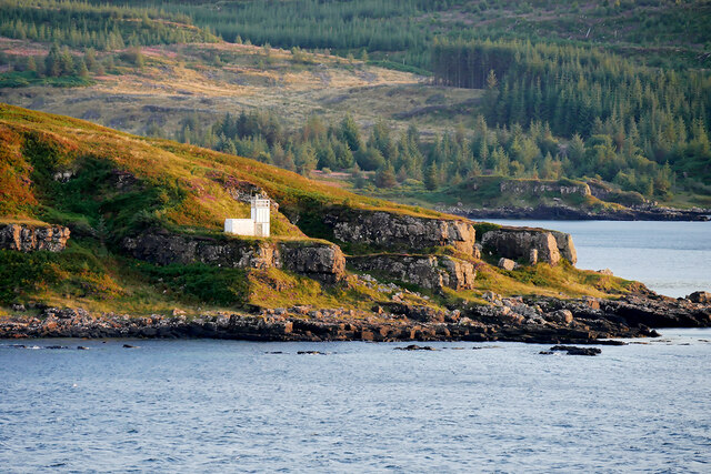
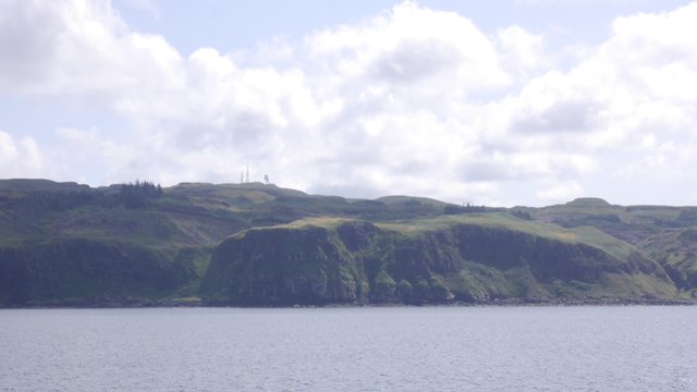
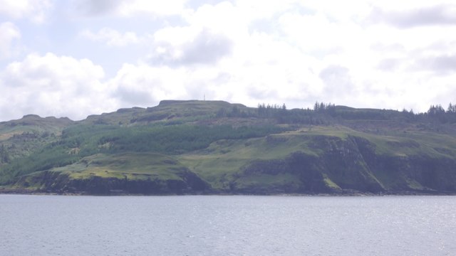
Creag an t-Seol-chrainn is a prominent coastal feature located in Argyllshire, Scotland. Situated on the western coast of the country, this headland juts out into the Atlantic Ocean, offering stunning views and an unspoiled natural environment.
The name "Creag an t-Seol-chrainn" translates to "Rock of the Kelp Sail" in English, a reference to the rich marine life and seaweed that can be found in the area. This headland is characterized by its rugged cliffs, which provide nesting grounds for various seabird species such as guillemots and fulmars.
The rocky shoreline of Creag an t-Seol-chrainn is also home to a diverse range of marine flora and fauna. The intertidal zone is teeming with seaweed, providing food and shelter for numerous species of fish and invertebrates. Visitors may also spot seals and dolphins swimming in the waters surrounding the headland.
From a geological perspective, Creag an t-Seol-chrainn is composed of ancient rocks, formed during the geological processes that shaped the region millions of years ago. The headland's cliffs display distinct layers of sediment, providing a glimpse into the area's geological history.
Due to its picturesque scenery and abundant wildlife, Creag an t-Seol-chrainn is a popular destination for nature enthusiasts and hikers. A coastal path leads visitors along the headland, offering breathtaking views of the surrounding ocean and the nearby islands of the Inner Hebrides.
In summary, Creag an t-Seol-chrainn in Argyllshire is a stunning coastal feature characterized by its rugged cliffs, diverse marine life, and rich geological history. It is a must-visit location for those seeking to experience the beauty and tranquility of Scotland's western coastline.
If you have any feedback on the listing, please let us know in the comments section below.
Creag an t-Seol-chrainn Images
Images are sourced within 2km of 56.649243/-6.1545635 or Grid Reference NM4558. Thanks to Geograph Open Source API. All images are credited.


Creag an t-Seol-chrainn is located at Grid Ref: NM4558 (Lat: 56.649243, Lng: -6.1545635)
Unitary Authority: Argyll and Bute
Police Authority: Argyll and West Dunbartonshire
What 3 Words
///regular.gilding.edge. Near Tobermory, Argyll & Bute
Nearby Locations
Related Wikis

Glengorm Castle
Glengorm Castle, also known as Castle Sorn, is a 19th-century country house on the Isle of Mull, Scotland. Located in Mishnish, 6 kilometres (4 mi) northwest...

Battle of Bloody Bay
The Battle of Bloody Bay, or Blàr Bàgh na Fala in Scottish Gaelic, was a naval battle fought near Tobermory, Scotland. It was fought on the coast of Mull...

Rubha nan Gall
Rubha nan Gall lighthouse is located north of Tobermory on the Isle of Mull beside the Sound of Mull. The name means "Stranger's Point" in Scottish Gaelic...

Tobermory High School
Tobermory High School (Scottish Gaelic: Àrd-sgoil Thobar Mhoire) is the only secondary school on the Isle of Mull. It is located in Tobermory, at the northern...

Tobermory distillery
Tobermory distillery is a Scotch whisky distillery situated on the Hebridean island of Mull, Scotland in the town of Tobermory. The distillery, which...
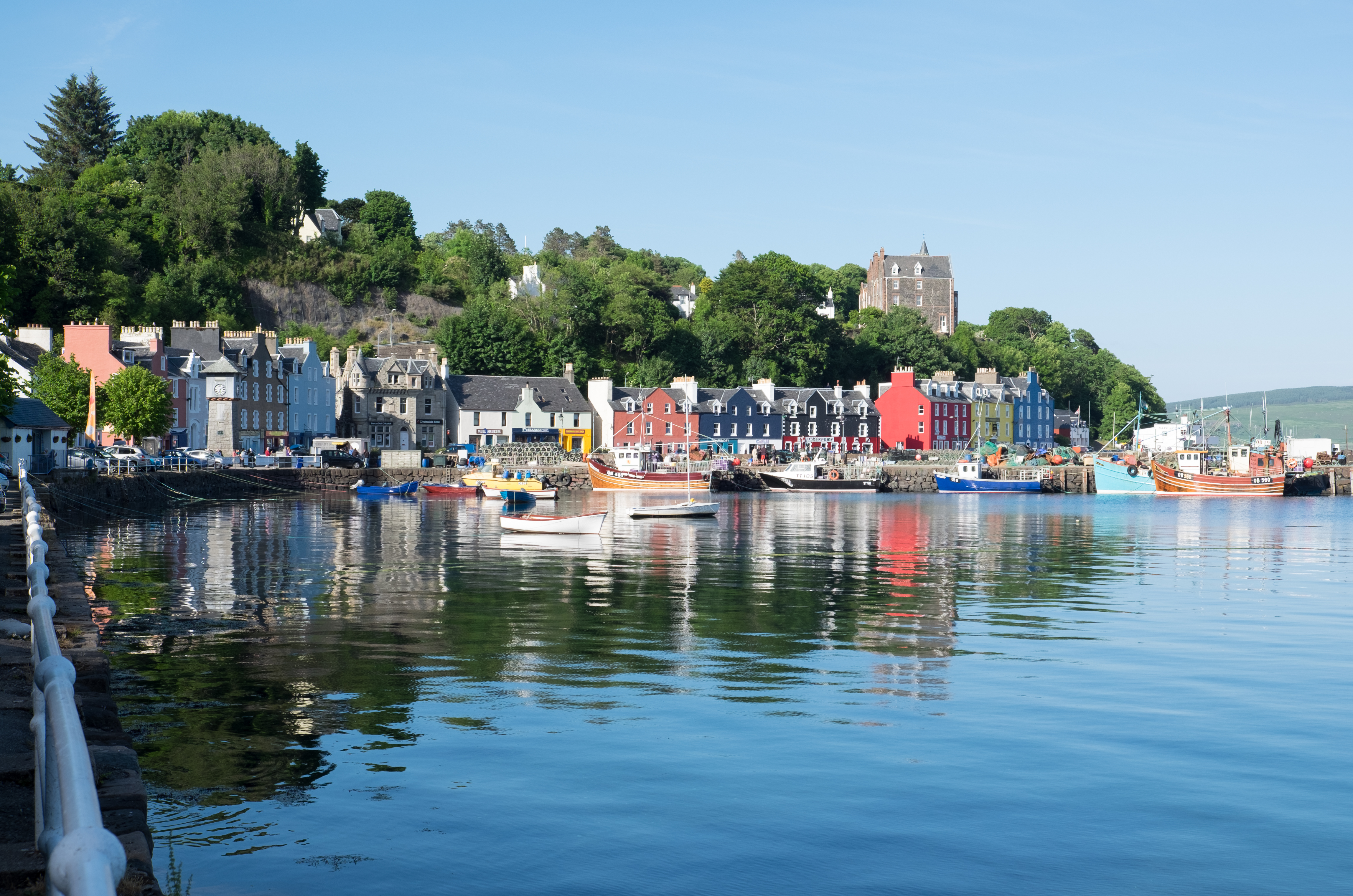
Tobermory, Mull
Tobermory (; Scottish Gaelic: Tobar Mhoire) is the capital of, and until 1973 the only burgh on, the Isle of Mull in the Scottish Inner Hebrides. It is...

Kilchoan
Kilchoan (Scottish Gaelic: Cille Chòmhain) is a village on the Scottish peninsula of Ardnamurchan, beside the Sound of Mull in Lochaber, Highland. It is...

Mingary Castle
Mingary Castle (Scottish Gaelic: Caisteal Mhìogharraidh), also known as Mingarry Castle, is a castle situated one mile (1.5 kilometres) southeast of the...
Nearby Amenities
Located within 500m of 56.649243,-6.1545635Have you been to Creag an t-Seol-chrainn?
Leave your review of Creag an t-Seol-chrainn below (or comments, questions and feedback).