Nan Creagachain

Cliff, Slope in Argyllshire

Scotland

Nan Creagachain

Track in Scoor Forest
Track in Scoor Forest Credit: Andy Waddington

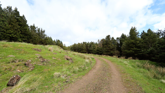
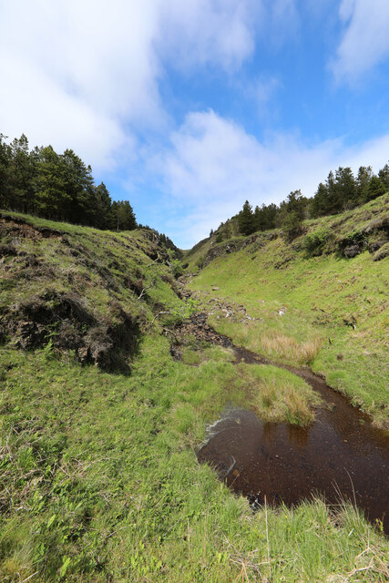
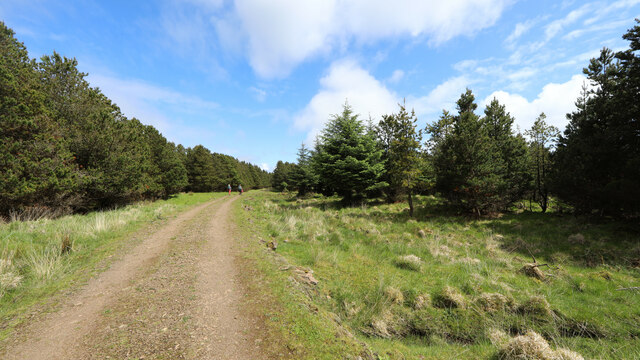
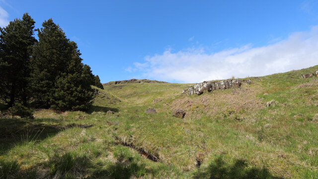
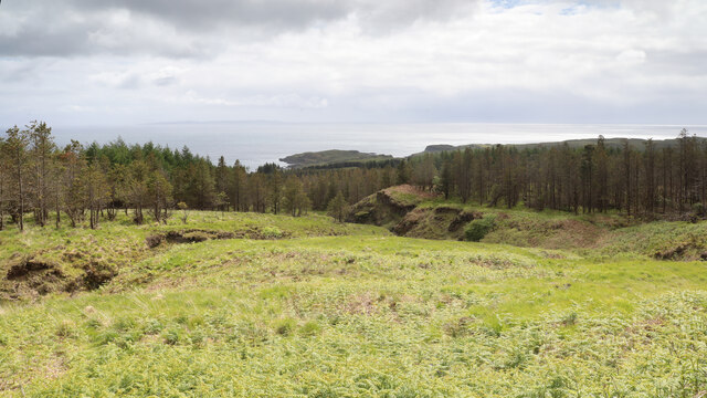
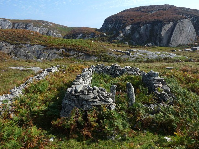
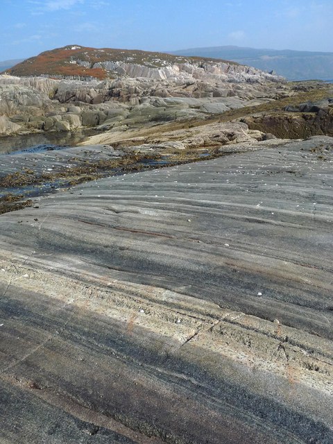
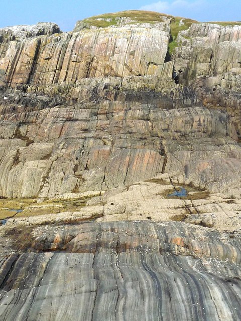
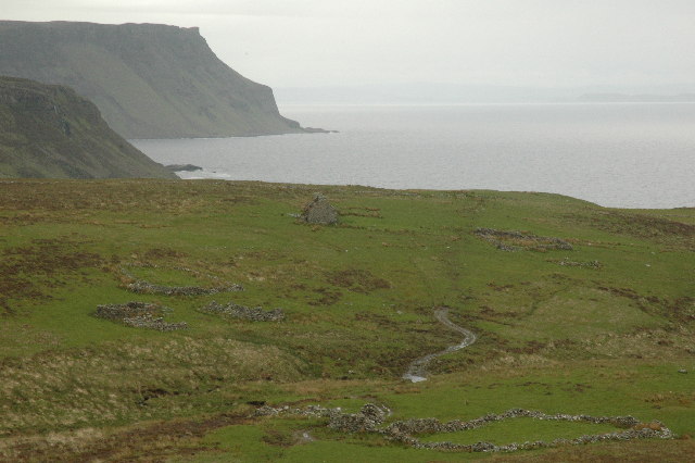
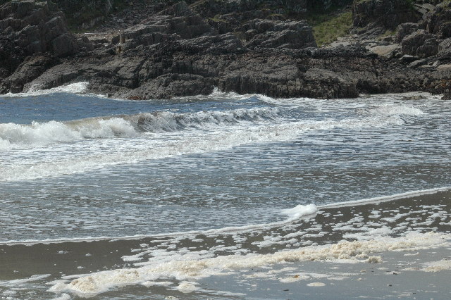
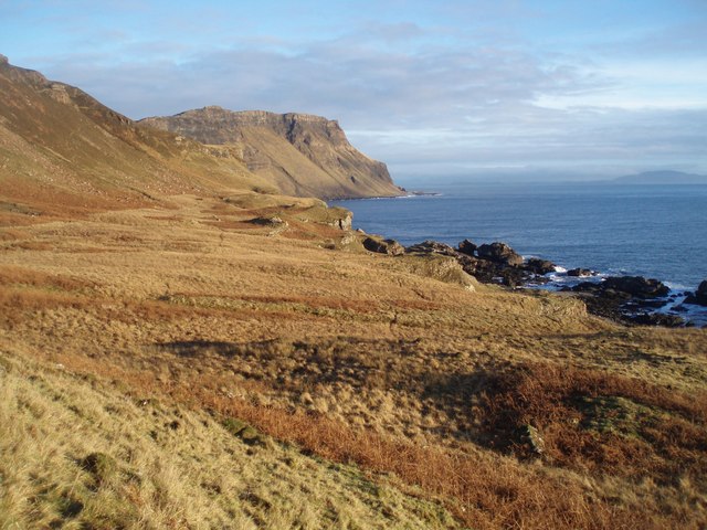
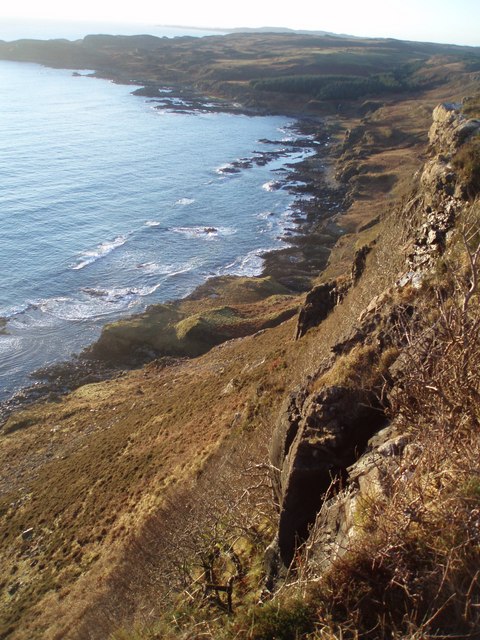
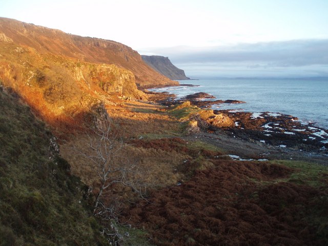
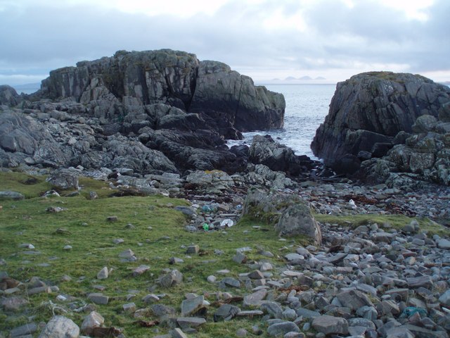
Nan Creagachain is a prominent cliff located in Argyllshire, Scotland. It is situated in a remote and rugged area, surrounded by stunning natural beauty and breathtaking views of the Scottish Highlands. The cliff is known for its steep slopes and rocky terrain, making it a popular destination for hikers and climbers looking for a challenge.

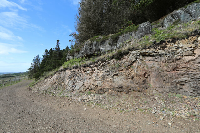
The geology of Nan Creagachain is comprised of ancient rock formations, including schist and gneiss, which have been shaped by centuries of erosion and weathering. The cliff rises dramatically from the surrounding landscape, creating a striking contrast against the rolling hills and lush greenery that characterize the region.

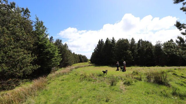
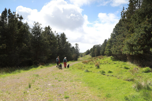
Visitors to Nan Creagachain can enjoy stunning panoramic views of the surrounding countryside, including Loch Lomond and the Trossachs National Park. The area is also home to a diverse range of wildlife, including red deer, golden eagles, and other native species.

Overall, Nan Creagachain is a must-visit destination for outdoor enthusiasts and nature lovers looking to explore the rugged beauty of the Scottish Highlands. Its unique geology, stunning views, and remote location make it a truly unforgettable experience for those who venture to its slopes.

If you have any feedback on the listing, please let us know in the comments section below.

Nan Creagachain Images

Images are sourced within 2km of 56.297326/-6.122156 or Grid Reference NM4519. Thanks to Geograph Open Source API. All images are credited.

Track in Scoor Forest
Final ride at eastern end of Scoor Forest
Turning space at end of Scoor Forest track
Forest track cut through lava flow
Allt an Fhir above Scoor Forest track
Track in Scoor Forest
Forest escape via Allt an Sgalain Bhig
Looking down the Allt an Fhir from Scoor Forest track
Ruined building above Tràigh Bhàn, Isle of Mull The building was already shown as unroofed on the 1st edition OS six inch map which was surveyed in 1878.
Ruined building above Tràigh Bhàn, Isle of Mull
The building was already shown as unroofed on the 1st edition OS six inch map which was surveyed in 1878.
Coastline at Rubha nam Bràithrean, Isle of Mull
Shiaba Shiaba was a crofting township on the Ross of Mull. The 130 residents were cleared to make way for sheep. These are the remains of their houses.
Shiaba
Shiaba was a crofting township on the Ross of Mull. The 130 residents were cleared to make way for sheep. These are the remains of their houses.
Waterfall on Ross of Mull This is one of the many waterfalls in this area.
Waterfall on Ross of Mull
This is one of the many waterfalls in this area.
Traigh Bhan The beach at Traigh Bhan, one of a number on this part of the Ross of Mull.
Traigh Bhan
The beach at Traigh Bhan, one of a number on this part of the Ross of Mull.
East to Malcolms Point Crossing a feature shown as Aoineadh Beag on the map, meaning the little steep brae with rocks! - well I suppose it is a steep slope to the left and there are rocks on the shore!
Malcolms Point in distance with Carsaig Arches below, just about peeking round the corner.
The high ground at extreme right of picture is the island of Scarba.
East to Malcolms Point
Crossing a feature shown as Aoineadh Beag on the map, meaning the little steep brae with rocks! - well I suppose it is a steep slope to the left and there are rocks on the shore! Malcolms Point in distance with Carsaig Arches below, just about peeking round the corner. The high ground at extreme right of picture is the island of Scarba.
Clifftop View This is more like the terrain you would expect for Aoineadh Beag, or
a small steep brae with rocks, as the OS map names on the 1km square to the east. Dramatic scenery all the same with a 300 foot drop beneath my feet!
Clifftop View
This is more like the terrain you would expect for Aoineadh Beag, or a small steep brae with rocks, as the OS map names on the 1km square to the east. Dramatic scenery all the same with a 300 foot drop beneath my feet!
Last  Sun of the Year, Ross of Mull The sun will soon set on 2007 on the Ross of Mull. At the very western extremity of the South Mull Coast SSSI - the best example of coastal tertiary igneous escarpments in the Hebrides - Malcolms Point in the distance.
Last Sun of the Year, Ross of Mull
The sun will soon set on 2007 on the Ross of Mull. At the very western extremity of the South Mull Coast SSSI - the best example of coastal tertiary igneous escarpments in the Hebrides - Malcolms Point in the distance.
Between the Rocks to Jura Paps of Jura seen down an inlet on the rocky coast of the Ross of Mull.
Between the Rocks to Jura
Paps of Jura seen down an inlet on the rocky coast of the Ross of Mull.
Show me another place!

Nan Creagachain is located at Grid Ref: NM4519 (Lat: 56.297326, Lng: -6.122156)

Unitary Authority: Argyll and Bute

Police Authority: Argyll and West Dunbartonshire

What 3 Words

///downhill.gratuity.taxed. Near Fionnphort, Argyll & Bute

Related Wikis

Shiaba

Shiaba (Scottish Gaelic: Siaba) is a ruined township located on the southwestern peninsula of the Isle of Mull, Scotland. It lies about 8 km to the east...
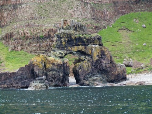
Carsaig Arches

Carsaig Arches are natural arch cliff formations on the Ross of Mull in the south of the Isle of Mull, on the west coast of Scotland. They are situated...

Uisken

Uisken (Scottish Gaelic: Uisgean, meaning "water-bay") is a settlement on a sandy bay on the Ross of Mull in the south of the Isle of Mull, on the west...

Knockan

Knockan (Scottish Gaelic: An Cnocan) is a township of six crofts in the community of Ardtun, in the south of the Isle of Mull off the west coast of Scotland...

Nearby Amenities

Located within 500m of 56.297326,-6.122156
Created By: dmgroom_coastlines
Source: PGS
Lat/Long: 56.2964/-6.11422
Created By: dmgroom_coastlines
Source: PGS
Lat/Long: 56.29669/-6.11558
Created By: dmgroom_coastlines
Source: PGS
Lat/Long: 56.29701/-6.11832
Created By: dmgroom_coastlines
Source: PGS
Lat/Long: 56.29701/-6.11878
Created By: dmgroom_coastlines
Source: PGS
Lat/Long: 56.29692/-6.12017
Source: PGS
Lat/Long: 56.2970605/-6.1204947
Source: PGS
Lat/Long: 56.2971224/-6.1209378
Source: PGS
Lat/Long: 56.2970301/-6.1217242
Source: PGS
Lat/Long: 56.2968836/-6.1232455
Source: PGS
Lat/Long: 56.2966914/-6.1253645
Source: PGS
Lat/Long: 56.2966455/-6.1267002
Source: PGS
Lat/Long: 56.2963121/-6.1276637
Created By: dmgroom_coastlines
Source: PGS
Lat/Long: 56.29529/-6.12721
Created By: dmgroom_coastlines
Source: PGS
Lat/Long: 56.29515/-6.12676
Source: PGS
Lat/Long: 56.2950507/-6.1259488
Source: PGS
Lat/Long: 56.2947946/-6.1259305
Created By: dmgroom_coastlines
Source: PGS
Lat/Long: 56.29476/-6.12632
Source: PGS
Lat/Long: 56.2944876/-6.127257
Cnoc nan Gabhar
Place: hamlet
Lat/Long: 56.299798/-6.1270523
The data included in this document is from www.openstreetmap.org. The data is made available under ODbL.

Have you been to Nan Creagachain?

Leave your review of Nan Creagachain below (or comments, questions and feedback).