Rosemodress Cliff

Cliff, Slope in Cornwall

England

Rosemodress Cliff

Lamorna Cove Lamorna Cove viewed from the carpark above the slipway.
Lamorna Cove Credit: Kevin Pearson

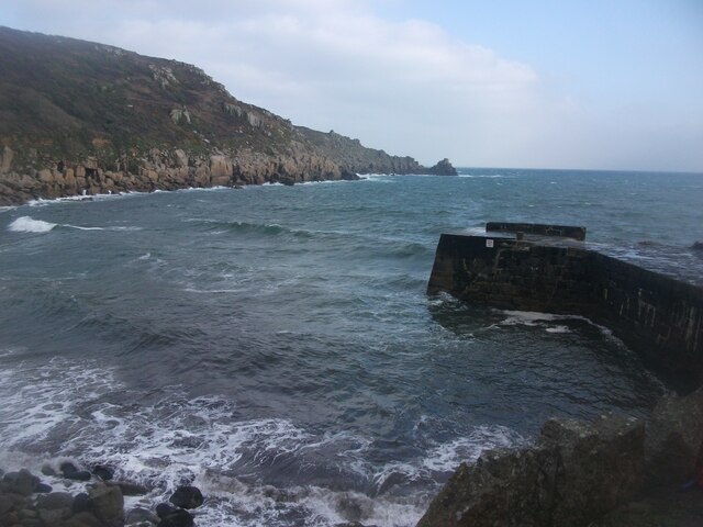
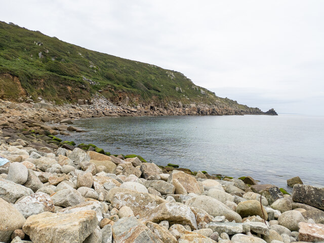
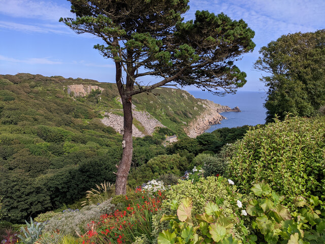
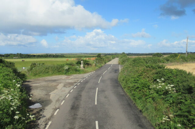
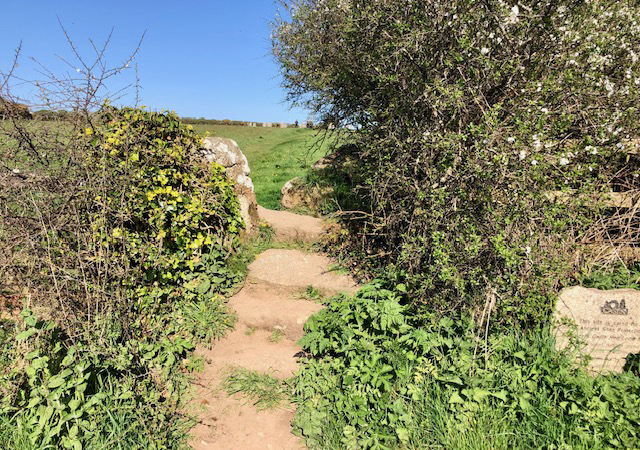
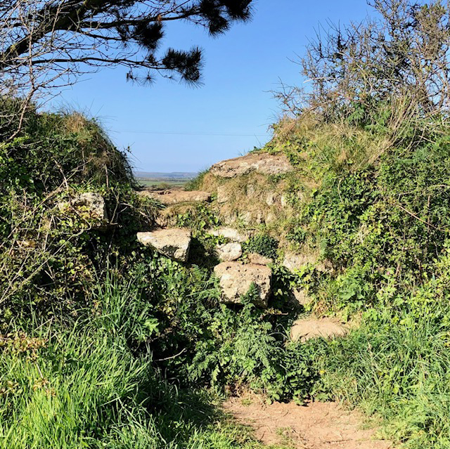
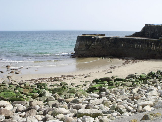
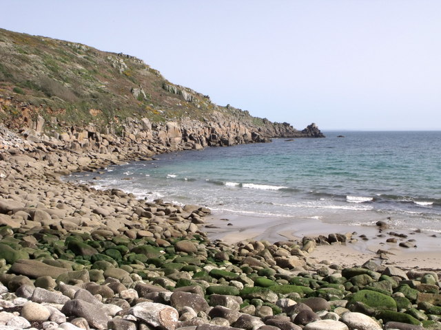
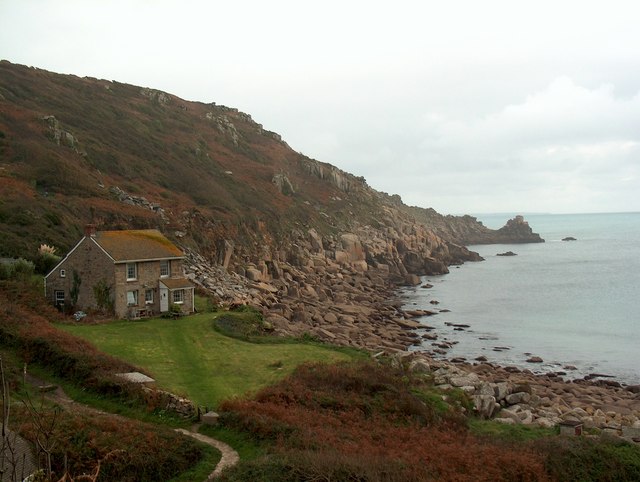
Rosemodress Cliff is a picturesque coastal feature located in Cornwall, England. It is situated on the southern coast, overlooking the Celtic Sea. This cliff, with its steep slope, is a prominent landmark in the area and offers breathtaking views of the surrounding landscape.

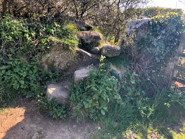
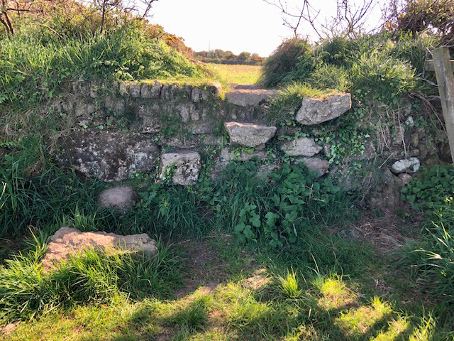
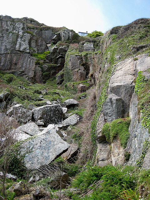
The cliff stands at an impressive height, providing visitors with magnificent vistas of the rugged coastline and the azure waters below. Its rugged and rocky terrain is a result of millions of years of erosion by the relentless forces of wind and water. The cliff face is composed of a diverse range of geological formations, including granite, slate, and schist.

Rosemodress Cliff is also known for its rich biodiversity. The cliff's unique microclimate supports a variety of plant and animal species. Lush vegetation, including heather, gorse, and wildflowers, blankets the cliff face, creating a vibrant and colorful scene. Additionally, various seabirds, such as gulls, razorbills, and fulmars, nest and roost on the cliff ledges, adding to the area's natural beauty.

The cliff is a popular destination for outdoor enthusiasts and nature lovers. Visitors can embark on exhilarating hikes along the cliff-top trails, which offer stunning views and opportunities for birdwatching. The more adventurous can also try their hand at rock climbing on the craggy cliff face.

Overall, Rosemodress Cliff is a must-see attraction in Cornwall, offering visitors a glimpse into the region's geological history and providing a serene and picturesque setting for outdoor activities.

If you have any feedback on the listing, please let us know in the comments section below.

Rosemodress Cliff Images

Images are sourced within 2km of 50.052329/-5.5767755 or Grid Reference SW4423. Thanks to Geograph Open Source API. All images are credited.

Lamorna Cove Lamorna Cove viewed from the carpark above the slipway.
Lamorna Cove
Lamorna Cove viewed from the carpark above the slipway.
Merry Maidens Stone Circle <span class="nowrap"><a title="https://www.megalithic.co.uk/article.php?sid=118" rel="nofollow ugc noopener" href="https://www.megalithic.co.uk/article.php?sid=118">Link</a><img style="margin-left:2px;" alt="External link" title="External link - shift click to open in new window" src="https://s1.geograph.org.uk/img/external.png" width="10" height="10"/></span>
Merry Maidens Stone Circle
Lamorna Cove
Lamorna Cove
View through garden south east from entrance to Chygurno Gardens
The B3315 at Boleigh Farm
The B3315 at Boskenna Cross
The Merry Maidens stone circle
Borah Chapel
Borah Chapel
Lamorna Glamping Safari Tents
Stone Stile, Merry Maidens Stone Circle From a little car park on the B3315, Cornwall footpath 121/90/2 looking to the field with the Stone Circle. 
The view SW is <a href="https://www.geograph.org.uk/photo/7557453">SW4324 : Stone Stile, Merry Maidens Stone Circle</a>.
Merry Maidens (aka Dawns Men) see <a href="https://www.geograph.org.uk/photo/912784">SW4324 : The Merry Maidens - they all look stoned to me</a> is Grade II listed <span class="nowrap"><a title="https://www.heritagegateway.org.uk/Gateway/Results_Single.aspx?uid=MCO18453&resourceID=1020" rel="nofollow ugc noopener" href="https://www.heritagegateway.org.uk/Gateway/Results_Single.aspx?uid=MCO18453&resourceID=1020">Link</a><img style="margin-left:2px;" alt="External link" title="External link - shift click to open in new window" src="https://s1.geograph.org.uk/img/external.png" width="10" height="10"/></span>
Stone Stile, Merry Maidens Stone Circle
From a little car park on the B3315, Cornwall footpath 121/90/2 looking to the field with the Stone Circle. The view SW is SW4324 : Stone Stile, Merry Maidens Stone Circle. Merry Maidens (aka Dawns Men) see SW4324 : The Merry Maidens - they all look stoned to me is Grade II listed LinkExternal link
Stone Stile, Merry Maidens Stone Circle From a little car park on the B3315, Cornwall footpath 121/90/2 looking from the field with the Stone Circle. 
The view NE is <a href="https://www.geograph.org.uk/photo/7557450">SW4324 : Stone Stile, Merry Maidens Stone Circle</a>. 
Merry Maidens (aka Dawns Men) see <a href="https://www.geograph.org.uk/photo/912784">SW4324 : The Merry Maidens - they all look stoned to me</a> is Grade II listed <span class="nowrap"><a title="https://www.heritagegateway.org.uk/Gateway/Results_Single.aspx?uid=MCO18453&resourceID=1020" rel="nofollow ugc noopener" href="https://www.heritagegateway.org.uk/Gateway/Results_Single.aspx?uid=MCO18453&resourceID=1020">Link</a><img style="margin-left:2px;" alt="External link" title="External link - shift click to open in new window" src="https://s1.geograph.org.uk/img/external.png" width="10" height="10"/></span>
Stone Stile, Merry Maidens Stone Circle
From a little car park on the B3315, Cornwall footpath 121/90/2 looking from the field with the Stone Circle. The view NE is SW4324 : Stone Stile, Merry Maidens Stone Circle. Merry Maidens (aka Dawns Men) see SW4324 : The Merry Maidens - they all look stoned to me is Grade II listed LinkExternal link
Stone Stile, Merry Maidens Stone Circle On Cornwall footpath 121/90/2 looking in the direction of the Stone Circle. The view NE is <a href="https://www.geograph.org.uk/photo/7557712">SW4324 : Stone Stile, Merry Maidens Stone Circle</a>.
Stone Stile, Merry Maidens Stone Circle
On Cornwall footpath 121/90/2 looking in the direction of the Stone Circle. The view NE is SW4324 : Stone Stile, Merry Maidens Stone Circle.
Stone Stile, Merry Maidens Stone Circle On Cornwall footpath 121/90/2 leading to the Stone Circle (behind the camera). The view SW is <a href="https://www.geograph.org.uk/photo/7557711">SW4324 : Stone Stile, Merry Maidens Stone Circle</a>.
Stone Stile, Merry Maidens Stone Circle
On Cornwall footpath 121/90/2 leading to the Stone Circle (behind the camera). The view SW is SW4324 : Stone Stile, Merry Maidens Stone Circle.
The quay at Lamorna Cove
Lamorna Cove
Lamorna Cove
Cottages at Lamorna Cove
Coast footpath sign at Lamorna Cove
Lamorna Cove, Cornwall A house overlooking the cove
Lamorna Cove, Cornwall
A house overlooking the cove
Show me another place!

Rosemodress Cliff is located at Grid Ref: SW4423 (Lat: 50.052329, Lng: -5.5767755)

Unitary Authority: Cornwall

Police Authority: Devon and Cornwall

What 3 Words

///surpasses.valley.convinced. Near St Buryan, Cornwall

Related Wikis

Tater Du Lighthouse

Tater Du Lighthouse is Cornwall's most recently built lighthouse. The construction of the lighthouse came out of the tragedy of losing a small Spanish...

Tregurnow

Tregurnow is a settlement in St Buryan civil parish on the Penwith peninsula in Cornwall, England, United Kingdom. At Tregurnow farm is an interesting...
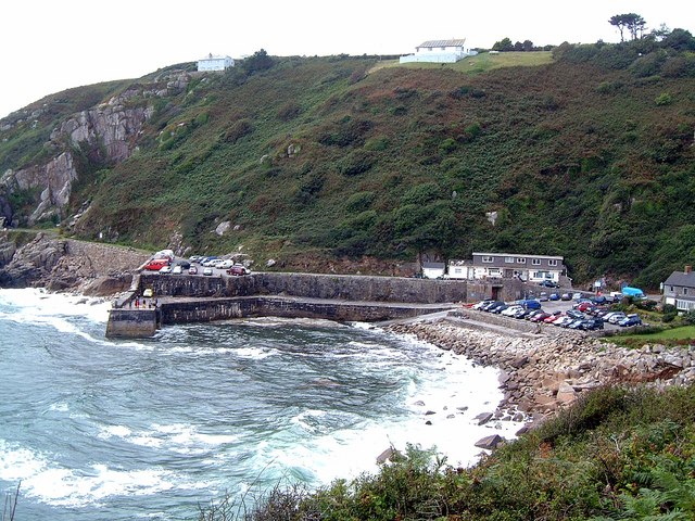
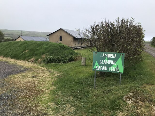
Lamorna

Lamorna (Cornish: Nansmornow) is a village, valley and cove in west Cornwall, England, UK. It is on the Penwith peninsula approximately 4 miles (6 km)...

St Loy's Cove

St Loy's Cove is a small wooded valley and beach in the civil parish of St Buryan in Cornwall, England, UK. It is located two miles to the south of St...

Related Videos

Super STEEP WALK! LAMORNA COVE Cornwall - Stunning Coastal Walk

This week, join us on a fabulous 5 mile circular walk from Lamorna Cove to St Loy. Have you walked the this stretch of South West ...

Will Lamorna ruin your holiday? Car Park Scam?

Unfortunately there are an increasing number of car parks in Cornwall being managed by remote, faceless parking companies.

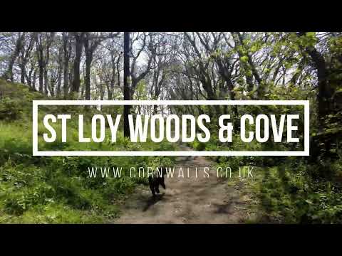
St Loy Woods and Cove walk

One of the prettiest woodland walks around, and with a beach at the end... St Loy (St Loye) is located between Lamorna and ...

Lamorna to St Loy walk

Stunning walk but please be so careful - so many dangerous areas! Instant death in many areas! Probably won't do this one ...

Nearby Amenities

Located within 500m of 50.052329,-5.5767755
Source: PGS
Lat/Long: 50.0519877/-5.5773635
Created By: almien_coastlines
Source: PGS
Lat/Long: 50.052562/-5.575844
Created By: almien_coastlines
Source: PGS
Lat/Long: 50.052693/-5.575651
Barrier: kissing_gate
Lat/Long: 50.0540399/-5.5758599
Barrier: stile
Lat/Long: 50.0534845/-5.5798543
Power: pole
Transformer: distribution
Lat/Long: 50.0532744/-5.5782236
Power: pole
Lat/Long: 50.0532141/-5.579381
Power: pole
Lat/Long: 50.0544704/-5.5804203
Power: pole
Lat/Long: 50.0544764/-5.5813819
Power: pole
Lat/Long: 50.0544868/-5.5825058
Power: pole
Transformer: distribution
Lat/Long: 50.0564844/-5.5766103
The data included in this document is from www.openstreetmap.org. The data is made available under ODbL.

Have you been to Rosemodress Cliff?

Leave your review of Rosemodress Cliff below (or comments, questions and feedback).