Tol Toft

Sea, Estuary, Creek in Cornwall

England

Tol Toft

Lamorna Cove Lamorna Cove viewed from the carpark above the slipway.
Lamorna Cove Credit: Kevin Pearson

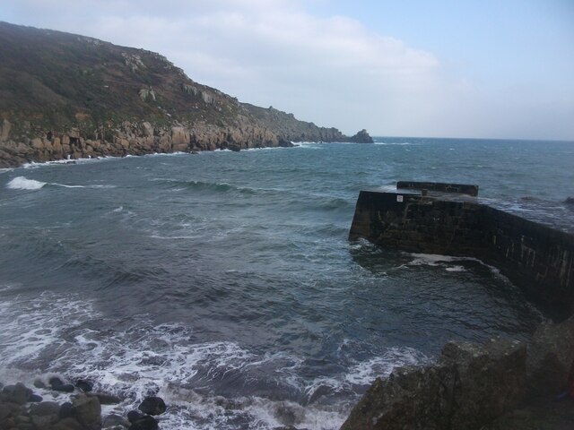
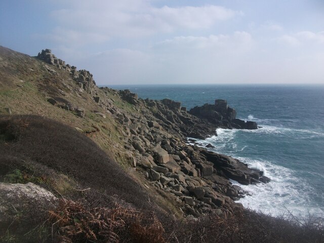
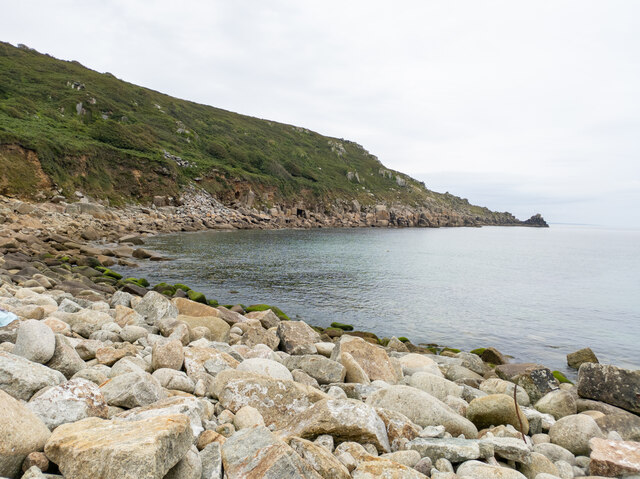
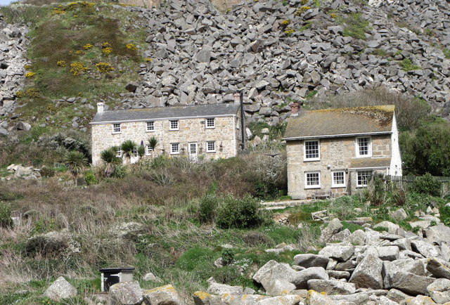
Tol Toft is a picturesque coastal village located in Cornwall, England. Nestled between the towns of Fowey and Polruan, it is situated on the southern coast of the county, overlooking the English Channel. Known for its breathtaking natural beauty, Tol Toft offers visitors a unique blend of sea, estuary, and creek.

The village is blessed with a stunning coastline, with golden sandy beaches stretching along its shores. The crystal-clear waters of the sea are perfect for swimming, surfing, and other water sports. The beach is also a popular spot for sunbathing and picnicking, attracting both locals and tourists during the summer months.

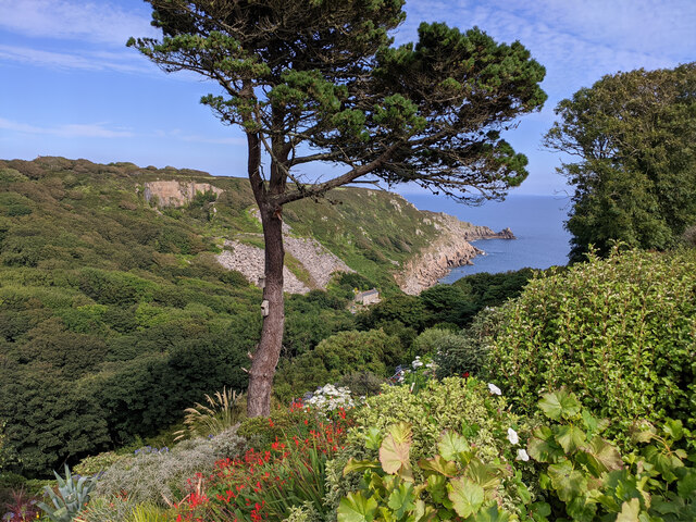
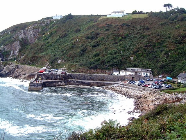
In addition to the sea, Tol Toft boasts an enchanting estuary that meanders through the village. This estuary provides a haven for various species of birds and other wildlife, making it a paradise for nature enthusiasts. Visitors can explore the estuary by boat or kayak, immersing themselves in the serene and tranquil surroundings.

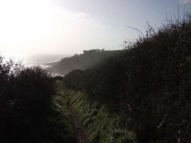
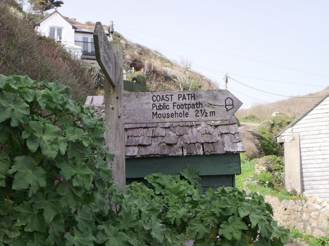
Furthermore, Tol Toft is blessed with a charming creek that winds its way through the village. The creek offers idyllic views and is a popular spot for fishing and boating. Many locals and visitors enjoy leisurely walks along the creek, taking in the beautiful scenery and enjoying the peaceful atmosphere.

Overall, Tol Toft is a hidden gem in Cornwall, offering a unique combination of sea, estuary, and creek. Whether you are seeking relaxation on the beach, adventure on the water, or a peaceful retreat in nature, Tol Toft has something to offer for everyone.

If you have any feedback on the listing, please let us know in the comments section below.

Tol Toft Images

Images are sourced within 2km of 50.0546/-5.5716905 or Grid Reference SW4423. Thanks to Geograph Open Source API. All images are credited.

Lamorna Cove Lamorna Cove viewed from the carpark above the slipway.
Lamorna Cove
Lamorna Cove viewed from the carpark above the slipway.
SW Coast Path between Lamorna and Mousehole A view east along the coast on the South West Coast Path between Mousehole and Lamorna.
SW Coast Path between Lamorna and Mousehole
A view east along the coast on the South West Coast Path between Mousehole and Lamorna.
Kemyel from the SW Coast Path Looking south west along the coastal path between Mousehole and Lamorna towards Kemyel.
Kemyel from the SW Coast Path
Looking south west along the coastal path between Mousehole and Lamorna towards Kemyel.
Merry Maidens Stone Circle <span class="nowrap"><a title="https://www.megalithic.co.uk/article.php?sid=118" rel="nofollow ugc noopener" href="https://www.megalithic.co.uk/article.php?sid=118">Link</a><img style="margin-left:2px;" alt="External link" title="External link - shift click to open in new window" src="https://s1.geograph.org.uk/img/external.png" width="10" height="10"/></span>
Merry Maidens Stone Circle
Lamorna Cove
Lamorna Cove
View through garden south east from entrance to Chygurno Gardens
The B3315 at Boleigh Farm
The Merry Maidens stone circle
Borah Chapel
Borah Chapel
Lamorna Glamping Safari Tents
Stone Stile, Merry Maidens Stone Circle From a little car park on the B3315, Cornwall footpath 121/90/2 looking to the field with the Stone Circle. 
The view SW is <a href="https://www.geograph.org.uk/photo/7557453">SW4324 : Stone Stile, Merry Maidens Stone Circle</a>.
Merry Maidens (aka Dawns Men) see <a href="https://www.geograph.org.uk/photo/912784">SW4324 : The Merry Maidens - they all look stoned to me</a> is Grade II listed <span class="nowrap"><a title="https://www.heritagegateway.org.uk/Gateway/Results_Single.aspx?uid=MCO18453&resourceID=1020" rel="nofollow ugc noopener" href="https://www.heritagegateway.org.uk/Gateway/Results_Single.aspx?uid=MCO18453&resourceID=1020">Link</a><img style="margin-left:2px;" alt="External link" title="External link - shift click to open in new window" src="https://s1.geograph.org.uk/img/external.png" width="10" height="10"/></span>
Stone Stile, Merry Maidens Stone Circle
From a little car park on the B3315, Cornwall footpath 121/90/2 looking to the field with the Stone Circle. The view SW is SW4324 : Stone Stile, Merry Maidens Stone Circle. Merry Maidens (aka Dawns Men) see SW4324 : The Merry Maidens - they all look stoned to me is Grade II listed LinkExternal link
Stone Stile, Merry Maidens Stone Circle From a little car park on the B3315, Cornwall footpath 121/90/2 looking from the field with the Stone Circle. 
The view NE is <a href="https://www.geograph.org.uk/photo/7557450">SW4324 : Stone Stile, Merry Maidens Stone Circle</a>. 
Merry Maidens (aka Dawns Men) see <a href="https://www.geograph.org.uk/photo/912784">SW4324 : The Merry Maidens - they all look stoned to me</a> is Grade II listed <span class="nowrap"><a title="https://www.heritagegateway.org.uk/Gateway/Results_Single.aspx?uid=MCO18453&resourceID=1020" rel="nofollow ugc noopener" href="https://www.heritagegateway.org.uk/Gateway/Results_Single.aspx?uid=MCO18453&resourceID=1020">Link</a><img style="margin-left:2px;" alt="External link" title="External link - shift click to open in new window" src="https://s1.geograph.org.uk/img/external.png" width="10" height="10"/></span>
Stone Stile, Merry Maidens Stone Circle
From a little car park on the B3315, Cornwall footpath 121/90/2 looking from the field with the Stone Circle. The view NE is SW4324 : Stone Stile, Merry Maidens Stone Circle. Merry Maidens (aka Dawns Men) see SW4324 : The Merry Maidens - they all look stoned to me is Grade II listed LinkExternal link
Stone Stile, Merry Maidens Stone Circle On Cornwall footpath 121/90/2 looking in the direction of the Stone Circle. The view NE is <a href="https://www.geograph.org.uk/photo/7557712">SW4324 : Stone Stile, Merry Maidens Stone Circle</a>.
Stone Stile, Merry Maidens Stone Circle
On Cornwall footpath 121/90/2 looking in the direction of the Stone Circle. The view NE is SW4324 : Stone Stile, Merry Maidens Stone Circle.
Stone Stile, Merry Maidens Stone Circle On Cornwall footpath 121/90/2 leading to the Stone Circle (behind the camera). The view SW is <a href="https://www.geograph.org.uk/photo/7557711">SW4324 : Stone Stile, Merry Maidens Stone Circle</a>.
Stone Stile, Merry Maidens Stone Circle
On Cornwall footpath 121/90/2 leading to the Stone Circle (behind the camera). The view SW is SW4324 : Stone Stile, Merry Maidens Stone Circle.
The quay at Lamorna Cove
Lamorna Cove
Lamorna Cove
Cottages at Lamorna Cove
Coast footpath sign at Lamorna Cove
Show me another place!

Tol Toft is located at Grid Ref: SW4423 (Lat: 50.0546, Lng: -5.5716905)

Unitary Authority: Cornwall

Police Authority: Devon and Cornwall

What 3 Words

///ambushed.probably.airbase. Near St Buryan, Cornwall

Related Wikis

Tater Du Lighthouse

Tater Du Lighthouse is Cornwall's most recently built lighthouse. The construction of the lighthouse came out of the tragedy of losing a small Spanish...

Tregurnow

Tregurnow is a settlement in St Buryan civil parish on the Penwith peninsula in Cornwall, England, United Kingdom. At Tregurnow farm is an interesting...
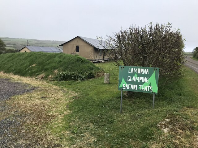
Lamorna

Lamorna (Cornish: Nansmornow) is a village, valley and cove in west Cornwall, England, UK. It is on the Penwith peninsula approximately 4 miles (6 km)...
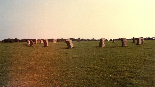
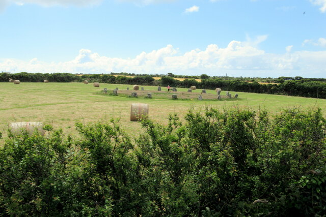
The Merry Maidens

The Merry Maidens (grid reference SW432245), also known as Dawn's Men (a likely corruption of the Cornish Dons Men "Stone Dance") is a late neolithic...

Nearby Amenities

Located within 500m of 50.0546,-5.5716905
Source: PGS
Lat/Long: 50.0519877/-5.5773635
Created By: almien_coastlines
Source: PGS
Lat/Long: 50.052562/-5.575844
Created By: almien_coastlines
Source: PGS
Lat/Long: 50.052693/-5.575651
Barrier: kissing_gate
Lat/Long: 50.0586637/-5.5689404
Barrier: kissing_gate
Lat/Long: 50.0540399/-5.5758599
Tourism: viewpoint
Lat/Long: 50.0558172/-5.5692549
Barrier: kissing_gate
Lat/Long: 50.0580785/-5.5693935
Power: pole
Transformer: distribution
Lat/Long: 50.0532744/-5.5782236
Power: pole
Transformer: distribution
Lat/Long: 50.0564844/-5.5766103
Power: pole
Lat/Long: 50.0571319/-5.5774686
The data included in this document is from www.openstreetmap.org. The data is made available under ODbL.

Have you been to Tol Toft?

Leave your review of Tol Toft below (or comments, questions and feedback).