Cat Cleuch Head

Landscape Feature in Peeblesshire

Scotland

Cat Cleuch Head

Track towards Clover Law In the Broughton Heights, a compact group of moorland hills of modest height in the north-western corner of the Scottish Borders.
Track towards Clover Law Credit: Alan O'Dowd

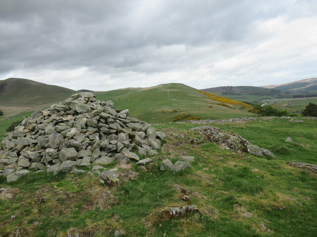
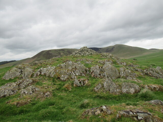
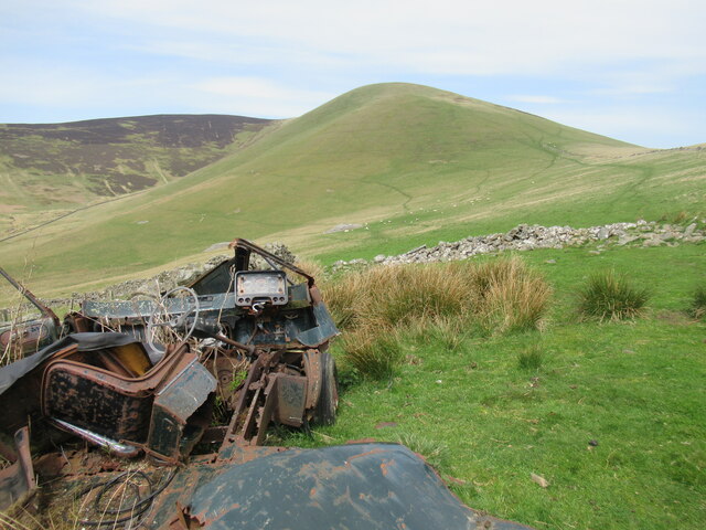
Cat Cleuch Head is a prominent landscape feature located in Peeblesshire, a historic county in the Scottish Borders region of Scotland. It is a stunning hill that forms part of the scenic Southern Uplands. Rising to an elevation of approximately 561 meters (1,841 feet), Cat Cleuch Head offers breathtaking panoramic views of the surrounding countryside.

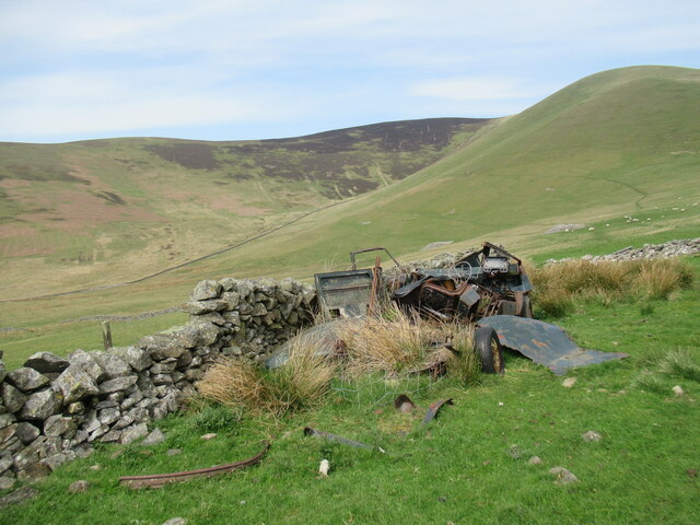
The hill is characterized by its steep slopes, rugged terrain, and rocky outcrops, making it a challenging but rewarding destination for hikers and outdoor enthusiasts. Its distinctive name, "Cat Cleuch," derives from the Scots Gaelic term "cleuch," meaning a narrow, steep-sided valley, and "cat," referring to the wildcat that once roamed these hills.

The landscape surrounding Cat Cleuch Head is diverse and captivating. Walking along its ridges, visitors are treated to sweeping vistas of rolling hills, deep valleys, and dense forests. The hill is home to a variety of flora and fauna, including heather, grasses, and mosses, as well as bird species such as peregrine falcons and golden eagles.

Cat Cleuch Head is also part of the larger Tweedsmuir Hills, a designated Area of Outstanding Natural Beauty. This designation reflects the area's exceptional scenic value and rich biodiversity. The hill attracts not only hikers but also nature photographers, birdwatchers, and those seeking a peaceful retreat in the heart of nature.

Overall, Cat Cleuch Head is a captivating landscape feature in Peeblesshire, offering a challenging yet rewarding experience for outdoor enthusiasts while providing a glimpse into the natural beauty and diversity of the Scottish Borders.

If you have any feedback on the listing, please let us know in the comments section below.

Cat Cleuch Head Images

Images are sourced within 2km of 55.620703/-3.3851637 or Grid Reference NT1237. Thanks to Geograph Open Source API. All images are credited.

Track towards Clover Law In the Broughton Heights, a compact group of moorland hills of modest height in the north-western corner of the Scottish Borders.
Track towards Clover Law
In the Broughton Heights, a compact group of moorland hills of modest height in the north-western corner of the Scottish Borders.
South-western spur of Clover Law Some remnants of the snowfall earlier in the week are clinging on. The village of Broughton is visible in the distance.
South-western spur of Clover Law
Some remnants of the snowfall earlier in the week are clinging on. The village of Broughton is visible in the distance.
Trahenna Hill A view across the Earn Cleuch, the upper reaches of which can be seen on the right-hand side of the distant hillside.
Trahenna Hill
A view across the Earn Cleuch, the upper reaches of which can be seen on the right-hand side of the distant hillside.
Gate on John Buchan Way between Broomy Side and Hammer Head The John Buchan Way is a thirteen mile-long path through the hills of Tweeddale, between Broughton and Peebles.  The area featured in many of Buchan's written works.
Gate on John Buchan Way between Broomy Side and Hammer Head
The John Buchan Way is a thirteen mile-long path through the hills of Tweeddale, between Broughton and Peebles. The area featured in many of Buchan's written works.
Cairn on the summit of Hammer Head A summit 513 metres above sea level in the Broughton Heights, a compact group of hills of a fairly modest height in the north-west corner of the Scottish Borders. The view here is towards the distant hill of Tinto, in Lanarkshire.
Cairn on the summit of Hammer Head
A summit 513 metres above sea level in the Broughton Heights, a compact group of hills of a fairly modest height in the north-west corner of the Scottish Borders. The view here is towards the distant hill of Tinto, in Lanarkshire.
Summit of Hammer Head A summit 513 metres above sea level in the Broughton Heights, a compact group of hills of a fairly modest height in the north-west corner of the Scottish Borders.
Summit of Hammer Head
A summit 513 metres above sea level in the Broughton Heights, a compact group of hills of a fairly modest height in the north-west corner of the Scottish Borders.
View towards Hammer Head from Green Lairs Undulating moorland hills in the Broughton Heights, in the north-western corner of the Scottish Borders.
View towards Hammer Head from Green Lairs
Undulating moorland hills in the Broughton Heights, in the north-western corner of the Scottish Borders.
Not much snow left on the Broughton Heights A tiny remnant of the previous week's snowfall in what looks like a small quarry on the slopes of Green Lairs.
Not much snow left on the Broughton Heights
A tiny remnant of the previous week's snowfall in what looks like a small quarry on the slopes of Green Lairs.
Hammer Head and Green Lairs from Grey Yade Rolling moorland summits in the Broughton Heights, in the north-western corner of the Scottish Borders.
Hammer Head and Green Lairs from Grey Yade
Rolling moorland summits in the Broughton Heights, in the north-western corner of the Scottish Borders.
Fence junction on Trahenna Hill Modern fencing cutting across an old drystane dyke in the Broughton Heights.
Fence junction on Trahenna Hill
Modern fencing cutting across an old drystane dyke in the Broughton Heights.
Undulating moorland on Trahenna Hill Low winter sunlight on the Broughton Heights, in the north-western corner of the Scottish Borders.
Undulating moorland on Trahenna Hill
Low winter sunlight on the Broughton Heights, in the north-western corner of the Scottish Borders.
War memorial, Broughton
Cairn at Dreva Craig Dreva Craig has the extensive remnants of a prehistoric fort, settlement and protective structures.  For more information see <span class="nowrap"><a title="https://canmore.org.uk/site/49881/dreva-craig" rel="nofollow ugc noopener" href="https://canmore.org.uk/site/49881/dreva-craig">Link</a><img style="margin-left:2px;" alt="External link" title="External link - shift click to open in new window" src="https://s1.geograph.org.uk/img/external.png" width="10" height="10"/></span>
Cairn at Dreva Craig
Dreva Craig has the extensive remnants of a prehistoric fort, settlement and protective structures. For more information see LinkExternal link
Dreva Craig Dreva Craig is the site of a prehistoric fort, settlement and defences. For more information, see <span class="nowrap"><a title="https://canmore.org.uk/site/49881/dreva-craig" rel="nofollow ugc noopener" href="https://canmore.org.uk/site/49881/dreva-craig">Link</a><img style="margin-left:2px;" alt="External link" title="External link - shift click to open in new window" src="https://s1.geograph.org.uk/img/external.png" width="10" height="10"/></span>
Dreva Craig
Dreva Craig is the site of a prehistoric fort, settlement and defences. For more information, see LinkExternal link
Trahenna Hill viewed from hillside above Dreva Hope Part of the Broughton Heights group of hills, Trahenna Hill rises to 549 metres above sea level.
Trahenna Hill viewed from hillside above Dreva Hope
Part of the Broughton Heights group of hills, Trahenna Hill rises to 549 metres above sea level.
Remains of a van below Trahenna Hill The old Bedford van/shed photographed by Richard Webb in 2005 (<a href="https://www.geograph.org.uk/photo/44843">NT1336 : Old van, Dreva</a>) has now completely fallen apart, leaving something of an eyesore.
Remains of a van below Trahenna Hill
The old Bedford van/shed photographed by Richard Webb in 2005 (NT1336 : Old van, Dreva) has now completely fallen apart, leaving something of an eyesore.
Remains of a van below Trahenna Hill The old Bedford van/shed photographed by Richard Webb in 2005 (<a href="https://www.geograph.org.uk/photo/44843">NT1336 : Old van, Dreva</a>) has now completely fallen apart, leaving something of an eyesore.

And all with only 80,000-odd miles on the clock – although it may have gone round the clock more than once.
Remains of a van below Trahenna Hill
The old Bedford van/shed photographed by Richard Webb in 2005 (NT1336 : Old van, Dreva) has now completely fallen apart, leaving something of an eyesore. And all with only 80,000-odd miles on the clock – although it may have gone round the clock more than once.
Near the summit of Trahenna Hill Looking across towards Hammer Head in the Broughton Heights.
Near the summit of Trahenna Hill
Looking across towards Hammer Head in the Broughton Heights.
Show me another place!

Cat Cleuch Head is located at Grid Ref: NT1237 (Lat: 55.620703, Lng: -3.3851637)

Unitary Authority: The Scottish Borders

Police Authority: The Lothians and Scottish Borders

What 3 Words

///boot.reveal.detonated. Near Biggar, South Lanarkshire

Related Wikis

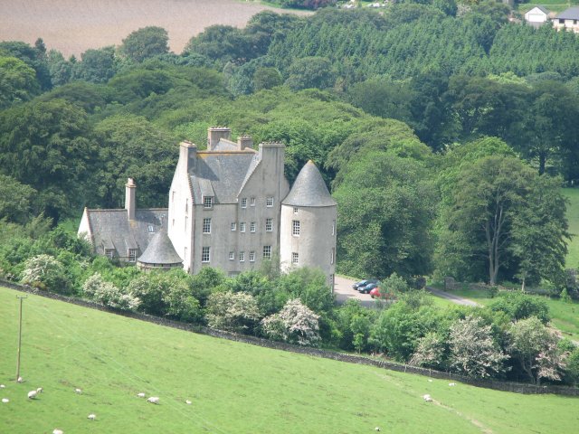
Broughton Place, Scottish Borders

Broughton Place is a historic house in the village of Broughton, Scottish Borders. It was designed by Basil Spence in the style of a 17th-century Scottish...

Dreva on Tweed

Dreva on Tweed (or simply Dreva) is a hamlet in the Scottish Borders. It was historically in Peebles-shire. It is noted for the historical presence of...

Broughton, Scottish Borders

Broughton is a village in Tweeddale in the historical county of Peeblesshire in the Scottish Borders council area, in the south of Scotland, in the civil...

Biggar Water

Biggar Water is a river in Lanarkshire and Peeblesshire, in the Southern Uplands of Scotland. It forms part of the River Tweed system. It rises, as Biggar...

Broughton railway station (Scotland)

Broughton railway station served the village of Broughton, Scottish Borders, Scotland from 1860 to 1950 on the Symington, Biggar and Broughton Railway...

Broughton, Glenholm and Kilbucho

Broughton, Glenholm and Kilbucho is a parish in Peeblesshire in the Scottish Borders, 11 miles south-west of Peebles, lying in the upper part of the valley...

Holms Water

The Holms Water is a river and a tributary of the Biggar Water, which is a tributary of the River Tweed, in the parish of Broughton, Glenholm and Kilbucho...

Drumelzier

Drumelzier (), is a village and civil parish on the B712 in the Tweed Valley in the Scottish Borders. The area of the village is extensive and includes...

Nearby Amenities

Located within 500m of 55.620703,-3.3851637
Cat Cleuch Head
Natural: peak
Lat/Long: 55.6207765/-3.3854424
The data included in this document is from www.openstreetmap.org. The data is made available under ODbL.

Have you been to Cat Cleuch Head?

Leave your review of Cat Cleuch Head below (or comments, questions and feedback).