Craig Head

Landscape Feature in Peeblesshire

Scotland

Craig Head

Looking towards Stanhope Taken from the Logan Burn and looking in the general direction of Stanhope Farm which is hidden in the trees.
Looking towards Stanhope Credit: Colin Kinnear

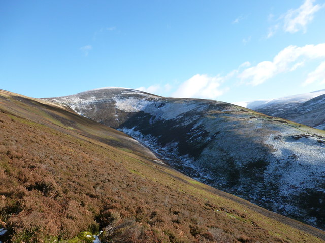
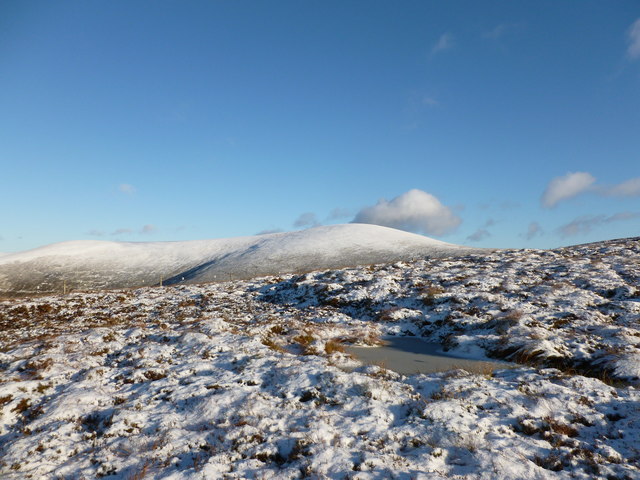
Craig Head is a prominent landscape feature located in Peeblesshire, Scotland. Rising to an impressive height of approximately 608 meters (1,995 feet), it stands as one of the highest points in the area, offering breathtaking panoramic views of the surrounding countryside. Situated within the expansive beauty of the Southern Uplands, it is a significant landmark known for its natural and historical importance.

The terrain of Craig Head is characterized by rolling hills, heather-covered moorland, and rocky outcrops, creating a diverse and visually stunning landscape. The area is rich in biodiversity, supporting a variety of plant and animal species. Mosses, ferns, and wildflowers can be found dotting the slopes, while birds of prey such as peregrine falcons and golden eagles soar gracefully above.

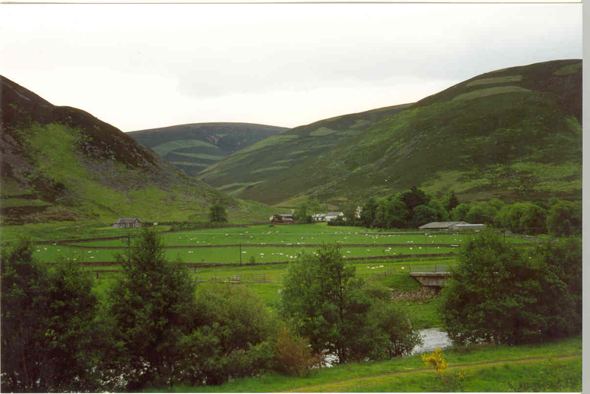
The summit of Craig Head serves as a vantage point for visitors to appreciate the surrounding countryside. On a clear day, one can see as far as the Lammermuir Hills to the east and the Galloway Forest Park to the west. The picturesque Tweed Valley stretches out below, with the River Tweed meandering through the lush green fields.

In addition to its natural beauty, Craig Head is also steeped in history. The remains of ancient hill forts and settlements can be found on its slopes, providing evidence of human occupation dating back thousands of years. These archaeological sites offer a glimpse into the lives and cultures of the past, adding to the allure of this remarkable landscape feature.

Overall, Craig Head in Peeblesshire is a captivating landscape feature that combines stunning natural beauty with a rich historical heritage, making it a must-visit destination for nature lovers and history enthusiasts alike.

If you have any feedback on the listing, please let us know in the comments section below.

Craig Head Images

Images are sourced within 2km of 55.55324/-3.380649 or Grid Reference NT1329. Thanks to Geograph Open Source API. All images are credited.

Looking towards Stanhope Taken from the Logan Burn and looking in the general direction of Stanhope Farm which is hidden in the trees.
Looking towards Stanhope
Taken from the Logan Burn and looking in the general direction of Stanhope Farm which is hidden in the trees.
Tree Plantation at Norman's Castle
Scree patch on Craig Head Looking back towards Stanhope and the distinctively-shaped Worm Hill on the opposite side of the A701.
Scree patch on Craig Head
Looking back towards Stanhope and the distinctively-shaped Worm Hill on the opposite side of the A701.
Meldonhope Burn and Taberon Law Looking across the valley of the Meldonhope Burn towards the spur named Eskenkneis ('kneis' having the same origin as naze - a headland or spur) which runs down off Taberon Law.
Meldonhope Burn and Taberon Law
Looking across the valley of the Meldonhope Burn towards the spur named Eskenkneis ('kneis' having the same origin as naze - a headland or spur) which runs down off Taberon Law.
North-west spur of Taberon Law Frozen ground and a light smattering of snow makes the going a bit less boggy here.  Culter Fell and the Glenkerie Wind Farm can be seen in the distance.
North-west spur of Taberon Law
Frozen ground and a light smattering of snow makes the going a bit less boggy here. Culter Fell and the Glenkerie Wind Farm can be seen in the distance.
Frozen pool on Taberon Law Looking towards a snow-covered Drumelzier Law and Glenstivon Dod.
Frozen pool on Taberon Law
Looking towards a snow-covered Drumelzier Law and Glenstivon Dod.
Scottish Borders : Countryside Scenery The scenery near Worm Hill in the Scottish Borders.
Scottish Borders : Countryside Scenery
The scenery near Worm Hill in the Scottish Borders.
Taberon Law Summit Cairn (Donald Top) Looking towards Middle Hill (Donald) from the summit of Taberon Law (Donald Top).
Taberon Law Summit Cairn (Donald Top)
Looking towards Middle Hill (Donald) from the summit of Taberon Law (Donald Top).
The hill of Craig Head, Stanhope
The Tweed Valley from the air Looking north east over Stanhope.
The Tweed Valley from the air
Looking north east over Stanhope.
Fields, Stanhope Beside the Tweed downstream of Tweedsmuir.
Fields, Stanhope
Beside the Tweed downstream of Tweedsmuir.
Stanhope Fields and shelterbelt at Stanhope, Tweeddale.
Stanhope
Fields and shelterbelt at Stanhope, Tweeddale.
Towards Norman's Castle A dun is marked on the map, just above the plantation.  Near Stanhope, Peeblesshire.
Towards Norman's Castle
A dun is marked on the map, just above the plantation. Near Stanhope, Peeblesshire.
The Logan Burn The burn flows through the trackbed of the railway which was used in the building of Talla Reservoir.
The Logan Burn
The burn flows through the trackbed of the railway which was used in the building of Talla Reservoir.
The River Tweed from the air Stanhope and Mossfennan are also visible, as is Worm Hill on the left.
The River Tweed from the air
Stanhope and Mossfennan are also visible, as is Worm Hill on the left.
River Tweed, Stanhope The River Tweed is 97 miles long and flows generally west to east through the Scottish borders. It rises at Tweedsmuir and passes through small towns like Peebles, Selkirk, Melrose, Galashields and Kelso, before entering the North Sea at Berwick on Tweed.
River Tweed, Stanhope
The River Tweed is 97 miles long and flows generally west to east through the Scottish borders. It rises at Tweedsmuir and passes through small towns like Peebles, Selkirk, Melrose, Galashields and Kelso, before entering the North Sea at Berwick on Tweed.
Tweed Valley, Laigh Hill
Bridge over the Talla railway A shortlived railway up Tweeddale, built to service the construction of the Talla Reservoir.  Accommodation bridges were built using concrete piers.
Bridge over the Talla railway
A shortlived railway up Tweeddale, built to service the construction of the Talla Reservoir. Accommodation bridges were built using concrete piers.
Show me another place!

Craig Head is located at Grid Ref: NT1329 (Lat: 55.55324, Lng: -3.380649)

Unitary Authority: The Scottish Borders

Police Authority: The Lothians and Scottish Borders

What 3 Words

///rapid.fidget.honeybees. Near Biggar, South Lanarkshire

Nearby Locations

Craig Head

Related Wikis

Stanhope, Peeblesshire

Stanhope is a small settlement in the Scottish Borders region. It is situated in the parish of Drumelzier in Peeblesshire, in the valley of the River...

Mossfennan

Mossfennan is a small settlement in southern Scotland near Drumelzier in the Scottish Borders, in the valley of the River Tweed. Mossfennan is a wooded...

Polmood

Polmood is a small settlement in southern Scotland near Tweedsmuir in the Scottish Borders, in the valley of the River Tweed. Polmood was for many centuries...

A701 road

The A701 is a major road in Scotland that runs from Dumfries to Edinburgh. == Route == The A701 leaves Dumfries and travels north to meet the A74(M) east...

Nearby Amenities

Located within 500m of 55.55324,-3.380649
Turning Circle
Lat/Long: 55.5561906/-3.3792011
The data included in this document is from www.openstreetmap.org. The data is made available under ODbL.

Have you been to Craig Head?

Leave your review of Craig Head below (or comments, questions and feedback).