Acharn Point

Coastal Feature, Headland, Point in Perthshire

Scotland

Acharn Point

Loch Tay Loch Tay is a freshwater loch in the central highlands of Scotland, in the Perth and Kinross and Stirling council areas. It is the largest body of fresh water in Perth and Kinross, and the sixth largest loch in Scotland. 
It is a long, narrow loch about 14.5 miles long, and typically around 1 to 1.5 miles.
Loch Tay Credit: N Chadwick

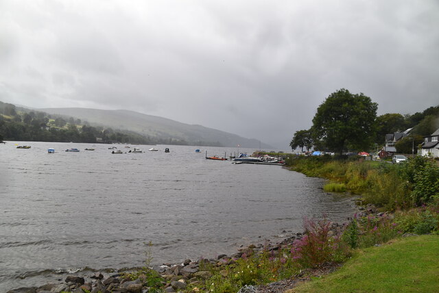
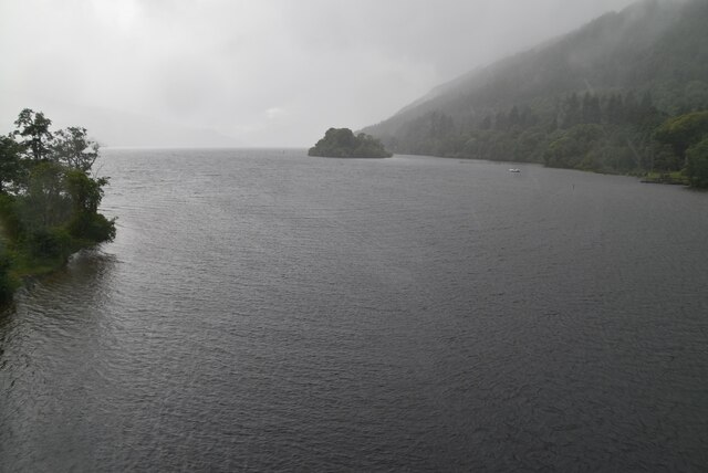
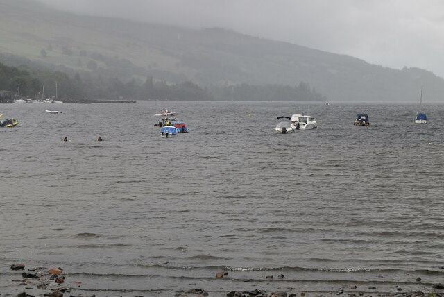
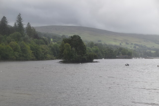
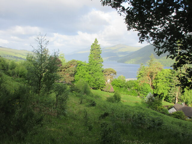
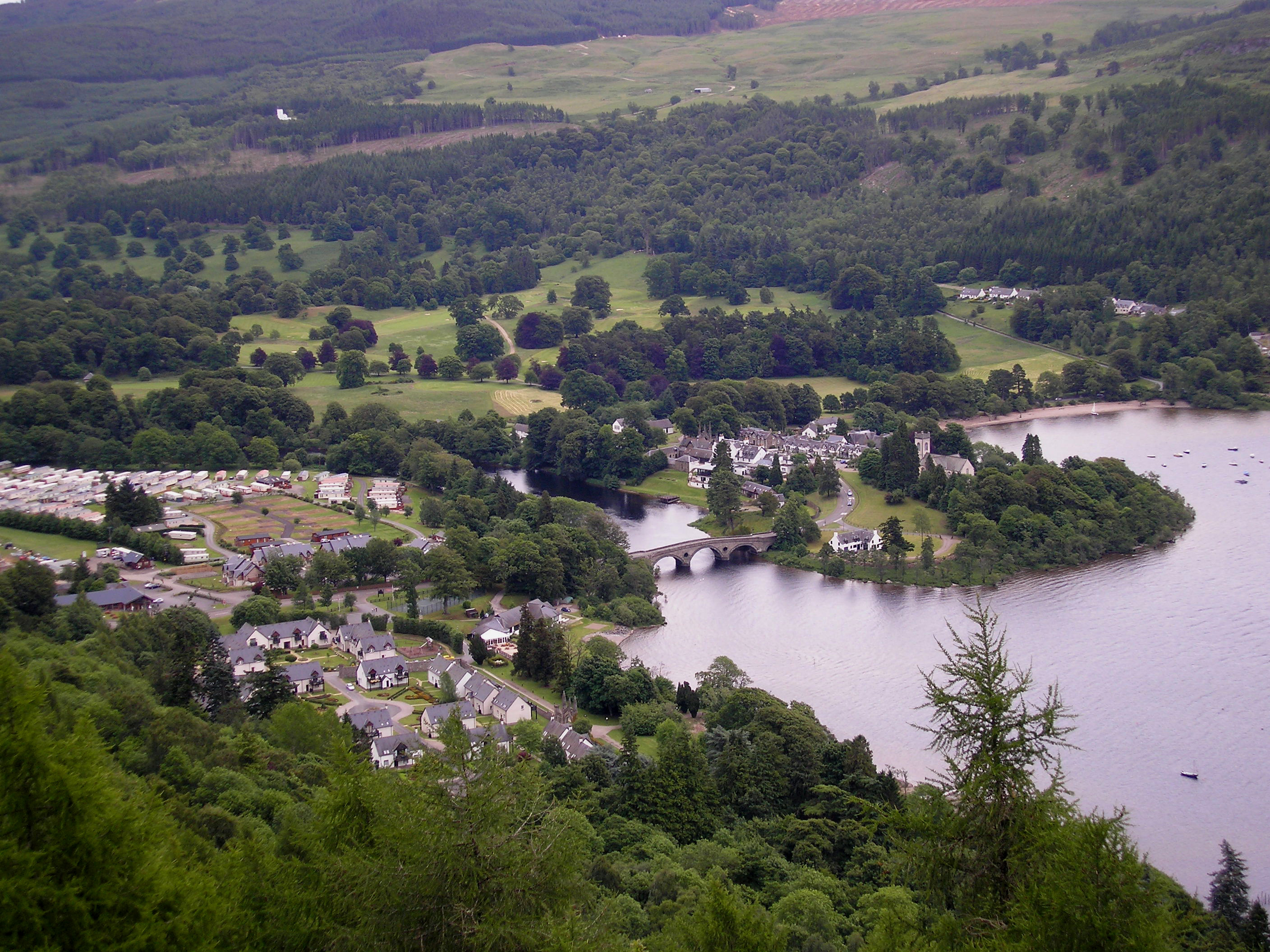
Acharn Point is a prominent coastal feature located in Perthshire, Scotland. It is a headland that juts out into Loch Tay, a large freshwater loch in the central highlands of Scotland. The point is positioned on the southern shore of the loch, offering stunning panoramic views of the surrounding landscape.

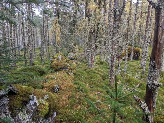
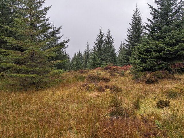
The headland is characterized by rugged cliffs that rise sharply from the water's edge, providing a dramatic and picturesque backdrop. These cliffs are composed of ancient rocks, showcasing the area's geological history. Acharn Point is known for its diverse range of flora and fauna, with various species of seabirds often seen nesting on the rocky ledges.

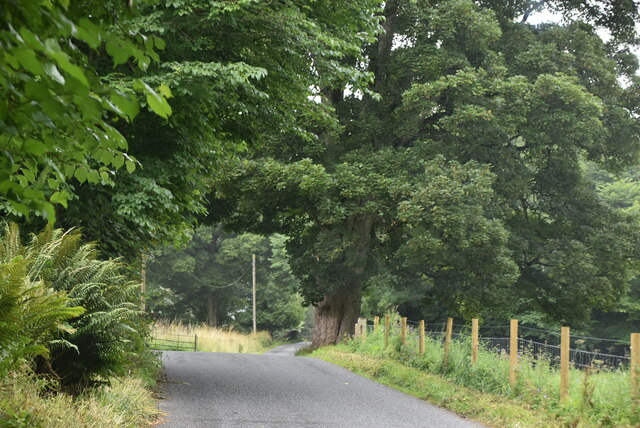
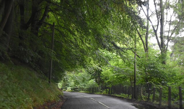
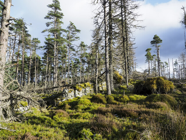
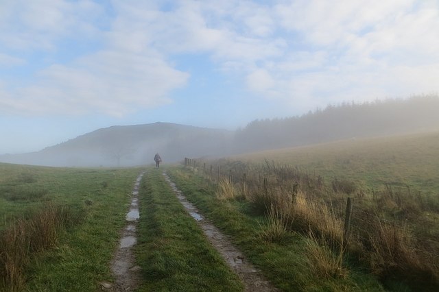
The point is accessible via a well-maintained footpath that winds along the shoreline, allowing visitors to explore the area's natural beauty. Along the route, there are several vantage points where one can stop and admire the breathtaking vistas. The path is also popular among hikers and nature enthusiasts, providing an opportunity to immerse oneself in the tranquil surroundings.

Acharn Point is a popular spot for outdoor activities such as fishing, birdwatching, and picnicking. Its secluded location and peaceful ambiance make it an ideal destination for those looking to escape the hustle and bustle of everyday life. The point also serves as a gateway to further exploration of Loch Tay and its surrounding areas, with boat trips and water-based activities available nearby.

Overall, Acharn Point offers a unique and captivating coastal experience, combining natural beauty, wildlife, and recreational opportunities. It is a must-visit destination for anyone seeking to discover the charm and serenity of Perthshire's coastline.

If you have any feedback on the listing, please let us know in the comments section below.

Acharn Point Images

Images are sourced within 2km of 56.572419/-4.0264882 or Grid Reference NN7544. Thanks to Geograph Open Source API. All images are credited.

Loch Tay Loch Tay is a freshwater loch in the central highlands of Scotland, in the Perth and Kinross and Stirling council areas. It is the largest body of fresh water in Perth and Kinross, and the sixth largest loch in Scotland. 
It is a long, narrow loch about 14.5 miles long, and typically around 1 to 1.5 miles.
Loch Tay
Loch Tay is a freshwater loch in the central highlands of Scotland, in the Perth and Kinross and Stirling council areas. It is the largest body of fresh water in Perth and Kinross, and the sixth largest loch in Scotland. It is a long, narrow loch about 14.5 miles long, and typically around 1 to 1.5 miles.
Lane along Loch Tay
Lane along Loch Tay
Entering Acharn
Entering Acharn
Acharn
Acharn
A827, Tay Forest Park The A827 is a cross-country route through the glens of central Scotland, running 35 miles along the entire length of Loch Tay, from Lix Toll to Ballinluig. 
<span class="nowrap"><a title="https://www.sabre-roads.org.uk/wiki/index.php?title=A827" rel="nofollow ugc noopener" href="https://www.sabre-roads.org.uk/wiki/index.php?title=A827">Link</a><img style="margin-left:2px;" alt="External link" title="External link - shift click to open in new window" src="https://s1.geograph.org.uk/img/external.png" width="10" height="10"/></span>
A827, Tay Forest Park
The A827 is a cross-country route through the glens of central Scotland, running 35 miles along the entire length of Loch Tay, from Lix Toll to Ballinluig. LinkExternal link
A827 The A827 is a cross-country route through the glens of central Scotland, running 35 miles along the entire length of Loch Tay, from Lix Toll to Ballinluig. 
<span class="nowrap"><a title="https://www.sabre-roads.org.uk/wiki/index.php?title=A827" rel="nofollow ugc noopener" href="https://www.sabre-roads.org.uk/wiki/index.php?title=A827">Link</a><img style="margin-left:2px;" alt="External link" title="External link - shift click to open in new window" src="https://s1.geograph.org.uk/img/external.png" width="10" height="10"/></span>
A827
The A827 is a cross-country route through the glens of central Scotland, running 35 miles along the entire length of Loch Tay, from Lix Toll to Ballinluig. LinkExternal link
Loch Tay Loch Tay is a freshwater loch in the central highlands of Scotland, in the Perth and Kinross and Stirling council areas. It is the largest body of fresh water in Perth and Kinross, and the sixth largest loch in Scotland. 
It is a long, narrow loch about 14.5 miles long, and typically around 1 to 1.5 miles.
Loch Tay
Loch Tay is a freshwater loch in the central highlands of Scotland, in the Perth and Kinross and Stirling council areas. It is the largest body of fresh water in Perth and Kinross, and the sixth largest loch in Scotland. It is a long, narrow loch about 14.5 miles long, and typically around 1 to 1.5 miles.
Isle of Spar, Loch Tay Loch Tay is a freshwater loch in the central highlands of Scotland, in the Perth and Kinross and Stirling council areas. It is the largest body of fresh water in Perth and Kinross, and the sixth largest loch in Scotland. 
It is a long, narrow loch about 14.5 miles long, and typically around 1 to 1.5 miles.
Isle of Spar, Loch Tay
Loch Tay is a freshwater loch in the central highlands of Scotland, in the Perth and Kinross and Stirling council areas. It is the largest body of fresh water in Perth and Kinross, and the sixth largest loch in Scotland. It is a long, narrow loch about 14.5 miles long, and typically around 1 to 1.5 miles.
Woodland above Loch Tay Looking west from above Kenmore to mixed woodland, with Loch Tay beyond.
Woodland above Loch Tay
Looking west from above Kenmore to mixed woodland, with Loch Tay beyond.
Ruined wall along ridge of Drummond Hill A view to the east from the ridge wall at the western end of Drummond Hill towards the highest point which is unseen, beyond a dip. Most of the way along the ridge is a chaos of standing and windthrown conifers with mossy domes. It's all but pathless.
Ruined wall along ridge of Drummond Hill
A view to the east from the ridge wall at the western end of Drummond Hill towards the highest point which is unseen, beyond a dip. Most of the way along the ridge is a chaos of standing and windthrown conifers with mossy domes. It's all but pathless.
A827 towards Kenmore
Drummond Hill summit Looking east from the top of the hill along the summit wall.
Drummond Hill summit
Looking east from the top of the hill along the summit wall.
Drummond Hill trees At a slight col on Drummond Hill's ridge.
Drummond Hill trees
At a slight col on Drummond Hill's ridge.
Queen's Drive At the edge of the fog in a temperature inversion.
Queen's Drive
At the edge of the fog in a temperature inversion.
Show me another place!

Acharn Point is located at Grid Ref: NN7544 (Lat: 56.572419, Lng: -4.0264882)

Unitary Authority: Perth and Kinross

Police Authority: Tayside

What 3 Words

///captions.tight.excellent. Near Aberfeldy, Perth & Kinross

Related Wikis

Acharn, Perth and Kinross

Acharn (Scottish Gaelic: Àth a' Chàirn meaning 'Field of the Cairn[s]') is a hamlet in the Kenmore parish of the Scottish council area of Perth and Kinross...
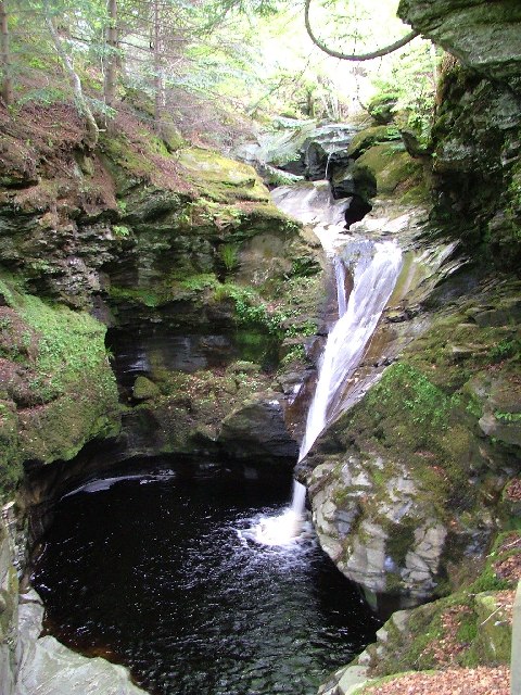
Falls of Acharn

Falls of Acharn is a waterfall of Scotland. == See also == Acharn Waterfalls of Scotland == References ==

Kenmore, Perth and Kinross

Kenmore (Scottish Gaelic: A' Cheannmhor, IPA:[ˈaˈçaun̴̪auvɔɾ]) is a small village in Perthshire, in the Highlands of Scotland, located where Loch Tay drains...

Càrn na Marbh

Càrn na Marbh (meaning "mound" or "cairn of the dead") is a re-used Bronze Age tumulus, located in Fortingall in Perthshire, Scotland. The mound was used...

Nearby Amenities

Located within 500m of 56.572419,-4.0264882
Acharn
Name Gd: Achadh Chàrn
Place: village
Wikidata: Q3775756
Wikipedia: en:Acharn, Perth and Kinross
Lat/Long: 56.5697796/-4.0263934
Noexit: yes
Lat/Long: 56.5685942/-4.0252679
Post Box
Collection Times: Mo-Sa 13:00
Operator: Royal Mail
Post Box Type: wall
Ref: PH15 50
Royal Cypher: GVIR
Royal Cypher Wikidata: Q33102169
Lat/Long: 56.5699365/-4.0256623
Acharn
1860name: Corn Mill, Saw Mill
Pont: yes
Stobie1783: no
Designation: Historic Mill
Historic: archaeological_site
Source: OS Six inch 1st series
Lat/Long: 56.5702305/-4.0258772
Material: wood
Power: pole
Lat/Long: 56.5691849/-4.0210176
Material: wood
Power: pole
Lat/Long: 56.5691302/-4.0224016
Material: wood
Power: pole
Lat/Long: 56.5690859/-4.0233859
Material: wood
Power: pole
Lat/Long: 56.5690445/-4.0243274
Material: wood
Power: pole
Lat/Long: 56.5689425/-4.0253614
Material: wood
Power: pole
Lat/Long: 56.5683574/-4.0275568
Defibrillator
Defibrillator Location: end wall of house
Emergency: defibrillator
Opening Hours: 24/7
Lat/Long: 56.5700566/-4.0252425
Bus Stop
Bench: yes
Naptan AtcoCode: 64801680
Naptan NaptanCode: 73726934
Shelter: yes
Lat/Long: 56.569954/-4.0256135
Booth: K6
Covered: booth
Disused Amenity: telephone
Man Made: telephone_box
Lat/Long: 56.5698351/-4.0260369
Material: wood
Power: pole
Transformer: distribution
Lat/Long: 56.5686765/-4.0264598
Bench
Lat/Long: 56.5699489/-4.0256306
Bench
Lat/Long: 56.5701593/-4.0256833
The data included in this document is from www.openstreetmap.org. The data is made available under ODbL.

Have you been to Acharn Point?

Leave your review of Acharn Point below (or comments, questions and feedback).