Àird Leathann Ghruth an Diona

Landscape Feature in Ross-shire

Scotland

Àird Leathann Ghruth an Diona

Loch Faoghail am Tuim Looking south towards the hills of West Lewis. The little house highlighted by a ray of sunshine is a boathouse, in the next square. The nearest hill on the left is Ciorabhal, and on the right is Geure Dubh Mhòr. On the distant skyline is Roineabhal.
Loch Faoghail am Tuim Credit: Anne Burgess

Àird Leathann Ghruth an Diona is a prominent landscape feature located in Ross-shire, Scotland. Situated in the northwest Highlands, it is a mountainous region renowned for its breathtaking natural beauty. The name Àird Leathann Ghruth an Diona translates to "Broad Headland of the Druid's Rough Land."

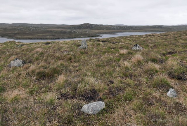
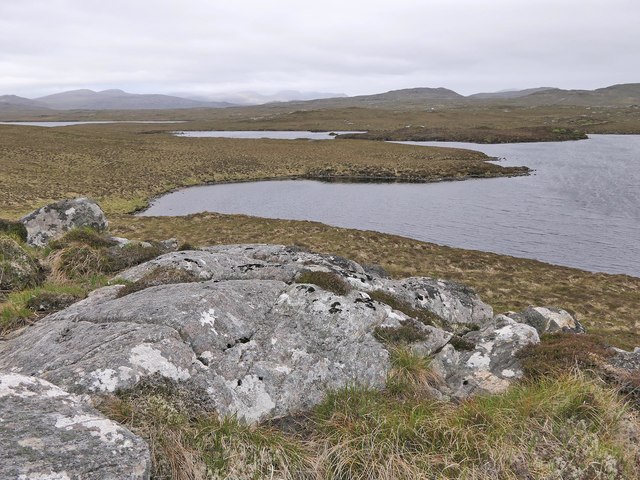
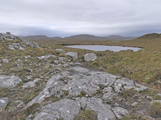
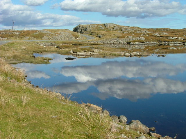
The landscape of Àird Leathann Ghruth an Diona is characterized by rugged terrain, with steep slopes and rocky outcrops dominating the area. The mountain range is part of the Scottish Highlands, boasting peaks that reach heights of over 900 meters. The slopes are covered in a variety of vegetation, including heather, grasses, and scattered patches of woodland.

The area is home to a diverse range of wildlife, with bird species such as golden eagles, peregrine falcons, and red grouse frequently spotted in the skies above. Mammals like red deer, mountain hares, and wildcats are also known to inhabit the region.

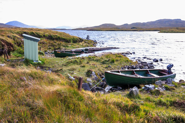
One notable feature of Àird Leathann Ghruth an Diona is its breathtaking panoramic views. From various vantage points, visitors can enjoy sweeping vistas of the surrounding mountains, lochs, and moorlands. The area offers numerous opportunities for outdoor activities such as hiking, mountaineering, and wildlife spotting.

Overall, Àird Leathann Ghruth an Diona is a captivating landscape feature that showcases the raw beauty of the Scottish Highlands. Its rugged terrain, stunning vistas, and diverse wildlife make it a must-visit destination for nature enthusiasts and outdoor adventurers alike.

If you have any feedback on the listing, please let us know in the comments section below.

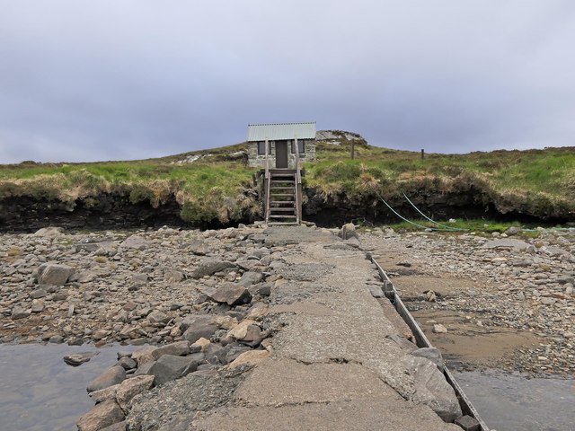
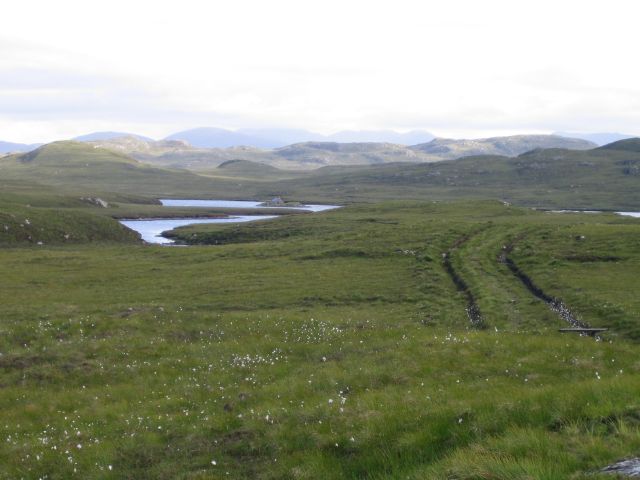
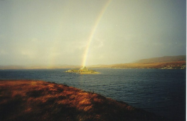
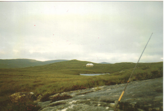
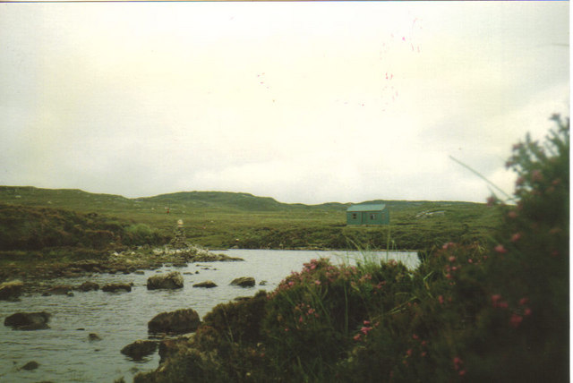
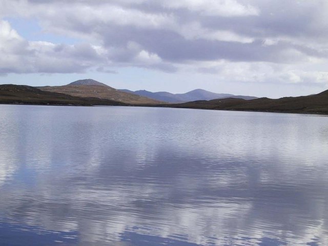
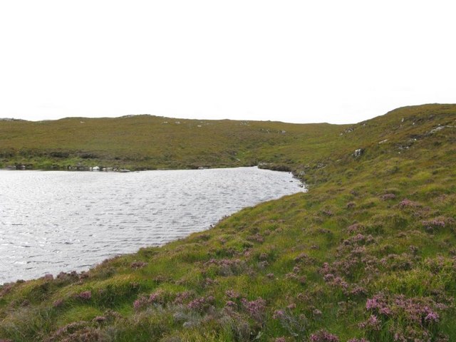
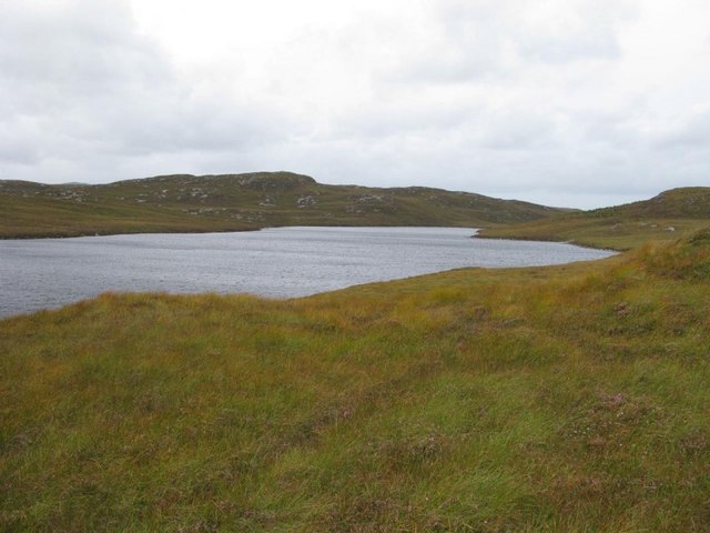
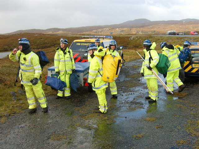
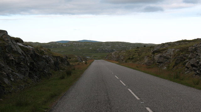
Àird Leathann Ghruth an Diona Images

Images are sourced within 2km of 58.142481/-6.745007 or Grid Reference NB2026. Thanks to Geograph Open Source API. All images are credited.

Loch Faoghail am Tuim Looking south towards the hills of West Lewis. The little house highlighted by a ray of sunshine is a boathouse, in the next square. The nearest hill on the left is Ciorabhal, and on the right is Geure Dubh Mhòr. On the distant skyline is Roineabhal.
Loch Faoghail am Tuim
Looking south towards the hills of West Lewis. The little house highlighted by a ray of sunshine is a boathouse, in the next square. The nearest hill on the left is Ciorabhal, and on the right is Geure Dubh Mhòr. On the distant skyline is Roineabhal.
Fishing boats on Loch Fadhail Chiorabhal Looking south towards Roineaval, which is the hill on the left.
Fishing boats on Loch Fadhail Chiorabhal
Looking south towards Roineaval, which is the hill on the left.
Looking south east from the old Ardroil road A short spur which has been bypassed by new road construction forms a convenient parking place to admire the view.
Looking south east from the old Ardroil road
A short spur which has been bypassed by new road construction forms a convenient parking place to admire the view.
Stone setting, Druim Cam, Isle of Lewis Looking towards Loch Faoghail Charrasan, most of which lies within the grid square.

From Discovery and Excavation in Scotland, 1991: "Possible kerb cairn or hut circle.  There is a sub-circular setting of 7 stones on edge set firmly into the ground, now under 20cm to 40cm of peat. The largest stone is 0.5m high. The internal dimensions are approximately 5.5m by 4.0m.  It is located on near-level ground on a gently sloping rock and heather ridge overlooking land on the shore of the loch."
Stone setting, Druim Cam, Isle of Lewis
Looking towards Loch Faoghail Charrasan, most of which lies within the grid square. From Discovery and Excavation in Scotland, 1991: "Possible kerb cairn or hut circle. There is a sub-circular setting of 7 stones on edge set firmly into the ground, now under 20cm to 40cm of peat. The largest stone is 0.5m high. The internal dimensions are approximately 5.5m by 4.0m. It is located on near-level ground on a gently sloping rock and heather ridge overlooking land on the shore of the loch."
Causeway and fishing bothy, Loch Faoghail an Tuim, Isle of Lewis Loch Faoghail an Tuim is part of the Grimersta salmon system (<span class="nowrap"><a title="https://www.grimersta.com/guide.htm" rel="nofollow ugc noopener" href="https://www.grimersta.com/guide.htm">Link</a><img style="margin-left:2px;" alt="External link" title="External link - shift click to open in new window" src="https://s1.geograph.org.uk/img/external.png" width="10" height="10"/></span> ).
Causeway and fishing bothy, Loch Faoghail an Tuim, Isle of Lewis
Loch Faoghail an Tuim is part of the Grimersta salmon system (LinkExternal link ).
Rock slab, Dromannan Easa Ghil, Isle of Lewis Looking towards Loch Ruadh Gheure Dubh Mhòr, the south eastern part of which lies within the grid square.
Rock slab, Dromannan Easa Ghil, Isle of Lewis
Looking towards Loch Ruadh Gheure Dubh Mhòr, the south eastern part of which lies within the grid square.
Rock slab, Cnoc na Clais, Isle of Lewis The OS Name Book of 1848-1852 describes Cnoc na Clais as, "a small, round, rocky, heathy hill" and says that its name means Furrows Hill.
Rock slab, Cnoc na Clais, Isle of Lewis
The OS Name Book of 1848-1852 describes Cnoc na Clais as, "a small, round, rocky, heathy hill" and says that its name means Furrows Hill.
Jetty and fishing bothy, Loch Faoghail an Tuim, Isle of Lewis Loch Faoghail an Tuim is part of the Grimersta salmon system (<span class="nowrap"><a title="https://www.grimersta.com/guide.htm" rel="nofollow ugc noopener" href="https://www.grimersta.com/guide.htm">Link</a><img style="margin-left:2px;" alt="External link" title="External link - shift click to open in new window" src="https://s1.geograph.org.uk/img/external.png" width="10" height="10"/></span> ).
Jetty and fishing bothy, Loch Faoghail an Tuim, Isle of Lewis
Loch Faoghail an Tuim is part of the Grimersta salmon system (LinkExternal link ).
Moorland Moorland and a track out to the loch at the head of the Grimersta river.
Moorland
Moorland and a track out to the loch at the head of the Grimersta river.
Loch Faoghail an Tuim The rainbow strikes through the bothy on an islet in the Loch which is linked to the shore by stepping stones.
Loch Faoghail an Tuim
The rainbow strikes through the bothy on an islet in the Loch which is linked to the shore by stepping stones.
Bothy on Loch Faoghail Charrasan Uig Hills in Distance
Bothy on Loch Faoghail Charrasan
Uig Hills in Distance
Bothy and cairn at Faoghail Kirrival Faoghail is the gaelic word for Ford or crossing place.
Bothy and cairn at Faoghail Kirrival
Faoghail is the gaelic word for Ford or crossing place.
Loch Faoghail Charrasen The second loch up on the famous Grimersta salmon system. A huge number of salmon pass through this loch each year and the loch below is famous for producing 333 salmon to one rod for a week. The fishing is protected and held by Grimersta and anyone wishing to fish should ask at the lodge.
Loch Faoghail Charrasen
The second loch up on the famous Grimersta salmon system. A huge number of salmon pass through this loch each year and the loch below is famous for producing 333 salmon to one rod for a week. The fishing is protected and held by Grimersta and anyone wishing to fish should ask at the lodge.
South west corner of Loch Cleit Steirmeis
Loch an Ois Ghuirm
Loch an Ois Ghuirm
Stornoway Cliff Rescue Team waiting to be lifted by helicopter from the old road The Stonoway based coastguard rescue helicopter lifted the team to a job in a remote part of the west coast of the island which has no road access.
Stornoway Cliff Rescue Team waiting to be lifted by helicopter from the old road
The Stonoway based coastguard rescue helicopter lifted the team to a job in a remote part of the west coast of the island which has no road access.
Rocky cutting on the B8011 The reconstructed B8011 in West Lewis has been built through the landscape with cuttings and embankments, unlike the old road which was laid over the landscape. The new road encourages rapid progress, but drivers should beware of sheep and red deer.
Rocky cutting on the B8011
The reconstructed B8011 in West Lewis has been built through the landscape with cuttings and embankments, unlike the old road which was laid over the landscape. The new road encourages rapid progress, but drivers should beware of sheep and red deer.
Reflections on Loch Sgaire A short causeway separates this loch from Loch Faoghail an Tuim.
Reflections on Loch Sgaire
A short causeway separates this loch from Loch Faoghail an Tuim.
Show me another place!

Àird Leathann Ghruth an Diona is located at Grid Ref: NB2026 (Lat: 58.142481, Lng: -6.745007)

Unitary Authority: Na h-Eileanan an Iar

Police Authority: Highlands and Islands

What 3 Words

///cyber.solution.podcast. Near Leurbost, Na h-Eileanan Siar

Related Wikis

Callanish IV

The Callanish IV stone circle (Scottish Gaelic: Ceann Hulavig) is one of many megalithic structures around the better-known (and larger) Calanais I on...

Eilean Mòr, Loch Langavat

Eilean Mòr is an island in Loch Langavat on the Isle of Lewis in the Outer Hebrides of Scotland. == Footnotes ==

Garynahine

Garynahine (Scottish Gaelic: Gearraidh na h-aibhne) is a settlement on Lewis, in the Outer Hebrides, Scotland. Garynahine is situated at a T-junction where...

Garynahine Estate

Garynahine Estate (Scottish Gaelic: Gearraidh na h-aibhne) in Garynahine, a village on the Isle of Lewis, Outer Hebrides was owned by Sir James Matheson...

Have you been to Àird Leathann Ghruth an Diona?

Leave your review of Àird Leathann Ghruth an Diona below (or comments, questions and feedback).