Gearraidh Geure Dhubh Bheag

Downs, Moorland in Ross-shire

Scotland

Gearraidh Geure Dhubh Bheag

Fishing boats on Loch Fadhail Chiorabhal Looking south towards Roineaval, which is the hill on the left.
Fishing boats on Loch Fadhail Chiorabhal Credit: Richard Barrett

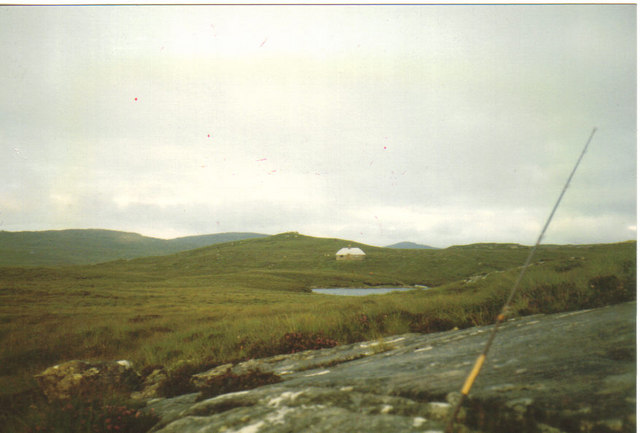
Gearraidh Geure Dhubh Bheag, located in Ross-shire, Scotland, is a picturesque village surrounded by stunning downs and moorland landscapes. The village is nestled in a valley, offering breathtaking views of the surrounding hills and countryside.

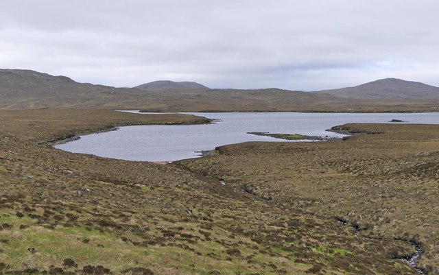
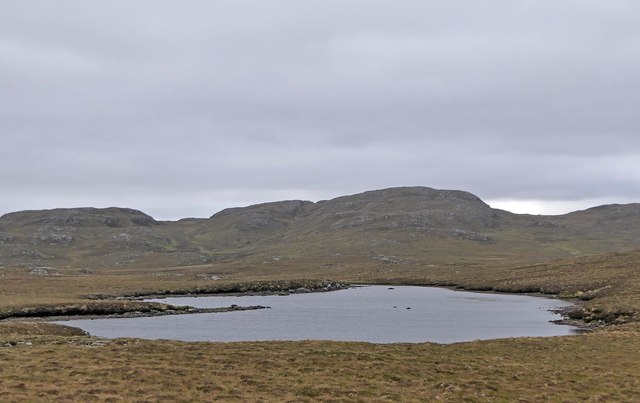
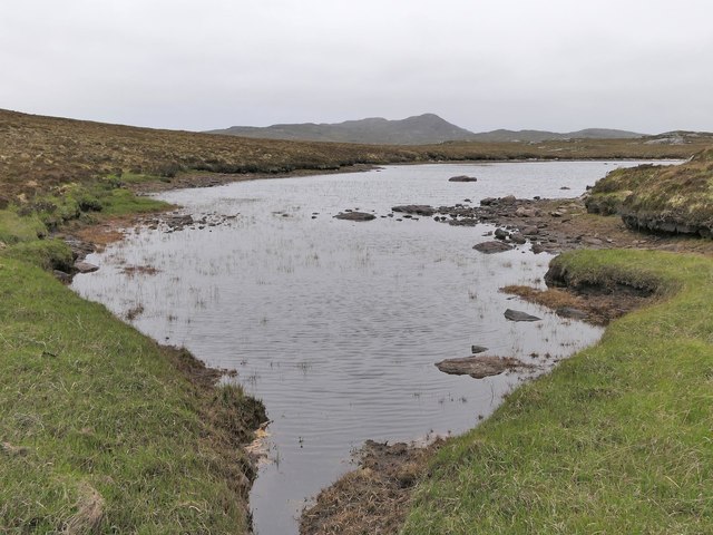
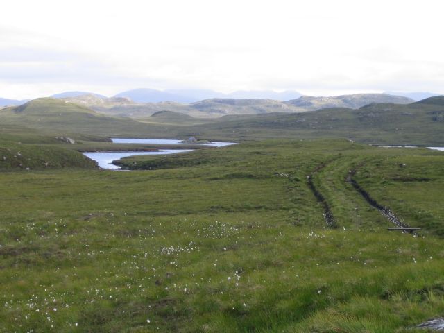
The downs in Gearraidh Geure Dhubh Bheag are characterized by their gently rolling hills and lush green pastures. These downs provide ideal grazing land for livestock, and visitors can often see sheep and cattle dotting the landscape. The peaceful and serene atmosphere of the downs makes them a popular spot for leisurely walks and picnics.

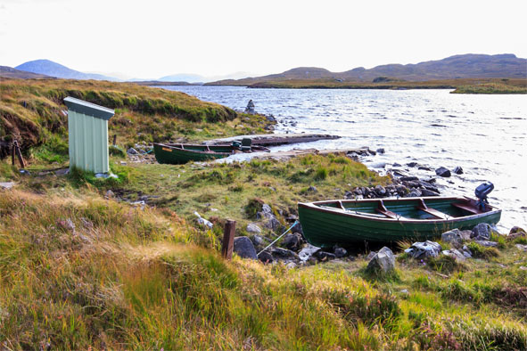
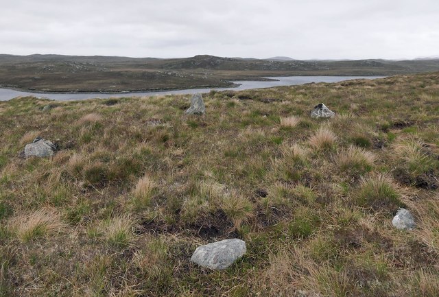
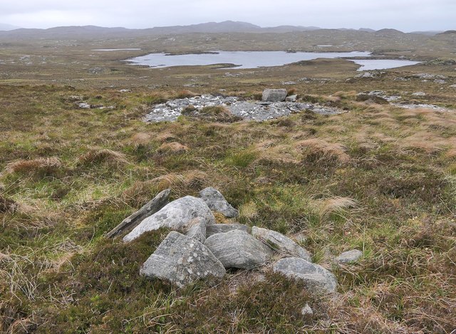
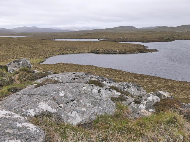
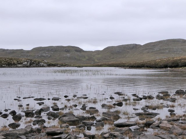
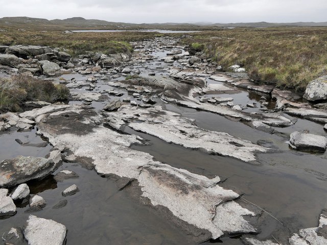
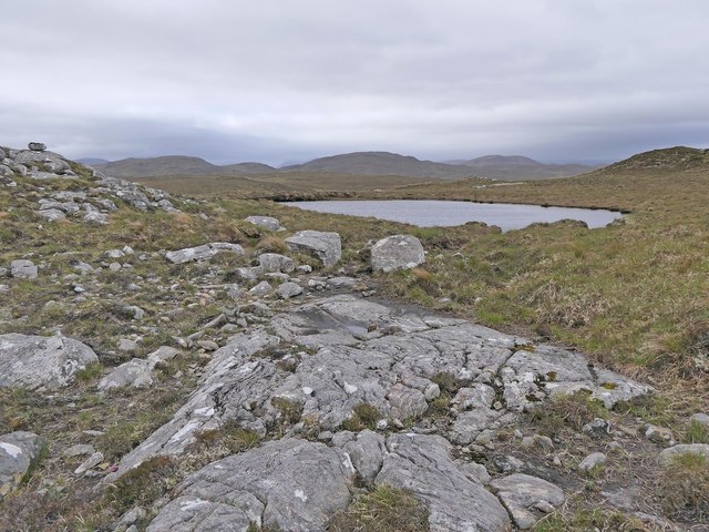
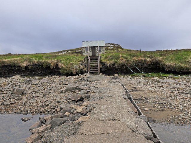
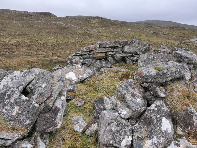
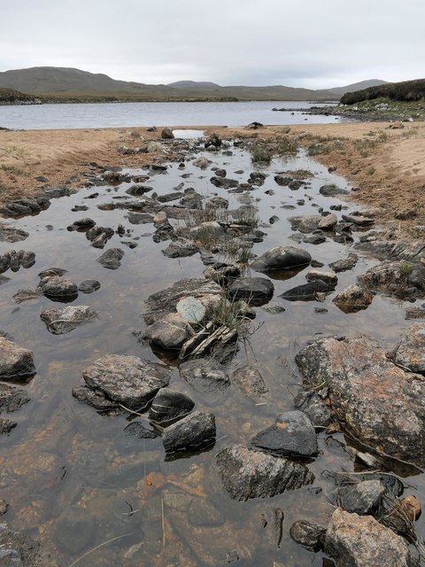
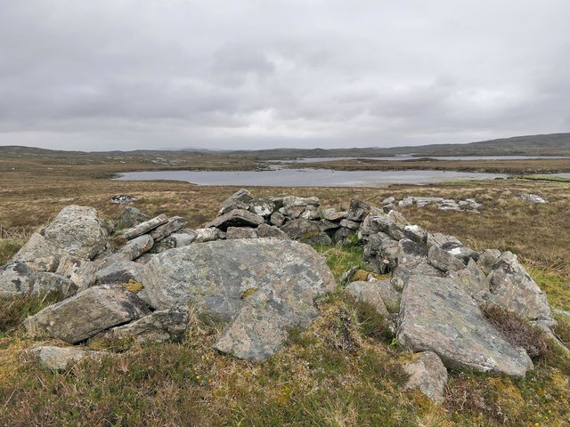
Adjacent to the downs, the moorland of Gearraidh Geure Dhubh Bheag stretches out, offering a wilder and more rugged landscape. The moorland is covered in heather and scattered with rocky outcrops, creating a striking contrast against the green downs. This untamed terrain is a haven for nature enthusiasts, who can explore the area’s diverse flora and fauna.

The village of Gearraidh Geure Dhubh Bheag itself is a charming and traditional Scottish village, with quaint stone cottages and friendly locals. It offers basic amenities such as a small grocery store and a post office, making it a peaceful retreat away from the hustle and bustle of larger towns.

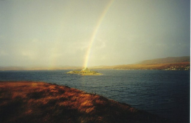
For those seeking outdoor adventures, Gearraidh Geure Dhubh Bheag is an ideal destination. The downs and moorland provide ample opportunities for hiking, cycling, and birdwatching. Visitors can also enjoy fishing in nearby rivers and lochs, or simply take in the breathtaking natural beauty that surrounds the village.

If you have any feedback on the listing, please let us know in the comments section below.

Gearraidh Geure Dhubh Bheag Images

Images are sourced within 2km of 58.13745/-6.7503744 or Grid Reference NB2026. Thanks to Geograph Open Source API. All images are credited.

Fishing boats on Loch Fadhail Chiorabhal Looking south towards Roineaval, which is the hill on the left.
Fishing boats on Loch Fadhail Chiorabhal
Looking south towards Roineaval, which is the hill on the left.
Stone setting, Druim Cam, Isle of Lewis Looking towards Loch Faoghail Charrasan, most of which lies within the grid square.

From Discovery and Excavation in Scotland, 1991: "Possible kerb cairn or hut circle.  There is a sub-circular setting of 7 stones on edge set firmly into the ground, now under 20cm to 40cm of peat. The largest stone is 0.5m high. The internal dimensions are approximately 5.5m by 4.0m.  It is located on near-level ground on a gently sloping rock and heather ridge overlooking land on the shore of the loch."
Stone setting, Druim Cam, Isle of Lewis
Looking towards Loch Faoghail Charrasan, most of which lies within the grid square. From Discovery and Excavation in Scotland, 1991: "Possible kerb cairn or hut circle. There is a sub-circular setting of 7 stones on edge set firmly into the ground, now under 20cm to 40cm of peat. The largest stone is 0.5m high. The internal dimensions are approximately 5.5m by 4.0m. It is located on near-level ground on a gently sloping rock and heather ridge overlooking land on the shore of the loch."
Cairn, Cleit na Faoghalach, Isle of Lewis Looking towards Loch an Easa Ghil.

The cairn is shown on OS maps with a scale of 1:25,000 and larger.
Cairn, Cleit na Faoghalach, Isle of Lewis
Looking towards Loch an Easa Ghil. The cairn is shown on OS maps with a scale of 1:25,000 and larger.
Causeway and fishing bothy, Loch Faoghail an Tuim, Isle of Lewis Loch Faoghail an Tuim is part of the Grimersta salmon system (<span class="nowrap"><a title="https://www.grimersta.com/guide.htm" rel="nofollow ugc noopener" href="https://www.grimersta.com/guide.htm">Link</a><img style="margin-left:2px;" alt="External link" title="External link - shift click to open in new window" src="https://s1.geograph.org.uk/img/external.png" width="10" height="10"/></span> ).
Causeway and fishing bothy, Loch Faoghail an Tuim, Isle of Lewis
Loch Faoghail an Tuim is part of the Grimersta salmon system (LinkExternal link ).
Rock slab, Dromannan Easa Ghil, Isle of Lewis Looking towards Loch Ruadh Gheure Dubh Mhòr, the south eastern part of which lies within the grid square.
Rock slab, Dromannan Easa Ghil, Isle of Lewis
Looking towards Loch Ruadh Gheure Dubh Mhòr, the south eastern part of which lies within the grid square.
Loch an Fhir Mhaoil, Isle of Lewis The burn flowing into the loch is the Os an Fhir Mhaoil flowing down from Loch Ruadh Gheure Dubh Mhòr.
Loch an Fhir Mhaoil, Isle of Lewis
The burn flowing into the loch is the Os an Fhir Mhaoil flowing down from Loch Ruadh Gheure Dubh Mhòr.
Loch na-h-Airde Coinnich, Isle of Lewis Looking towards the bealach between Beinn a' Chuailein and Beinn a' Sgurain.
Loch na-h-Airde Coinnich, Isle of Lewis
Looking towards the bealach between Beinn a' Chuailein and Beinn a' Sgurain.
The Abhainn an Easa Ghil, Isle of Lewis The river runs from Loch Airigh a' Bhealaich to Loch Beag an Easa Ghil, which it is seen flowing into in the distance.
The Abhainn an Easa Ghil, Isle of Lewis
The river runs from Loch Airigh a' Bhealaich to Loch Beag an Easa Ghil, which it is seen flowing into in the distance.
Rock slab, Cnoc na Clais, Isle of Lewis The OS Name Book of 1848-1852 describes Cnoc na Clais as, "a small, round, rocky, heathy hill" and says that its name means Furrows Hill.
Rock slab, Cnoc na Clais, Isle of Lewis
The OS Name Book of 1848-1852 describes Cnoc na Clais as, "a small, round, rocky, heathy hill" and says that its name means Furrows Hill.
Jetty and fishing bothy, Loch Faoghail an Tuim, Isle of Lewis Loch Faoghail an Tuim is part of the Grimersta salmon system (<span class="nowrap"><a title="https://www.grimersta.com/guide.htm" rel="nofollow ugc noopener" href="https://www.grimersta.com/guide.htm">Link</a><img style="margin-left:2px;" alt="External link" title="External link - shift click to open in new window" src="https://s1.geograph.org.uk/img/external.png" width="10" height="10"/></span> ).
Jetty and fishing bothy, Loch Faoghail an Tuim, Isle of Lewis
Loch Faoghail an Tuim is part of the Grimersta salmon system (LinkExternal link ).
Shieling hut, Airigh a' Chuailein, Isle of Lewis Shielings were moorland summer grazings for cattle.  Shieling huts (often also referred to as shielings) were dwellings located within the shieling.  They were usually occupied from May until the “flitting” in September.  In early May the men of a village would go onto the moor to check and repair the shieling huts.  They would be joined by the women and children for one night before the men returned to the village to tend to crops or to travel away for summer work such as fishing.  The women and children would spend the summer at the shielings tending the cattle and making cheese and butter, some of which was for immediate use but most was salted to preserve it for the winter.  Peat cutting for fuel would also be done.  Evenings would be spent making music and story telling.  Visits were made between the shielings of different villages.

The shieling huts were made from materials available in the immediate vicinity.  They usually had walls made of stone or turf, turf roofs and compacted earth or clay floors.  In coastal areas and on the islands rafters would be made from locally collected driftwood.  Usually there would be a single doorway, facing away from the prevailing wind (although some shieling huts have two doors opposite each other), and often no windows.  Furniture built into shieling huts included stone or turf beds covered with heather, turf seats and cupboards and niches built into the stone wall, often one above the door.  Other furniture would be carried out onto the moor for the season.  In places where the practice of using shielings continued into the 20th century, shieling huts can be found which are constructed making more extensive use of timber than in the traditional type, along with other materials such as tin and bitumen.  There are also examples of buses and caravans used as shieling huts.

The Clearances and ongoing changes in agricultural methods meant that the shieling tradition had generally ended by the close of the nineteenth century.  In places it continued for longer and, particularly on Lewis, some shieling huts are still used today during the peat cutting season and as summer retreats.

The remains of shieling huts can be seen as

changes in vegetation: <a href="https://www.geograph.org.uk/photo/1962348">ND1340 : Shieling site by the Allt a' Cheracher</a> ;
shieling mounds where successive shieling huts have been built on the same site: <a href="https://www.geograph.org.uk/photo/5238987">NB5059 : Shieling mounds by the Abhainn Dhail, Isle of Lewis</a> ;
footings: <a href="https://www.geograph.org.uk/photo/5027765">NB5357 : Shieling footings beside the Feadan Mòr, Isle of Lewis</a> ; and
more substantial remains: <a href="https://www.geograph.org.uk/photo/5238993">NB3040 : Shieling above Gleann Leitir, Isle of Lewis</a> .

Examples of modern shielings are shown at:

<a href="https://www.geograph.org.uk/photo/5238999">NB5458 : Shieling, Airigh A' Bhealaich, Isle of Lewis</a> and <a href="https://www.geograph.org.uk/photo/5048077">NB5458 : Disused shieling, Airigh A' Bhealaich, Isle of Lewis</a> .
Shieling hut, Airigh a' Chuailein, Isle of Lewis
Shielings were moorland summer grazings for cattle. Shieling huts (often also referred to as shielings) were dwellings located within the shieling. They were usually occupied from May until the “flitting” in September. In early May the men of a village would go onto the moor to check and repair the shieling huts. They would be joined by the women and children for one night before the men returned to the village to tend to crops or to travel away for summer work such as fishing. The women and children would spend the summer at the shielings tending the cattle and making cheese and butter, some of which was for immediate use but most was salted to preserve it for the winter. Peat cutting for fuel would also be done. Evenings would be spent making music and story telling. Visits were made between the shielings of different villages. The shieling huts were made from materials available in the immediate vicinity. They usually had walls made of stone or turf, turf roofs and compacted earth or clay floors. In coastal areas and on the islands rafters would be made from locally collected driftwood. Usually there would be a single doorway, facing away from the prevailing wind (although some shieling huts have two doors opposite each other), and often no windows. Furniture built into shieling huts included stone or turf beds covered with heather, turf seats and cupboards and niches built into the stone wall, often one above the door. Other furniture would be carried out onto the moor for the season. In places where the practice of using shielings continued into the 20th century, shieling huts can be found which are constructed making more extensive use of timber than in the traditional type, along with other materials such as tin and bitumen. There are also examples of buses and caravans used as shieling huts. The Clearances and ongoing changes in agricultural methods meant that the shieling tradition had generally ended by the close of the nineteenth century. In places it continued for longer and, particularly on Lewis, some shieling huts are still used today during the peat cutting season and as summer retreats. The remains of shieling huts can be seen as changes in vegetation: ND1340 : Shieling site by the Allt a' Cheracher ; shieling mounds where successive shieling huts have been built on the same site: NB5059 : Shieling mounds by the Abhainn Dhail, Isle of Lewis ; footings: NB5357 : Shieling footings beside the Feadan Mòr, Isle of Lewis ; and more substantial remains: NB3040 : Shieling above Gleann Leitir, Isle of Lewis . Examples of modern shielings are shown at: NB5458 : Shieling, Airigh A' Bhealaich, Isle of Lewis and NB5458 : Disused shieling, Airigh A' Bhealaich, Isle of Lewis .
Loch na-h-Airde Coinnich, Isle of Lewis Looking towards Beinn a' Sgurain.
Loch na-h-Airde Coinnich, Isle of Lewis
Looking towards Beinn a' Sgurain.
Loch na-h-Airde Coinnich, Isle of Lewis Looking towards Griosamol.
Loch na-h-Airde Coinnich, Isle of Lewis
Looking towards Griosamol.
Inflow to Loch an Fhir Mhaoil, Isle of Lewis The burn flowing into the loch is the Os an Fhir Mhaoil flowing down from Loch Ruadh Gheure Dubh Mhòr.

According to the OS Namebook of 1848-1852, Loch an Fhir Mhaoil means Loch of the Bald Headed Man.
Inflow to Loch an Fhir Mhaoil, Isle of Lewis
The burn flowing into the loch is the Os an Fhir Mhaoil flowing down from Loch Ruadh Gheure Dubh Mhòr. According to the OS Namebook of 1848-1852, Loch an Fhir Mhaoil means Loch of the Bald Headed Man.
Shieling hut,  Airigh Cnoc na h-Aibhne, Isle of Lewis Looking towards Loch Beag an Easa Ghil and Loch an Easa Ghil beyond.
Shieling hut, Airigh Cnoc na h-Aibhne, Isle of Lewis
Looking towards Loch Beag an Easa Ghil and Loch an Easa Ghil beyond.
Moorland Moorland and a track out to the loch at the head of the Grimersta river.
Moorland
Moorland and a track out to the loch at the head of the Grimersta river.
Loch Faoghail an Tuim The rainbow strikes through the bothy on an islet in the Loch which is linked to the shore by stepping stones.
Loch Faoghail an Tuim
The rainbow strikes through the bothy on an islet in the Loch which is linked to the shore by stepping stones.
Bothy on Loch Faoghail Charrasan Uig Hills in Distance
Bothy on Loch Faoghail Charrasan
Uig Hills in Distance
Show me another place!

Gearraidh Geure Dhubh Bheag is located at Grid Ref: NB2026 (Lat: 58.13745, Lng: -6.7503744)

Unitary Authority: Na h-Eileanan an Iar

Police Authority: Highlands and Islands

What 3 Words

///unfolds.scarf.stems. Near Leurbost, Na h-Eileanan Siar

Related Wikis

Eilean Mòr, Loch Langavat

Eilean Mòr is an island in Loch Langavat on the Isle of Lewis in the Outer Hebrides of Scotland. == Footnotes ==

Callanish IV

The Callanish IV stone circle (Scottish Gaelic: Ceann Hulavig) is one of many megalithic structures around the better-known (and larger) Calanais I on...

Garynahine

Garynahine (Scottish Gaelic: Gearraidh na h-aibhne) is a settlement on Lewis, in the Outer Hebrides, Scotland. Garynahine is situated at a T-junction where...

Garynahine Estate

Garynahine Estate (Scottish Gaelic: Gearraidh na h-aibhne) in Garynahine, a village on the Isle of Lewis, Outer Hebrides was owned by Sir James Matheson...

Have you been to Gearraidh Geure Dhubh Bheag?

Leave your review of Gearraidh Geure Dhubh Bheag below (or comments, questions and feedback).