Mill Stream

Lake, Pool, Pond, Freshwater Marsh in Kent Canterbury

England

Mill Stream

Farmland and pylon
Farmland and pylon Credit: N Chadwick

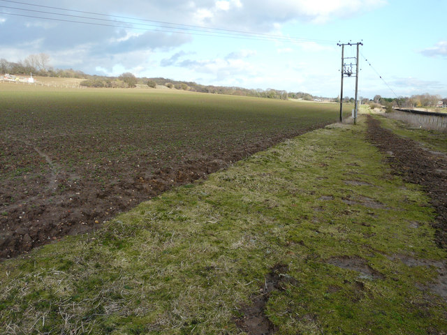
Mill Stream is a freshwater marsh located in the county of Kent in southeast England. Spanning over an area of approximately 10 acres, it is a serene and picturesque water body that serves as a haven for diverse flora and fauna. The stream is fed by natural springs and rainwater runoff, ensuring a constant flow of clean water throughout the year.

The marsh is surrounded by lush vegetation, including reeds, rushes, and water lilies, which provide vital habitat for numerous species of birds, insects, and amphibians. It is not uncommon to spot herons, kingfishers, and mallards gracefully gliding across the water, while dragonflies and damselflies dart through the air.

The water in Mill Stream is typically calm and still, making it an ideal spot for fishing enthusiasts. Anglers can expect to find a variety of freshwater fish species, such as roach, perch, and carp, making it a popular destination for recreational fishing.

The surrounding area of Mill Stream is also home to a diverse range of wildlife. Foxes, rabbits, and deer can often be seen roaming the nearby fields, while otters have been spotted occasionally near the water's edge.

The marsh is easily accessible, with several footpaths and nature trails winding their way around its perimeter. These paths offer visitors the opportunity to enjoy the tranquility of the marsh while observing the abundant wildlife.

Overall, Mill Stream is a beautiful and ecologically significant freshwater marsh that provides a vital habitat for numerous species. It offers visitors a unique opportunity to connect with nature and appreciate the wonders of Kent's natural landscapes.

If you have any feedback on the listing, please let us know in the comments section below.

Mill Stream Images

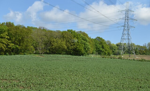
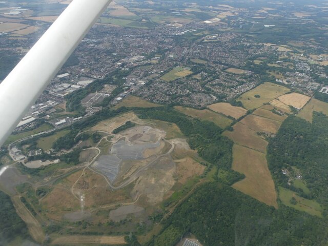
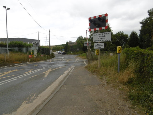
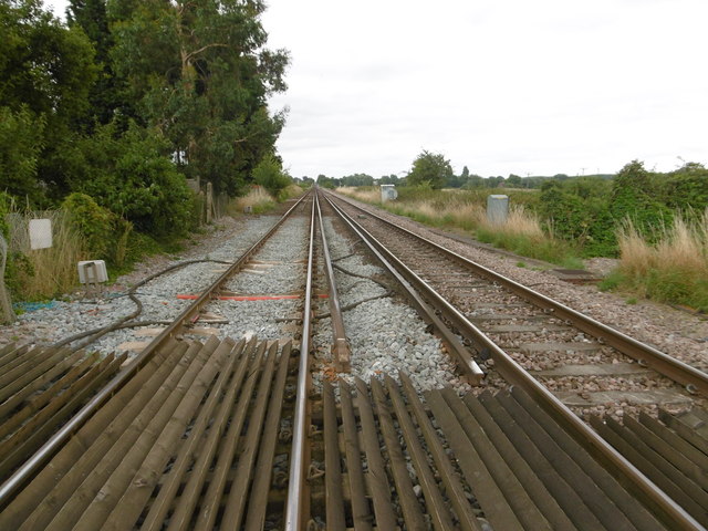
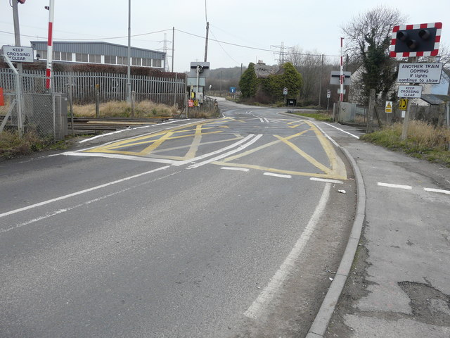
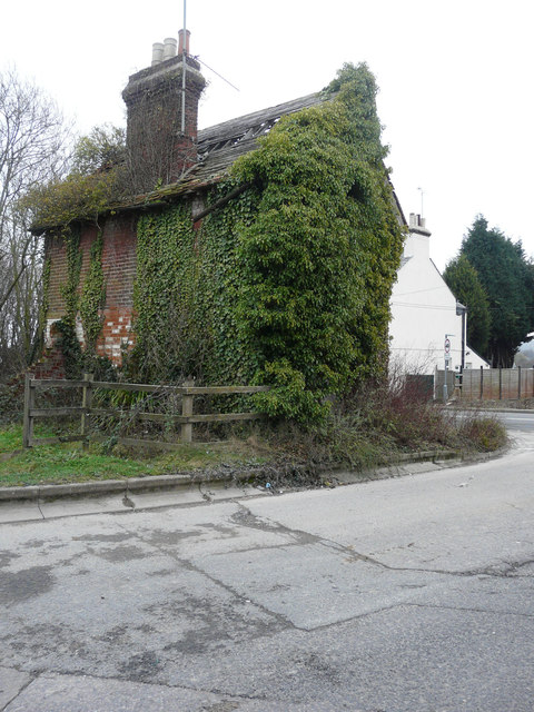
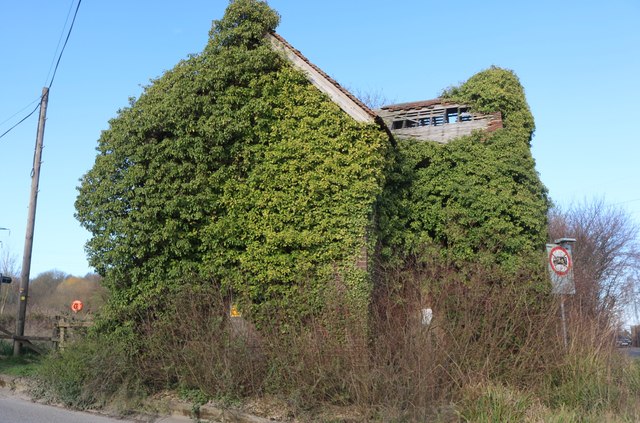
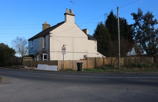
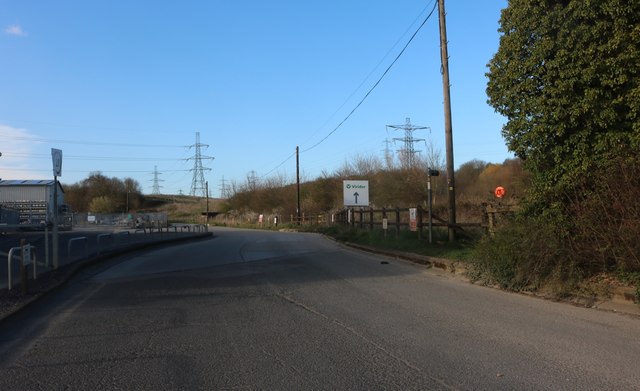
Images are sourced within 2km of 51.288047/1.0902586 or Grid Reference TR1558. Thanks to Geograph Open Source API. All images are credited.

Farmland and pylon
Farmland and pylon
Barton Down, NE of Canterbury: aerial 2022
University of Kent at Canterbury A road on the northern side of the campus site.
University of Kent at Canterbury
A road on the northern side of the campus site.
Level crossing on Shalloak Road On 6th February 1846, the South Eastern Railway began services from Ashford to Canterbury West and two months later in April 1846 services were extended though here to Ramsgate. Electric services started on 9th October 1961 and in December 2009, the line became part of the Southeastern High Speed service to London St Pancras.

The next station to the right here is Canterbury West and to the left is Sturry, although the High Speed trains do not stop at the latter.
Level crossing on Shalloak Road
On 6th February 1846, the South Eastern Railway began services from Ashford to Canterbury West and two months later in April 1846 services were extended though here to Ramsgate. Electric services started on 9th October 1961 and in December 2009, the line became part of the Southeastern High Speed service to London St Pancras. The next station to the right here is Canterbury West and to the left is Sturry, although the High Speed trains do not stop at the latter.
Level crossing on Shalloak Road On 6th February 1846, the South Eastern Railway began services from Ashford to Canterbury West and two months later in April 1846 services were extended though here to Ramsgate. Electric services started on 9th October 1961 and in December 2009, the line became part of the Southeastern High Speed service to London St Pancras.

The next station to the left here is Canterbury West and to the right is Sturry, although the High Speed trains do not stop at the latter.
Level crossing on Shalloak Road
On 6th February 1846, the South Eastern Railway began services from Ashford to Canterbury West and two months later in April 1846 services were extended though here to Ramsgate. Electric services started on 9th October 1961 and in December 2009, the line became part of the Southeastern High Speed service to London St Pancras. The next station to the left here is Canterbury West and to the right is Sturry, although the High Speed trains do not stop at the latter.
View down the line from Broadoak Crossing On 6th February 1846, the South Eastern Railway began services from Ashford to Canterbury West and two months later in April 1846 services were extended though here to Ramsgate. Electric services started on 9th October 1961 and in December 2009, the line became part of the Southeastern High Speed service to London St Pancras.

This view is from Broadoak Crossing where Shalloak Road crosses the line. The next station in this direction is Sturry, although the High Speed trains do not stop there.
View down the line from Broadoak Crossing
On 6th February 1846, the South Eastern Railway began services from Ashford to Canterbury West and two months later in April 1846 services were extended though here to Ramsgate. Electric services started on 9th October 1961 and in December 2009, the line became part of the Southeastern High Speed service to London St Pancras. This view is from Broadoak Crossing where Shalloak Road crosses the line. The next station in this direction is Sturry, although the High Speed trains do not stop there.
Works associated with Richborough Connection Project, Shalloak Road This is a proposed 400kV electricity transmission connection between Richborough and Canterbury in Kent to connect the proposed new UK to Belgium interconnector (known as the Nemo Link) <span class="nowrap"><a title="https://infrastructure.planninginspectorate.gov.uk/projects/south-east/richborough-connection-project/" rel="nofollow ugc noopener" href="https://infrastructure.planninginspectorate.gov.uk/projects/south-east/richborough-connection-project/">Link</a><img style="margin-left:2px;" alt="External link" title="External link - shift click to open in new window" src="https://s1.geograph.org.uk/img/external.png" width="10" height="10"/></span>
Works associated with Richborough Connection Project, Shalloak Road
This is a proposed 400kV electricity transmission connection between Richborough and Canterbury in Kent to connect the proposed new UK to Belgium interconnector (known as the Nemo Link) LinkExternal link
Derelict house, Shalloak Road
Broadoak Crossing There is a <a href="https://www.geograph.org.uk/photo/5666209">TR1660 : Derelict house, Shalloak Road</a> on the other side of the level crossing.
Broadoak Crossing
There is a TR1660 : Derelict house, Shalloak Road on the other side of the level crossing.
Derelict house, Shalloak Road David Anstiss’ <a href="https://www.geograph.org.uk/photo/1958397">TR1660 : Disused house near Broadoak Crossing</a> shows the building, when it was in a far better condition!
Derelict house, Shalloak Road
David Anstiss’ TR1660 : Disused house near Broadoak Crossing shows the building, when it was in a far better condition!
Farmland Planning permission was refused by Canterbury City Council under application number CA//17/01383 for an “outline application with all matters reserved for up to 700 houses, primary school, medical hub, community building, car park and associated amenity space; and detailed application for the construction of part of the Sturry Relief Road and a local road from the Sturry Relief Road to Shalloak Road”. 

To the right of the electricity pole is the railway line between Sturry and Canterbury West stations.
Farmland
Planning permission was refused by Canterbury City Council under application number CA//17/01383 for an “outline application with all matters reserved for up to 700 houses, primary school, medical hub, community building, car park and associated amenity space; and detailed application for the construction of part of the Sturry Relief Road and a local road from the Sturry Relief Road to Shalloak Road”. To the right of the electricity pole is the railway line between Sturry and Canterbury West stations.
House returning to nature If the walls are eaten away it will become the way it was originally plus the rubble underneath.
House returning to nature
If the walls are eaten away it will become the way it was originally plus the rubble underneath.
Houses by Broadoak Crossing, Canterbury
Industrial estate in Broad Oak, Canterbury
Field off Shalloak Road
Woolf Building, University of Kent Founded in 1965, the University of Kent is a campus university. The main Canterbury campus covers 300 acres and is just over two miles from the city centre. There are also sites at Medway and Tonbridge.
Website: <span class="nowrap"><a title="http://www.kent.ac.uk/" rel="nofollow ugc noopener" href="http://www.kent.ac.uk/">Link</a><img style="margin-left:2px;" alt="External link" title="External link - shift click to open in new window" src="https://s1.geograph.org.uk/img/external.png" width="10" height="10"/></span>
Woolf Building, University of Kent
Founded in 1965, the University of Kent is a campus university. The main Canterbury campus covers 300 acres and is just over two miles from the city centre. There are also sites at Medway and Tonbridge. Website: LinkExternal link
Mathematics Department, University of Kent Founded in 1965, the University of Kent is a campus university. The main Canterbury campus covers 300 acres and is just over two miles from the city centre. There are also sites at Medway and Tonbridge.
Website: <span class="nowrap"><a title="http://www.kent.ac.uk/" rel="nofollow ugc noopener" href="http://www.kent.ac.uk/">Link</a><img style="margin-left:2px;" alt="External link" title="External link - shift click to open in new window" src="https://s1.geograph.org.uk/img/external.png" width="10" height="10"/></span>
Mathematics Department, University of Kent
Founded in 1965, the University of Kent is a campus university. The main Canterbury campus covers 300 acres and is just over two miles from the city centre. There are also sites at Medway and Tonbridge. Website: LinkExternal link
Shalloak Rd
Shalloak Rd
Show me another place!

Mill Stream is located at Grid Ref: TR1558 (Lat: 51.288047, Lng: 1.0902586)

Administrative County: Kent

District: Canterbury

Police Authority: Kent

What 3 Words

///homes.branded.winner. Near Canterbury, Kent

Nearby Locations

Northgate Mill Stream

Related Wikis

Kingsmead Stadium

Kingsmead Stadium was a greyhound racing and motorcycle speedway track and Association football ground in Canterbury. It was host to Canterbury City F...

Canterbury power station

Canterbury power station supplied electricity to the city of Canterbury, Kent, England from 1900 to 1960. This small generating station was owned and operated...

Beverley Ground

The Beverley Ground was a cricket ground in Canterbury in Kent. It was in use in the mid-19th century, with recorded matches taking place between 1839...

Canterbury Law Courts

Canterbury Law Courts, also known as Canterbury Combined Court Centre, is a Crown Court venue, which deals with criminal cases, as well as a County Court...

Nearby Amenities

Located within 500m of 51.288047,1.0902586
Post Box
Post Box Type: meter
Postal Code: CT1
Ref: CT1 293
Source: survey
Lat/Long: 51.2847899/1.0935458
Telephone
Booth: KX100
Check Date: 2023-01-11
Covered: booth
Lat/Long: 51.2870796/1.0940545
Bus Stop
Hawthorn Avenue
Naptan AtcoCode: 2400A049260A
Naptan Bearing: NE
Naptan CommonName: Hawthorn Avenue
Naptan Indicator: opp
Naptan Landmark: Allotments
Naptan NaptanCode: kntgamgj
Naptan PlusbusZoneRef: CNTBE
Naptan Street: Broad Oak Road
Naptan Verified: no
Public Transport: platform
Ref: kntgamgj
Source: naptan_import
Source Date: 2018-03-29T12:41:00
Lat/Long: 51.2888358/1.0863248
Bus Stop
Hawthorn Avenue
Naptan AtcoCode: 2400A049270A
Naptan Bearing: SW
Naptan CommonName: Hawthorn Avenue
Naptan Indicator: adj
Naptan Landmark: Allotments
Naptan NaptanCode: kntgamgm
Naptan PlusbusZoneRef: CNTBE
Naptan Street: Broad Oak Road
Naptan Verified: no
Public Transport: platform
Ref: kntgamgm
Shelter: no
Source: naptan_import
Source Date: 2010-03-01T10:13:00
Lat/Long: 51.2888406/1.0865576
Post Box
Collection Times: Mo-Fr 09:00; Sa 07:00
Operator: Royal Mail
Post Box Type: pillar
Postal Code: CT2
Ref: CT2 332
Royal Cypher: EIIR
Royal Cypher Wikidata: Q33102113
Source: survey
Lat/Long: 51.2894591/1.0879333
Turning Circle
Lat/Long: 51.2863607/1.0841756
Bicycle Parking
Bicycle Parking: stands
Capacity: 8
Covered: no
Cyclestreets Id: 44780
Lat/Long: 51.2861101/1.0844408
Crossing
Crossing: uncontrolled
Crossing Ref: zebra
Lat/Long: 51.2883354/1.0855212
Millennium Milepost Brymore Road
Description: 1) Fordwich 1.75, Dover 30.5 2) Canterbury 1, London 92
Image: https://www.cyclestreets.net/location/198288/cyclestreets198288.jpg
Information: guidepost
Ncn Milepost: mills
Source: survey
Sustrans Ref: MP 1154
Tourism: information
Lat/Long: 51.285775/1.0958676
Bicycle Parking
Bicycle Parking: stands
Capacity: 10
Covered: yes
Lat/Long: 51.2877469/1.0916241
Kerb: raised
Lat/Long: 51.2868149/1.0937467
Crossing
Crossing: unmarked
Tactile Paving: yes
Lat/Long: 51.2841169/1.0868637
Traffic Calming: table
Lat/Long: 51.2873865/1.0856147
Pharmacy
Eckersley's Pharmacy
Check Date: 2023-09-16
Dispensing: yes
Healthcare: pharmacy
Opening Hours: Mo-Fr 08:30-18:00, Sa 09:00-12:30
Wheelchair: yes
Lat/Long: 51.2842325/1.0867208
Post Box
Collection Times: Mo-Fr 18:45; Sa 13:00
Post Box Type: pillar
Postal Code: CT1
Ref: CT1 2921
Royal Cypher: EIIR
Royal Cypher Wikidata: Q33102113
Source: survey
Lat/Long: 51.284773/1.0935672
Post Box
Collection Times: Mo-Fr 09:00, Sa 07:00
Operator: Royal Mail
Post Box Type: lamp
Postal Code: CT1
Ref: CT1 15
Royal Cypher: EIIR
Royal Cypher Wikidata: Q33102113
Source: survey
Lat/Long: 51.2875776/1.0937082
Post Box
Collection Times: Mo-Fr 17:30, Sa 13:15
Indoor: yes
Note: In foyer of ASDA
Operator: Royal Mail
Post Box Type: pillar
Postal Code: CT1
Ref: CT1 75
Royal Cypher: EIIR
Royal Cypher Wikidata: Q33102113
Source: survey
Lat/Long: 51.2902789/1.0964273
Bicycle Parking
Bicycle Parking: stands
Capacity: 10
Covered: yes
Cyclestreets Id: 27022
Source: survey
Lat/Long: 51.2889785/1.0930572
Bicycle Parking
Bicycle Parking: stands
Capacity: 10
Covered: yes
Cyclestreets Id: 27116
Source: survey
Lat/Long: 51.2879605/1.0927081
Bicycle Parking
Bicycle Parking: stands
Capacity: 2
Covered: no
Cyclestreets Id: 27117
Source: survey
Lat/Long: 51.2883266/1.0939789
Crossing
Button Operated: yes
Crossing: traffic_signals
Crossing Ref: pelican
Tactile Paving: yes
Traffic Signals Sound: yes
Traffic Signals Vibration: yes
Lat/Long: 51.2846309/1.0867025
Bus Stop
Sainsbury's
Naptan AtcoCode: 240096703
Naptan Bearing: SE
Naptan CommonName: Sainsbury's
Naptan Indicator: opp
Naptan Landmark: Sainsbury's
Naptan NaptanCode: kntgmagt
Naptan PlusbusZoneRef: CNTBE
Naptan Street: Kingsmead Road
Naptan Verified: no
Shelter: no
Source: naptan_import
Tactile Paving: no
Lat/Long: 51.2858241/1.0844234
Bus Stop
Civic Centre
Bench: no
Naptan AtcoCode: 2400A039900A
Naptan Bearing: NE
Naptan CommonName: Civic Centre
Naptan Indicator: opp
Naptan Landmark: All Saints Ch
Naptan NaptanCode: kntdptdw
Naptan PlusbusZoneRef: CNTBE
Naptan Street: Military Road
Naptan Verified: no
Shelter: no
Source: naptan_import
Lat/Long: 51.2845883/1.0927315
Bus Stop
Brymore Road
Bench: no
Bin: no
Check Date Shelter: 2023-01-11
Lit: yes
Naptan AtcoCode: 2400A039920A
Naptan Bearing: SW
Naptan CommonName: Brymore Road
Naptan Indicator: SW-bound
Naptan Landmark: Terminus
Naptan NaptanCode: kntdptgd
Naptan PlusbusZoneRef: CNTBE
Naptan Street: Brymore Road
Naptan Verified: no
Shelter: no
Source: naptan_import
Tactile Paving: no
Lat/Long: 51.2862109/1.0963406
Bus Stop
Hudson Road
Bench: yes
Bin: no
Lit: yes
Naptan AtcoCode: 2400A039930A
Naptan Bearing: NE
Naptan CommonName: Hudson Road
Naptan Indicator: NE-bound
Naptan Landmark: Casino House
Naptan NaptanCode: kntdptgj
Naptan PlusbusZoneRef: CNTBE
Naptan Street: Hudson Rd
Naptan Verified: no
Shelter: no
Source: naptan_import
Tactile Paving: no
Lat/Long: 51.2857463/1.0938422
Bus Stop
Civic Centre
Naptan AtcoCode: 2400A039940A
Naptan Bearing: SW
Naptan CommonName: Civic Centre
Naptan Indicator: adj
Naptan Landmark: All Saints Ch
Naptan NaptanCode: kntdptgm
Naptan PlusbusZoneRef: CNTBE
Naptan Street: Military Road
Naptan Verified: no
Source: naptan_import
Lat/Long: 51.2843179/1.0924121
Bus Stop
Kingsmead Roundabout
Bench: yes
Bin: no
Check Date Shelter: 2021-04-08
Lit: yes
Naptan AtcoCode: 2400A039960A
Naptan Bearing: NE
Naptan CommonName: Kingsmead Roundabout
Naptan Indicator: adj
Naptan Landmark: Kingsmead Roundabout
Naptan NaptanCode: kntdptgt
Naptan PlusbusZoneRef: CNTBE
Naptan Street: Sturry Road
Naptan Verified: no
Shelter: yes
Source: naptan_import
Tactile Paving: no
Lat/Long: 51.2846605/1.0876157
Bus Stop
Kingsmead Roundabout
Bench: yes
Bin: no
Check Date Shelter: 2021-04-08
Lit: yes
Naptan AtcoCode: 2400A039970A
Naptan Bearing: NE
Naptan CommonName: Kingsmead Roundabout
Naptan Indicator: NE-bound
Naptan Landmark: Kingsmead Roundabout
Naptan NaptanCode: kntdptgw
Naptan PlusbusZoneRef: CNTBE
Naptan Street: Sturry Road
Naptan Verified: no
Shelter: yes
Source: naptan_import
Tactile Paving: no
Lat/Long: 51.2847297/1.0877208
Bus Stop
Sainsburys
Bench: no
Bin: no
Check Date Shelter: 2024-01-10
Lit: yes
Naptan AtcoCode: 2400A040270A
Naptan Bearing: NW
Naptan CommonName: Sainsburys
Naptan Indicator: o/s
Naptan Landmark: Sainsburys
Naptan NaptanCode: kntdpwag
Naptan PlusbusZoneRef: CNTBE
Naptan Street: Kingsmead Road
Naptan Verified: no
Shelter: no
Source: naptan_import
Tactile Paving: no
Lat/Long: 51.2851362/1.0856108
Bus Stop
Farleigh Road Corner
Naptan AtcoCode: 2400A049280A
Naptan Bearing: SW
Naptan CommonName: Farleigh Road Corner
Naptan Indicator: opp
Naptan Landmark: Bookers
Naptan NaptanCode: kntgamgp
Naptan PlusbusZoneRef: CNTBE
Naptan ShortCommonName: Farleigh Road Cnr
Naptan Street: Broad Oak Rd
Naptan Verified: no
Public Transport: platform
Ref: kntgamgp
Shelter: no
Short Name: Farleigh Road Cnr
Source: naptan_import
Source Date: 2014-07-04T15:12:00
Lat/Long: 51.2903519/1.0888786
Bus Stop
ASDA
Bench: yes
Bin: yes
Lit: yes
Naptan AtcoCode: 2400A049440A
Naptan Bearing: NE
Naptan CommonName: ASDA
Naptan Indicator: adj
Naptan Landmark: ASDA
Naptan NaptanCode: kntgampw
Naptan PlusbusZoneRef: CNTBE
Naptan Street: Sturry Road
Naptan Verified: no
Shelter: yes
Source: naptan_import
Tactile Paving: no
Lat/Long: 51.2890909/1.0970747
Bus Stop
ASDA
Bench: no
Bin: no
Check Date Shelter: 2023-01-11
Lit: yes
Naptan AtcoCode: 2400A049450A
Naptan Bearing: SW
Naptan CommonName: ASDA
Naptan Indicator: opp
Naptan Landmark: ASDA
Naptan NaptanCode: kntgamta
Naptan PlusbusZoneRef: CNTBE
Naptan Street: Sturry Road
Naptan Verified: yes
Shelter: yes
Source: naptan_import
Tactile Paving: no
Lat/Long: 51.2884899/1.0961063
Bus Stop
Brymore Road
Bench: no
Bin: no
Check Date Shelter: 2021-04-08
Lit: yes
Naptan AtcoCode: 2400A049460A
Naptan Bearing: NE
Naptan CommonName: Brymore Road
Naptan Indicator: opp
Naptan Landmark: TA Centre
Naptan NaptanCode: kntgamtd
Naptan PlusbusZoneRef: CNTBE
Naptan Street: Sturry Road
Naptan Verified: no
Shelter: no
Source: naptan_import
Tactile Paving: no
Lat/Long: 51.2874588/1.0933692
Bus Stop
Honeywood Close
Bench: yes
Bin: no
Check Date Shelter: 2021-04-08
Lit: yes
Naptan AtcoCode: 2400A049470A
Naptan Bearing: SW
Naptan CommonName: Honeywood Close
Naptan Indicator: adj
Naptan Landmark: Watling Tyres
Naptan NaptanCode: kntgamtg
Naptan PlusbusZoneRef: CNTBE
Naptan Street: Sturry Road
Naptan Verified: yes
Shelter: yes
Source: naptan_import
Tactile Paving: no
Lat/Long: 51.286457/1.0915207
Bus Stop
Kingsmead Roundabout
Bench: no
Bin: no
Check Date Shelter: 2021-04-08
Lit: yes
Naptan AtcoCode: 2400A049480A
Naptan Bearing: SW
Naptan CommonName: Kingsmead Roundabout
Naptan Indicator: SW-bound
Naptan Landmark: Starle Close
Naptan NaptanCode: kntgamtj
Naptan PlusbusZoneRef: CNTBE
Naptan Street: Sturry Road
Naptan Verified: no
Shelter: no
Source: naptan_import
Tactile Paving: no
Lat/Long: 51.2852172/1.0890157
Bus Stop
Farleigh Road Corner
Bench: no
Bin: no
Naptan AtcoCode: 2400A050190A
Naptan Bearing: NW
Naptan CommonName: Farleigh Road Corner
Naptan Indicator: NW-bound
Naptan Landmark: Broad Oak Road
Naptan NaptanCode: kntgatdp
Naptan PlusbusZoneRef: CNTBE
Naptan ShortCommonName: Farleigh Road Cnr
Naptan Street: Farleigh Road
Naptan Verified: no
Public Transport: platform
Ref: kntgatdp
Shelter: no
Short Name: Farleigh Road Cnr
Source: naptan_import
Source Date: 2018-03-29T12:18:00
Lat/Long: 51.2911013/1.0887711
Bicycle Parking
Bicycle Parking: stands
Capacity: 6
Check Date Capacity: 2023-01-11
Covered: no
Cyclestreets Id: 19263
Source: survey
Lat/Long: 51.2857649/1.0950555
Traffic Calming: table
Lat/Long: 51.2875011/1.0863289
Crossing
Button Operated: yes
Crossing: traffic_signals
Crossing Island: no
Crossing Ref: pelican
Tactile Paving: yes
Traffic Signals Sound: yes
Traffic Signals Vibration: yes
Lat/Long: 51.2888624/1.0967711
Crossing
Button Operated: yes
Check Date Crossing: 2021-04-08
Crossing: traffic_signals
Crossing Island: no
Crossing Ref: pelican
Kerb: lowered
Tactile Paving: yes
Traffic Signals Sound: yes
Traffic Signals Vibration: yes
Lat/Long: 51.2849191/1.0881121
Bicycle Parking
Access: private
Bicycle Parking: ramp
Capacity: 16
Covered: yes
Lat/Long: 51.2879293/1.0888644
Bicycle Parking
Bicycle Parking: stands
Capacity: 50
Check Date: 2024-01-10
Covered: yes
Cyclestreets Id: 27115
Lat/Long: 51.2884541/1.0920483
Bicycle Parking
Bicycle Parking: front_wheel
Capacity: 9
Covered: yes
Cyclestreets Id: 27307
Lat/Long: 51.2893054/1.0941126
Entrance: main
Lat/Long: 51.29022/1.0963343
Crossing
Crossing: uncontrolled
Crossing Ref: zebra
Tactile Paving: yes
Lat/Long: 51.2892663/1.0963378
Crossing
Crossing: uncontrolled
Crossing Ref: zebra
Tactile Paving: yes
Lat/Long: 51.2900546/1.0963371
Check Date: 2023-01-11
Traffic Calming: cushion
Lat/Long: 51.2883473/1.0967505
Barrier: fence
Lat/Long: 51.2875415/1.0849782
Bench
Backrest: yes
Colour: black
Material: wood
Lat/Long: 51.2843397/1.0924268
Waste Basket
Lat/Long: 51.2852515/1.0914229
Power: tower
Lat/Long: 51.2904092/1.0891194
Power: portal
Lat/Long: 51.2905414/1.0868663
Power: tower
Lat/Long: 51.2905034/1.0875017
Power: tower
Lat/Long: 51.2901113/1.0892854
Power: portal
Lat/Long: 51.2909142/1.0876301
Power: tower
Lat/Long: 51.2904049/1.0872815
Crossing
Crossing Island: yes
Lat/Long: 51.290921/1.0891953
Power: tower
Lat/Long: 51.2918023/1.0912755
Power: portal
Lat/Long: 51.2906998/1.0871757
Power: tower
Lat/Long: 51.2906619/1.0878439
Power: tower
Lat/Long: 51.2916064/1.0915841
Power: portal
Lat/Long: 51.2918138/1.0940395
Barrier: cycle_barrier
Cycle Barrier: single
Cycle Barrier Installation: fixed
Lat/Long: 51.2857577/1.0956883
Cycleway: asl
Lat/Long: 51.286841/1.0920493
Cycleway: asl
Lat/Long: 51.2868781/1.0916861
Crossing
Crossing: unmarked
Tactile Paving: yes
Lat/Long: 51.2857199/1.0853953
Crossing Barrier: no
Railway: crossing
Lat/Long: 51.2916258/1.0874621
Crossing Barrier: no
Railway: crossing
Lat/Long: 51.2916491/1.0874311
Bicycle Parking
Bicycle Parking: wall_loops
Capacity: 2
Covered: no
Lat/Long: 51.2846221/1.0865735
Barrier: bollard
Bollard: removable
Lat/Long: 51.2879539/1.0912654
Barrier: bollard
Bollard: removable
Lat/Long: 51.2879586/1.0912572
Barrier: bollard
Lat/Long: 51.2884144/1.0922794
Man Made: monitoring_station
Monitoring Traffic: induction_loop
Vehicle: yes
Lat/Long: 51.2878442/1.0944588
Power: tower
Lat/Long: 51.2914688/1.0935246
Power: tower
Lat/Long: 51.2918645/1.0928179
Bicycle Parking
Bicycle Parking: stands
Capacity: 30
Covered: yes
Cyclestreets Id: 66345
Lat/Long: 51.2896864/1.0941618
Power: portal
Lat/Long: 51.2905966/1.086977
Power: portal
Lat/Long: 51.2908585/1.0875123
Power: portal
Lat/Long: 51.2907699/1.0873135
Communication Mobile Phone: yes
Man Made: tower
Operator: O2
Tower Type: communication
Lat/Long: 51.2911348/1.0881269
Board Type: notice
Information: board
Tourism: information
Lat/Long: 51.2838617/1.0927829
Bench
Lat/Long: 51.2838835/1.0928299
Barracks
Place: suburb
Lat/Long: 51.2863566/1.0947844
Traffic Signals
Note: Bus priority signals.
Traffic Signals: signal
Lat/Long: 51.2837323/1.0896361
Timpson
Brand: Timpson
Brand Wikidata: Q7807658
Check Date: 2023-09-16
Opening Hours: Mo-Sa 09:00-18:00; Su 10:00-16:00
Shop: shoe_repair;key_cutting
Wheelchair: yes
Lat/Long: 51.2902714/1.0961531
Generator Method: photovoltaic
Generator Orientation: 128
Generator Solar Modules: 12
Generator Source: solar
Generator Type: solar_photovoltaic_panel
Location: roof
Power: generator
Lat/Long: 51.2886494/1.0887435
Generator Method: photovoltaic
Generator Orientation: 144
Generator Solar Modules: 8
Generator Source: solar
Generator Type: solar_photovoltaic_panel
Location: roof
Power: generator
Lat/Long: 51.2852424/1.0923296
Generator Method: photovoltaic
Generator Orientation: 144
Generator Solar Modules: 12
Generator Source: solar
Generator Type: solar_photovoltaic_panel
Location: roof
Power: generator
Lat/Long: 51.2847818/1.0901879
Generator Method: photovoltaic
Generator Orientation: 144
Generator Output Electricity: yes
Generator Solar Modules: 12
Generator Source: solar
Generator Type: solar_photovoltaic_panel
Location: roof
Power: generator
Lat/Long: 51.2856601/1.0921392
Generator Method: photovoltaic
Generator Orientation: 146
Generator Solar Modules: 8
Generator Source: solar
Generator Type: solar_photovoltaic_panel
Location: roof
Power: generator
Lat/Long: 51.288303/1.0952894
Generator Method: photovoltaic
Generator Orientation: 146
Generator Solar Modules: 8
Generator Source: solar
Generator Type: solar_photovoltaic_panel
Location: roof
Power: generator
Lat/Long: 51.288412/1.0955442
Entrance: yes
Lat/Long: 51.2881918/1.0950698
Generator Method: photovoltaic
Generator Orientation: 234
Generator Solar Modules: 14
Generator Source: solar
Generator Type: solar_photovoltaic_panel
Location: roof
Power: generator
Lat/Long: 51.2896022/1.0851493
Generator Method: photovoltaic
Generator Orientation: 234
Generator Solar Modules: 16
Generator Source: solar
Generator Type: solar_photovoltaic_panel
Location: roof
Power: generator
Lat/Long: 51.2893875/1.0841677
Generator Method: photovoltaic
Generator Orientation: 234
Generator Solar Modules: 2
Generator Source: solar
Generator Type: solar_photovoltaic_panel
Location: roof
Power: generator
Lat/Long: 51.2889496/1.0960123
Generator Method: photovoltaic
Generator Orientation: 237
Generator Output Electricity: yes
Generator Solar Modules: 12
Generator Source: solar
Generator Type: solar_photovoltaic_panel
Location: roof
Power: generator
Lat/Long: 51.2864586/1.0927963
Generator Method: photovoltaic
Generator Orientation: 57
Generator Output Electricity: yes
Generator Solar Modules: 15
Generator Source: solar
Generator Type: solar_photovoltaic_panel
Location: roof
Power: generator
Lat/Long: 51.2868243/1.0935527
Generator Method: photovoltaic
Generator Orientation: 237
Generator Output Electricity: yes
Generator Solar Modules: 12
Generator Source: solar
Generator Type: solar_photovoltaic_panel
Location: roof
Power: generator
Lat/Long: 51.2870675/1.09355
Generator Method: photovoltaic
Generator Orientation: 237
Generator Output Electricity: yes
Generator Solar Modules: 12
Generator Source: solar
Generator Type: solar_photovoltaic_panel
Location: roof
Power: generator
Lat/Long: 51.2870029/1.0936144
Generator Method: photovoltaic
Generator Orientation: 237
Generator Output Electricity: yes
Generator Solar Modules: 12
Generator Source: solar
Generator Type: solar_photovoltaic_panel
Location: roof
Power: generator
Lat/Long: 51.2866314/1.0940114
Generator Method: photovoltaic
Generator Orientation: 235
Generator Solar Modules: 5
Generator Source: solar
Generator Type: solar_photovoltaic_panel
Location: roof
Power: generator
Lat/Long: 51.2840982/1.0910824
Generator Method: photovoltaic
Generator Orientation: 144
Generator Solar Modules: 9
Generator Source: solar
Generator Type: solar_photovoltaic_panel
Location: roof
Power: generator
Lat/Long: 51.2844321/1.0899639
Generator Method: photovoltaic
Generator Orientation: 144
Generator Source: solar
Generator Type: solar_photovoltaic_panel
Location: roof
Power: generator
Lat/Long: 51.2888616/1.0951741
Generator Method: photovoltaic
Generator Orientation: 234
Generator Source: solar
Generator Type: solar_photovoltaic_panel
Location: roof
Power: generator
Lat/Long: 51.2888633/1.0952117
Generator Method: photovoltaic
Generator Orientation: 310
Generator Solar Modules: 7
Generator Source: solar
Generator Type: solar_photovoltaic_panel
Location: roof
Power: generator
Lat/Long: 51.2886142/1.089634
Generator Method: photovoltaic
Generator Orientation: 130
Generator Solar Modules: 7
Generator Source: solar
Generator Type: solar_photovoltaic_panel
Location: roof
Power: generator
Lat/Long: 51.2885789/1.0896957
Generator Output Electricity: yes
Generator Solar Modules: 3
Generator Source: solar
Generator Type: solar_photovoltaic_panel
Location: roof
Power: generator
Lat/Long: 51.2873602/1.0865495
Generator Output Electricity: yes
Generator Solar Modules: 6
Generator Source: solar
Generator Type: solar_photovoltaic_panel
Location: roof
Power: generator
Lat/Long: 51.2873921/1.0865052
Generator Output Electricity: yes
Generator Solar Modules: 10
Generator Source: solar
Generator Type: solar_photovoltaic_panel
Location: roof
Power: generator
Lat/Long: 51.2857851/1.089575
Crossing
Crossing: uncontrolled
Crossing Island: yes
Lat/Long: 51.2879043/1.0847978
Playground: slide
Lat/Long: 51.2865442/1.0872117
Playground: springy
Lat/Long: 51.286833/1.0876412
Playground: springy
Lat/Long: 51.2868145/1.0875963
Playground: springy
Lat/Long: 51.2868241/1.0876972
Playground: structure
Lat/Long: 51.2865342/1.0871969
Baby: yes
Playground: swing
Lat/Long: 51.2866088/1.0873792
Baby: no
Playground: structure
Lat/Long: 51.2867236/1.0875514
Playground: basketswing
Lat/Long: 51.2867046/1.087765
Barrier: bollard
Lat/Long: 51.2867882/1.0872644
Bicycle Parking
Bicycle Parking: stands
Capacity: 6
Colour: silver
Covered: no
Cyclestreets Id: 200813
Material: metal
Lat/Long: 51.2849521/1.0876827
Bicycle Parking
Bicycle Parking: stands
Capacity: 34
Colour: silver
Covered: no
Cyclestreets Id: 200817
Lit: yes
Material: metal
Lat/Long: 51.2858689/1.0855477
Waste Basket
Fixme: Check exact position
Waste: trash
Lat/Long: 51.2860719/1.086646
Covered: no
Fixme: Check exact position
Leisure: picnic_table
Lat/Long: 51.2860988/1.0866085
Covered: no
Fixme: Check exact position
Leisure: picnic_table
Lat/Long: 51.2861516/1.0870175
Covered: no
Fixme: Check exact position
Leisure: picnic_table
Lat/Long: 51.2861222/1.0868284
Bicycle Parking
Bicycle Parking: stands
Capacity: 10
Colour: silver
Covered: no
Cyclestreets Id: 196223
Material: metal
Lat/Long: 51.2858111/1.0862907
Bicycle Parking
Bicycle Parking: stands
Capacity: 14
Colour: silver
Covered: no
Cyclestreets Id: 196223
Material: metal
Lat/Long: 51.2858035/1.0864046
Traffic Calming: table
Lat/Long: 51.285835/1.086173
Crossing
Crossing: unmarked
Tactile Paving: yes
Lat/Long: 51.2853894/1.0853751
Crossing
Crossing: unmarked
Tactile Paving: yes
Lat/Long: 51.2854184/1.0854216
Bicycle Parking
Bicycle Parking: stands
Capacity: 10
Colour: silver
Covered: no
Cyclestreets Id: 196227
Material: metal
Lat/Long: 51.285499/1.0855798
Crossing
Crossing: unmarked
Tactile Paving: yes
Lat/Long: 51.2856625/1.0854224
Bench
Backrest: no
Lat/Long: 51.2855275/1.0863255
Bench
Backrest: no
Lat/Long: 51.2853799/1.0864542
Bench
Backrest: no
Lat/Long: 51.2852365/1.0863953
Waste Basket
Waste: trash
Lat/Long: 51.285203/1.0864287
Waste Basket
Waste: trash
Lat/Long: 51.2853329/1.0864904
Bicycle Parking
Bicycle Parking: two-tier
Capacity: 36
Colour: silver
Covered: yes
Cyclestreets Id: 200812
Fixme: Improve position and double-check capacity.
Material: metal
Note: Top tier of two-tier system on top. Sheffield stands beneath.
Surveillance: yes
Lat/Long: 51.2849803/1.0874815
Bicycle Parking
Bicycle Parking: two-tier
Capacity: 43
Colour: silver
Covered: no
Cyclestreets Id: 200812
Fixme: Improve position and double-check capacity.
Material: metal
Note: Top tier of two-tier system on top. Sheffield stands beneath.
Surveillance: yes
Lat/Long: 51.2849601/1.0875285
Bicycle Parking
Bicycle Parking: stands
Capacity: 8
Colour: silver
Covered: no
Cyclestreets Id: 200811
Material: metal
Lat/Long: 51.284994/1.0877538
Barrier: bollard
Bollard: removable
Fixme: Check exact position.
Lat/Long: 51.2848971/1.0878002
Bicycle Parking
Bicycle Parking: stands
Capacity: 14
Colour: silver
Covered: no
Cyclestreets Id: 200814
Material: metal
Lat/Long: 51.2846342/1.087037
Bicycle Parking
Bicycle Parking: stands
Capacity: 4
Colour: silver
Covered: no
Cyclestreets Id: 200816
Material: metal
Lat/Long: 51.2847106/1.0868901
Bicycle Parking
Bicycle Parking: stands
Capacity: 6
Colour: silver
Covered: no
Cyclestreets Id: 200815
Material: metal
Lat/Long: 51.2846892/1.0869028
Bicycle Parking
Bicycle Parking: stands
Capacity: 16
Colour: silver
Covered: no
Cyclestreets Id: 196226
Material: metal
Lat/Long: 51.285109/1.086174
Barrier: cycle_barrier
Cycle Barrier: double
Cycle Barrier Installation: fixed
Lat/Long: 51.2866461/1.092318
Barrier: cycle_barrier
Cycle Barrier: double
Cycle Barrier Installation: fixed
Lat/Long: 51.2861144/1.0928568
Information: board
Tourism: information
Lat/Long: 51.2873896/1.0846947
Bench
Backrest: no
Lat/Long: 51.2874567/1.0843688
Bench
Backrest: yes
Lat/Long: 51.2873753/1.0843635
Bench
Backrest: yes
Lat/Long: 51.2871279/1.0836299
Bench
Backrest: no
Lat/Long: 51.2872947/1.0837127
Bench
Backrest: yes
Lat/Long: 51.2868652/1.083442
Welcome to Kingsmead Field Village Green
Board Type: history
Information: board
Tourism: information
Lat/Long: 51.2863519/1.0840258
Bicycle Parking
Bicycle Parking: stands
Capacity: 10
Covered: no
Lat/Long: 51.2863131/1.0839964
Waste Basket
Waste: trash
Lat/Long: 51.2872759/1.084795
Barrier: cycle_barrier
Lat/Long: 51.2866467/1.0850507
Bicycle: yes
Man Made: monitoring_station
Monitoring Traffic: induction_loop
Lat/Long: 51.2903245/1.0950497
Barrier: bollard
Bollard: removable
Lat/Long: 51.2848434/1.0878787
Crossing
Crossing Ref: zebra
Lat/Long: 51.2881823/1.0963361
Crossing
Crossing Ref: zebra
Lat/Long: 51.2883029/1.0962118
Waste Basket
Waste: trash
Lat/Long: 51.2883361/1.0957722
Grit Bin
Colour: yellow
Lat/Long: 51.2873259/1.0935406
Waste Basket
Waste: trash
Lat/Long: 51.2874349/1.0936788
Charging Station
Capacity: 2
Motorcar: yes
Operator: Alfen
Socket Type2: 2
Lat/Long: 51.2852189/1.0867251
Charging Station
Capacity: 2
Motorcar: yes
Operator: Alfen
Socket Type2: 2
Lat/Long: 51.2852033/1.0866685
Charging Station
Capacity: 2
Motorcar: yes
Operator: Alfen
Socket Type2: 2
Lat/Long: 51.2851877/1.086612
Charging Station
Capacity: 2
Motorcar: yes
Operator: Alfen
Socket Type2: 2
Lat/Long: 51.2851721/1.0865554
Charging Station
Capacity: 2
Motorcar: yes
Operator: Alfen
Socket Type2: 2
Lat/Long: 51.2851565/1.0864988
Charging Station
Capacity: 2
Motorcar: yes
Operator: Alfen
Socket Type2: 2
Lat/Long: 51.2851409/1.0864422
Bicycle Parking
Bicycle Parking: wall_loops
Capacity: 5
Covered: yes
Lat/Long: 51.2853523/1.0869129
Fast Food
Fireaway
Addr City: Canterbury
Addr Housenumber: 11
Addr Postcode: CT1 1BU
Addr Street: The Riverside
Check Date: 2024-05-03
Cuisine: pizza
Fhrs Id: 1582095
Opening Hours: Mo-Su 12:00-23:00
Website: https://fireaway.co.uk/
Lat/Long: 51.2847307/1.0874788
Waste Basket
Waste: trash
Lat/Long: 51.285567/1.0862839
Barrier: bollard
Bollard: removable
Lat/Long: 51.285316/1.0870384
Barrier: bollard
Bollard: removable
Lat/Long: 51.2853846/1.0873559
Camera Mount: pole
Camera Type: dome
Man Made: surveillance
Surveillance: public
Surveillance Type: camera
Surveillance Zone: town
Lat/Long: 51.286139/1.0872468
Bicycle Parking
Bicycle Parking: wall_loops
Capacity: 10
Colour: silver
Covered: yes
Cyclestreets Id: 197242
Lat/Long: 51.2902173/1.0961006
Atm
Cash In: no
Check Date: 2023-09-16
Operator: Barclays
Lat/Long: 51.2902256/1.0959432
Atm
Cash In: no
Check Date: 2023-09-16
Operator: Barclays
Lat/Long: 51.2902252/1.0959696
Atm
Cash In: no
Check Date: 2023-09-16
Operator: Barclays
Lat/Long: 51.2902254/1.0959853
Parcel Locker
Brand: InPost
Colour: gray
Lat/Long: 51.2893556/1.093367
Bicycle Parking
Bicycle Parking: stands
Capacity: 10
Colour: silver
Covered: no
Cyclestreets Id: 198177
Material: metal
Lat/Long: 51.2893044/1.093548
Leisure: fitness_station
Lat/Long: 51.2862463/1.0874374
Starry Mart
Addr City: Canterbury
Addr Parentstreet: Sturry Road
Addr Postcode: CT1 1BU
Addr Street: The Riverside
Addr Unit: 12
Check Date: 2024-05-03
Cuisine: asian
Fhrs Id: 1675750
Opening Hours: Mo-Sa 10:00-21:00; Su 10:00-20:00
Phone: +44 1227 768804
Shop: supermarket
Source Addr: FHRS Open Data
Website: https://kent.starymart.co.uk
Lat/Long: 51.2848202/1.0875638
Bench
Backrest: no
Colour: brown
Material: wood
Lat/Long: 51.2875414/1.0896273
Bench
Backrest: no
Colour: brown
Material: wood
Lat/Long: 51.2869006/1.0887341
Bench
Backrest: no
Colour: brown
Material: wood
Lat/Long: 51.2869132/1.0887375
Bench
Backrest: no
Colour: brown
Material: wood
Lat/Long: 51.2864733/1.0876545
Bench
Backrest: no
Colour: brown
Material: wood
Lat/Long: 51.2864833/1.0876586
Waste Basket
Waste: trash
Lat/Long: 51.2852986/1.088604
Waste Basket
Colour: black
Waste: trash
Lat/Long: 51.2860455/1.0883412
Barrier: bollard
Bollard: fixed
Colour: silver
Material: metal
Lat/Long: 51.2855252/1.0890057
Bench
Backrest: no
Colour: brown
Lat/Long: 51.2855707/1.0889205
Waste Basket
Colour: black
Waste: trash
Lat/Long: 51.2855234/1.0890768
Crossing
Bicycle: yes
Crossing: uncontrolled
Crossing Island: no
Crossing Markings: surface
Tactile Paving: yes
Lat/Long: 51.2859681/1.0884204
Barton Mill
Board Type: history;wildlife
Information: board
Tourism: information
Lat/Long: 51.2876802/1.0897996
Sidequest
Addr City: Canterbury
Addr Housenumber: 1
Addr Postcode: CT1 1BU
Addr Street: Sturry Road
Check Date: 2024-05-03
Leisure: amusement_arcade
Opening Hours: Mo-Su 12:00-22:00
Website: https://sidequesthub.com/
Lat/Long: 51.2846624/1.0873271
Power: transformer
Lat/Long: 51.2908552/1.0863402
Power: transformer
Lat/Long: 51.2910162/1.086697
Power: transformer
Lat/Long: 51.2911906/1.0870188
The data included in this document is from www.openstreetmap.org. The data is made available under ODbL.

Have you been to Mill Stream?

Leave your review of Mill Stream below (or comments, questions and feedback).