Northgate

Settlement in Kent Canterbury

England

Northgate

Utility Pole near Brickhouse Wood
Utility Pole near Brickhouse Wood Credit: Chris Whippet

Northgate is a neighborhood located in the city of Kent, Washington. It is situated in King County, just south of Seattle, and is part of the larger Seattle metropolitan area. With a population of approximately 6,500 residents, Northgate is a diverse and vibrant community.

The neighborhood offers a mix of residential, commercial, and industrial areas. It is primarily characterized by single-family homes, townhouses, and apartments, providing a range of housing options for its residents. The streets are well-maintained and lined with trees, creating a pleasant and inviting atmosphere.

Northgate is home to several schools, including Northwood Middle School and Kent-Meridian High School, providing educational opportunities for its residents. The neighborhood also features several parks and recreational facilities, such as Northwood Park and Northwood Tot Lot, which offer green spaces for outdoor activities and family gatherings.

In terms of amenities, Northgate offers a variety of shopping and dining options. The Northgate Plaza Shopping Center and Northgate Village provide convenient access to grocery stores, restaurants, and retail outlets. Additionally, the neighborhood is well-served by public transportation, with bus routes connecting residents to other parts of the city and surrounding areas.

Overall, Northgate is a thriving and inclusive community that offers a high quality of life to its residents. Its convenient location, range of housing options, and access to amenities make it an attractive place to live for individuals and families alike.

If you have any feedback on the listing, please let us know in the comments section below.
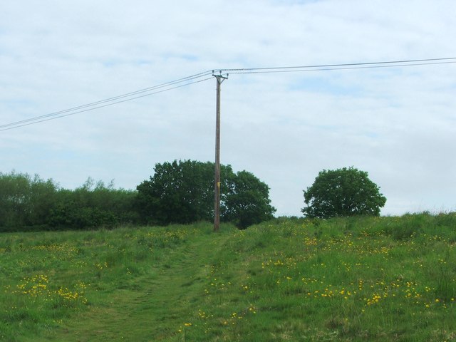
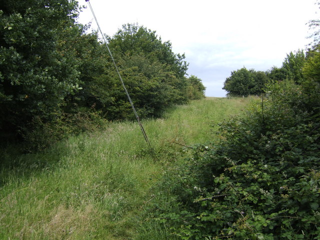
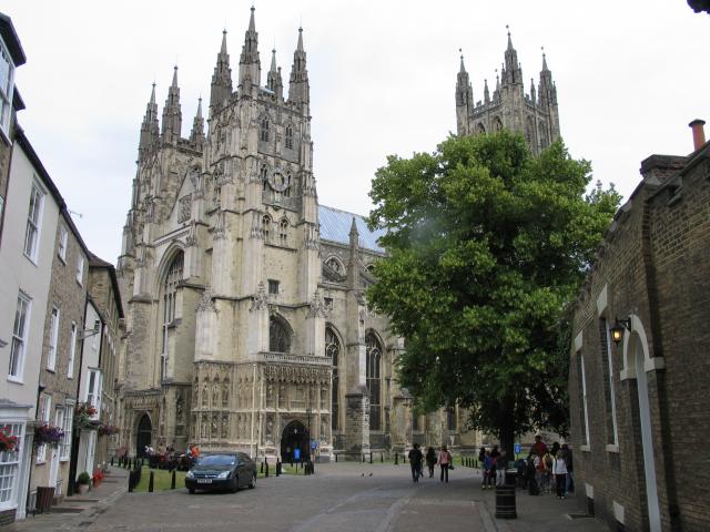
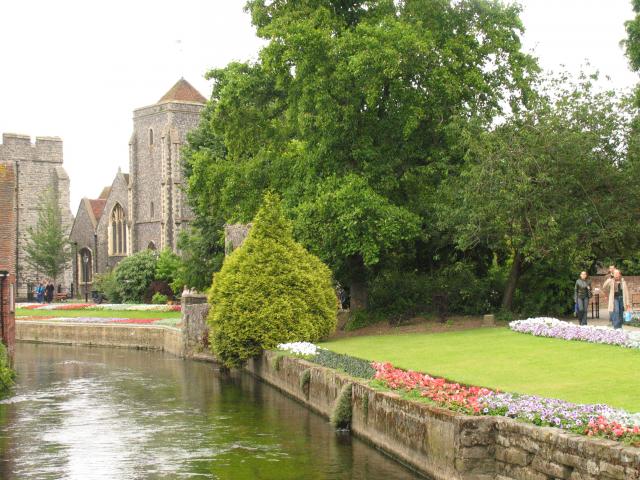
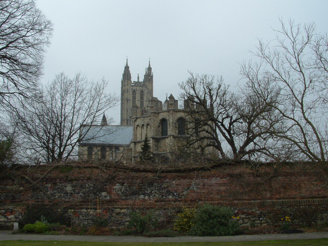
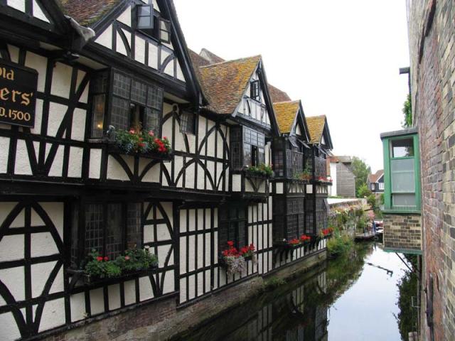
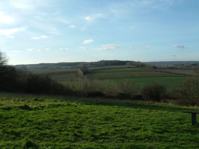
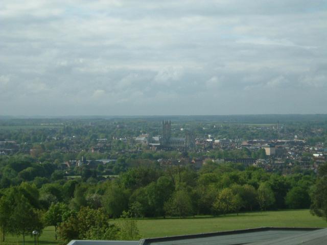
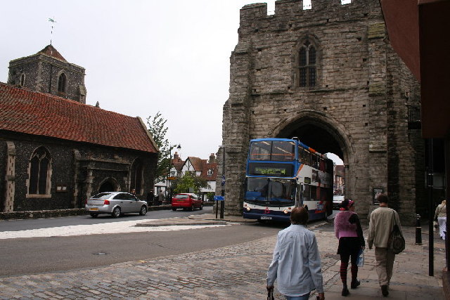
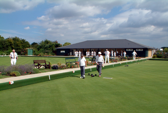
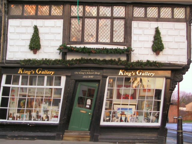
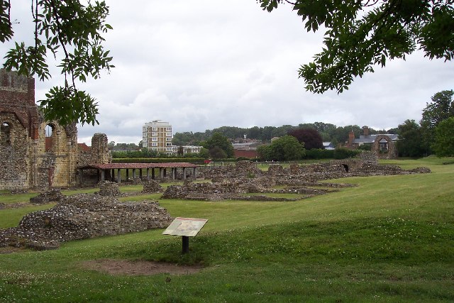
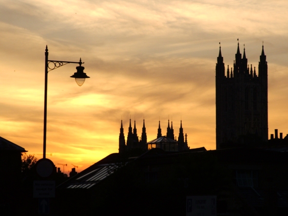
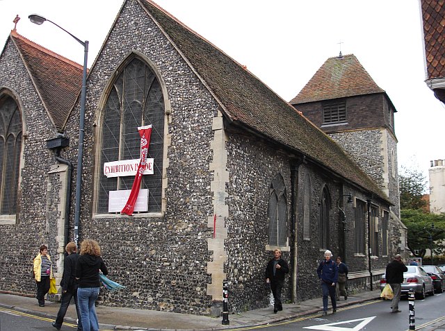
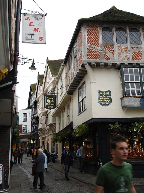
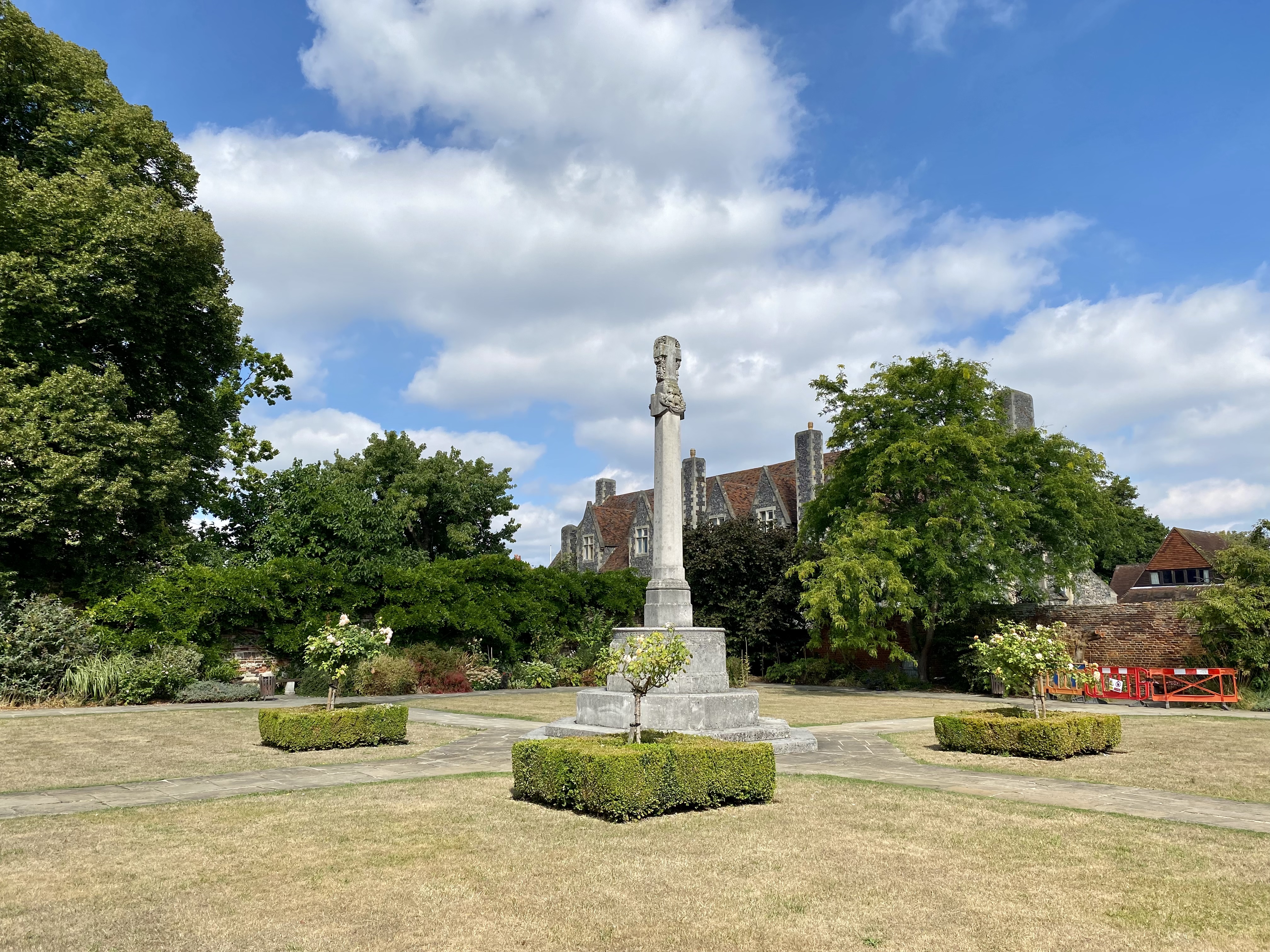
Northgate Images

Images are sourced within 2km of 51.283026/1.0859054 or Grid Reference TR1558. Thanks to Geograph Open Source API. All images are credited.

Utility Pole near Brickhouse Wood
Footpath north to Brickhouse Wood Just beyond the final urban sprawl of north Canterbury.
Footpath north to Brickhouse Wood
Just beyond the final urban sprawl of north Canterbury.
Hissing pipe and Drilling Rig This former quarry to the South of Shelford Farm. Has been back-filled (presumably with household waste) and boreholes are now being drilled into the site to release the gases built up in the ground.
Hissing pipe and Drilling Rig
This former quarry to the South of Shelford Farm. Has been back-filled (presumably with household waste) and boreholes are now being drilled into the site to release the gases built up in the ground.
Footpath to Brickhouse Wood This path leads from Hunton Garden, Hales Place. It should lead straight over Barton Down to Shelford Farm. Due to the backfilling of a quarry in Barton Down the footpath is diverted northwards. The former landfilled quarry is on the right.
Footpath to Brickhouse Wood
This path leads from Hunton Garden, Hales Place. It should lead straight over Barton Down to Shelford Farm. Due to the backfilling of a quarry in Barton Down the footpath is diverted northwards. The former landfilled quarry is on the right.
Stile and Gate near Brickhouse Wood This stile is on a diverted footpath from Hunton Gardens, Hale Place, Canterbury towards Shelford Farm. The path should lead direct to the farm, but it leads through a former quarry, south of the farm. The quarry has now been backfilled with landfill and so the path has been diverted around via the wood.
Stile and Gate near Brickhouse Wood
This stile is on a diverted footpath from Hunton Gardens, Hale Place, Canterbury towards Shelford Farm. The path should lead direct to the farm, but it leads through a former quarry, south of the farm. The quarry has now been backfilled with landfill and so the path has been diverted around via the wood.
Canterbury Cathedral The cathedral entrance, right in the city centre taken from the southwest. The cathedral's central 'Bell Harry Tower' (250' high) is on the right, dating from c.1500AD.
Canterbury Cathedral
The cathedral entrance, right in the city centre taken from the southwest. The cathedral's central 'Bell Harry Tower' (250' high) is on the right, dating from c.1500AD.
City Gate seen beyond the Church, from the River: Canterbury Situated in the southern part of the grid square.
City Gate seen beyond the Church, from the River: Canterbury
Situated in the southern part of the grid square.
Approach to Canterbury Cathedral 11.00 am, Palm Sunday 2005. Photograph taken from gardens just inside city walls.
Approach to Canterbury Cathedral
11.00 am, Palm Sunday 2005. Photograph taken from gardens just inside city walls.
Canterbury A section of one of the channels of the Great Stour that flows through the centre of the town next to this 1500 building, now an Italian Restaurant. This scene is situated more or less in the centre of the square. This was taken looking more or less north east.
Canterbury
A section of one of the channels of the Great Stour that flows through the centre of the town next to this 1500 building, now an Italian Restaurant. This scene is situated more or less in the centre of the square. This was taken looking more or less north east.
Golden Hill The view from the National Trust owned 'Golden Hill'
Golden Hill
The view from the National Trust owned 'Golden Hill'
Canterbury View of Canterbury, looking south from the 4th floor of the Templeman Library at the University of Kent.
Canterbury
View of Canterbury, looking south from the 4th floor of the Templeman Library at the University of Kent.
West Gate, Canterbury
Canterbury Bowling Club The club was founded in the reign of Queen Victoria. This is the club's new site, in South Canterbury Road. It boasts two well-kept greens.
Canterbury Bowling Club
The club was founded in the reign of Queen Victoria. This is the club's new site, in South Canterbury Road. It boasts two well-kept greens.
Tipsy One over the eight? No, this door has been cut to accommodate the settlement of this quaint old building over the centuries.
Tipsy
One over the eight? No, this door has been cut to accommodate the settlement of this quaint old building over the centuries.
St Augustine's Abbey, Canterbury, Kent The remains of St Augustine's Abbey in Canterbury. It was founded by St Augustine in about 598AD to mark the success of his mission to restore Christianity to England. Many of the Kings of Kent and early Archbishops of Canterbury are buried there. After the Dissolution of the Monasteries Henry VIII converted part of it to a royal palace (left end of picture). The site is now owned by English Heritage.
St Augustine's Abbey, Canterbury, Kent
The remains of St Augustine's Abbey in Canterbury. It was founded by St Augustine in about 598AD to mark the success of his mission to restore Christianity to England. Many of the Kings of Kent and early Archbishops of Canterbury are buried there. After the Dissolution of the Monasteries Henry VIII converted part of it to a royal palace (left end of picture). The site is now owned by English Heritage.
Canterbury Cathedral Sunset Sunset over Canterbury Cathedral
Canterbury Cathedral Sunset
Sunset over Canterbury Cathedral
St Alphege Lane At its junction with Palace Street. The former church is now used as a local heritage centre.
St Alphege Lane
At its junction with Palace Street. The former church is now used as a local heritage centre.
The Sun Hotel, Sun Street, Canterbury The plaque on the wall reads "Sun Hotel formerly known as The Little Inn made famous by Chas. Dickens in his travels thro' Kent Built 1503" It has been a jeweller's shop for many years. Sun Street runs around the south east side of the Cathedral precinct from the Butter Market into Palace Street.
The Sun Hotel, Sun Street, Canterbury
The plaque on the wall reads "Sun Hotel formerly known as The Little Inn made famous by Chas. Dickens in his travels thro' Kent Built 1503" It has been a jeweller's shop for many years. Sun Street runs around the south east side of the Cathedral precinct from the Butter Market into Palace Street.
Show me another place!

Northgate is located at Grid Ref: TR1558 (Lat: 51.283026, Lng: 1.0859054)

Administrative County: Kent

District: Canterbury

Police Authority: Kent

What 3 Words

///ground.blur.editor. Near Canterbury, Kent

Nearby Locations

Northgate Mill Stream

Related Wikis

Canterbury power station

Canterbury power station supplied electricity to the city of Canterbury, Kent, England from 1900 to 1960. This small generating station was owned and operated...

The King's School, Canterbury

The King's School is a public school in Canterbury, Kent, England. It is a member of the Headmasters' and Headmistresses' Conference and the Eton Group...

Kingsmead Stadium

Kingsmead Stadium was a greyhound racing and motorcycle speedway track and Association football ground in Canterbury. It was host to Canterbury City F...

Old Synagogue (Canterbury)

The Old Synagogue in Canterbury is considered to be the best example of an Egyptian Revival synagogue. == History == === Community === The earliest record...

Trinity Chapel

Trinity Chapel at the east end of Canterbury Cathedral forms part of a UNESCO World Heritage Site. It was built under the supervision of the master-masons...

Diocese of Canterbury

The Diocese of Canterbury is a Church of England diocese covering eastern Kent which was founded by St. Augustine of Canterbury in 597. The diocese is...

Bus Company Island

Bus Company Island is a 1.1-hectare (2.7-acre) Local Nature Reserve in Canterbury in Kent. It is owned and managed by Canterbury City Council.The island...

Harris Memorial Garden

The Harris Memorial Garden is a war memorial in The Precincts of Canterbury Cathedral in Canterbury, Kent. The garden is named for George Harris, 4th Baron...

Nearby Amenities

Located within 500m of 51.283026,1.0859054
Crossing
Crossing: marked
Crossing Island: no
Crossing Ref: zebra
Kerb: lowered
Tactile Paving: yes
Lat/Long: 51.2866214/1.0816959
Crossing
Crossing: traffic_signals
Crossing Ref: pelican
Lat/Long: 51.2843482/1.0796999
Barrier: bollard
Bollard: fixed
Lat/Long: 51.2802262/1.0860466
Traffic Calming: hump
Lat/Long: 51.2825695/1.0808006
Check Date: 2023-01-25
Traffic Calming: table
Lat/Long: 51.2833431/1.0852407
Crossing
Bicycle: yes
Crossing: uncontrolled
Crossing Island: no
Crossing Ref: tiger
Tactile Paving: yes
Lat/Long: 51.2835511/1.0919215
Bicycle: yes
Man Made: monitoring_station
Monitoring Traffic: induction_loop
Motor Vehicle: no
Lat/Long: 51.2826507/1.0880672
Crossing
Button Operated: yes
Crossing: traffic_signals
Crossing Island: no
Crossing Ref: toucan
Lat/Long: 51.2825217/1.08839
Barrier: bollard
Bollard: fixed
Lat/Long: 51.2828761/1.084408
Telephone
Booth: K6
Covered: booth
Listed Status: Grade II
Payment Card: yes
Payment Coins: yes
Phone: +44 1227 765290
Lat/Long: 51.2815418/1.0824709
Post Box
Check Date Collection Times: 2023-01-25
Collection Times: Mo-Fr 09:00; Sa 07:00
Operator: Royal Mail
Operator Wikidata: Q638098
Post Box Type: wall
Postal Code: CT1
Ref: CT1 7D
Royal Cypher: EVIIR
Royal Cypher Wikidata: Q33102324
Lat/Long: 51.281521/1.0824036
Telephone
Booth: KX100
Check Date: 2022-08-02
Operator: BT
Operator Wikidata: Q593786
Lat/Long: 51.282659/1.0806311
Recycling
Check Date: 2022-08-02
Opening Hours: 24/7
Recycling Cans: yes
Recycling Cardboard: yes
Recycling Clothes: yes
Recycling Glass: yes
Recycling Glass Bottles: yes
Recycling Newspaper: yes
Recycling Paper: yes
Recycling Plastic: yes
Recycling Plastic Bottles: yes
Recycling Shoes: yes
Recycling Type: container
Lat/Long: 51.2851674/1.0845832
Turning Circle
Lat/Long: 51.2814935/1.0914407
Turning Circle
Lat/Long: 51.2817799/1.0905846
Historic: monument
Lat/Long: 51.2793396/1.0851378
Post Box
Collection Times: Mo-Fr 17:30; Sa 13:00
Operator: Royal Mail
Post Box Type: pillar
Postal Code: CT1
Ref: CT1 389
Royal Cypher: EIIR
Royal Cypher Wikidata: Q33102113
Source: survey
Lat/Long: 51.284566/1.0847775
Bicycle Parking
Bicycle Parking: stands
Capacity: 8
Check Date: 2022-08-02
Covered: yes
Cyclestreets Id: 35626
Lat/Long: 51.285032/1.0848594
Bicycle Parking
Bicycle Parking: stands
Capacity: 8
Check Date: 2022-08-02
Covered: no
Cyclestreets Id: 26309
Lat/Long: 51.2826874/1.0806647
Bicycle Parking
Bicycle Parking: stands
Capacity: 6
Covered: no
Cyclestreets Id: 26305
Lat/Long: 51.2824939/1.0826409
Turning Circle
Lat/Long: 51.2863607/1.0841756
Bicycle Parking
Bicycle Parking: stands
Capacity: 8
Covered: no
Cyclestreets Id: 44780
Lat/Long: 51.2861101/1.0844408
Bicycle Parking
Bicycle Parking: stands
Capacity: 40
Covered: yes
Cyclestreets Id: 44862
Lat/Long: 51.2796199/1.0877487
Post Box
Collection Times: Mo-Fr 09:00; Sa 07:00
Operator: Royal Mail
Operator Wikidata: Q638098
Post Box Type: wall
Postal Code: CT2
Ref: CT2 6D
Royal Cypher: GR
Royal Cypher Wikidata: Q33102273
Source: survey
Lat/Long: 51.2840073/1.0792242
Mini Roundabout
Direction: clockwise
Lat/Long: 51.279032/1.0867023
Millennium Milepost Canterbury
Description: 1) Dover 31 2) John O'Groats 1400
Image: https://www.cyclestreets.net/location/185576/cyclestreets185576.jpg
Information: guidepost
Ncn Milepost: mills
Sustrans Ref: MP 310 & MP 1102
Tourism: information
Lat/Long: 51.2836054/1.0919498
Crossing
Crossing: unmarked
Crossing Island: yes
Kerb: lowered
Tactile Paving: no
Lat/Long: 51.2831362/1.0896927
Crossing
Crossing: unmarked
Tactile Paving: yes
Lat/Long: 51.2841169/1.0868637
Post Box
Collection Times: Mo-Fr 18:30; Sa 12:30; Su off
Post Box Type: wall
Postal Code: CT1
Ref: CT1 160
Royal Cypher: GR
Royal Cypher Wikidata: Q33102273
Source: survey
Lat/Long: 51.2800343/1.0838192
Traffic Calming: table
Lat/Long: 51.2873865/1.0856147
Bicycle Parking
Access: public
Bicycle Parking: stands
Capacity: 8
Check Date: 2022-08-02
Covered: no
Cyclestreets Id: 26307
Lat/Long: 51.2809119/1.081313
Entrance: main
Lat/Long: 51.2847489/1.0846376
Dentist
Richard Flanagan & Associates Orthodontic Practices
Addr City: Canterbury
Addr Country: GB
Addr County: Kent
Addr Postcode: CT1 2AJ
Addr Street: King Street
Healthcare: dentist
Lat/Long: 51.2818403/1.0814843
Pharmacy
Eckersley's Pharmacy
Check Date: 2023-09-16
Dispensing: yes
Healthcare: pharmacy
Opening Hours: Mo-Fr 08:30-18:00, Sa 09:00-12:30
Wheelchair: yes
Lat/Long: 51.2842325/1.0867208
Bicycle Parking
Bicycle Parking: stands
Capacity: 6
Colour: green
Covered: no
Cyclestreets Id: 27228
Material: metal
Source: survey
Lat/Long: 51.2838158/1.0928847
Post Box
Check Date Collection Times: 2023-01-11
Collection Plate: CP1D
Collection Times: Mo-Fr 09:00; Sa 07:00
Lastcheck: 2023-03-14
Old Ref: CT1 78
Operator: Royal Mail
Operator Wikidata: Q638098
Post Box Mounting: building
Post Box Type: wall
Postal Code: CT1
Ref: CT1 78D
Royal Cypher: GR
Royal Cypher Wikidata: Q33102273
Source: survey
Lat/Long: 51.2825497/1.0837199
Pub
The New Inn
Addr City: Canterbury
Addr Country: GB
Addr County: Kent
Addr Housenumber: 19
Addr Postcode: CT1 1NP
Addr Street: Havelock Street
Fhrs Id: 1079591
Opening Hours: Mo-Th 08:00-17:00,17:30-23:30; Fr,Sa 12:00-00:00, Su 12:00-23:30
Source: survey
Source Addr: FHRS Open Data
Lat/Long: 51.2806944/1.0872085
Cafe
Starbucks
Addr City: Canterbury
Addr Country: GB
Addr County: Kent
Addr Postcode: CT1 1BW
Addr Street: Kingsmead Road
Brand: Starbucks
Brand Wikidata: Q37158
Brand Wikipedia: en:Starbucks
Cuisine: coffee_shop
Fhrs Id: 1102262
Indoor Seating: yes
Is In: Sainsbury's
Official Name: Starbucks Coffee
Outdoor Seating: yes
Source Addr: FHRS Open Data
Takeaway: yes
Website: https://www.starbucks.com/store-locator/store/2565/canterbury-kingsmead-sainsbu-kingsmead-road-canterbury-eng-ct-1-1-bw-gb
Lat/Long: 51.2848799/1.0847822
Waste Basket
Check Date: 2022-08-02
Lat/Long: 51.2843517/1.083051
Waste Basket
Lat/Long: 51.2844493/1.083101
Bench
Backrest: yes
Lat/Long: 51.2844806/1.0831347
Waste Basket
Lat/Long: 51.2845642/1.0831724
Waste Basket
Lat/Long: 51.2846383/1.0832326
Bench
Lat/Long: 51.2845987/1.0832092
Waste Basket
Lat/Long: 51.2845547/1.0831888
Waste Basket
Lat/Long: 51.283487/1.0813128
Bench
Backrest: yes
Lat/Long: 51.2835077/1.0813845
Waste Basket
Check Date: 2022-08-02
Lat/Long: 51.2834754/1.0812975
Bench
Backrest: yes
Lat/Long: 51.2833059/1.0810234
Waste Basket
Check Date: 2022-08-02
Lat/Long: 51.2828363/1.0805356
Crossing
Crossing: uncontrolled
Crossing Ref: zebra
Tactile Paving: yes
Lat/Long: 51.2811587/1.0852862
Crossing
Button Operated: yes
Crossing: traffic_signals
Crossing Island: no
Crossing Ref: pelican
Lat/Long: 51.2814822/1.0860946
Crossing
Button Operated: yes
Crossing: traffic_signals
Crossing Ref: pelican
Tactile Paving: yes
Traffic Signals Sound: yes
Traffic Signals Vibration: yes
Lat/Long: 51.2846309/1.0867025
Barrier: bollard
Bollard: fixed
Foot: yes
Lat/Long: 51.2814477/1.0798489
Barrier: bollard
Bicycle: no
Bollard: fixed
Foot: yes
Lat/Long: 51.2819197/1.0800632
Bus Stop
Sainsbury's
Naptan AtcoCode: 240096703
Naptan Bearing: SE
Naptan CommonName: Sainsbury's
Naptan Indicator: opp
Naptan Landmark: Sainsbury's
Naptan NaptanCode: kntgmagt
Naptan PlusbusZoneRef: CNTBE
Naptan Street: Kingsmead Road
Naptan Verified: no
Shelter: no
Source: naptan_import
Tactile Paving: no
Lat/Long: 51.2858241/1.0844234
Bus Stop
Civic Centre
Naptan AtcoCode: 2400A039940A
Naptan Bearing: SW
Naptan CommonName: Civic Centre
Naptan Indicator: adj
Naptan Landmark: All Saints Ch
Naptan NaptanCode: kntdptgm
Naptan PlusbusZoneRef: CNTBE
Naptan Street: Military Road
Naptan Verified: no
Source: naptan_import
Lat/Long: 51.2843179/1.0924121
Bus Stop
Kingsmead Roundabout
Bench: yes
Bin: no
Bus: yes
Check Date Shelter: 2021-04-08
Lit: yes
Naptan AtcoCode: 2400A039960A
Naptan Bearing: NE
Naptan CommonName: Kingsmead Roundabout
Naptan Indicator: adj
Naptan Landmark: Kingsmead Roundabout
Naptan NaptanCode: kntdptgt
Naptan PlusbusZoneRef: CNTBE
Naptan Street: Sturry Road
Naptan Verified: no
Public Transport: platform
Shelter: yes
Source: naptan_import
Tactile Paving: no
Lat/Long: 51.2846605/1.0876157
Bus Stop
Kingsmead Roundabout
Bench: yes
Bin: no
Bus: yes
Check Date Shelter: 2021-04-08
Lit: yes
Naptan AtcoCode: 2400A039970A
Naptan Bearing: NE
Naptan CommonName: Kingsmead Roundabout
Naptan Indicator: NE-bound
Naptan Landmark: Kingsmead Roundabout
Naptan NaptanCode: kntdptgw
Naptan PlusbusZoneRef: CNTBE
Naptan Street: Sturry Road
Naptan Verified: no
Public Transport: platform
Seating: yes
Shelter: yes
Source: naptan_import
Source 1: survey
Survey Date: 2024-05-23
Tactile Paving: no
Lat/Long: 51.2847297/1.0877208
Bus Stop
Sainsburys
Bench: no
Bin: no
Check Date Shelter: 2024-01-10
Lit: yes
Naptan AtcoCode: 2400A040270A
Naptan Bearing: NW
Naptan CommonName: Sainsburys
Naptan Indicator: o/s
Naptan Landmark: Sainsburys
Naptan NaptanCode: kntdpwag
Naptan PlusbusZoneRef: CNTBE
Naptan Street: Kingsmead Road
Naptan Verified: no
Shelter: no
Source: naptan_import
Tactile Paving: no
Lat/Long: 51.2851362/1.0856108
Bus Stop
The Causeway
Bus: yes
Naptan AtcoCode: 2400A049220A
Naptan Bearing: N
Naptan CommonName: The Causeway
Naptan Indicator: opp
Naptan Landmark: Bus Depot
Naptan NaptanCode: kntgamdt
Naptan PlusbusZoneRef: CNTBE
Naptan Street: St Stephens Road
Naptan Verified: no
Public Transport: platform
Shelter: no
Source: naptan_import
Lat/Long: 51.2840914/1.0795165
Bus Stop
The Causeway
Bus: yes
Naptan AtcoCode: 2400A049230A
Naptan Bearing: NE
Naptan CommonName: The Causeway
Naptan Indicator: adj
Naptan Landmark: Bus Depot
Naptan NaptanCode: kntgamdw
Naptan PlusbusZoneRef: CNTBE
Naptan Street: St Stephens Road
Naptan Verified: no
Public Transport: platform
Shelter: no
Source: naptan_import
Lat/Long: 51.2841955/1.0793227
Bus Stop
St Stephen's Roundabout
Naptan AtcoCode: 2400A049240A
Naptan Bearing: SW
Naptan CommonName: St Stephen's Roundabout
Naptan Indicator: SW-bound
Naptan Landmark: Malthouse Road
Naptan NaptanCode: kntgamga
Naptan PlusbusZoneRef: CNTBE
Naptan Street: St Stephen's Road
Naptan Verified: no
Shelter: no
Source: naptan_import
Lat/Long: 51.2864188/1.0816518
Bus Stop
Kingsmead Roundabout
Bench: no
Bin: no
Check Date Shelter: 2021-04-08
Lit: yes
Naptan AtcoCode: 2400A049480A
Naptan Bearing: SW
Naptan CommonName: Kingsmead Roundabout
Naptan Indicator: SW-bound
Naptan Landmark: Starle Close
Naptan NaptanCode: kntgamtj
Naptan PlusbusZoneRef: CNTBE
Naptan Street: Sturry Road
Naptan Verified: no
Shelter: no
Source: naptan_import
Tactile Paving: no
Lat/Long: 51.2852172/1.0890157
Bus Stop
St. Thomas' School
Naptan AtcoCode: 2400A049490A
Naptan Bearing: NE
Naptan CommonName: St. Thomas' School
Naptan Indicator: opp
Naptan Landmark: St. Thomas' School
Naptan NaptanCode: kntgamtm
Naptan PlusbusZoneRef: CNTBE
Naptan Street: Military Road
Naptan Verified: no
Shelter: no
Source: naptan_import
Lat/Long: 51.2817052/1.0864421
Bus Stop
St. Thomas' School
Bench: no
Bus: yes
Naptan AtcoCode: 2400A049500A
Naptan Bearing: SW
Naptan CommonName: St. Thomas' School
Naptan Indicator: adj
Naptan Landmark: St. Thomas' School
Naptan NaptanCode: kntgamtp
Naptan PlusbusZoneRef: CNTBE
Naptan Street: Military Road
Naptan Verified: no
Public Transport: platform
Shelter: no
Source: naptan_import
Lat/Long: 51.2815101/1.08642
Bus Stop
Magistrates Court
Bench: no
Bin: no
Lit: yes
Naptan AtcoCode: 2400A049510A
Naptan Bearing: S
Naptan CommonName: Magistrates Court
Naptan Indicator: adj
Naptan Landmark: Magistrates Court
Naptan NaptanCode: kntgamtw
Naptan PlusbusZoneRef: CNTBE
Naptan Street: Broad Street
Naptan Verified: no
Public Transport: platform
Ref: kntgamtw
Shelter: no
Source: naptan_import
Source Date: 2018-03-29T13:58:00
Tactile Paving: no
Lat/Long: 51.278669/1.0854268
Bus Stop
Magistrates Court
Bench: no
Bin: no
Flag: yes
Lit: yes
Naptan AtcoCode: 2400A049520A
Naptan Bearing: N
Naptan CommonName: Magistrates Court
Naptan Indicator: opp
Naptan Landmark: Magistrates Court
Naptan NaptanCode: kntgamwa
Naptan PlusbusZoneRef: CNTBE
Naptan Street: Broad Street
Naptan Verified: no
Public Transport: platform
Ref: kntgamwa
Shelter: no
Source: naptan_import
Source Date: 2018-03-29T13:59:00
Tactile Paving: no
Lat/Long: 51.2798002/1.0858469
Bicycle Parking
Bicycle Parking: stands
Capacity: 6
Colour: green
Covered: no
Cyclestreets Id: 27229
Material: metal
Source: survey
Lat/Long: 51.2837862/1.092829
Bicycle Parking
Bicycle Parking: stands
Capacity: 2
Check Date: 2023-06-20
Covered: no
Cyclestreets Id: 27506
Source: survey
Lat/Long: 51.2826261/1.0789763
Bar
The Ballroom
Addr City: Canterbury
Addr Country: GB
Addr County: Kent
Addr Housenumber: 15
Addr Postcode: CT1 2JA
Addr Street: Orange Street
Fhrs Id: 1102692
Opening Hours: Mo-Sa 18:30-00:00
Phone: +44 1227 760801
Website: https://www.theballroom.co/
Lat/Long: 51.2804219/1.080227
Pub
Bramleys
Addr City: Canterbury
Addr Country: GB
Addr County: Kent
Addr Housenumber: 15
Addr Postcode: CT1 2JA
Addr Street: Orange Street
Contact Phone: +44 1227 379933
Fhrs Id: 1102748
Opening Hours: Mo-Th 18:00-23:00; Fr-Sa 18:00-00:30; Su off
Operator: Shepherd Neame
Website: https://www.bramleysbar.co.uk/
Lat/Long: 51.2804322/1.0801776
Traffic Calming: table
Lat/Long: 51.2875011/1.0863289
Bicycle Parking
Bicycle Parking: stands
Capacity: 6
Check Date: 2022-08-02
Covered: no
Cyclestreets Id: 35626
Lat/Long: 51.2850269/1.0848657
Bicycle Parking
Bicycle Parking: stands
Capacity: 2
Check Date: 2022-08-02
Covered: no
Cyclestreets Id: 35626
Lat/Long: 51.285036/1.0848517
Atm
Brand: Sainsbury's Bank
Check Date: 2022-08-02
Lat/Long: 51.2847219/1.0846643
Crossing
Button Operated: yes
Check Date Crossing: 2021-04-08
Crossing: traffic_signals
Crossing Island: no
Crossing Ref: pelican
Kerb: lowered
Tactile Paving: yes
Traffic Signals Sound: yes
Traffic Signals Vibration: yes
Lat/Long: 51.2849191/1.0881121
Waste Basket
Check Date: 2022-08-02
Lat/Long: 51.2841616/1.0831829
Waste Basket
Check Date: 2022-08-02
Lat/Long: 51.2844265/1.0837476
Waste Basket
Check Date: 2022-08-02
Lat/Long: 51.2838579/1.0836431
Bench
Lat/Long: 51.2839003/1.0835556
Bench
Backrest: yes
Lat/Long: 51.2841051/1.0832507
Waste Basket
Check Date: 2022-08-02
Lat/Long: 51.284061/1.0833354
Waste Basket
Lat/Long: 51.283955/1.083485
Crossing
Crossing Island: yes
Lat/Long: 51.2840194/1.0789984
Waste Basket
Lat/Long: 51.2818674/1.0868203
Waste Basket
Lat/Long: 51.2807336/1.0813034
Waste Basket
Lat/Long: 51.279951/1.0807519
Bicycle Parking
Access: destination
Bicycle Parking: front_wheel
Capacity: 9
Covered: no
Cyclestreets Id: 27114
Lat/Long: 51.2860046/1.0829005
Bench
Backrest: yes
Colour: black
Material: wood
Lat/Long: 51.2843397/1.0924268
Waste Basket
Lat/Long: 51.2852515/1.0914229
Waste Basket
Lat/Long: 51.2859373/1.0828389
Traffic Calming: hump
Lat/Long: 51.2826392/1.0795621
Traffic Calming: hump
Lat/Long: 51.282876/1.0843336
Barrier: lift_gate
Lat/Long: 51.2828486/1.0807136
Waste Basket
Note: dog poo
Lat/Long: 51.2822296/1.0875187
Entrance: yes
Lat/Long: 51.2796284/1.0826264
Entrance: main
Lat/Long: 51.2790745/1.0868371
Entrance: yes
Lat/Long: 51.2799357/1.0904578
Entrance: yes
Lat/Long: 51.2801602/1.0899235
Dominican Priory 1315
Historic: castle
Lat/Long: 51.2815834/1.0792711
Crossing
Button Operated: yes
Crossing: traffic_signals
Crossing Ref: pelican
Tactile Paving: yes
Traffic Signals Sound: no
Traffic Signals Vibration: yes
Lat/Long: 51.2794057/1.0858367
Traffic Calming: hump
Lat/Long: 51.278581/1.0865831
Crossing
Crossing: uncontrolled
Crossing Markings: yes
Lat/Long: 51.2846906/1.0844895
Crossing
Crossing: uncontrolled
Crossing Markings: yes
Lat/Long: 51.2846083/1.084328
Crossing
Crossing: uncontrolled
Crossing Markings: yes
Lat/Long: 51.2845153/1.0841455
Traffic Calming: cushion
Lat/Long: 51.2792802/1.0868125
Barrier: bollard
Bollard: fixed
Lat/Long: 51.2815888/1.0804537
Crossing
Crossing: unmarked
Tactile Paving: yes
Lat/Long: 51.2857199/1.0853953
Man Made: monitoring_station
Monitoring Air Quality: continuous
Monitoring Air Quality NO: yes
Monitoring Air Quality NO2: yes
Lat/Long: 51.2819279/1.0873076
Barrier: bollard
Bicycle: yes
Bollard: removable
Foot: yes
Horse: yes
Lat/Long: 51.2814101/1.0879295
Bicycle Parking
Bicycle Parking: wall_loops
Capacity: 2
Covered: no
Lat/Long: 51.2846221/1.0865735
Entrance: main
Lat/Long: 51.2838247/1.0929134
Man Made: surveillance
Source: photograph
Surveillance: public
Lat/Long: 51.282356/1.0834032
Bicycle: yes
Traffic Counter: induction_loop
Lat/Long: 51.2826151/1.0902991
Man Made: monitoring_station
Monitoring Traffic: induction_loop
Vehicle: yes
Lat/Long: 51.2819659/1.0872534
Man Made: monitoring_station
Monitoring Traffic: induction_loop
Vehicle: yes
Lat/Long: 51.2820031/1.087209
Man Made: monitoring_station
Monitoring Traffic: induction_loop
Vehicle: yes
Lat/Long: 51.2864001/1.0829037
Man Made: monitoring_station
Monitoring Traffic: induction_loop
Vehicle: yes
Lat/Long: 51.2856766/1.0807203
Toilets
Changing Table: yes
Check Date: 2022-08-02
Fee: no
Toilets Wheelchair: yes
Wheelchair: yes
Wheelchair Description: Inside Sainsbury’s
Lat/Long: 51.284756/1.0848456
Addr City: Canterbury
Addr Country: GB
Addr County: Kent
Addr Housenumber: 29
Addr Postcode: CT1 2AP
Addr Street: Blackfriars Street
Source Postcode: land_registry_price_paid_data
Lat/Long: 51.2814142/1.0799337
Addr City: Canterbury
Addr Country: GB
Addr County: Kent
Addr Housenumber: 30
Addr Postcode: CT1 2AP
Addr Street: Blackfriars Street
Source Postcode: land_registry_price_paid_data
Lat/Long: 51.2814877/1.0799702
Addr City: Canterbury
Addr Country: GB
Addr County: Kent
Addr Housenumber: 31
Addr Postcode: CT1 2AP
Addr Street: Blackfriars Street
Source Addr Postcode: interpolation
Lat/Long: 51.2815448/1.079936
Addr City: Canterbury
Addr Country: GB
Addr County: Kent
Addr Housenumber: 32
Addr Postcode: CT1 2AP
Addr Street: Blackfriars Street
Source Postcode: land_registry_price_paid_data
Lat/Long: 51.2815769/1.0799474
Addr City: Canterbury
Addr Country: GB
Addr County: Kent
Addr Housenumber: 33
Addr Postcode: CT1 2AP
Addr Street: Blackfriars Street
Source Postcode: land_registry_price_paid_data
Lat/Long: 51.2816118/1.0799599
Addr City: Canterbury
Addr Country: GB
Addr County: Kent
Addr Housenumber: 34
Addr Postcode: CT1 2AP
Addr Street: Blackfriars Street
Source Addr Postcode: interpolation
Lat/Long: 51.2816518/1.0799816
Addr City: Canterbury
Addr Country: GB
Addr County: Kent
Addr Housenumber: 35
Addr Postcode: CT1 2AP
Addr Street: Blackfriars Street
Source Postcode: land_registry_price_paid_data
Lat/Long: 51.2816932/1.0799953
Addr City: Canterbury
Addr Country: GB
Addr County: Kent
Addr Housenumber: 36
Addr Postcode: CT1 2AP
Addr Street: Blackfriars Street
Source Addr Postcode: interpolation
Lat/Long: 51.2817353/1.080009
Addr City: Canterbury
Addr Country: GB
Addr County: Kent
Addr Housenumber: 37
Addr Postcode: CT1 2AP
Addr Street: Blackfriars Street
Source Addr Postcode: interpolation
Lat/Long: 51.281761/1.0800192
Addr City: Canterbury
Addr Country: GB
Addr County: Kent
Addr Housenumber: 38
Addr Postcode: CT1 2AP
Addr Street: Blackfriars Street
Source Postcode: land_registry_price_paid_data
Lat/Long: 51.2818059/1.0800375
Addr City: Canterbury
Addr Country: GB
Addr County: Kent
Addr Housenumber: 39
Addr Postcode: CT1 2AP
Addr Street: Blackfriars Street
Source Addr Postcode: interpolation
Lat/Long: 51.2818337/1.0800477
Addr City: Canterbury
Addr Country: GB
Addr County: Kent
Addr Housenumber: 40
Addr Postcode: CT1 2AP
Addr Street: Blackfriars Street
Source Postcode: land_registry_price_paid_data
Lat/Long: 51.2818716/1.0800649
Traffic Calming: table
Lat/Long: 51.2795649/1.0857665
Toilets
Coach Park Welcome Centre
Access: yes
Addr City: Canterbury
Addr Country: GB
Addr County: Kent
Fee: no
Toilets Wheelchair: no
Wheelchair: no
Wheelchair Description: Two steps up to RADAR key toilet. No step free route available mid morning Saturday when visited. Unmarked door at back of gift shop ONLY when that is open?
Lat/Long: 51.2840544/1.0831006
Bicycle Parking
Bicycle Parking: stands
Capacity: 6
Check Date Capacity: 2023-01-11
Covered: no
Lat/Long: 51.2817257/1.0826172
Entrance: main
Lat/Long: 51.2813668/1.0806758
Entrance: main
Lat/Long: 51.2813004/1.0806083
Entrance: main
Lat/Long: 51.281285/1.0805926
Entrance: main
Lat/Long: 51.2812236/1.08053
Entrance: main
Lat/Long: 51.2812063/1.0805124
Entrance: main
Lat/Long: 51.2811377/1.0804425
Entrance: main
Lat/Long: 51.281147/1.0801629
Entrance: main
Lat/Long: 51.281105/1.0802404
Entrance: main
Lat/Long: 51.2810233/1.0802779
Bicycle Parking
Bicycle Parking: stands
Capacity: 6
Check Date Capacity: 2021-04-08
Covered: no
Lat/Long: 51.2831735/1.0848526
Entrance: main
Lat/Long: 51.2807004/1.0798852
Entrance: main
Lat/Long: 51.2806421/1.0798152
Entrance: main
Lat/Long: 51.2804207/1.0800539
Place Of Worship
CCCU Chapel
Lat/Long: 51.2794215/1.0899976
Board Type: notice
Information: board
Tourism: information
Lat/Long: 51.2838617/1.0927829
Bench
Lat/Long: 51.2838835/1.0928299
Addr City: Canterbury
Addr Country: GB
Addr County: Kent
Addr Housenumber: 15
Addr Street: Mill Lane
Lat/Long: 51.2816442/1.080513
Addr City: Canterbury
Addr Country: GB
Addr County: Kent
Addr Housenumber: 18
Addr Street: Mill Lane
Lat/Long: 51.281554/1.080584
Entrance: yes
Lat/Long: 51.2819581/1.0807355
Addr City: Canterbury
Addr Country: GB
Addr County: Kent
Addr Housenumber: 13
Addr Street: Mill Lane
Lat/Long: 51.2817179/1.080455
Bicycle Parking
Capacity: 10
Source: survey
Lat/Long: 51.2853271/1.0803254
Bicycle Parking
Capacity: 10
Source: survey
Lat/Long: 51.2852734/1.0799915
Entrance: main
Lat/Long: 51.2854463/1.080063
Access: customers
Sport: climbing
Lat/Long: 51.2854265/1.0802114
Recycling
Fixme: Approximate position
Indoor: yes
Note: Inside shop near checkouts
Operator: Sainsbury's
Recycling Batteries: yes
Recycling Plastic Bags: yes
Recycling Type: container
Lat/Long: 51.2843784/1.0851762
The King's Mile
Place: suburb
Lat/Long: 51.2820881/1.0828923
Access: private
Addr City: Canterbury
Addr Country: GB
Addr County: Kent
Addr Housename: Dean Court
Addr Housenumber: 6-15
Addr Postcode: CT1 2LT
Addr Street: Broad Street
Entrance: main
Lat/Long: 51.2818191/1.0843552
Access: private
Addr City: Canterbury
Addr Country: GB
Addr County: Kent
Addr Housenumber: 1 Dean Court
Addr Postcode: CT1 2LT
Addr Street: Broad Street
Entrance: main
Lat/Long: 51.2819237/1.0843861
Access: private
Addr City: Canterbury
Addr Country: GB
Addr County: Kent
Addr Housenumber: 2 Dean Court
Addr Postcode: CT1 2LT
Addr Street: Broad Street
Entrance: main
Lat/Long: 51.281882/1.0844515
Access: private
Addr City: Canterbury
Addr Country: GB
Addr County: Kent
Addr Housenumber: 3 Dean Court
Addr Postcode: CT1 2LT
Addr Street: Broad Street
Entrance: main
Lat/Long: 51.2818452/1.0845091
Access: private
Addr City: Canterbury
Addr Country: GB
Addr County: Kent
Addr Housenumber: 4 Dean Court
Addr Postcode: CT1 2LT
Addr Street: Broad Street
Entrance: main
Lat/Long: 51.2818086/1.0845665
Access: private
Addr City: Canterbury
Addr Country: GB
Addr County: Kent
Addr Housenumber: 5 Dean Court
Addr Postcode: CT1 2LT
Addr Street: Broad Street
Entrance: main
Lat/Long: 51.2817755/1.0846185
Traffic Signals
Note: Bus priority signals.
Traffic Signals: signal
Lat/Long: 51.2837323/1.0896361
Defibrillator
Defibrillator Location: Inside undercroft on right hand side
Emergency: defibrillator
Lat/Long: 51.2811221/1.0838753
Defibrillator
Defibrillator Location: Inside St Augustine's Porters' Lodge
Emergency: defibrillator
Lat/Long: 51.2790031/1.0869008
Defibrillator
Defibrillator Location: Inside Mint Yard security hut
Emergency: defibrillator
Lat/Long: 51.2814861/1.0826026
Description: To side of vehicle gate. Damaged as of Feb 2019
Man Made: survey_point
Operator: Ordnance Survey
Operator Wikidata: Q548721
Survey Point: benchmark
Lat/Long: 51.2815712/1.0825663
Generator Method: photovoltaic
Generator Orientation: 144
Generator Solar Modules: 12
Generator Source: solar
Generator Type: solar_photovoltaic_panel
Location: roof
Power: generator
Lat/Long: 51.2847818/1.0901879
Bicycle Parking
Bicycle Parking: stands
Capacity: 10
Source: survey
Lat/Long: 51.2854156/1.0802034
Place Of Worship
Trinity Chapel
Building: chapel
Denomination: anglican
Level: 0
Religion: christian
Wikidata: Q7842627
Wikipedia: en:Trinity Chapel
Lat/Long: 51.2797313/1.0836838
Street Lamp
Camera Mount: pole
Camera Type: dome
Man Made: surveillance
Surveillance: public
Surveillance Type: camera
Surveillance Zone: town
Lat/Long: 51.2838936/1.0865602
Defibrillator
Defibrillator Location: Inside Jobcentre Plus
Emergency: defibrillator
Indoor: yes
Opening Hours: Mo-Fr 08:00-18:00
Operator: Jobcentre Plus
Lat/Long: 51.2837971/1.086477
Entrance: main
Lat/Long: 51.2838174/1.0864594
Generator Method: photovoltaic
Generator Orientation: 214
Generator Output Electricity: yes
Generator Solar Modules: 8
Generator Source: solar
Generator Type: solar_photovoltaic_panel
Location: roof
Power: generator
Lat/Long: 51.2826759/1.0882153
Generator Method: photovoltaic
Generator Orientation: 235
Generator Solar Modules: 5
Generator Source: solar
Generator Type: solar_photovoltaic_panel
Location: roof
Power: generator
Lat/Long: 51.2840982/1.0910824
Generator Method: photovoltaic
Generator Orientation: 144
Generator Solar Modules: 9
Generator Source: solar
Generator Type: solar_photovoltaic_panel
Location: roof
Power: generator
Lat/Long: 51.2844321/1.0899639
Generator Output Electricity: yes
Generator Solar Modules: 3
Generator Source: solar
Generator Type: solar_photovoltaic_panel
Location: roof
Power: generator
Lat/Long: 51.2873602/1.0865495
Generator Output Electricity: yes
Generator Solar Modules: 6
Generator Source: solar
Generator Type: solar_photovoltaic_panel
Location: roof
Power: generator
Lat/Long: 51.2873921/1.0865052
Generator Output Electricity: yes
Generator Solar Modules: 6
Generator Source: solar
Generator Type: solar_photovoltaic_panel
Location: roof
Power: generator
Lat/Long: 51.2805592/1.0882352
Generator Output Electricity: yes
Generator Solar Modules: 6
Generator Source: solar
Generator Type: solar_photovoltaic_panel
Location: roof
Power: generator
Lat/Long: 51.2804602/1.088191
Charging Station
St Radigunds Car Park
Capacity: 2
Motorcar: yes
Ref: BMM-CP-000419
Socket Type2: 2
Lat/Long: 51.2828144/1.0807961
Generator Output Electricity: yes
Generator Solar Modules: 10
Generator Source: solar
Generator Type: solar_photovoltaic_panel
Location: roof
Power: generator
Lat/Long: 51.2857851/1.089575
Generator Method: photovoltaic
Generator Output Electricity: yes
Generator Solar Modules: 8
Generator Source: solar
Generator Type: solar_photovoltaic_panel
Location: roof
Power: generator
Lat/Long: 51.2820093/1.0917342
Generator Method: photovoltaic
Generator Output Electricity: yes
Generator Solar Modules: 8
Generator Source: solar
Generator Type: solar_photovoltaic_panel
Location: roof
Power: generator
Lat/Long: 51.2819833/1.0917097
Generator Output Electricity: yes
Generator Solar Modules: 8
Generator Source: solar
Generator Type: solar_photovoltaic_panel
Location: roof
Power: generator
Lat/Long: 51.2816027/1.0912018
Generator Output Electricity: yes
Generator Solar Modules: 8
Generator Source: solar
Generator Type: solar_photovoltaic_panel
Location: roof
Power: generator
Lat/Long: 51.281586/1.0912554
Playground: slide
Lat/Long: 51.2865442/1.0872117
Playground: springy
Lat/Long: 51.286833/1.0876412
Playground: springy
Lat/Long: 51.2868145/1.0875963
Playground: springy
Lat/Long: 51.2868241/1.0876972
Playground: structure
Lat/Long: 51.2865342/1.0871969
Baby: yes
Playground: swing
Lat/Long: 51.2866088/1.0873792
Baby: no
Playground: structure
Lat/Long: 51.2867236/1.0875514
Playground: basketswing
Lat/Long: 51.2867046/1.087765
Crossing
Crossing: marked
Crossing Island: no
Crossing Ref: zebra
Kerb: flush
Tactile Paving: yes
Lat/Long: 51.2859662/1.0809835
Barrier: bollard
Lat/Long: 51.2867882/1.0872644
Charging Station
Capacity: 2
Fee: 0.30
Motorcar: yes
Operator: EV Dot
Ref: BMM-CP-000421
Lat/Long: 51.2812139/1.0880797
Artwork Type: sculpture
Survey Date: 2021-07-22
Tourism: artwork
Lat/Long: 51.2852239/1.0831266
The Canterbury War Horse
Artist Name: Canterbury School of Visual Arts
Artwork Type: sculpture
Material: wood
Survey Date: 2021-07-23
Tourism: artwork
Lat/Long: 51.2794572/1.0840104
Entrance: main
Lat/Long: 51.2824936/1.0836247
Bicycle Parking
Bicycle Parking: stands
Capacity: 6
Colour: silver
Covered: no
Cyclestreets Id: 200813
Material: metal
Lat/Long: 51.2849521/1.0876827
Defibrillator
Access: yes
Defibrillator Location: On wall in corridor leading to pool changing rooms
Emergency: defibrillator
Indoor: yes
Lat/Long: 51.285794/1.082862
Generator Method: photovoltaic
Generator Source: solar
Generator Type: solar_photovoltaic_panel
Location: roof
Power: generator
Start Date: 2019
Lat/Long: 51.280909/1.0796562
King Ethelbert Statue
Artwork Type: statue
Tourism: artwork
Lat/Long: 51.2791977/1.0861746
Queen Bertha Statue
Artwork Type: statue
Tourism: artwork
Lat/Long: 51.2791642/1.0862962
Historic: memorial
Memorial: statue
Lat/Long: 51.2791985/1.0862291
Information: board
Tourism: information
Lat/Long: 51.2791744/1.0861966
Generator Method: photovoltaic
Generator Output Electricity: yes
Generator Source: solar
Generator Type: solar_photovoltaic_panel
Location: roof
Power: generator
Lat/Long: 51.2838848/1.085419
Generator Method: photovoltaic
Generator Output Electricity: yes
Generator Source: solar
Generator Type: solar_photovoltaic_panel
Location: roof
Power: generator
Lat/Long: 51.2838441/1.0852808
Parking
Access: yes
Capacity: 5
Fee: yes
Fee Conditional: no @ (18:30-08:00)
Parking: lane
Survey Date: 2022-08-20
Wheelchair: yes
Lat/Long: 51.2830101/1.0886365
Bicycle Parking
Bicycle Parking: stands
Capacity: 34
Colour: silver
Covered: no
Cyclestreets Id: 200817
Lit: yes
Material: metal
Lat/Long: 51.2858689/1.0855477
Waste Basket
Fixme: Check exact position
Waste: trash
Lat/Long: 51.2860719/1.086646
Covered: no
Fixme: Check exact position
Leisure: picnic_table
Lat/Long: 51.2860988/1.0866085
Covered: no
Fixme: Check exact position
Leisure: picnic_table
Lat/Long: 51.2861516/1.0870175
Covered: no
Fixme: Check exact position
Leisure: picnic_table
Lat/Long: 51.2861222/1.0868284
Bicycle Parking
Bicycle Parking: stands
Capacity: 10
Colour: silver
Covered: no
Cyclestreets Id: 196223
Material: metal
Lat/Long: 51.2858111/1.0862907
Bicycle Parking
Bicycle Parking: stands
Capacity: 14
Colour: silver
Covered: no
Cyclestreets Id: 196223
Material: metal
Lat/Long: 51.2858035/1.0864046
Traffic Calming: table
Lat/Long: 51.285835/1.086173
Crossing
Crossing: unmarked
Tactile Paving: yes
Lat/Long: 51.2853894/1.0853751
Crossing
Crossing: unmarked
Tactile Paving: yes
Lat/Long: 51.2854184/1.0854216
Bicycle Parking
Bicycle Parking: stands
Capacity: 10
Colour: silver
Covered: no
Cyclestreets Id: 196227
Material: metal
Lat/Long: 51.285499/1.0855798
Crossing
Crossing: unmarked
Tactile Paving: yes
Lat/Long: 51.2856625/1.0854224
Bench
Backrest: no
Lat/Long: 51.2855275/1.0863255
Bench
Backrest: no
Lat/Long: 51.2853799/1.0864542
Bench
Backrest: no
Lat/Long: 51.2852365/1.0863953
Waste Basket
Waste: trash
Lat/Long: 51.285203/1.0864287
Waste Basket
Waste: trash
Lat/Long: 51.2853329/1.0864904
Bicycle Parking
Bicycle Parking: two-tier
Capacity: 36
Colour: silver
Covered: yes
Cyclestreets Id: 200812
Fixme: Improve position and double-check capacity.
Material: metal
Note: Top tier of two-tier system on top. Sheffield stands beneath.
Surveillance: yes
Lat/Long: 51.2849803/1.0874815
Bicycle Parking
Bicycle Parking: two-tier
Capacity: 43
Colour: silver
Covered: no
Cyclestreets Id: 200812
Fixme: Improve position and double-check capacity.
Material: metal
Note: Top tier of two-tier system on top. Sheffield stands beneath.
Surveillance: yes
Lat/Long: 51.2849601/1.0875285
Bicycle Parking
Bicycle Parking: stands
Capacity: 8
Colour: silver
Covered: no
Cyclestreets Id: 200811
Material: metal
Lat/Long: 51.284994/1.0877538
Barrier: bollard
Bollard: removable
Fixme: Check exact position.
Lat/Long: 51.2848971/1.0878002
Bicycle Parking
Bicycle Parking: stands
Capacity: 14
Colour: silver
Covered: no
Cyclestreets Id: 200814
Material: metal
Lat/Long: 51.2846342/1.087037
Bicycle Parking
Bicycle Parking: stands
Capacity: 4
Colour: silver
Covered: no
Cyclestreets Id: 200816
Material: metal
Lat/Long: 51.2847106/1.0868901
Bicycle Parking
Bicycle Parking: stands
Capacity: 6
Colour: silver
Covered: no
Cyclestreets Id: 200815
Material: metal
Lat/Long: 51.2846892/1.0869028
Bicycle Parking
Bicycle Parking: stands
Capacity: 16
Colour: silver
Covered: no
Cyclestreets Id: 196226
Material: metal
Lat/Long: 51.285109/1.086174
Information: board
Tourism: information
Lat/Long: 51.2873896/1.0846947
Bench
Backrest: yes
Lat/Long: 51.2873753/1.0843635
Bench
Backrest: yes
Lat/Long: 51.2871279/1.0836299
Bench
Backrest: no
Lat/Long: 51.2872947/1.0837127
Bench
Backrest: yes
Lat/Long: 51.2868652/1.083442
What makes the River Stour so special?
Board Type: nature
Information: board
Tourism: information
Lat/Long: 51.2867267/1.0832839
Information: board
Tourism: information
Lat/Long: 51.2865492/1.0831134
Welcome to Kingsmead Field Village Green
Board Type: history
Information: board
Tourism: information
Lat/Long: 51.2863519/1.0840258
Bicycle Parking
Bicycle Parking: stands
Capacity: 10
Covered: no
Lat/Long: 51.2863131/1.0839964
Waste Basket
Waste: trash
Lat/Long: 51.2872759/1.084795
Barrier: cycle_barrier
Lat/Long: 51.2866467/1.0850507
Barrier: bollard
Bollard: removable
Lat/Long: 51.2848434/1.0878787
Charging Station
Capacity: 2
Motorcar: yes
Operator: Alfen
Socket Type2: 2
Lat/Long: 51.2852189/1.0867251
Charging Station
Capacity: 2
Motorcar: yes
Operator: Alfen
Socket Type2: 2
Lat/Long: 51.2852033/1.0866685
Charging Station
Capacity: 2
Motorcar: yes
Operator: Alfen
Socket Type2: 2
Lat/Long: 51.2851877/1.086612
Charging Station
Capacity: 2
Motorcar: yes
Operator: Alfen
Socket Type2: 2
Lat/Long: 51.2851721/1.0865554
Charging Station
Capacity: 2
Motorcar: yes
Operator: Alfen
Socket Type2: 2
Lat/Long: 51.2851565/1.0864988
Charging Station
Capacity: 2
Motorcar: yes
Operator: Alfen
Socket Type2: 2
Lat/Long: 51.2851409/1.0864422
Bicycle Parking
Bicycle Parking: wall_loops
Capacity: 5
Covered: yes
Lat/Long: 51.2853523/1.0869129
Entrance: yes
Lat/Long: 51.2857771/1.0824466
Fast Food
Fireaway
Addr City: Canterbury
Addr Housenumber: 11
Addr Postcode: CT1 1BU
Addr Street: The Riverside
Check Date: 2024-05-03
Cuisine: pizza
Fhrs Id: 1582095
Opening Hours: Mo-Su 12:00-23:00
Website: https://fireaway.co.uk/
Lat/Long: 51.2847307/1.0874788
Entrance: yes
Lat/Long: 51.2828745/1.084232
Addr Housenumber: 1
Addr Street: Craddock Road
Lat/Long: 51.2826696/1.092219
Addr Housenumber: 1
Addr Street: Craddock Drive
Lat/Long: 51.2825287/1.090024
Addr Housenumber: 1a
Addr Street: Laurel Row
Lat/Long: 51.2828996/1.0927411
Addr Housenumber: 1d
Addr Street: Laurel Row
Lat/Long: 51.2827472/1.0924813
Barrier: entrance
Lat/Long: 51.282408/1.0891295
Covered: no
Leisure: picnic_table
Lat/Long: 51.2824697/1.0886819
Waste Basket
Lat/Long: 51.2813894/1.087822
Waste Basket
Covered: no
Source: survey
Survey Date: 2024-05-23
Lat/Long: 51.2832527/1.0894409
Covered: no
Leisure: picnic_table
Lat/Long: 51.2824974/1.0895064
Covered: no
Leisure: picnic_table
Lat/Long: 51.2824559/1.089328
Barrier: bollard
Bollard: fixed
Lat/Long: 51.2826943/1.0903812
Barrier: bollard
Bollard: fixed
Lat/Long: 51.2825664/1.0902199
Addr Housenumber: 1
Addr Street: Albion Place
Lat/Long: 51.2814277/1.0850669
Addr Housenumber: 55
Addr Street: Broad Street
Lat/Long: 51.2815901/1.0847511
Waste Basket
Lat/Long: 51.2827302/1.0805202
Waste Basket
Waste: dog_excrement
Lat/Long: 51.2827308/1.0804322
Barrier: lift_gate
Lat/Long: 51.2827592/1.0806396
Addr Housenumber: 1b
Addr Street: Craddock Road
Entrance: yes
Lat/Long: 51.2828618/1.0926337
Addr Housenumber: 1c
Addr Street: Craddock Road
Lat/Long: 51.2827905/1.0925744
Bench
Backrest: yes
Lat/Long: 51.2826923/1.0892056
St. Radigund's Garden
Board Type: history
Information: board
Tourism: information
Lat/Long: 51.2824353/1.0830208
The Buffs
Historic: memorial
Memorial: statue
Lat/Long: 51.2794777/1.0846264
Former Mill Race
Historic: ruins
Historic Civilization: modern
Ruins: building
Lat/Long: 51.2824522/1.0802908
Parcel Locker
Brand: InPost
Colour: gray
Operator: InPost
Parcel Mail In: yes
Parcel Pickup: yes
Refrigerated: no
Lat/Long: 51.2842605/1.0852026
Waste Basket
Waste: trash
Lat/Long: 51.285567/1.0862839
Barrier: bollard
Bollard: removable
Lat/Long: 51.285316/1.0870384
Barrier: bollard
Bollard: removable
Lat/Long: 51.2853846/1.0873559
Camera Mount: pole
Camera Type: dome
Man Made: surveillance
Surveillance: public
Surveillance Type: camera
Surveillance Zone: town
Lat/Long: 51.286139/1.0872468
Argos
Brand: Argos
Brand Wikidata: Q4789707
Shop: catalogue
Lat/Long: 51.2844217/1.0851671
Count Louis Zborowski
Historic: memorial
Inscription: Count Louis Zborowski 1895 –1924 Constructed two Chitty Chitty Bang Bang racing cars here at the former Bligh Brothers Coachworks 1921-1922
Memorial: blue_plaque
Subject Wikidata: Q3072009
Subject Wikipedia: en:Louis Zborowski
Lat/Long: 51.2826161/1.0819086
Leisure: fitness_station
Lat/Long: 51.2862463/1.0874374
Starry Mart
Addr City: Canterbury
Addr Parentstreet: Sturry Road
Addr Postcode: CT1 1BU
Addr Street: The Riverside
Addr Unit: 12
Check Date: 2024-05-03
Cuisine: asian
Fhrs Id: 1675750
Opening Hours: Mo-Sa 10:00-21:00; Su 10:00-20:00
Phone: +44 1227 768804
Shop: supermarket
Source Addr: FHRS Open Data
Website: https://kent.starymart.co.uk
Lat/Long: 51.2848202/1.0875638
Street Lamp
Ref: CKR 012
Lat/Long: 51.2828436/1.0918761
Bench
Backrest: no
Colour: brown
Material: wood
Lat/Long: 51.2869006/1.0887341
Bench
Backrest: no
Colour: brown
Material: wood
Lat/Long: 51.2869132/1.0887375
Bench
Backrest: no
Colour: brown
Material: wood
Lat/Long: 51.2864733/1.0876545
Bench
Backrest: no
Colour: brown
Material: wood
Lat/Long: 51.2864833/1.0876586
Waste Basket
Waste: trash
Lat/Long: 51.2852986/1.088604
Waste Basket
Colour: black
Waste: trash
Lat/Long: 51.2860455/1.0883412
Barrier: bollard
Bollard: fixed
Colour: silver
Material: metal
Lat/Long: 51.2855252/1.0890057
Bench
Backrest: no
Colour: brown
Lat/Long: 51.2855707/1.0889205
Waste Basket
Colour: black
Waste: trash
Lat/Long: 51.2855234/1.0890768
Crossing
Bicycle: yes
Crossing: uncontrolled
Crossing Island: no
Crossing Markings: surface
Tactile Paving: yes
Lat/Long: 51.2859681/1.0884204
Entrance: main
Lat/Long: 51.2797244/1.0817996
Sidequest
Addr City: Canterbury
Addr Housenumber: 1
Addr Postcode: CT1 1BU
Addr Street: Sturry Road
Check Date: 2024-05-03
Leisure: amusement_arcade
Opening Hours: Mo-Su 12:00-22:00
Website: https://sidequesthub.com/
Lat/Long: 51.2846624/1.0873271
Bicycle Parking
Bicycle Parking: wall_loops
Capacity: 3
Colour: silver
Covered: yes
Cyclestreets Id: 202607
Material: metal
Lat/Long: 51.2801985/1.083068
Waste Basket
Ashtray: yes
Colour: black
Covered: yes
Note: This litter bin has a stubber plate.
Source: survey
Survey Date: 2024-05-09
Lat/Long: 51.2792429/1.0859381
Waste Basket
Colour: black
Covered: yes
Source: survey
Survey Date: 2024-05-23
Lat/Long: 51.2847732/1.0877912
The data included in this document is from www.openstreetmap.org. The data is made available under ODbL.

Have you been to Northgate?

Leave your review of Northgate below (or comments, questions and feedback).