Sharp Corner Mere

Lake, Pool, Pond, Freshwater Marsh in Cambridgeshire South Cambridgeshire

England

Sharp Corner Mere

St Mary, Bluntisham: late September 2021
St Mary, Bluntisham: late September 2021 Credit: Basher Eyre

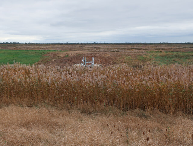
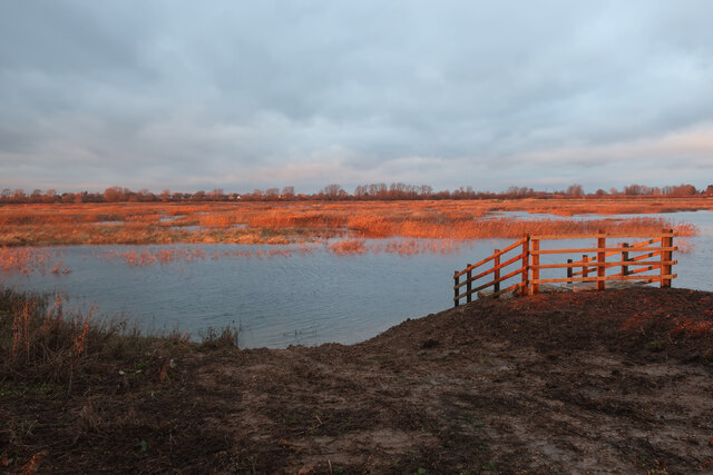
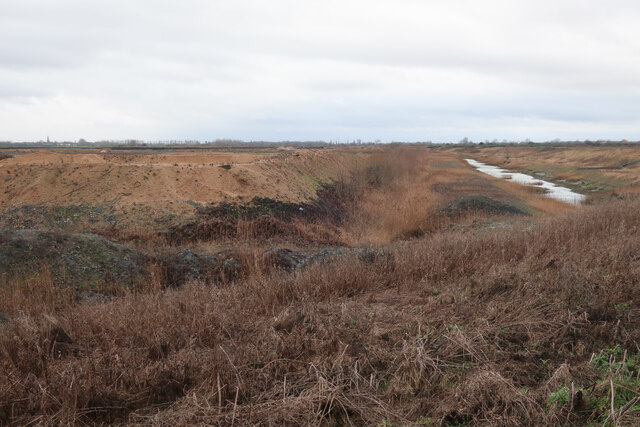
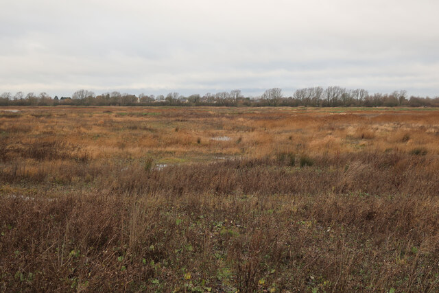
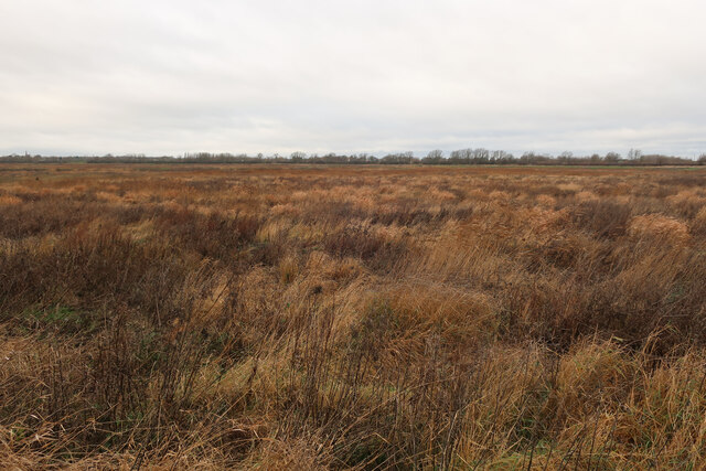
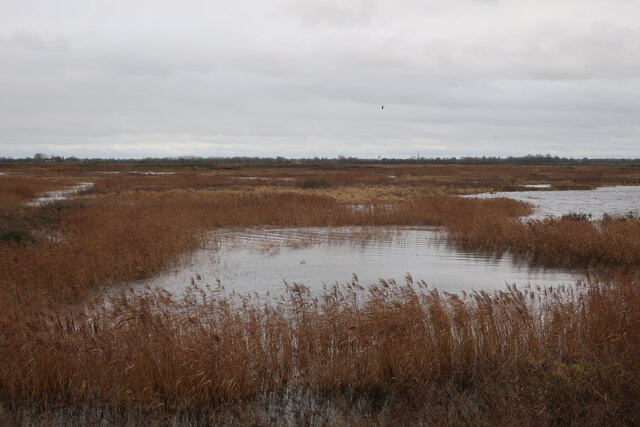
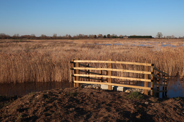
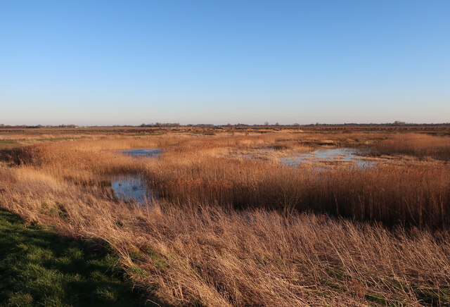
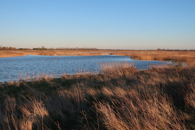
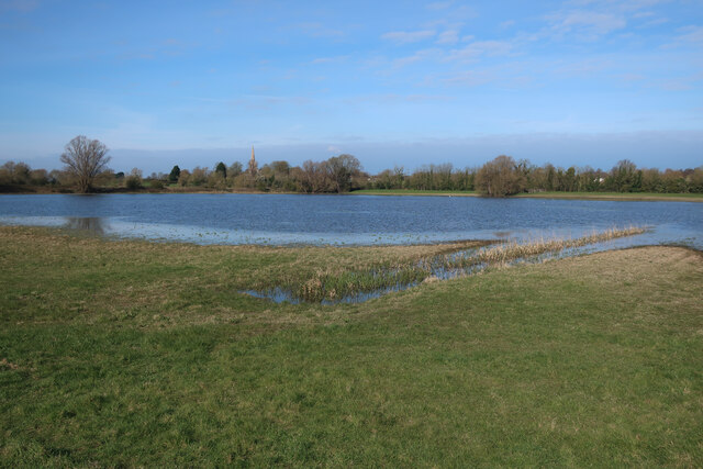
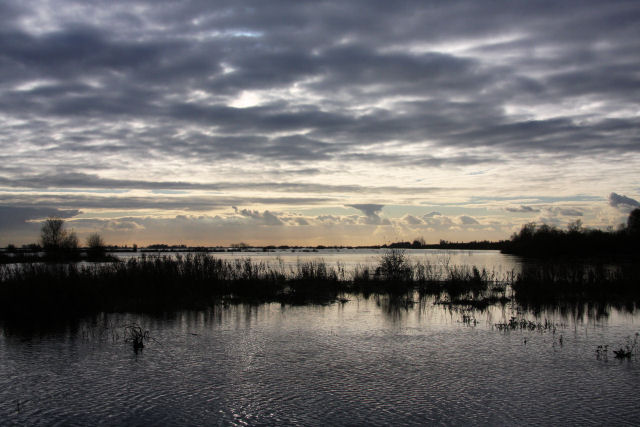
Sharp Corner Mere, located in Cambridgeshire, is a picturesque freshwater marsh encompassing an area of approximately 50 acres. This serene body of water is classified as a mere, which refers to a small lake or pool, often shallow and with a high concentration of vegetation. Nestled amidst the stunning English countryside, Sharp Corner Mere offers a tranquil retreat for both wildlife and visitors alike.

The mere boasts crystal-clear waters, thanks to its freshwater source, making it an ideal habitat for a diverse array of aquatic flora and fauna. The pool is surrounded by lush vegetation such as reeds, rushes, and water lilies, providing a haven for numerous bird species, amphibians, and insects. The marshy nature of the landscape also attracts a range of wetland birds, including herons, ducks, and grebes.

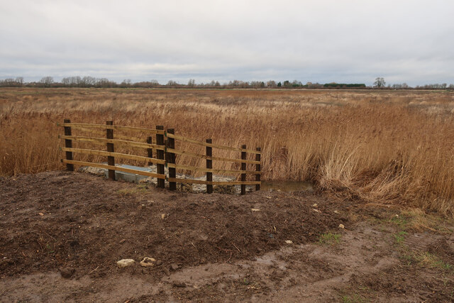
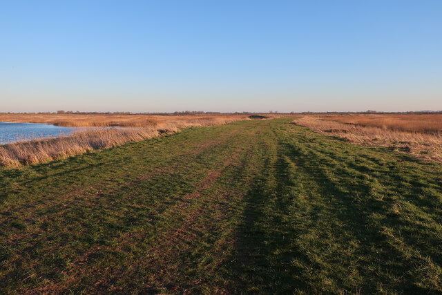
Sharp Corner Mere offers ample opportunities for nature enthusiasts and photographers to observe and capture the beauty of its inhabitants. Visitors can explore the area on foot, following designated paths that traverse the wetland, enabling them to get up close to the abundant wildlife. The tranquil atmosphere and stunning scenery make it an idyllic location for nature walks, birdwatching, and peaceful picnics.

The mere also plays a crucial role in the local ecosystem, acting as a natural water filter and flood control system. Its marshy vegetation helps to regulate water levels and prevent erosion, while also providing a habitat for numerous plant and animal species.

Overall, Sharp Corner Mere, with its enchanting landscape and diverse wildlife, offers a captivating experience for those seeking a peaceful and immersive encounter with nature in Cambridgeshire.

If you have any feedback on the listing, please let us know in the comments section below.

Sharp Corner Mere Images

Images are sourced within 2km of 52.340849/0.018322928 or Grid Reference TL3773. Thanks to Geograph Open Source API. All images are credited.

St Mary, Bluntisham: late September 2021
Approaching the junction of the A1123 with Holliday's Road
New sluice at Ouse Fen Allowing water level control of the next phase of the wetland creation project that is following the sand and gravel quarry.
New sluice at Ouse Fen
Allowing water level control of the next phase of the wetland creation project that is following the sand and gravel quarry.
Field by West Fen Road
Crane's Fen (Cell 8) flooded After a prolonged wait for the sluices, the northern end of Ouse Fen RSPB reserve is starting to be flooded to make more reedbeds.
Crane's Fen (Cell 8) flooded
After a prolonged wait for the sluices, the northern end of Ouse Fen RSPB reserve is starting to be flooded to make more reedbeds.
Gravel works by Ouse Fen The Hanson sand and gravel quarry is being turned into wetland habitat by the RSPB after each area is completed.
Gravel works by Ouse Fen
The Hanson sand and gravel quarry is being turned into wetland habitat by the RSPB after each area is completed.
Lockspit's Mere (Cell 9) The northern end of Ouse Fen RSPB, soon to be flooded to create new wetland habitat. The area has been lowered by a sand and gravel quarry, allowing it to become wetland, after landscaping and water level management work.
Lockspit's Mere (Cell 9)
The northern end of Ouse Fen RSPB, soon to be flooded to create new wetland habitat. The area has been lowered by a sand and gravel quarry, allowing it to become wetland, after landscaping and water level management work.
Crane's Fen (Cell 8) flooded After a prolonged wait for the sluices, the northern end of Ouse Fen RSPB reserve is starting to be flooded to make more reedbeds.
Crane's Fen (Cell 8) flooded
After a prolonged wait for the sluices, the northern end of Ouse Fen RSPB reserve is starting to be flooded to make more reedbeds.
Lockspit's Mere (Cell 9) This area was arable land, then a sand and gravel quarry, then profiled to be a wetland nature reserve and is now finally flooded. See <a href="https://www.geograph.org.uk/photo/3207556">TL3974 : No 18 Drove</a>, <a href="https://www.geograph.org.uk/photo/4044817">TL3974 : Stripped and ready for extraction</a>, <a href="https://www.geograph.org.uk/photo/4664779">TL3974 : Hanson Aggregates quarry</a> and <a href="https://www.geograph.org.uk/photo/7062680">TL3974 : Lockspit's Mere (Cell 9)</a>
Lockspit's Mere (Cell 9)
This area was arable land, then a sand and gravel quarry, then profiled to be a wetland nature reserve and is now finally flooded. See TL3974 : No 18 Drove, TL3974 : Stripped and ready for extraction, TL3974 : Hanson Aggregates quarry and TL3974 : Lockspit's Mere (Cell 9)
Gravel quarry by Ouse Fen Once the quarrying is done the area will be profiled into a further wetland cell and added to the nature reserve. It was previously arable land <a href="https://www.geograph.org.uk/photo/4134384">TL3973 : Wheat field by Long Holme Drove</a>
Gravel quarry by Ouse Fen
Once the quarrying is done the area will be profiled into a further wetland cell and added to the nature reserve. It was previously arable land TL3973 : Wheat field by Long Holme Drove
Long Holme (Cell 7), Ouse Fen RSPB Former sand and gravel quarry, and arable land before that.
Long Holme (Cell 7), Ouse Fen RSPB
Former sand and gravel quarry, and arable land before that.
Crane's Fen (Cell 8), Ouse Fen RSPB Former sand and gravel quarry, and arable land before that.
Crane's Fen (Cell 8), Ouse Fen RSPB
Former sand and gravel quarry, and arable land before that.
Path at Ouse Fen One of the reserve paths from the car park at the north end.
Path at Ouse Fen
One of the reserve paths from the car park at the north end.
Houses at Bluntisham A semi-detached pair at the junction of Holliday's Road with Rectory Road [A1123]. The RH one looks as if it has nest boxes for swifts, or other birds, under the eaves?
Houses at Bluntisham
A semi-detached pair at the junction of Holliday's Road with Rectory Road [A1123]. The RH one looks as if it has nest boxes for swifts, or other birds, under the eaves?
Little Fen Floodplain by the Great Ouse.
Little Fen
Floodplain by the Great Ouse.
Show me another place!

Sharp Corner Mere is located at Grid Ref: TL3773 (Lat: 52.340849, Lng: 0.018322928)

Administrative County: Cambridgeshire

District: South Cambridgeshire

Police Authority: Cambridgeshire

What 3 Words

///hardens.latitudes.sonic. Near Bluntisham, Cambridgeshire

Related Wikis

Bluntisham

Bluntisham is a village and civil parish in Cambridgeshire, England. The population of the civil parish at the 2011 census was 2,003. Bluntisham lies approximately...

Earith

Earith is a village and civil parish in Cambridgeshire, England. Lying approximately 10 miles (16 km) east of Huntingdon, Earith is situated within Huntingdonshire...

Berry Fen

Berry Fen is a 15.3-hectare (38-acre) biological Site of Special Scientific Interest on the western outskirts of Earith in Cambridgeshire.This neutral...

New Bedford River

The New Bedford River, also known as the Hundred Foot Drain because of the distance between the tops of the two embankments on either side of the river...

Bluntisham railway station

Bluntisham railway station was a station in Bluntisham, Cambridgeshire on the Ely and St Ives Railway. The station closed for regular passenger services...

Cambridgeshire

Cambridgeshire (abbreviated Cambs.) is a ceremonial county in the East of England and East Anglia. It is bordered by Lincolnshire to the north, Norfolk...

List of Sites of Special Scientific Interest in Cambridgeshire

Cambridgeshire is a county in eastern England, with an area of 339,746 hectares (1,312 sq mi) and a population as of mid-2015 of 841,218. It is crossed...

List of local nature reserves in Cambridgeshire

Cambridgeshire is a county in eastern England, with an area of 1,308 square miles (3,390 km2) and a population as of 2011 of 708,719. It is crossed by...

Nearby Amenities

Located within 500m of 52.340849,0.018322928
Ouse Fen
Natural: fen
Source: npe
Lat/Long: 52.3418935/0.0213578
Note: Not a bridge as such, just flat grass over drain
Lat/Long: 52.3409393/0.0118044
Southern Barren Area
Place: locality
Lat/Long: 52.3396877/0.0244361
The data included in this document is from www.openstreetmap.org. The data is made available under ODbL.

Have you been to Sharp Corner Mere?

Leave your review of Sharp Corner Mere below (or comments, questions and feedback).