St James's Park Lake

Lake, Pool, Pond, Freshwater Marsh in Middlesex

England

St James's Park Lake

Millbank Estate 'Gainsborough House' from 'Wilkie House': one of fifteen social housing units dating from the end of the 19th century which occupy the vast tract of land, adjacent to the Thames, released for development when the huge Millbank Penitentiary was demolished.

The site included provision for the erection of the Tate Gallery, to the east, which was commenced a little earlier, such that each of the new apartment buildings was named after a leading British artist.

The quality of the design, and the brick construction, would put much latter-day Council housing to shame, and this is supplemented by extensive planting of what are now mature trees. (Any current social tenants must surely reflect on what it would cost to live here if these were privately-built properties,  so near to the centre of Westminster: a small terraced house, in the streets near Parliament, north of here, would cost upwards of  £6M.)
Millbank Estate Credit: Anthony O'Neil

St James's Park Lake, located in Middlesex, is a picturesque body of water nestled within the iconic St James's Park. Spanning approximately 6 acres, this freshwater lake is a prominent feature of the park and offers a tranquil oasis amidst the bustling city of London.

The lake is renowned for its natural beauty and serves as a habitat for various species of wildlife, including ducks, swans, and other waterfowl. Visitors often enjoy feeding these birds or simply observing them as they gracefully glide across the calm waters.

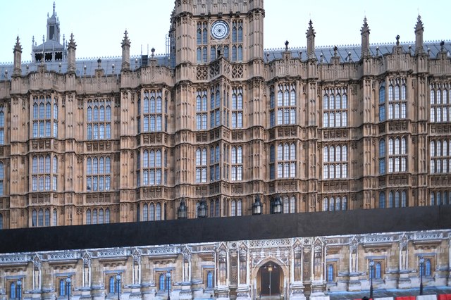
Surrounded by lush greenery and manicured lawns, St James's Park Lake provides a serene environment for both locals and tourists seeking a peaceful retreat. Its central location offers stunning views of nearby landmarks, such as Buckingham Palace and the Horse Guards Parade, further enhancing its appeal.

In addition to its aesthetic value, the lake also serves functional purposes. It acts as a reservoir, supplying water to the various fountains within the park. The lake's freshwater marshes provide a vital habitat for aquatic plants and insects, contributing to the overall ecological balance of the area.

Visitors can explore the lake by walking along its perimeter or by renting rowboats, which are available during the summer months. This allows individuals to fully immerse themselves in the beauty of the surroundings and create lasting memories of their time in St James's Park.

Overall, St James's Park Lake in Middlesex offers a blend of natural beauty, wildlife, and recreational opportunities, making it a must-visit destination for nature enthusiasts and those seeking a peaceful retreat in the heart of London.

If you have any feedback on the listing, please let us know in the comments section below.

St James's Park Lake Images

Images are sourced within 2km of 51.502442/-0.1338927 or Grid Reference TQ2979. Thanks to Geograph Open Source API. All images are credited.

Millbank Estate 'Gainsborough House' from 'Wilkie House': one of fifteen social housing units dating from the end of the 19th century which occupy the vast tract of land, adjacent to the Thames, released for development when the huge Millbank Penitentiary was demolished.

The site included provision for the erection of the Tate Gallery, to the east, which was commenced a little earlier, such that each of the new apartment buildings was named after a leading British artist.

The quality of the design, and the brick construction, would put much latter-day Council housing to shame, and this is supplemented by extensive planting of what are now mature trees. (Any current social tenants must surely reflect on what it would cost to live here if these were privately-built properties,  so near to the centre of Westminster: a small terraced house, in the streets near Parliament, north of here, would cost upwards of  £6M.)
Millbank Estate
'Gainsborough House' from 'Wilkie House': one of fifteen social housing units dating from the end of the 19th century which occupy the vast tract of land, adjacent to the Thames, released for development when the huge Millbank Penitentiary was demolished. The site included provision for the erection of the Tate Gallery, to the east, which was commenced a little earlier, such that each of the new apartment buildings was named after a leading British artist. The quality of the design, and the brick construction, would put much latter-day Council housing to shame, and this is supplemented by extensive planting of what are now mature trees. (Any current social tenants must surely reflect on what it would cost to live here if these were privately-built properties, so near to the centre of Westminster: a small terraced house, in the streets near Parliament, north of here, would cost upwards of £6M.)
Nelson From Cockspur Street
Nelson
From Cockspur Street
View of Vauxhall Bridge Changing high-rise horizon from Tate Britain
View of Vauxhall Bridge
Changing high-rise horizon from Tate Britain
Looking at Art (1) Tate Britain
Looking at Art (1)
Tate Britain
Looking at Art (2) Henry Moore: Tate Britain
Looking at Art (2)
Henry Moore: Tate Britain
Looking at Art (3) Henry Moore: Tate Britain
Looking at Art (3)
Henry Moore: Tate Britain
St Thomas's Hospital From Victoria Tower Gardens, Thames: distant view of The Shard, on the right.
St Thomas's Hospital
From Victoria Tower Gardens, Thames: distant view of The Shard, on the right.
Behind the barricades Parliament has a dilemma, as more and more of their House falls into disrepair ... to move or not to move.

There are a thousand rooms here, altogether, and almost nowhere else that could accommodate the Lords and Commons together. The potential costs are astronomical and the UK is drastically short of funds.
Behind the barricades
Parliament has a dilemma, as more and more of their House falls into disrepair ... to move or not to move. There are a thousand rooms here, altogether, and almost nowhere else that could accommodate the Lords and Commons together. The potential costs are astronomical and the UK is drastically short of funds.
Historic Pub, Mayfair In business since 1737 and became a haunt of fighter pilots in the 1940s due to its proximity to the RAF Club in Piccadilly.
Historic Pub, Mayfair
In business since 1737 and became a haunt of fighter pilots in the 1940s due to its proximity to the RAF Club in Piccadilly.
Mayfair eatery Shepherd Market
Mayfair eatery
Shepherd Market
Food for thought Caffé-in, Shepherd Street, Mayfair
Food for thought
Caffé-in, Shepherd Street, Mayfair
A dazzling image National Portrait Gallery, London
A dazzling image
National Portrait Gallery, London
Royal afternoon tea National Portrait Gallery, London
Royal afternoon tea
National Portrait Gallery, London
Luxury bargain hunters GOYARD, Mount Street, London (Paris 1853): if you want a shopping bag for £1,000 or more, this is the place ... especially in the Christmas sale.
Luxury bargain hunters
GOYARD, Mount Street, London (Paris 1853): if you want a shopping bag for £1,000 or more, this is the place ... especially in the Christmas sale.
View of the tombs of Edward Mansell and Robert Cholmondelly in Westminster Abbey Looking northwest.
View of the tombs of Edward Mansell and Robert Cholmondelly in Westminster Abbey
Looking northwest.
View of the tombs of Mary Beaufoy and Jane Stoteville in Westminster Abbey Looking northwest.
View of the tombs of Mary Beaufoy and Jane Stoteville in Westminster Abbey
Looking northwest.
View of the ceiling in the quire of Westminster Abbey Looking west.
View of the ceiling in the quire of Westminster Abbey
Looking west.
View of a tomb in St. Mary's Chapel in Westminster Abbey Looking south-southwest.
View of a tomb in St. Mary's Chapel in Westminster Abbey
Looking south-southwest.
Show me another place!

St James's Park Lake is located at Grid Ref: TQ2979 (Lat: 51.502442, Lng: -0.1338927)

Unitary Authority: Westminster

Police Authority: Metropolitan

What 3 Words

///dance.tasty.woods. Near London

Related Wikis

St James's Park

St James's Park is a 23-hectare (57-acre) urban park in the City of Westminster, central London. A Royal Park, it is at the southernmost end of the St...

London 10,000

The London 10,000 is an annual road running event over 10 kilometres (6.2 mi) which takes place in late May in London, United Kingdom. Established in 2008...

Birdcage Walk

Birdcage Walk is a street in the City of Westminster in London. It runs east–west as a continuation of Great George Street, from the crossroads with Horse...

St Stephen's Club

St Stephen's Club was a private member's club in Westminster, London, founded in 1870.St Stephen's was originally on the corner of Bridge Street and the...

The Mall, London

The Mall () is a ceremonial route and roadway in the City of Westminster, central London, that travels 1 kilometre (0.62 mi) between Buckingham Palace...

Statue of Queen Anne, Queen Anne's Gate

A Grade I-listed statue of Queen Anne stands on a pedestal alongside the north wall of No. 15 Queen Anne's Gate in Westminster, London. It portrays the...

Law Commission (England and Wales)

In England and Wales the Law Commission (Welsh: Comisiwn y Gyfraith) is an independent law commission set up by Parliament by the Law Commissions Act 1965...

Queen Anne's Gate

Queen Anne’s Gate is a street in Westminster, London. Many of the buildings are Grade I listed, known for their Queen Anne architecture. Simon Bradley...

Nearby Amenities

Located within 500m of 51.502442,-0.1338927
Crossing
Crossing: uncontrolled
Crossing Ref: zebra
Lat/Long: 51.5052831/-0.1381782
Crossing
Button Operated: yes
Crossing: traffic_signals
Crossing Island: yes
Crossing Markings: dots
Crossing Ref: pelican
Kerb: lowered
Tactile Paving: yes
Traffic Signals Sound: yes
Lat/Long: 51.5009153/-0.1338966
Crossing
Button Operated: yes
Crossing: traffic_signals
Crossing Island: no
Crossing Markings: dots
Crossing Ref: pelican
Tactile Paving: yes
Traffic Signals Sound: yes
Lat/Long: 51.5009785/-0.1405377
Crossing
Crossing: uncontrolled
Crossing Island: yes
Crossing Ref: zebra
Tactile Paving: yes
Lat/Long: 51.4996147/-0.1329746
Traffic Signals
Traffic Signals Direction: backward
Lat/Long: 51.4991747/-0.1297493
Crossing
Crossing: uncontrolled
Crossing Island: yes
Crossing Ref: zebra
Tactile Paving: yes
Lat/Long: 51.4996838/-0.1340877
Mini Roundabout
Direction: clockwise
Lat/Long: 51.499721/-0.1338377
Crossing
Crossing: unmarked
Crossing Island: yes
Crossing Markings: no
Lat/Long: 51.4997684/-0.129539
Created By: YahooApplet 1.0
Lat/Long: 51.502948/-0.1319583
St. James's Park
Fare Zone: 1
Line: District;Circle
Loc Name: Saint James Park
Name Ru: Сент-Джеймс Парк
Naptan AtcoCode: 940GZZLUSJP
Network: London Underground
Operator: London Underground
Platforms: 2
Public Transport: station
Railway: station
Station: subway
Subway: yes
Wheelchair: no
Wikidata: Q1567095
Wikipedia: en:St James's Park tube station
Lat/Long: 51.4992816/-0.1345942
Crossing
Crossing: unmarked
Crossing Island: no
Tactile Paving: yes
Traffic Calming: table
Lat/Long: 51.5011386/-0.1317118
Check Date Wheelchair: 2022-03-12
Entrance: yes
Entrance Marker Subway: yes
Railway: subway_entrance
Wheelchair: no
Lat/Long: 51.4990353/-0.1353083
Crossing
Crossing: unmarked
Crossing Island: no
Tactile Paving: no
Lat/Long: 51.5043785/-0.1291864
Post Box
Brand: Royal Mail
Brand Wikidata: Q638098
Brand Wikipedia: en:Royal Mail
Collection Times: Mo-Fr 18:30, Sa 11:30
Old Ref: SW1 320
Operator: Royal Mail
Operator Wikidata: Q638098
Post Box Apertures: 2
Post Box Manufacturer: McDowall, Steven & Co Ltd, London & Falkirk
Post Box Type: pillar
Ref: SW1H 2;SW1H 102
Royal Cypher: EIIR
Royal Cypher Wikidata: Q33102113
Source: survey;photo
Lat/Long: 51.5004507/-0.1339324
Mapillary: 1041367943637061
Operator: Arqiva
Operator Wikidata: Q4795774
Payment Coins: yes
Payment Credit Cards: yes
Payment Debit Cards: yes
Phone: +44 20 7976 7407
Removed Amenity: telephone
Survey Date: 2024-01-25
Lat/Long: 51.4996528/-0.1336513
Post Box
Brand: Royal Mail
Brand Wikidata: Q638098
Brand Wikipedia: en:Royal Mail
Collection Times: Mo-Fr 18:45, Sa 11:30
Operator: Royal Mail
Operator Wikidata: Q638098
Post Box Apertures: 2
Post Box Type: pillar
Ref: SW1H 3;SW1H 103
Royal Cypher: EIIR
Royal Cypher Wikidata: Q33102113
Lat/Long: 51.4996408/-0.1338245
Cafe
Starbucks
Addr City: London
Addr Country: GB
Addr Housenumber: 16-18
Addr Postcode: SW1H 0AD
Addr Street: Palmer Street
Brand: Starbucks
Brand Wikidata: Q37158
Brand Wikipedia: en:Starbucks
Cuisine: coffee_shop
Fhrs Id: 428179
Official Name: Starbucks Coffee
Opening Hours: Mo-Fr 06:00-19:00; Sa 09:00-17:00
Takeaway: yes
Lat/Long: 51.4989916/-0.1354995
Fast Food
Greggs
Addr City: London
Addr Housenumber: 26
Addr Postcode: SW1H 0AD
Addr Street: Palmer Street
Brand: Greggs
Brand Wikidata: Q3403981
Brand Wikipedia: en:Greggs
Contact Website: https://www.greggs.co.uk/shop-finder?shop-code=0919
Cuisine: sandwich;bakery
Fhrs Confidence Management: 5
Fhrs Hygiene: 5
Fhrs Id: 414485
Fhrs Local Authority Id: 01888/0026/0/001
Fhrs Rating: 5
Fhrs Structural: 5
Source Addr: FSA Food Hygiene Ratings Database
Source Postcode: FSA Food Hygiene Ratings Database
Takeaway: yes
Lat/Long: 51.4982302/-0.1352163
Disused Amenity: telephone
Note: telephone cubicles recessed into front wall of building, no telephone equipment, now boarded over, but circular phone symbol sign remains
Lat/Long: 51.4982763/-0.1340161
Telephone
Booth: KXPlus
Check Date: 2021-04-04
Covered: booth
Lat/Long: 51.4993875/-0.1360286
Restaurant
Bon Gusto
Addr City: London
Addr Country: GB
Addr Housenumber: 75-76
Addr Postcode: SW1E 6PD
Addr Street: Buckingham Gate
Cuisine: italian
Fhrs Id: 412670
Lat/Long: 51.4992102/-0.1378188
Embassy of the Republic of North Macedonia
Country: MK
Diplomatic: embassy
Embassy: yes
Name Fr: Ambassade de Macédoine
Office: diplomatic
Short Name: Embassy of North Macedonia
Target: GB
Wikidata: Q16836829
Lat/Long: 51.4992223/-0.1378841
Restaurant
Bank Restaurant & Bar
Addr City: London
Addr Housenumber: 45
Addr Postcode: SW1E 6BS
Addr Street: Buckingham Gate
Alt Name: Zander Bar
Email: westminster.reservations@bankrestaurants.com
Phone: +44 20 7630 6644
Website: www.individualrestaurants.com
Lat/Long: 51.4986304/-0.1372558
Prime Dry Cleaners
Addr Housenumber: 35
Addr Street: Buckingham Gate
Shop: dry_cleaning
Lat/Long: 51.4991055/-0.1385776
Telephone
Booth: KX100
Covered: booth
Operator: BT
Operator Wikidata: Q593786
Phone: +44 20 7976 0339
Lat/Long: 51.4994317/-0.1332592
Bicycle Parking
Bicycle Parking: stands
Capacity: 12
Mapillary: 236816134559826
Survey Date: 2019-01-04
Lat/Long: 51.4992884/-0.1296732
Bicycle Parking
Bicycle Parking: stands
Capacity: 8
Check Date Capacity: 2021-07-17
Covered: no
Lat/Long: 51.4998056/-0.1335494
Pub
Munich Cricket Club
Addr City: London
Addr Country: GB
Addr Housenumber: 1
Addr Postcode: SW1P 2LU
Addr Street: Abbey Orchard Street
Brewery: yes
Cuisine: german
Fhrs Id: 1156885
Indoor Seating: yes
Level: -1
Outdoor Seating: no
Lat/Long: 51.4981992/-0.1324675
Addr City: London
Addr Housenumber: 19
Addr Postcode: SW1H 0DJ
Addr Street: Dacre Street
Disused: yes
Note: Vacated by Action Bikes 2017-04-21 at expiry of lease. Vacated by Cama Gallery (art shop) somewhere late 2019/early 2020.
Lat/Long: 51.4989/-0.132106
Pub
The Red Lion
Addr Street: Crown Passage
Wheelchair: no
Wikidata: Q26319820
Lat/Long: 51.5056546/-0.1376692
Monument to the 2002 Bali bombings
Historic: memorial
Memorial: sculpture
Wheelchair: yes
Wikidata: Q18458048
Wikimedia Commons: File:Bali bombing memorial in London, Horse Guard Road.JPG
Wikipedia: en:Bali Bombings Memorial, London
Lat/Long: 51.5024054/-0.1295373
Earl Mountbatten of Burma
Artwork Type: statue
Historic: memorial
Memorial: statue
Name Zh: 缅甸蒙巴顿伯爵像
Tourism: artwork
Wheelchair: no
Wikidata: Q18548908
Wikipedia: en:Statue of the Earl Mountbatten, London
Lat/Long: 51.5035988/-0.1286233
Crossing
Button Operated: yes
Crossing: traffic_signals
Crossing Island: no
Crossing Ref: pelican
Tactile Paving: yes
Traffic Signals Sound: no
Traffic Signals Vibration: no
Lat/Long: 51.5057851/-0.1310009
Earl of Derby
Artist Wikidata: Q6791021
Artist Wikipedia: en:Matthew Noble
Artist Name: Matthew Noble
Historic: memorial
Memorial: statue
Start Date: 1874-07-11
Subject Wikidata: Q237829
Subject Wikipedia: en:Edward Smith-Stanley, 14th Earl of Derby
Wikidata: Q18116483
Wikipedia: en:Statue of the Earl of Derby, Parliament Square
Lat/Long: 51.5007874/-0.1273028
Earl of Beaconsfield
Historic: memorial
Memorial: statue
Lat/Long: 51.5006372/-0.1273001
Telephone
Booth: K6
Covered: booth
Listed Status: Grade II
Operator: BT
Operator Wikidata: Q593786
Lat/Long: 51.5012817/-0.1281114
Telephone
Booth: K6
Covered: booth
Listed Status: Grade II
Operator: BT
Operator Wikidata: Q593786
Lat/Long: 51.5012469/-0.1275803
Telephone
Booth: K2
Covered: booth
Listed Status: Grade II
Operator: BT
Operator Wikidata: Q593786
Phone: +44 20 7930 1397
Lat/Long: 51.501218/-0.1273408
George Canning
Artist Wikidata: Q6238282
Artist Wikipedia: en:Richard Westmacott
Artist Name: Richard Westmacott
Description: The statue was first erected near St Margaret's, Westminster, and was moved to Parliament Square in 1867.
Height: 3.56
Historic: memorial
Material: bronze
Memorial: statue
Start Date: 1832-05-02
Subject Wikidata: Q219731
Subject Wikipedia: en:George Canning
Wikidata: Q21546419
Wikipedia: en:Statue of George Canning, Parliament Square
Lat/Long: 51.5010033/-0.1277194
Abraham Lincoln
Alt Name: Standing Lincoln
Artist Wikidata: Q770625
Artist Wikipedia: en:Augustus Saint-Gaudens
Artist Name: Augustus Saint-Gaudens
Height: 3.7
Historic: memorial
Material: bronze
Memorial: statue
Name Be: Абрагам Лінкальн
Name En: Abraham Lincoln
Name Ru: Авраам Линкольн
Name Zh: 亚伯拉罕 林肯
Start Date: 1920
Subject Wikidata: Q91
Subject Wikipedia: en:Abraham Lincoln
Wikidata: Q25338500
Lat/Long: 51.5005254/-0.1277126
Post Box
Brand: Royal Mail
Brand Wikidata: Q638098
Brand Wikipedia: en:Royal Mail
Check Date: 2024-03-02
Collection Times: Mo-Fr 18:45; Sa 11:30
Colour: gold
Inscription: This post box has been painted gold by Royal Mail to celebrate London as the host city of the 2012 Olympic and Paralympic Games and was unveiled by Jo Swinson MP, Under Secretary of State, Department for Business, Innovation and Skills
Operator: Royal Mail
Operator Wikidata: Q638098
Post Box Apertures: 2
Post Box Type: pillar
Postal Code: SW1
Ref: SW1H 1;SW1H 101
Royal Cypher: EIIR
Royal Cypher Wikidata: Q33102113
Lat/Long: 51.4995865/-0.129761
Post Box
Brand: Royal Mail
Brand Wikidata: Q638098
Brand Wikipedia: en:Royal Mail
Collection Times: Mo-Fr 18:45, Sa 11:30
Operator: Royal Mail
Operator Wikidata: Q638098
Post Box Apertures: 2
Post Box Type: pillar
Ref: SW1H 14;SW1H 114
Royal Cypher: EIIR
Royal Cypher Wikidata: Q33102113
Source: survey
Lat/Long: 51.5007981/-0.1316316
Fast Food
Pret A Manger
Addr City: London
Addr Housenumber: 49
Addr Postcode: SW1H 9LQ
Addr Street: Tothill Street
Brand: Pret A Manger
Brand Wikidata: Q2109109
Brand Wikipedia: en:Pret a Manger
Contact Website: https://locations.pret.co.uk/london/49-tothill-street
Cuisine: sandwich
Fhrs Confidence Management: 5
Fhrs Hygiene: 10
Fhrs Id: 427747
Fhrs Local Authority Id: 00262/0049/0/000
Fhrs Rating: 4
Fhrs Structural: 5
Operator: Prêt à Manger
Ref: 128
Short Name: Pret
Source Addr: FSA Food Hygiene Ratings Database
Source Postcode: FSA Food Hygiene Ratings Database
Takeaway: yes
Lat/Long: 51.4995978/-0.1324895
Kerb: raised
Lat/Long: 51.5051838/-0.1294797
King George VI
Historic: memorial
Name Hu: VI. György király
Wikidata: Q26319313
Lat/Long: 51.5052166/-0.1338073
Queen Elizabeth (The Queen Mother)
Historic: memorial
Memorial: statue
Wikidata: Q26689954
Lat/Long: 51.5051598/-0.1337633
The Royal Society
Addr City: London
Addr Housenumber: 6-9
Addr Postcode: SW1Y 5AG
Addr Street: Carlton House Terrace
Fhrs Confidence Management: 0
Fhrs Hygiene: 0
Fhrs Id: 412345
Fhrs Local Authority Id: 00779/0006/0/000
Fhrs Rating: 5
Fhrs Structural: 5
Source Addr: FSA Food Hygiene Ratings Database
Source Postcode: FSA Food Hygiene Ratings Database
Wikidata: Q123885
Wikipedia: en:Royal Society
Lat/Long: 51.5059345/-0.1323299
Bus Stop
Westminster Abbey
Bench: yes
Bin: no
Bus: yes
Lit: yes
Local Ref: R
Naptan AtcoCode: 490014495R
Naptan Bearing: E
Naptan CommonName: Westminster Abbey
Naptan Indicator: R
Naptan Street: VICTORIA STREET
Public Transport: platform
Ref: 76870
Shelter: yes
Tactile Paving: no
Lat/Long: 51.4990281/-0.1309145
Bus Stop
Westminster Abbey
Bench: yes
Bin: yes
Bus: yes
Lit: yes
Local Ref: S
Naptan AtcoCode: 490014495S
Naptan Bearing: E
Naptan CommonName: Westminster Abbey
Naptan Indicator: S
Naptan Street: VICTORIA STREET
Public Transport: platform
Shelter: yes
Tactile Paving: no
Lat/Long: 51.4991695/-0.1305258
Bus Stop
Westminster Abbey
Addr City: London
Addr Street: Victoria Street
Bench: yes
Bin: no
Bus: yes
Lit: yes
Local Ref: T
Naptan AtcoCode: 490014495T
Naptan Bearing: W
Naptan CommonName: Westminster Abbey
Naptan Indicator: T
Naptan Street: VICTORIA STREET
Public Transport: platform
Shelter: yes
Tactile Paving: no
Toilets Wheelchair: no
Wheelchair: yes
Wheelchair Description: Step-free to stops opposite via island refuge.
Lat/Long: 51.4986036/-0.1316987
Bus Stop
Great Smith Street / Westminster Abbey
Addr City: London
Addr Street: Victoria Street
Bench: yes
Bin: no
Bus: yes
Lit: yes
Local Ref: V
Naptan AtcoCode: 490014495V
Naptan Bearing: W
Naptan CommonName: Westminster Abbey
Naptan Indicator: Stop V
Public Transport: platform
Ref: 47982
Shelter: yes
Tactile Paving: no
Toilets Wheelchair: no
Wheelchair: yes
Wheelchair Description: Step-free to stops opposite via island refuge.
Lat/Long: 51.4986873/-0.131465
Bus Stop
Tothill Street / St James's Park Station
Bus: yes
Naptan AtcoCode: 490014495W1
Naptan Bearing: W
Naptan CommonName: Westminster Abbey
Naptan Indicator: Stop
Public Transport: platform
Shelter: no
Lat/Long: 51.4996528/-0.1322859
Bus Stop
Westminster Abbey
Bench: yes
Bin: no
Bus: yes
Lit: yes
Local Ref: X
Naptan AtcoCode: 490014495X
Naptan Bearing: S
Naptan CommonName: Westminster Abbey
Naptan Indicator: Stop X
Naptan Street: GREAT SMITH STREET
Public Transport: platform
Ref: 53680
Shelter: yes
Tactile Paving: no
Lat/Long: 51.4989102/-0.1297336
Bus Stop
Pall Mall / St James's Palace
Bus: yes
Naptan AtcoCode: 490017354W
Naptan Bearing: W
Naptan CommonName: St James's Palace
Naptan Indicator: Stop
Public Transport: platform
Ref: 91573
Source Ref: naptan
Wheelchair: yes
Lat/Long: 51.5055097/-0.1368605
Post Box
Brand: Royal Mail
Brand Wikidata: Q638098
Brand Wikipedia: en:Royal Mail
Collection Times: Mo-Fr 18:30; Sa 11:30
Operator: Royal Mail
Operator Wikidata: Q638098
Post Box Apertures: 2
Post Box Design: type_c
Post Box Type: pillar
Ref: SW1H 10;SW1H 110
Royal Cypher: EIIR
Royal Cypher Wikidata: Q33102113
Source: survey
Lat/Long: 51.4988391/-0.130962
Telephone
Booth: K6
Check Date: 2023-10-06
Covered: booth
Lat/Long: 51.4988136/-0.1310317
Restaurant
Avenue
Addr City: London
Addr Floor: 0
Addr Housename: Byron House
Addr Housenumber: 7-9
Addr Postcode: SW1A 1EE
Addr Street: St James
Contact Twitter: https://twitter.com/avenuestjames
Cuisine: modern european
Fhrs Id: 412147
Phone: +44 20 7321 2111
Source Addr: FHRS Open Data
Website: https://www.avenue-restaurant.co.uk/
Lat/Long: 51.5057653/-0.1382964
Bicycle Parking
Access: yes
Bicycle Parking: stands
Capacity: 14
Covered: no
Lat/Long: 51.5040057/-0.1314704
Lobb
Alt Name: Lobb
Shop: shoes
Url: http://www.johnlobbltd.co.uk/main/main.htm
Wheelchair: no
Lat/Long: 51.5058332/-0.1383721
Crossing
Crossing: traffic_signals
Crossing Island: yes
Crossing Ref: pelican
Lat/Long: 51.5022768/-0.1395285
Description: Jubilee Greenway
Tourism: plaque
Lat/Long: 51.5011507/-0.1271559
Traffic Signals
Crossing: no
Traffic Signals: traffic_lights
Traffic Signals Direction: forward
Lat/Long: 51.5009846/-0.1273873
Post Box
Collection Times: Mo-Fr 18:30; Sa 12:30
Post Box Apertures: 2
Post Box Design: type_c
Post Box Manufacturer: Carron Company, Stirlingshire
Post Box Type: pillar
Ref: SW1Y 24;SW1Y 124
Royal Cypher: EIIR
Royal Cypher Wikidata: Q33102113
Lat/Long: 51.5063351/-0.1320711
George Nathaniel Curzon
Historic: memorial
Lat/Long: 51.5059572/-0.13328
Post Box
Brand: Royal Mail
Brand Wikidata: Q638098
Brand Wikipedia: en:Royal Mail
Collection Times: Mo-Fr 18:45; Sa 11:30
Operator: Royal Mail
Operator Wikidata: Q638098
Post Box Apertures: 2
Post Box Design: type_c
Post Box Type: pillar
Ref: SW1Y 32;SW1Y 132
Royal Cypher: EIIR
Royal Cypher Wikidata: Q33102113
Source: survey
Lat/Long: 51.5060814/-0.1357934
Cafe
St James Caffe
Addr City: London
Addr Housenumber: 41
Addr Postcode: SW1Y 5JG
Addr Street: Pall Mall
Check Date: 2023-09-23
Fhrs Id: 772743
Level: 0
Source Addr: FHRS Open Data
Wheelchair: limited
Lat/Long: 51.5060928/-0.1359706
Pub
The Golden Lion
Brand: Greene King
Brand Wikidata: Q5564162
Toilets: yes
Toilets Access: customers
Website: https://www.greeneking.co.uk/pubs/greater-london/golden-lion-st-james-s
Wikidata: Q27080748
Lat/Long: 51.5063153/-0.1374883
Pub
Davy's
Addr City: London
Addr Postcode: SW1Y 6QY
Addr Street: Crown Passage
Alt Name: Davy's at St. James
Brewery: yes
Fhrs Id: 427708
Opening Hours: Mo-Fr 12:00-22:00
Phone: +44 20 7839 8831
Website: https://www.davy.co.uk/
Lat/Long: 51.5060459/-0.1380125
Fast Food
EAT.
Brand: EAT.
Brand Wikidata: Q5331219
Brand Wikipedia: en:Eat (restaurant)
Cuisine: sandwich
Takeaway: yes
Lat/Long: 51.5059503/-0.1378119
Restaurant
Il Vicolo
Addr City: London
Addr Housenumber: 3-4
Addr Street: Crown Passage
Cuisine: italian
Fhrs Confidence Management: 10
Fhrs Hygiene: 5
Fhrs Id: 412437
Fhrs Local Authority Id: 00812/0003/0/000
Fhrs Rating: 3
Fhrs Structural: 10
Outdoor Seating: yes
Postal Code: SW1Y 6PP
Source Addr: FSA Food Hygiene Ratings Database
Source Postcode: FSA Food Hygiene Ratings Database
Lat/Long: 51.5057403/-0.1376092
Berry Bros & Rudd
Addr City: London
Addr Housenumber: 3
Addr Postcode: SW1A 1EG
Addr Street: St James's Street
Alcohol: wine
Fhrs Id: 412145
Shop: alcohol
Source Addr: FHRS Open Data
Website: https://www.bbr.com/
Wheelchair: no
Wikidata: Q2899153
Lat/Long: 51.5055543/-0.1380673
Bicycle Parking
Bicycle Parking: stands
Capacity: 12
Covered: no
Lat/Long: 51.5041545/-0.1312244
Crossing
Crossing: unmarked
Lat/Long: 51.5031101/-0.1378364
Crossing
Button Operated: yes
Crossing: traffic_signals
Crossing Island: yes
Tactile Paving: yes
Traffic Signals Sound: yes
Lat/Long: 51.503798/-0.1360968
Crossing
Crossing: unmarked
Tactile Paving: yes
Lat/Long: 51.5058032/-0.1312528
Bicycle Rental
Waterloo Place
Bicycle Rental: docking_station
Brand: Santander Cycles
Brand Wikidata: Q807961
Capacity: 20
Historic Ref: CH25037
Local: St. James's
Network: tfl_cycle_hire
Official Name: Waterloo Place, St. James's
Official Ref: 160
Operator: Serco
Operator Wikidata: Q499104
Lat/Long: 51.5065751/-0.131725
Bicycle Rental
Pall Mall
Bicycle Rental: docking_station
Brand: Santander Cycles
Brand Wikidata: Q807961
Capacity: 22
Historic Amenity: bicycle_rental
Historic Network: tfl_cycle_hire
Local: St. James's
Network: tfl_cycle_hire
Official Name: Pall Mall, St. James's
Operator: Serco
Operator Wikidata: Q499104
Ref: CH24023
Wheelchair: yes
Lat/Long: 51.5057988/-0.1365647
Bicycle Rental
Abbey Orchard Street
Authority: City of Westminster
Bicycle Rental: docking_station
Brand: Santander Cycles
Brand Wikidata: Q807961
Capacity: 29
Historic Ref: CH26055
Local: Westminster
Network: tfl_cycle_hire
Official Name: Abbey Orchard Street, Westminster
Official Ref: 108
Operator: Serco
Operator Wikidata: Q499104
Lat/Long: 51.4981579/-0.1319441
Camera Direction: west
Man Made: surveillance
Surveillance Type: camera
Lat/Long: 51.5007707/-0.1297902
Crossing
Crossing: marked
Crossing Island: yes
Tactile Paving: yes
Lat/Long: 51.5054987/-0.1370881
Camera Direction: south
Man Made: surveillance
Surveillance Type: camera
Lat/Long: 51.5007458/-0.129662
London, St. James's Park
Ele: 5
Man Made: monitoring_station
Monitoring Weather: yes
Ref Wmo: 03770
Source Position: Bing
Lat/Long: 51.5048979/-0.1310046
Curve Geometry: yes
Lat/Long: 51.502213/-0.1405932
Post Box
Brand: Royal Mail
Brand Wikidata: Q638098
Brand Wikipedia: en:Royal Mail
Collection Times: Mo-Fr 18:45, Sa 11:30
Note: LH aperture blocked up
Operator: Royal Mail
Operator Wikidata: Q638098
Post Box Apertures: 2
Post Box Type: pillar
Ref: SW1H 158
Royal Cypher: EIIR
Royal Cypher Wikidata: Q33102113
Source: survey
Lat/Long: 51.501236/-0.129826
Entrance: yes
Lat/Long: 51.5017871/-0.129523
Bicycle Parking
Bicycle Parking: stands
Capacity: 10
Check Date Capacity: 2021-07-17
Covered: no
Lat/Long: 51.4997688/-0.1340242
Westminster Scholars War Memorial
Historic: memorial
Memorial: war_memorial
Start Date: 1861
Wikidata: Q20786141
Wikipedia: en:Westminster Scholars War Memorial
Lat/Long: 51.4995079/-0.1291453
Telephone
Booth: K6
Check Date: 2022-09-29
Covered: booth
Lat/Long: 51.4993085/-0.130239
Bench
Backrest: yes
Lat/Long: 51.498643/-0.1301734
Suffragette Memorial
Alt Name: Suffragette Monument
Historic: memorial
Wikidata: Q18144073
Lat/Long: 51.4982213/-0.1348421
Drinking Water
Fountain: bubbler
Maintenance: ok
Wheelchair: yes
Wheelchair Description: Besides asphalt path, "drinking fountain and basin" type with push button tap.
Lat/Long: 51.5032412/-0.1359286
Barrier: bollard
Bollard: rising
Lat/Long: 51.5031964/-0.1269726
Addr City: London
Addr Housenumber: 9
Addr Postcode: SW1A 2AG
Addr Street: Downing Street
Lat/Long: 51.5033349/-0.1275081
Bicycle Parking
Bicycle Parking: stands
Capacity: 10
Covered: no
Fixme: Check location
Lat/Long: 51.5063328/-0.1317819
Street Lamp
Lat/Long: 51.5052031/-0.1294186
Traffic Signals
Crossing: no
Traffic Signals: traffic_lights
Traffic Signals Direction: forward
Lat/Long: 51.5010089/-0.1275269
Post Office
Broadway Post Office
Addr City: London
Addr Country: GB
Addr Postcode: SW1H 0AX
Branch: Broadway
Brand: Post Office
Brand Wikidata: Q1783168
Check Date: 2023-07-23
Contact Website: https://www.postoffice.co.uk/branch-finder/0100110/broadway
Opening Hours: Mo,We-Fr 09:00-18:00; Tu 09:30-18:00
Operator: Post Office
Operator Wikidata: Q1783168
Ref Pol Id: 19747
Lat/Long: 51.4985265/-0.1340042
Traffic Signals
Crossing: no
Traffic Signals: traffic_lights
Traffic Signals Direction: forward
Lat/Long: 51.500245/-0.1276415
Crossing
Crossing: uncontrolled
Crossing Island: no
Crossing Ref: zebra
Tactile Paving: yes
Lat/Long: 51.4990005/-0.1378897
Crossing
Crossing: uncontrolled
Crossing Island: no
Crossing Ref: zebra
Tactile Paving: yes
Lat/Long: 51.4990974/-0.137907
Addr Housenumber: 10
Addr Street: Downing Street
Boot Scraper: both
Entrance: yes
Lat/Long: 51.503335/-0.1276113
Proposed Barrier: gate
Proposed Vehicle: permissive
Lat/Long: 51.4997065/-0.131318
Give Way
Direction: backward
Lat/Long: 51.4998465/-0.133914
Crossing
Crossing: traffic_signals
Crossing Markings: dots
Crossing Ref: pelican
Tactile Paving: yes
Traffic Signals Sound: yes
Lat/Long: 51.5008643/-0.1396445
Curve Geometry: yes
Lat/Long: 51.5021946/-0.1403817
Crossing
Crossing: uncontrolled
Crossing Ref: zebra
Lat/Long: 51.5053227/-0.1380761
Embassy of Sudan
Addr City: London
Addr Country: GB
Addr Housenumber: 3
Addr Street: Cleveland Row
Country: SD
Diplomatic: embassy
Embassy: yes
Name Ar: سفارة السودان
Name En: Embassy of Sudan
Name Fr: Ambassade du Soudan
Name Sr: Амбасада Судана
Office: diplomatic
Opening Hours: Mo-Fr 11:00-16:00
Phone: +44 20 7839 8080
Target: GB
Website: https://www.sudan-embassy.co.uk/
Wikidata: Q16991739
Wikipedia: en:Embassy of Sudan, London
Lat/Long: 51.5048678/-0.1386287
Entrance: main
Lat/Long: 51.5000023/-0.1296204
Cafe
Snax
Addr City: London
Addr Country: GB
Source: photograph
Lat/Long: 51.4983969/-0.1340004
Telephone
Check Date: 2023-10-06
Note: not BT
Source: Bing;photograph
Lat/Long: 51.4982408/-0.1326749
Crossing
Crossing: marked
Tactile Paving: yes
Lat/Long: 51.5055503/-0.1371392
Crossing
Crossing: uncontrolled
Crossing Ref: zebra
Lat/Long: 51.506716/-0.1336979
Crossing
Crossing: uncontrolled
Crossing Ref: zebra
Lat/Long: 51.5067684/-0.1337443
Bicycle Parking
Bicycle Parking: stands
Capacity: 6
Covered: no
Fee: no
Lat/Long: 51.4982303/-0.1354059
Bicycle Parking
Bicycle Parking: stands
Capacity: 14
Check Date Capacity: 2022-03-12
Covered: no
Fee: no
Lat/Long: 51.4997417/-0.132865
Henry Purcell
Artwork Type: statue
Tourism: artwork
Lat/Long: 51.4979561/-0.1342145
Giro
Alt Name: Giro the dog
Historic: tomb
Inscription: EIN TREUER BEGLEITER ! LONDON IM FEBRUAR 1934. HOESCH.
Website: http://www.tiredoflondontiredoflife.com/2011/01/seek-out-grave-of-giro-nazi-dog.html
Lat/Long: 51.5062619/-0.1319523
Restaurant
Crussh
Cuisine: fit_food
Lat/Long: 51.50602/-0.1378818
Liberal Democrats
Addr City: London
Addr Housenumber: 8–10
Addr Postcode: SW1P 3AE
Addr Street: Great George Street
Office: political_party
Phone: +44 20 7222 7999
Website: https://www.libdems.org.uk/
Wikidata: Q9624
Wikipedia: en:Liberal Democrats
Lat/Long: 51.501073/-0.1285269
Fast Food
Abokado
Addr City: London
Addr Floor: 0
Addr Housenumber: 3
Addr Postcode: SW1H 0AZ
Addr Street: Broadway
Brand: Abokado
Brand Wikidata: Q21006819
Cuisine: japanese
Fhrs Id: 413182
Source: extrapolation
Source Addr: FHRS Open Data
Takeaway: yes
Website: https://abokado.com/
Lat/Long: 51.4987887/-0.1338005
Barth Coates Solicitors
Office: lawyer
Source: extrapolation
Lat/Long: 51.4990321/-0.1331303
Cafe
Café Fresco
Addr City: London
Addr Housenumber: 11A
Addr Postcode: SW1H 9LH
Addr Street: Tothill Street
Fhrs Confidence Management: 10
Fhrs Hygiene: 5
Fhrs Id: 411201
Fhrs Local Authority Id: 00262/2003/2/000
Fhrs Rating: 3
Fhrs Structural: 10
Opening Hours: Mo-Fr 06:00-18:00; Sa,Su 07:00-16:00
Source Addr: FSA Food Hygiene Ratings Database
Source Postcode: FSA Food Hygiene Ratings Database
Lat/Long: 51.4996087/-0.1309482
Pharmacy
Dolphins Pharmacy
Addr City: London
Healthcare: pharmacy
Source: extrapolation
Lat/Long: 51.4988765/-0.1337252
Cafe
Starbucks
Addr City: London
Addr Housenumber: 17
Addr Postcode: SW1H 0AZ
Addr Street: Broadway
Brand: Starbucks
Brand Wikidata: Q37158
Brand Wikipedia: en:Starbucks
Cuisine: coffee_shop
Fhrs Id: 1338942
Official Name: Starbucks Coffee
Source: extrapolation
Takeaway: yes
Lat/Long: 51.4990829/-0.13356
Post Box
Brand: Royal Mail
Brand Wikidata: Q638098
Brand Wikipedia: en:Royal Mail
Collection Times: Mo-Fr 18:45; Sa 12:30
Note: Posting suite, with three apertures; right-most sealed.
Operator: Royal Mail
Operator Wikidata: Q638098
Post Box Apertures: 3
Post Box Type: wall
Ref: SW1 53
Royal Cypher: no
Source: survey
Lat/Long: 51.4984655/-0.1339258
Telephone
Booth: K6
Covered: booth
Operator: BT
Operator Wikidata: Q593786
Phone: +44 20 7222 3479
Lat/Long: 51.4996179/-0.1299858
Restaurant
Blue Boar
Addr City: London
Cuisine: steak
Website: https://blueboarlondon.com/
Lat/Long: 51.4994554/-0.1320106
Operator: interactivity
Phone: +44 20 7222 9461
Removed Amenity: telephone
Lat/Long: 51.499636/-0.1328868
Telephone
Booth: K6
Covered: booth
Operator: BT
Operator Wikidata: Q593786
Phone: +44 20 7222 3481
Lat/Long: 51.4997353/-0.1299615
Telephone
Booth: KX100
Operator: BT
Operator Wikidata: Q593786
Phone: +44 20 7233 1690
Lat/Long: 51.4997498/-0.1327977
Board Type: history
Information: board
Note: Lord Haldane, 1856-1928. Statesman, Lawyer, Philosopher, lived here
Lat/Long: 51.5006519/-0.1312196
Telephone
Booth: KX100
Covered: booth
Operator: BT
Operator Wikidata: Q593786
Phone: +44 20 7799 1571
Lat/Long: 51.5007168/-0.1294903
Post Box
Collection Times: Mo-Fr 18:30, Sa 11:30
Operator: Royal Mail
Operator Wikidata: Q638098
Post Box Apertures: 2
Post Box Design: type_c
Post Box Type: pillar
Ref: SW1E 62;SW1E 162
Royal Cypher: EIIR
Royal Cypher Wikidata: Q33102113
Source: survey
Lat/Long: 51.4991636/-0.1379672
Post Box
Brand: Royal Mail
Brand Wikidata: Q638098
Brand Wikipedia: en:Royal Mail
Collection Times: Mo-Fr 18:45, Sa 11:30
Operator: Royal Mail
Operator Wikidata: Q638098
Post Box Apertures: 2
Post Box Manufacturer: McDowall, Steven & Co Ltd, London & Falkirk
Post Box Type: pillar
Ref: SW1H 80;SW1H 180
Royal Cypher: EIIR
Royal Cypher Wikidata: Q33102113
Source: survey
Lat/Long: 51.5006075/-0.1328708
Bicycle Parking
Bicycle Parking: stands
Capacity: 12
Covered: no
Lat/Long: 51.4997367/-0.1297976
Bicycle Parking
Bicycle Parking: stands
Capacity: 16
Covered: no
Lat/Long: 51.4997731/-0.1319684
Bicycle Parking
Bicycle Parking: stands
Capacity: 6
Check Date Capacity: 2021-07-17
Covered: no
Lat/Long: 51.4995354/-0.1331483
Addr City: London
Addr Country: GB
Addr Housenumber: 11a
Addr Street: Dacre Street
Lat/Long: 51.4989985/-0.1329596
Restaurant
Caxton Grill
Addr City: London
Addr Country: GB
Addr Housenumber: 2
Addr Postcode: SW1H 0QW
Addr Street: Caxton Street
Phone: +44 800 6521498
Website: https://www.caxtongrill.co.uk/
Wheelchair: limited
Lat/Long: 51.4987447/-0.1340051
Crossing
Crossing: traffic_signals
Crossing Island: no
Crossing Markings: dots
Crossing Ref: pelican
Tactile Paving: yes
Lat/Long: 51.5010523/-0.1275544
Crossing
Button Operated: yes
Crossing: traffic_signals
Crossing Island: no
Crossing Ref: pelican
Lat/Long: 51.5002876/-0.1276057
Crossing
Button Operated: yes
Crossing: traffic_signals
Crossing Island: no
Crossing Markings: dots
Crossing Ref: pelican
Tactile Paving: yes
Traffic Signals Sound: no
Lat/Long: 51.5011162/-0.1274547
Kerb: lowered
Tactile Paving: yes
Lat/Long: 51.500505/-0.1386463
Crossing
Crossing: traffic_signals
Crossing Markings: dots
Crossing Ref: pelican
Kerb: lowered
Tactile Paving: yes
Lat/Long: 51.5004319/-0.1386277
Defibrillator
Access: customers
Defibrillator Location: Behind the Ticket Office Counter.
Emergency: defibrillator
Indoor: yes
Opening Hours Url: http://www.iwm.org.uk/visits/churchill-war-rooms/directions
Lat/Long: 51.5021412/-0.1293253
Cycleway: asl
Direction: forward
Lat/Long: 51.5014574/-0.1297825
Barrier: kerb
Kerb: lowered
Tactile Paving: yes
Lat/Long: 51.5009634/-0.1272644
Crossing
Button Operated: yes
Crossing: traffic_signals
Crossing Island: no
Crossing Ref: pelican
Tactile Paving: yes
Traffic Signals Sound: no
Lat/Long: 51.499288/-0.1297651
Crossing
Crossing: traffic_signals
Crossing Ref: pelican
Tactile Paving: yes
Lat/Long: 51.4992855/-0.1299398
Crossing
Crossing: traffic_signals
Crossing Ref: pelican
Tactile Paving: yes
Lat/Long: 51.4993359/-0.12999
Traffic Signals
Lat/Long: 51.499405/-0.1295986
Crossing
Crossing: marked
Crossing Markings: zebra
Crossing Ref: zebra
Source: Bing
Tactile Paving: yes
Lat/Long: 51.4995797/-0.1295258
Crossing
Crossing: uncontrolled
Crossing Ref: zebra
Source: Bing
Lat/Long: 51.4996315/-0.1296846
Crossing
Crossing: marked
Crossing Markings: zebra
Crossing Ref: zebra
Source: Bing
Tactile Paving: yes
Lat/Long: 51.4996329/-0.1293987
Crossing
Crossing: uncontrolled
Crossing Ref: zebra
Source: Bing
Lat/Long: 51.4996916/-0.1296798
Crossing
Button Operated: yes
Crossing: traffic_signals
Crossing Ref: pelican
Source: Bing
Tactile Paving: incorrect
Traffic Signals Vibration: yes
Lat/Long: 51.499382/-0.1296574
Crossing
Button Operated: yes
Crossing: traffic_signals
Crossing Ref: pelican
Source: Bing
Tactile Paving: incorrect
Traffic Signals Vibration: yes
Lat/Long: 51.4994408/-0.1297141
Traffic Signals
Crossing: no
Traffic Signals: traffic_lights
Traffic Signals Direction: forward
Lat/Long: 51.5012499/-0.1293843
Traffic Signals
Lat/Long: 51.4993137/-0.1300494
Crossing
Button Operated: yes
Check Date Tactile Paving: 2023-01-31
Crossing: traffic_signals
Crossing Island: no
Crossing Markings: dots
Crossing Ref: pelican
Tactile Paving: yes
Traffic Calming: table
Traffic Signals Sound: yes
Lat/Long: 51.5014304/-0.1298939
Crossing
Button Operated: yes
Crossing: traffic_signals
Crossing Island: no
Crossing Markings: dots
Crossing Ref: pelican
Tactile Paving: yes
Traffic Calming: table
Traffic Signals Sound: yes
Lat/Long: 51.5014262/-0.1297853
Barrier: kerb
Kerb: flush
Tactile Paving: yes
Lat/Long: 51.5014288/-0.1298531
Crossing
Button Operated: yes
Crossing: traffic_signals
Crossing Island: no
Crossing Markings: dots
Crossing Ref: puffin
Lat/Long: 51.5013374/-0.1301062
Barrier: kerb
Kerb: flush
Tactile Paving: yes
Lat/Long: 51.5014279/-0.1298297
Crossing
Button Operated: yes
Crossing: traffic_signals
Crossing Island: no
Crossing Markings: dots
Crossing Ref: puffin
Tactile Paving: yes
Lat/Long: 51.5012739/-0.1301039
Curve Geometry: yes
Lat/Long: 51.5021302/-0.1402107
Finmeccanica UK Ltd
Addr City: London
Addr Housenumber: 8–10
Addr Postcode: SW1P 3AE
Addr Street: Great George Street
Office: warmonger
Phone: +44 20 7340 6100
Website: http://www.finmeccanica.co.uk/
Wikidata: Q910379
Wikipedia: en:Leonardo S.p.A.
Lat/Long: 51.5010484/-0.1285993
Ian Stuart Blewcoat
Addr City: London
Addr Housename: Blewcoat School
Addr Housenumber: 23
Addr Postcode: SW1H 0PY
Addr Street: Caxton Street
Designation: Designer Wedding Dress Shop
Shop: clothes
Source: survey
Website: http://www.ianstuart-blewcoat.com
Lat/Long: 51.4983527/-0.1360327
Cafe
Happy Hatty
Addr City: London
Addr Housenumber: 80
Addr Postcode: SW1E 6PD
Addr Street: Buckingham Gate
Lat/Long: 51.499176/-0.138098
Bicycle Rental
Buckingham Gate
Bicycle Rental: docking_station
Brand: Santander Cycles
Brand Wikidata: Q807961
Capacity: 16
Local: Westminster
Network: tfl_cycle_hire
Official Name: Buckingham Gate, Westminster
Official Ref: 646
Operator: Serco
Operator Wikidata: Q499104
Lat/Long: 51.498825/-0.1373722
Restaurant
The Royal Quarter Cafe
Addr City: London
Addr Country: GB
Addr Floor: 0
Addr Housename: Wellington House
Addr Housenumber: 70
Addr Postcode: SW1E 6AL
Addr Street: Buckingham Gate
Cuisine: international
Fhrs Id: 576400
Level: 0
Lat/Long: 51.4990301/-0.1375877
Curve Geometry: yes
Lat/Long: 51.5021655/-0.1402908
Crossing
Button Operated: yes
Crossing: traffic_signals
Crossing Island: no
Crossing Ref: pelican
Tactile Paving: yes
Traffic Signals Sound: no
Traffic Signals Vibration: no
Lat/Long: 51.5057695/-0.1306037
Drinking Water
Bottle: yes
Fountain: bubbler
Survey Date: 2023-04-21
Lat/Long: 51.4979657/-0.1341682
Fast Food
Coco di Mama
Brand: Coco di Mama
Brand Wikidata: Q118146052
Cuisine: italian
Takeaway: yes
Wheelchair: yes
Lat/Long: 51.5056766/-0.1375417
Statue of Queen Anne
Artist Name: Anon
Artwork Type: statue
Heritage: 2
Heritage Operator: he
Heritage Website: https://historicengland.org.uk/listing/the-list/list-entry/1227294
Historic: statue
Listed Status: Grade I
Ref GB Nhle: 1227294
Subject Wikipedia: en:Anne, Queen of Great Britain
Tourism: artwork
Wikidata: Q17527162
Wikipedia: en:Statue of Queen Anne, Queen Anne's Gate
Lat/Long: 51.5004813/-0.1330307
Royal Academy of Engineering
Addr City: London
Addr Housenumber: 3
Addr Postcode: SW1Y 5DG
Addr Street: Carlton House Terrace
Name Hu: Királyi Mérnökakadémia
Short Name: RAEng
Wikidata: Q1478095
Wikipedia: en:Royal Academy of Engineering
Lat/Long: 51.5056738/-0.1329191
Good News Bear
Artwork Group: the_paddington_trail
Artwork Type: sculpture
Sponsor: The Telegraph
Tourism: artwork
Lat/Long: 51.5012102/-0.1276931
London Takes the Bus
Artist Name: Rod Hunt
Artwork Group: year_of_the_bus_sculpture_trails
Artwork Type: sculpture
Fixme: verify gone
Historic Tourism: artwork
Note: yotb was 2014. See http://www.openstreetmap.org/note/733461
Sponsor: Wrightbus
Lat/Long: 51.4982978/-0.1325861
Jubilee Walkway
Board Type: history
Check Date: 2023-10-06
Information: board
Tourism: information
Lat/Long: 51.5011792/-0.1272671
Bicycle Parking
Bicycle Parking: stands
Capacity: 10
Covered: no
Mapillary: 2896636620601584
Survey Date: 2019-01-04
Lat/Long: 51.4983058/-0.1323064
Crossing
Crossing: unmarked
Crossing Island: no
Crossing Markings: no
Tactile Paving: yes
Lat/Long: 51.4991178/-0.1380486
Crossing
Crossing: unmarked
Crossing Island: no
Tactile Paving: no
Lat/Long: 51.5046537/-0.1292787
McColl's
Brand: McColl's
Brand Wikidata: Q16997477
Brand Wikipedia: en:McColl's
Shop: convenience
Lat/Long: 51.4988824/-0.1378507
Cafe
Crumpets
Addr City: London
Addr Country: GB
Addr Housenumber: 83
Addr Postcode: SW1E 6PD
Addr Street: Buckingham Gate
Fhrs Id: 412672
Opening Hours: Mo-Fr 07:00-16:00
Lat/Long: 51.4991875/-0.1382016
Telephone
Booth: K6
Check Date: 2022-02-23
Covered: booth
Lat/Long: 51.4991491/-0.1381435
Cafe
Alma
Cuisine: coffee_shop
Website: https://www.almacafe.co.uk
Lat/Long: 51.4991994/-0.137895
London Gifts & Souvenirs
Shop: gift
Lat/Long: 51.4992237/-0.1377326
Restaurant
Bistro 51
Lat/Long: 51.4985496/-0.1370145
The Hair Shop
Shop: hairdresser
Lat/Long: 51.49883/-0.1377596
Disused Amenity: cafe
Old Name: Rendezvous
Lat/Long: 51.4980363/-0.1352611
Telephone
Booth: NWKiosk
Check Date: 2023-10-06
Covered: booth
Mapillary: 227674475457013
Note: not BT
Lat/Long: 51.4990818/-0.1307112
Man Made: flagpole
Lat/Long: 51.4991729/-0.1299278
Man Made: flagpole
Lat/Long: 51.4991238/-0.1299417
Man Made: flagpole
Lat/Long: 51.4991449/-0.1299018
Man Made: flagpole
Lat/Long: 51.4991568/-0.1299615
Street Lamp
Lat/Long: 51.5019057/-0.1410336
Curve Geometry: yes
Lat/Long: 51.5022101/-0.1404838
Curve Geometry: yes
Lat/Long: 51.5020835/-0.1401503
Tactile Paving: yes
Lat/Long: 51.5008301/-0.1397278
Tactile Paving: yes
Lat/Long: 51.500931/-0.1394817
Bench
Backrest: yes
Check Date: 2021-04-20
Lat/Long: 51.5016614/-0.1391387
Crossing
Button Operated: yes
Crossing: traffic_signals
Crossing Island: yes
Tactile Paving: yes
Traffic Signals Sound: yes
Lat/Long: 51.5036241/-0.136242
Direction: 50
Information: map
Map Size: park
Tourism: information
Lat/Long: 51.5034764/-0.1358657
Barrier: kerb
Kerb: flush
Tactile Paving: yes
Lat/Long: 51.5014248/-0.1297485
Fountain
Swire Fountain
Description: Swire fountain
Lat/Long: 51.503613/-0.1309323
Motorcycle Parking
Addr City: London
Addr Country: GB
Covered: no
Fee: yes
Lat/Long: 51.499328/-0.1333284
Motorcycle Parking
Addr City: London
Addr Country: GB
Capacity: 12
Covered: no
Fee: yes
Lat/Long: 51.4996834/-0.1336381
Motorcycle Parking
Addr City: London
Addr Country: GB
Capacity: 5
Covered: no
Fee: yes
Lat/Long: 51.4997541/-0.1318685
Motorcycle Parking
Addr City: London
Addr Country: GB
Capacity: 16
Covered: no
Fee: yes
Lat/Long: 51.4998231/-0.1326371
Motorcycle Parking
Addr City: London
Addr Country: GB
Fee: yes
Lat/Long: 51.4998313/-0.1306003
Motorcycle Parking
Addr City: London
Addr Country: GB
Covered: no
Fee: yes
Lat/Long: 51.5002502/-0.1318954
Fast Food
Pret A Manger
Addr City: London
Addr Country: GB
Addr Housenumber: 22-24
Addr Postcode: SW1H 0QU
Addr Street: Caxton Street
Brand: Pret A Manger
Brand Wikidata: Q2109109
Brand Wikipedia: en:Pret a Manger
Cuisine: sandwich
Fhrs Id: 780881
Internet Access: wlan
Opening Hours: Mo-Fr 06:45-19:00
Phone: +44 20 7799 6002
Ref: 309
Short Name: Pret
Takeaway: yes
Lat/Long: 51.4986634/-0.1358889
Addr Housenumber: 26
Addr Street: Caxton Street
Lat/Long: 51.4986312/-0.1363783
Addr Housenumber: 57
Addr Street: Buckingham Gate
Lat/Long: 51.4983612/-0.1365562
Bicycle Parking
Bicycle Parking: rack
Capacity: 36
Covered: no
Lat/Long: 51.5064429/-0.1321767
Level: 0
Lat/Long: 51.4990591/-0.1350658
Level: -2
Lat/Long: 51.4990996/-0.1349587
Level: 0
Lat/Long: 51.4991498/-0.135151
Level: -2
Lat/Long: 51.4991865/-0.1350465
Entrance: yes
Entrance Marker Subway: yes
Railway: subway_entrance
Wheelchair: no
Lat/Long: 51.4991997/-0.1335124
Level: -2
Lat/Long: 51.4992968/-0.1342836
Level: 0
Lat/Long: 51.4993393/-0.1341333
Level: -2
Lat/Long: 51.4993513/-0.1341617
Level: -1
Lat/Long: 51.4993804/-0.1340945
Level: -1
Lat/Long: 51.4994152/-0.1341025
Level: -2
Lat/Long: 51.4994228/-0.1343803
Level: -1
Lat/Long: 51.4994242/-0.1341089
Level: 0
Lat/Long: 51.4994254/-0.1340651
Level: -1
Lat/Long: 51.4994334/-0.1341155
Level: 0
Lat/Long: 51.4994346/-0.1340718
Level: 0
Lat/Long: 51.4994436/-0.1340785
Level: -2
Lat/Long: 51.4994446/-0.134238
Level: -1
Lat/Long: 51.4994587/-0.13415
Level: 0
Lat/Long: 51.499471/-0.1342106
Entrance: yes
Entrance Marker Subway: yes
Railway: subway_entrance
Wheelchair: no
Lat/Long: 51.4996111/-0.1339422
Entrance: yes
Entrance Marker Subway: yes
Railway: subway_entrance
Wheelchair: no
Lat/Long: 51.4996031/-0.1332778
Entrance: yes
Lat/Long: 51.5062807/-0.1353058
Bicycle Parking
Bicycle Parking: stands
Capacity: 12
Covered: no
Lat/Long: 51.5066186/-0.1354576
Traffic Signals
Bicycle: yes
Crossing: no
Traffic Signals: traffic_lights
Traffic Signals Direction: forward
Lat/Long: 51.5009775/-0.1270876
Crossing
Button Operated: yes
Crossing: traffic_signals
Crossing Island: no
Crossing Markings: dots
Crossing Ref: pelican
Tactile Paving: yes
Lat/Long: 51.5011505/-0.1274492
Traffic Signals
Bicycle: yes
Crossing: no
Traffic Signals: traffic_lights
Traffic Signals Direction: forward
Lat/Long: 51.5011628/-0.1275116
Westminster
Rcn: yes
Rcn Name: Westminster
Lat/Long: 51.5013085/-0.1294918
Addr Housenumber: 31a
Addr Street: St James's Square
Lat/Long: 51.5068707/-0.1339352
Entrance: yes
Lat/Long: 51.506923/-0.133545
Addr Housenumber: 20
Addr Street: St James's Square
Lat/Long: 51.506676/-0.1359426
Addr Housenumber: 21
Addr Street: St James's Square
Lat/Long: 51.5065424/-0.1358194
Addr Housenumber: 22
Addr Street: St James's Square
Lat/Long: 51.5064304/-0.1353848
Addr Housenumber: 22a
Addr Street: St James's Square
Lat/Long: 51.5065891/-0.134953
Addr Housenumber: 23
Addr Street: St James's Square
Lat/Long: 51.506615/-0.1348825
Addr Housenumber: 24
Addr Street: St James's Square
Lat/Long: 51.5066488/-0.1347906
Addr Housenumber: 26
Addr Street: St James's Square
Lat/Long: 51.5066955/-0.1346634
Addr Housenumber: 28
Addr Street: St James's Square
Lat/Long: 51.5067762/-0.134444
Addr Housenumber: 29
Addr Street: Pall Mall
Lat/Long: 51.5065078/-0.134652
Addr Housenumber: 30
Addr Street: St James's Square
Lat/Long: 51.5068695/-0.1341901
Addr Housenumber: 30-35
Addr Street: Pall Mall
Lat/Long: 51.5064426/-0.1348295
Addr Housenumber: 36-39
Addr Street: Pall Mall
Entrance: yes
Lat/Long: 51.5063825/-0.1356722
Crossing
Crossing: unmarked
Crossing Island: no
Crossing Markings: no
Kerb: lowered
Tactile Paving: no
Lat/Long: 51.5012391/-0.1278589
Crossing
Button Operated: yes
Crossing: traffic_signals
Tactile Paving: yes
Lat/Long: 51.5009776/-0.1272755
Cafe
Caffe Grana
Addr City: London
Addr Country: GB
Addr Housename: 55 Broadway
Addr Postcode: SW1H 0BB
Phone: +44 20 7233 1201
Lat/Long: 51.4994525/-0.1337101
Traffic Signals
Bicycle: yes
Traffic Signals Direction: forward
Lat/Long: 51.5009479/-0.1273832
Entrance: yes
Wheelchair: yes
Lat/Long: 51.4997499/-0.1349162
Traffic Signals
Bicycle: yes
Traffic Signals Direction: backward
Lat/Long: 51.5021941/-0.1402086
Department for Digital, Culture, Media & Sport
Addr City: London
Addr Housenumber: 100
Addr Postcode: SW1A 2BQ
Addr Street: Parliament Street
Alt Name: DCMS
Description: Government Department
Government: ministry
Office: government
Website: https://gov.uk/dcms
Wikidata: Q910019
Wikipedia: en:Department for Culture, Media and Sport
Lat/Long: 51.5016402/-0.1272385
Bus Stop
Parliament Square / Westminster Station
Bench: no
Bin: no
Bus: yes
Lit: no
Local Ref: Q
Naptan AtcoCode: 490015048Z
Naptan NaptanCode: 91509
Public Transport: platform
Ref: 91509
Shelter: no
Source Ref: naptan
Tactile Paving: no
Lat/Long: 51.5006761/-0.1275765
Parliament Square / Westminster Station
Bus: yes
Local Ref: Q
Public Transport: stop_position
Lat/Long: 51.5006829/-0.1275191
Bicycle Parking
Bicycle Parking: stands
Capacity: 6
Covered: no
Lat/Long: 51.5062484/-0.1320104
Restaurant
Chutney Mary
Cuisine: indian
Name En: Chutney Mary
Wikidata: Q28170098
Lat/Long: 51.5056905/-0.138682
The Guards Museum
Email: guardsmuseum@aol.com
Name Hu: Királyi Testőrség Múueuma
Opening Hours: Mo-Su 10:00-16:00
Tourism: museum
Website: https://theguardsmuseum.com/
Wikidata: Q3521171
Wikipedia: en:The Guards Museum
Lat/Long: 51.5000475/-0.1361252
Bicycle Parking
Bicycle Parking: stands
Capacity: 4
Check Date Capacity: 2021-08-31
Covered: no
Lat/Long: 51.4991209/-0.1378898
Check Date: 2021-04-04
Information: map
Tourism: information
Lat/Long: 51.4991209/-0.1380803
Waste Basket
Check Date: 2021-04-04
Lat/Long: 51.4991008/-0.1379891
The Mall
Tourism: attraction
Wheelchair: yes
Wikidata: Q842930
Wikipedia: en:The Mall, London
Lat/Long: 51.5042691/-0.1347305
Carlton House Terrace
Historic: yes
Lat/Long: 51.5063919/-0.1317205
Traffic Signals
Traffic Signals Direction: backward
Lat/Long: 51.5057004/-0.1304754
Dunhill Tobacco
Shop: tobacco
Lat/Long: 51.505422/-0.1379757
Simon Ray
Artwork Type: Indian_&_Islamic_Works_of_Art
Shop: art
Lat/Long: 51.5061312/-0.138003
Fast Food
Fuzzy's Grub
Lat/Long: 51.5058098/-0.1376903
Restaurant
Get The Focaccia
Lat/Long: 51.5058661/-0.1377421
Fast Food
Wrap It Up
Lat/Long: 51.5059869/-0.1379691
Rachel Trevor-Morgan
Shop: clothes
Lat/Long: 51.5059198/-0.1379088
Rupert Wace Ancient Art
Shop: antiques
Lat/Long: 51.5058905/-0.1378729
Abs Bespoke Tailoring
Shop: tailor
Lat/Long: 51.5058131/-0.13781
Fast Food
Pret A Manger
Addr City: London
Addr Country: GB
Addr Housenumber: 21
Addr Postcode: SW1Y 6PP
Addr Street: Crown Passage
Brand: Pret A Manger
Brand Wikidata: Q2109109
Brand Wikipedia: en:Pret a Manger
Cuisine: sandwich
Fhrs Id: 427914
Short Name: Pret
Takeaway: yes
Lat/Long: 51.5057524/-0.1377558
Truefitt & Hill
Shop: hairdresser
Wikidata: Q3408485
Lat/Long: 51.5057593/-0.1387593
Arts Centre
Institute of Contemporary Arts
Addr Street: The Mall
Check Date: 2023-01-14
Internet Access: wlan
Internet Access Fee: no
Internet Access Ssid: ICA
Payment Credit Cards: yes
Payment Debit Cards: yes
Short Name: ICA
Tourism: yes
Website: https://ica.art/
Wikidata: Q1665153
Lat/Long: 51.5061576/-0.1309517
British Academy
Office: ngo
Lat/Long: 51.5063495/-0.1311525
Cafe
ICA Café Bar
Check Date: 2023-01-14
Email: info@ica.art
Website: https://www.ica.art/
Lat/Long: 51.5063667/-0.1306339
Royal Naval Division Memorial
Historic: memorial
Memorial: war_memorial
Wikidata: Q18161521
Wikipedia: en:Royal Naval Division War Memorial
Lat/Long: 51.5053505/-0.1290373
Memorial to the Siege of Cádiz
Historic: memorial
Memorial: war_memorial
Wheelchair: yes
Wikidata: Q17986192
Wikipedia: en:Cádiz Memorial
Lat/Long: 51.5041897/-0.1273012
Statue of Herbert Kitchener
Historic: memorial
Memorial: statue
Wheelchair: yes
Wikidata: Q18162040
Lat/Long: 51.5039265/-0.1279537
Paperchase
Addr City: London
Brand: Paperchase
Brand Wikidata: Q7132739
Brand Wikipedia: en:Paperchase
Shop: stationery
Lat/Long: 51.4992648/-0.1335081
Crossing
Button Operated: yes
Crossing: traffic_signals
Crossing Island: no
Crossing Markings: dots
Crossing Ref: pelican
Kerb: lowered
Tactile Paving: yes
Lat/Long: 51.5009772/-0.1339115
Crossing
Crossing: traffic_signals
Crossing Markings: dots
Crossing Ref: pelican
Kerb: lowered
Tactile Paving: yes
Lat/Long: 51.5004839/-0.1386409
Crossing
Crossing: unmarked
Crossing Island: no
Traffic Calming: table
Lat/Long: 51.501206/-0.1317314
Westminster Abbey Shop
Shop: gift
Toilets Wheelchair: no
Wheelchair: limited
Lat/Long: 51.4993315/-0.1287069
Man Made: surveillance
Surveillance Type: camera
Lat/Long: 51.5005787/-0.1308904
Traffic Signals
Crossing: no
Traffic Signals: traffic_lights
Traffic Signals Direction: forward
Lat/Long: 51.5005739/-0.1393487
Traffic Signals
Bicycle: yes
Crossing: no
Traffic Signals: traffic_lights
Traffic Signals Direction: forward
Lat/Long: 51.5018774/-0.1399136
Crossing
Button Operated: yes
Crossing: traffic_signals
Crossing Island: no
Crossing Markings: dots
Crossing Ref: pelican
Lat/Long: 51.5009149/-0.1395215
School
Harris Westminster Sixth Form
Addr City: London
Addr Housenumber: 11A
Addr Postcode: SW1H 9LH
Addr Street: Tothill Street
Wikidata: Q16993697
Lat/Long: 51.4996085/-0.1310359
hub by Premier Inn London Westminster Abbey
Addr City: London
Addr Country: GB
Addr Housenumber: 21
Addr Postcode: SW1H 9LL
Addr Street: Tothill Street
Brand: Premier Inn
Brand Wikidata: Q2108626
Brand Wikipedia: en:Premier Inn
Contact Website: https://www.premierinn.com/gb/en/hotels/england/greater-london/london/hub-london-westminster-abbey.html
Fhrs Id: 997233
Internet Access: wlan
Internet Access Fee: customers
Internet Access Operator: Virgin Media
Internet Access Ssid: Premier Inn Free Wi-Fi
Tourism: hotel
Wheelchair: yes
Lat/Long: 51.4995883/-0.1314606
Portlands express
Shop: convenience
Lat/Long: 51.4994696/-0.1354158
The Spectator
Addr City: London
Addr Housenumber: 22
Addr Street: Old Queen Street
Office: newspaper
Lat/Long: 51.5009346/-0.1306926
Association of Conservative Clubs
Office: ngo
Lat/Long: 51.5009345/-0.1308357
Entrance: yes
Lat/Long: 51.4992322/-0.1385082
Brigita Vather
Shop: beauty
Lat/Long: 51.4991928/-0.1379548
Restaurant
Quilon
Addr City: London
Addr Country: GB
Addr Housenumber: 41
Addr Postcode: SW1E 6BS
Addr Street: Buckingham Gate
Fhrs Id: 412664
Lat/Long: 51.4987428/-0.1375558
Fire Hydrant
Emergency: fire_hydrant
Fire Hydrant Diameter: 4"
Fire Hydrant Position: sidewalk
Fire Hydrant Type: underground
Lat/Long: 51.4997951/-0.1321444
Street Lamp
Ref: 1
Lat/Long: 51.4998049/-0.1327365
Fire Hydrant
Emergency: fire_hydrant
Fire Hydrant Diameter: 100
Fire Hydrant Position: sidewalk
Fire Hydrant Type: underground
Lat/Long: 51.4996367/-0.1331542
Street Lamp
Lat/Long: 51.4996302/-0.1331502
Street Lamp
Ref: 2
Lat/Long: 51.4998517/-0.1337772
Street Lamp
Lat/Long: 51.4997627/-0.1339844
Street Lamp
Lat/Long: 51.4998575/-0.1339576
Check Date: 2022-03-12
Information: map
Network: legible_london
Note: Legible London map/sign (wider version)
Tourism: information
Lat/Long: 51.4998573/-0.1339643
Street Lamp
Lat/Long: 51.4997356/-0.1329417
Street Lamp
Lat/Long: 51.4997014/-0.1332139
Street Lamp
Lat/Long: 51.4997844/-0.133393
Bircham Dyson Bell LLP
Addr City: London
Addr Housenumber: 50
Addr Street: Broadway
Office: company
Lat/Long: 51.5000491/-0.1333272
Regus
Addr City: London
Addr Housenumber: 50
Addr Street: Broadway
Lat/Long: 51.5000541/-0.1333702
Street Lamp
Lat/Long: 51.4997441/-0.1336198
Historic: memorial
Inscription: This plaque was unveiled by the UN Secretary-General Dr Boutros Boutros-Ghali to mark the 50th anniversary of the first United Nations General Assembly held here in 1946. 10th January 1996
Memorial: plaque
Openplaques Id: 42562
Lat/Long: 51.4997654/-0.1300732
Street Lamp
Lat/Long: 51.499631/-0.1300925
Street Lamp
Lat/Long: 51.4997314/-0.1297659
Historic: memorial
Inscription: To glory of God and in prayer for peace on Earth this tablet commemorates the first meeting of the General Assembly of the United Nations in the Methodist Central Hall Westminsster Jan. 10-Feb. 14, 1946
Memorial: plaque
Openplaques Id: 42563
Lat/Long: 51.4997653/-0.1300724
Street Lamp
Lat/Long: 51.4997703/-0.131046
Street Lamp
Lat/Long: 51.5009019/-0.1294803
Entrance: service
Lat/Long: 51.5008042/-0.1294312
Fire Hydrant
Emergency: fire_hydrant
Fire Hydrant Type: underground
Lat/Long: 51.5007333/-0.129493
Bicycle Rental
Storey's Gate
Bicycle Rental: docking_station
Brand: Santander Cycles
Brand Wikidata: Q807961
Local: Westminster
Network: tfl_cycle_hire
Official Name: Storey's Gate, Westminster
Official Ref: 762
Operator: Serco
Operator Wikidata: Q499104
Lat/Long: 51.5007395/-0.1296479
Barrier: bollard
Foot: yes
Lat/Long: 51.5006743/-0.1297075
Street Lamp
Lat/Long: 51.5007762/-0.1296607
Loading Bay
Entrance: service
Lat/Long: 51.5007675/-0.1293876
Clock
Display: analog
Support: wall_mounted
Lat/Long: 51.5005546/-0.1297086
Bar
Storey's Wine Bar
Addr City: London
Addr Housenumber: 10
Addr Street: Storey's Gate
Level: -1
Lat/Long: 51.5004932/-0.129778
Entrance: main
Lat/Long: 51.5002388/-0.1289631
Barrier: bollard
Bollard: removable
Lat/Long: 51.5004714/-0.129481
Street Lamp
Lat/Long: 51.5005158/-0.1295105
Security Entrance
Entrance: service
Lat/Long: 51.5005381/-0.1293851
Storey's Gate Entrance
Entrance: yes
Lat/Long: 51.5005277/-0.129341
Access: private
Barrier: lift_gate
Lat/Long: 51.5001272/-0.1293495
Access: private
Barrier: lift_gate
Lat/Long: 51.5002057/-0.1306278
Access: private
Barrier: lift_gate
Lat/Long: 51.50035/-0.1306376
Give Way
Direction: forward
Lat/Long: 51.5003051/-0.1296647
Fire Hydrant
Emergency: fire_hydrant
Fire Hydrant Type: underground
Lat/Long: 51.5005943/-0.1317649
Street Lamp
Ref: 12
Lat/Long: 51.5005924/-0.1317427
Street Lamp
Lat/Long: 51.5007946/-0.1316509
Apollo International Art Magazine
Addr City: London
Addr Housenumber: 22
Addr Street: Old Queen Street
Office: newspaper
Lat/Long: 51.500934/-0.1307087
Erected By: City of Westminster
Historic: memorial
Inscription: A building of historic significance William & Mary period c1690-1700 Grade II listed; former home of the Beaverbrook Foundation established by Lord Beaverbrook 1879-1964
Memorial: plaque
Lat/Long: 51.5008027/-0.1302455
Richard Savage
Colour: blue
Historic: memorial
Inscription: Richard Savage Fourth Earl Rivers Governor of the Tower of London 1660 - 1712 Lived Here
Memorial: plaque
Lat/Long: 51.5008089/-0.1301832
The Benevolent Fund of the Institution of Civil Engineers
Addr City: London
Addr Housenumber: 8
Addr Street: Storey's Gate
Office: ngo
Lat/Long: 51.5006043/-0.1299571
Thomas Telford
Addr City: London
Addr Housenumber: 8
Addr Street: Storey's Gate
Note: Part of the Institutional of Civil Engineers
Office: company
Lat/Long: 51.5006009/-0.1299906
Addr City: London
Addr Housenumber: 5
Addr Street: Storey's Gate
Lat/Long: 51.5009618/-0.1296855
Fire Hydrant
Emergency: fire_hydrant
Fire Hydrant Type: underground
Lat/Long: 51.5010855/-0.1278983
Barrier: kerb
Kerb: lowered
Lat/Long: 51.5010985/-0.1278609
Barrier: kerb
Kerb: lowered
Lat/Long: 51.5011009/-0.1278923
Street Lamp
Ref: 6
Lat/Long: 51.5011286/-0.1281553
Barrier: kerb
Kerb: lowered
Lat/Long: 51.5012145/-0.1294716
Street Lamp
Lat/Long: 51.5011795/-0.1295876
Barrier: kerb
Kerb: lowered
Lat/Long: 51.5012194/-0.1296018
Institute of Marine Engineering, Science & Technology
Addr City: London
Addr Housenumber: 1
Addr Postcode: SW1H 9JJ
Addr Street: Birdcage Walk
Alt Name: IMarEST
Note: Occupies part of the Institution of Mechanical Engineers building
Office: ngo
Source Addr Postcode: code-point_open
Lat/Long: 51.5011469/-0.1297894
Street Lamp
Lat/Long: 51.5013439/-0.1296074
Street Lamp
Lat/Long: 51.5014032/-0.1297207
Street Lamp
Lat/Long: 51.5013707/-0.1298471
Location: indoor
Operator: UK Power Networks
Operator Wikidata: Q7864927
Power: substation
Ref: 30022
Lat/Long: 51.5005417/-0.1312868
Street Lamp
Lat/Long: 51.5008243/-0.1314276
Man Made: surveillance
Surveillance Type: camera
Lat/Long: 51.5006886/-0.1299205
Man Made: surveillance
Surveillance Type: camera
Lat/Long: 51.5006755/-0.1300717
Man Made: surveillance
Surveillance Type: camera
Lat/Long: 51.5005834/-0.1307441
HM Treasury
Addr City: London
Addr Housenumber: 1
Addr Postcode: SW1A 2BQ
Addr Street: Horse Guards Road
Government: ministry
Office: government
Phone: +44 20 7270 5000
Toilets Wheelchair: yes
Website: http://www.hm-treasury.gov.uk/
Wheelchair: yes
Wikidata: Q578269
Wikipedia: en:HM Treasury
Lat/Long: 51.5019442/-0.1279467
Bus Stop
Pall Mall / St James's Palace
Bench: no
Bus: yes
Naptan AtcoCode: 490017354E
Public Transport: platform
Ref: 91250
Shelter: no
Source Ref: naptan
Wheelchair: yes
Lat/Long: 51.5060088/-0.1359662
Cafe
The Royal Quarter Cafe
Addr City: London
Addr Country: GB
Addr Floor: 0
Addr Housename: Wellington House
Addr Housenumber: 70
Addr Postcode: SW1E 6AL
Addr Street: Buckingham Gate
Fhrs Id: 576400
Internet Access: yes
Level: 0
Lat/Long: 51.4992608/-0.1384479
Traffic Signals
Bicycle: yes
Traffic Signals Direction: forward
Lat/Long: 51.5003776/-0.1395949
Progress
Artwork Type: statue
Name Zh: 进步
Tourism: artwork
Lat/Long: 51.5018777/-0.1402166
Peace
Artwork Type: statue
Mapillary: 4287390954640963
Name Zh: 和平
Survey Date: 2021-07-11
Tourism: artwork
Lat/Long: 51.5020337/-0.1403781
Agriculture
Name Zh: 农业
Tourism: artwork
Lat/Long: 51.501651/-0.1407954
Manufacture
Name Zh: 制造业
Tourism: artwork
Lat/Long: 51.5018011/-0.1409555
The Boy Statue
Artwork Type: statue
Material: marble
Tourism: artwork
Wheelchair: yes
Wikidata: Q27081477
Lat/Long: 51.501178/-0.1340924
Admiral Sir John Franklin
Artwork Type: statue
Historic: monument
Wikidata: Q26319141
Lat/Long: 51.5064867/-0.1323085
Sir Keith Park
Artist Name: Les Johnson
Artwork Type: statue
Tourism: artwork
Wikidata: Q27089573
Year: 2010
Lat/Long: 51.5066288/-0.1324357
John Fox Burgoyne
Artist Name: Joseph Edgar Boehm
Artwork Type: statue
Tourism: artwork
Wikidata: Q26319140
Year: 1877
Lat/Long: 51.5063516/-0.1322135
Colin Campbell
Artist Name: Carlo Marochetti
Artwork Type: statue
Subject Wikipedia: en:Colin Campbell, 1st Baron Clyde
Tourism: artwork
Wikidata: Q27083599
Year: 1867
Lat/Long: 51.5066963/-0.1317031
John Lawrence
Artwork Type: statue
Subject Wikipedia: en:John Lawrence, 1st Baron Lawrence
Tourism: artwork
Wikidata: Q26319142
Lat/Long: 51.5065549/-0.1315892
Traffic Signals
Crossing: no
Traffic Signals: traffic_lights
Traffic Signals Direction: backward
Lat/Long: 51.5010773/-0.1295467
Traffic Signals
Crossing: no
Traffic Signals: traffic_lights
Traffic Signals Direction: backward
Lat/Long: 51.5012737/-0.1301757
Traffic Signals
Bicycle: yes
Crossing: no
Traffic Signals: traffic_lights
Traffic Signals Direction: backward
Lat/Long: 51.5013055/-0.1294469
Traffic Signals
Bicycle: yes
Crossing: no
Traffic Signals: traffic_lights
Traffic Signals Direction: backward
Lat/Long: 51.5013374/-0.1301633
Charles de Gaulle
Artist Wikidata: Q4762412
Artist Wikipedia: en:Angela Conner
Artist Name: Angela Conner
Historic: memorial
Material: bronze
Memorial: statue
Name Zh: 夏尔·戴高乐像
Start Date: 1993-06-23
Subject Wikidata: Q2042
Subject Wikipedia: en:Charles de Gaulle
Wikidata: Q26277285
Wikimedia Commons: File:General de Gaulle - geograph.org.uk - 717956.jpg
Wikipedia: en:Statue of Charles de Gaulle, London
Lat/Long: 51.5055799/-0.1342415
Bicycle Parking
Access: yes
Bicycle Parking: stands
Capacity: 22
Covered: no
Lat/Long: 51.4992425/-0.1365511
Bicycle Parking
Access: yes
Bicycle Parking: stands
Capacity: 2
Covered: no
Lat/Long: 51.499436/-0.1358427
Bicycle Parking
Access: yes
Bicycle Parking: stands
Capacity: 14
Covered: no
Lat/Long: 51.5007848/-0.1383368
Motorcycle Parking
Motorcycle parking
Capacity: 74
Covered: no
Lat/Long: 51.5066702/-0.1349716
Access: customers
Entrance: main
Lat/Long: 51.4995117/-0.1356578
Barrier: chain
Lat/Long: 51.4992523/-0.1353967
Barrier: lift_gate
Lat/Long: 51.499396/-0.1354352
Parking
Access: private
Layer: -1
Parking: underground
Lat/Long: 51.4992973/-0.1350396
Barrier: kerb
Kerb: raised
Lat/Long: 51.5003085/-0.1276616
Access: private
Addr Flats: 14-20
Addr Housename: Albany Court
Addr Street: Palmer Street
Entrance: home
Lat/Long: 51.4991659/-0.1353188
Access: private
Entrance: yes
Lat/Long: 51.4992519/-0.1350669
Access: customers
Addr City: London
Addr Housenumber: 11
Addr Postcode: SW1H 0AD
Addr Street: Palmer Street
Entrance: main
Lat/Long: 51.4990921/-0.1353332
Access: private
Addr Flats: 1-12
Addr Housename: Albany Court
Addr Street: Palmer Street
Entrance: home
Lat/Long: 51.4994555/-0.1352291
Waste Basket
Lat/Long: 51.5037797/-0.1344441
Tothill Street / St James's Park Station
Bus: yes
Public Transport: stop_position
Lat/Long: 51.499699/-0.1322901
Great Smith Street / Westminster Abbey
Bus: yes
Local Ref: V
Public Transport: stop_position
Lat/Long: 51.4987361/-0.1315159
Westminster Abbey
Bus: yes
Local Ref: T
Public Transport: stop_position
Lat/Long: 51.4986474/-0.1317558
Westminster Abbey
Bus: yes
Local Ref: R
Public Transport: stop_position
Lat/Long: 51.4989858/-0.1308534
Westminster Abbey
Bus: yes
Local Ref: S
Public Transport: stop_position
Lat/Long: 51.4991262/-0.1304723
Westminster Abbey
Bus: yes
Local Ref: X
Public Transport: stop_position
Lat/Long: 51.4989197/-0.1298212
Westminster Abbey
Bus: yes
Public Transport: stop_position
Lat/Long: 51.4987273/-0.1298754
Addr City: London
Addr Housenumber: 31
Addr Postcode: SW1H 0PH
Addr Street: Palmer Street
Old Name: Cards Galore
Shop: vacant
Lat/Long: 51.4981729/-0.1352288
Bench
Backrest: yes
Lat/Long: 51.500698/-0.137228
Bench
Backrest: yes
Lat/Long: 51.5007853/-0.1363874
Bench
Backrest: yes
Lat/Long: 51.5008774/-0.1354725
Bench
Backrest: yes
Lat/Long: 51.5009499/-0.1347922
Bench
Backrest: yes
Lat/Long: 51.5010045/-0.1342441
Check Date: 2023-01-31
Information: map
Map Size: site
Operator: The Royal Parks
Tourism: information
Lat/Long: 51.5010477/-0.1338849
Waste Basket
Lat/Long: 51.5014712/-0.1344624
Waste Basket
Lat/Long: 51.501586/-0.1346825
Waste Basket
Lat/Long: 51.5018431/-0.1349813
Information: guidepost
Tourism: information
Lat/Long: 51.5020433/-0.1350456
Street Lamp
Lamp Type: electric
Lat/Long: 51.5021738/-0.1351138
Street Lamp
Lamp Type: electric
Lat/Long: 51.5021653/-0.1351505
Street Lamp
Lamp Type: electric
Lat/Long: 51.5025026/-0.1352924
Street Lamp
Lamp Type: electric
Lat/Long: 51.5024973/-0.135324
Information: guidepost
Tourism: information
Lat/Long: 51.5026319/-0.135353
St James's Park
Board Type: nature
Information: board
Operator: The Royal Parks
Tourism: information
Lat/Long: 51.5026548/-0.1351941
Waste Basket
Lat/Long: 51.5031637/-0.1340473
Waste Basket
Lat/Long: 51.5031667/-0.1332171
Bench
Backrest: yes
Lat/Long: 51.5031697/-0.133167
Bench
Backrest: yes
Lat/Long: 51.5031748/-0.1331039
Waterfowl of St James's Park
Board Type: nature
Information: board
Operator: The Royal Parks
Tourism: information
Lat/Long: 51.5031565/-0.1329318
Bench
Backrest: yes
Lat/Long: 51.5032077/-0.1328064
Bench
Backrest: yes
Lat/Long: 51.5032169/-0.1327733
Bench
Backrest: yes
Lat/Long: 51.50323/-0.1327082
Bench
Backrest: yes
Lat/Long: 51.5032577/-0.1326053
Bench
Backrest: yes
Lat/Long: 51.5032866/-0.1325093
Bench
Backrest: yes
Lat/Long: 51.5034047/-0.1322123
Bench
Backrest: yes
Lat/Long: 51.5034206/-0.1321795
Waterfowl of St James's Park
Board Type: nature
Information: board
Operator: The Royal Parks
Tourism: information
Lat/Long: 51.5034853/-0.131919
Waste Basket
Lat/Long: 51.5036631/-0.131783
Bench
Backrest: yes
Lat/Long: 51.5036821/-0.1317582
Bench
Backrest: yes
Lat/Long: 51.5037108/-0.1317129
Bench
Backrest: yes
Lat/Long: 51.5037366/-0.1316779
Bench
Backrest: yes
Lat/Long: 51.5037677/-0.1316402
Bench
Backrest: yes
Lat/Long: 51.5038281/-0.1315861
Bench
Backrest: yes
Lat/Long: 51.5038677/-0.1315514
Bench
Backrest: yes
Lat/Long: 51.5038914/-0.1315404
Bench
Backrest: yes
Lat/Long: 51.503928/-0.1315175
Street Lamp
Lamp Type: electric
Lat/Long: 51.5040844/-0.131372
Lit: no
Man Made: flagpole
Lat/Long: 51.5040994/-0.1313964
Information: guidepost
Tourism: information
Lat/Long: 51.5040925/-0.1313873
Waste Basket
Lat/Long: 51.5040963/-0.1313294
Information: guidepost
Tourism: information
Lat/Long: 51.504289/-0.1295948
Street Lamp
Lat/Long: 51.5006084/-0.1320599
Charles Townley
Erected By: Greater London Council
Historic: memorial
Inscription: Charles Townley 1737-1805 Antiquary and Collector lived here
Memorial: blue_plaque
Openplaques Id: 76
Subject Wikidata: Q2960340
Lat/Long: 51.5006406/-0.1323288
Lord Fisher
Erected By: Greater London Council
Historic: memorial
Inscription: Admiral of the Fleet Lord Fisher 1841-1920 lived here as First Sea Lord 1904-1910
Memorial: blue_plaque
Openplaques Id: 130
Subject Wikidata: Q334999
Lat/Long: 51.5006411/-0.1324482
William Smith M.P.
Erected By: Greater London Council
Historic: memorial
Inscription: William Smith M.P. 1756-1835 Pioneer of religious liberty lived here
Memorial: blue_plaque
Openplaques Id: 610
Subject Wikidata: Q8018541
Lat/Long: 51.5006412/-0.1324864
Lord Palmerston
Erected By: London County Council
Historic: memorial
Inscription: Lord Palmerston (1784-1865) Prime Minister Born here
Memorial: blue_plaque
Openplaques Id: 575
Subject Wikidata: Q193656
Lat/Long: 51.5006419/-0.1326741
Street Lamp
Lat/Long: 51.5006101/-0.1323885
Street Lamp
Lat/Long: 51.5004945/-0.132485
Street Lamp
Lat/Long: 51.4999982/-0.132587
Street Lamp
Lat/Long: 51.5001994/-0.1325937
Street Lamp
Ref: 1
Lat/Long: 51.4998178/-0.1322342
Stella Lady Reading
Erected By: English Heritage
Historic: memorial
Inscription: Stella Lady Reading 1894-1971 Founder of the Women's Voluntary Services worked at its headquarters here 1938-1966
Memorial: blue_plaque
Openplaques Id: 43365
Subject Wikidata: Q6485161
Lat/Long: 51.4996319/-0.132198
Traffic Calming: hump
Lat/Long: 51.499635/-0.1319352
Street Lamp
Lat/Long: 51.5005801/-0.1333085
Lord Haldane
Erected By: London County Council
Historic: memorial
Inscription: Lord Haldane (1856-1928) statesman lawyer and philosopher lived here
Memorial: blue_plaque
Openplaques Id: 87
Subject Wikidata: Q334078
Lat/Long: 51.5006107/-0.1331381
Street Lamp
Lat/Long: 51.500502/-0.1330691
Barrier: bollard
Bicycle: yes
Bollard: fixed
Foot: yes
Motorcar: no
Note: Not sure what to call this barrier, it's a kind of anti-terrorist barrier to prevent vehicles going through but with a way through for pedestrians.
Lat/Long: 51.5005499/-0.133816
James Mill, John Stuart Mill
Erected By: English Heritage
Historic: memorial
Inscription: James Mill 1773-1836 John Stuart Mill 1806-1873 Philosophers lived here 1814-1831
Memorial: blue_plaque
Openplaques Id: 39390
Subject Wikidata: Q50020
Lat/Long: 51.5004715/-0.1341533
Street Lamp
Ref: 4
Lat/Long: 51.5004882/-0.1341929
Street Lamp
Lat/Long: 51.5005617/-0.1336961
Fire Hydrant
Emergency: fire_hydrant
Fire Hydrant Position: sidewalk
Fire Hydrant Type: underground
Lat/Long: 51.5004273/-0.1338315
Street Lamp
Lat/Long: 51.5002837/-0.1338422
Street Lamp
Lat/Long: 51.5001059/-0.1339629
Jeremy Bentham
Colour: green
Erected By: City of Westminster;University College London
Historic: memorial
Inscription: Jeremy Bentham philosopher and reformer 1748-1832 lived in a house on this site 1792-1832
Memorial: plaque
Openplaques Id: 1316
Scheme: City of Westminster Green Plaques
Lat/Long: 51.5001676/-0.1340904
Crown Prosecution Service
Government: prosecutor
Office: government
Short Name: CPS
Wikidata: Q1141790
Wikipedia: en:Crown Prosecution Service
Lat/Long: 51.5001309/-0.1345477
Street Lamp
Lat/Long: 51.5004749/-0.1339569
Crossing
Button Operated: yes
Crossing: traffic_signals
Tactile Paving: yes
Traffic Signals Sound: no
Traffic Signals Vibration: yes
Lat/Long: 51.5010132/-0.1273318
Barrier: kerb
Kerb: flush
Tactile Paving: yes
Lat/Long: 51.5010636/-0.1275073
Barrier: kerb
Kerb: flush
Tactile Paving: yes
Lat/Long: 51.5010509/-0.1273784
Barrier: kerb
Kerb: flush
Tactile Paving: yes
Lat/Long: 51.5010997/-0.1274574
Fire Hydrant
Emergency: fire_hydrant
Fire Hydrant Type: underground
Lat/Long: 51.5063927/-0.1321042
Traffic Signals
Crossing: no
Traffic Signals: pedestrian_crossing
Traffic Signals Direction: backward
Lat/Long: 51.5004239/-0.1387054
Traffic Signals
Bicycle: yes
Crossing: no
Traffic Signals: pedestrian_crossing
Traffic Signals Direction: forward
Lat/Long: 51.5009856/-0.1338367
Traffic Signals
Traffic Signals Direction: backward
Lat/Long: 51.5019215/-0.1400111
Traffic Signals
Crossing: no
Traffic Signals: pedestrian_crossing
Traffic Signals Direction: backward
Lat/Long: 51.5009063/-0.1339854
Traffic Signals
Bicycle: yes
Crossing: no
Traffic Signals: pedestrian_crossing
Traffic Signals Direction: forward
Lat/Long: 51.5008614/-0.1394653
Traffic Signals
Bicycle: yes
Crossing: no
Traffic Signals: pedestrian_crossing
Traffic Signals Direction: backward
Lat/Long: 51.5009688/-0.1339854
Traffic Signals
Bicycle: yes
Crossing: no
Traffic Signals: pedestrian_crossing
Traffic Signals Direction: backward
Lat/Long: 51.5009641/-0.139572
Traffic Signals
Crossing: no
Traffic Signals: traffic_lights
Traffic Signals Direction: forward
Lat/Long: 51.5009165/-0.1406076
Traffic Signals
Crossing: no
Traffic Signals: pedestrian_crossing
Traffic Signals Direction: forward
Lat/Long: 51.5009159/-0.1396994
Traffic Signals
Bicycle: yes
Crossing: no
Traffic Signals: pedestrian_crossing
Traffic Signals Direction: forward
Lat/Long: 51.5004898/-0.1385706
Traffic Signals
Traffic Signals Direction: forward
Lat/Long: 51.5022345/-0.1396312
Traffic Signals
Traffic Signals Direction: backward
Lat/Long: 51.502307/-0.1394464
Traffic Signals
Crossing: no
Traffic Signals: pedestrian_crossing
Traffic Signals Direction: forward
Lat/Long: 51.5009236/-0.1338156
Traffic Signals
Crossing: no
Traffic Signals: pedestrian_crossing
Traffic Signals Direction: forward
Lat/Long: 51.5014003/-0.1298982
Traffic Signals
Traffic Signals Direction: forward
Lat/Long: 51.5021455/-0.1402454
Traffic Signals
Bicycle: yes
Crossing: no
Traffic Signals: pedestrian_crossing
Traffic Signals Direction: backward
Lat/Long: 51.5004766/-0.1387154
Traffic Signals
Crossing: no
Traffic Signals: traffic_lights
Traffic Signals Direction: forward
Lat/Long: 51.5015146/-0.1297909
Traffic Signals
Crossing: no
Traffic Signals: pedestrian_crossing
Traffic Signals Direction: forward
Lat/Long: 51.5004409/-0.1385394
Traffic Signals
Traffic Signals Direction: backward
Lat/Long: 51.5021378/-0.139866
Queen Alexandra Memorial
Heritage: 2
Heritage Operator: he
Heritage Website: https://historicengland.org.uk/listing/the-list/list-entry/1239703
Historic: memorial
Inscription: Faith. Hope. Love. The Guiding Virtues of Queen Alexandra
Listed Status: Grade I
Memorial: statue
Ref GB Nhle: 1239703
Wikidata: Q17527305
Wikipedia: en:Queen Alexandra Memorial
Lat/Long: 51.5046719/-0.1367952
Barrier: lift_gate
Lat/Long: 51.5057849/-0.1316637
Access: no
Barrier: bollard
Bicycle: destination
Lat/Long: 51.503765/-0.1363261
Traffic Signals
Bicycle: yes
Traffic Signals Direction: forward
Lat/Long: 51.5037805/-0.1362858
Access: no
Barrier: bollard
Foot: yes
Lat/Long: 51.5038379/-0.1364024
Traffic Signals
Bicycle: yes
Traffic Signals Direction: backward
Lat/Long: 51.503962/-0.1359047
Barrier: lift_gate
Lat/Long: 51.5040645/-0.1358266
Barrier: lift_gate
Lat/Long: 51.5032057/-0.1378044
Traffic Signals
Traffic Signals: signal
Traffic Signals Direction: forward
Lat/Long: 51.5039994/-0.135999
Access: no
Barrier: bollard
Bicycle: designated
Lat/Long: 51.5057535/-0.1316333
Access: no
Barrier: bollard
Bicycle: designated
Lat/Long: 51.5031845/-0.1377806
Access: no
Barrier: bollard
Bicycle: designated
Bollard: removable
Lat/Long: 51.5040157/-0.1357863
Flying Tiger Copenhagen
Addr City: London
Branch: of Copenhagen
Brand: Flying Tiger Copenhagen
Brand Wikidata: Q2786319
Brand Wikipedia: en:Flying Tiger Copenhagen
Shop: variety_store
Short Name: Flying Tiger
Lat/Long: 51.499521/-0.1337008
Bench
Lat/Long: 51.4982341/-0.1346775
Bench
Lat/Long: 51.4982282/-0.1341908
Bench
Lat/Long: 51.4982305/-0.134431
Cafe
Lat/Long: 51.5010712/-0.1380114
Toilets
Child: only
Female: yes
Male: yes
Supervised: yes
Lat/Long: 51.5011353/-0.1380452
Drinking Water
Lat/Long: 51.5011774/-0.1379739
Covered: no
Leisure: picnic_table
Lat/Long: 51.5011435/-0.1379166
viewpoint for Buckingham Palace
Direction: -105
Tourism: viewpoint
Wheelchair: no
Lat/Long: 51.5017382/-0.1406744
Crossing
Crossing: uncontrolled
Crossing Island: no
Crossing Ref: zebra
Tactile Paving: yes
Lat/Long: 51.5051732/-0.1373659
Traffic Calming: island
Lat/Long: 51.5057605/-0.1385317
Remains of entrance to Tothill Prison
Lat/Long: 51.5003628/-0.1284076
Cycleway: asl
Direction: backward
Lat/Long: 51.5059712/-0.1305263
Barrier: bollard
Bollard: fixed
Lat/Long: 51.5060166/-0.1310528
Crossing
Button Operated: yes
Crossing: traffic_signals
Crossing Island: no
Crossing Ref: pelican
Tactile Paving: yes
Traffic Signals Sound: no
Traffic Signals Vibration: no
Lat/Long: 51.5059382/-0.1306096
Access: no
Barrier: bollard
Foot: yes
Lat/Long: 51.5032294/-0.1378323
Traffic Signals
Traffic Signals Direction: forward
Lat/Long: 51.5055908/-0.1314734
Access: no
Barrier: bollard
Foot: yes
Lat/Long: 51.5031614/-0.1379986
Access: no
Barrier: bollard
Bicycle: designated
Lat/Long: 51.503113/-0.1379473
Barrier: bollard
Lat/Long: 51.5027731/-0.1387533
Barrier: lift_gate
Lat/Long: 51.5031341/-0.1379699
Barrier: bollard
Lat/Long: 51.5027441/-0.1388232
Traffic Signals
Traffic Signals Direction: forward
Lat/Long: 51.5058561/-0.1313176
Traffic Signals
Traffic Signals Direction: backward
Lat/Long: 51.5060098/-0.130437
Cycleway: asl
Direction: forward
Lat/Long: 51.5056307/-0.1313766
Access: no
Barrier: bollard
Bicycle: designated
Foot: no
Lat/Long: 51.5025429/-0.1394687
Access: no
Barrier: bollard
Foot: yes
Lat/Long: 51.5025045/-0.1394098
Cycleway: asl
Direction: backward
Lat/Long: 51.5057363/-0.1305421
Direction: 320
Information: map
Map Size: park
Map Type: yes
Tourism: information
Lat/Long: 51.5021824/-0.1392817
Jubilee Walkway
Board Type: hiking
Direction: 150;330
Information: board
Tactile Writing: yes
Tourism: information
Lat/Long: 51.5040863/-0.1346096
Direction: 230
Information: map
Map Size: park
Tourism: information
Lat/Long: 51.5057181/-0.1308887
Man Made: manhole
Manhole: drain
Lat/Long: 51.5023828/-0.137302
Board Type: sight
Direction: 100
Information: board
Tactile Writing: yes
Tourism: information
Lat/Long: 51.5017415/-0.1393119
Taxi
Capacity: 3
Lat/Long: 51.4997252/-0.1335265
Access: private
Barrier: lift_gate
Lat/Long: 51.5043937/-0.139198
Addr Housenumber: 1
Addr Street: Carlton House Terrace
Entrance: yes
Lat/Long: 51.5057153/-0.1335505
Addr Housenumber: 2
Addr Street: Carlton House Terrace
Entrance: yes
Lat/Long: 51.5057965/-0.1332997
George Curzon
Historic: memorial
Inscription: George Nathaniel Curzon, Marquess Curzon of Kedleston (1859–1925) Statesman Viceroy of India lived and died here
Memorial: plaque
Openplaques Id: 6258
Lat/Long: 51.5057188/-0.1334616
Addr Housenumber: 4
Addr Street: Carlton Gardens
Entrance: yes
Lat/Long: 51.5056541/-0.1336604
General Charles De Gaulle
Historic: memorial
Inscription: General Charles De Gaulle (1890-1970) President of the French National Committee set up the Headquarters of the Free French Forces here in 1940
Memorial: blue_plaque
Openplaques Id: 550
Subject Wikidata: Q2042
Subject Wikipedia: en:Charles de Gaulle
Wikimedia Commons: File:4 Carlton Gardens London plaque commemorating the headquarters of Charles de Gaulle.jpg
Lat/Long: 51.5056269/-0.1337431
Thomas Gainsborough
Historic: memorial
Inscription: Thomas Gainsborough (1727-1788) ARTIST lived here
Memorial: blue_plaque
Openplaques Id: 2
Subject Wikidata: Q192720
Lat/Long: 51.5059053/-0.135784
Addr Housenumber: 11
Addr Street: Carlton House Terrace
Entrance: yes
Lat/Long: 51.5065686/-0.1311946
Addr Housenumber: 10
Addr Street: Carlton House Terrace
Entrance: yes
Lat/Long: 51.5065017/-0.1313834
Gladstone
Historic: memorial
Inscription: William Ewart Gladstone (1809-1898) Statesman Lived here
Memorial: blue_plaque
Openplaques Id: 118
Subject Wikidata: Q160852
Lat/Long: 51.506527/-0.1312173
Addr Housenumber: 12
Addr Street: Carlton House Terrace
Entrance: yes
Lat/Long: 51.5065414/-0.1309889
Addr Housenumber: 3
Addr Street: Queen Anne's Gate
Entrance: yes
Lat/Long: 51.5004833/-0.132175
Edward Grey
Historic: memorial
Inscription: Viscount Grey of Fallodon SIR EDWARD GREY (1862-1933) Foreign Secretary lived here
Memorial: blue_plaque
Openplaques Id: 1291
Subject Wikidata: Q335187
Lat/Long: 51.5004835/-0.1322277
Addr Housenumber: 1
Addr Street: Catherine Wheel Yard
Entrance: yes
Lat/Long: 51.5051664/-0.1396091
Addr Housenumber: 1
Addr Street: Carlton Gardens
Entrance: yes
Lat/Long: 51.5053713/-0.1345298
Addr Housenumber: 2
Addr Street: Carlton Gardens
Entrance: yes
Lat/Long: 51.505276/-0.1341387
Herbert Kitchener
Historic: memorial
Inscription: Field-Marshal Earl Kitchener of Khartoum, K.G. 1850–1916 Lived here 1914–15
Memorial: plaque
Openplaques Id: 590
Lat/Long: 51.5052147/-0.1341092
Addr Housenumber: 2
Addr Street: St. James's Street
Entrance: shop
Lat/Long: 51.5054586/-0.1380699
Addr Housenumber: 1
Addr Street: St. James's Street
Entrance: home
Lat/Long: 51.5054049/-0.1380204
Palmerston
Colour: brown
Historic: memorial
Inscription: Lord Palmerston 1784-1865 Statesman lived here
Memorial: plaque
Openplaques Id: 706
Operator: English Heritage
Lat/Long: 51.5056423/-0.1336961
Give Way
Direction: backward
Lat/Long: 51.5025433/-0.1394553
Give Way
Direction: backward
Lat/Long: 51.502784/-0.1387423
Give Way
Direction: forward
Lat/Long: 51.5027448/-0.1388416
Give Way
Direction: forward
Lat/Long: 51.5031122/-0.1379722
Give Way
Direction: backward
Lat/Long: 51.5032001/-0.1377686
Traffic Signals
Traffic Signals: signal
Traffic Signals Direction: backward
Lat/Long: 51.5039992/-0.1362864
Traffic Signals
Traffic Signals: signal
Traffic Signals Direction: forward
Lat/Long: 51.5035948/-0.1363201
Give Way
Direction: forward
Lat/Long: 51.5057888/-0.1315894
Traffic Signals
Bicycle: yes
Traffic Signals Direction: forward
Lat/Long: 51.5001654/-0.1278784
Traffic Signals
Traffic Signals Direction: forward
Lat/Long: 51.5001321/-0.127894
Telephone
Booth: KX100
Covered: booth
Operator: BT
Operator Wikidata: Q593786
Phone: +44 20 7976 0339
Lat/Long: 51.49942/-0.1332657
Traffic Signals
Bicycle: yes
Crossing: no
Traffic Signals: pedestrian_crossing
Traffic Signals Direction: forward
Lat/Long: 51.5013398/-0.1300448
Jubilee Walkway
Description: Distinctive metal waypost sculpture for the Silver Jubilee Walkway, featuring the dome of St Paul's within a crown.
Information: guidepost
Tourism: information
Lat/Long: 51.5012414/-0.1277188
Tactile Paving: yes
Lat/Long: 51.5011696/-0.1274461
Jubilee Walkway
Board Type: hiking
Information: board
Tourism: information
Lat/Long: 51.5064173/-0.1316367
Jubilee Walkway
Board Type: hiking
Information: board
Tourism: information
Lat/Long: 51.5042609/-0.1292464
Traffic Signals
Bicycle: yes
Crossing: no
Traffic Signals: traffic_lights
Traffic Signals Direction: backward
Lat/Long: 51.5005765/-0.1391683
Traffic Signals
Traffic Signals Direction: backward
Lat/Long: 51.503835/-0.1357307
Barrier: kerb
Kerb: flush
Tactile Paving: yes
Lat/Long: 51.5038562/-0.1359564
Barrier: kerb
Kerb: flush
Tactile Paving: yes
Lat/Long: 51.5037378/-0.1362437
Street Lamp
Lat/Long: 51.5022914/-0.140851
Barrier: kerb
Kerb: flush
Tactile Paving: yes
Lat/Long: 51.5014318/-0.1299301
Traffic Signals
Crossing: no
Traffic Signals: pedestrian_crossing
Traffic Signals Direction: forward
Lat/Long: 51.5012745/-0.1300363
Barrier: kerb
Kerb: lowered
Tactile Paving: yes
Lat/Long: 51.5013552/-0.1301069
Barrier: kerb
Kerb: lowered
Tactile Paving: yes
Lat/Long: 51.5012432/-0.1301028
Give Way
Direction: forward
Lat/Long: 51.4992994/-0.1368713
Give Way
Direction: backward
Lat/Long: 51.4995905/-0.1355129
Crossing
Crossing: unmarked
Crossing Markings: no
Lat/Long: 51.499334/-0.1366972
Crossing
Crossing: unmarked
Crossing Markings: no
Tactile Paving: no
Lat/Long: 51.4993038/-0.1366741
Stop
Direction: backward
Lat/Long: 51.4993325/-0.1370602
Give Way
Direction: backward
Lat/Long: 51.4992769/-0.1370882
Camera Direction: 95
Camera Mount: building
Camera Type: fixed
Man Made: surveillance
Surveillance: outdoor
Surveillance Type: camera
Lat/Long: 51.5033205/-0.1279784
Camera Mount: building
Camera Type: panning
Man Made: surveillance
Surveillance: outdoor
Surveillance Type: camera
Lat/Long: 51.503313/-0.1279779
Camera Direction: 230
Camera Mount: building
Camera Type: fixed
Man Made: surveillance
Surveillance: outdoor
Surveillance Type: camera
Lat/Long: 51.5033003/-0.1280094
Camera Direction: 98
Camera Mount: building
Camera Type: fixed
Man Made: surveillance
Surveillance: outdoor
Surveillance Type: camera
Lat/Long: 51.5031933/-0.1278619
Camera Mount: building
Camera Type: dome
Man Made: surveillance
Surveillance: outdoor
Surveillance Type: camera
Surveillance Zone: area
Lat/Long: 51.5033107/-0.127387
Camera Mount: building
Camera Type: dome
Man Made: surveillance
Surveillance: outdoor
Surveillance Type: camera
Surveillance Zone: area
Lat/Long: 51.5033814/-0.1272891
Camera Mount: street_lamp
Camera Type: fixed
Man Made: surveillance
Surveillance: public
Surveillance Type: camera
Surveillance Zone: area
Lat/Long: 51.5031624/-0.1291597
Camera Mount: wall
Camera Type: panning
Man Made: surveillance
Surveillance: public
Surveillance Type: camera
Surveillance Zone: area
Lat/Long: 51.5038528/-0.1281982
Man Made: surveillance
Surveillance: checkpoint
Surveillance Type: guard
Surveillance Zone: entrance
Lat/Long: 51.5038392/-0.1282303
Man Made: surveillance
Surveillance: checkpoint
Surveillance Type: guard
Surveillance Zone: entrance
Lat/Long: 51.5033902/-0.1289172
Camera Mount: building
Camera Type: panning
Man Made: surveillance
Surveillance: public
Surveillance Type: camera
Surveillance Zone: area
Lat/Long: 51.5039264/-0.127504
Camera Direction: 110
Camera Mount: building
Camera Type: fixed
Man Made: surveillance
Surveillance: public
Surveillance Type: camera
Lat/Long: 51.5012363/-0.12739
Camera Direction: 260
Camera Mount: building
Camera Type: fixed
Man Made: surveillance
Surveillance: public
Surveillance Type: camera
Lat/Long: 51.5012471/-0.1275318
Camera Direction: 260
Camera Mount: building
Camera Type: fixed
Man Made: surveillance
Surveillance: public
Surveillance Type: camera
Lat/Long: 51.5012907/-0.1283227
Camera Direction: 260
Camera Mount: building
Camera Type: fixed
Man Made: surveillance
Surveillance: public
Surveillance Type: camera
Lat/Long: 51.5013414/-0.1291726
Camera Direction: 110
Camera Mount: building
Camera Type: fixed
Man Made: surveillance
Surveillance: public
Surveillance Type: camera
Lat/Long: 51.5012836/-0.1281823
Camera Direction: 110
Camera Mount: building
Camera Type: fixed
Man Made: surveillance
Surveillance: public
Surveillance Type: camera
Lat/Long: 51.5013356/-0.1290321
Camera Direction: 110
Camera Mount: building
Camera Type: fixed
Man Made: surveillance
Surveillance: public
Surveillance Type: camera
Lat/Long: 51.5013653/-0.1294227
Camera Mount: building
Camera Type: panning
Man Made: surveillance
Surveillance: public
Surveillance Type: camera
Lat/Long: 51.5013466/-0.1296034
Camera Direction: 110
Camera Mount: building
Camera Type: fixed
Man Made: surveillance
Surveillance: public
Surveillance Type: ALPR
Surveillance Zone: traffic
Lat/Long: 51.5013408/-0.1296048
Camera Direction: 284
Camera Mount: building
Camera Type: fixed
Man Made: surveillance
Surveillance: public
Surveillance Type: camera
Lat/Long: 51.5011475/-0.1287593
Camera Mount: building
Camera Type: dome
Man Made: surveillance
Surveillance: public
Surveillance Type: camera
Lat/Long: 51.5011392/-0.1286538
Camera Mount: building
Camera Type: dome
Man Made: surveillance
Surveillance: public
Surveillance Type: camera
Lat/Long: 51.5011167/-0.1283393
Sullivan's Plaque
Historic: memorial
Inscription: To the glory of God and in ever living memory of Gnr. Arthur P. Sullivan V.C. who was accidentally killed on April 9th 1937 whilst serving as a representative of his country at the Coronation of H.M.King George VI.
Memorial: plaque
Lat/Long: 51.5003096/-0.139037
Give Way
Direction: forward
Lat/Long: 51.4996976/-0.1296071
Crossing
Crossing: unmarked
Crossing Island: separate
Kerb: flush
Tactile Paving: yes
Traffic Calming: table
Lat/Long: 51.5007298/-0.1362992
Tactile Paving: yes
Lat/Long: 51.5010409/-0.1275992
Traffic Signals
Crossing: no
Traffic Signals: traffic_lights
Traffic Signals Direction: forward
Lat/Long: 51.5011276/-0.12754
Addr City: London
Addr Housenumber: 11
Addr Postcode: SW1P 3AE
Addr Street: Great George Street
Wikidata: Q17549456
Lat/Long: 51.5010385/-0.1282087
Camera Mount: wall
Camera Type: panning
Man Made: surveillance
Surveillance: public
Surveillance Type: camera
Surveillance Zone: area
Lat/Long: 51.5053154/-0.1292896
Camera Mount: wall
Camera Type: dome
Man Made: surveillance
Surveillance: public
Surveillance Type: camera
Surveillance Zone: area
Lat/Long: 51.5059129/-0.1296914
Direction: 300
Man Made: surveillance
Surveillance: public
Surveillance Type: ALPR
Surveillance Zone: traffic
Lat/Long: 51.5055899/-0.1301052
Direction: 135
Man Made: surveillance
Surveillance: public
Surveillance Type: ALPR
Surveillance Zone: traffic
Lat/Long: 51.5055865/-0.1300977
Camera Mount: street_lamp
Camera Type: dome
Man Made: surveillance
Surveillance: public
Surveillance Type: camera
Surveillance Zone: area
Lat/Long: 51.5055934/-0.1300953
Waste Basket
Lat/Long: 51.5019264/-0.1353567
Bench
Backrest: yes
Lat/Long: 51.5019173/-0.1353993
Bench
Backrest: yes
Lat/Long: 51.5019099/-0.1354669
Nutritionist
By-cecilia Dieteticienne Nutritionniste
Addr City: London
Addr Housename: By-cecilia
Addr Housenumber: 105
Addr Postcode: SW1E 6QT
Addr Street: Victoria Street
Healthcare: dietitian
Lat/Long: 51.4983171/-0.1322111
Barrier: bollard
Lat/Long: 51.5033483/-0.1287833
Bicycle Parking
Bicycle Parking: post_hoop
Capacity: 2
Ref GB Tflcid: RWG058789
Lat/Long: 51.5060093/-0.1333599
Bicycle Parking
Bicycle Parking: post_hoop
Capacity: 2
Ref GB Tflcid: RWG058690
Lat/Long: 51.4996354/-0.1308965
Bicycle Parking
Bicycle Parking: post_hoop
Capacity: 2
Ref GB Tflcid: RWG058689
Lat/Long: 51.4996461/-0.1312356
Bicycle Parking
Bicycle Parking: post_hoop
Capacity: 2
Covered: no
Ref GB Tflcid: RWG058698
Lat/Long: 51.5012025/-0.129309
Kerb: no
Tactile Paving: yes
Lat/Long: 51.5057926/-0.1305507
Kerb: no
Tactile Paving: yes
Lat/Long: 51.505724/-0.1306851
Crossing
Crossing: unmarked
Crossing Island: separate
Kerb: flush
Tactile Paving: yes
Traffic Calming: table
Lat/Long: 51.5006715/-0.136283
Barrier: kerb
Kerb: lowered
Tactile Paving: no
Lat/Long: 51.5010622/-0.1332865
Barrier: kerb
Kerb: lowered
Tactile Paving: yes
Lat/Long: 51.5008791/-0.1338878
Barrier: kerb
Kerb: lowered
Tactile Paving: yes
Lat/Long: 51.5010007/-0.1339172
Crossing
Crossing: unmarked
Crossing Island: no
Tactile Paving: no
Lat/Long: 51.5005805/-0.1366452
Barrier: kerb
Kerb: flush
Tactile Paving: yes
Lat/Long: 51.5006394/-0.1362742
Barrier: kerb
Kerb: flush
Tactile Paving: yes
Lat/Long: 51.5006982/-0.1362905
Barrier: kerb
Kerb: flush
Tactile Paving: yes
Lat/Long: 51.5007132/-0.1362946
Barrier: kerb
Kerb: flush
Tactile Paving: yes
Lat/Long: 51.5007433/-0.1363029
Kerb: lowered
Tactile Paving: yes
Lat/Long: 51.5003917/-0.1386173
Crossing
Crossing: unmarked
Crossing Island: no
Lat/Long: 51.500347/-0.1389033
Communication Satellite: yes
Man Made: antenna
Operator: Serco
Lat/Long: 51.5055938/-0.1293656
Barrier: bollard
Bollard: fixed
Lat/Long: 51.500452/-0.1276995
Barrier: block
Bicycle: yes
Lat/Long: 51.5013057/-0.1296186
Crossing
Crossing: unmarked
Crossing Island: no
Crossing Markings: no
Kerb: lowered
Lat/Long: 51.5010997/-0.1278766
Crossing
Crossing: unmarked
Crossing Island: no
Crossing Markings: no
Kerb: lowered
Lat/Long: 51.501217/-0.1295358
Access: yes
Barrier: swing_gate
Lat/Long: 51.5012648/-0.1296209
Barrier: block
Bicycle: yes
Lat/Long: 51.5013263/-0.1296157
Direction: backward
Traffic Sign: GB:642
Lat/Long: 51.5012745/-0.1300224
Give Way
Direction: forward
Lat/Long: 51.5008938/-0.129646
Barrier: kerb
Kerb: lowered
Tactile Paving: no
Lat/Long: 51.501238/-0.1278417
Barrier: kerb
Kerb: lowered
Tactile Paving: no
Lat/Long: 51.50124/-0.1278719
Barrier: bollard
Bollard: rising
Motor Vehicle: private
Lat/Long: 51.5012086/-0.1278626
Cinema
ICA Cinema
Check Date: 2023-01-14
Screen: 2
Lat/Long: 51.5061096/-0.1311127
Unherd
Office: yes
Website: https://unherd.com/
Lat/Long: 51.5009048/-0.1300425
Entrance: main
Lat/Long: 51.4994709/-0.1285392
Bench
Lat/Long: 51.5034914/-0.1389168
Bench
Lat/Long: 51.503565/-0.1387096
The Royal Society
Office: association
Lat/Long: 51.506049/-0.1320202
Artwork Type: statue
Tourism: artwork
Lat/Long: 51.5004511/-0.1358235
Bus Stop
Description: Coach drop off for tourist groups visiting Westminster Abbey
Note: honestly this is not a place=locality
Lat/Long: 51.4994599/-0.1290591
Fountain
The Tiffany Fountain
Description: Gift from The Tiffany & Co. Foundation.
Website: https://www.royalparks.org.uk/parks/st-jamess-park/things-to-see-and-do/monuments-fountains-and-statues/the-tiffany-fountain
Lat/Long: 51.5026247/-0.1313099
pelican
Attraction: animal
Wheelchair: yes
Lat/Long: 51.5026871/-0.1310492
Pelican Rock
Place: locality
Lat/Long: 51.5026821/-0.1311035
Addr City: London
Addr Housenumber: 80
Addr Street: Pall Mall
Lat/Long: 51.5057735/-0.1358905
Addr City: London
Addr Housenumber: 82
Addr Street: Pall Mall
Lat/Long: 51.5058375/-0.1357295
Artwork Type: statue
Tourism: artwork
Wheelchair: yes
Lat/Long: 51.5010684/-0.1400787
Artwork Type: statue
Tourism: artwork
Lat/Long: 51.5012259/-0.1396994
Pall Mall Store
Check Date: 2023-09-23
Level: 0
Shop: newsagent
Lat/Long: 51.5061173/-0.1358807
Crossing
Lat/Long: 51.5001976/-0.1339628
Tourism: artwork
Lat/Long: 51.4983969/-0.1328981
Tourism: artwork
Lat/Long: 51.4985531/-0.1330537
Tourism: artwork
Lat/Long: 51.4987751/-0.1332656
Crossing
Crossing: marked
Crossing Island: no
Traffic Calming: table
Lat/Long: 51.4983237/-0.1324414
Man Made: manhole
Lat/Long: 51.4985602/-0.1361622
Man Made: manhole
Lat/Long: 51.498604/-0.1352005
Man Made: manhole
Lat/Long: 51.4989173/-0.1353013
Man Made: manhole
Lat/Long: 51.498946/-0.1354005
Toilets
Lat/Long: 51.5032889/-0.1360057
UK Research and Innovation
Government: administrative
Office: government
Old Name: Research Councils UK
Short Name: UKRI
Website: https://www.ukri.org/
Wikidata: Q38609561
Wikipedia: en:UK Research and Innovation
Lat/Long: 51.4998733/-0.1309053
Bicycle Rental
Mapillary: 682468373964298
Lat/Long: 51.4996392/-0.132911
Playground: swing
Lat/Long: 51.5010008/-0.1383483
Cafe
Wesley’s Café
Addr City: London
Addr Postcode: SW1H 9NH
Addr Street: Storey's Gate
Internet Access: wlan
Website: https://www.c-h-w.com/wesleys-cafe
Lat/Long: 51.4998209/-0.129672
Bicycle: yes
Information: guidepost
Tourism: information
Lat/Long: 51.5027806/-0.1386963
St. James's Park
Operator: London Underground
Public Transport: stop_position
Railway: stop
Subway: yes
Lat/Long: 51.4994295/-0.1341728
St. James's Park
Operator: London Underground
Public Transport: stop_position
Railway: stop
Subway: yes
Lat/Long: 51.4991032/-0.1350491
Bicycle Parking
Access: yes
Bicycle Parking: stands
Capacity: 8
Covered: no
Fee: no
Operator Type: public
Lat/Long: 51.5012316/-0.1283251
The data included in this document is from www.openstreetmap.org. The data is made available under ODbL.

Have you been to St James's Park Lake?

Leave your review of St James's Park Lake below (or comments, questions and feedback).