Eagle Pond

Lake, Pool, Pond, Freshwater Marsh in Surrey

England

Eagle Pond

Brixton Windmill The Windmill at Brixton in London
Brixton Windmill Credit: Chris Wood

Eagle Pond, located in Surrey, is a natural freshwater body encompassing a vast area of approximately 50 acres. It is considered a significant ecological feature in the region, known for its diverse flora and fauna. The pond is surrounded by lush greenery, creating a serene and picturesque environment.

The water in Eagle Pond is crystal clear and replenished by a combination of natural springs and rainfall. It serves as a habitat for numerous aquatic species, including various fish, amphibians, and invertebrates. The pond also attracts a wide range of bird species, making it a popular spot for birdwatching enthusiasts.

The pond's shoreline is dotted with reeds, rushes, and other aquatic plants, providing essential habitats for a variety of wildlife. Additionally, the surrounding marshland is home to several rare and endangered plant species, contributing to the biodiversity of the area.

Eagle Pond offers recreational opportunities for visitors as well. It is a perfect spot for fishing, with anglers often trying their luck in catching carp, pike, and tench. The surrounding area also features walking trails, allowing visitors to explore and appreciate the natural beauty of the pond and its surroundings.

Conservation efforts are in place to protect the delicate ecosystem of Eagle Pond. Local authorities and environmental organizations work together to maintain water quality, manage invasive species, and preserve the natural balance of the pond's ecosystem.

In summary, Eagle Pond is a pristine freshwater body in Surrey, known for its rich biodiversity and tranquil surroundings. It provides a haven for various aquatic and bird species, while also offering recreational opportunities for visitors to enjoy its natural beauty.

If you have any feedback on the listing, please let us know in the comments section below.
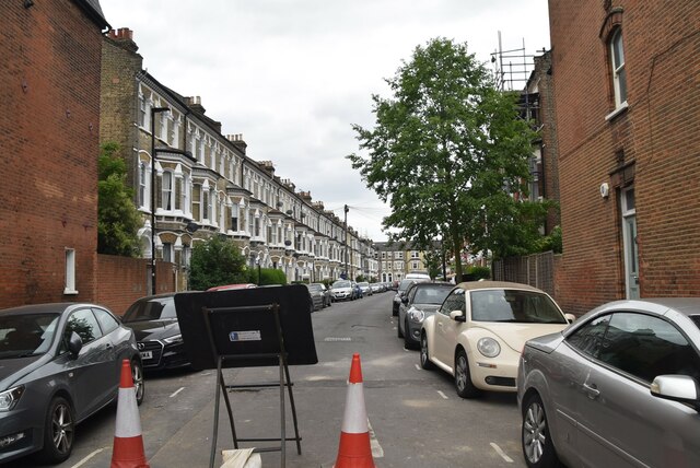
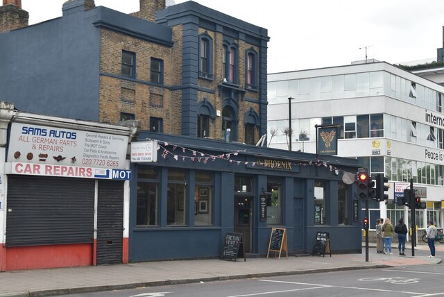
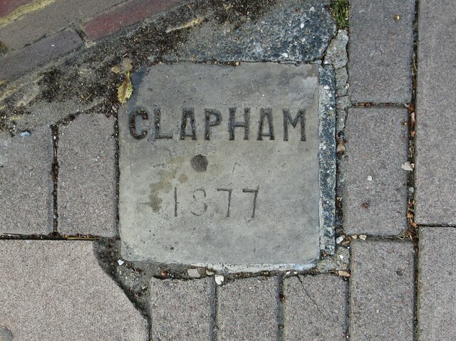
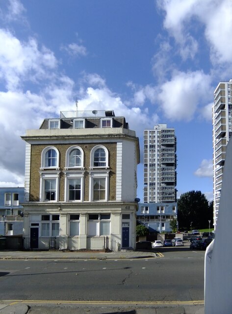
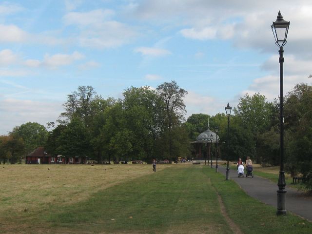
Eagle Pond Images

Images are sourced within 2km of 51.45604/-0.14518503 or Grid Reference TQ2874. Thanks to Geograph Open Source API. All images are credited.

Brixton Windmill The Windmill at Brixton in London
Brixton Windmill
The Windmill at Brixton in London
Sainsbury's Local on Clapham Road
The Clapham North public house On Clapham Road.
See <a href="https://www.geograph.org.uk/photo/7258871">TQ3075 : Sign for the Clapham North public house</a> for sign.
The Clapham North public house
On Clapham Road. See TQ3075 : Sign for the Clapham North public house for sign.
Sign for the Clapham North public house See <a href="https://www.geograph.org.uk/photo/7258870">TQ3075 : The Clapham North public house</a> for public house.
Sign for the Clapham North public house
Clapham Road (A3)
Clapham Road (A3)
Houses on Clapham Road
Labyrinth #111, Clapham North Clapham North is an Underground station in Clapham. It is on the Northern line between Clapham Common and Stockwell. The station is located in Travelcard Zone 2, at the northern end of Clapham High Street, and a short walk away from Clapham High Street railway station. Although there is no direct interchange between the two. The station opened in 1900.
Labyrinth #111, Clapham North
Clapham North is an Underground station in Clapham. It is on the Northern line between Clapham Common and Stockwell. The station is located in Travelcard Zone 2, at the northern end of Clapham High Street, and a short walk away from Clapham High Street railway station. Although there is no direct interchange between the two. The station opened in 1900.
Clapham North Station Clapham North is an Underground station in Clapham. It is on the Northern line between Clapham Common and Stockwell. The station is located in Travelcard Zone 2, at the northern end of Clapham High Street, and a short walk away from Clapham High Street railway station. Although there is no direct interchange between the two. The station opened in 1900.
Clapham North Station
Clapham North is an Underground station in Clapham. It is on the Northern line between Clapham Common and Stockwell. The station is located in Travelcard Zone 2, at the northern end of Clapham High Street, and a short walk away from Clapham High Street railway station. Although there is no direct interchange between the two. The station opened in 1900.
Clapham North Station A few years ago I read a book by Mark Mason "Walking the lines" in which he walked the route of the London Underground lines, overground. I will repeat this visiting all 272 stations (some more than once). My route tries to follow the line of the railway as closely as possible, using footpaths and roads, deviations are made to make the walk more "interesting".
Clapham North Station
A few years ago I read a book by Mark Mason "Walking the lines" in which he walked the route of the London Underground lines, overground. I will repeat this visiting all 272 stations (some more than once). My route tries to follow the line of the railway as closely as possible, using footpaths and roads, deviations are made to make the walk more "interesting".
Church of St Bede Grade II listed.
Church of St Bede
Grade II listed.
Church of St John Grade II listed.
Church of St John
Grade II listed.
Clapham Rd The A3 runs from London to Portsmouth <a href="https://www.geograph.org.uk/photo/7104617">SZ6299 : End of the road (A3)</a>.
The A3, known as the Portsmouth Road for much of its length, is a dual carriageway, or expressway, which follows the historic route between London and Portsmouth. For much of its 67 mile length, it is a trunk road and, apart from a section in London is dual carriageway. At its southerly end, the original road has been replaced by the A3(M), but the designation A3 is still used to identify the old road. The road goes through the newly constructed Hindhead Tunnel.
Clapham Rd
The A3 runs from London to Portsmouth SZ6299 : End of the road (A3). The A3, known as the Portsmouth Road for much of its length, is a dual carriageway, or expressway, which follows the historic route between London and Portsmouth. For much of its 67 mile length, it is a trunk road and, apart from a section in London is dual carriageway. At its southerly end, the original road has been replaced by the A3(M), but the designation A3 is still used to identify the old road. The road goes through the newly constructed Hindhead Tunnel.
Stirling Rd
Stirling Rd
Phoenix
Phoenix
Old Boundary Marker on Emmanuel Road, London SW12 Parish Boundary Marker set in the pavement on the northwest side of the junction of Emmanuel Road and the B221 Thornton Road, both SW12. On the former boundary of Clapham and Streatham parishes, now Lambeth Borough. 

Milestone Society National ID: SY_CLAP13pb
Old Boundary Marker on Emmanuel Road, London SW12
Parish Boundary Marker set in the pavement on the northwest side of the junction of Emmanuel Road and the B221 Thornton Road, both SW12. On the former boundary of Clapham and Streatham parishes, now Lambeth Borough. Milestone Society National ID: SY_CLAP13pb
A view from Wandsworth Road Seen from a point not far south-west of Wandsworth Road station.

The building just across the road must have been a pub for most of its existence.  Another contributor gives the names of the two high-rise blocks as Amesbury Tower and Durrington Tower - both names with megalithic associations: <a title="https://www.geograph.org.uk/photo/421969" href="https://www.geograph.org.uk/photo/421969">Link</a>
A view from Wandsworth Road
Seen from a point not far south-west of Wandsworth Road station. The building just across the road must have been a pub for most of its existence. Another contributor gives the names of the two high-rise blocks as Amesbury Tower and Durrington Tower - both names with megalithic associations: Link
Matrimony Place, Clapham A curious survival that must date back centuries - a passageway leading up from Wandsworth Road to Rectory Grove, passing through St Paul's churchyard.   

How - I wonder - did it get its name?
Matrimony Place, Clapham
A curious survival that must date back centuries - a passageway leading up from Wandsworth Road to Rectory Grove, passing through St Paul's churchyard. How - I wonder - did it get its name?
Show me another place!

Eagle Pond is located at Grid Ref: TQ2874 (Lat: 51.45604, Lng: -0.14518503)

Unitary Authority: Lambeth

Police Authority: Metropolitan

What 3 Words

///sailor.global.level. Near Brixton Hill, London

Related Wikis

Clapham Common

Clapham Common is a large triangular urban park in Clapham, south London, England. Originally common land for the parishes of Battersea and Clapham, it...

South London Hospital for Women and Children

The South London Hospital for Women and Children was a general hospital treating women and children on Clapham Common in London, UK. It was also known...

Clapham South tube station

Clapham South is a station on London Underground's Northern line between Clapham Common and Balham. The station is located at the corner of Balham Hill...

Lambeth Academy

The Elms Academy is a mixed secondary academy in the London borough of Lambeth. Its sponsor is United Learning. == Admissions == The Elms Academy is owned...

Clapham Park

Clapham Park is an area in the Borough of Lambeth in London, to the south of central Clapham and west of Brixton. == History == The original Clapham Park...

Clapham Common (ward)

Clapham Common was an administrative division of the London Borough of Lambeth, United Kingdom from 2002 to 2022. == Demography == The ward stretched south...

Clapham College

Clapham College was a Roman Catholic secondary school for boys in South London. == Background == It opened in 1897 and closed in 1989. Its history falls...

Saint Francis Xavier College, Clapham

Saint Francis Xavier College is a Roman Catholic sixth form college in South West London, England. It is located on the borders of Wandsworth and Lambeth...

Nearby Amenities

Located within 500m of 51.45604,-0.14518503
Crossing
Bicycle: yes
Crossing: traffic_signals
Crossing Island: no
Crossing Ref: toucan
Tactile Paving: yes
Traffic Signals Sound: yes
Lat/Long: 51.4547245/-0.1491236
Crossing
Crossing: marked
Crossing Island: no
Crossing Markings: yes
Crossing Ref: zebra
Tactile Paving: yes
Traffic Calming: table
Lat/Long: 51.4529306/-0.1494761
Surface: asphalt
Traffic Calming: table
Lat/Long: 51.4554073/-0.1424661
Surface: asphalt
Traffic Calming: table
Lat/Long: 51.454825/-0.1409396
Clapham South
Fare Zone: 2;3
Line: Northern
Name Ru: Клэпхем-Саут
Naptan AtcoCode: 940GZZLUCPS
Network: London Underground
Network Wikidata: Q20075
Public Transport: station
Railway: station
Station: subway
Subway: yes
Wheelchair: no
Wikidata: Q1095083
Wikipedia: en:Clapham South tube station
Lat/Long: 51.4527671/-0.1476057
Traffic Calming: cushion
Lat/Long: 51.4560758/-0.1392654
Pub
The Abbeville
Addr City: London
Addr Housenumber: 67-69
Addr Postcode: SW4 9JW
Addr Street: Abbeville Road
Fhrs Authority: Lambeth
Fhrs Id: 482925
Fhrs Inspectiondate: 2013-02-13
Fhrs Rating: 3
Toilets: yes
Toilets Access: customers
Lat/Long: 51.454953/-0.1395127
Telephone
Booth: KX200
Lat/Long: 51.4531941/-0.1409649
Created By: Potlatch 0.7
Shop: convenience
Lat/Long: 51.4538667/-0.1458518
Tesco
Addr City: London
Addr Housename: South Clapham Hospital
Addr Housenumber: 128
Addr Postcode: SW4 9DF
Addr Street: Clapham Common South Side
Alt Name: Tesco Clapham Superstore
Brand: Tesco
Brand Wikidata: Q487494
Brand Wikipedia: en:Tesco
Check Date: 2023-08-29
Contact Website: https://www.tesco.com/store-locator/london/128-clapham-common-south-side
Fhrs Id: 483345
Opening Hours: Mo-Sa 08:00-22:00; Su 10:00-16:00
Shop: supermarket
Source Addr: FHRS Open Data
Wheelchair: yes
Lat/Long: 51.4530045/-0.1465366
Crossing
Bicycle: yes
Crossing: traffic_signals
Crossing Ref: toucan
Lat/Long: 51.4555569/-0.1509758
Crossing
Crossing: unmarked
Crossing Markings: no
Lat/Long: 51.4523773/-0.1421507
Bicycle Parking
Bicycle Parking: stands
Capacity: 4
Covered: no
Source: survey ch
Lat/Long: 51.4545817/-0.1397457
Car Sharing
Capacity: 1
Operator: Streetcar
Source: WebSite
Lat/Long: 51.4563/-0.1424
Car Sharing
Capacity: 1
Operator: Streetcar
Source: WebSite
Lat/Long: 51.4531/-0.1418
Crossing
Bicycle: yes
Crossing: traffic_signals
Crossing Ref: toucan
Lat/Long: 51.4596672/-0.141193
Pub
The Windmill
Addr City: London
Addr Postcode: SW4 9DE
Addr Street: Windmill Drive
Email: windmillhotel@youngs.co.uk
Fhrs Authority: Lambeth
Fhrs Id: 483109
Fhrs Inspectiondate: 2010-08-03
Fhrs Rating: 5
Opening Hours Covid19: closed
Operator: Youngs
Outdoor Seating: yes
Phone: +44 20 8673 4578
Toilets: yes
Toilets Access: customers
Website: https://www.windmillclapham.co.uk/
Lat/Long: 51.4575038/-0.1441572
Clapham Common
Rcn: yes
Rcn Name: Clapham Common
Lat/Long: 51.4566386/-0.1467963
Post Box
Post Box Type: pillar
Ref: SW4 12
Lat/Long: 51.4576861/-0.1424925
Cafe
Pear Tree Cafe
Cuisine: italian;pizza;pasta;pastry;ice_cream
Opening Hours: Mo, Tu 08:00-18:00; We-Sa 08:00-22:00; Su 08:00-19:00
Outdoor Seating: yes
Phone: +44 20 7924 2429
Takeaway: yes
Website: https://www.peartreecafe.co.uk/
Wheelchair: yes
Lat/Long: 51.4583633/-0.1486927
Bus Stop
Cavendish Road Police Station
Bus: yes
Local Ref: SJ
Naptan AtcoCode: 490004889E
Naptan Bearing: E
Naptan CommonName: Cavendish Road Police Station
Naptan Indicator: Stop SJ
Naptan Verified: no
Public Transport: platform
Lat/Long: 51.4526479/-0.142473
Bus Stop
Cavendish Road Police Station
Bus: yes
Local Ref: SM
Naptan AtcoCode: 490004889W
Naptan Bearing: W
Naptan CommonName: Cavendish Road Police Station
Naptan Indicator: Stop SM
Naptan Verified: no
Public Transport: platform
Lat/Long: 51.4527353/-0.1428547
Bus Stop
Cavendish Road / Clapham South Station
Bus: yes
Local Ref: SN
Naptan AtcoCode: 490005329SG
Naptan Bearing: N
Naptan CommonName: Cavendish RdClapham South Stn
Naptan Indicator: SN
Naptan Verified: no
Public Transport: platform
Ref: 71302
Source Ref: naptan
Lat/Long: 51.4537172/-0.1453244
Bus Stop
Cavendish Road / Clapham South Station
Bus: yes
Local Ref: SH
Naptan AtcoCode: 490005329SH
Naptan Bearing: E
Naptan CommonName: Cavendish RdClapham South Stn
Naptan Indicator: SH
Naptan Street: CAVENDISH ROAD
Naptan Verified: no
Public Transport: platform
Ref: 59070
Source Ref: naptan
Lat/Long: 51.4539937/-0.1456964
Bus Stop
Elms Road / Windmill on the Common
Bus: yes
Departures Board: timetable
Local Ref: C
Naptan AtcoCode: 490006520N
Naptan Bearing: N
Naptan CommonName: Elms RdWindmill On The Common
Naptan Indicator: Stop C
Naptan Street: CLAPHAM COMMON SOUTH SIDE
Naptan Verified: no
Public Transport: platform
Shelter: yes
Lat/Long: 51.457172/-0.1435402
Bus Stop
Elms Road / Windmill on the Common
Bench: yes
Bus: yes
Local Ref: J
Naptan AtcoCode: 490006520S
Naptan Bearing: S
Naptan CommonName: Elms RdWindmill On The Common
Naptan Indicator: Stop J
Naptan Street: CLAPHAM COMMON SOUTH SIDE
Naptan Verified: no
Public Transport: platform
Shelter: yes
Lat/Long: 51.4565485/-0.1438391
Bus Stop
Lynette Avenue
Bus: yes
Local Ref: SE
Naptan AtcoCode: 490009474SE
Naptan Bearing: S
Naptan CommonName: Lynette Avenue Clapham South
Naptan Indicator: SE
Naptan Street: CLAPHAM COMMON SOUTH SIDE
Naptan Verified: no
Public Transport: platform
Ref: 77729
Source Ref: naptan
Lat/Long: 51.4544412/-0.1458909
Bus Stop
Lynette Avenue
Bench: yes
Bin: no
Bus: yes
Local Ref: SF
Naptan AtcoCode: 490009474SF
Naptan Bearing: N
Naptan CommonName: Lynette Avenue Clapham South
Naptan Indicator: SF
Naptan Street: CLAPHAM COMMON SOUTH SIDE
Naptan Verified: no
Public Transport: platform
Ref: 55760
Shelter: yes
Source Ref: naptan
Lat/Long: 51.4545265/-0.1460222
Bus Stop
Clapham South Station
Bench: yes
Bus: yes
Local Ref: SA
Naptan AtcoCode: 490000052SA
Naptan Bearing: W
Naptan CommonName: Clapham South
Naptan Indicator: Stop SA
Naptan Street: NIGHTINGALE LANE
Naptan Verified: no
Public Transport: platform
Shelter: yes
Tactile Paving: no
Lat/Long: 51.4529021/-0.1485537
Bus Stop
Clapham South Station
Bench: yes
Bus: yes
Local Ref: SB
Naptan AtcoCode: 490000052SB
Naptan Bearing: E
Naptan CommonName: Clapham South
Naptan Indicator: Stop SB
Naptan Street: NIGHTINGALE LANE
Naptan Verified: no
Public Transport: platform
Shelter: yes
Tactile Paving: no
Lat/Long: 51.4530019/-0.1484153
Bus Stop
Clapham South Station
Bench: yes
Bus: yes
Local Ref: SC
Naptan AtcoCode: 490000052SC
Naptan Bearing: N
Naptan CommonName: Clapham South
Naptan Indicator: Stop SC
Naptan Street: BALHAM HILL
Naptan Verified: no
Public Transport: platform
Shelter: yes
Tactile Paving: no
Lat/Long: 51.4526357/-0.1476073
Bus Stop
Clapham South Station
Bench: yes
Bus: yes
Local Ref: SD
Naptan AtcoCode: 490000052SD
Naptan Bearing: S
Naptan CommonName: Clapham South
Naptan Indicator: Stop SD
Naptan Street: BALHAM HILL
Naptan Verified: no
Public Transport: platform
Shelter: yes
Tactile Paving: no
Lat/Long: 51.4525186/-0.1474938
Crossing
Kerb: lowered
Lat/Long: 51.4564628/-0.1478547
Euro Lodge Clapham
Addr Housenumber: 89
Addr Street: Clapham South Side Road
Contact Phone: +44 20 8772 1234
Internet Access: wlan
Name Botanical: Lynette Avenue
Operator: Eurohotels Group
Postal Code: SW4 9DJ
Source: local_knowledge
Tourism: hotel
Website: www.eurohotelgroup.co.uk
Wheelchair: yes
Lat/Long: 51.4546813/-0.1454482
WHSmith
Branch: Local
Brand: WHSmith
Brand Wikidata: Q1548712
Brand Wikipedia: en:WHSmith
Drive Through: no
Ref: SW4 1
Shop: newsagent
Lat/Long: 51.4542239/-0.1398283
Post Box
Operator: Royal Mail
Operator Wikidata: Q638098
Ref: SW4 15
Lat/Long: 51.4552136/-0.1452054
Surface: paving_stones
Traffic Calming: table
Lat/Long: 51.4573236/-0.1434348
The Windmill
Operator: Youngs
Tourism: hotel
Lat/Long: 51.4577709/-0.1442608
Crossing
Crossing: traffic_signals
Crossing Ref: pelican
Lat/Long: 51.4526923/-0.1473552
Crossing
Crossing: uncontrolled
Crossing Ref: zebra
Lat/Long: 51.4521783/-0.1421587
Cafe
The Georgian
Addr City: London
Addr Housenumber: 27
Addr Postcode: SW12 9DX
Addr Street: Balham Hill
Fhrs Id: 297298
Source Addr: FHRS Open Data
Wheelchair: yes
Lat/Long: 51.4521568/-0.1475348
Fast Food
Chicken Cottage
Addr City: London
Addr Housenumber: 31
Addr Postcode: SW12 9DX
Addr Street: Balham Hill
Brand: Chicken Cottage
Brand Wikidata: Q5096233
Cuisine: chicken
Fhrs Id: 297789
Source Addr: FHRS Open Data
Takeaway: yes
Wheelchair: yes
Lat/Long: 51.4519673/-0.1476149
Addr Housenumber: 29
Addr Street: Balham Hill
Lat/Long: 51.4521067/-0.1480514
Addr Housenumber: 33
Addr Street: Balham Hill
Lat/Long: 51.452236/-0.1480239
Bench
Lat/Long: 51.4596998/-0.1410039
Addr Housenumber: 75
Lat/Long: 51.4558282/-0.1442564
Cafe
Sequoia Lounge
Addr Housenumber: 5
Addr Street: Cavendish Parade
Wheelchair: no
Lat/Long: 51.4537243/-0.1463492
Addr Housenumber: 62
Lat/Long: 51.4571657/-0.1428976
Addr Housenumber: 77
Lat/Long: 51.4557068/-0.144388
Dexters
Brand: Dexters
Brand Wikidata: Q113950230
Office: estate_agent
Lat/Long: 51.4535043/-0.1465799
Bar
Gigalum
Lat/Long: 51.4536596/-0.1464242
Euro Hotel Clapham
Addr Street: Clapham South Side Road
Operator: Euro Hotels Group
Source: local_knowledge
Tourism: hotel
Wheelchair: yes
Lat/Long: 51.4553637/-0.1446562
Headmasters
Addr Housenumber: 11
Brand: Headmasters
Brand Wikidata: Q113700332
Shop: hairdresser
Wheelchair: limited
Lat/Long: 51.4534216/-0.1466749
Costcutter
Brand: Costcutter
Brand Wikidata: Q5175072
Brand Wikipedia: en:Costcutter
Shop: convenience
Wheelchair: yes
Lat/Long: 51.4561664/-0.1439191
Cafe
Costa
Addr City: London
Addr Housenumber: 15
Addr Postcode: SW12 9DY
Addr Street: Balham Hill
Brand: Costa
Brand Wikidata: Q608845
Brand Wikipedia: en:Costa Coffee
Cuisine: coffee_shop
Fhrs Id: 483414
Takeaway: yes
Wheelchair: yes
Lat/Long: 51.4526355/-0.1473026
Fast Food
Chatkhara
Cuisine: indian
Lat/Long: 51.4525428/-0.1473632
Cafe
Mirage
Lat/Long: 51.453909/-0.1461102
Ref GB Tflcid: RWG100197
Traffic Calming: hump
Lat/Long: 51.452669/-0.1468451
Addr Housenumber: 64-68
Addr Street: Clapham Common South Side
Lat/Long: 51.4563478/-0.1435769
Restaurant
Pizzeria on the Green
Addr City: London
Addr Housename: Cavendish Parade
Addr Housenumber: 4
Addr Postcode: SW4 9DW
Addr Street: Clapham Common South Side
Fhrs Id: 483925
Source Addr: FHRS Open Data
Wheelchair: yes
Lat/Long: 51.4538084/-0.146251
Addr Housenumber: 61
Lat/Long: 51.4572825/-0.1427981
Addr Housenumber: 76
Lat/Long: 51.4557674/-0.1443177
Crossing
Bicycle: yes
Crossing: traffic_signals
Crossing Ref: toucan
Lat/Long: 51.4575915/-0.143008
Man Made: surveillance
Surveillance: outdoor
Lat/Long: 51.4554729/-0.144691
Penguin
Shop: dry_cleaning
Lat/Long: 51.4534664/-0.1466268
Bar
Firefly
Lat/Long: 51.456217/-0.1438869
Addr Housenumber: 63
Lat/Long: 51.4570629/-0.142997
Man Made: surveillance
Surveillance: outdoor
Lat/Long: 51.4552982/-0.1448686
Addr Housenumber: 130
Addr Street: Clapham Common South Side
Lat/Long: 51.4530015/-0.1468625
Duck & Hedges
Office: yes
Lat/Long: 51.4561149/-0.1439833
Dentist
Clapham South Dental
Healthcare: dentist
Wheelchair: yes
Lat/Long: 51.4525895/-0.1473357
Addr Housenumber: 1
Addr Street: Wakeford Close
Lat/Long: 51.4566885/-0.1432374
Restaurant
Haweli of Clapham
Cuisine: indian
Lat/Long: 51.4538733/-0.1461722
Entrance: yes
Lat/Long: 51.4571525/-0.1424711
Moxon's
Opening Hours: Tu-Fr 09:00-19:00; Sa 09:00-17:30; Su 10:00-16:00
Phone: +44 20 8675 2468
Shop: seafood
Website: https://moxonsfreshfish.com/
Wheelchair: yes
Lat/Long: 51.4528604/-0.1478397
Addr Housenumber: 27
Lat/Long: 51.4556702/-0.1429405
Post Office
Balham Hill Post Office
Addr City: London
Addr Postcode: SW12 9DZ
Addr Street: Balham Hill
Brand: Post Office
Brand Wikidata: Q1783168
Ref Pol Id: 17967
Wheelchair: yes
Lat/Long: 51.4525045/-0.1478155
Shop: alcohol
Lat/Long: 51.4550014/-0.1394595
Sainsbury's Local
Addr City: London
Addr Housenumber: 36-38
Addr Postcode: SW4 9NG
Addr Street: Abbeville Road
Alt Name: Sainsbury's Clapham Abbeville Road Local
Brand: Sainsbury's Local
Brand Wikidata: Q13218434
Brand Wikipedia: en:Sainsbury's Local
Fhrs Authority: Lambeth
Fhrs Id: 517198
Fhrs Inspectiondate: 2013-02-16
Fhrs Rating: 5
Shop: convenience
Website: https://stores.sainsburys.co.uk/4993/clapham-abbeville-road-local
Lat/Long: 51.4542678/-0.1397877
Restaurant
Newtons Restaurant & Bar
Addr City: London
Addr Housenumber: 33
Addr Postcode: SW4 9LA
Addr Street: Abbeville Road
Cuisine: international
Fhrs Authority: Lambeth
Fhrs Id: 482918
Fhrs Inspectiondate: 2013-02-13
Fhrs Rating: 4
Lat/Long: 51.4540141/-0.1404398
Abbeville Village
Place: neighbourhood
Lat/Long: 51.4545041/-0.1398146
Bicycle Parking
Bicycle Parking: stands
Capacity: 4
Covered: no
Source: survey ch
Lat/Long: 51.4542035/-0.1399647
Bicycle Parking
Bicycle Parking: stands
Capacity: 8
Covered: no
Source: survey ch
Lat/Long: 51.4548812/-0.1392494
Bicycle Parking
Bicycle Parking: stands
Capacity: 2
Covered: no
Source: survey ch
Lat/Long: 51.4527795/-0.142545
Bicycle Parking
Bicycle Parking: stands
Capacity: 8
Covered: no
Source: survey ch
Lat/Long: 51.454947/-0.1393535
Bicycle Parking
Bicycle Parking: stands
Capacity: 2
Covered: no
Source: survey ch
Lat/Long: 51.453662/-0.140882
Bicycle Parking
Bicycle Parking: post_hoop
Capacity: 2
Covered: no
Source: survey ch
Lat/Long: 51.4578162/-0.1431539
Bicycle Parking
Bicycle Parking: stands
Capacity: 6
Covered: no
Source: survey ch
Lat/Long: 51.4582481/-0.1483976
Bicycle Parking
Bicycle Parking: stands
Capacity: 8
Check Date Capacity: 2022-02-20
Covered: no
Source: survey ch
Lat/Long: 51.4597855/-0.1486175
Cafe
Honest Tom's
Addr City: London
Addr Housename: Honest Tom's
Addr Postcode: SW4 9AP
Addr Street: Windmill Drive
Building: no
Cuisine: breakfast;british
Internet Access: no
Note: Mobile facility.
Outdoor Seating: yes
Takeaway: yes
Lat/Long: 51.4559431/-0.1503289
Cafe
Bowling Green Cafe - currently closed
Addr City: London
Addr Postcode: SW4 9AN
Addr Street: Clapham Common West Side
Fhrs Id: 297060
Source Addr: FHRS Open Data
Lat/Long: 51.454289/-0.1518116
Source Traffic Calming: survey
Traffic Calming: rumble_strip
Lat/Long: 51.4565523/-0.1477391
Bicycle Parking: stands
Capacity: 8
Source Capacity: survey
Lat/Long: 51.4596977/-0.1483951
Traffic Calming: rumble_strip
Lat/Long: 51.4582443/-0.1481002
Check Date: 2022-02-20
Traffic Calming: rumble_strip
Lat/Long: 51.4597191/-0.1483346
Traffic Calming: rumble_strip
Lat/Long: 51.4576813/-0.1479701
Traffic Calming: rumble_strip
Lat/Long: 51.457847/-0.1479867
Check Date: 2022-02-20
Traffic Calming: rumble_strip
Lat/Long: 51.4598493/-0.1483605
Traffic Calming: rumble_strip
Lat/Long: 51.4580811/-0.1480617
Restaurant
La Bonne Heure
Addr City: London
Addr Housenumber: 31
Addr Postcode: SW4 9LA
Addr Street: Abbeville Road
Cuisine: french
Fhrs Authority: Lambeth
Fhrs Id: 508069
Fhrs Inspectiondate: 2013-01-26
Fhrs Rating: 5
Lat/Long: 51.453934/-0.1405172
Sainsbury's Local
Addr City: London
Addr Housenumber: 21
Addr Postcode: SW12 9DY
Addr Street: Balham Hill
Alt Name: Sainsbury's Balham Hill Local
Brand: Sainsbury's Local
Brand Wikidata: Q13218434
Brand Wikipedia: en:Sainsbury's Local
Opening Hours: Mo-Su 06:30-24:00
Shop: convenience
Website: https://stores.sainsburys.co.uk/4013/balham-hill-local
Wheelchair: yes
Lat/Long: 51.4523663/-0.1473632
Treohans Hardware
Shop: doityourself
Lat/Long: 51.4538539/-0.1406042
Restaurant
Abbeville Kitchen
Addr City: London
Addr Housenumber: 47
Addr Postcode: SW4 9JX
Addr Street: Abbeville Road
Cuisine: international
Fhrs Authority: Lambeth
Fhrs Id: 483718
Fhrs Inspectiondate: 2012-02-29
Fhrs Rating: 4
Lat/Long: 51.454445/-0.1399977
Restaurant
PizzaExpress
Addr City: London
Addr Housenumber: 43-45
Addr Postcode: SW4 9JX
Addr Street: Abbeville Road
Brand: PizzaExpress
Brand Wikidata: Q662845
Brand Wikipedia: en:PizzaExpress
Cuisine: pizza
Fhrs Authority: Lambeth
Fhrs Id: 482920
Fhrs Inspectiondate: 2007-09-19
Fhrs Rating: 5
Website: https://www.pizzaexpress.com/clapham-abbeville-road
Lat/Long: 51.4542874/-0.1401884
Restaurant
Bistro Union
Cuisine: international
Lat/Long: 51.4543628/-0.1396863
The Ginger Pig
Addr City: London
Addr Housenumber: 55
Addr Place: Clapham
Addr Postcode: SW4 9JW
Addr Street: Abbeville Road
Opening Hours: Mo-Sa 09:00-17:00; Su 10:00-15:00
Phone: +44 203 869 7860
Shop: butcher
Website: https://thegingerpig.co.uk/blogs/locations/clapham/
Lat/Long: 51.4546485/-0.1398261
Fixme: In a hurry, didnt note whtat it was but not Starbucks
Old Amenity: cafe
Old Name: Starbucks
Lat/Long: 51.4542028/-0.1402666
Traffic Calming: cushion
Lat/Long: 51.4565172/-0.1399743
Semokwan Hapkido Academy
Addr City: London
Addr Housename: The Contact Centre
Addr Housenumber: 60
Addr Postcode: SW4 9EH
Addr Street: Hambalt Road
Building: house
Leisure: sports_centre
Phone: +44 7932 667 336
Sport: hapkido
Website: http://semokwan-hapkido.co.uk/
Lat/Long: 51.4549318/-0.1415387
Bench
Backrest: yes
Source: gps+mapnoter
Lat/Long: 51.4589549/-0.1432953
Bench
Backrest: yes
Source: gps+mapnoter
Lat/Long: 51.4590459/-0.1435913
Bench
Backrest: yes
Source: gps+mapnoter
Lat/Long: 51.4590597/-0.1429262
Bench
Backrest: yes
Source: gps+mapnoter
Lat/Long: 51.4593083/-0.1435668
Waste Basket
Source: gps+mapnoter
Lat/Long: 51.4581339/-0.1485819
Bench
Backrest: yes
Source: gps+mapnoter
Lat/Long: 51.4582237/-0.1469226
Waste Basket
Source: gps+mapnoter
Waste: dog
Lat/Long: 51.4582604/-0.1465792
Waste Basket
Source: gps+mapnoter
Lat/Long: 51.4581939/-0.1481657
Bench
Backrest: yes
Source: gps+mapnoter
Lat/Long: 51.4583005/-0.1461823
Childrens grass play area
Source: gps+mapnoter
Lat/Long: 51.4573496/-0.1499033
Bench
Backrest: yes
Colour: brown
Material: wood
Source: gps+mapnoter
Lat/Long: 51.4569757/-0.1508093
Bench
Backrest: yes
Colour: brown
Material: wood
Source: gps+mapnoter
Lat/Long: 51.4569118/-0.1508725
Patrick Henry
Addr City: London
Addr Housenumber: 25
Addr Postcode: SW12 9DX
Addr Street: Balham Hill
Office: estate_agent
Wheelchair: yes
Lat/Long: 51.4522142/-0.1475054
Post Box
Lat/Long: 51.4542576/-0.1399109
Co-op Food
Brand: Co-op Food
Brand Wikidata: Q3277439
Brand Wikipedia: en:Co-op Food
Operator: The Co-operative Group
Operator Wikidata: Q117202
Shop: supermarket
Website: https://www.coop.co.uk/store-finder/SW4-9NF/56-58-abbeville-road
Lat/Long: 51.4547854/-0.1392317
COOK
Addr City: London
Addr Housenumber: 37
Addr Postcode: SW4 9JX
Addr Street: Abbeville Road
Alt Name: COOK Clapham
Brand: Cook
Brand Wikidata: Q113457474
Operator: Cook
Shop: frozen_food
Lat/Long: 51.4541644/-0.1403112
Bottle Apostle
Drive Through: no
Shop: alcohol
Lat/Long: 51.4547339/-0.1397382
Restaurant
Tokyo Retro
Cuisine: japanese
Lat/Long: 51.4546902/-0.1397798
Eclectic
Shop: kitchen
Lat/Long: 51.4548648/-0.1395995
Piccoli
Shop: gift
Lat/Long: 51.4548206/-0.1396446
KFH
Office: estate_agent
Lat/Long: 51.4545262/-0.1395038
Abbeville Hair and Beauty
Shop: hairdresser
Lat/Long: 51.4545728/-0.1394561
McFarlane's
Shop: deli
Lat/Long: 51.4546151/-0.1394164
Fast Food
Kerbisher & Malt
Addr City: London
Addr Housenumber: 50
Addr Postcode: SW4 9NF
Addr Street: Abbeville Road
Cuisine: fish_and_chips
Drive Through: no
Phone: +44 20 3417 4350
Takeaway: yes
Website: http://www.kerbisher.co.uk/
Wheelchair: yes
Lat/Long: 51.4546587/-0.1393732
Veterinary
David Cuffe & Associates
Lat/Long: 51.4547019/-0.1393227
Chameleon
Shop: beauty
Lat/Long: 51.4547417/-0.1392793
Clapham South
Rcn: yes
Rcn Name: Clapham South station
Lat/Long: 51.4529396/-0.1474116
Traffic Signals
Traffic Signals Direction: backward
Lat/Long: 51.4530856/-0.1473332
Cycleway: asl
Direction: forward
Lat/Long: 51.4539375/-0.1465439
Traffic Signals
Traffic Signals: signal
Traffic Signals Direction: backward
Lat/Long: 51.454326/-0.1461237
Traffic Signals
Traffic Signals: signal
Traffic Signals Direction: forward
Lat/Long: 51.4540138/-0.1460213
Traffic Calming: cushion
Lat/Long: 51.4542205/-0.1446323
Traffic Calming: cushion
Lat/Long: 51.4538652/-0.1436777
Traffic Calming: cushion
Lat/Long: 51.4547343/-0.1442179
Traffic Calming: cushion
Lat/Long: 51.4548317/-0.142704
Traffic Calming: cushion
Lat/Long: 51.4556677/-0.1431304
Taxi
Atlas Cars
Lat/Long: 51.4522923/-0.1479382
Bellissima
Shop: beauty
Wheelchair: limited
Lat/Long: 51.4523308/-0.1479174
Costcutter
Brand: Costcutter
Brand Wikidata: Q5175072
Brand Wikipedia: en:Costcutter
Shop: convenience
Wheelchair: yes
Lat/Long: 51.4525238/-0.1478201
Creative Hair Salon
Shop: hairdresser
Lat/Long: 51.4522221/-0.147965
Fast Food
Doner Inn
Addr City: London
Addr Flats: 2
Addr Housename: Westbury Parade
Addr Postcode: SW12 9DZ
Addr Street: Balham Hill
Cuisine: kebab
Fhrs Id: 296352
Outdoor Seating: no
Source Addr: FHRS Open Data
Takeaway: yes
Wheelchair: limited
Lat/Long: 51.4524248/-0.1478693
Gentlemens Hairdressers
Shop: hairdresser
Wheelchair: yes
Lat/Long: 51.4524604/-0.1478439
Greenfield Dry Cleaners
Shop: dry_cleaning
Wheelchair: yes
Lat/Long: 51.4523768/-0.147892
Fast Food
King Rooster
Addr City: London
Addr Flats: 2a
Addr Housename: Westbury Parade
Addr Postcode: SW12 9DU
Addr Street: Balham Hill
Cuisine: burger;chicken;kebab
Fhrs Id: 296351
Outdoor Seating: no
Source Addr: FHRS Open Data
Takeaway: yes
Wheelchair: no
Lat/Long: 51.452687/-0.1477481
M & J Town
Addr City: London
Addr Housename: Clapham South Station
Addr Postcode: SW12 9DU
Addr Street: Balham Hill
Fhrs Id: 296448
Shop: newsagent
Source Addr: FHRS Open Data
Lat/Long: 51.4527517/-0.1477184
Fast Food
Mayflower
Addr City: London
Addr Flats: 2b
Addr Housename: Westbury Parade
Addr Postcode: SW12 9DU
Addr Street: Balham Hill
Cuisine: chinese
Fhrs Id: 296358
Outdoor Seating: no
Source Addr: FHRS Open Data
Takeaway: only
Wheelchair: limited
Lat/Long: 51.4525949/-0.1477955
Fast Food
Moxie's Fish Bar
Addr City: London
Addr Flats: 7
Addr Housename: Westbury Parade
Addr Postcode: SW12 9DZ
Addr Street: Balham Hill
Cuisine: fish_and_chips
Fhrs Id: 507996
Outdoor Seating: no
Source Addr: FHRS Open Data
Takeaway: only
Wheelchair: limited
Lat/Long: 51.452258/-0.1479516
Bicycle Parking
Bicycle Parking: stands
Capacity: 6
Covered: no
Lat/Long: 51.4520185/-0.1479346
Telephone
Check Date: 2021-02-20
Colour: black
Covered: booth
Description: Not working
Note: not BT
Payment Coins: yes
Lat/Long: 51.4523956/-0.1477982
Bicycle Parking
Bicycle Parking: stands
Capacity: 16
Covered: no
Lat/Long: 51.4527846/-0.1476175
Bicycle Parking
Bicycle Parking: stands
Capacity: 20
Covered: no
Lat/Long: 51.4529305/-0.1477463
Clapham South
Public Transport: stop_position
Railway: stop
Subway: yes
Lat/Long: 51.4530117/-0.1473927
Drinking Water
Bottle: yes
Fountain: drinking
Note: Working again (2023-04-26)
Lat/Long: 51.4585152/-0.1483109
Railway: subway_entrance
Lat/Long: 51.4528688/-0.1477147
Railway: subway_entrance
Lat/Long: 51.4528161/-0.1476459
Railway: subway_entrance
Lat/Long: 51.4528558/-0.1476481
Give Way
Direction: forward
Lat/Long: 51.4547205/-0.149223
Barrier: bollard
Bicycle: yes
Bollard: fixed
Lat/Long: 51.4566673/-0.1467975
Barrier: bollard
Bicycle: yes
Bollard: fixed
Lat/Long: 51.4564226/-0.1478562
Barrier: bollard
Bollard: fixed
Lat/Long: 51.4565057/-0.1478655
Give Way
Direction: forward
Lat/Long: 51.4523948/-0.1419301
Give Way
Direction: forward
Lat/Long: 51.4544985/-0.1396938
Give Way
Direction: backward
Lat/Long: 51.4545389/-0.139785
Atm
Check Date: 2021-02-13
Fee: no
Operator: sainsbury's
Wheelchair: yes
Lat/Long: 51.4524604/-0.1473625
Barrier: bollard
Lat/Long: 51.455612/-0.1509245
Barrier: bollard
Lat/Long: 51.4555236/-0.1510226
Barrier: bollard
Lat/Long: 51.4556624/-0.1508909
Barrier: bollard
Lat/Long: 51.4556955/-0.1509127
Clapham South
Public Transport: stop_position
Railway: stop
Subway: yes
Lat/Long: 51.4530268/-0.1474632
Cycleway: asl
Direction: forward
Lat/Long: 51.452692/-0.1472571
Traffic Signals
Traffic Signals Direction: forward
Lat/Long: 51.4530228/-0.1476374
Cycleway: asl
Direction: backward
Lat/Long: 51.4530431/-0.1473606
Crossing
Crossing: traffic_signals
Crossing Island: yes
Crossing Ref: pelican
Lat/Long: 51.4529046/-0.1472729
Traffic Signals
Traffic Signals Direction: backward
Lat/Long: 51.4528396/-0.1471307
Crossing
Button Operated: yes
Crossing: traffic_signals
Crossing Island: yes
Crossing Markings: dots
Crossing Ref: pelican
Tactile Paving: yes
Traffic Signals Sound: no
Traffic Signals Vibration: yes
Lat/Long: 51.4528246/-0.1474456
Traffic Signals
Traffic Signals Direction: forward
Lat/Long: 51.4527427/-0.1474866
Bench
Lat/Long: 51.4563949/-0.1444735
Bench
Lat/Long: 51.4600258/-0.1479558
Traffic Calming: cushion
Lat/Long: 51.4559024/-0.1382653
Cafe
SHED Clapham South
Wheelchair: limited
Lat/Long: 51.4527926/-0.1476692
Crossing
Crossing: unmarked
Crossing Markings: no
Lat/Long: 51.4540032/-0.1401607
Bicycle Parking
Bicycle Parking: hoop
Capacity: 2
Tfl Id: RWG118364
Lat/Long: 51.4522413/-0.1417684
Bicycle Parking
Bicycle Parking: stands
Capacity: 4
Tfl Id: RWG097952
Lat/Long: 51.4551388/-0.1391876
Bicycle Parking
Bicycle Parking: stands
Capacity: 4
Tfl Id: RWG097999
Lat/Long: 51.4545554/-0.1396407
Bicycle Parking
Bicycle Parking: stands
Capacity: 4
Tfl Id: RWG097980
Lat/Long: 51.4544625/-0.1399081
Bicycle Parking
Bicycle Parking: stands
Capacity: 2
Tfl Id: RWG097989
Lat/Long: 51.4541706/-0.1400345
Bicycle Parking
Bicycle Parking: stands
Capacity: 6
Lat/Long: 51.4533412/-0.1467999
Bicycle Parking
Bicycle Parking: stands
Capacity: 6
Lat/Long: 51.4534214/-0.146738
Bicycle Parking
Bicycle Parking: stands
Capacity: 20
Lat/Long: 51.4532625/-0.1469138
Bench
Backrest: yes
Material: wood,_steel
Lat/Long: 51.4581474/-0.1496573
Waste Basket
Lat/Long: 51.4580532/-0.1497162
Yes
Barrier: planter
Bicycle: yes
Emergency: yes
Foot: yes
Motor Vehicle: no
Note: No motor vehicles except emergency services
Website: https://quietway5.commonplace.is/schemes/proposals/1-windmill-drive-modal-filter/details
Lat/Long: 51.456467/-0.1478422
Yes
Barrier: planter
Bicycle: yes
Emergency: yes
Foot: yes
Motor Vehicle: no
Note: No motor vehicles except emergency services
Website: https://quietway5.commonplace.is/schemes/proposals/1-windmill-drive-modal-filter/details
Lat/Long: 51.4566264/-0.1468636
Give Way
Direction: backward
Lat/Long: 51.4567239/-0.1439126
Give Way
Direction: forward
Lat/Long: 51.4580905/-0.142721
Crossing
Crossing: unmarked
Crossing Island: yes
Lat/Long: 51.4588298/-0.1419852
Crossing
Lat/Long: 51.4579809/-0.1425442
Crossing
Crossing: unmarked
Lat/Long: 51.4573225/-0.143413
Cycleway: asl
Direction: backward
Lat/Long: 51.456226/-0.1442564
Traffic Signals
Traffic Signals: signal
Traffic Signals Direction: backward
Lat/Long: 51.4562582/-0.1442245
Traffic Signals
Traffic Signals: signal
Traffic Signals Direction: forward
Lat/Long: 51.4559982/-0.1444819
Cycleway: asl
Direction: forward
Lat/Long: 51.4560437/-0.1444408
Crossing
Crossing: traffic_signals
Crossing Ref: pelican
Lat/Long: 51.4561796/-0.1443016
Cycleway: asl
Direction: forward
Lat/Long: 51.4560511/-0.1441853
Traffic Signals
Traffic Signals: signal
Traffic Signals Direction: forward
Lat/Long: 51.4560285/-0.1441221
Traffic Calming: cushion
Lat/Long: 51.4559479/-0.1439011
Cycleway: asl
Direction: backward
Lat/Long: 51.4542862/-0.1461632
Cycleway: asl
Direction: forward
Lat/Long: 51.4540345/-0.1460735
Crossing
Button Operated: yes
Crossing: traffic_signals
Crossing Island: yes
Tactile Paving: yes
Traffic Signals Sound: no
Traffic Signals Vibration: yes
Lat/Long: 51.4542516/-0.1461977
Traffic Signals
Traffic Signals: signal
Traffic Signals Direction: forward
Lat/Long: 51.453899/-0.1465808
Traffic Signals
Traffic Signals: signal
Traffic Signals Direction: backward
Lat/Long: 51.4536302/-0.1468615
Cycleway: asl
Direction: backward
Lat/Long: 51.4535937/-0.1469032
Cycleway: asl
Direction: forward
Lat/Long: 51.4527776/-0.1474718
Crossing
Button Operated: yes
Crossing: traffic_signals
Crossing Ref: pelican
Tactile Paving: yes
Traffic Signals Sound: no
Traffic Signals Vibration: yes
Lat/Long: 51.4530228/-0.1475905
Traffic Signals
Traffic Signals: signal
Traffic Signals Direction: forward
Lat/Long: 51.4529641/-0.1477528
Traffic Signals
Traffic Signals Direction: forward
Lat/Long: 51.4534686/-0.1471733
Cycleway: asl
Direction: forward
Lat/Long: 51.4534792/-0.1470129
Cycleway: asl
Direction: backward
Lat/Long: 51.4528605/-0.1471751
Traffic Signals
Traffic Signals: signal
Traffic Signals Direction: forward
Lat/Long: 51.4526835/-0.1472061
Traffic Signals
Traffic Signals: signal
Traffic Signals Direction: backward
Lat/Long: 51.4555312/-0.1509233
Traffic Calming: cushion
Lat/Long: 51.4552369/-0.1389752
Traffic Calming: cushion
Lat/Long: 51.4560045/-0.1414955
Traffic Calming: cushion
Lat/Long: 51.4556785/-0.1414877
Traffic Calming: cushion
Lat/Long: 51.453571/-0.1422623
Traffic Calming: cushion
Lat/Long: 51.4544228/-0.1416069
Traffic Calming: cushion
Lat/Long: 51.4531352/-0.1411644
Traffic Calming: cushion
Lat/Long: 51.4553957/-0.1408473
Traffic Calming: cushion
Lat/Long: 51.4547314/-0.1395175
Traffic Calming: cushion
Lat/Long: 51.4558695/-0.1403759
Traffic Calming: cushion
Lat/Long: 51.454184/-0.1416041
Traffic Calming: cushion
Lat/Long: 51.4551099/-0.1416929
Traffic Calming: cushion
Lat/Long: 51.4561595/-0.1408712
Traffic Calming: cushion
Lat/Long: 51.4539587/-0.1421746
Traffic Calming: cushion
Lat/Long: 51.4570469/-0.1409072
Traffic Calming: cushion
Lat/Long: 51.4552016/-0.1436827
Traffic Calming: cushion
Lat/Long: 51.4538056/-0.1404604
Traffic Calming: cushion
Lat/Long: 51.4534716/-0.1426344
Traffic Calming: cushion
Lat/Long: 51.4548094/-0.138902
Traffic Calming: cushion
Lat/Long: 51.4574994/-0.1418641
Traffic Calming: cushion
Lat/Long: 51.4543419/-0.1431847
Restaurant
No 3 at Nightingale Place
Website: https://www.no3clapham.co.uk
Lat/Long: 51.452666/-0.1487287
Crossing
Crossing: marked
Crossing Markings: yes
Tactile Paving: yes
Lat/Long: 51.4535804/-0.1470678
Cycleway: asl
Direction: forward
Lat/Long: 51.4535082/-0.1471957
Traffic Signals
Traffic Signals Direction: forward
Lat/Long: 51.4534409/-0.1470506
Barrier: bollard
Bollard: fixed
Lat/Long: 51.4561745/-0.1445323
Traffic Signals
Bicycle: yes
Traffic Signals Direction: backward
Lat/Long: 51.4561786/-0.1445447
Crossing
Button Operated: yes
Crossing: traffic_signals
Crossing Ref: pelican
Tactile Paving: yes
Traffic Signals Sound: no
Traffic Signals Vibration: yes
Lat/Long: 51.4529654/-0.1478146
Give Way
Direction: backward
Lat/Long: 51.4547939/-0.1409708
Give Way
Direction: forward
Lat/Long: 51.4548533/-0.1409099
Give Way
Direction: backward
Lat/Long: 51.4554375/-0.1424414
Traffic Signals
Traffic Signals: signal
Traffic Signals Direction: forward
Lat/Long: 51.4555855/-0.1510304
Give Way
Direction: backward
Lat/Long: 51.4556781/-0.1511417
Give Way
Direction: backward
Lat/Long: 51.4565215/-0.1477281
Jack Hobbs
Historic: memorial
Inscription: Sir Jack Hobbs (1882-1963) Cricketer lived here
Memorial: blue_plaque
Openplaques Id: 112
Subject Wikidata: Q967556
Lat/Long: 51.4528127/-0.145037
Traffic Calming: bump
Lat/Long: 51.4527145/-0.1416036
Give Way
Direction: forward
Lat/Long: 51.453293/-0.1409359
Give Way
Direction: backward
Lat/Long: 51.4523712/-0.1421815
Give Way
Direction: backward
Lat/Long: 51.4598334/-0.1483579
Give Way
Direction: forward
Lat/Long: 51.4597372/-0.1483391
Give Way
Direction: backward
Lat/Long: 51.458208/-0.1480916
Give Way
Direction: forward
Lat/Long: 51.4581155/-0.1480697
Give Way
Direction: backward
Lat/Long: 51.4577881/-0.1479755
Give Way
Direction: forward
Lat/Long: 51.4577081/-0.1479701
Bench
Tom's bench
Backrest: yes
Colour: brown
Description: A bench commemorating Tom Hucklesby
Material: wood
Source: gps+mapnoter;local knowledge
Lat/Long: 51.4561437/-0.1505355
Bench
Backrest: yes
Material: wood,_steel
Lat/Long: 51.4582006/-0.1495888
Bench
Backrest: yes
Material: wood,_steel
Lat/Long: 51.4582509/-0.1494433
Bench
Backrest: yes
Material: wood,_steel
Lat/Long: 51.45821/-0.1490493
Bench
Backrest: yes
Material: wood,_steel
Lat/Long: 51.4581222/-0.1489558
Bench
Backrest: yes
Material: wood,_steel
Lat/Long: 51.4580266/-0.1497334
Bench
Backrest: yes
Material: wood,_steel
Lat/Long: 51.457919/-0.1497148
Bench
Backrest: yes
Material: wood,_steel
Lat/Long: 51.4578582/-0.1496645
Bench
Backrest: yes
Material: wood,_steel
Lat/Long: 51.4578172/-0.1496119
Bench
Backrest: yes
Material: wood,_steel
Lat/Long: 51.4577531/-0.1494733
Bench
Backrest: yes
Material: wood,_steel
Lat/Long: 51.4577671/-0.1491041
Bench
Backrest: yes
Material: wood,_steel
Lat/Long: 51.4578087/-0.1490181
Bench
Backrest: yes
Material: wood,_steel
Lat/Long: 51.4578704/-0.148951
Bench
Backrest: yes
Material: wood,_steel
Lat/Long: 51.4579306/-0.1489028
Bench
Backrest: yes
Material: wood,_steel
Lat/Long: 51.4579938/-0.1488912
Drinking Water
Access: yes
Fee: no
Indoor: no
Wheelchair: yes
Lat/Long: 51.457035/-0.1457848
Clapham Flowers
Addr City: London
Addr Housename: UNIT E Clapham South Station
Addr Postcode: SW4 9AE
Addr Street: Nightingale Lane
Email: claphamflowers@hotmail.co.uk
Opening Hours: Mo 08:00-18:00; Tu-Fr 08:00-20:00; Sa 08:00-19:00; Su 09:00-16:00
Phone: +44 20 867 32958
Shop: florist
Website: https://www.claphamflowers.co.uk/
Wheelchair: yes
Lat/Long: 51.45286/-0.1478945
Restaurant
The Urban Greek
Cuisine: greek
Delivery: yes
Takeaway: yes
Lat/Long: 51.4517982/-0.1474691
Bicycle Parking
Capacity: 30
Covered: no
Lat/Long: 51.4528708/-0.1484662
Telephone
Booth: InLink
Operator: BT
Operator Wikidata: Q593786
Lat/Long: 51.4519581/-0.147707
Post Box
Post Box Type: pillar
Lat/Long: 51.452451/-0.147779
Bicycle Parking
Bicycle Parking: stands
Capacity: 8
Covered: no
Lat/Long: 51.4523792/-0.1475293
Traffic Calming: cushion
Lat/Long: 51.4521875/-0.1414656
Traffic Calming: table
Lat/Long: 51.4523921/-0.1421148
Barrier: turnstile
Lat/Long: 51.4528386/-0.1476897
Crossing
Crossing: marked
Crossing Markings: yes
Not Crossing: traffic_signals
Lat/Long: 51.456076/-0.1442533
Give Way
Direction: forward
Lat/Long: 51.4556119/-0.1447732
Crossing
Crossing: unmarked
Lat/Long: 51.4554474/-0.1424319
Crossing
Crossing: unmarked
Crossing Markings: no
Lat/Long: 51.4548644/-0.1408986
Crossing
Crossing: unmarked
Crossing Markings: no
Lat/Long: 51.4545447/-0.1397997
Crossing
Crossing: unmarked
Crossing Markings: no
Lat/Long: 51.4545528/-0.1397045
Crossing
Lat/Long: 51.4547841/-0.1409805
Crossing
Crossing: unmarked
Crossing Markings: no
Lat/Long: 51.4544823/-0.1397777
Crossing
Lat/Long: 51.4542896/-0.1394205
Office: estate_agent
Lat/Long: 51.4544968/-0.139945
Shop: cheese
Lat/Long: 51.4544183/-0.1400655
Give Way
Direction: forward
Lat/Long: 51.457319/-0.143398
Give Way
Direction: backward
Lat/Long: 51.4573419/-0.1434719
Give Way
Direction: backward
Lat/Long: 51.4572084/-0.1438536
Give Way
Direction: forward
Lat/Long: 51.457123/-0.1439114
Crossing
Lat/Long: 51.4555963/-0.1447315
Crossing
Lat/Long: 51.455107/-0.1452149
Crossing
Lat/Long: 51.4546113/-0.1456856
Crossing
Button Operated: no
Crossing: traffic_signals
Crossing Island: no
Crossing Ref: pelican
Traffic Signals Sound: no
Traffic Signals Vibration: no
Lat/Long: 51.4540599/-0.1461372
Give Way
Direction: forward
Lat/Long: 51.4546264/-0.145723
Give Way
Direction: forward
Lat/Long: 51.4551186/-0.1452457
Give Way
Direction: backward
Lat/Long: 51.4556111/-0.138522
Give Way
Direction: backward
Lat/Long: 51.4556523/-0.1385889
Give Way
Direction: backward
Lat/Long: 51.4549656/-0.1391855
Give Way
Direction: forward
Lat/Long: 51.4550175/-0.1392798
Give Way
Direction: forward
Lat/Long: 51.4540131/-0.1401825
Give Way
Direction: backward
Lat/Long: 51.4540504/-0.1402882
Give Way
Direction: forward
Lat/Long: 51.4529067/-0.1429424
Crossing
Crossing: unmarked
Crossing Markings: no
Lat/Long: 51.4529043/-0.1414993
Crossing
Crossing: unmarked
Crossing Markings: no
Lat/Long: 51.4523691/-0.1419114
Crossing
Lat/Long: 51.4521866/-0.1416456
Crossing
Crossing: unmarked
Crossing Markings: no
Lat/Long: 51.4532738/-0.1408974
Give Way
Direction: forward
Lat/Long: 51.4544715/-0.1412379
Crossing
Crossing: unmarked
Crossing Markings: no
Lat/Long: 51.4540571/-0.1403053
Traffic Signals
Traffic Signals: signal
Traffic Signals Direction: forward
Lat/Long: 51.4596372/-0.1412345
Traffic Signals
Traffic Signals: signal
Traffic Signals Direction: backward
Lat/Long: 51.4597094/-0.1411302
Barrier: kerb
Kerb: lowered
Tactile Paving: yes
Lat/Long: 51.4536089/-0.14703
Cycleway: asl
Direction: forward
Lat/Long: 51.4540458/-0.1466509
Traffic Signals
Traffic Signals: signal
Traffic Signals Direction: forward
Lat/Long: 51.4540397/-0.1467274
Crossing
Crossing: marked
Crossing Markings: yes
Lat/Long: 51.4540557/-0.1465744
Traffic Calming: island
Lat/Long: 51.4540715/-0.1463944
Traffic Signals
Traffic Signals: signal
Traffic Signals Direction: forward
Lat/Long: 51.4541849/-0.1462763
Crossing
Crossing: marked
Crossing Markings: yes
Lat/Long: 51.4542423/-0.1462086
Crossing
Crossing: unmarked
Crossing Markings: no
Lat/Long: 51.4523003/-0.1475578
Crossing
Crossing: marked
Crossing Markings: yes
Lat/Long: 51.4526955/-0.1473408
Give Way
Direction: backward
Lat/Long: 51.4524876/-0.1462322
Give Way
Direction: forward
Lat/Long: 51.4525048/-0.1463243
Crossing
Crossing: marked
Crossing Markings: yes
Lat/Long: 51.4528857/-0.1472311
Give Way
Direction: forward
Lat/Long: 51.4523119/-0.1476004
Crossing
Button Operated: yes
Crossing: traffic_signals
Tactile Paving: yes
Traffic Signals Vibration: yes
Lat/Long: 51.4535462/-0.1472068
Crossing
Lat/Long: 51.4536305/-0.1466453
Access: no
Barrier: bollard
Foot: yes
Lat/Long: 51.456472/-0.143763
Crossing
Lat/Long: 51.4564335/-0.1438007
Access: no
Barrier: bollard
Foot: yes
Lat/Long: 51.4564102/-0.1438235
Traffic Signals
Traffic Signals: signal
Traffic Signals Direction: backward
Lat/Long: 51.4576245/-0.1429779
Traffic Signals
Traffic Signals: signal
Traffic Signals Direction: forward
Lat/Long: 51.4575456/-0.1430463
Crossing
Lat/Long: 51.459453/-0.1413423
Crossing
Lat/Long: 51.4592107/-0.1415661
Crossing
Lat/Long: 51.4589451/-0.1417746
Crossing
Lat/Long: 51.4587026/-0.1419644
Crossing
Lat/Long: 51.4583387/-0.1422519
Crossing
Lat/Long: 51.4581521/-0.1424022
Crossing
Lat/Long: 51.4578087/-0.1426877
Crossing
Lat/Long: 51.4574289/-0.1430062
Crossing
Crossing: unmarked
Lat/Long: 51.4567467/-0.143931
Crossing
Crossing: unmarked
Lat/Long: 51.4580912/-0.1427526
Crossing
Lat/Long: 51.4530044/-0.1402764
Crossing
Lat/Long: 51.4529191/-0.1401194
Pennypics London - Newborn, Baby, Family & Portrait Photographer
Addr City: London
Addr Housename: Flat 104, Westbury Court
Addr Postcode: SW4 9AD
Addr Street: Nightingale Lane
Craft: photographer
Description: Pennypics is a London based portrait and family photographer offering pregnancy photoshoots, newborn photography, baby, children and family photography at your home and on-location, as well as family portrait photography in the studio.
Opening Hours: Mo-Fr 09:30-18:00
Phone: +44 7493104062
Website: https://www.pennypics.co.uk/
Lat/Long: 51.4521177/-0.1484183
Bicycle Parking
Access: private
Bicycle Parking: shed
Capacity: 6
Operator: cyclehoop
Ref: Bikehangar 1882
Lat/Long: 51.4520015/-0.1463713
Give Way
Direction: forward
Lat/Long: 51.457412/-0.1437612
Bench
Backrest: yes
Source: gps+mapnoter
Lat/Long: 51.4589718/-0.1431035
Street Lamp
Lamp Mount: straight_mast
Lamp Number: 16
Lamp Type: electric
Lat/Long: 51.4585306/-0.1511255
Restaurant
Osteria
Name En: Osteria Toscana
Lat/Long: 51.4539509/-0.1405495
Restaurant
33 Abbeville Road
Lat/Long: 51.4539786/-0.1404775
Jacksons Clapham Estate Agents
Office: estate_agent
Lat/Long: 51.4551623/-0.1392839
Fast Food
Pizza Hut Delivery
Brand: Pizza Hut Delivery
Brand Wikidata: Q107293079
Cuisine: pizza
Delivery: yes
Takeaway: only
Lat/Long: 51.4551965/-0.1392178
Give Way
Direction: backward
Lat/Long: 51.4534154/-0.1424897
Give Way
Direction: backward
Lat/Long: 51.4538873/-0.1419897
Crossing
Lat/Long: 51.4530362/-0.142731
Restaurant
Camile Thai
Addr Housenumber: Camile Thai
Addr Street: Abbeville Road
Lat/Long: 51.4544549/-0.1399721
Traffic Calming: hump
Lat/Long: 51.4556972/-0.1384857
Traffic Calming: hump
Lat/Long: 51.4555746/-0.1386149
Traffic Calming: bump
Lat/Long: 51.4572246/-0.1404093
Traffic Calming: bump
Lat/Long: 51.4573595/-0.1404861
Crossing
Crossing: unmarked
Crossing Markings: no
Lat/Long: 51.4556876/-0.1511133
Crossing
Crossing: unmarked
Crossing Markings: no
Lat/Long: 51.4547079/-0.1492354
Traffic Signals
Traffic Signals: signal
Traffic Signals Direction: backward
Lat/Long: 51.4546972/-0.149062
Traffic Signals
Traffic Signals: signal
Traffic Signals Direction: forward
Lat/Long: 51.4547459/-0.1491819
Barrier: kerb
Kerb: lowered
Tactile Paving: yes
Lat/Long: 51.4539858/-0.1473793
Barrier: kerb
Kerb: lowered
Tactile Paving: yes
Lat/Long: 51.4539608/-0.1473907
Crossing
Crossing: unmarked
Crossing Markings: no
Tactile Paving: yes
Lat/Long: 51.4540241/-0.1473772
Crossing
Crossing: unmarked
Crossing Markings: no
Tactile Paving: yes
Lat/Long: 51.4539461/-0.1474349
Noexit: yes
Lat/Long: 51.4539718/-0.1475071
Noexit: yes
Lat/Long: 51.4547755/-0.1493737
Give Way
Direction: backward
Lat/Long: 51.4543752/-0.1414788
Give Way
Direction: backward
Lat/Long: 51.45565/-0.1400458
Crossing
Crossing: unmarked
Crossing Markings: no
Lat/Long: 51.4556305/-0.1400695
Give Way
Direction: backward
Lat/Long: 51.4552603/-0.1405348
Give Way
Direction: forward
Lat/Long: 51.4558088/-0.1417819
Traffic Calming: cushion
Lat/Long: 51.4556695/-0.142136
Crossing
Crossing: marked
Crossing Markings: yes
Lat/Long: 51.4569693/-0.1406095
Bicycle: yes
Colour Arrow: white
Colour Back: blue
Colour Text: white
Cycle Network: GB:London Cycle Network
Description: LCN fingerpost signs, indicating east for Norbury (LCN5) and north for Clapham Village (LCN3)
Destination: Clapham Village;Norbury
Direction: 340;90
Guide Type: destination
Information: guidepost
Operator: Lambeth Council
Tourism: information
Lat/Long: 51.4564782/-0.1475834
Bicycle: yes
Colour Arrow: white
Colour Back: blue
Colour Text: white
Cycle Network: GB:London Cycle Network
Description: London Cycle Network route signs (turn north for LCN3, LCN5, LCN25, west for LCN3)
Direction: 90
Information: guidepost
Operator: Lambeth Council
Tourism: information
Lat/Long: 51.456514/-0.1473792
Bicycle: yes
Colour Arrow: white
Colour Back: blue
Colour Text: white
Cycle Network: GB:London Cycle Network
Description: London Cycle Network route sign (southeast for LCN5 & 25)
Direction: 250
Information: guidepost
Operator: Lambeth Council
Tourism: information
Lat/Long: 51.4567255/-0.1462319
Bicycle: yes
Colour Arrow: white
Colour Back: blue
Colour Text: white
Cycle Network: GB:London Cycle Network
Description: LCN fingerpost signs, indicating west for Clapham Junction and southeast for Tooting (3 miles)
Destination: Clapham Junction;Tooting
Direction: 160;250
Guide Type: destination
Information: guidepost
Operator: Lambeth Council
Tourism: information
Lat/Long: 51.4567335/-0.1463605
Bicycle: yes
Colour Arrow: white
Colour Back: blue
Colour Text: white
Cycle Network: GB:London Cycle Network
Description: London Cycle Network route sign (west for LCN5 & 25)
Direction: 120
Information: guidepost
Operator: Lambeth Council
Tourism: information
Lat/Long: 51.4567122/-0.1462773
Bicycle: yes
Colour Arrow: white
Colour Back: blue
Colour Text: white
Description: fingerpost showing north for the Avenue Verte
Direction: 80;250
Information: guidepost
Operator: Lambeth Council
Tourism: information
Lat/Long: 51.4564964/-0.1479217
Bicycle: yes
Colour Arrow: white
Colour Back: blue
Colour Text: white
Cycle Network: GB:London Cycle Network
Description: route markers for LCN3, 5 & 25.
Direction: 360;180
Information: guidepost
Operator: Lambeth Council
Tourism: information
Lat/Long: 51.4565162/-0.1477858
Bicycle: yes
Colour Arrow: white
Colour Back: blue
Colour Text: white
Description: Cycle route sign indicating straight on to Tooting Common
Destination: Tooting Common
Direction: 40
Guide Type: destination
Information: guidepost
Operator: Lambeth Council
Tourism: information
Lat/Long: 51.4526871/-0.1415678
Bicycle: yes
Colour Arrow: white
Colour Back: blue
Colour Text: white
Cycle Network: GB:London Cycle Network
Description: London Cycle Network sign indicating to turn into Abbeville Road for Battersea Park (2 miles) and Clapham Common (½ mile)
Destination: Battersea Park;Clapham Common
Direction: 180
Guide Type: destination
Information: guidepost
Operator: Lambeth Council
Tourism: information
Lat/Long: 51.4524275/-0.1421338
Bicycle: yes
Colour Arrow: white
Colour Back: blue
Colour Text: white
Cycle Network: GB:London Cycle Network
Description: London Cycle Nework signs., indicating LCN5 & LCN25 cross the A24 here, with a left turn for Norbury & Dulwich.
Destination: Norbury;Dulwich
Direction: 30
Guide Type: destination
Information: guidepost
Operator: Lambeth Council
Tourism: information
Lat/Long: 51.4561094/-0.1441865
Bicycle: yes
Colour Arrow: white
Colour Back: blue
Colour Text: white
Cycle Network: GB:London Cycle Network
Description: London Cycle Nework route marker for LCN5 and LCN25
Direction: 120
Information: guidepost
Operator: Lambeth Council
Tourism: information
Lat/Long: 51.4561971/-0.1444572
Bicycle: yes
Colour Arrow: white
Colour Back: blue
Colour Text: white
Cycle Network: GB:London Cycle Network
Description: London Cycle Nework signs., indicating straight on for Dulwich (LCN25) and a right turn for Norbury (LCN5)
Destination: Norbury;Dulwich
Direction: 300
Guide Type: destination
Information: guidepost
Operator: Lambeth Council
Tourism: information
Lat/Long: 51.4546144/-0.1398994
Bicycle: yes
Colour Arrow: white
Colour Back: blue
Colour Text: white
Cycle Network: GB:London Cycle Network
Description: London Cycle Nework signs., indicating straight on for Brixton (LCN25)
Destination: Brixton
Direction: 300
Guide Type: destination
Information: guidepost
Operator: Lambeth Council
Tourism: information
Lat/Long: 51.4544728/-0.1395651
Bicycle: yes
Colour Arrow: white
Colour Back: blue
Colour Text: white
Cycle Network: GB:London Cycle Network
Description: London Cycle Nework signs., indicating straight west to Clapham Common (½ mile) and south to Tooting Common (1½ miles) (LCN25)
Destination: Clapham Common;Tooting Common
Direction: 120
Guide Type: destination
Information: guidepost
Note: Error on the sign - southbound route is LCN5, not LCN25
Operator: Lambeth Council
Tourism: information
Lat/Long: 51.4542265/-0.1392956
Bicycle: yes
Colour Arrow: white
Colour Back: blue
Colour Text: white
Description: Cycle route sign indicating straight on to Tooting Common (¾ mile) and Streatham (1½ miles)
Destination: Tooting BecCommon;Streatham
Direction: 340
Guide Type: destination
Information: guidepost
Operator: Lambeth Council
Tourism: information
Lat/Long: 51.4523125/-0.1421244
Bicycle: yes
Colour Back: blue;#DC0963
Colour Text: white
Cycle Network: GB:London Cycleways
Description: Cycle Superhighway 7 sign: 10 mins to Stockwell, 25 mins to Elephant & Castle, 30 mins to the City
Destination: Stockwell;Elephant & Castle;City
Direction: 210
Guide Type: destination
Information: guidepost
Operator: TfL
Tourism: information
Lat/Long: 51.457969/-0.1428258
Bicycle: yes
Colour Back: blue;#DC0963
Colour Text: white
Cycle Network: GB:London Cycleways
Description: Cycle Superhighway 7 sign: 10 mins to Balham, 2 mins to Tooting, 25 mins to Colliers Wood
Destination: Balham;Tooting;Colliers Wood
Direction: 30
Guide Type: destination
Information: guidepost
Operator: TfL
Tourism: information
Lat/Long: 51.4574172/-0.1430292
Traffic Calming: choker
Lat/Long: 51.4546739/-0.1492734
Barrier: kerb
Kerb: lowered
Lat/Long: 51.4546799/-0.1491064
Barrier: kerb
Kerb: lowered
Lat/Long: 51.4546445/-0.1492613
Bicycle Parking
Bicycle Parking: stands
Capacity: 10
Ref GB Tflcid: RWG110568
Lat/Long: 51.4542534/-0.1510114
Bicycle Parking
Bicycle Parking: stands
Capacity: 8
Ref GB Tflcid: RWG097905
Lat/Long: 51.4528188/-0.1472271
Cafe
Nue Ground
Changing Table: yes
Changing Table Count: 1
Changing Table Location: wheelchair_toilet
Cuisine: coffeeshop
Highchair: yes
Kids Area: no
Level: 0
Opening Hours: Mo-Sa 07:30-16:00, 08:00-17:00
Outdoor Seating: yes
Smoking: outside
Takeaway: yes
Toilets: yes
Toilets Access: customers
Toilets Wheelchair: yes
Lat/Long: 51.4541459/-0.1399292
Parcel Locker
Brand: InPost
Brand Wikidata: Q3182097
Check Date: 2023-08-29
Level: 0
Parcel Mail In: yes
Parcel Pickup: yes
Source: survey
Lat/Long: 51.452802/-0.1462946
Bicycle Rental
Clapham South
Bicycle Rental: docking_station
Brand: Santander Cycles
Brand Wikidata: Q807961
Local: Clapham South
Network: tfl_cycle_hire
Official Name: Clapham South, Clapham South
Operator: Serco
Operator Type: public
Operator Wikidata: Q499104
Lat/Long: 51.4530074/-0.1486621
Shelter
Clapham South Deep Level Shelter
Access: private
Depth: 30 m
Fixme: position
Layer: -3
Listed Status: Grade II
Shelter Type: bomb_shelter
Tunnel: yes
Width: 3 m
Lat/Long: 51.4526677/-0.1475714
Shelter
Clapham South Deep Level Shelter
Access: private
Depth: 30 m
Fixme: position
Layer: -3
Listed Status: Grade II
Shelter Type: bomb_shelter
Tunnel: yes
Width: 5 m
Lat/Long: 51.4524859/-0.14746
Addr Housenumber: 1
Addr Street: Timothy Close
Lat/Long: 51.457571/-0.1414136
Addr Housenumber: 2
Addr Street: Timothy Close
Lat/Long: 51.4576002/-0.1414629
Addr Housenumber: 3
Addr Street: Timothy Close
Lat/Long: 51.4576646/-0.1415894
Addr Housenumber: 4
Addr Street: Timothy Close
Lat/Long: 51.4577016/-0.1416519
Addr Housenumber: 5
Addr Street: Timothy Close
Lat/Long: 51.4577695/-0.1417362
Addr Housenumber: 6
Addr Street: Timothy Close
Lat/Long: 51.4577308/-0.1417882
Addr Housenumber: 7
Addr Street: Timothy Close
Lat/Long: 51.4576803/-0.1418155
Addr Housenumber: 1a
Addr Street: Timothy Close
Lat/Long: 51.4574217/-0.1414505
Addr Housenumber: 1b
Addr Street: Timothy Close
Lat/Long: 51.4573678/-0.1412768
Addr Housenumber: 1c
Addr Street: Timothy Close
Lat/Long: 51.4573341/-0.1411676
Addr Housenumber: 1
Addr Street: Timothy Close
Lat/Long: 51.457391/-0.1411258
Addr Housenumber: 78
Lat/Long: 51.4556054/-0.144475
Tactile Paving: yes
Lat/Long: 51.4540359/-0.1461591
Tactile Paving: yes
Lat/Long: 51.4541118/-0.1459886
Tactile Paving: yes
Lat/Long: 51.45408/-0.1461189
Crossing
Button Operated: no
Crossing: traffic_signals
Crossing Island: no
Crossing Ref: pelican
Traffic Signals Sound: no
Traffic Signals Vibration: no
Lat/Long: 51.4540903/-0.1460127
Tactile Paving: yes
Lat/Long: 51.4540719/-0.1460348
Was Highway: crossing
Lat/Long: 51.4541174/-0.1460865
The data included in this document is from www.openstreetmap.org. The data is made available under ODbL.

Have you been to Eagle Pond?

Leave your review of Eagle Pond below (or comments, questions and feedback).