Old Mill Race
Lake, Pool, Pond, Freshwater Marsh in Huntingdonshire Huntingdonshire
England
Old Mill Race
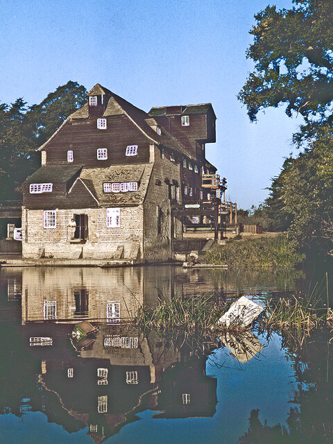
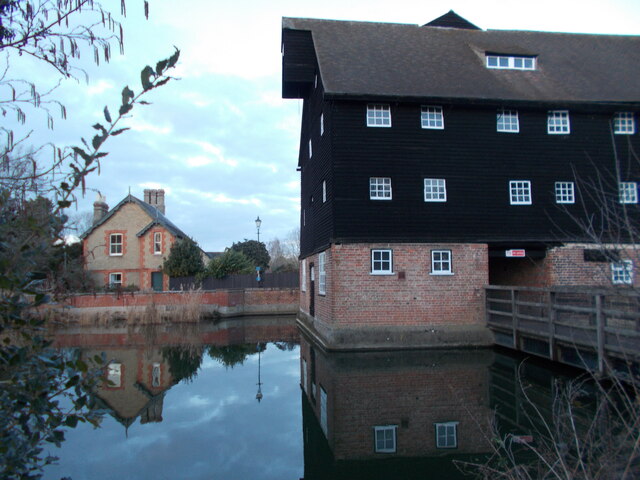
Old Mill Race, located in Huntingdonshire, is a picturesque area consisting of a lake, pool, pond, and freshwater marsh. This natural haven is a popular destination for nature enthusiasts and offers a diverse range of habitats for various species of flora and fauna.
The lake is the centerpiece of Old Mill Race, spanning a significant area and surrounded by lush greenery. It provides a serene setting for boating and fishing activities, attracting both locals and tourists alike. The crystal-clear waters of the lake are home to several species of fish, including trout and perch, making it a prime spot for anglers.
Adjacent to the lake is a pool, a smaller body of water that serves as a breeding ground for amphibians and waterfowl. The pool's shallow waters and surrounding vegetation provide an ideal habitat for these creatures, ensuring their survival and reproduction.
A tranquil pond can also be found within Old Mill Race, acting as a watering hole for various animals. It serves as a vital water source for local wildlife, attracting mammals, birds, and insects seeking refreshment.
Finally, the area is encompassed by a freshwater marsh, characterized by its wetland vegetation and unique ecosystem. This marshland supports a rich biodiversity, providing a habitat for numerous species of plants and animals. It serves as a nesting site for water birds and is a vital part of the local ecosystem, acting as a natural filter for water and a breeding ground for aquatic organisms.
Old Mill Race in Huntingdonshire is a natural treasure, offering visitors the opportunity to explore and appreciate the beauty of its lake, pool, pond, and freshwater marsh.
If you have any feedback on the listing, please let us know in the comments section below.
Old Mill Race Images
Images are sourced within 2km of 52.33072/-0.12207984 or Grid Reference TL2871. Thanks to Geograph Open Source API. All images are credited.


Old Mill Race is located at Grid Ref: TL2871 (Lat: 52.33072, Lng: -0.12207984)
Administrative County: Cambridgeshire
District: Huntingdonshire
Police Authority: Cambridgeshire
What 3 Words
///collision.fetch.loitering. Near Houghton, Cambridgeshire
Nearby Locations
Related Wikis
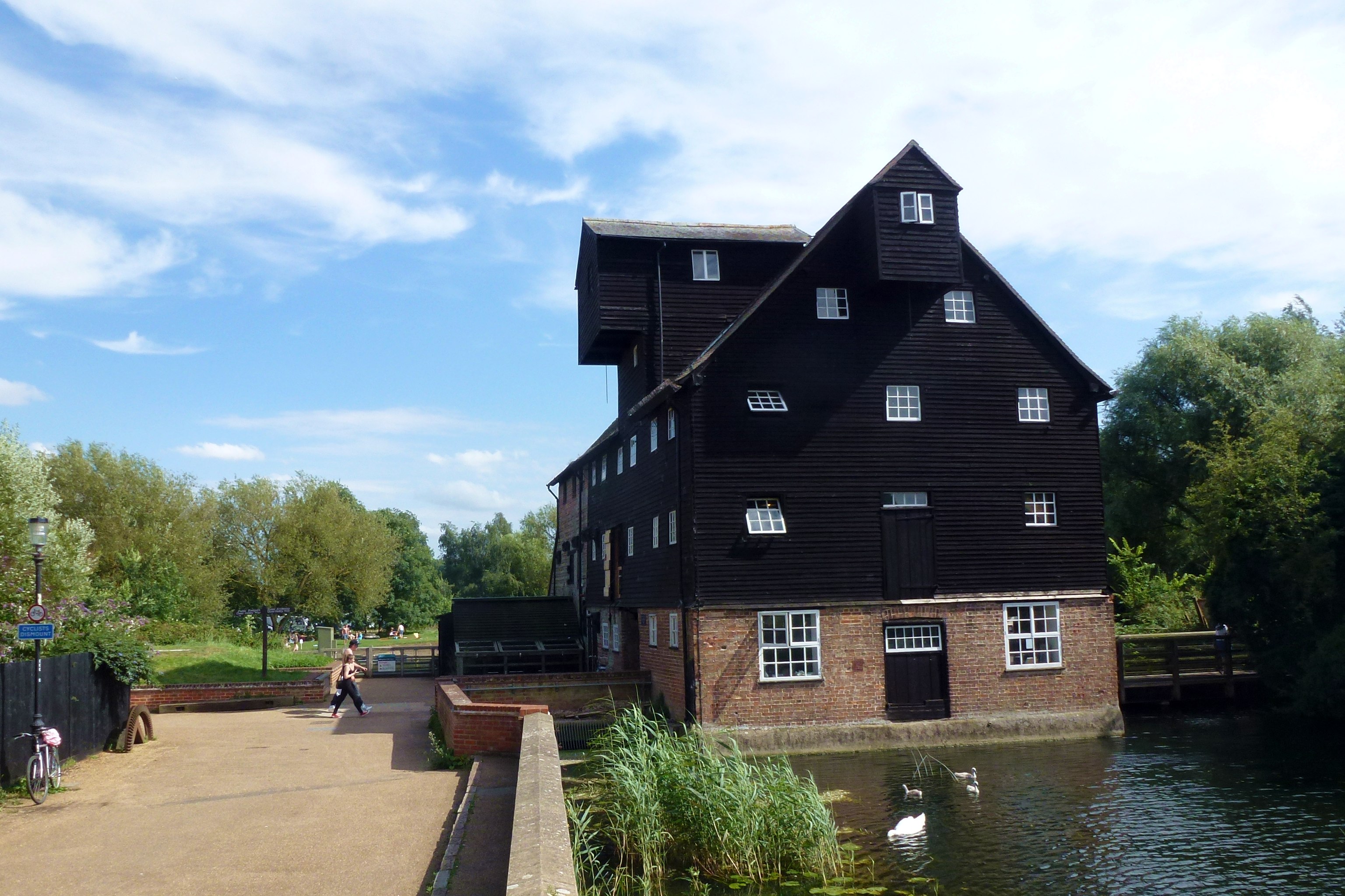
Houghton Mill
Houghton Mill is a water mill located on the Great Ouse in the village of Houghton, Cambridgeshire, England. It is a National Trust property and a Grade...

Houghton, Cambridgeshire
Houghton is a village and former civil parish, now in the parish of Houghton and Wyton, in Cambridgeshire, England, approximately 3 miles (5 km) east...
Wyton, Cambridgeshire
Wyton is a village and former civil parish, now in the parish of Houghton and Wyton, in Cambridgeshire, England. It lies approximately 2 miles (3 km) east...
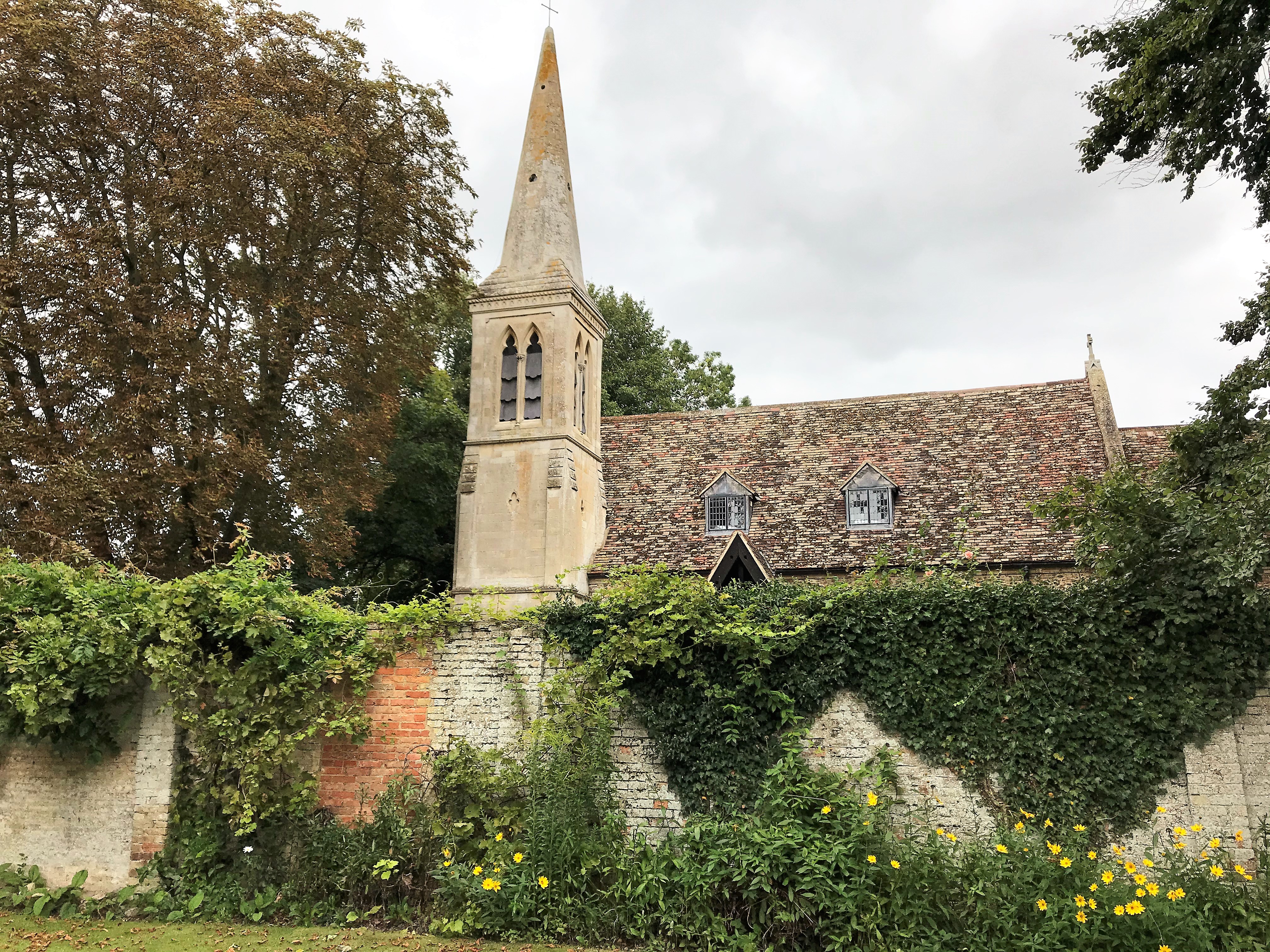
St Margaret's Church, Hemingford Abbots
St Margaret's Church, in Hemingford Abbots is a Church of England church, dedicated to Saint Margaret of Antioch. A church has stood on the site since...
Nearby Amenities
Located within 500m of 52.33072,-0.12207984Have you been to Old Mill Race?
Leave your review of Old Mill Race below (or comments, questions and feedback).