Cloudy Lake
Lake, Pool, Pond, Freshwater Marsh in Huntingdonshire Huntingdonshire
England
Cloudy Lake

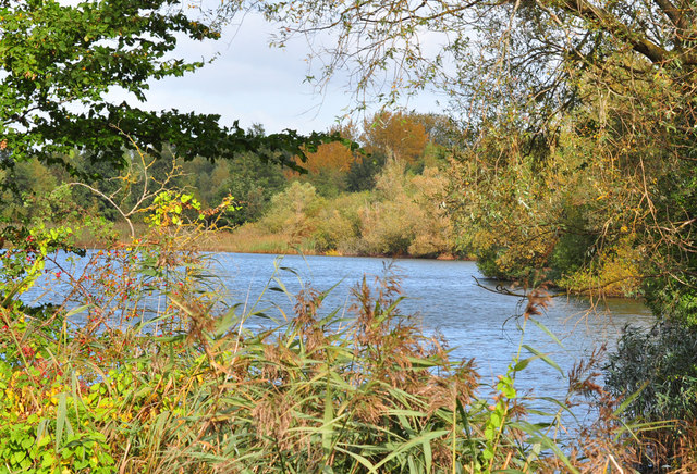
Cloudy Lake is a serene freshwater body situated in the county of Huntingdonshire in England. This picturesque lake, also referred to as a pool or pond, offers a tranquil and natural setting for visitors to immerse themselves in the beauty of the surrounding landscape. Spanning across a sprawling area, Cloudy Lake is nestled within a freshwater marsh, enhancing its ecological significance.
The water in Cloudy Lake is crystal clear, reflecting the vibrant hues of the sky and the lush greenery that surrounds it. The lake is fed by several small streams and springs, ensuring a constant flow of fresh water that supports a diverse range of aquatic life. Anglers are drawn to Cloudy Lake due to the abundance of fish species, including roach, perch, and tench, making it an ideal spot for fishing enthusiasts.
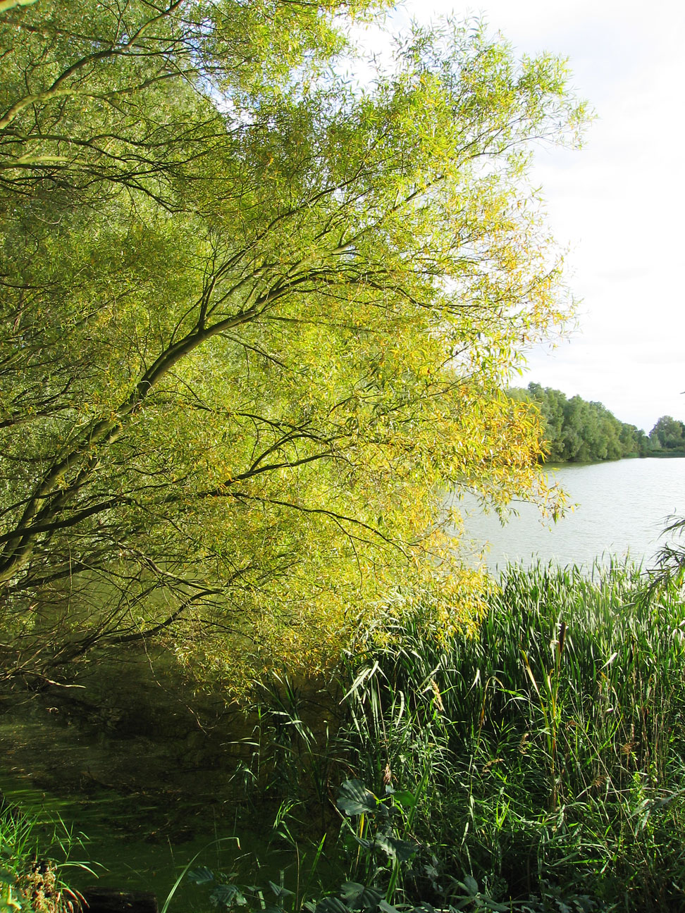
The marshland surrounding Cloudy Lake is teeming with a rich variety of flora and fauna. Tall reeds and grasses sway gently in the breeze, providing a haven for numerous bird species and small mammals. It is not uncommon to spot graceful swans gliding across the lake's surface or ducks paddling peacefully amidst the lily pads.
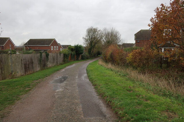
Nature enthusiasts can explore the area by walking along the well-maintained trails that encircle the lake, offering breathtaking views from different vantage points. Additionally, Cloudy Lake provides an ideal setting for photography, painting, and simply enjoying the serenity of nature.
Overall, Cloudy Lake in Huntingdonshire is a captivating destination for those seeking a peaceful retreat amidst nature's wonders. Its combination of a freshwater lake, marshland, and abundant wildlife makes it a must-visit for anyone looking to experience the beauty and tranquility of the English countryside.
If you have any feedback on the listing, please let us know in the comments section below.
Cloudy Lake Images
Images are sourced within 2km of 52.25033/-0.2491649 or Grid Reference TL1962. Thanks to Geograph Open Source API. All images are credited.


Cloudy Lake is located at Grid Ref: TL1962 (Lat: 52.25033, Lng: -0.2491649)
Administrative County: Cambridgeshire
District: Huntingdonshire
Police Authority: Cambridgeshire
What 3 Words
///officials.scare.assurance. Near Little Paxton, Cambridgeshire
Nearby Locations
Related Wikis

Little Paxton
Little Paxton in Cambridgeshire, England is a village and civil parish that lies 5 miles (8.0 km) south of Huntingdon and 1.7 miles (2.7 km) north of St...
Southoe
Southoe is a small village and former civil parish, now in the parish of Southoe and Midloe, in Cambridgeshire, England. Southoe lies approximately 6 miles...
Paxton Pits Nature Reserve
Paxton Pits is an area of active and disused gravel pits at Little Paxton near St Neots in Cambridgeshire, England. The disused pits have been turned into...
Little Paxton Pits
Little Paxton Pits is a 127.4-hectare (315-acre) biological Site of Special Scientific Interest in Little Paxton in Cambridgeshire. Part of it is also...
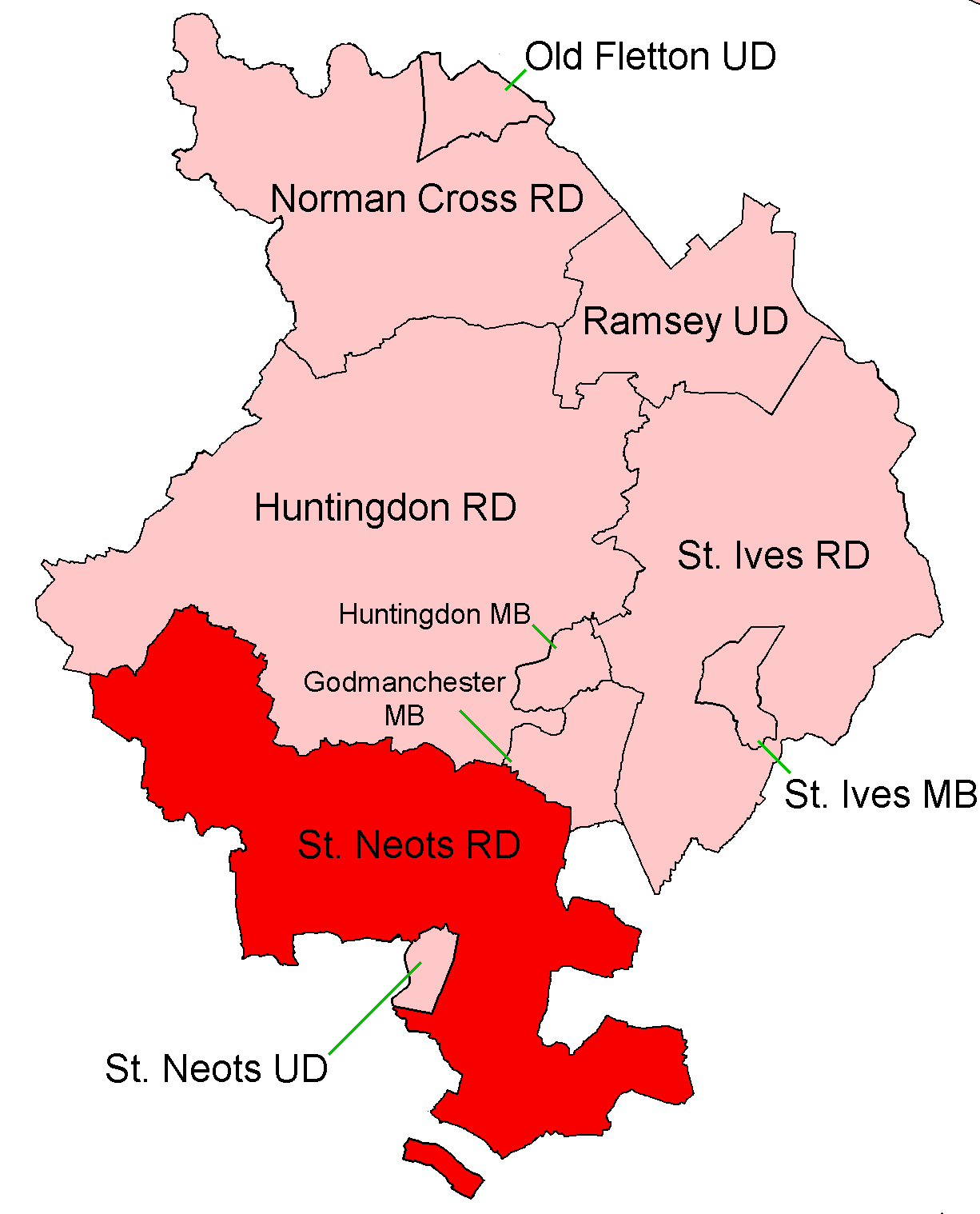
St Neots Rural District
St Neots was a rural district in Huntingdonshire, England from 1894 to 1974, around the northern and eastern sides of the urban area of St Neots. The district...

River Kym
The River Kym is a river in Cambridgeshire, England. It flows through the village of Tilbrook, to Kimbolton, and joins the Great Ouse at St Neots. It is...

St Neots Town F.C.
St Neots Town Football Club is an English semi-professional football club based in St Neots, Cambridgeshire. The club are currently members of the United...
1895 St. Neots rail accident
The St. Neots Derailment 1895 occurred near to St. Neots railway station on 10 November 1895 when a Great Northern Railway Scottish express from Kings...
Nearby Amenities
Located within 500m of 52.25033,-0.2491649Have you been to Cloudy Lake?
Leave your review of Cloudy Lake below (or comments, questions and feedback).