Cowley Lake

Lake, Pool, Pond, Freshwater Marsh in Middlesex

England

Cowley Lake

Station Road bridge, West Drayton The first West Drayton station (1838-1884) was to the left of the bridge. The current station is to the right of it.
Station Road bridge, West Drayton Credit: Nigel Thompson

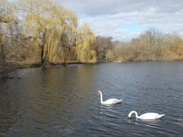
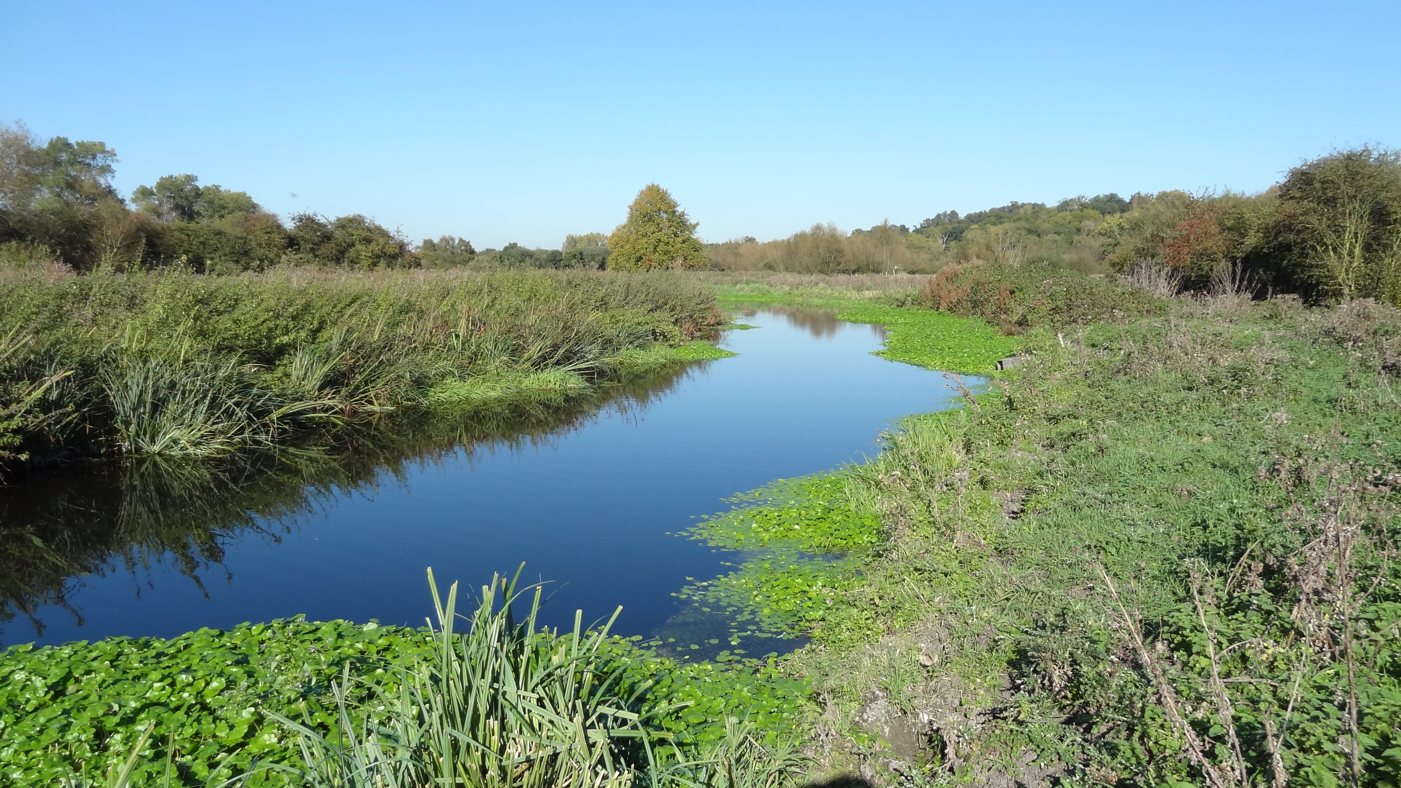
Cowley Lake is a small freshwater marsh located in Middlesex, England. It is an important natural habitat for a variety of plant and animal species, making it a popular destination for nature enthusiasts and birdwatchers.

Covering an area of approximately 5 hectares, Cowley Lake is characterized by its calm and serene atmosphere. The lake is surrounded by lush vegetation, including reeds, grasses, and water lilies, which provide shelter and food for numerous species of birds, insects, and amphibians. The diverse plant life also contributes to the overall beauty of the area.

The lake itself is relatively shallow, with an average depth of around 2 meters. This makes it an ideal habitat for a range of aquatic organisms, such as fish, frogs, and water insects, which thrive in the calm and nutrient-rich waters.

Birdwatchers are particularly drawn to Cowley Lake due to its role as a breeding ground and resting spot for a variety of bird species. Common sightings include swans, ducks, herons, and various types of songbirds. The lake's proximity to surrounding woodlands and fields further enhances its appeal, as it attracts migratory birds during the spring and autumn seasons.

In addition to its ecological significance, Cowley Lake also provides recreational opportunities for visitors. The calm waters offer a peaceful setting for fishing, kayaking, and paddleboarding. The surrounding nature trails provide an opportunity for leisurely walks and wildlife observation.

Overall, Cowley Lake is a valuable natural resource in Middlesex, providing a habitat for diverse species, a haven for birdwatchers, and a peaceful retreat for outdoor enthusiasts.

If you have any feedback on the listing, please let us know in the comments section below.
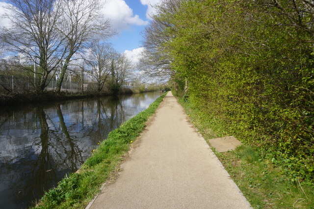
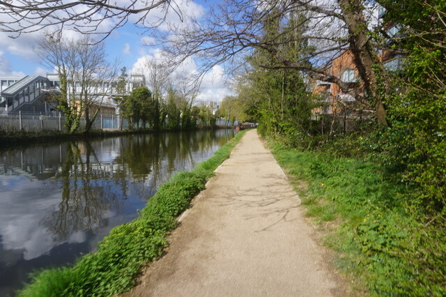
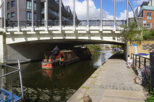
Cowley Lake Images

Images are sourced within 2km of 51.522099/-0.4858419 or Grid Reference TQ0581. Thanks to Geograph Open Source API. All images are credited.

Station Road bridge, West Drayton The first West Drayton station (1838-1884) was to the left of the bridge. The current station is to the right of it.
Station Road bridge, West Drayton
The first West Drayton station (1838-1884) was to the left of the bridge. The current station is to the right of it.
Ferrers Avenue, West Drayton
Station Road, West Drayton
Bridge at the Slough Arm of the canal Another point on the London Loop between West Drayton and Uxbridge - along with Stockley Park - where the route digresses from the Grand Union Canal before returning to it later.
Bridge at the Slough Arm of the canal
Another point on the London Loop between West Drayton and Uxbridge - along with Stockley Park - where the route digresses from the Grand Union Canal before returning to it later.
Little Britain Lake As David Sharp observes in his London Loop book, this is a scenic spot to stop for a while for those walking this part of the Loop. The route from the Slough Arm of the canal emerges here at a series of former gravel pits, now an attractive series of lakes overhung in places by weeping willows and home to various types of water bird.
Little Britain Lake
As David Sharp observes in his London Loop book, this is a scenic spot to stop for a while for those walking this part of the Loop. The route from the Slough Arm of the canal emerges here at a series of former gravel pits, now an attractive series of lakes overhung in places by weeping willows and home to various types of water bird.
West Drayton 1st railway station (site), Greater London Opened in 1838 by the Great Western Railway on the line from London Paddington to Reading, this station closed in 1884 when the main line was quadrupled, resulting in the current station being built 200m further east.
View west towards Iver and Slough, from the current station. From 1856 it was the junction for Uxbridge Vine Street and later, Staines West. The first station was located beyond the road underbridge, at the point where the lines diverging to the right can be seen.
Fore more information, see <span class="nowrap"><a title="http://disused-stations.org.uk/w/west_drayton/index.shtml" rel="nofollow ugc noopener" href="http://disused-stations.org.uk/w/west_drayton/index.shtml">Link</a><img style="margin-left:2px;" alt="External link" title="External link - shift click to open in new window" src="https://s1.geograph.org.uk/img/external.png" width="10" height="10"/></span>
West Drayton 1st railway station (site), Greater London
Opened in 1838 by the Great Western Railway on the line from London Paddington to Reading, this station closed in 1884 when the main line was quadrupled, resulting in the current station being built 200m further east. View west towards Iver and Slough, from the current station. From 1856 it was the junction for Uxbridge Vine Street and later, Staines West. The first station was located beyond the road underbridge, at the point where the lines diverging to the right can be seen. Fore more information, see LinkExternal link
Grand Union Canal towards bridge #192
Canal boat Slow Escape, Grand Union Canal
Grand Union Canal towards bridge #192
Grand Union Canal at Colham Bridge, bridge #192
Grand Union Canal towards bridge #191
Canal boat Justus 111,  Grand Union Canal
Canal boat Justus 111, Grand Union Canal
Canal boat Willum, Grand Union Canal
Grand Union Canal towards bridge #191
Canal boat Leviathan, Grand Union Canal
Show me another place!

Cowley Lake is located at Grid Ref: TQ0581 (Lat: 51.522099, Lng: -0.4858419)

Unitary Authority: Hillingdon

Police Authority: Metropolitan

What 3 Words

///remote.sings.badge. Near Iver, Buckinghamshire

Related Wikis

Cowley, London

Cowley is a village contiguous with the town of Uxbridge in the London Borough of Hillingdon. A largely suburban village with 16 listed buildings, Cowley...
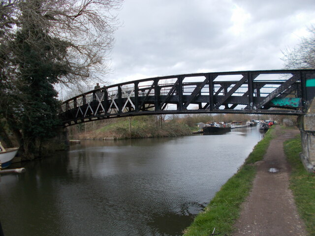
Frays River

Frays River is a semi-canalised short river in England that branches off the River Colne at Uxbridge Moor and rejoins it at West Drayton. It is believed...
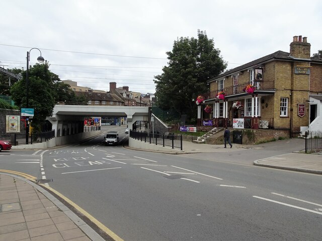
The Shovel, Cowley

The Malt Shovel is a Grade II listed public house at Iver Lane, Cowley, London.It was built early 19th century. It is now called The Malt Shovel. ��2...

River Pinn

The Pinn is a suburban, outer west London river. It has dendritic headwaters, the furthest is considered its source – in Harrow Weald. Its confluence with...

Nearby Amenities

Located within 500m of 51.522099,-0.4858419
Traffic Calming: island
Lat/Long: 51.520504/-0.4796098
Turning Circle
Lat/Long: 51.5214023/-0.4795149
Ref GB Tflcid: RWG243867
Traffic Calming: yes
Lat/Long: 51.521911/-0.4840293
Bus Stop
Benbow Waye
Bus: yes
Local Ref: Q
Naptan AtcoCode: 490003887S
Naptan Bearing: S
Naptan CommonName: Benbow Waye
Naptan Indicator: Stop Q
Naptan Verified: no
Public Transport: platform
Ref: 71687
Source Ref: naptan
Lat/Long: 51.5255579/-0.4824765
Bus Stop
Benbow Waye
Bus: yes
Local Ref: F
Naptan AtcoCode: 490003887W
Naptan Bearing: W
Naptan CommonName: Benbow Waye
Naptan Indicator: Stop F
Naptan Verified: no
Public Transport: platform
Ref: 77502
Source Ref: naptan
Lat/Long: 51.5259811/-0.4828669
Bus Stop
Packet Boat Lane
Bus: yes
Local Ref: D
Naptan AtcoCode: 490010708N
Naptan Bearing: N
Naptan CommonName: Packet Boat Lane
Naptan Indicator: Stop D
Naptan Verified: no
Public Transport: platform
Ref: 49409
Source Ref: naptan
Lat/Long: 51.5203803/-0.4795439
Traffic Signals
Lat/Long: 51.5202183/-0.4827717
Traffic Signals
Lat/Long: 51.5201252/-0.4830015
Waste Basket
Lat/Long: 51.5206339/-0.4902983
Barrier: bollard
Lat/Long: 51.5227933/-0.4834896
Bus Stop
Sefton Way
Bench: yes
Bus: yes
Covered: yes
Local Ref: E
Naptan AtcoCode: 490011977N
Naptan NaptanCode: 71813
Network: London Buses
Network Wikidata: Q1192411
Operator: Transport for London
Public Transport: platform
Ref: 71813
Shelter: yes
Lat/Long: 51.5222125/-0.4815841
Bus Stop
New Peachey Lane
Bench: yes
Bus: yes
Covered: yes
Local Ref: R
Naptan AtcoCode: 490010244S
Naptan NaptanCode: 50081
Network: London Buses
Network Wikidata: Q1192411
Operator: Transport for London
Public Transport: platform
Ref: 50081
Shelter: yes
Lat/Long: 51.5223815/-0.4813775
Pub
Waters Edge
Addr City: Cowley
Addr Postcode: UB8 2JS
Addr Street: Packet Boat Lane
Opening Hours: Tu-Sa 12:00-23:00; Su 12:00-22:30
Website: https://the-watersedge.co.uk/
Lat/Long: 51.5199653/-0.4830879
Bench
Lat/Long: 51.525234/-0.4907429
Bench
Lat/Long: 51.5248239/-0.4904444
Turning Circle
Lat/Long: 51.5232747/-0.4809101
Brookford Launderettes
Addr City: Uxbridge
Addr Country: GB
Addr County: Middlesex
Addr Housenumber: 30
Addr Postcode: UB8 2HL
Addr Street: Cowley High Road
Addr Suburb: Cowley
Opening Hours: Mo-Su 07:00-19:00
Payment Cash: yes
Self Service: yes
Shop: laundry
Lat/Long: 51.5224189/-0.4811647
The Bakery at Cowley
Addr Postcode: UB8 2HL
Addr Street: Cowley High Road
Opening Hours: Mo-Fr 05:00-14:30; Sa 06:30-13:00
Phone: +44 1895 812900
Shop: bakery
Website: http://www.thebakerycowley.co.uk/
Lat/Long: 51.5223069/-0.4811033
Bal's Convenience Store
Addr Housenumber: 30
Addr Postcode: UB8 2HL
Addr Street: Cowley High Road
Shop: convenience
Lat/Long: 51.5224773/-0.4811904
Cafe
Lady Marmalade Cafe
Addr Housenumber: 30
Addr Postcode: UB8 2HL
Addr Street: Cowley High Road
Opening Hours: Mo-Fr 06:30-14:30; Sa 07:00-14:00
Phone: +44 7533 134125
Lat/Long: 51.5225247/-0.4812196
Direction: SSE
Generator Method: photovoltaic
Generator Output Electricity: yes
Generator Solar Modules: 16
Generator Source: solar
Generator Type: solar_photovoltaic_panel
Location: roof
Power: generator
Lat/Long: 51.5213727/-0.4829681
Direction: SSE
Generator Method: photovoltaic
Generator Output Electricity: yes
Generator Solar Modules: 54
Generator Source: solar
Generator Type: solar_photovoltaic_panel
Location: roof
Power: generator
Lat/Long: 51.5213425/-0.4826459
Direction: SSE
Generator Method: photovoltaic
Generator Output Electricity: yes
Generator Solar Modules: 21
Generator Source: solar
Generator Type: solar_photovoltaic_panel
Location: roof
Power: generator
Lat/Long: 51.5214133/-0.4830663
Direction: 170
Generator Method: photovoltaic
Generator Output Electricity: yes
Generator Solar Modules: 6
Generator Source: solar
Generator Type: solar_photovoltaic_panel
Location: roof
Power: generator
Lat/Long: 51.5247434/-0.4828869
Direction: SSE
Generator Method: photovoltaic
Generator Output Electricity: yes
Generator Solar Modules: 9
Generator Source: solar
Generator Type: solar_photovoltaic_panel
Location: roof
Power: generator
Lat/Long: 51.5211671/-0.4824401
Direction: SSE
Generator Method: photovoltaic
Generator Output Electricity: yes
Generator Solar Modules: 12
Generator Source: solar
Generator Type: solar_photovoltaic_panel
Location: roof
Power: generator
Lat/Long: 51.5213982/-0.4828589
Direction: SSE
Generator Method: photovoltaic
Generator Output Electricity: yes
Generator Solar Modules: 9;12
Generator Source: solar
Generator Type: solar_photovoltaic_panel
Location: roof
Power: generator
Lat/Long: 51.521058/-0.4823677
Direction: SSE
Generator Method: photovoltaic
Generator Output Electricity: yes
Generator Solar Modules: 9
Generator Source: solar
Generator Type: solar_photovoltaic_panel
Location: roof
Power: generator
Lat/Long: 51.5212194/-0.4824727
Direction: SSE
Generator Method: photovoltaic
Generator Output Electricity: yes
Generator Solar Modules: 19
Generator Source: solar
Generator Type: solar_photovoltaic_panel
Location: roof
Power: generator
Lat/Long: 51.521393/-0.4832454
Cowley Peachey
Place: village
Lat/Long: 51.5210312/-0.4802837
Leisure: fishing
Lat/Long: 51.5219269/-0.485665
Leisure: fishing
Lat/Long: 51.5193485/-0.4895032
Information: guidepost
Tourism: information
Lat/Long: 51.5226786/-0.4892741
Weir
Waterway: weir
Lat/Long: 51.5233711/-0.4898504
Information: map
Tourism: information
Lat/Long: 51.5226516/-0.4893853
Bench
Lat/Long: 51.526453/-0.4856055
Bench
Lat/Long: 51.5264463/-0.4855559
Bench
Lat/Long: 51.5264338/-0.4854633
Bench
Lat/Long: 51.5263979/-0.4852192
Bench
Lat/Long: 51.5264196/-0.4853681
Bench
Lat/Long: 51.5264896/-0.4850575
Information: map
Map Size: park
Tourism: information
Lat/Long: 51.5251537/-0.4856105
Fast Food
Cowley Fish Bar
Cuisine: fish_and_chips
Lat/Long: 51.5226382/-0.4812715
Restaurant
Lee Garden
Cuisine: chinese
Lat/Long: 51.5225856/-0.4812448
P&D News
Shop: newsagent
Lat/Long: 51.5223641/-0.4811327
Bicycle Parking
Bicycle Parking: stands
Capacity: 6
Ref GB Tflcid: RWG238485
Lat/Long: 51.5223799/-0.4812212
Speed Camera
Direction: 130
Maxspeed: 30 mph
Lat/Long: 51.5208216/-0.4802261
Speed Camera
Direction: 310
Maxspeed: 30 mph
Lat/Long: 51.5204873/-0.4795796
Fuel
Esso
Brand: Esso
Brand Wikidata: Q867662
Lat/Long: 51.5259223/-0.4824248
Tesco Express
Brand: Tesco Express
Brand Wikidata: Q98456772
Operator: Tesco Express
Shop: convenience
Lat/Long: 51.5257571/-0.4824114
Parking
Lat/Long: 51.5258155/-0.4819259
Bench
Backrest: no
Material: metal
Lat/Long: 51.5187571/-0.488977
Waste Basket
Material: metal
Lat/Long: 51.5186936/-0.4891074
Bench
Backrest: yes
Inscription: Bench donated by the London Borough of Hillingdon in memory of a younger angler Robbie Patrick Bell who died tragically 7th August 1987 aged 8 years.
Material: metal
Lat/Long: 51.5186485/-0.4900548
Waste Basket
Lat/Long: 51.5187238/-0.4896156
Bench
Lat/Long: 51.5186924/-0.4893245
Waste Basket
Waste: dog_excrement
Lat/Long: 51.5186529/-0.4899457
Waste Basket
Lat/Long: 51.5186438/-0.4901783
Bench
Backrest: no
Material: metal
Lat/Long: 51.5186406/-0.4902579
The data included in this document is from www.openstreetmap.org. The data is made available under ODbL.

Have you been to Cowley Lake?

Leave your review of Cowley Lake below (or comments, questions and feedback).