Ten Acre Pond

Lake, Pool, Pond, Freshwater Marsh in Surrey Waverley

England

Ten Acre Pond

Bridleway 285 Dunsfold by The Mill House The overgrown mill pond is on the left.
Bridleway 285 Dunsfold by The Mill House Credit: Robin Webster

Ten Acre Pond is a picturesque body of water located in Surrey, England. As the name suggests, it covers an area of approximately ten acres, making it a relatively small pond compared to other bodies of water in the region. Nestled within a lush and verdant landscape, the pond attracts both locals and visitors alike.

The pond is classified as a freshwater marsh, serving as a habitat for a diverse range of flora and fauna. The surrounding vegetation includes reeds, lily pads, and various water plants, providing a vital ecosystem for aquatic life. Visitors can often spot an array of bird species, such as ducks, swans, and herons, along with smaller creatures like frogs and dragonflies.

Ten Acre Pond offers a tranquil and serene setting, making it an ideal spot for relaxation and contemplation. Many people enjoy picnicking on the grassy banks or simply sitting by the water's edge, taking in the beautiful surroundings. The calm and reflective nature of the pond also makes it a popular spot for fishing enthusiasts seeking to catch freshwater fish, such as carp and perch.

The pond is easily accessible, with a designated car park nearby, and it is well-maintained by local authorities to ensure its natural beauty is preserved. Visitors are encouraged to respect the wildlife and surroundings, refraining from littering or disturbing the peaceful habitat.

In summary, Ten Acre Pond in Surrey offers a charming and tranquil escape for nature lovers and those seeking a moment of respite. With its diverse ecosystem and beautiful surroundings, it provides a haven for both wildlife and visitors to enjoy.

If you have any feedback on the listing, please let us know in the comments section below.

Ten Acre Pond Images

Images are sourced within 2km of 51.127174/-0.56310024 or Grid Reference TQ0037. Thanks to Geograph Open Source API. All images are credited.

Bridleway 285 Dunsfold by The Mill House The overgrown mill pond is on the left.
Bridleway 285 Dunsfold by The Mill House
The overgrown mill pond is on the left.
Digger in yard, Field Place Farm It is making good the site of a former farm building.
Digger in yard, Field Place Farm
It is making good the site of a former farm building.
Field west of Hook House Lane
Fields west of Hook House Lane with water trough The nearer posts seem to have insulators but no electric fence wires.
Fields west of Hook House Lane with water trough
The nearer posts seem to have insulators but no electric fence wires.
Private drive leading to Pear Tree Green So says the large signpost, but the small one says public footpath. It is footpath 204 Dunsfold, a way towards Breakneck Hill.
Private drive leading to Pear Tree Green
So says the large signpost, but the small one says public footpath. It is footpath 204 Dunsfold, a way towards Breakneck Hill.
Barns at Red Leaf Farm A non-farming farm now.
Barns at Red Leaf Farm
A non-farming farm now.
Old Milestone, was at Park Hatch, B2130, Dunsfold Road The milestone was located opposite the junction with Dunsfold Common Road, on the East side of the road on the verge beside the drive to the house. Parish of Dunsfold (Waverley district). Cast iron post, Guildford iron casting design, erected by Godalming & Painshill turnpike trust in the 19th century.

Inscription read:-  HORSHAM / 13  ::  GODALMING / 5  ::  BRIGHTON / 35

This image was taken before 2003 when the milestone was smashed by a flail and the remains later totally removed.

Milestone Society National ID: SY_HOGO13
Old Milestone, was at Park Hatch, B2130, Dunsfold Road
The milestone was located opposite the junction with Dunsfold Common Road, on the East side of the road on the verge beside the drive to the house. Parish of Dunsfold (Waverley district). Cast iron post, Guildford iron casting design, erected by Godalming & Painshill turnpike trust in the 19th century. Inscription read:- HORSHAM / 13 :: GODALMING / 5 :: BRIGHTON / 35 This image was taken before 2003 when the milestone was smashed by a flail and the remains later totally removed. Milestone Society National ID: SY_HOGO13
Woodland debris - Creek Copse Some of those look like beech mast - but I'm not an expert on seeds and fruit.
Woodland debris - Creek Copse
Some of those look like beech mast - but I'm not an expert on seeds and fruit.
Oak Tree Lane, Dunsfold Along the north side of the common.
Oak Tree Lane, Dunsfold
Along the north side of the common.
Houses on Oak Tree Lane, Dunsfold Oak Tree Cottage is the near house, Pond Cottage the far. Both are grade II listed buildings.
Houses on Oak Tree Lane, Dunsfold
Oak Tree Cottage is the near house, Pond Cottage the far. Both are grade II listed buildings.
Bridleway 285 Dunsfold Heading west towards Chiddingfold Road.
Bridleway 285 Dunsfold
Heading west towards Chiddingfold Road.
River Lox by bridleway bridge The mill stream from Dunsfold Mill (near) rejoins the main river here.
River Lox by bridleway bridge
The mill stream from Dunsfold Mill (near) rejoins the main river here.
Bridge over River Lox Bridleway 285 Dunsfold crosses.
Bridge over River Lox
Bridleway 285 Dunsfold crosses.
Barn at The Mill House
Animal shelter near former Dunsfold Mill Not in residence currently.
Animal shelter near former Dunsfold Mill
Not in residence currently.
Hedgerow trees, Dunsfold
Valley north of Hook House Lane
Hedge and field east of Hook House Lane
Show me another place!

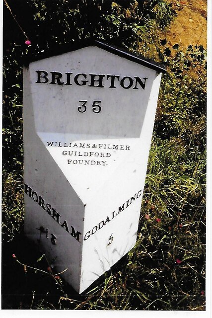
Ten Acre Pond is located at Grid Ref: TQ0037 (Lat: 51.127174, Lng: -0.56310024)

Administrative County: Surrey

District: Waverley

Police Authority: Surrey

What 3 Words

///curated.rolled.respect. Near Chiddingfold, Surrey

Related Wikis

Hascombe Hill

Hascombe Hill or Hascombe Camp is the site of an Iron Age multivallate hill fort close to the village of Hascombe in Surrey, England. == History == The...

Dunsfold

Dunsfold is a village in the borough of Waverley, Surrey, England, 8.7 miles (14.0 kilometres) south of Guildford. It lies in the Weald and reaches in...

Top Gear test track

The Top Gear test track is used by the BBC automotive television programme Top Gear. It is located at Dunsfold Aerodrome in Surrey, United Kingdom. The...

Dunsfold Aerodrome

Dunsfold Aerodrome (former ICAO code EGTD) is an unlicensed airfield in Surrey, England, near the village of Cranleigh. It extends across land in the villages...

Hascombe

Hascombe is a village and civil parish in Surrey, England. It is around 3 miles (4.8 km) southeast of Godalming in the Borough of Waverley. The settlement...

Hascombe Court

Hascombe Court is a 172-acre (70 ha) estate in Hascombe, Surrey, best known for its vast garden designed by Gertrude Jekyll. Hascombe Court is listed Grade...

Fir Tree Copse

Fir Tree Copse is a 6-hectare (15-acre) nature reserve south-east of Dunsfold in Surrey. It is managed by the Surrey Wildlife Trust and is part of the...

Wey and Arun Canal

The Wey and Arun Canal is a partially open, 23-mile-long (37 km) canal in the southeast of England. It runs southwards from the River Wey at Gunsmouth...

Nearby Amenities

Located within 500m of 51.127174,-0.56310024
Bus Stop
Griggs Meadow
Naptan AtcoCode: 40004411099A
Naptan Bearing: SW
Naptan CommonName: Griggs Meadow
Naptan Indicator: Just after
Naptan Landmark: Griggs Meadow
Naptan NaptanCode: surdtmja
Naptan Street: Dunsfold Common Road
Naptan Verified: no
Public Transport: platform
Source: naptan_import
Lat/Long: 51.1235416/-0.5620925
Bus Stop
Griggs Meadow
Naptan AtcoCode: 40004411099B
Naptan Bearing: NE
Naptan CommonName: Griggs Meadow
Naptan Indicator: Just Before
Naptan Landmark: Griggs Meadow
Naptan NaptanCode: surdtmjd
Naptan Street: Dunsfold Common Road
Naptan Verified: no
Public Transport: platform
Source: naptan_import
Lat/Long: 51.1235265/-0.5623749
Barrier: stile
Lat/Long: 51.1232338/-0.5599972
Post Box
Ref: GU8 69
Lat/Long: 51.1235106/-0.5625334
Addr Housenumber: 2
Lat/Long: 51.1234326/-0.5617344
Addr Housename: Burdons
Addr Housenumber: 1
Lat/Long: 51.1235036/-0.5616531
Addr Housename: Elmlea Cottage
Lat/Long: 51.1227268/-0.5640491
Addr Housename: Blueberry Cottage
Lat/Long: 51.1227652/-0.5639925
Addr Housename: Spindleberry Cottage
Lat/Long: 51.1228979/-0.5639663
Addr Housename: Redvers
Lat/Long: 51.1229533/-0.5638514
Addr Housename: The Haven
Lat/Long: 51.1229359/-0.5636359
Addr Housename: Pine Cottage
Lat/Long: 51.1229743/-0.56358
Addr Housename: Frenshams Cottage
Lat/Long: 51.1230413/-0.5634518
Addr Housename: Farleigh Cottage
Addr Housenumber: 1
Lat/Long: 51.1230014/-0.563539
Addr Housename: South View
Lat/Long: 51.1231424/-0.5633081
Addr Housename: Chennels Cottage
Lat/Long: 51.1242144/-0.5604007
Addr Housename: Chennels
Addr Housenumber: 3
Lat/Long: 51.1243687/-0.5602558
The data included in this document is from www.openstreetmap.org. The data is made available under ODbL.

Have you been to Ten Acre Pond?

Leave your review of Ten Acre Pond below (or comments, questions and feedback).