The Pillinge

Lake, Pool, Pond, Freshwater Marsh in Bedfordshire

England

The Pillinge
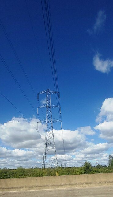
Electricity Pylon near Caulcott
Electricity Pylon near Caulcott Credit: Anthony Parkes

The Pillinge is a picturesque freshwater marsh located in Bedfordshire, England. Nestled in the heart of the charming village of Pillinge, this natural beauty spot is a haven for wildlife enthusiasts and nature lovers alike.

Spanning over an area of approximately 10 acres, The Pillinge is home to a diverse range of flora and fauna. The marsh is characterized by its tranquil atmosphere, with its calm waters reflecting the surrounding lush greenery. The area is primarily composed of a serene lake, a pool, and a pond, each offering a unique ecosystem and habitat for various species.

The lake, with its crystal-clear waters, serves as a breeding ground for numerous fish species, including perch and roach. Anglers can often be spotted casting their lines and enjoying the peaceful ambiance. The pool is home to a vibrant collection of water lilies, which bloom during the summer months, adding a splash of color to the landscape. The pond, on the other hand, is a crucial habitat for a variety of amphibians, such as frogs and newts.

Visitors can explore The Pillinge by following the well-maintained footpaths that wind through the marsh. The pathways offer breathtaking views of the surrounding countryside and provide ample opportunities for birdwatching. Common sightings include herons, kingfishers, and various species of ducks and geese.

The Pillinge is not only a natural gem but also a local conservation area. Its importance in preserving biodiversity has led to ongoing efforts to protect and enhance its ecological value. As such, visitors are urged to respect the wildlife and surroundings, ensuring that this idyllic freshwater marsh can be enjoyed by generations to come.

If you have any feedback on the listing, please let us know in the comments section below.

The Pillinge Images

Images are sourced within 2km of 52.060908/-0.53390087 or Grid Reference TL0041. Thanks to Geograph Open Source API. All images are credited.

Electricity Pylon near Caulcott
Marston Moretaine Church The church is odd in that the churchtower is actually a short distance from the main church building!
Marston Moretaine Church
The church is odd in that the churchtower is actually a short distance from the main church building!
Lower Shelton (Old) An large old house in Lower Shelton.
Lower Shelton (Old)
An large old house in Lower Shelton.
Lower Shelton (New) A development of new houses in Lower Shelton
Lower Shelton (New)
A development of new houses in Lower Shelton
Ampthill Angling Club Lake which was a former Hanson Brick clay pit - now used exclusively by Ampthill angling club.
Ampthill Angling Club
Lake which was a former Hanson Brick clay pit - now used exclusively by Ampthill angling club.
Moreteyne Manor Looking across the moat to Moreteyne Manor, now a restaurant, formerly known as Moat Farm in Marston Moretaine
Moreteyne Manor
Looking across the moat to Moreteyne Manor, now a restaurant, formerly known as Moat Farm in Marston Moretaine
Row of houses and club A row of houses probably built by the brick company or local council with an adjacent working man's club.
Row of houses and club
A row of houses probably built by the brick company or local council with an adjacent working man's club.
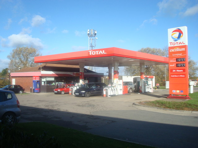
Petrol Station, Marston Moretaine, Bedfordshire
St. Mary's, Marston Moretaine, Bedfordshire The tower is separate from the rest of the church and is out of picture.
St. Mary's, Marston Moretaine, Bedfordshire
The tower is separate from the rest of the church and is out of picture.
Jubilee Cottage Allotments Just opposite the Jubilee Cottages outside of Marston Moretaine
Jubilee Cottage Allotments
Just opposite the Jubilee Cottages outside of Marston Moretaine
Bedford Road Methodist Chapel, Marston Moretaine
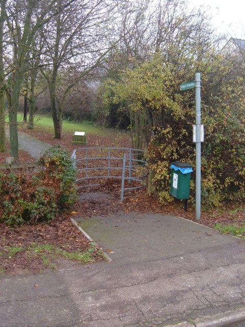
Public Footpath This footpath runs from the Bedford Road Sports Ground in Marston Moretaine, over the A421 and towards Lower Shelton.
Public Footpath
This footpath runs from the Bedford Road Sports Ground in Marston Moretaine, over the A421 and towards Lower Shelton.
Beancroft Road Approaching the A421 interchange.
Beancroft Road
Approaching the A421 interchange.
Beancroft Road Heading away from Marston Moretaine, this part in quite new, a bypass of Beancroft Farm over to the right, built together with the A421 and the interchange here.
Beancroft Road
Heading away from Marston Moretaine, this part in quite new, a bypass of Beancroft Farm over to the right, built together with the A421 and the interchange here.
A Methodist Chapel in Lower Shelton circa 1920 This Chapel recently had its bicentenary, and due to a falling congregation size has been deconsecrated and sold. My parents were married here, I was Christened here, I went to Sunday school here. The Chapel is to the right and the Sunday school is the left building.
A Methodist Chapel in Lower Shelton circa 1920
This Chapel recently had its bicentenary, and due to a falling congregation size has been deconsecrated and sold. My parents were married here, I was Christened here, I went to Sunday school here. The Chapel is to the right and the Sunday school is the left building.
Marston Moretaine church detached bell-tower
Marston Interchange, A421 The A421 runs 44miles east-west from Black Cat Roundabout on the A1 to Brackley.
<span class="nowrap"><a title="http://www.sabre-roads.org.uk/wiki/index.php?title=A421" rel="nofollow ugc noopener" href="http://www.sabre-roads.org.uk/wiki/index.php?title=A421">Link</a><img style="margin-left:2px;" alt="External link" title="External link - shift click to open in new window" src="https://s1.geograph.org.uk/img/external.png" width="10" height="10"/></span>
Marston Interchange, A421
The A421 runs 44miles east-west from Black Cat Roundabout on the A1 to Brackley. LinkExternal link
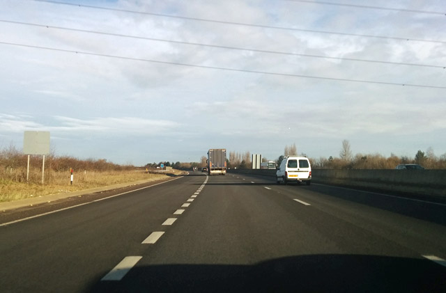
A421 towards Bedford The slip road from the grade separated Marston Junction comes in on the left.
A421 towards Bedford
The slip road from the grade separated Marston Junction comes in on the left.
Show me another place!

The Pillinge is located at Grid Ref: TL0041 (Lat: 52.060908, Lng: -0.53390087)

Unitary Authority: Central Bedfordshire

Police Authority: Bedfordshire

What 3 Words

///grasp.dripping.breathing. Near Marston Moretaine, Bedfordshire

Related Wikis

Marston Vale

Marston Vale is an area of Bedfordshire. It lies to the south west of Bedford and Kempston, near Junction 13 of the M1 motorway. Historically it was one...

Millbrook railway station (Bedfordshire)

Millbrook railway station serves the villages of Millbrook and Marston Moretaine in Bedfordshire, England. It is on the Marston Vale Line, between Stewartby...

Marston Moreteyne

Marston Moreteyne (or Marston Moretaine) is a large village and civil parish in Central Bedfordshire, England, located on the A421 between Bedford and...

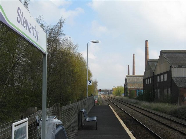
Stewartby railway station

Stewartby railway station is a station on the London Northwestern Railway, which serves the Bedfordshire village of Stewartby in England. It is the nearest...

Nearby Amenities

Located within 500m of 52.060908,-0.53390087
Toilets
Access: yes
Changing Table: yes
Disabled: yes
Fee: no
Female: yes
Male: yes
Lat/Long: 52.0645773/-0.535554
Cafe
The Forest Centre Cafe
Addr City: Marston Moretaine
Addr Country: GB
Addr Housename: The Forest Centre
Addr Postcode: MK43 0PR
Addr Street: Station Road
Cuisine: coffee_shop
Fhrs Authority: Central Bedfordshire
Fhrs Id: 450218
Fhrs Local Authority Id: 1529
Source: Local Knowledge
Website: http://marstonvale.org/
Wheelchair: yes
Wifi: no
Lat/Long: 52.0646499/-0.5354575
Power: tower
Source: bing
Lat/Long: 52.0582099/-0.538358
Millennium Country Park Turbine
Generator Method: wind_turbine
Generator Source: wind
Generator Type: horizontal_axis
Power: generator
Lat/Long: 52.0639267/-0.5292465
Tourism: viewpoint
Lat/Long: 52.058791/-0.5314363
Tourism: viewpoint
Lat/Long: 52.0590361/-0.5327798
Generator Method: photovoltaic
Generator Output Electricity: yes
Generator Source: solar
Generator Type: solar_photovoltaic_panel
Power: generator
Lat/Long: 52.0647791/-0.5351425
Recycling
Recycling Cans: yes
Recycling Glass Bottles: yes
Lat/Long: 52.0649484/-0.535847
Waste Basket
Lat/Long: 52.0649611/-0.5358356
Bicycle Repair Station
Access: yes
Fee: no
Service Bicycle Chaintool: no
Service Bicycle Pump: yes
Lat/Long: 52.0649616/-0.5355856
The data included in this document is from www.openstreetmap.org. The data is made available under ODbL.

Have you been to The Pillinge?

Leave your review of The Pillinge below (or comments, questions and feedback).