Broadwaters Upper Pool

Lake, Pool, Pond, Freshwater Marsh in Worcestershire Wyre Forest

England

Broadwaters Upper Pool

Church of St John the Baptist at Wolverley, Worcestershire This telephoto assisted image was taken from the lockside beer "garden" of the Lock Inn. Looking across the canal to the north-west, the church is 275 metres distant.
Church of St John the Baptist at Wolverley, Worcestershire Credit: Roger Kidd

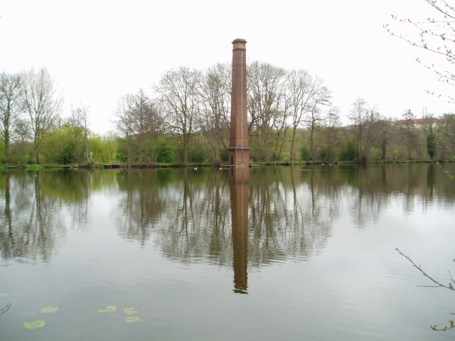
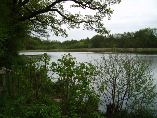
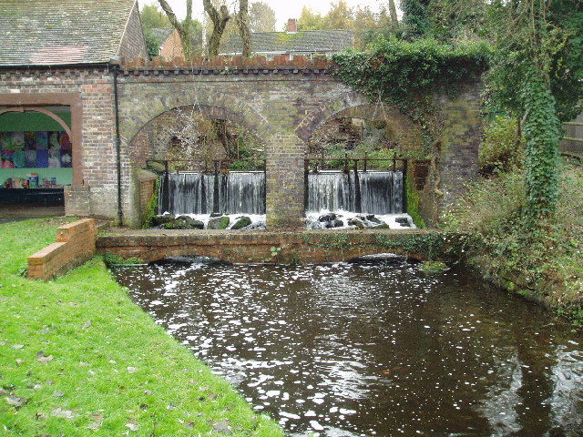
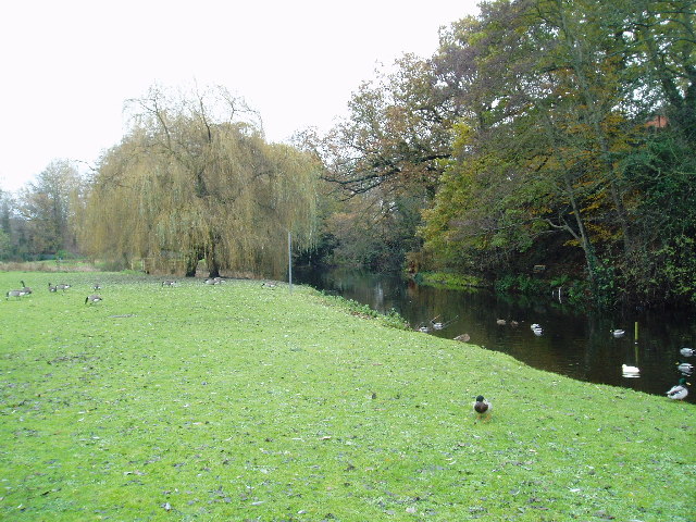
Broadwaters Upper Pool is a renowned freshwater lake located in Worcestershire, England. Spanning an area of approximately 5 hectares, it serves as an essential ecological habitat and recreational area for both locals and tourists. The pool is situated within the larger Broadwaters Park, which encompasses a diverse range of flora and fauna.

Surrounded by picturesque countryside, the upper pool is characterized by its calm and serene atmosphere. The lake itself is predominantly fed by local springs, ensuring a constant supply of freshwater. Its depth varies throughout the year, with the average depth reaching around 3 meters.

The pool is rich in aquatic life, hosting a variety of fish species such as roach, bream, and carp. These fish provide an excellent opportunity for anglers to indulge in their favorite sport. Furthermore, the lake is home to a vast array of bird species, including swans, ducks, herons, and kingfishers. Birdwatchers flock to the area to observe these magnificent creatures in their natural habitat.

The surrounding vegetation includes reeds, rushes, and water lilies, which thrive in the freshwater marshes. These plants provide shelter and breeding grounds for a range of insects and amphibians, further enhancing the pool's ecological diversity.

Broadwaters Upper Pool offers various recreational activities, including boating, kayaking, and canoeing. Visitors can explore the tranquil waters while being surrounded by the picturesque scenery. The lake also features designated picnic areas and walking paths, allowing visitors to immerse themselves in the beauty of nature.

Overall, Broadwaters Upper Pool is a cherished natural gem in Worcestershire, offering a haven for both wildlife and outdoor enthusiasts.

If you have any feedback on the listing, please let us know in the comments section below.

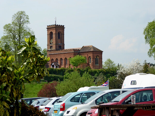
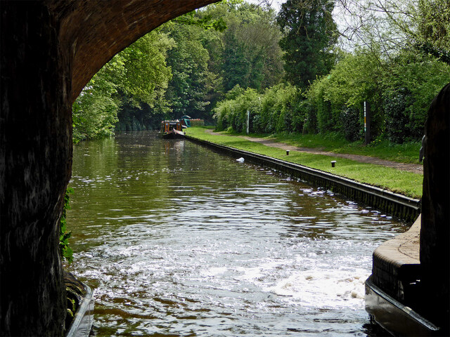
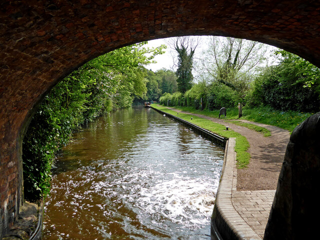
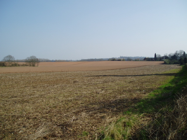
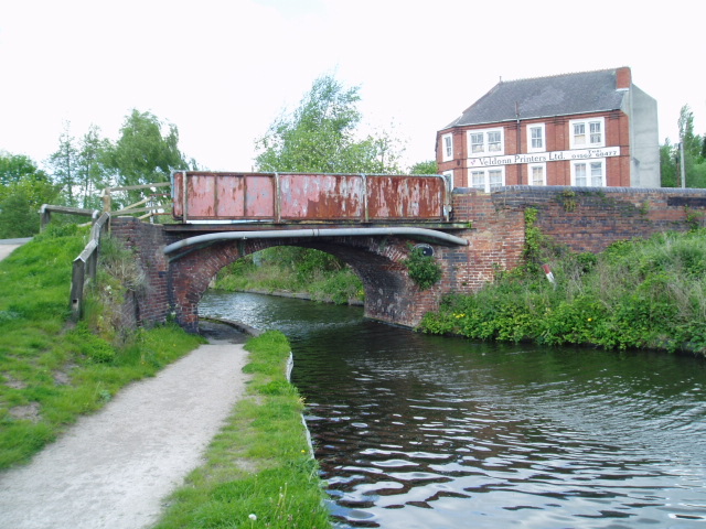
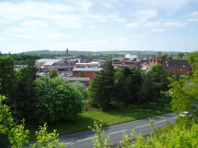
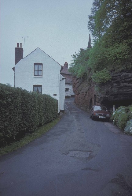
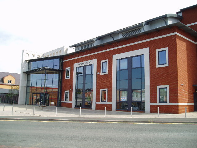
Broadwaters Upper Pool Images

Images are sourced within 2km of 52.40019/-2.232456 or Grid Reference SO8478. Thanks to Geograph Open Source API. All images are credited.

Church of St John the Baptist at Wolverley, Worcestershire This telephoto assisted image was taken from the lockside beer "garden" of the Lock Inn. Looking across the canal to the north-west, the church is 275 metres distant.
Church of St John the Baptist at Wolverley, Worcestershire
This telephoto assisted image was taken from the lockside beer "garden" of the Lock Inn. Looking across the canal to the north-west, the church is 275 metres distant.
Canal below Wolverley Lock in Staffordshire Looking south towards Kidderminster from under Wolverley Bridge, No 20.
Canal below Wolverley Lock in Staffordshire
Looking south towards Kidderminster from under Wolverley Bridge, No 20.
Canal below Wolverley Lock in Staffordshire This is the Staffordshire and Worcestershire Canal, looking south towards Kidderminster from under Wolverley Bridge, No 20.
Canal below Wolverley Lock in Staffordshire
This is the Staffordshire and Worcestershire Canal, looking south towards Kidderminster from under Wolverley Bridge, No 20.
Open farmland, east of Kidderminster. Picture taken from the minor road at SO8513 76982, looking south-east towards Offmore Farm, visible on the right of the photograph. Lack of public access limits the scope of recording geographical features within this square.
Open farmland, east of Kidderminster.
Picture taken from the minor road at SO8513 76982, looking south-east towards Offmore Farm, visible on the right of the photograph. Lack of public access limits the scope of recording geographical features within this square.
Stack Pool, Kidderminster The chimney built at the edge of the pool can be identified on the 1:25,000 map as the small dot on the north bank of the main pool. Picture taken from SO 83389 77754.
Stack Pool, Kidderminster
The chimney built at the edge of the pool can be identified on the 1:25,000 map as the small dot on the north bank of the main pool. Picture taken from SO 83389 77754.
Kidderminster Kidderminster Lock on the Staffordshire and Worcestershire Canal.
Kidderminster
Kidderminster Lock on the Staffordshire and Worcestershire Canal.
Wolverley Lock A picturesque spot by the lock on the Staffordshire and Worcestershire Canal
Wolverley Lock
A picturesque spot by the lock on the Staffordshire and Worcestershire Canal
Hurcott Pool Picture taken from SO 85164 77937, the car park at the west end of the pool, looking east.
Hurcott Pool
Picture taken from SO 85164 77937, the car park at the west end of the pool, looking east.
Limekiln Bridge, Staffs & Worcs. Canal, Kidderminster Any evidence of a Limekiln has long since vanished, and clearly, the bridge has enjoyed better days. Some of the upper brickwork on both sides has been replaced by the rather unattractive metal sheeting.
Limekiln Bridge, Staffs & Worcs. Canal, Kidderminster
Any evidence of a Limekiln has long since vanished, and clearly, the bridge has enjoyed better days. Some of the upper brickwork on both sides has been replaced by the rather unattractive metal sheeting.
Kidderminster Taken from the minor road at SO 83515 76309, the photograph depicts the view looking north-west across the town centre of Kidderminster. This is a view which has changed considerably over the past four years during which time some of the former carpet factories have made way for new retail developments. Much of the town’s layout  differs from its current representation on the OS map : the bus station and law courts now occupy different sites, and the river has been re-routed in order to accommodate a super-market car park.
Kidderminster
Taken from the minor road at SO 83515 76309, the photograph depicts the view looking north-west across the town centre of Kidderminster. This is a view which has changed considerably over the past four years during which time some of the former carpet factories have made way for new retail developments. Much of the town’s layout differs from its current representation on the OS map : the bus station and law courts now occupy different sites, and the river has been re-routed in order to accommodate a super-market car park.
Brookside Cottages in Wolverley
Kidderminster Magistrates Court The new Magistrates Court building is situated in Comberton Place, just below the Severn Valley Railway station.
Kidderminster Magistrates Court
The new Magistrates Court building is situated in Comberton Place, just below the Severn Valley Railway station.
Broadwaters Mill Broadwaters Mill is situated immediately adjacent to the A449 trunk road, at the foot of the grid square. Picture taken from SO 84138 78036.
Broadwaters Mill
Broadwaters Mill is situated immediately adjacent to the A449 trunk road, at the foot of the grid square. Picture taken from SO 84138 78036.
Broadwaters Mill pool The picture shows the feeder pool situated to the east of Broadwaters Mill. Taken from SO 84166 78026.
Broadwaters Mill pool
The picture shows the feeder pool situated to the east of Broadwaters Mill. Taken from SO 84166 78026.
Kidderminster Town Station This is the southern terminus of the Severn Valley Railway <span class="nowrap"><a title="http://www.svr.org.uk" rel="nofollow ugc noopener" href="http://www.svr.org.uk">Link</a><img style="margin-left:2px;" alt="External link" title="External link - shift click to open in new window" src="https://s1.geograph.org.uk/img/external.png" width="10" height="10"/></span> , not to be confused with the more modest affair next door <a href="https://www.geograph.org.uk/photo/118927">SO8376 : Kidderminster (Network Rail) Station</a> .  Despite appearances the station building was only constructed in 1986 and is a classic Great Western Railway design modelled on the now closed Ross on Wye station <span class="nowrap"><a title="http://www.ross-on-wye.com/index.php?page=ross_541-Old_pictures_and_photos_from_Ross&pg=1" rel="nofollow ugc noopener" href="http://www.ross-on-wye.com/index.php?page=ross_541-Old_pictures_and_photos_from_Ross&pg=1">Link</a><img style="margin-left:2px;" alt="External link" title="External link - shift click to open in new window" src="https://s1.geograph.org.uk/img/external.png" width="10" height="10"/></span> on the former Gloucester to Hereford line. Details such as the roof crestings and the porte cochere (the canopy over the entrance) have been added over the years through the work of The Friends of Kidderminster Station <span class="nowrap"><a title="http://www.kfriends.org.uk" rel="nofollow ugc noopener" href="http://www.kfriends.org.uk">Link</a><img style="margin-left:2px;" alt="External link" title="External link - shift click to open in new window" src="https://s1.geograph.org.uk/img/external.png" width="10" height="10"/></span> .  Extension work is currently in progress by the SVR to extend the station building with another wing and a canopy over the concourse <a href="https://www.geograph.org.uk/photo/118931">SO8376 : Building work at Kidderminster Town Station</a>.
Kidderminster Town Station
This is the southern terminus of the Severn Valley Railway LinkExternal link , not to be confused with the more modest affair next door SO8376 : Kidderminster (Network Rail) Station . Despite appearances the station building was only constructed in 1986 and is a classic Great Western Railway design modelled on the now closed Ross on Wye station LinkExternal link on the former Gloucester to Hereford line. Details such as the roof crestings and the porte cochere (the canopy over the entrance) have been added over the years through the work of The Friends of Kidderminster Station LinkExternal link . Extension work is currently in progress by the SVR to extend the station building with another wing and a canopy over the concourse SO8376 : Building work at Kidderminster Town Station.
Kidderminster (Network Rail) Station The small modern building on the main line at Kidderminster.  This replaced a grand black and white timber framed building which was demolished in the 1960s as being beyond repair. Looking at the modern replacement building it is hardly surprising that it is not unknown for intending passengers to mistakenly go to the much more traditional Severn Valley Railway station <a href="https://www.geograph.org.uk/photo/118920">SO8376 : Kidderminster Town Station</a> next door to try and by their main line tickets!
Kidderminster (Network Rail) Station
The small modern building on the main line at Kidderminster. This replaced a grand black and white timber framed building which was demolished in the 1960s as being beyond repair. Looking at the modern replacement building it is hardly surprising that it is not unknown for intending passengers to mistakenly go to the much more traditional Severn Valley Railway station SO8376 : Kidderminster Town Station next door to try and by their main line tickets!
Building work at Kidderminster Town Station Work in progress to build a second wing to the SVR <span class="nowrap"><a title="http://www.svr.org.uk" rel="nofollow ugc noopener" href="http://www.svr.org.uk">Link</a><img style="margin-left:2px;" alt="External link" title="External link - shift click to open in new window" src="https://s1.geograph.org.uk/img/external.png" width="10" height="10"/></span> station building (seen from the front in <a href="https://www.geograph.org.uk/photo/118920">SO8376 : Kidderminster Town Station</a>) and to add a traditional Great Western Railway style canopy covering the concourse area within. The next stage of construction can be seen in <a href="https://www.geograph.org.uk/photo/134319">SO8376 : New Canopy at Kidderminster Town Station</a>
Building work at Kidderminster Town Station
Work in progress to build a second wing to the SVR LinkExternal link station building (seen from the front in SO8376 : Kidderminster Town Station) and to add a traditional Great Western Railway style canopy covering the concourse area within. The next stage of construction can be seen in SO8376 : New Canopy at Kidderminster Town Station
Kidderminster Town Station forecourt A few of the incidental items in the forecourt of <a href="https://www.geograph.org.uk/photo/118920">SO8376 : Kidderminster Town Station</a>.  The blue shed was a coal merchant's office as a reminder that until the new station was constructed in the early 1980s, this was actually the goods & coalyard of Kidderminster main line station.  The green Bundy time clock was originally used on the Birmingham Tramways for accurate time recording and was once a common sight at strategic points on the streets around the network.  The example was moved here and recommissioned on this site by The Friends of Kidderminster Station <span class="nowrap"><a title="http://www.kfriends.org.uk/" rel="nofollow ugc noopener" href="http://www.kfriends.org.uk/">Link</a><img style="margin-left:2px;" alt="External link" title="External link - shift click to open in new window" src="https://s1.geograph.org.uk/img/external.png" width="10" height="10"/></span> in 2001.
Kidderminster Town Station forecourt
A few of the incidental items in the forecourt of SO8376 : Kidderminster Town Station. The blue shed was a coal merchant's office as a reminder that until the new station was constructed in the early 1980s, this was actually the goods & coalyard of Kidderminster main line station. The green Bundy time clock was originally used on the Birmingham Tramways for accurate time recording and was once a common sight at strategic points on the streets around the network. The example was moved here and recommissioned on this site by The Friends of Kidderminster Station LinkExternal link in 2001.
Show me another place!

Broadwaters Upper Pool is located at Grid Ref: SO8478 (Lat: 52.40019, Lng: -2.232456)

Administrative County: Worcestershire

District: Wyre Forest

Police Authority: West Mercia

What 3 Words

///grape.rings.banks. Near Kidderminster, Worcestershire

Related Wikis

Heathfield Knoll School

Heathfield Knoll School and First Steps Day Nursery is a small, independent, non-denominational day school and day nursery in Wolverley, near Kidderminster...

The Shrubbery, Kidderminster

The Shrubbery is a former military installation in Kidderminster, Worcestershire. It is a Grade II listed building. == History == The building is an early...

Holy Trinity School, Kidderminster

Holy Trinity School is a co-educational free school located in Kidderminster, Worcestershire, England, offering education to children from 4 years up to...

Wyre Forest (UK Parliament constituency)

Wyre Forest is a county constituency represented in the House of Commons of the Parliament of the United Kingdom. It elects one Member of Parliament...

Nearby Amenities

Located within 500m of 52.40019,-2.232456
Mini Roundabout
Direction: clockwise
Source: survey
Lat/Long: 52.3987192/-2.2370107
Bus Stop
Batham Road
Bus: yes
Naptan AtcoCode: 2000G102202
Naptan Bearing: NE
Naptan CommonName: Batham Road
Naptan Crossing: Batham Road
Naptan Indicator: Opp
Naptan NaptanCode: wocdjdmt
Naptan PlusbusZoneRef: KDRMNST
Naptan Street: Highfield Road
Naptan Verified: no
Public Transport: platform
Source: naptan_import
Lat/Long: 52.3988866/-2.2321178
Bus Stop
Greenhill (K'minster)- Turton Street
Bus: yes
Naptan AtcoCode: 2000G102203
Naptan Bearing: S
Naptan CommonName: Greenhill (K'minster)- Turton Street
Naptan Indicator: Adj
Naptan Landmark: Turton Street
Naptan NaptanCode: wocgdjpm
Naptan PlusbusZoneRef: KDRMNST
Naptan Street: Turton Street
Naptan Verified: no
Public Transport: platform
Source: naptan_import
Lat/Long: 52.3970344/-2.2334211
Bus Stop
Hurcott Road
Bus: yes
Naptan AtcoCode: 2000G196993
Naptan Bearing: W
Naptan CommonName: Hurcott Road
Naptan Crossing: Batham Road
Naptan Indicator: opp
Naptan NaptanCode: wocdapta
Naptan PlusbusZoneRef: KDRMNST
Naptan Street: Hurcott Road
Naptan Verified: no
Public Transport: platform
Source: naptan_import
Lat/Long: 52.3959748/-2.2315293
Sion Hill
Naptan AtcoCode: 2000G198298
Naptan Bearing: E
Naptan BusStopType: CUS
Naptan CommonName: Sion Hill
Naptan Crossing: Usmere Road
Naptan Indicator: opp
Naptan NaptanCode: wocgpdpd
Naptan PlusbusZoneRef: KDRMNST
Naptan Street: Upton Road
Naptan Verified: no
Source: naptan_import
Lat/Long: 52.4006443/-2.2388293
Bus Stop
Sion Hill
Bench: no
Bin: yes
Bus: yes
Lit: yes
Naptan AtcoCode: 2000G502333
Naptan Bearing: NW
Naptan CommonName: Sion Hill
Naptan Indicator: Bottom
Naptan NaptanCode: wocgmjpm
Naptan PlusbusZoneRef: KDRMNST
Naptan Street: Sion Hill
Naptan Verified: no
Public Transport: platform
Shelter: no
Source: naptan_import
Tactile Paving: no
Lat/Long: 52.3996305/-2.2365668
Bus Stop
Stourbridge Road
Bench: no
Bin: no
Bus: yes
Lit: yes
Naptan AtcoCode: 2000G502337
Naptan Bearing: NE
Naptan CommonName: Stourbridge Road
Naptan Indicator: adj
Naptan Landmark: Post Office
Naptan NaptanCode: wocgmjpt
Naptan PlusbusZoneRef: KDRMNST
Naptan Street: Stourbridge Road
Naptan Verified: no
Public Transport: platform
Shelter: no
Source: naptan_import
Tactile Paving: no
Lat/Long: 52.3997779/-2.2360027
Bus Stop
Stourbridge Road
Bus: yes
Naptan AtcoCode: 2000G502338
Naptan Bearing: NE
Naptan CommonName: Stourbridge Road
Naptan Indicator: opp
Naptan Landmark: Footbridge
Naptan NaptanCode: wocgmjpw
Naptan PlusbusZoneRef: KDRMNST
Naptan Street: Stourbridge Road
Naptan Verified: no
Public Transport: platform
Source: naptan_import
Lat/Long: 52.400465/-2.2340809
Bus Stop
Wolverhampton Road
Bench: no
Bin: no
Bus: yes
Mapillary: 4215620321806648
Naptan AtcoCode: 2000G502339
Naptan Bearing: N
Naptan CommonName: Wolverhampton Road
Naptan Indicator: inbound
Naptan NaptanCode: wocgmjta
Naptan PlusbusZoneRef: KDRMNST
Naptan Street: Wolverhampton Road
Naptan Verified: no
Public Transport: platform
Shelter: no
Source: naptan_import
Survey Date: 2021-06-24
Lat/Long: 52.4033882/-2.2288194
Bus Stop
Wolverhampton Road
Bus: yes
Naptan AtcoCode: 2000G502340
Naptan Bearing: SW
Naptan CommonName: Wolverhampton Road
Naptan Indicator: outbound
Naptan NaptanCode: wocgmjtd
Naptan PlusbusZoneRef: KDRMNST
Naptan Street: Wolverhampton Road
Naptan Verified: no
Public Transport: platform
Source: naptan_import
Lat/Long: 52.4033076/-2.2286426
Bus Stop
Broadwaters Drive
Bench: no
Bin: yes
Bus: yes
Layby: yes
Lit: yes
Naptan AtcoCode: 2000G502342
Naptan Bearing: SW
Naptan CommonName: Broadwaters Drive
Naptan Indicator: adj
Naptan Landmark: Broadwaters Drive
Naptan NaptanCode: wocgmjtg
Naptan PlusbusZoneRef: KDRMNST
Naptan Street: Stourbirdge Road
Note: no ople present when surveyed but road marking said bus stop
Public Transport: platform
Shelter: no
Tactile Paving: no
Lat/Long: 52.3991203/-2.2366459
Stourbridge Road
Naptan AtcoCode: 2000G592338
Naptan Bearing: SW
Naptan BusStopType: CUS
Naptan CommonName: Stourbridge Road
Naptan Indicator: adj
Naptan Landmark: Footbridge
Naptan NaptanCode: wocgpdpg
Naptan PlusbusZoneRef: KDRMNST
Naptan Street: Stourbridge Road
Naptan Verified: no
Source: naptan_import
Lat/Long: 52.4003758/-2.2337424
Source: gps_survey
Lat/Long: 52.4029003/-2.2270912
Source: gps_survey
Lat/Long: 52.4029522/-2.2270091
Source: gps_survey
Lat/Long: 52.4028495/-2.227174
Mini Roundabout
Direction: clockwise
Source: gps_survey
Lat/Long: 52.4006793/-2.2332472
Source: gps_survey
Lat/Long: 52.4019204/-2.2319995
Source: gps_survey
Lat/Long: 52.401752/-2.2324608
Source: gps_survey
Lat/Long: 52.4014013/-2.2319768
Source: gps_survey
Lat/Long: 52.4018114/-2.2323212
Source: gps_survey
Lat/Long: 52.4017719/-2.2324129
Source: gps_survey
Lat/Long: 52.4020401/-2.2317166
Source: gps_survey
Lat/Long: 52.4021022/-2.2316073
Source: gps_survey
Lat/Long: 52.4021158/-2.2317091
Source: gps_survey
Lat/Long: 52.4020766/-2.2316523
Source: gps_survey
Lat/Long: 52.4010613/-2.2295684
Source: gps_survey
Lat/Long: 52.4013386/-2.2285378
Grit Bin
Access: private
Lat/Long: 52.40004/-2.2367
Grit Bin
Access: private
Source: gps_survey
Lat/Long: 52.40047/-2.23816
Crossing
Crossing: uncontrolled
Crossing Island: no
Crossing Ref: zebra
Source: gps_survey
Tactile Paving: yes
Lat/Long: 52.4021162/-2.2376956
Grit Bin
Access: private
Lat/Long: 52.40345/-2.23242
Grit Bin
Access: private
Source: gps_survey
Lat/Long: 52.40281/-2.23147
Pub
Hare and Hounds
Lat/Long: 52.3998547/-2.2360248
Pub
The Boadwaters Inn
Lat/Long: 52.4006719/-2.2338576
Grit Bin
Access: private
Lat/Long: 52.40133/-2.23431
Place Of Worship
Denomination: methodist
Religion: christian
Lat/Long: 52.4012301/-2.23419
Barrier: cycle_barrier
Source: survey
Lat/Long: 52.3993395/-2.2367302
Crossing
Crossing: unmarked
Crossing Island: yes
Source: gps_survey
Tactile Paving: yes
Lat/Long: 52.3993413/-2.2366583
Source: gps_survey
Tourism: artwork
Lat/Long: 52.4000074/-2.2342954
Turning Circle
Source: survey
Lat/Long: 52.3963704/-2.2343815
Pub
The Yew Tree
Source: survey
Lat/Long: 52.3979052/-2.2369999
Theatre
The Rose Theatre
Source: survey
Wheelchair: yes
Lat/Long: 52.3984677/-2.2374933
Carpenters Car Sales
Shop: car
Source: survey
Lat/Long: 52.399115/-2.237141
Waterway: weir
Lat/Long: 52.3998583/-2.2344834
Fast Food
Broadwaters Chippy
Source: gps_survey
Lat/Long: 52.3995256/-2.2367085
Cafe
Broadwaters Community Café
Source: gps_survey
Lat/Long: 52.3995784/-2.2366992
Broadwaters Wine Cellar
Shop: convenience
Source: gps_survey
Lat/Long: 52.399649/-2.2366993
Parkway Scouts
Building: yes
Source: survey
Lat/Long: 52.3998218/-2.2341005
Operator: Central Networks
Operator Wikidata: Q3045727
Power: substation
Ref: 0708138
Source: survey
Lat/Long: 52.3995294/-2.2346087
Bench
Source: survey
Lat/Long: 52.4000092/-2.2345413
Bench
Source: survey
Lat/Long: 52.4000366/-2.2344327
Greenhill
Is In: Kidderminster
Place: village
Source: OS OpenData StreetView
Lat/Long: 52.3965124/-2.2321686
Sion Hill
Place: village
Source: NPTG
Lat/Long: 52.4025316/-2.2373434
Broadwaters
Place: village
Source: NPTG
Lat/Long: 52.4006728/-2.235465
N. Singh
Shop: convenience
Source: GPS Survey
Lat/Long: 52.3959363/-2.2328891
Elizabeth and Giovanni's
Addr City: Kidderminster
Addr Housenumber: 120
Addr Postcode: DY10 2RG
Addr Street: Hurcott Road
Shop: hairdresser
Lat/Long: 52.3958126/-2.2336037
Generator Method: photovoltaic
Generator Output Electricity: yes
Generator Source: solar
Generator Type: solar_photovoltaic_panel
Location: roof
Power: generator
Lat/Long: 52.3988808/-2.2322389
Generator Method: photovoltaic
Generator Output Electricity: yes
Generator Source: solar
Generator Type: solar_photovoltaic_panel
Location: roof
Power: generator
Lat/Long: 52.4014108/-2.2259894
Generator Method: photovoltaic
Generator Output Electricity: yes
Generator Source: solar
Generator Type: solar_photovoltaic_panel
Location: roof
Power: generator
Lat/Long: 52.4009248/-2.2264642
Generator Method: photovoltaic
Generator Output Electricity: yes
Generator Source: solar
Generator Type: solar_photovoltaic_panel
Location: roof
Power: generator
Lat/Long: 52.4013126/-2.2338992
Generator Method: photovoltaic
Generator Output Electricity: yes
Generator Source: solar
Generator Type: solar_photovoltaic_panel
Location: roof
Power: generator
Lat/Long: 52.4026234/-2.2318796
Generator Method: photovoltaic
Generator Output Electricity: yes
Generator Source: solar
Generator Type: solar_photovoltaic_panel
Location: roof
Power: generator
Lat/Long: 52.4027199/-2.2317133
Generator Method: photovoltaic
Generator Output Electricity: yes
Generator Source: solar
Generator Type: solar_photovoltaic_panel
Location: roof
Power: generator
Lat/Long: 52.4023632/-2.2328022
Generator Method: photovoltaic
Generator Output Electricity: yes
Generator Source: solar
Generator Type: solar_photovoltaic_panel
Location: roof
Power: generator
Lat/Long: 52.4024532/-2.232483
Generator Method: photovoltaic
Generator Output Electricity: yes
Generator Source: solar
Generator Type: solar_photovoltaic_panel
Location: roof
Power: generator
Lat/Long: 52.4032518/-2.2320136
Generator Method: photovoltaic
Generator Output Electricity: yes
Generator Source: solar
Generator Type: solar_photovoltaic_panel
Location: roof
Power: generator
Lat/Long: 52.403458/-2.2317454
Generator Method: photovoltaic
Generator Output Electricity: yes
Generator Source: solar
Generator Type: solar_photovoltaic_panel
Location: roof
Power: generator
Lat/Long: 52.4034204/-2.2316462
Generator Method: photovoltaic
Generator Output Electricity: yes
Generator Source: solar
Generator Type: solar_photovoltaic_panel
Location: roof
Power: generator
Lat/Long: 52.4033827/-2.2342935
Generator Method: photovoltaic
Generator Output Electricity: yes
Generator Source: solar
Generator Type: solar_photovoltaic_panel
Location: roof
Power: generator
Lat/Long: 52.4034171/-2.2340843
Generator Method: photovoltaic
Generator Output Electricity: yes
Generator Source: solar
Generator Type: solar_photovoltaic_panel
Location: roof
Power: generator
Lat/Long: 52.3996057/-2.2326466
Generator Method: photovoltaic
Generator Output Electricity: yes
Generator Source: solar
Generator Type: solar_photovoltaic_panel
Location: roof
Power: generator
Lat/Long: 52.3989102/-2.2323328
Post Box
Lat/Long: 52.3959179/-2.2329808
Leisure: picnic_table
Lat/Long: 52.4006127/-2.2312377
Waterway: weir
Lat/Long: 52.4001143/-2.2338917
Post Box
Mapillary: 428323388634369
Operator: Royal Mail
Operator Wikidata: Q638098
Post Box Mounting: pier
Post Box Type: lamp
Lat/Long: 52.4000246/-2.2353486
The data included in this document is from www.openstreetmap.org. The data is made available under ODbL.

Have you been to Broadwaters Upper Pool?

Leave your review of Broadwaters Upper Pool below (or comments, questions and feedback).