Old Pond

Lake, Pool, Pond, Freshwater Marsh in Gloucestershire Stroud

England

Old Pond

Woodchester Park car park, near Nympsfield The car park is reached via an unmade track with, this summer at least, quite a few puddles. The car park, once reached, is unremarkable. Not very busy today.
Woodchester Park car park, near Nympsfield Credit: Brian Robert Marshall

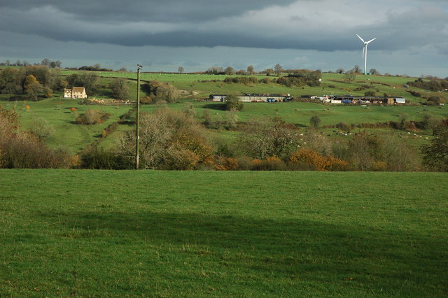
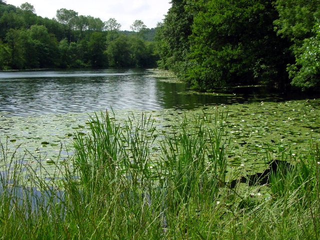
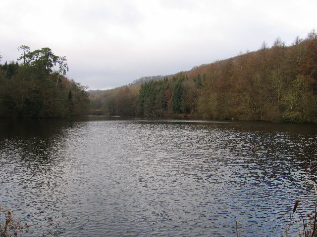
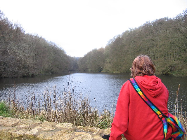
Old Pond is a picturesque freshwater feature located in the rural county of Gloucestershire, England. Nestled within a serene natural landscape, this body of water is categorized as a pond due to its relatively small size and shallow depth. Spanning approximately 1 acre, it serves as a vital habitat for various flora and fauna species, making it an area of ecological significance.

Surrounded by lush greenery, the pond is fed by natural springs and rainfall, ensuring its water remains fresh and replenished. Its still surface reflects the surrounding trees, creating a tranquil and enchanting atmosphere. The water is relatively shallow, with an average depth of 1.5 meters, but it provides an ideal environment for aquatic plants such as lilies, cattails, and water lilies to thrive.

Old Pond is home to a diverse range of wildlife. Visitors may catch a glimpse of various species of fish, including common carp, roach, and perch, swimming beneath the water's surface. Additionally, the pond attracts a multitude of waterfowl, such as ducks, geese, and swans, which can be observed gracefully gliding across the calm waters.

The surrounding area is a haven for nature enthusiasts and offers opportunities for peaceful walks and birdwatching. The pond's freshwater marshes provide a habitat for numerous amphibians, such as frogs and newts, while the surrounding trees and shrubs offer nesting sites for a variety of birds.

Overall, Old Pond is a serene and biodiverse freshwater feature, providing both a scenic retreat for visitors and a crucial habitat for a wide range of plant and animal species.

If you have any feedback on the listing, please let us know in the comments section below.

Old Pond Images

Images are sourced within 2km of 51.711687/-2.2666667 or Grid Reference SO8101. Thanks to Geograph Open Source API. All images are credited.

Woodchester Park car park, near Nympsfield The car park is reached via an unmade track with, this summer at least, quite a few puddles. The car park, once reached, is unremarkable. Not very busy today.
Woodchester Park car park, near Nympsfield
The car park is reached via an unmade track with, this summer at least, quite a few puddles. The car park, once reached, is unremarkable. Not very busy today.
Woodchester Park car park and a pylon, near Nympsfield The car park isn't hard-surfaced and the pylon isn't unusual. The weather was as dull as this snap.
Woodchester Park car park and a pylon, near Nympsfield
The car park isn't hard-surfaced and the pylon isn't unusual. The weather was as dull as this snap.
Track to car park, Woodchester Park Track to the National Trust car park at the west end of Woodchester Park.
Track to car park, Woodchester Park
Track to the National Trust car park at the west end of Woodchester Park.
Nympsfield Long Barrow The remains of a Neolithic burial chamber almost 5000 years old, 17 sets of bones were found here of both adults and children.

Maintained by English Heritage.
Nympsfield Long Barrow
The remains of a Neolithic burial chamber almost 5000 years old, 17 sets of bones were found here of both adults and children. Maintained by English Heritage.
Farmland at Nympsfield View across a valley to the wind turbine on Lynch Knoll.
Farmland at Nympsfield
View across a valley to the wind turbine on Lynch Knoll.
Stone Stile, Nympsfield On Gloucestershire footpath CNY13 looking West in the direction of Nympsfield.
Stone Stile, Nympsfield
On Gloucestershire footpath CNY13 looking West in the direction of Nympsfield.
Stone Stile, Nympsfield A "Fallen Idle" on Gloucestershire footpath CNY13 looking East. A large slab left to stabalise the ground at the field boundary/stile.
Stone Stile, Nympsfield
A "Fallen Idle" on Gloucestershire footpath CNY13 looking East. A large slab left to stabalise the ground at the field boundary/stile.
Woodchester Mansion
Woodchester Mansion
Lake at Woodchester Park
Wind Turbine at Nympsfield A solitary wind turbine just outside the village of Nympsfield in the Cotswolds
Wind Turbine at Nympsfield
A solitary wind turbine just outside the village of Nympsfield in the Cotswolds
Bristol and Gloucestershire Gliding Club Planes on the air strip at the Bristol and Gloucestershire Gliding Club
Bristol and Gloucestershire Gliding Club
Planes on the air strip at the Bristol and Gloucestershire Gliding Club
Lone Generator at Lynch Knoll The wind turbine is in an ideal spot for steady winds
Lone Generator at Lynch Knoll
The wind turbine is in an ideal spot for steady winds
Woodchester Mansion in snow
Parkmill Pond Parkmill Pond is the last in the chain of man-made lakes in Woodchester Park.
Parkmill Pond
Parkmill Pond is the last in the chain of man-made lakes in Woodchester Park.
Kennel Pond This is between Kennel Pond and Parkmill Pond looking towards Kennel Pond. These ponds are a chain of man-made ponds in Woodchester Park.
Kennel Pond
This is between Kennel Pond and Parkmill Pond looking towards Kennel Pond. These ponds are a chain of man-made ponds in Woodchester Park.
Woodchester Mansion Woodchester Mansion is an uncompleted Victorian Dream. This is the ground floor corridor, looking from the entrance hall towards the Drawing Room and Chapel. Now the haunt of rare bats, the house is open to the public at certain times.
Woodchester Mansion
Woodchester Mansion is an uncompleted Victorian Dream. This is the ground floor corridor, looking from the entrance hall towards the Drawing Room and Chapel. Now the haunt of rare bats, the house is open to the public at certain times.
Uneven ground on Selsley Common The humpy, bumpy nature of the ground in this area of Selsey Common is because there was once a fairly large Cotswold stone (oolitic limestone) quarry here.  The quarry was already disused by 1888, as indicated on maps of that date.
Uneven ground on Selsley Common
The humpy, bumpy nature of the ground in this area of Selsey Common is because there was once a fairly large Cotswold stone (oolitic limestone) quarry here. The quarry was already disused by 1888, as indicated on maps of that date.
Cows on Selsley Common With so much land to roam on, these cows have chosen to find pasture perilously close to the B4066.  Cattle grids placed a strategic locations prevent the cattle from straying from the commonland.
Cows on Selsley Common
With so much land to roam on, these cows have chosen to find pasture perilously close to the B4066. Cattle grids placed a strategic locations prevent the cattle from straying from the commonland.
Show me another place!

Old Pond is located at Grid Ref: SO8101 (Lat: 51.711687, Lng: -2.2666667)

Administrative County: Gloucestershire

District: Stroud

Police Authority: Gloucestershire

What 3 Words

///loudness.tractor.rotate. Near Nailsworth, Gloucestershire

Related Wikis

Woodchester Park SSSI

Woodchester Park (grid reference SO820014) is a 214.9-hectare (531-acre) biological Site of Special Scientific Interest in Gloucestershire, notified in...

Easter Park Farm Quarry

Easter Park Farm Quarry (grid reference SO810009) is a 0.15-hectare (0.37-acre) geological Site of Special Scientific Interest in Gloucestershire, notified...

Nympsfield

Nympsfield is a village and civil parish in the English county of Gloucestershire. It is located around four miles south-west of the town of Stroud. As...

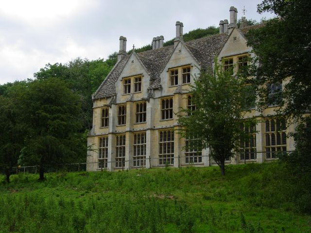
Convent of Poor Clares, Woodchester

A former Convent of Poor Clares is located in Woodchester, near Stroud in Gloucestershire. The convent was home to nuns of the Poor Clares order from 1850...

Coaley Peak

Coaley Peak is a picnic site and viewpoint in the English county of Gloucestershire. Located about 4 miles (6.4 km) south-west of the town of Stroud overlooking...

Woodchester

Woodchester is a Gloucestershire village in the Nailsworth (or Woodchester) Valley, a valley in the South Cotswolds in England, running southwards from...

King's Stanley

King's Stanley is a civil parish and village in Gloucestershire, England, to the south of Stonehouse and southwest of the town of Stroud. == Geography... ==

Leonard Stanley

Leonard Stanley, or Stanley St.Leonard, is a village and parish in Gloucestershire, England, 95 miles (150 km) west of London and 3.5 miles (5.5 km) southwest...

Nearby Amenities

Located within 500m of 51.711687,-2.2666667
Barrier: kissing_gate
Bicycle: no
Foot: yes
Lat/Long: 51.7123095/-2.2647314
Barrier: stile
Lat/Long: 51.7101421/-2.2680711
Noexit: yes
Lat/Long: 51.7091685/-2.266654
Bench
Backrest: no
Lat/Long: 51.712634/-2.2610715
Direction: 230
Tourism: viewpoint
Lat/Long: 51.7126279/-2.2610828
Barrier: kissing_gate
Lat/Long: 51.7102771/-2.2631584
Barrier: kissing_gate
Lat/Long: 51.7115554/-2.2631157
The data included in this document is from www.openstreetmap.org. The data is made available under ODbL.

Have you been to Old Pond?

Leave your review of Old Pond below (or comments, questions and feedback).