Broughton Pool

Lake, Pool, Pond, Freshwater Marsh in Staffordshire Stafford

England

Broughton Pool

Entering the small Hamlet of Sugnall The sign is showing the Sugnall walled kitchen garden to the left, which is part of the Sugnall Hall Estate.  see<span class="nowrap"><a title="http://www.sugnall.co.uk/history.html" rel="nofollow ugc noopener" href="http://www.sugnall.co.uk/history.html">Link</a><img style="margin-left:2px;" alt="External link" title="External link - shift click to open in new window" src="https://s1.geograph.org.uk/img/external.png" width="10" height="10"/></span>
Entering the small Hamlet of Sugnall Credit: Mick Malpass

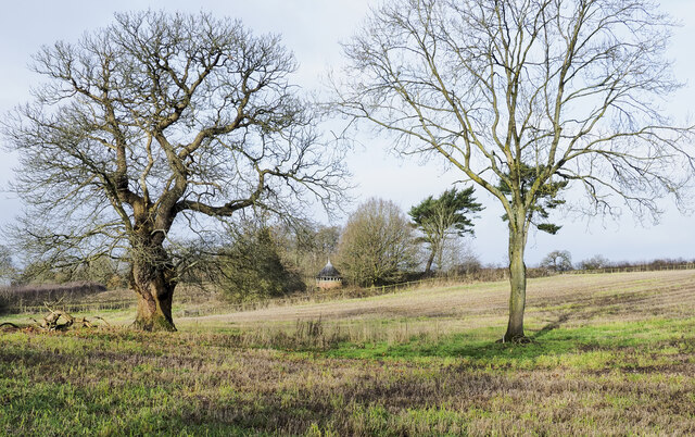
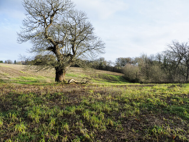
Broughton Pool is a freshwater lake located in Staffordshire, England. Covering an area of approximately 12 acres, it is surrounded by picturesque countryside and offers a tranquil and serene environment for visitors.

The pool is known for its crystal clear waters, which are fed by underground springs and streams. This natural water source ensures that the pool remains clean and unpolluted, providing a healthy habitat for various aquatic species. The water is also home to a diverse range of plant life, including water lilies and reeds, adding to the pool's natural beauty.

Broughton Pool is a popular destination for anglers, as it is stocked with a variety of fish species, including carp, pike, roach, and tench. Fishing permits can be obtained on-site, allowing visitors to enjoy a peaceful day out on the water while trying their luck at catching a prized fish.

Nature enthusiasts will also find plenty to admire at Broughton Pool. The surrounding area is a haven for wildlife, with an abundance of birds, mammals, and insects making their home in the adjacent woodlands and meadows. Visitors may spot kingfishers darting across the water, or perhaps catch a glimpse of a deer grazing on the banks.

Broughton Pool offers a range of facilities for visitors, including parking, toilets, and picnic areas. The pool is easily accessible by car, and there are footpaths and nature trails that allow visitors to explore the surrounding countryside.

Overall, Broughton Pool is a beautiful and peaceful freshwater lake, ideal for fishing, bird watching, or simply enjoying a leisurely stroll in nature.

If you have any feedback on the listing, please let us know in the comments section below.

Broughton Pool Images

Images are sourced within 2km of 52.869858/-2.3041153 or Grid Reference SJ7930. Thanks to Geograph Open Source API. All images are credited.

Entering the small Hamlet of Sugnall The sign is showing the Sugnall walled kitchen garden to the left, which is part of the Sugnall Hall Estate.  see<span class="nowrap"><a title="http://www.sugnall.co.uk/history.html" rel="nofollow ugc noopener" href="http://www.sugnall.co.uk/history.html">Link</a><img style="margin-left:2px;" alt="External link" title="External link - shift click to open in new window" src="https://s1.geograph.org.uk/img/external.png" width="10" height="10"/></span>
Entering the small Hamlet of Sugnall
The sign is showing the Sugnall walled kitchen garden to the left, which is part of the Sugnall Hall Estate. seeLinkExternal link
Derelict Red Brick Stables at Sugnall
Pasture to the left of Sugnall Hall The main Hall is on the opposite side of the B5026 to the Walled Garden.  see<span class="nowrap"><a title="http://www.sugnall.co.uk/history.html" rel="nofollow ugc noopener" href="http://www.sugnall.co.uk/history.html">Link</a><img style="margin-left:2px;" alt="External link" title="External link - shift click to open in new window" src="https://s1.geograph.org.uk/img/external.png" width="10" height="10"/></span>
Pasture to the left of Sugnall Hall
The main Hall is on the opposite side of the B5026 to the Walled Garden. seeLinkExternal link
Outbuildings for Sugnall Hall
The B5026 on its way to Sugnall
Storage Yard for Farm Implements in Croxton
Side Streets in Croxton The lane straight on rejoins the B5026 just outside the village, the lane to the left goes to Woodwall Green.
Side Streets in Croxton
The lane straight on rejoins the B5026 just outside the village, the lane to the left goes to Woodwall Green.
Country Lane near Croxton
Road from Woodwall Green to Croxton
House on the crossroads in Croxton
Offley Brook Mill A commercially working watermill with two wheels and an auxiliary diesel alternator set. The mill house is opposite. This is a very rural location.
Offley Brook Mill
A commercially working watermill with two wheels and an auxiliary diesel alternator set. The mill house is opposite. This is a very rural location.
Old house on the corner of Chester Road, Sugnall
Farm equipment by Eccleshall Road, Croxton
Eccleshall Road, Croxton
Junction on Eccleshall Road, Croxton Looking towards Windmill Lane.
Junction on Eccleshall Road, Croxton
Looking towards Windmill Lane.
Small building at Sugnall Park Sugnall Park is an area of land below the farm at Sugnall and north of the lake at Cop Mere. The building resembles a turret and is fenced around within an area of woodland.
Small building at Sugnall Park
Sugnall Park is an area of land below the farm at Sugnall and north of the lake at Cop Mere. The building resembles a turret and is fenced around within an area of woodland.
Land with lone tree in Sugnall Park Sugnall Park is an area of land below the farm at Sugnall and north of the lake at Cop Mere.
The land has held a crop recently, probably of maize.
Land with lone tree in Sugnall Park
Sugnall Park is an area of land below the farm at Sugnall and north of the lake at Cop Mere. The land has held a crop recently, probably of maize.
The Star Inn The Starr Inn is at Copmere End which is a location where five minor roads converge and is part of a complex of other minor roads with dispersed settlement near to Eccleshall.
The Star Inn
The Starr Inn is at Copmere End which is a location where five minor roads converge and is part of a complex of other minor roads with dispersed settlement near to Eccleshall.
Show me another place!

Broughton Pool is located at Grid Ref: SJ7930 (Lat: 52.869858, Lng: -2.3041153)

Administrative County: Staffordshire

District: Stafford

Police Authority: Staffordshire

What 3 Words

///eventful.confusion.tint. Near Eccleshall, Staffordshire

Related Wikis

Cop Mere

Cop Mere is one of the largest natural bodies of water in Staffordshire, England, covering 42 acres (17 ha). It has been designated a SSSI as an oligotrophic...

Jackson's Coppice and Marsh

Jackson's Coppice and Marsh is a nature reserve of the Staffordshire Wildlife Trust. It is along the River Sow, near the village of Bishop's Offley and...

Offleyhay

Offleyhay is a village in Staffordshire, England. The population as taken at the 2011 census can be found under Eccleshall. == References ==

Croxton, Staffordshire

Croxton is a village on the B5026 between Eccleshall and Loggerheads. Population details for the 2011 census can be found under Eccleshall. It is notable...

Eccleshall F.C.

Eccleshall Football Club is a football club based in Eccleshall, Staffordshire, England. They are currently members of the North West Counties League Division...

Copmere End

Copmere End is a small settlement in Staffordshire, England. It is 2 kilometres (1 mi) west of Eccleshall where the population taken for the 2011 census...

Outlands, Staffordshire

Outlands is a hamlet in the English county of Staffordshire. It lies 1 km eas of Bishop's Offley. == External links == Map sources for Outlands, Staffordshire

Eccleshall Castle

Eccleshall Castle is located in Eccleshall, Staffordshire, England (grid reference SJ827295). It was originally built in the 13th century. It is a Scheduled...

Nearby Amenities

Located within 500m of 52.869858,-2.3041153
Barrier: stile
Lat/Long: 52.8660619/-2.3061646
Barrier: stile
Lat/Long: 52.8680502/-2.3015445
Barrier: stile
Lat/Long: 52.8682187/-2.2997922
Barrier: stile
Lat/Long: 52.8682464/-2.3009564
Barrier: kissing_gate
Lat/Long: 52.8722455/-2.2982451
Power: pole
Lat/Long: 52.8672461/-2.3099277
Power: pole
Lat/Long: 52.8665058/-2.3086029
The data included in this document is from www.openstreetmap.org. The data is made available under ODbL.

Have you been to Broughton Pool?

Leave your review of Broughton Pool below (or comments, questions and feedback).