Waters Meeting

Lake, Pool, Pond, Freshwater Marsh in Lancashire

England

Waters Meeting

Bridgewater Canal by Hawthorn Rd, Stretford
Bridgewater Canal by Hawthorn Rd, Stretford Credit: Colin Park

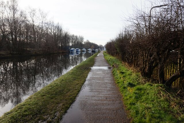
Waters Meeting is a picturesque area located in Lancashire, England, known for its natural water features including a lake, pool, pond, and freshwater marsh. Situated near the confluence of two rivers, the River Tonge and River Irwell, this unique landscape offers a diverse and rich ecosystem.

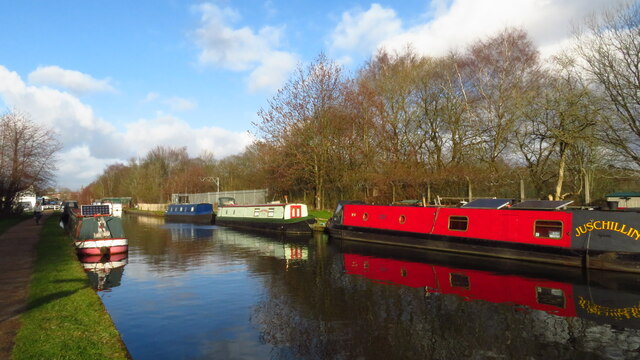
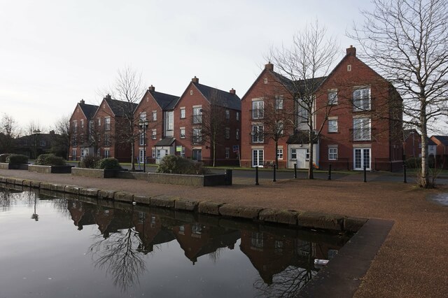
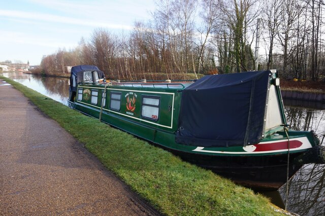
The lake in Waters Meeting is a tranquil body of water, surrounded by lush greenery and dotted with aquatic plants. Its calm surface reflects the surrounding trees and provides a serene atmosphere for visitors to enjoy. The lake is home to various species of fish, including carp and perch, making it a popular spot for anglers.

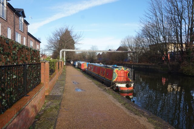
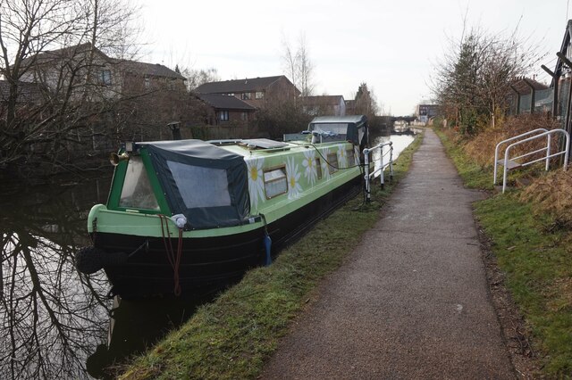
Adjacent to the lake is a smaller pool, which is also teeming with aquatic life. This pool is shallower than the lake and is often frequented by waterfowl such as ducks and swans, creating a delightful sight for birdwatchers.

A pond is nestled within the area as well, offering a different perspective of the water ecosystem. It is a smaller, more secluded water body, providing a habitat for amphibians like frogs and newts. The pond is often covered with lily pads, adding to its natural beauty.

Finally, the freshwater marsh in Waters Meeting is a vital part of the local ecology. It is characterized by its waterlogged soil and abundance of reeds and other wetland plants. This marsh serves as a breeding ground for various bird species, such as reed warblers and sedge warblers. It also acts as a natural filter, purifying the water that flows through it.

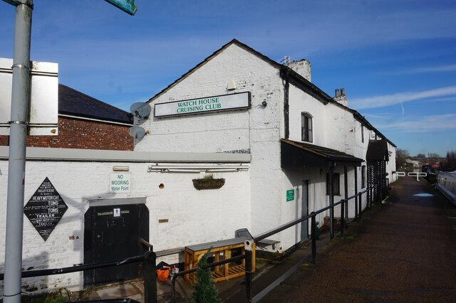
Waters Meeting in Lancashire is a haven for nature enthusiasts, offering a diverse range of water features that support a thriving ecosystem. Whether one is interested in fishing, birdwatching, or simply enjoying the tranquility of nature, this area provides a delightful experience for all.

If you have any feedback on the listing, please let us know in the comments section below.

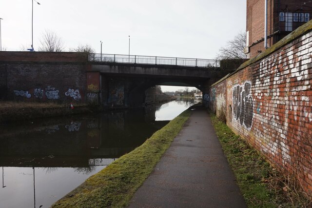
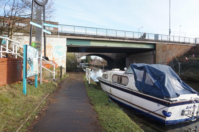
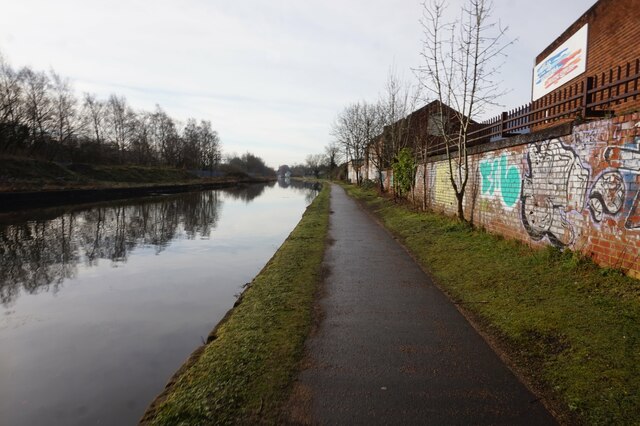
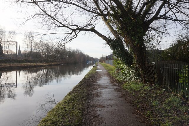
Waters Meeting Images

Images are sourced within 2km of 53.45652/-2.3083244 or Grid Reference SJ7995. Thanks to Geograph Open Source API. All images are credited.

Bridgewater Canal by Hawthorn Rd, Stretford
Bridgewater Canal at Europa Gate Road Bridge
Bridgewater Canal towards Stretford
Bridgewater Canal towards the Manchester Ship Canal
Bridgewater Canal towards Stretford
Canal boat Crusader, Bridgewater Canal
Houses at Stretford Marina, Bridgewater Canal
Bridgewater Canal at Stretford Marina
Canal boat Anne, Bridgewater Canal
Bridgewater Canal towards Edge Lane Bridge
Bridgewater Canal at Edge Lane Bridge
Bridgewater Canal towards the M60 Bridge
Bridgewater Canal towards the M6 Bridge
Bridgewater Canal towards the M60 Bridge
Canal boat Phoenix, Bridgewater Canal
Watch House Cruising Club, Bridgewater Canal
Show me another place!

Waters Meeting is located at Grid Ref: SJ7995 (Lat: 53.45652, Lng: -2.3083244)

Unitary Authority: Trafford

Police Authority: Greater Manchester

What 3 Words

///hobby.flags.comet. Near Stretford, Manchester

Nearby Locations

Waters Meeting

Related Wikis

Trafford Park railway station

Trafford Park railway station is in Stretford, close to the border of Trafford Park in the Trafford Metropolitan Borough of Greater Manchester in the North...

Trafford Park Railway

The Trafford Park Railway System is a disused railway system that runs around the site of the large Trafford Park Industrial Estate. Rail service stopped...

Manchester Plant

The Manchester Plant is a large food factory in North West England; during World War II, it was the largest food factory in Europe. It is devoted to manufacturing...

Municipal Borough of Stretford

Stretford was, from 1868 to 1974, a local government district coterminate with the town of Stretford, Lancashire, England. == Local Board and Urban... ==

Nearby Amenities

Located within 500m of 53.45652,-2.3083244
Water's Meet
Alt Name: Three Ways
Note: Canal junction situated between Stretford and Trafford Park, at the far end of the MIFT terminal.
Lat/Long: 53.4565714/-2.3083545
Railway: level_crossing
Lat/Long: 53.4598336/-2.3065461
Turning Circle
Lat/Long: 53.4524938/-2.3094899
Traffic Calming: hump
Lat/Long: 53.453805/-2.3060641
Traffic Calming: hump
Lat/Long: 53.4550255/-2.3065156
Traffic Calming: hump
Lat/Long: 53.4534829/-2.3067922
Give Way
Direction: backward
Lat/Long: 53.4548144/-2.3103888
Turning Circle
Lat/Long: 53.4520827/-2.3071145
Barrier: block
Lat/Long: 53.4566143/-2.3103747
Traffic Calming: hump
Lat/Long: 53.4547097/-2.3059618
Traffic Calming: hump
Lat/Long: 53.4542038/-2.305967
Traffic Calming: hump
Lat/Long: 53.455486/-2.3070458
Traction Power (Spares) Limited
Shop: motor_accessories
Lat/Long: 53.4544817/-2.3106447
Crossing
Crossing: zebra
Lat/Long: 53.4535047/-2.3104304
Glendale Motors
Shop: car_repair
Lat/Long: 53.4556228/-2.3096791
Barrier: bollard
Lat/Long: 53.4555299/-2.3082226
Trafford Angling Supplies
Shop: angling
Lat/Long: 53.4522797/-2.3099615
Painters
B&B Industrial Services Ltd
Lat/Long: 53.4557574/-2.3097793
Post Box
Ref: M32 404
Lat/Long: 53.4536599/-2.3105975
D.G. Motors
Shop: car_repair
Lat/Long: 53.4556901/-2.3097292
Telephone
Booth: KX100
Covered: booth
Phone: +44 161 865 1455
Postal Code: M32 0AZ
Lat/Long: 53.4544988/-2.3105544
Note: no name visible
Shop: convenience
Lat/Long: 53.4534357/-2.3101689
Barrier: bollard
Lat/Long: 53.4532135/-2.3086158
HGWorks
Shop: car_repair
Lat/Long: 53.4555555/-2.309629
Barrier: bollard
Lat/Long: 53.4531074/-2.3082756
Barrier: bollard
Lat/Long: 53.4545384/-2.3078455
Motor Painting
M&M Taxi & Paint
Lat/Long: 53.4554881/-2.3095789
Power: substation
Ref: 166549
Lat/Long: 53.4548059/-2.310979
Barrier: bollard
Lat/Long: 53.4563709/-2.3087431
Noexit: yes
Lat/Long: 53.457747/-2.3011859
Barrier: bollard
Lat/Long: 53.456196/-2.306307
Barrier: bollard
Lat/Long: 53.4565662/-2.3053489
Post Box
Ref: M32 405
Lat/Long: 53.4560712/-2.3017279
Cafe
OJ's Cafe & Sandwich Bar
Lat/Long: 53.4545937/-2.3024431
Nansen's Newsagent
Shop: newsagent
Lat/Long: 53.4551074/-2.3030677
Fast Food
Mei Mei
Cuisine: chinese
Phone: +44 161 865 2333
Lat/Long: 53.4547778/-2.3026671
Railway: switch
Lat/Long: 53.4565672/-2.3073745
Railway: switch
Lat/Long: 53.4569394/-2.3055303
Railway: buffer_stop
Lat/Long: 53.4569736/-2.3059093
Railway: buffer_stop
Lat/Long: 53.4569515/-2.305873
Railway: buffer_stop
Lat/Long: 53.4569319/-2.3058408
Railway: buffer_stop
Lat/Long: 53.4569054/-2.3057974
Railway: switch
Lat/Long: 53.4572307/-2.3048716
Railway: buffer_stop
Lat/Long: 53.456551/-2.30635
Railway: switch
Lat/Long: 53.4567508/-2.3058884
Noexit: yes
Lat/Long: 53.4604465/-2.3057486
Noexit: yes
Lat/Long: 53.4605887/-2.3056507
Noexit: yes
Lat/Long: 53.4607053/-2.3055607
Noexit: yes
Lat/Long: 53.460267/-2.3049891
Trafford Park
Naptan AtcoCode: 9100TRFDPK
Network: National Rail
Network Website: https://www.nationalrail.co.uk/stations/tra/
Network Wikidata: Q26334
Operator: Northern Rail
Operator Website: https://www.northernrailway.co.uk/stations/trafford-park
Operator Wikidata: Q85789775
Public Transport: station
Railway: station
Ref Crs: TRA
Train: yes
Wikidata: Q3932222
Wikipedia: en:Trafford Park railway station
Lat/Long: 53.4547767/-2.3116958
Traffic Calming: bump
Lat/Long: 53.4556986/-2.3156322
Traffic Calming: bump
Lat/Long: 53.4555492/-2.3149443
Barrier: lift_gate
Lat/Long: 53.4606364/-2.3109464
Crossing
Crossing: zebra
Lat/Long: 53.4560231/-2.3147599
Traffic Calming: bump
Lat/Long: 53.4566316/-2.3146573
Crossing
Crossing: zebra
Lat/Long: 53.4571902/-2.3151854
Crossing
Crossing: zebra
Lat/Long: 53.4562815/-2.3147901
Traffic Calming: bump
Lat/Long: 53.4573503/-2.3154345
Traffic Calming: bump
Lat/Long: 53.4555881/-2.3155822
Traffic Calming: bump
Lat/Long: 53.4557925/-2.3142672
Barrier: kerb
Kerb: flush
Lat/Long: 53.4554657/-2.3083538
Traffic Calming: cushion
Lat/Long: 53.455669/-2.3104226
Crossing
Crossing: zebra
Lat/Long: 53.4592228/-2.3090718
Give Way
Direction: backward
Lat/Long: 53.4593488/-2.3089314
Parking
Access: private
Parking: surface
Lat/Long: 53.4541168/-2.3067615
Tourism: artwork
Lat/Long: 53.453898/-2.3057713
Traffic Calming: cushion
Lat/Long: 53.4549775/-2.3104676
Generator Method: photovoltaic
Generator Output Electricity: yes
Generator Source: solar
Generator Type: solar_photovoltaic_panel
Power: generator
Lat/Long: 53.4562512/-2.3118913
Generator Method: photovoltaic
Generator Output Electricity: yes
Generator Source: solar
Generator Type: solar_photovoltaic_panel
Power: generator
Lat/Long: 53.4562595/-2.3111138
Give Way
Direction: backward
Lat/Long: 53.4563604/-2.311342
Give Way
Direction: backward
Lat/Long: 53.4563903/-2.3104586
Traffic Signals
Traffic Signals: signal
Traffic Signals Direction: forward
Lat/Long: 53.4522296/-2.3103696
Crossing
Crossing: traffic_signals
Lat/Long: 53.4522052/-2.3103681
Traffic Calming: cushion
Lat/Long: 53.4528291/-2.3103978
Traffic Calming: table
Lat/Long: 53.4536082/-2.3105756
Traffic Calming: table
Lat/Long: 53.4535961/-2.3103127
Traffic Calming: table
Lat/Long: 53.4536774/-2.3104395
Traffic Calming: table
Lat/Long: 53.4534696/-2.3104288
Give Way
Direction: backward
Lat/Long: 53.4535935/-2.3103909
Give Way
Direction: backward
Lat/Long: 53.4536051/-2.3104827
Traffic Calming: hump
Lat/Long: 53.4523838/-2.3087038
Traffic Calming: hump
Lat/Long: 53.4529168/-2.3087292
Traffic Calming: hump
Lat/Long: 53.4534744/-2.308755
Railway: switch
Lat/Long: 53.4570935/-2.3052069
Give Way
Direction: backward
Lat/Long: 53.4593341/-2.3080171
Barrier: block
Lat/Long: 53.4596556/-2.3074695
Barrier: block
Lat/Long: 53.4596284/-2.3074964
Barrier: block
Lat/Long: 53.4595941/-2.3075279
Barrier: block
Lat/Long: 53.4595661/-2.3075567
Barrier: block
Lat/Long: 53.4595406/-2.3075835
Barrier: block
Lat/Long: 53.4595038/-2.3076104
Barrier: block
Lat/Long: 53.4594683/-2.3076486
Barrier: block
Lat/Long: 53.4594404/-2.3076721
Barrier: block
Lat/Long: 53.4594116/-2.3077022
Barrier: block
Lat/Long: 53.4593817/-2.3077405
Barrier: block
Lat/Long: 53.4593609/-2.307778
Barrier: block
Lat/Long: 53.4593362/-2.3078303
Barrier: block
Lat/Long: 53.4593186/-2.3078819
Barrier: block
Lat/Long: 53.4592859/-2.3078759
Barrier: block
Lat/Long: 53.4592611/-2.3078156
Noexit: yes
Lat/Long: 53.459963/-2.3065536
Noexit: yes
Lat/Long: 53.460371/-2.3068795
Noexit: yes
Lat/Long: 53.460692/-2.3066247
Trafford Park
Local Ref: 2
Public Transport: stop_position
Railway: stop
Ref: 2
Train: yes
Lat/Long: 53.4545566/-2.312701
Trafford Park
Local Ref: 1
Public Transport: stop_position
Railway: stop
Ref: 1
Train: yes
Lat/Long: 53.4549993/-2.3108305
Manchester Container Terminal
Railway: yard
Lat/Long: 53.4581311/-2.3035632
Information: guidepost
Tourism: information
Lat/Long: 53.4554839/-2.3082955
The data included in this document is from www.openstreetmap.org. The data is made available under ODbL.

Have you been to Waters Meeting?

Leave your review of Waters Meeting below (or comments, questions and feedback).