Between the Caulds Pool

Lake, Pool, Pond, Freshwater Marsh in Roxburghshire

Scotland

Between the Caulds Pool

Crop field near Rutherford Burnside Towards Hardie's Burn Strip woodland.
Crop field near Rutherford Burnside Credit: JThomas

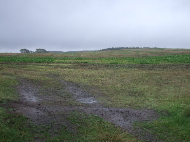
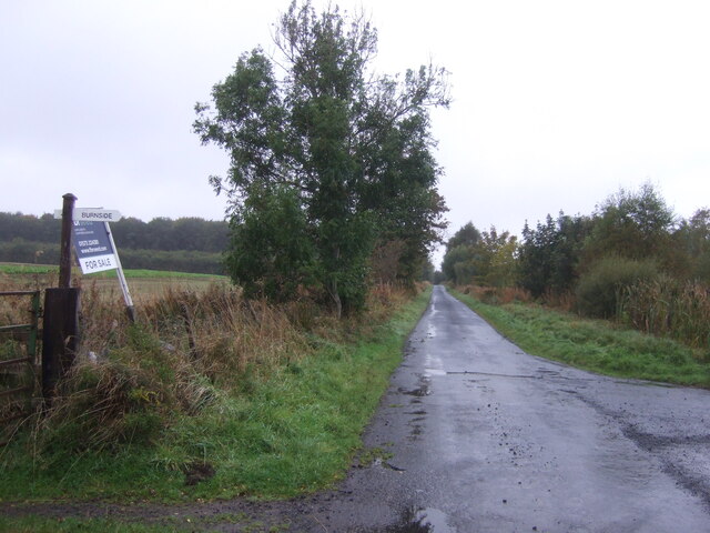
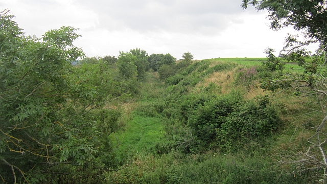
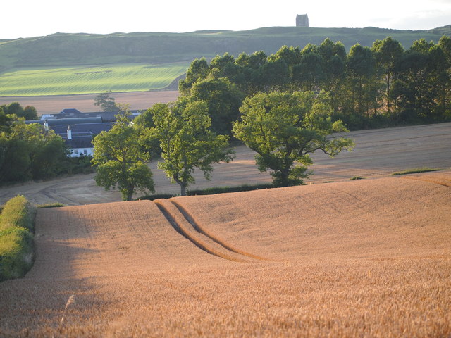
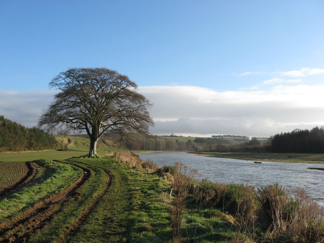
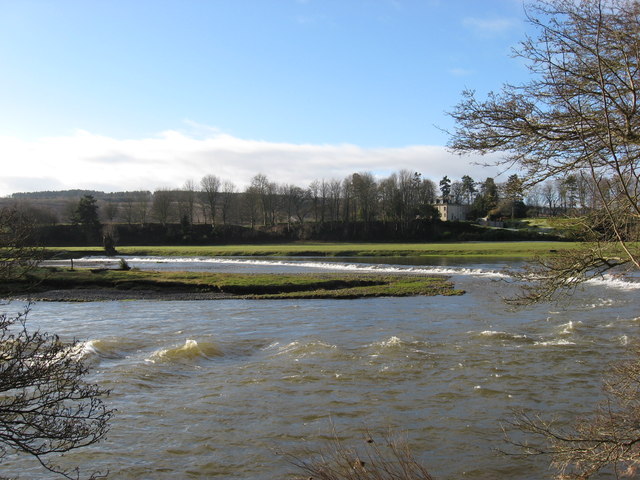
Between the Caulds Pool, located in Roxburghshire, Scotland, is a picturesque freshwater feature that can be classified as a lake, pool, pond, and freshwater marsh all at once. Spanning an area of approximately 2 hectares, it is nestled amidst rolling hills and verdant meadows, creating a serene and idyllic landscape.

The pool's name, "Between the Caulds," originates from the Old English word "cauld," meaning cold or chilly. This indicates that the water in the pool tends to be cool and refreshing, making it an enticing spot for both locals and visitors.

The pool is fed by a combination of natural springs and small watercourses, ensuring a constant flow of fresh water. This inflow of water also supports the growth of diverse aquatic plants, creating a thriving ecosystem within the pool. The presence of reeds, rushes, and water lilies further enhances the natural beauty of the pool, attracting a variety of waterfowl and other wildlife.

Surrounded by a verdant shoreline, the pool offers ample opportunities for nature lovers to observe and appreciate the abundant flora and fauna. The tranquil atmosphere and the reflection of the surrounding landscape on the pool's surface make it an ideal spot for relaxation and contemplation.

As a designated site of special scientific interest, Between the Caulds Pool serves as an important habitat for several rare and protected species, including various dragonflies, amphibians, and aquatic plants. The pool's conservation status ensures that its ecological value is preserved and that it continues to thrive as a haven for biodiversity.

In conclusion, Between the Caulds Pool is a captivating freshwater feature in Roxburghshire, Scotland, boasting a harmonious blend of lake, pool, pond, and freshwater marsh characteristics. Its natural beauty, diverse wildlife, and ecological significance make it a cherished destination for both nature enthusiasts and environmentalists alike.

If you have any feedback on the listing, please let us know in the comments section below.

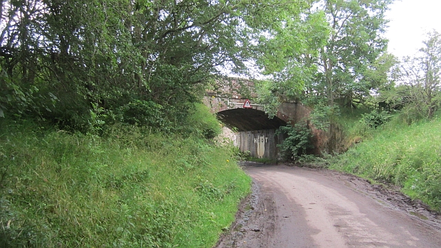
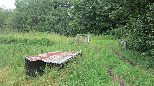
Between the Caulds Pool Images

Images are sourced within 2km of 55.574524/-2.5431211 or Grid Reference NT6531. Thanks to Geograph Open Source API. All images are credited.

Crop field near Rutherford Burnside Towards Hardie's Burn Strip woodland.
Crop field near Rutherford Burnside
Towards Hardie's Burn Strip woodland.
Minor road near Rutherford Burnside Towards Pirnie.
Minor road near Rutherford Burnside
Towards Pirnie.
A phone box at Makerstoun It appears to be used as the village library.
A phone box at Makerstoun
It appears to be used as the village library.
Makerstoun phone box The box is being used as a library.
Makerstoun phone box
The box is being used as a library.
Arable land, Rutherford Burnside Several fields here have recently accumulated piles of stones. This suggests a recent switch to arable use.
Arable land, Rutherford Burnside
Several fields here have recently accumulated piles of stones. This suggests a recent switch to arable use.
Rutherford Burnside Newly emerging cereal crop in dry conditions.
Rutherford Burnside
Newly emerging cereal crop in dry conditions.
Border Berries at Rutherford Farm Two large fields on the south side of the main farm buildings are used during the summer months as a pick your own fruit farm. The main fruits are strawberries, raspberries, gooseberries, red currants and black currants. On this occasion I was picking strawberries.
Border Berries at Rutherford Farm
Two large fields on the south side of the main farm buildings are used during the summer months as a pick your own fruit farm. The main fruits are strawberries, raspberries, gooseberries, red currants and black currants. On this occasion I was picking strawberries.
Border Berries A large area on the south side of Rutherford Farm buildings is used during the summer months as a pick your own fruit farm. The main fruits are strawberries, raspberries, gooseberries, red currants, black currants, Tay berries and black berries. Due to an unseasonably cold spring and recent inclement weather some fruits will ripen later than usual but strawberries were ready for picking on my visit.
Border Berries
A large area on the south side of Rutherford Farm buildings is used during the summer months as a pick your own fruit farm. The main fruits are strawberries, raspberries, gooseberries, red currants, black currants, Tay berries and black berries. Due to an unseasonably cold spring and recent inclement weather some fruits will ripen later than usual but strawberries were ready for picking on my visit.
The "Hoot Bridge", Rutherford Overbridge which carried the Kelso Branch over a minor road. There is a sharp left on the other side - hence the owl message <a href="https://www.geograph.org.uk/photo/1988949">NT6430 : Motorists, hoot your horn!</a>.
The "Hoot Bridge", Rutherford
Overbridge which carried the Kelso Branch over a minor road. There is a sharp left on the other side - hence the owl message NT6430 : Motorists, hoot your horn!.
Kelso Branch Railway A track allows farm access to the trackbed which is used as field access here.
Kelso Branch Railway
A track allows farm access to the trackbed which is used as field access here.
Tweed flood plain near Rutherford Grassland beside the Tweed.
Tweed flood plain near Rutherford
Grassland beside the Tweed.
Roxburgh Newtown Sheep graze beside the Stockstruther Burn on land obviously unsuited to arable use.
Roxburgh Newtown
Sheep graze beside the Stockstruther Burn on land obviously unsuited to arable use.
Stockstruther Burn Flowing between steep banks towards the Tweed.
Stockstruther Burn
Flowing between steep banks towards the Tweed.
Kelso Branch Railway Overgrown railway trackbed at Roxburgh Newtown.
Kelso Branch Railway
Overgrown railway trackbed at Roxburgh Newtown.
The Old Threshing Mill, Millfield View towards Old Threshing Mill with Smailholm Tower on horizon.
The Old Threshing Mill, Millfield
View towards Old Threshing Mill with Smailholm Tower on horizon.
Railway bridge, Roxburgh Newtown A road bridge over the Kelso Branch Railway.
Railway bridge, Roxburgh Newtown
A road bridge over the Kelso Branch Railway.
'In Isolation' This fine specimen of a Beech Tree stands close to the River Tweed near Dalcove Braes.
'In Isolation'
This fine specimen of a Beech Tree stands close to the River Tweed near Dalcove Braes.
The Weir at Rutherford Lodge Crossing the Tweed from bank to bank this weir may well be the longest on the river. In spate conditions it's certainly one of the noisiest.
The Weir at Rutherford Lodge
Crossing the Tweed from bank to bank this weir may well be the longest on the river. In spate conditions it's certainly one of the noisiest.
Show me another place!

Between the Caulds Pool is located at Grid Ref: NT6531 (Lat: 55.574524, Lng: -2.5431211)

Unitary Authority: The Scottish Borders

Police Authority: The Lothians and Scottish Borders

What 3 Words

///regulates.fashion.tangling. Near Saint Boswells, Scottish Borders

Related Wikis

Rutherford railway station

Rutherford railway station served the parish of Maxton, Roxburghshire, Scotland from 1851 to 1964 on the Kelso Line. == History == The station opened in...

Makerstoun

Makerstoun is a parish in the Scottish Borders area of Scotland, as well as the historic county of Roxburghshire, 4 miles (6 km) south-west of Kelso.The...

Borders Abbeys Way

The Borders Abbeys Way is a long-distance footpath in the Scottish Borders area of Scotland. It is a circular walkway and is 109 kilometres (68 mi) in...

Smailholm Tower

Smailholm Tower is a peel tower at Smailholm, around five miles (8 km) west of Kelso in the Scottish Borders. Its dramatic situation, atop a crag of Lady...

Roxburgh railway station

Roxburgh railway station was on the Kelso Line, and served the village of Roxburgh, Scottish Borders, from 1850 to 1964. == History == The station was...

Mertoun

Mertoun is a parish in the south-west of the historic county of Berwickshire in the Scottish Borders area of Scotland. Together with the parish of Maxton...

Mertoun House

Mertoun House is a country house situated by the River Tweed, 2 miles (3 kilometres) east of St Boswells in the Scottish Borders. It is home to the Duke...

Roxburgh (village)

Roxburgh (Gaelic, Rosbrog) is a village off the A699, by the River Teviot, near Kelso in the Scottish Borders area of Scotland. It should not be confused...

Nearby Amenities

Located within 500m of 55.574524,-2.5431211
Whitewater Rapid Grade: 2
Lat/Long: 55.5764124/-2.5480953
West Lodge
Place: locality
Lat/Long: 55.5756986/-2.5372984
Mill Island
Place: locality
Lat/Long: 55.576321/-2.5489948
Site of Rutherford Village
Historic: archaeological_site
Lat/Long: 55.5734777/-2.5501423
Rutherford Mill
Place: locality
Lat/Long: 55.5724087/-2.5389554
The data included in this document is from www.openstreetmap.org. The data is made available under ODbL.

Have you been to Between the Caulds Pool?

Leave your review of Between the Caulds Pool below (or comments, questions and feedback).