Long Stream

Lake, Pool, Pond, Freshwater Marsh in Berwickshire

Scotland

Long Stream

Gated track off B6404 Leading to the woods at Danderhall.
Gated track off B6404 Credit: Russel Wills

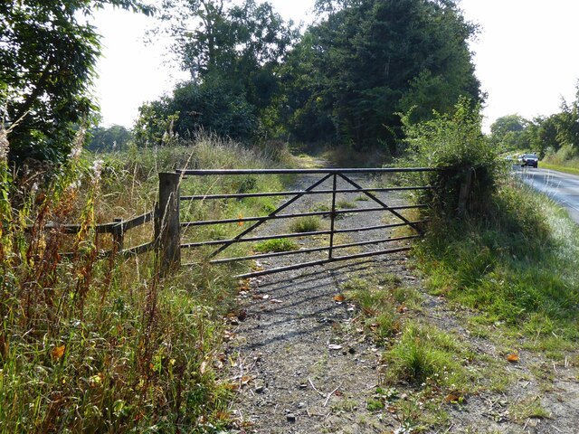
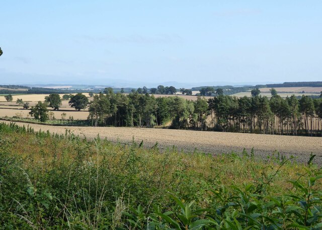
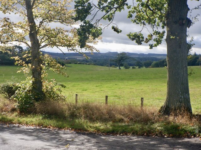
Long Stream, located in the picturesque region of Berwickshire, is a stunning freshwater marsh that encompasses a lake, pool, pond, and various other bodies of water. Spanning over a vast area, this natural marvel is a haven for biodiversity and offers breathtaking views to visitors and nature enthusiasts alike.

The main attraction of Long Stream is its expansive lake, which is fed by a network of smaller streams and springs. The lake's crystal-clear water is home to a diverse range of aquatic life, including various species of fish, amphibians, and waterfowl. The tranquil ambiance of the lake makes it a perfect spot for boating, fishing, and birdwatching, attracting enthusiasts from far and wide.

Adjacent to the lake, there is a smaller pool and pond that further contribute to the area's rich ecosystem. These smaller bodies of water serve as vital habitats for various plant and animal species, such as water lilies, dragonflies, and frogs. Exploring the pool and pond allows visitors to immerse themselves in the enchanting world of freshwater marshes and witness the delicate balance of nature firsthand.

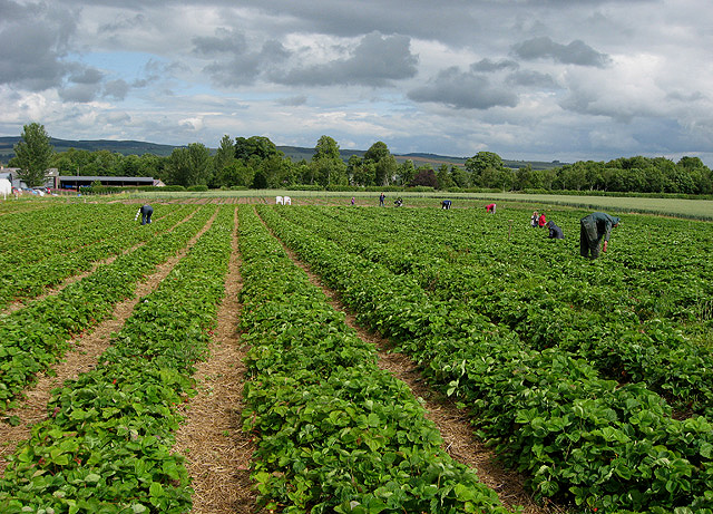
The freshwater marsh surrounding Long Stream provides a thriving habitat for a plethora of wildlife. The marshland is characterized by dense vegetation, including reeds, grasses, and sedges, which act as a sanctuary for numerous species of birds, insects, and small mammals. The marsh also plays a crucial role in water filtration and flood prevention, making it an essential ecological feature in the region.

In conclusion, Long Stream in Berwickshire is a remarkable natural landscape that encompasses a lake, pool, pond, and freshwater marsh. Its diverse range of habitats supports a wide array of plant and animal life, making it a must-visit destination for nature lovers and those seeking solace in the beauty of the great outdoors.

If you have any feedback on the listing, please let us know in the comments section below.
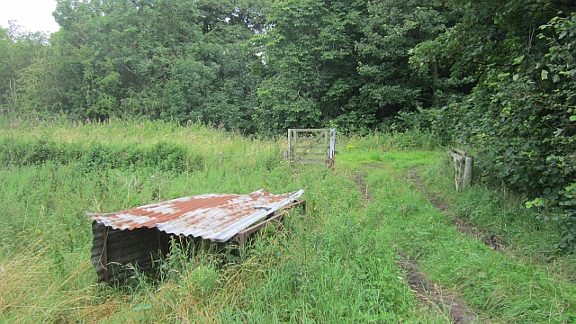
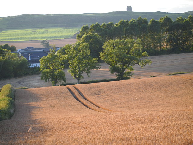
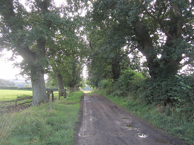
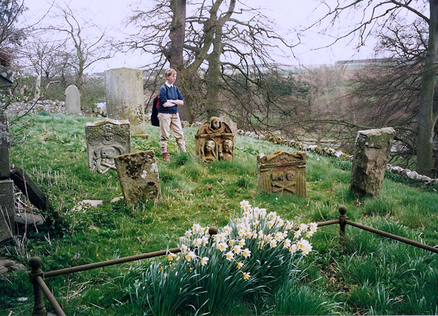
Long Stream Images

Images are sourced within 2km of 55.577665/-2.5697319 or Grid Reference NT6431. Thanks to Geograph Open Source API. All images are credited.

Gated track off B6404 Leading to the woods at Danderhall.
Gated track off B6404
Leading to the woods at Danderhall.
Arable land east of Danderhall Looking into the valley of the River Tweed.
Arable land east of Danderhall
Looking into the valley of the River Tweed.
Field, Whitehouse Mertoun Estate.
Field, Whitehouse
Mertoun Estate.
A symbolic gravestone at Mertoun Old Parish graveyard The winged soul at the top of the stone is a symbol of immortality and represents the human soul rising to Heaven for the Day of Judgement. The skull and crossed femur bones are symbols of mortality. There is no trace of an inscription, but according to the Pevsner architectural guide to the Borders, this 1741 stone is for William Sanderson. The old graveyard towards the eastern boundary of Mertoun Estate was the site of the original Mertoun Parish Church thought to date back to the 12th century and dedicated to St Ninian by David De Bernham in 1241. The church is long gone and the only building in the graveyard is a neglected vault that was a mausoleum for the Scotts of Harden.
A symbolic gravestone at Mertoun Old Parish graveyard
The winged soul at the top of the stone is a symbol of immortality and represents the human soul rising to Heaven for the Day of Judgement. The skull and crossed femur bones are symbols of mortality. There is no trace of an inscription, but according to the Pevsner architectural guide to the Borders, this 1741 stone is for William Sanderson. The old graveyard towards the eastern boundary of Mertoun Estate was the site of the original Mertoun Parish Church thought to date back to the 12th century and dedicated to St Ninian by David De Bernham in 1241. The church is long gone and the only building in the graveyard is a neglected vault that was a mausoleum for the Scotts of Harden.
Border Berries at Rutherford Farm Two large fields on the south side of the main farm buildings are used during the summer months as a pick your own fruit farm. The main fruits are strawberries, raspberries, gooseberries, red currants and black currants. On this occasion I was picking strawberries.
Border Berries at Rutherford Farm
Two large fields on the south side of the main farm buildings are used during the summer months as a pick your own fruit farm. The main fruits are strawberries, raspberries, gooseberries, red currants and black currants. On this occasion I was picking strawberries.
A sign for Border Berries Fruit Farm This sign is by the A699 at Broomhouse, 700m before the turn-off for Rutherford Farm where Borders Berries is located. For a view of the fruit farm, see <a href="https://www.geograph.org.uk/photo/2515759">NT6430 : Border Berries at Rutherford Farm</a>.
A sign for Border Berries Fruit Farm
This sign is by the A699 at Broomhouse, 700m before the turn-off for Rutherford Farm where Borders Berries is located. For a view of the fruit farm, see NT6430 : Border Berries at Rutherford Farm.
Border Berries A large area on the south side of Rutherford Farm buildings is used during the summer months as a pick your own fruit farm. The main fruits are strawberries, raspberries, gooseberries, red currants, black currants, Tay berries and black berries. Due to an unseasonably cold spring and recent inclement weather some fruits will ripen later than usual but strawberries were ready for picking on my visit.
Border Berries
A large area on the south side of Rutherford Farm buildings is used during the summer months as a pick your own fruit farm. The main fruits are strawberries, raspberries, gooseberries, red currants, black currants, Tay berries and black berries. Due to an unseasonably cold spring and recent inclement weather some fruits will ripen later than usual but strawberries were ready for picking on my visit.
The "Hoot Bridge", Rutherford Overbridge which carried the Kelso Branch over a minor road. There is a sharp left on the other side - hence the owl message <a href="https://www.geograph.org.uk/photo/1988949">NT6430 : Motorists, hoot your horn!</a>.
The "Hoot Bridge", Rutherford
Overbridge which carried the Kelso Branch over a minor road. There is a sharp left on the other side - hence the owl message NT6430 : Motorists, hoot your horn!.
Kelso Branch Railway A track allows farm access to the trackbed which is used as field access here.
Kelso Branch Railway
A track allows farm access to the trackbed which is used as field access here.
Tweed flood plain near Rutherford Grassland beside the Tweed.
Tweed flood plain near Rutherford
Grassland beside the Tweed.
The Old Threshing Mill, Millfield View towards Old Threshing Mill with Smailholm Tower on horizon.
The Old Threshing Mill, Millfield
View towards Old Threshing Mill with Smailholm Tower on horizon.
Road, Magdalenehall A tree lined farm road running towards the Tweed.
Road, Magdalenehall
A tree lined farm road running towards the Tweed.
Mertoun old parish graveyard This old graveyard towards the eastern boundary of Mertoun Estate was the site of the original Mertoun Parish Church thought to date back to the 12th century and dedicated to St Ninian by David De Bernham in 1241. The church is long gone and the only building in the graveyard is a neglected vault that was a mausoleum for the Scotts of Harden. A replacement church was constructed 900m to the west of this site in 1658 and a new parish graveyard is at Clintmains. There are some good 18th century symbolic gravestones and there is a small modern burial enclosure adjacent to the west boundary of the old graveyard. This photo was taken in April 1995 when the graveyard was obviously being maintained but it was neglected on a recent visit and winter is the best time to go when the vegetation has died back.
Mertoun old parish graveyard
This old graveyard towards the eastern boundary of Mertoun Estate was the site of the original Mertoun Parish Church thought to date back to the 12th century and dedicated to St Ninian by David De Bernham in 1241. The church is long gone and the only building in the graveyard is a neglected vault that was a mausoleum for the Scotts of Harden. A replacement church was constructed 900m to the west of this site in 1658 and a new parish graveyard is at Clintmains. There are some good 18th century symbolic gravestones and there is a small modern burial enclosure adjacent to the west boundary of the old graveyard. This photo was taken in April 1995 when the graveyard was obviously being maintained but it was neglected on a recent visit and winter is the best time to go when the vegetation has died back.
A symbolic stone at Mertoun old parish graveyard This old graveyard towards the eastern boundary of Mertoun Estate was the site of the original Mertoun Parish Church thought to date back to the 12th century and dedicated to St Ninian by David De Bernham in 1241. The church is long gone and the only building in the graveyard is a neglected vault that was a mausoleum for the Scotts of Harden. A replacement church was constructed 900m to the west of this site in 1658 and a new parish graveyard is at Clintmains. There are some good 18th century symbolic gravestones and there is a small modern burial enclosure adjacent to the west boundary of the old graveyard. This gravestone on the north side of the burial vault is dated 1763. The winged angel at the top is an emblem of immortality representing the human soul. The carved portrait figures below, with one holding a book showing religious devotion, represent the deceased.
A symbolic stone at Mertoun old parish graveyard
This old graveyard towards the eastern boundary of Mertoun Estate was the site of the original Mertoun Parish Church thought to date back to the 12th century and dedicated to St Ninian by David De Bernham in 1241. The church is long gone and the only building in the graveyard is a neglected vault that was a mausoleum for the Scotts of Harden. A replacement church was constructed 900m to the west of this site in 1658 and a new parish graveyard is at Clintmains. There are some good 18th century symbolic gravestones and there is a small modern burial enclosure adjacent to the west boundary of the old graveyard. This gravestone on the north side of the burial vault is dated 1763. The winged angel at the top is an emblem of immortality representing the human soul. The carved portrait figures below, with one holding a book showing religious devotion, represent the deceased.
A gravestone at Mertoun This stone is in the old Mertoun parish graveyard near Magdalene Hall Farm. I found this gravestone for Ebenezer Robison, late schoolmaster of the parish of Mertoun, interesting for the fraction included in his age.
A gravestone at Mertoun
This stone is in the old Mertoun parish graveyard near Magdalene Hall Farm. I found this gravestone for Ebenezer Robison, late schoolmaster of the parish of Mertoun, interesting for the fraction included in his age.
A burial vault on the Mertoun Estate This old graveyard towards the eastern boundary of Mertoun Estate was the site of the original Mertoun Parish Church thought to date back to the 12th century and dedicated to St Ninian by David De Bernham in 1241. The church is long gone and the only building in the graveyard is a neglected vault that was a mausoleum for the Scotts of Harden. A replacement church was constructed 900m to the west of this site in 1658 and a new parish graveyard is at Clintmains. There are some good 18th century symbolic gravestones and there is a small modern burial enclosure adjacent to the west boundary of the old graveyard. The graveyard is neglected and winter is the best time to go when the vegetation has died back. It seemed to be reasonably well maintained when I made a visit in April 1995, see <a href="https://www.geograph.org.uk/photo/3280864">NT6231 : Mertoun old parish graveyard</a>.
A burial vault on the Mertoun Estate
This old graveyard towards the eastern boundary of Mertoun Estate was the site of the original Mertoun Parish Church thought to date back to the 12th century and dedicated to St Ninian by David De Bernham in 1241. The church is long gone and the only building in the graveyard is a neglected vault that was a mausoleum for the Scotts of Harden. A replacement church was constructed 900m to the west of this site in 1658 and a new parish graveyard is at Clintmains. There are some good 18th century symbolic gravestones and there is a small modern burial enclosure adjacent to the west boundary of the old graveyard. The graveyard is neglected and winter is the best time to go when the vegetation has died back. It seemed to be reasonably well maintained when I made a visit in April 1995, see NT6231 : Mertoun old parish graveyard.
An inscription on a burial vault at Mertoun This inscription is on the west elevation of a neglected vault in Mertoun old parish graveyard that was a mausoleum for the Scotts of Harden. The vault stands on the site of a 12th century church that was replaced by the present Mertoun church 900m to the west and built in 1658. The inscription for family members formerly buried here is:

THE FOLLOWING AND OTHERS
WHO DIED YOUNG ARE BURIED HERE
WALTER SCOTT 1724 – 1793
LADY DIANA HUME CAMPBELL
HIS WIFE 1735 – 1827
ANN SCOTT THEIR DAUGHTER 1755 – 1819
HUGH SCOTT 6TH BARON OF POLWARTH
THEIR SON 1758 – 1841
HARRIET BRUHL HIS WIFE 1773 – 1853
HENRY FRANCIS SCOTT 7TH BARON
POLWARTH THEIR SON 1800 – 1867
GEORGINA BAILLIE HIS WIFE 1812 – 1859
HELEN GEORGINA THEIR DAUGHTER
1840 – 1868
WALTER HUGH SCOTT 8TH BARON
POLWARTH THEIR SON 1838 – 1920
MARY HAMILTON GORDON HIS WIFE
1844 – 1914
KATHERINE GRISELL BAILLIE
An inscription on a burial vault at Mertoun
This inscription is on the west elevation of a neglected vault in Mertoun old parish graveyard that was a mausoleum for the Scotts of Harden. The vault stands on the site of a 12th century church that was replaced by the present Mertoun church 900m to the west and built in 1658. The inscription for family members formerly buried here is: THE FOLLOWING AND OTHERS WHO DIED YOUNG ARE BURIED HERE WALTER SCOTT 1724 – 1793 LADY DIANA HUME CAMPBELL HIS WIFE 1735 – 1827 ANN SCOTT THEIR DAUGHTER 1755 – 1819 HUGH SCOTT 6TH BARON OF POLWARTH THEIR SON 1758 – 1841 HARRIET BRUHL HIS WIFE 1773 – 1853 HENRY FRANCIS SCOTT 7TH BARON POLWARTH THEIR SON 1800 – 1867 GEORGINA BAILLIE HIS WIFE 1812 – 1859 HELEN GEORGINA THEIR DAUGHTER 1840 – 1868 WALTER HUGH SCOTT 8TH BARON POLWARTH THEIR SON 1838 – 1920 MARY HAMILTON GORDON HIS WIFE 1844 – 1914 KATHERINE GRISELL BAILLIE
Inside the Scotts of Harden burial vault at Mertoun This 18th century mausoleum stands on the site of the original Mertoun parish church in the old parish graveyard. The present Mertoun parish church built in 1658 is located 900m to the west. Family members formerly buried here are inscribed on the outer west wall of the mausoleum. For a view of the inscriptions, see <a href="https://www.geograph.org.uk/photo/3280892">NT6231 : An inscription on a burial vault at Mertoun</a>. For an external view of the neglected building, see <a href="https://www.geograph.org.uk/photo/3280884">NT6231 : A burial vault on the Mertoun Estate</a>.
Inside the Scotts of Harden burial vault at Mertoun
This 18th century mausoleum stands on the site of the original Mertoun parish church in the old parish graveyard. The present Mertoun parish church built in 1658 is located 900m to the west. Family members formerly buried here are inscribed on the outer west wall of the mausoleum. For a view of the inscriptions, see NT6231 : An inscription on a burial vault at Mertoun. For an external view of the neglected building, see NT6231 : A burial vault on the Mertoun Estate.
Show me another place!

Long Stream is located at Grid Ref: NT6431 (Lat: 55.577665, Lng: -2.5697319)

Unitary Authority: The Scottish Borders

Police Authority: The Lothians and Scottish Borders

What 3 Words

///strapping.fend.chose. Near Saint Boswells, Scottish Borders

Nearby Locations

Crow Wood Long Stream

Related Wikis

Borders Abbeys Way

The Borders Abbeys Way is a long-distance footpath in the Scottish Borders area of Scotland. It is a circular walkway and is 109 kilometres (68 mi) in...

Rutherford railway station

Rutherford railway station served the parish of Maxton, Roxburghshire, Scotland from 1851 to 1964 on the Kelso Line. == History == The station opened in...

Mertoun

Mertoun is a parish in the south-west of the historic county of Berwickshire in the Scottish Borders area of Scotland. Together with the parish of Maxton...

Mertoun House

Mertoun House is a country house situated by the River Tweed, 2 miles (3 kilometres) east of St Boswells in the Scottish Borders. It is home to the Duke...

Makerstoun

Makerstoun is a parish in the Scottish Borders area of Scotland, as well as the historic county of Roxburghshire, 4 miles (6 km) south-west of Kelso.The...

Smailholm Tower

Smailholm Tower is a peel tower at Smailholm, around five miles (8 km) west of Kelso in the Scottish Borders. Its dramatic situation, atop a crag of Lady...

Clintmains

Clintmains is a village by the River Tweed, in the parish of Mertoun, to the east of Newtown St Boswells, in the Scottish Borders area of Scotland, in...

Maxton railway station

Maxton railway station served the hamlet of Maxton, Roxburghshire, Scotland from 1851 to 1964 on the Kelso Line. == History == The station opened in June...

Nearby Amenities

Located within 500m of 55.577665,-2.5697319
Ford: yes
Lat/Long: 55.5795684/-2.5665087
The data included in this document is from www.openstreetmap.org. The data is made available under ODbL.

Have you been to Long Stream?

Leave your review of Long Stream below (or comments, questions and feedback).