Quarry Stream

Lake, Pool, Pond, Freshwater Marsh in Roxburghshire

Scotland

Quarry Stream

Green lane, Middle Moor
Green lane, Middle Moor Credit: Richard Webb

Quarry Stream is a small freshwater marsh located in Roxburghshire, a historic county in the Scottish Borders region of Scotland. It is not a lake, pool, or pond in the conventional sense, but rather a serene and ecologically diverse wetland area. The stream itself runs through the marsh, adding to its charm and significance.

Covering an area of approximately 10 acres, Quarry Stream is home to a wide variety of plant and animal species. The marsh is characterized by its rich vegetation, including reeds, rushes, and sedges, which provide habitats for numerous bird species, insects, and small mammals. The diverse plant life also enhances the overall aesthetic appeal of the area, creating a picturesque landscape.

The stream that flows through Quarry Stream is vital for the marsh's ecosystem. It not only supplies water to the wetland but also acts as a natural drainage system, preventing flooding during heavy rains. Additionally, the stream supports a range of aquatic species, such as fish and amphibians, further contributing to the biodiversity of the area.

Quarry Stream is an important site for nature enthusiasts and conservationists alike. It offers opportunities for birdwatching, as several bird species, including waders and waterfowl, can be spotted here. The marsh also serves as a vital breeding ground for some rare and endangered species, making it of significant ecological value.

Overall, Quarry Stream in Roxburghshire is a tranquil and ecologically important freshwater marsh. Its rich vegetation, diverse wildlife, and the presence of a flowing stream make it a unique and captivating natural habitat worth preserving and appreciating.

If you have any feedback on the listing, please let us know in the comments section below.

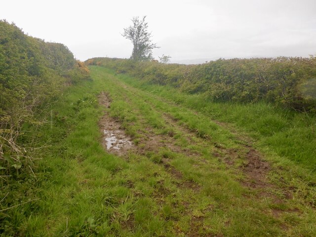
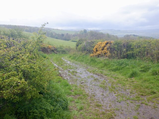
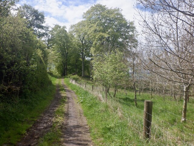
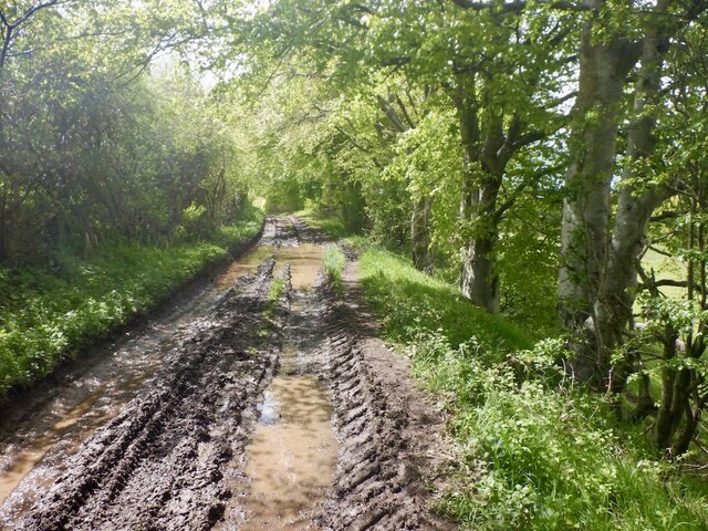
Quarry Stream Images

Images are sourced within 2km of 55.608968/-2.7547678 or Grid Reference NT5235. Thanks to Geograph Open Source API. All images are credited.

Green lane, Middle Moor
Green lane, Middle Moor The Southern Upland Way descends towards the Tweed.
Green lane, Middle Moor
The Southern Upland Way descends towards the Tweed.
Woodland above Housebyers
Mud, Southern Upland Way Track, Gattonside.
Mud, Southern Upland Way
Track, Gattonside.
Southern Upland Way, Gattonside Descent to the Tweed.
Southern Upland Way, Gattonside
Descent to the Tweed.
Riverside path, Gattonside
Woodland beside the Tweed Southern Upland Way, Gattonside.
Woodland beside the Tweed
Southern Upland Way, Gattonside.
Melrose Cauld A bit of an obstacle in the river and not shown on the Ordnance Survey maps.  Not all weirs have neat dressed surfaces.
Melrose Cauld
A bit of an obstacle in the river and not shown on the Ordnance Survey maps. Not all weirs have neat dressed surfaces.
River Tweed, Melrose Upstream of Melrose Cauld.
River Tweed, Melrose
Upstream of Melrose Cauld.
Path, Melrose Beside the Tweed.
Path, Melrose
Beside the Tweed.
Riverside path, Melrose
Rails to trails, Tweedbank Sadly not yet restored to a railway. Tweedbank Station is just around the corner.
Rails to trails, Tweedbank
Sadly not yet restored to a railway. Tweedbank Station is just around the corner.
Tweedbank Station The current terminus of the Borders Railway.
Tweedbank Station
The current terminus of the Borders Railway.
Tweedbank Outdoor Sports Complex Grass football pitches
Tweedbank Outdoor Sports Complex
Grass football pitches
Weaver's Linn, Tweedbank
Gun Knowe Loch, Tweedbank
Honeylees Drive, Tweedbank
Path, Tweedbank Behind Hareshaw Bank.
Path, Tweedbank
Behind Hareshaw Bank.
Show me another place!

Quarry Stream is located at Grid Ref: NT5235 (Lat: 55.608968, Lng: -2.7547678)

Unitary Authority: The Scottish Borders

Police Authority: The Lothians and Scottish Borders

What 3 Words

///herb.scavenger.tidal. Near Tweedbank, Scottish Borders

Related Wikis

Tweedbank railway station

Tweedbank is a railway station on the Borders Railway, which runs between Edinburgh Waverley and Tweedbank. The station, situated 35 miles 34 chains (57...

Tweedbank

Tweedbank is a large village south-east of Galashiels in the Scottish Borders, Scotland. It is part of the county of Roxburghshire. It is an outer suburb...

Darnick

Darnick is a village near Melrose in the Scottish Borders area of Scotland, in the former Roxburghshire. The name was first recorded in 1124, and has changed...

Borders General Hospital

Borders General Hospital (BGH) is a district general hospital on the outskirts of Melrose, Scotland. It is managed by NHS Borders. == History == The hospital...

Netherdale

Netherdale is a sports complex in Galashiels, Scottish Borders, consisting of two adjacent stadiums used for rugby union and football. The rugby ground...

Gattonside

Gattonside is a small village in the Scottish Borders. It is located 1 kilometre (0.62 mi) north of Melrose, on the north side of the River Tweed. In 1143...

Borders College

Borders College (Scottish Gaelic: Colaiste nan Crìochan) is a further education institution in the Scottish Borders, Scotland. Its main campus is located...

Melrose, Scottish Borders

Melrose (Scottish Gaelic: Maolros, "bald moor") is a town and civil parish in the Scottish Borders, historically in Roxburghshire. It lies within the Eildon...

Nearby Amenities

Located within 500m of 55.608968,-2.7547678
Naptan AtcoCode: 69001041
Naptan Bearing: E
Naptan CommonName: Tweedbank
Naptan Indicator: opp Access road to Industrial Estate
Naptan Landmark: Industrial Estate
Naptan NaptanCode: 72726424
Naptan Street: Tweedbank Drive
Not Highway: bus_stop
Not Name: Tweedbank
Note: surveyed and found no bus stop here
Source: naptan_import;survey
Lat/Long: 55.6051342/-2.7577444
Bus Stop
Tweedbank Industrial Estate
Bench: no
Bin: no
Bus: yes
Departures Board: timetable
Lit: no
Local Ref: nr
Naptan AtcoCode: 69001042
Naptan Bearing: W
Naptan CommonName: Tweedbank Industrial Estate
Naptan Indicator: nr
Naptan NaptanCode: 72726394
Naptan Street: Tweedbank Drive
Operator: Scottish Borders Council
Public Transport: platform
Ref: 69001042
Shelter: yes
Source: local knowledge;survey;NaPTAN
Tactile Paving: yes
Lat/Long: 55.60469/-2.7562934
Bus Stop
Tweedbank Industrial Estate
Bench: no
Bin: no
Bus: yes
Departures Board: timetable
Lit: no
Local Ref: opp
Naptan AtcoCode: 69001043
Naptan Bearing: E
Naptan CommonName: Tweedbank Industrial Estate
Naptan Indicator: opp
Naptan NaptanCode: 72726373
Naptan Street: Tweedbank Drive
Operator: Scottish Borders Council
Public Transport: platform
Ref: 69001043
Shelter: yes
Source: local knowledge;survey;NaPTAN
Tactile Paving: yes
Lat/Long: 55.6045286/-2.7553872
Bus Stop
Gattonside Toll
Bench: no
Bin: no
Bus: yes
Departures Board: no
Lit: no
Local Ref: adj
Naptan AtcoCode: 6900225
Naptan Bearing: NW
Naptan CommonName: Toll
Naptan Indicator: adj
Naptan Landmark: Lowood Bridge
Naptan NaptanCode: 72723897
Naptan Street: B6374
Naptan Verified: yes
Public Transport: platform
Ref: 6900225
Shelter: no
Source: local knowledge;survey;NaPTAN
Tactile Paving: no
Lat/Long: 55.6061425/-2.7500791
Bus Stop
Pavilion Road End
Bench: no
Bus: yes
Departures Board: no
Lit: no
Local Ref: opp
Naptan AtcoCode: 6900626
Naptan Bearing: W
Naptan CommonName: Pavilion Rd End
Naptan Indicator: opp
Naptan Landmark: Road End
Naptan NaptanCode: 72723969
Naptan Street: B6374
Naptan Verified: yes
Public Transport: platform
Ref: 6900626
Shelter: no
Source: local knowledge;survey;NaPTAN
Lat/Long: 55.6097722/-2.7545249
Bus Stop
Pavilion Road End
Bench: no
Bus: yes
Departures Board: no
Lit: no
Local Ref: nr
Naptan AtcoCode: 6900627
Naptan Bearing: E
Naptan CommonName: Pavilion Rd End
Naptan Indicator: nr
Naptan Landmark: Road End
Naptan NaptanCode: 72723972
Naptan Street: B6374
Naptan Verified: yes
Note: No bus stop sign
Public Transport: platform
Ref: 6900627
Shelter: no
Source: local knowledge;survey
Lat/Long: 55.6098932/-2.7545268
Bus Stop
Gattonside Toll
Bench: no
Bin: no
Bus: yes
Departures Board: no
Lit: no
Local Ref: opp
Naptan AtcoCode: 6900636
Naptan Bearing: S
Naptan CommonName: Toll
Naptan Indicator: opp
Naptan Landmark: Lowood Bridge
Naptan NaptanCode: 72723895
Naptan Street: B6374
Naptan Verified: yes
Public Transport: platform
Ref: 6900636
Shelter: no
Source: local knowledge;survey;NaPTAN
Lat/Long: 55.6060267/-2.7494212
Bench
Backrest: yes
Colour: brown
Material: wood
Seats: 2
Survey Date: 2021-05-14
Lat/Long: 55.6056924/-2.7588082
Noexit: yes
Lat/Long: 55.6049116/-2.7517728
Noexit: yes
Lat/Long: 55.6049277/-2.7529996
Noexit: yes
Lat/Long: 55.6050408/-2.7527614
Allan Lodge
Place: isolated_dwelling
Lat/Long: 55.6097112/-2.7525979
Pavilion Farm
Place: isolated_dwelling
Lat/Long: 55.6100536/-2.7517821
Pavilion
Place: hamlet
Lat/Long: 55.6088173/-2.7493398
Give Way
Direction: forward
Lat/Long: 55.6058693/-2.749349
Lowood House
Place: isolated_dwelling
Lat/Long: 55.6094349/-2.7616379
Mini Roundabout
Lat/Long: 55.6056472/-2.7570725
Railway: buffer_stop
Lat/Long: 55.6055732/-2.7578873
Tweedbank
Name Gd: Bruach Thuaidh
Naptan AtcoCode: 9100TWDBANK
Network: National Rail
Network Website: https://www.nationalrail.co.uk/stations/twb/
Network Wikidata: Q26334
Operator: ScotRail
Public Transport: station
Railway: station
Ref Crs: TWB
Start Date: 2015-09-06
Train: yes
Wheelchair: yes
Wikidata: Q7857482
Wikipedia: en:Tweedbank railway station
Lat/Long: 55.6058578/-2.7589963
Kerb: raised
Lat/Long: 55.6053292/-2.7573508
Bicycle Parking
Access: yes
Bicycle Parking: stands
Capacity: 20
Covered: yes
Fee: no
Survey Date: 2021-05-14
Lat/Long: 55.6053275/-2.7574266
Railway: buffer_stop
Lat/Long: 55.6055005/-2.7579581
Bus Stop
Tweedbank Station
Bench: yes
Bin: yes
Bus: yes
Departures Board: yes
Lit: yes
Local Ref: at
Naptan AtcoCode: 69002000
Naptan Bearing: NE
Naptan CommonName: Tweedbank Station
Naptan Indicator: at
Naptan NaptanCode: 72728487
Naptan Street: Station Access
Operator: Scottish Borders Council
Public Transport: platform
Ref: 69002000
Shelter: yes
Source: local knowledge;survey;NaPTAN
Tactile Paving: yes
Lat/Long: 55.6056118/-2.7572835
Noexit: yes
Lat/Long: 55.6058488/-2.7584781
Noexit: yes
Lat/Long: 55.6060614/-2.7592868
Charging Station
Capacity: 2
Operator: evolt
Lat/Long: 55.6060237/-2.7589452
Crossing
Bicycle: yes
Crossing: traffic_signals
Crossing Ref: toucan
Kerb: lowered
Tactile Paving: yes
Lat/Long: 55.6052917/-2.7586374
Check Date: 2022-11-30
Information: board
Tourism: information
Lat/Long: 55.6052271/-2.7573169
Noexit: yes
Lat/Long: 55.6064814/-2.7597345
Power: pole
Lat/Long: 55.6062034/-2.7497418
Bench
Backrest: yes
Colour: brown
Material: wood
Seats: 2
Survey Date: 2021-05-14
Lat/Long: 55.6057536/-2.7591482
Bench
Backrest: yes
Colour: grey
Material: metal
Seats: 4
Survey Date: 2021-05-14
Lat/Long: 55.6058178/-2.7589723
Generator Method: photovoltaic
Generator Output Electricity: yes
Generator Source: solar
Generator Type: solar_photovoltaic_panel
Power: generator
Lat/Long: 55.6097356/-2.7503331
Give Way
Direction: forward
Lat/Long: 55.6055694/-2.7597226
Power: pole
Lat/Long: 55.6130484/-2.7521669
Generator Method: photovoltaic
Generator Output Electricity: yes
Generator Source: solar
Generator Type: solar_photovoltaic_panel
Power: generator
Lat/Long: 55.6057003/-2.7580258
Communication Gsm-r: yes
Man Made: antenna
Tower Type: communication
Lat/Long: 55.6062843/-2.7600553
Bicycle Repair Station
Service Bicycle Pump: yes
Lat/Long: 55.6053079/-2.7574239
Power: pole
Lat/Long: 55.6111316/-2.7485745
Power: pole
Lat/Long: 55.6104804/-2.7488418
Power: pole
Lat/Long: 55.6098623/-2.7491255
Power: pole
Lat/Long: 55.6132417/-2.7540821
Power: pole
Lat/Long: 55.6067118/-2.7505381
Power: pole
Lat/Long: 55.6068476/-2.7507659
Bicycle Parking
Bicycle Parking: stands
Capacity: 20
Covered: yes
Lat/Long: 55.6054022/-2.7576188
Parking
Drop-off Point
Access: yes
Capacity: 3
Fee: no
Parking: lane
Surface: asphalt
Lat/Long: 55.6059002/-2.7571711
Noexit: yes
Lat/Long: 55.6055754/-2.7556365
Noexit: yes
Lat/Long: 55.605545/-2.7564108
Parking
Lat/Long: 55.613163/-2.7570364
Noexit: yes
Lat/Long: 55.6047893/-2.7530952
Entrance: yes
Lat/Long: 55.6054703/-2.7568215
The data included in this document is from www.openstreetmap.org. The data is made available under ODbL.

Have you been to Quarry Stream?

Leave your review of Quarry Stream below (or comments, questions and feedback).