Babraham

Settlement in Cambridgeshire South Cambridgeshire

England

Babraham

Little Abington, St Mary <span class="nowrap"><a title="http://www.druidic.org/camchurch/churches/ltabington.htm" rel="nofollow ugc noopener" href="http://www.druidic.org/camchurch/churches/ltabington.htm">Link</a><img style="margin-left:2px;" alt="External link" title="External link - shift click to open in new window" src="https://s1.geograph.org.uk/img/external.png" width="10" height="10"/></span>
Little Abington, St Mary Credit: mym

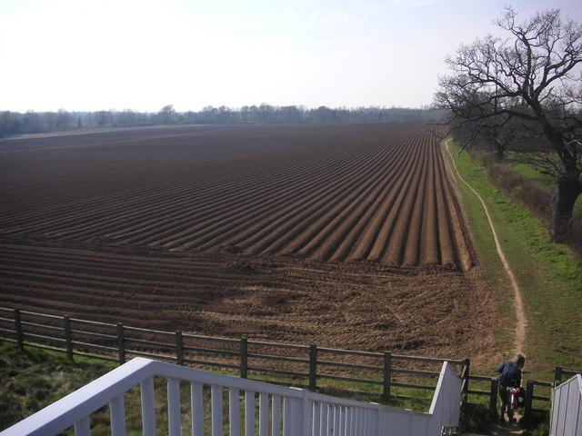
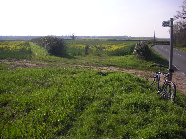
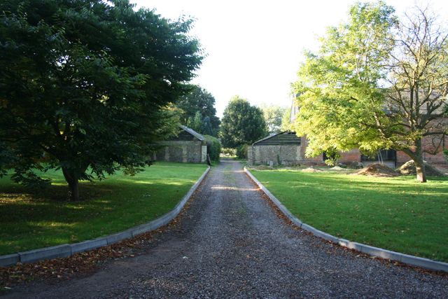
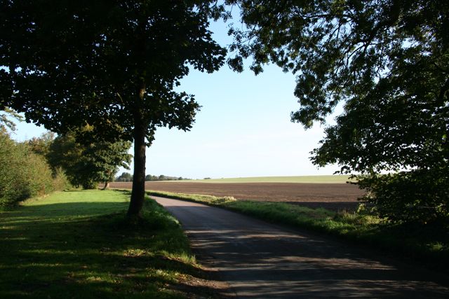
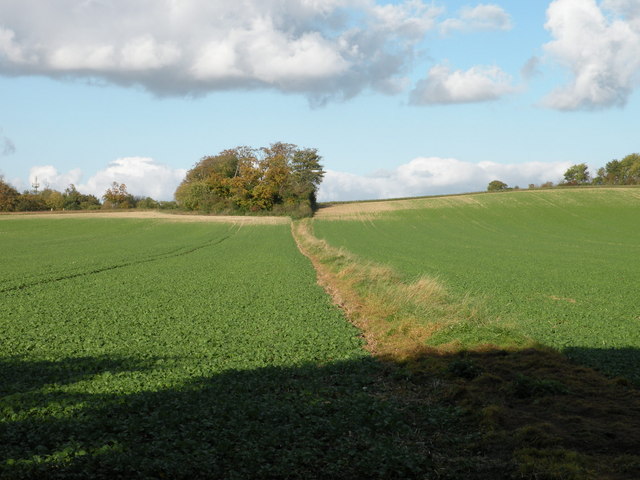
Babraham is a picturesque village located in the county of Cambridgeshire, England. Situated approximately 7 miles southeast of the city of Cambridge, it falls within the district of South Cambridgeshire. The village is surrounded by beautiful countryside, offering stunning views and a tranquil atmosphere.

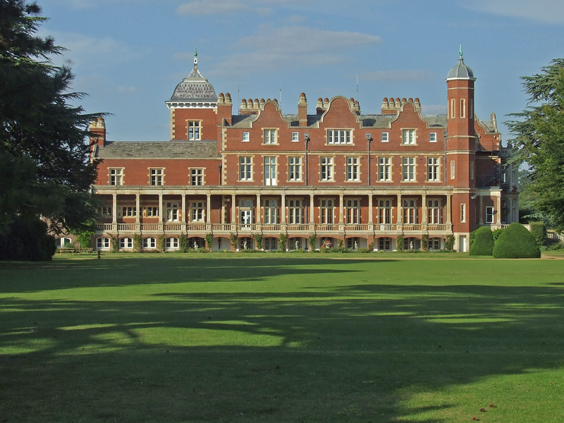
Babraham is well-known for its rich history, with evidence of human settlement dating back to the Roman times. The village is home to several historic buildings, including the Grade II listed Babraham Hall. This Jacobean mansion is known for its exquisite architecture and is set within stunning gardens, which are open to the public during certain times of the year.

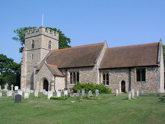
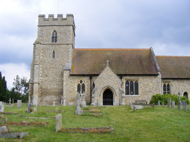
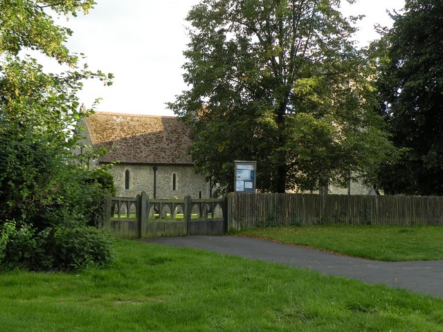
The village also boasts a vibrant community, with a range of amenities for residents and visitors alike. There is a primary school, a village hall, and a medieval church, St. Peter's, which dates back to the 13th century. Additionally, Babraham Research Campus, one of the UK's leading biotechnology hubs, is located within the village. This research center brings together scientists, entrepreneurs, and businesses to drive innovation and advancement in the life sciences sector.

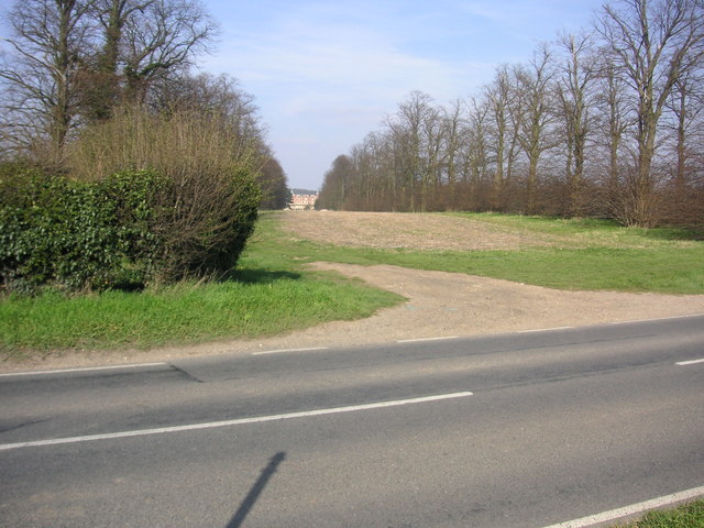
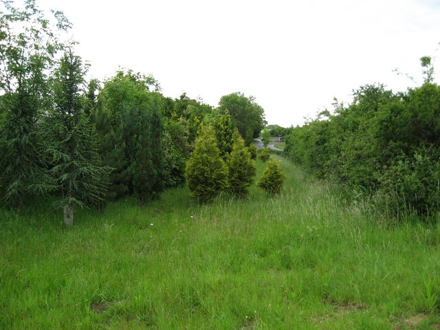
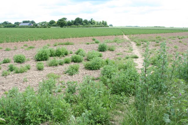
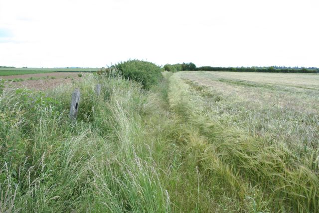
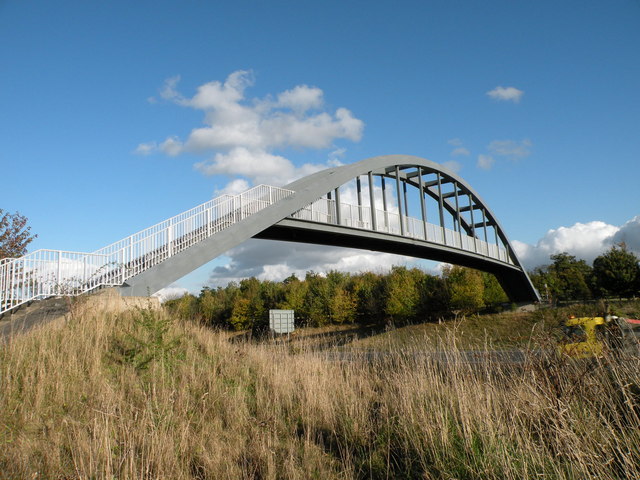
For nature enthusiasts, Babraham offers ample opportunities to explore the great outdoors. The village is surrounded by idyllic countryside, with many footpaths and bridleways that provide access to the stunning Cambridgeshire landscape. The nearby Babraham Park and Ride offers convenient transportation links to Cambridge, making it an ideal base for those wishing to explore the city.

In summary, Babraham is a charming village in Cambridgeshire that combines a rich history, stunning natural surroundings, and a thriving scientific community. Its picturesque setting and close proximity to Cambridge make it an appealing destination for both residents and visitors.

If you have any feedback on the listing, please let us know in the comments section below.

Babraham Images

Images are sourced within 2km of 52.131143/0.210133 or Grid Reference TL5150. Thanks to Geograph Open Source API. All images are credited.

Little Abington, St Mary <span class="nowrap"><a title="http://www.druidic.org/camchurch/churches/ltabington.htm" rel="nofollow ugc noopener" href="http://www.druidic.org/camchurch/churches/ltabington.htm">Link</a><img style="margin-left:2px;" alt="External link" title="External link - shift click to open in new window" src="https://s1.geograph.org.uk/img/external.png" width="10" height="10"/></span>
Little Abington, St Mary
Two Acre Plantation Two Acre Plantation viewed from footbridge over A11
Two Acre Plantation
Two Acre Plantation viewed from footbridge over A11
Footpath diverging from Sawston Road Footpath diverging from Sawston Road near Church Farm. At the horizon there are the buildings of Sawston visible.
Footpath diverging from Sawston Road
Footpath diverging from Sawston Road near Church Farm. At the horizon there are the buildings of Sawston visible.
Babraham Hall viewed from Sawston Road Babraham Hall viewed from Sawston Road near Church Farm
Babraham Hall viewed from Sawston Road
Babraham Hall viewed from Sawston Road near Church Farm
Course of old railway Course of the old Cambridge to Haverhill railway line (part of the 'Stour Valley Line') near Pampisford. The site of Pampisford station is now lost under the widened A11 trunk road.
Course of old railway
Course of the old Cambridge to Haverhill railway line (part of the 'Stour Valley Line') near Pampisford. The site of Pampisford station is now lost under the widened A11 trunk road.
Track from Babraham to Sawston At this point it crosses a dismantled railway.
Track from Babraham to Sawston
At this point it crosses a dismantled railway.
Track from Babraham to Sawston Showing the line of the dismantled railway.
Track from Babraham to Sawston
Showing the line of the dismantled railway.
Home Farm
Home Farm
The Road to Babraham near Home Farm Peaceful and calm fields yet just yards from the busy A505 and A11
The Road to Babraham near Home Farm
Peaceful and calm fields yet just yards from the busy A505 and A11
Footpath up the hill near Little Abington
The Temple Centre A venue for Weddings and Conferences
The Temple Centre
A venue for Weddings and Conferences
Footbridge over the A11
The Great Wall of Sugar-Beet
St. Mary's church, Little Abington This church (not to be confused with St Mary's, Great Abington, some four or five hundred metres distant) is of flint and rubble construction and dates from the early Norman period. Although it is said that some of the base stonework is possibly Saxon.
St. Mary's church, Little Abington
This church (not to be confused with St Mary's, Great Abington, some four or five hundred metres distant) is of flint and rubble construction and dates from the early Norman period. Although it is said that some of the base stonework is possibly Saxon.
The entrance to St. Mary's church, Little Abington
The A11 approaching the A505 turn off The A505 connects with the M11 north.
The A11 approaching the A505 turn off
The A505 connects with the M11 north.
A11 / A505 junction The A505 carries traffic to the M11 north, the A11 goes to the M11 south.
A11 / A505 junction
The A505 carries traffic to the M11 north, the A11 goes to the M11 south.
Show me another place!

Babraham is located at Grid Ref: TL5150 (Lat: 52.131143, Lng: 0.210133)

Administrative County: Cambridgeshire

District: South Cambridgeshire

Police Authority: Cambridgeshire

What 3 Words

///shelters.seducing.flame. Near Sawston, Cambridgeshire

Related Wikis

Babraham Institute

The Babraham Institute is a life sciences research institution and a partner organisation of the University of Cambridge. The Babraham Institute is based...

Abington railway station (England)

Abington railway station served Little Abington, Great Abington and Babraham in Cambridgeshire. It closed in 1851, along with its line which was one of...

Babraham

Babraham is a village and civil parish in the South Cambridgeshire district of Cambridgeshire, England, about 6 miles (9.7 km) south-east of Cambridge...

Bourne Bridge railway station

Bourne Bridge railway station served Little Abington, Great Abington, Pampisford and Babraham in Cambridgeshire. It was closed in 1851, along with its...

Pampisford railway station

Pampisford railway station is a former British railway station in Pampisford, Cambridgeshire. It was on the Stour Valley Railway from 1865 to its closure...

Granta Park

Granta Park is a science, technology and biopharmaceutical park based on the bank of the River Granta in Great Abington near Cambridge, England. The idea...

Roman Road, Cambridgeshire

The Roman Road in Cambridgeshire, also known as Worsted Street Roman Road, is a 12.4-hectare (31-acre) linear biological Site of Special Scientific Interest...

Pampisford Hall

Pampisford Hall is a country house designed by George Goldie in the civil parish of Pampisford in the English county of Cambridgeshire. It became a Grade...

Nearby Amenities

Located within 500m of 52.131143,0.210133
Babraham
Is In: Cambridgeshire, England, UK
Place: village
Population: 260
Source Name: local knowledge
Source Population: http://www.scambs.gov.uk/CommunityandLiving/VillageServicesAndAmenities/
Wikidata: Q1779225
Lat/Long: 52.1300968/0.2094278
Post Box
Collection Times: Mo-Fr 17:30; Sa 12:00
Operator: Royal Mail
Post Box Design: type_a
Post Box Type: pillar
Ref: CB22 205
Royal Cypher: EIIR
Royal Cypher Wikidata: Q33102113
Source: survey
Lat/Long: 52.1309072/0.2091627
Bus Stop
High Street
Naptan AtcoCode: 0500SBABR001
Naptan Bearing: SE
Naptan CommonName: High Street
Naptan Indicator: opp
Naptan Landmark: High Street
Naptan NaptanCode: cmbdtmtd
Naptan ShortCommonName: High Street
Naptan Street: Cambridge Road
Naptan Verified: no
Public Transport: platform
Shelter: yes
Source: naptan_import
Lat/Long: 52.1333115/0.2145829
Bus Stop
High Street
Naptan AtcoCode: 0500SBABR003
Naptan Bearing: NW
Naptan CommonName: High Street
Naptan Indicator: near
Naptan Landmark: High Street
Naptan NaptanCode: cmbdtmtj
Naptan ShortCommonName: High Street
Naptan Street: Cambridge Road
Naptan Verified: no
Public Transport: platform
Shelter: yes
Source: naptan_import
Lat/Long: 52.1337813/0.2133902
Crossing
Crossing: marked
Lat/Long: 52.1331116/0.2053819
Barrier: kissing_gate
Lat/Long: 52.1314077/0.2041923
Parking
Parking for Babraham Church
Lat/Long: 52.129531/0.2053201
Power: pole
Lat/Long: 52.1286416/0.2079356
Power: pole
Lat/Long: 52.1297798/0.2069243
Power: pole
Lat/Long: 52.1271626/0.2085181
Historic: memorial
Memorial: war_memorial
Lat/Long: 52.1311029/0.2095765
Barrier: kissing_gate
Lat/Long: 52.1320433/0.2034044
Babraham Pocket Park
Leisure: nature_reserve
Lat/Long: 52.1297843/0.205995
Crossing
Crossing: marked
Lat/Long: 52.1313433/0.2074282
Crossing
Crossing: marked
Lat/Long: 52.1318115/0.2076985
Crossing
Crossing: marked
Lat/Long: 52.1321211/0.2068244
Crossing
Crossing: marked
Lat/Long: 52.1317523/0.2067049
Crossing
Crossing: marked
Lat/Long: 52.1326806/0.2077084
Crossing
Crossing: marked
Lat/Long: 52.1325559/0.2070273
Crossing
Crossing: marked
Lat/Long: 52.1326635/0.2068246
Crossing
Crossing: marked
Lat/Long: 52.1333273/0.2058679
Crossing
Crossing: marked
Lat/Long: 52.1336791/0.2057714
Bench
Backrest: yes
Lat/Long: 52.1308815/0.2091136
Crossing
Crossing: marked
Lat/Long: 52.1344781/0.2059123
Crossing
Crossing: marked
Lat/Long: 52.1331186/0.2051278
Turning Circle
Lat/Long: 52.1330226/0.2044838
Turning Circle
Lat/Long: 52.1328977/0.2039954
Turning Circle
Lat/Long: 52.1306819/0.207104
Crossing
Kerb: flush
Lat/Long: 52.1334242/0.2136571
Crossing
Kerb: flush
Lat/Long: 52.1332705/0.2142824
Crossing
Kerb: flush
Lat/Long: 52.1333731/0.2143565
Waste Basket
Waste: dog_excrement
Lat/Long: 52.1313884/0.204214
The data included in this document is from www.openstreetmap.org. The data is made available under ODbL.

Have you been to Babraham?

Leave your review of Babraham below (or comments, questions and feedback).