Trafalgar Dock

Lake, Pool, Pond, Freshwater Marsh in Lancashire

England

Trafalgar Dock

Victoria Tower ** Victoria Tower is a Grade II listed Gothic Revival clock tower located alongside Salisbury Dock in Liverpool, England. Positioned among the two river entrance gates to the Salisbury Dock itself, the tower acted as an aid to ships by providing both an accurate time and also warning of impending meteorological changes.
Victoria Tower was designed by Jesse Hartley and was constructed between 1847 and 1848, to commemorate the opening of Salisbury Dock. Its design was based upon an earlier drawing by Philip Hardwick in 1846.
** Courtesy Wikipedia
Victoria Tower Credit: Arthur C Harris

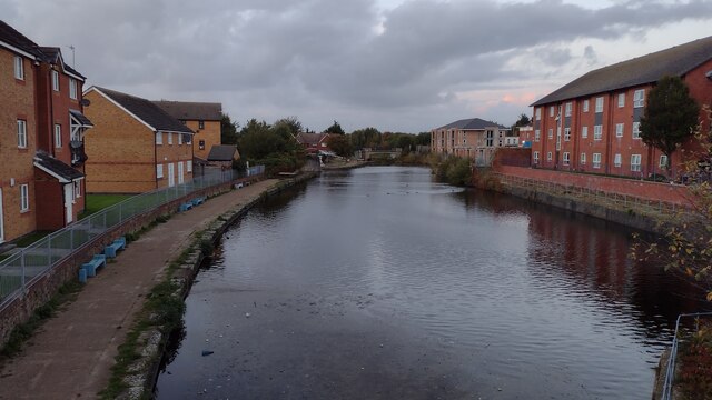
Trafalgar Dock, located in Lancashire, England, is a man-made freshwater dock that serves as a recreational area for locals and visitors alike. Spanning over an area of approximately 10 acres, the dock is surrounded by lush greenery and is home to various aquatic plant species, making it a picturesque spot for nature enthusiasts.

The dock itself is primarily used for boating and fishing activities. Its calm and serene waters attract anglers who are eager to cast their lines and try their luck at catching fish such as perch, pike, and roach. The dock's depth varies, with some sections being shallow enough for wading and paddling, while others are deep enough for boating.

Alongside the dock, there is a well-maintained walking path that allows visitors to explore the surrounding area. The path offers breathtaking views of the dock and is adorned with benches for those who wish to relax and take in the scenery. The dock's extensive reed beds and freshwater marsh provide a habitat for a variety of bird species, making it a popular spot for birdwatchers.

Trafalgar Dock is easily accessible, with a car park located nearby for visitors' convenience. The dock is open year-round and is an ideal destination for families, nature lovers, and those seeking a tranquil escape from the city's hustle and bustle. With its diverse plant and animal life, Trafalgar Dock offers a unique opportunity to appreciate Lancashire's natural beauty while engaging in outdoor activities.

If you have any feedback on the listing, please let us know in the comments section below.

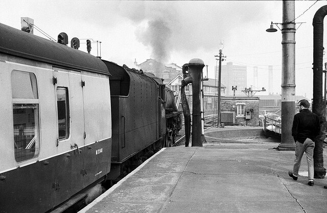
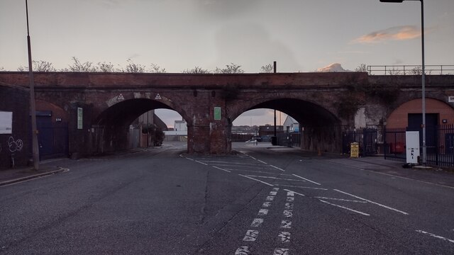
Trafalgar Dock Images

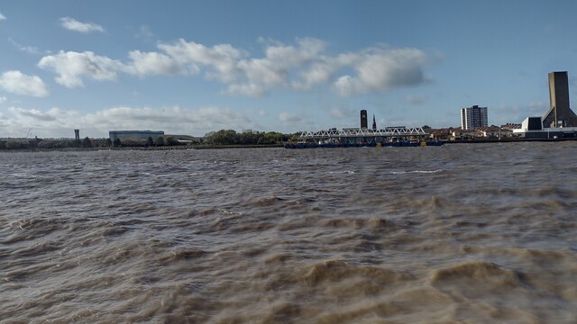
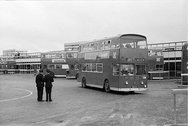
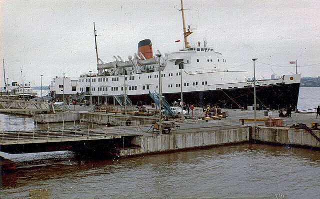
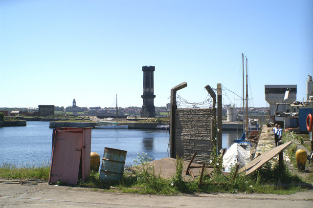
Images are sourced within 2km of 53.421536/-3.0037545 or Grid Reference SJ3392. Thanks to Geograph Open Source API. All images are credited.

Victoria Tower ** Victoria Tower is a Grade II listed Gothic Revival clock tower located alongside Salisbury Dock in Liverpool, England. Positioned among the two river entrance gates to the Salisbury Dock itself, the tower acted as an aid to ships by providing both an accurate time and also warning of impending meteorological changes.
Victoria Tower was designed by Jesse Hartley and was constructed between 1847 and 1848, to commemorate the opening of Salisbury Dock. Its design was based upon an earlier drawing by Philip Hardwick in 1846.
** Courtesy Wikipedia
Victoria Tower
** Victoria Tower is a Grade II listed Gothic Revival clock tower located alongside Salisbury Dock in Liverpool, England. Positioned among the two river entrance gates to the Salisbury Dock itself, the tower acted as an aid to ships by providing both an accurate time and also warning of impending meteorological changes. Victoria Tower was designed by Jesse Hartley and was constructed between 1847 and 1848, to commemorate the opening of Salisbury Dock. Its design was based upon an earlier drawing by Philip Hardwick in 1846. ** Courtesy Wikipedia
Bacchus Taverna No longer in business.
Interesting old building.
Apparently proposals exist to build a sixteen story apartment block on the site.
Bacchus Taverna
No longer in business. Interesting old building. Apparently proposals exist to build a sixteen story apartment block on the site.
Ready for departure, Liverpool Exchange Station – 1968 Stanier 'Black 5' 4-6-0 45212 at the head of a through train to Glasgow. Exchange Station was the Lancashire and Yorkshire Railway's Liverpool terminus but succumbed to rationalisation after the Beeching Report and closed in 1977. 45212 has survived into preservation; currently (2021) based on the Keighley & Worth Valley Railway, it is also available for main line operation.
Ready for departure, Liverpool Exchange Station – 1968
Stanier 'Black 5' 4-6-0 45212 at the head of a through train to Glasgow. Exchange Station was the Lancashire and Yorkshire Railway's Liverpool terminus but succumbed to rationalisation after the Beeching Report and closed in 1977. 45212 has survived into preservation; currently (2021) based on the Keighley & Worth Valley Railway, it is also available for main line operation.
Trumpet of Flowers Exchange Flags Square with the Trumpet of Flowers being prepared for the River of Light Trail with Liverpool Town Hall as the backdrop
Trumpet of Flowers
Exchange Flags Square with the Trumpet of Flowers being prepared for the River of Light Trail with Liverpool Town Hall as the backdrop
Chadwick Street Chadwick Street heading under the railway bridge
Chadwick Street
Chadwick Street heading under the railway bridge
Pall Mall Pall Mall approaching Leeds Street crossroads
Pall Mall
Pall Mall approaching Leeds Street crossroads
Leeds and Liverpool Canal From Eldonian Way Bridge looking to the Leeds and Liverpool Canal
Leeds and Liverpool Canal
From Eldonian Way Bridge looking to the Leeds and Liverpool Canal
Great Homer Street Great Homer Street heading up past Sainsbury's
Great Homer Street
Great Homer Street heading up past Sainsbury's
Path to Roscommon Street Path from Great Homer Street to Roscommon Street
Path to Roscommon Street
Path from Great Homer Street to Roscommon Street
Seacombe Ferry Terminal From the River Mersey looking to Seacombe Ferry Terminal
Seacombe Ferry Terminal
From the River Mersey looking to Seacombe Ferry Terminal
Looking across Albert Dock towards the Liver Building A view from a tour bus.
Looking across Albert Dock towards the Liver Building
A view from a tour bus.
Pier Head bus station – 1970 The bus station opened in 1965 to replace the windswept area formerly occupied by the tramway terminal loops. It featured a promenade on the roof of the circulation/shelter area which gave excellent views across the river.

From the 1970s onwards, the number of passengers using the bus station dwindled steadily with the dwindling number of passengers using the Mersey ferries – not unrelated to the opening of the second road tunnel – with final closure in the early 1990s. The area is now open space with the new Liverpool Canal Link passing through.

The bus is one of the first batch of Leyland Atlantean double-deck buses with MCW bodywork purchased by Liverpool City Transport in 1963 to their own design. Originally crew operated they were later adapted for one-person-operation. Bus L589 is seen here following the absorption of LCT into the Merseyside Passenger Transport Executive with its logo but still in Liverpool's green livery.

This is one of a series of views featuring buses in the 60s, 70s, and 80s. <a title="https://www.geograph.org.uk/search.php?i=137652761" href="https://www.geograph.org.uk/search.php?i=137652761">Link</a>
Pier Head bus station – 1970
The bus station opened in 1965 to replace the windswept area formerly occupied by the tramway terminal loops. It featured a promenade on the roof of the circulation/shelter area which gave excellent views across the river. From the 1970s onwards, the number of passengers using the bus station dwindled steadily with the dwindling number of passengers using the Mersey ferries – not unrelated to the opening of the second road tunnel – with final closure in the early 1990s. The area is now open space with the new Liverpool Canal Link passing through. The bus is one of the first batch of Leyland Atlantean double-deck buses with MCW bodywork purchased by Liverpool City Transport in 1963 to their own design. Originally crew operated they were later adapted for one-person-operation. Bus L589 is seen here following the absorption of LCT into the Merseyside Passenger Transport Executive with its logo but still in Liverpool's green livery. This is one of a series of views featuring buses in the 60s, 70s, and 80s. Link
Ventilation and control station, Pier Head, Liverpool The Mersey Tunnel ventilator towers are a magnificent set of structures - functional, visually stunning and emblematic of the different eras in which they were built. The largest one is this 1930s effort by Herbert Rowse who rebuilt it in the early 1950s after war damage. It contains "offices and huge fans that extract foul air and force clean air in". Grade II listed.
Ventilation and control station, Pier Head, Liverpool
The Mersey Tunnel ventilator towers are a magnificent set of structures - functional, visually stunning and emblematic of the different eras in which they were built. The largest one is this 1930s effort by Herbert Rowse who rebuilt it in the early 1950s after war damage. It contains "offices and huge fans that extract foul air and force clean air in". Grade II listed.
View from Museum of Liverpool Listed buildings and structures are officially designated as being of special architectural, historical or cultural significance. There are over half a million listed structures in the United Kingdom, covered by around 375,000 listings.
Listed status is more commonly associated with buildings or groups of buildings, however it can cover many other structures, including bridges, headstones, steps, ponds, monuments, walls, phone boxes, wrecks, parks, and heritage sites, and in more recent times a road crossing (Abbey Road) and graffiti art (Banksy 'Spy-booth') have been included.

In England and Wales there are three main listing designations;
Grade I (2.5%) - exceptional interest, sometimes considered to be internationally important.
Grade II* (5.5%) - particularly important buildings of more than special interest. 
Grade II (92%) - nationally important and of special interest. 

There are also locally listed structures (at the discretion of local authorities) using A, B and C designations.

In Scotland three classifications are also used but the criteria are different. There are around 47,500 Listed buildings.
Category A (8%)- generally equivalent to Grade I and II* in England and Wales
Category B (51%)- this appears generally to cover the ground of Grade II, recognising national importance.
Category C (41%)- buildings of local importance, probably with some overlap with English Grade II.

In Northern Ireland the criteria are similar to Scotland, but the classifications are:
Grade A (2.3%)
Grade B+ (4.7%)
Grade B (93%)

Read more at Wikipedia <span class="nowrap"><a title="http://en.wikipedia.org/wiki/Listed_building" rel="nofollow ugc noopener" href="http://en.wikipedia.org/wiki/Listed_building">Link</a><img style="margin-left:2px;" alt="External link" title="External link - shift click to open in new window" src="https://s1.geograph.org.uk/img/external.png" width="10" height="10"/></span>
View from Museum of Liverpool
Listed buildings and structures are officially designated as being of special architectural, historical or cultural significance. There are over half a million listed structures in the United Kingdom, covered by around 375,000 listings. Listed status is more commonly associated with buildings or groups of buildings, however it can cover many other structures, including bridges, headstones, steps, ponds, monuments, walls, phone boxes, wrecks, parks, and heritage sites, and in more recent times a road crossing (Abbey Road) and graffiti art (Banksy 'Spy-booth') have been included. In England and Wales there are three main listing designations; Grade I (2.5%) - exceptional interest, sometimes considered to be internationally important. Grade II* (5.5%) - particularly important buildings of more than special interest. Grade II (92%) - nationally important and of special interest. There are also locally listed structures (at the discretion of local authorities) using A, B and C designations. In Scotland three classifications are also used but the criteria are different. There are around 47,500 Listed buildings. Category A (8%)- generally equivalent to Grade I and II* in England and Wales Category B (51%)- this appears generally to cover the ground of Grade II, recognising national importance. Category C (41%)- buildings of local importance, probably with some overlap with English Grade II. In Northern Ireland the criteria are similar to Scotland, but the classifications are: Grade A (2.3%) Grade B+ (4.7%) Grade B (93%) Read more at Wikipedia LinkExternal link
Superlambanana on Pier Head An exhibition of 125 "superlambanana"s placed in and around Liverpool to mark the European Capital of Culture 2008 celebrations
Superlambanana on Pier Head
An exhibition of 125 "superlambanana"s placed in and around Liverpool to mark the European Capital of Culture 2008 celebrations
Royal Liver Building Listed buildings and structures are officially designated as being of special architectural, historical or cultural significance. There are over half a million listed structures in the United Kingdom, covered by around 375,000 listings.
Listed status is more commonly associated with buildings or groups of buildings, however it can cover many other structures, including bridges, headstones, steps, ponds, monuments, walls, phone boxes, wrecks, parks, and heritage sites, and in more recent times a road crossing (Abbey Road) and graffiti art (Banksy 'Spy-booth') have been included.

In England and Wales there are three main listing designations;
Grade I (2.5%) - exceptional interest, sometimes considered to be internationally important.
Grade II* (5.5%) - particularly important buildings of more than special interest. 
Grade II (92%) - nationally important and of special interest. 

There are also locally listed structures (at the discretion of local authorities) using A, B and C designations.

In Scotland three classifications are also used but the criteria are different. There are around 47,500 Listed buildings.
Category A (8%)- generally equivalent to Grade I and II* in England and Wales
Category B (51%)- this appears generally to cover the ground of Grade II, recognising national importance.
Category C (41%)- buildings of local importance, probably with some overlap with English Grade II.

In Northern Ireland the criteria are similar to Scotland, but the classifications are:
Grade A (2.3%)
Grade B+ (4.7%)
Grade B (93%)

Read more at Wikipedia <span class="nowrap"><a title="http://en.wikipedia.org/wiki/Listed_building" rel="nofollow ugc noopener" href="http://en.wikipedia.org/wiki/Listed_building">Link</a><img style="margin-left:2px;" alt="External link" title="External link - shift click to open in new window" src="https://s1.geograph.org.uk/img/external.png" width="10" height="10"/></span>
Royal Liver Building
Listed buildings and structures are officially designated as being of special architectural, historical or cultural significance. There are over half a million listed structures in the United Kingdom, covered by around 375,000 listings. Listed status is more commonly associated with buildings or groups of buildings, however it can cover many other structures, including bridges, headstones, steps, ponds, monuments, walls, phone boxes, wrecks, parks, and heritage sites, and in more recent times a road crossing (Abbey Road) and graffiti art (Banksy 'Spy-booth') have been included. In England and Wales there are three main listing designations; Grade I (2.5%) - exceptional interest, sometimes considered to be internationally important. Grade II* (5.5%) - particularly important buildings of more than special interest. Grade II (92%) - nationally important and of special interest. There are also locally listed structures (at the discretion of local authorities) using A, B and C designations. In Scotland three classifications are also used but the criteria are different. There are around 47,500 Listed buildings. Category A (8%)- generally equivalent to Grade I and II* in England and Wales Category B (51%)- this appears generally to cover the ground of Grade II, recognising national importance. Category C (41%)- buildings of local importance, probably with some overlap with English Grade II. In Northern Ireland the criteria are similar to Scotland, but the classifications are: Grade A (2.3%) Grade B+ (4.7%) Grade B (93%) Read more at Wikipedia LinkExternal link
Liverpool Wall of Fame
"Manx Maid" at Liverpool in June 1979 The "Manx Maid" was operated by the Isle of Man Steam Packet Company. It was built for them in 1962 by Cammell Laird at Birkenhead. It was the first vessel to be built for the company which was designed as a car ferry. It was side loading and cost just over one million pounds. The ferries arrived and departed via the River Mersey and docked near Pier Head, with its famous Royal Liver Building.

The primary route was at the time between here and Douglas on the Isle of Man. There had been a previous boat with the same name operated by the company. The one in this photograph was withdrawn in 1984, and scrapped in 1986.

I recently discovered this photograph, which was taken by my father who died many years ago. He was in the habit of throwing away most of his negatives, so this has had to be scanned from the surviving small print.
"Manx Maid" at Liverpool in June 1979
The "Manx Maid" was operated by the Isle of Man Steam Packet Company. It was built for them in 1962 by Cammell Laird at Birkenhead. It was the first vessel to be built for the company which was designed as a car ferry. It was side loading and cost just over one million pounds. The ferries arrived and departed via the River Mersey and docked near Pier Head, with its famous Royal Liver Building. The primary route was at the time between here and Douglas on the Isle of Man. There had been a previous boat with the same name operated by the company. The one in this photograph was withdrawn in 1984, and scrapped in 1986. I recently discovered this photograph, which was taken by my father who died many years ago. He was in the habit of throwing away most of his negatives, so this has had to be scanned from the surviving small print.
Show me another place!

Trafalgar Dock is located at Grid Ref: SJ3392 (Lat: 53.421536, Lng: -3.0037545)

Unitary Authority: Liverpool

Police Authority: Merseyside

What 3 Words

///zest.activism.prom. Near Liverpool, Merseyside

Related Wikis

Salisbury Dock

Salisbury Dock is a dock on the River Mersey, England, and part of the Port of Liverpool. It is situated in the northern dock system in Vauxhall and is...

Victoria Tower, Liverpool

Victoria Tower is a Grade II listed Gothic Revival clock tower located alongside Salisbury Dock in Liverpool, England. Positioned among the two river entrance...

Collingwood Dock

Collingwood Dock is a dock on the River Mersey, in England, and part of the Port of Liverpool. It is situated in the northern dock system in Vauxhall...

Nelson Dock, Liverpool

Nelson Dock is a dock on the River Mersey, England, and part of the Port of Liverpool. It is situated in the northern dock system in Vauxhall, connected...

Nearby Amenities

Located within 500m of 53.421536,-3.0037545
Source: PGS
Lat/Long: 53.4192824/-3.0051454
Source: PGS
Lat/Long: 53.4175297/-3.0046768
Pub
Farmers Arms
Lat/Long: 53.4196646/-2.9998637
Bus Stop
GREAT HOWARD STREET/STANLEY DOCK
Bus: yes
Naptan AtcoCode: 2800S40009B
Naptan Bearing: N
Naptan CommonName: GREAT HOWARD STREET/STANLEY DOCK
Naptan Indicator: GREAT HOWARD STREET
Naptan Landmark: NEAR CORNER OF WALTER STREET
Naptan NaptanCode: merawpwj
Naptan Notes: No Notes
Naptan PlusbusZoneRef: LVRPLCH
Naptan ShortCommonName: Stanley Dock
Naptan Street: GREAT HOWARD STREET
Naptan Verified: no
Public Transport: platform
Shelter: yes
Source: naptan_import
Lat/Long: 53.4209722/-2.996728
Bus Stop
REGENT RAOD/NR CLARENCE DOCKS
Bus: yes
Naptan AtcoCode: 2800S40018B
Naptan Bearing: N
Naptan CommonName: REGENT RAOD/NR CLARENCE DOCKS
Naptan Indicator: REGENT ROAD
Naptan Landmark: OPP DUBLIN STREET AND FARMERS ARMS PH
Naptan NaptanCode: merawtad
Naptan Notes: No Notes
Naptan PlusbusZoneRef: LVRPLCH
Naptan ShortCommonName: Regent Rd/Nr Docks
Naptan Street: REGENT ROAD
Naptan Verified: no
Public Transport: platform
Source: naptan_import
Lat/Long: 53.4198161/-3.0002602
Post Box
Collection Times: Mo-Fr 09:00; Sa 07:00
Description: EIIR post box L3 509 by Carron Company on Regent Road, Liverpool at junction with Regent Street.
Manufacturer: Carron Company
Operator: Royal Mail
Operator Wikidata: Q638098
Post Box Design: type_b
Post Box Type: pillar
Ref: L3 509
Royal Cypher: EIIR
Royal Cypher Wikidata: Q33102113
Wikimedia Commons: File:Post box on Regent Road, Liverpool.jpg
Lat/Long: 53.418015/-2.9998878
Seamark Type: gate
Waterway: lock_gate
Lat/Long: 53.4200677/-3.0032666
Seamark Type: gate
Waterway: lock_gate
Lat/Long: 53.4204221/-3.0027605
Waterway: lock_gate
Lat/Long: 53.4201383/-3.0020271
Friends Of Allonby Canoe club
Club: sport
Lat/Long: 53.4207508/-3.0022798
Clock
Victoria Tower
Date: no
Display: analog
Support: tower
Visibility: area
Wikidata: Q2522832
Wikipedia: en:Victoria Tower, Liverpool
Lat/Long: 53.4215154/-3.0050241
Cinema
Route 66 Drive in Cinema
Wikidata: Q41419660
Lat/Long: 53.4183037/-3.0016801
Invisible Wind Factory
Club: music
Lat/Long: 53.4183475/-2.9997632
Barrier: lift_gate
Lat/Long: 53.4222582/-3.0001783
Barrier: lift_gate
Lat/Long: 53.4222752/-2.9968074
Nelson Dock
Abandoned Railway: station
Railway: site
Wikidata: Q6990485
Wikipedia: en:Nelson Dock railway station
Lat/Long: 53.4238223/-3.0006208
Clarence Dock
Abandoned Railway: station
Railway: site
Wikidata: Q5126479
Wikipedia: en:Clarence Dock railway station
Lat/Long: 53.420496/-3.000433
Crossing
Crossing: traffic_signals
Lat/Long: 53.422569/-2.9967069
Crossing
Crossing: traffic_signals
Lat/Long: 53.4225206/-2.9965422
Crossing
Crossing: traffic_signals
Lat/Long: 53.4224165/-2.9968501
Crossing
Crossing: traffic_signals
Lat/Long: 53.4224162/-2.9964111
Bubbleid: 1162423428
Colour: black
Man Made: sewer_vent
Wikimedia Commons: File:Sewer vent on Regent Road at Stanley Dock bascule bridge.jpg
Lat/Long: 53.4213158/-3.0003743
Traffic Signals
Traffic Signals: signal
Lat/Long: 53.4225609/-2.9965435
Traffic Signals
Traffic Signals: signal
Traffic Signals Direction: backward
Lat/Long: 53.4224155/-2.9969328
Traffic Signals
Traffic Signals: signal
Traffic Signals Direction: backward
Lat/Long: 53.4224183/-2.996355
Traffic Signals
Traffic Signals: signal
Lat/Long: 53.4223388/-2.9966824
Traffic Signals
Lat/Long: 53.4213712/-3.0002701
Traffic Signals
Lat/Long: 53.4221101/-3.0002593
Traffic Signals
Lat/Long: 53.421832/-3.0003096
Crossing
Crossing: traffic_signals
Crossing Markings: dots
Crossing Ref: puffin
Kerb: lowered
Tactile Paving: yes
Lat/Long: 53.4220714/-3.0002562
The data included in this document is from www.openstreetmap.org. The data is made available under ODbL.

Have you been to Trafalgar Dock?

Leave your review of Trafalgar Dock below (or comments, questions and feedback).