Maggy's Tail

Lake, Pool, Pond, Freshwater Marsh in Peeblesshire

Scotland

Maggy's Tail

Track by the Hope Burn Bundles of fence posts by the track on the way up by Hope Burn towards the plantations of Glentress Forest.
Track by the Hope Burn Credit: Jim Barton

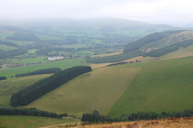
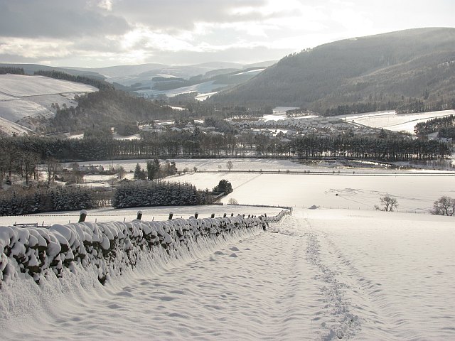
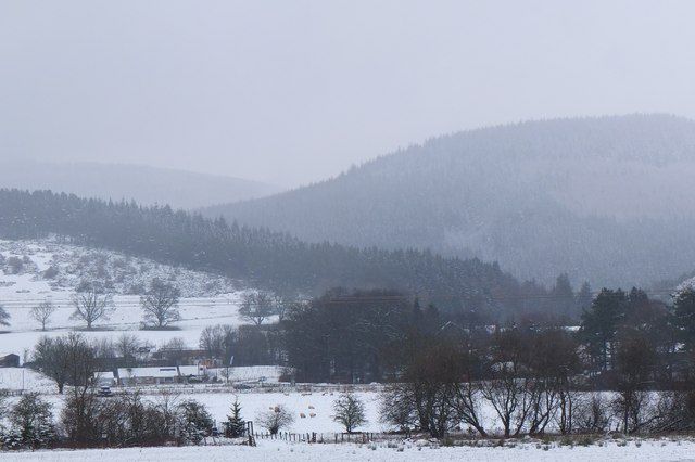
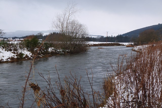
Maggy's Tail is a picturesque freshwater marsh located in Peeblesshire, Scotland. Nestled amidst lush greenery and rolling hills, it offers a serene and tranquil environment for nature lovers and outdoor enthusiasts.

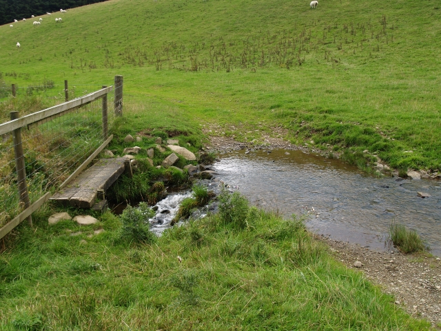
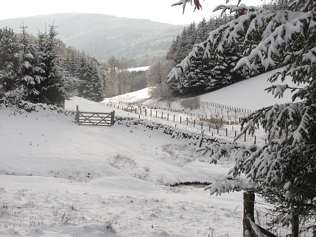
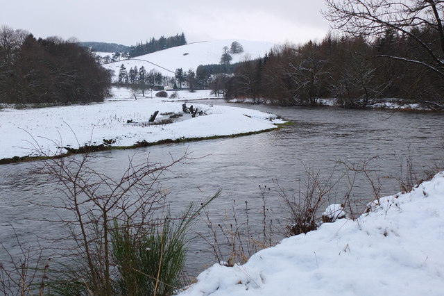
This enchanting waterbody is classified as a marsh due to its shallow depth and abundance of aquatic vegetation. The primary source of water in Maggy's Tail is rainfall and underground springs that ensure a constant flow of freshwater. The marsh is fed by several small streams that converge into a central pool, creating a diverse and thriving ecosystem.

The vegetation surrounding Maggy's Tail is rich and varied. Tall reeds and rushes dominate the marsh's edges, providing shelter and nesting sites for numerous bird species. Water lilies and other aquatic plants carpet the surface of the pool, adding a splash of color to the landscape.

The marsh is home to a wide array of wildlife. Visitors may catch glimpses of otters gracefully gliding through the water, while herons and ducks can be seen wading along the marsh's fringes. The surrounding woodlands are frequented by deer, squirrels, and a variety of songbirds.

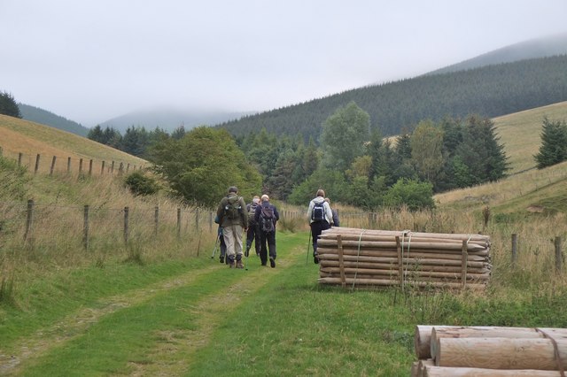
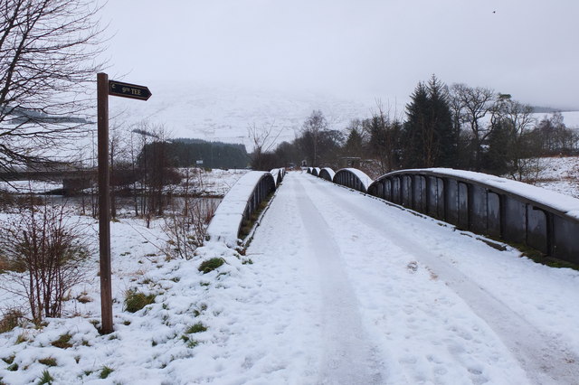
Maggy's Tail is a popular spot for nature walks and birdwatching. Visitors can explore the marsh by following a network of well-maintained trails that wind through the surrounding woodlands. These paths offer stunning views of the marsh and provide opportunities for observing the diverse flora and fauna.

Overall, Maggy's Tail is a haven of natural beauty and biodiversity. Its tranquil setting, diverse plant life, and abundant wildlife make it a must-visit destination for nature enthusiasts seeking to immerse themselves in the splendor of Peeblesshire's natural landscapes.

If you have any feedback on the listing, please let us know in the comments section below.

Maggy's Tail Images

Images are sourced within 2km of 55.638277/-3.1284817 or Grid Reference NT2938. Thanks to Geograph Open Source API. All images are credited.

Track by the Hope Burn Bundles of fence posts by the track on the way up by Hope Burn towards the plantations of Glentress Forest.
Track by the Hope Burn
Bundles of fence posts by the track on the way up by Hope Burn towards the plantations of Glentress Forest.
Bught Hill from Habs Cleuch Shank Much of the land in the middle foreground will be planted by the Forestry Commission over the next few years. The white building in the valley is the Macdonald Cardrona Hotel.
Bught Hill from Habs Cleuch Shank
Much of the land in the middle foreground will be planted by the Forestry Commission over the next few years. The white building in the valley is the Macdonald Cardrona Hotel.
Footbridge and ford, Horsburgh Hope Burn. Living at the end of this track might be the one valid reason for owning a SUV.
Footbridge and ford, Horsburgh Hope Burn.
Living at the end of this track might be the one valid reason for owning a SUV.
End of the Strip The butt of a shelterbelt rising up from the Hope.
End of the Strip
The butt of a shelterbelt rising up from the Hope.
Farm track, Nether Horsburgh Looking downhill along a trackway towards the new village of Cardrona on the floor of Tweeddale.
Farm track, Nether Horsburgh
Looking downhill along a trackway towards the new village of Cardrona on the floor of Tweeddale.
Enclosure, Bught Hill A circular earthbank on a spur, marked as an enclosure on the Ordnance Survey map.
Enclosure, Bught Hill
A circular earthbank on a spur, marked as an enclosure on the Ordnance Survey map.
Horseburgh Hope Looking downstream towards where sheep had just been fed.
Horseburgh Hope
Looking downstream towards where sheep had just been fed.
Horsburgh Castle ruin with sheep pasture
Horsburgh Castle Horsburgh Castle seen from the visitors centre on the opposite hillside.  Sheep and hills a plenty.
Horsburgh Castle
Horsburgh Castle seen from the visitors centre on the opposite hillside. Sheep and hills a plenty.
MacDonalds Cardrona Hotel This exclusive hotel, golf and country club has an idyllic location  on the north bank of the river Tweed. A glimpse of the river can be seen to the left of the picture. Between the hotel and the river is the golf course and a row of golf buggies are parked adjacent to a large bunker in front of the hotel.
MacDonalds Cardrona Hotel
This exclusive hotel, golf and country club has an idyllic location on the north bank of the river Tweed. A glimpse of the river can be seen to the left of the picture. Between the hotel and the river is the golf course and a row of golf buggies are parked adjacent to a large bunker in front of the hotel.
The Hub Cafe, Glentress Packed out as usual and sadly such a good, fair priced cafe as this just had to go. They were denied the chance to bid for the lease for the shiny new facility over the road and closed down by the Forestry Commission.  Apparently this is normal practice once one of their facilities becomes popular, and I have seen a similar enterprise in the Forest of Dean go the same way.  

The bike shop closed today, so no more good value, and quick services for my bikes.
The Hub Cafe, Glentress
Packed out as usual and sadly such a good, fair priced cafe as this just had to go. They were denied the chance to bid for the lease for the shiny new facility over the road and closed down by the Forestry Commission. Apparently this is normal practice once one of their facilities becomes popular, and I have seen a similar enterprise in the Forest of Dean go the same way. The bike shop closed today, so no more good value, and quick services for my bikes.
The Hub - the last day Having done so much for the success of the bike trails in Glentress Forest, today the shop was closed down by the Forestry Commission. They were not allowed to bid for the lease in the new all singing and all dancing centre across the road which we are expected to pay for (not a penny from me! - I'm parking elsewhere and riding in) and they are to be replaced by one of the big Edinburgh shops.

A legend!
The Hub - the last day
Having done so much for the success of the bike trails in Glentress Forest, today the shop was closed down by the Forestry Commission. They were not allowed to bid for the lease in the new all singing and all dancing centre across the road which we are expected to pay for (not a penny from me! - I'm parking elsewhere and riding in) and they are to be replaced by one of the big Edinburgh shops. A legend!
Old railway bridge, Cardrona The bridge over the Tweed, looking back to Cardrona and the site of the former station. The line is now a path and cycleway to Peebles. The golf course surrounds the nearby hotel and extends E along the riverside.
Old railway bridge, Cardrona
The bridge over the Tweed, looking back to Cardrona and the site of the former station. The line is now a path and cycleway to Peebles. The golf course surrounds the nearby hotel and extends E along the riverside.
Horsbrugh Castle A 16th century castle, now a roofless ruin, on a hillock just S of the A72 near Cardrona - see <span class="nowrap"><a title="http://www.scotlandsplaces.gov.uk/search_item/index.php?service=RCAHMS&id=51274" rel="nofollow ugc noopener" href="http://www.scotlandsplaces.gov.uk/search_item/index.php?service=RCAHMS&id=51274">Link</a><img style="margin-left:2px;" alt="External link" title="External link - shift click to open in new window" src="https://s1.geograph.org.uk/img/external.png" width="10" height="10"/></span> for more detail. Horsburgh is an alternative spelling for the name. There is also a ruined tower at Nether Horsburgh in NT3039 to the east.
Horsbrugh Castle
A 16th century castle, now a roofless ruin, on a hillock just S of the A72 near Cardrona - see LinkExternal link for more detail. Horsburgh is an alternative spelling for the name. There is also a ruined tower at Nether Horsburgh in NT3039 to the east.
The Tweed near Kailzie Compare with <a href="https://www.geograph.org.uk/photo/1850309">NT2838 : A bend on the River Tweed near Kailzie</a> which shows the same scene in May 2010.
The Tweed near Kailzie
Compare with NT2838 : A bend on the River Tweed near Kailzie which shows the same scene in May 2010.
Eshiels and Glentress A view from the old railway route between Cardrona and Peebles on a morning with light snow showers.
Eshiels and Glentress
A view from the old railway route between Cardrona and Peebles on a morning with light snow showers.
Decorated trees, Eshiels Community Woodland Trees with a brighter look at the site of the Eshiels Youth Sculpture Project in this part of the woodland by the Tweed - see also <a href="https://www.geograph.org.uk/photo/1306105">NT2739 : Eshiels Youth Sculpture project</a>.
Decorated trees, Eshiels Community Woodland
Trees with a brighter look at the site of the Eshiels Youth Sculpture Project in this part of the woodland by the Tweed - see also NT2739 : Eshiels Youth Sculpture project.
The Tweed near Scotsmill Looking upstream with some of the new houses at Whitehaugh on the edge of Peebles in view.
The Tweed near Scotsmill
Looking upstream with some of the new houses at Whitehaugh on the edge of Peebles in view.
Show me another place!

Maggy's Tail is located at Grid Ref: NT2938 (Lat: 55.638277, Lng: -3.1284817)

Unitary Authority: The Scottish Borders

Police Authority: The Lothians and Scottish Borders

What 3 Words

///clear.origin.aquatics. Near Peebles, Scottish Borders

Related Wikis

Kirkburn, Scottish Borders

Kirkburn is a village on the B7062, close to Peebles and the River Tweed, in the Scottish Borders area of Scotland, at the edge of the Cardrona Forest...
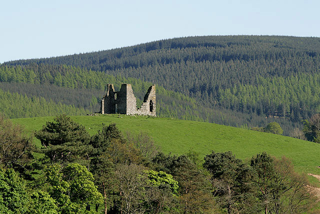
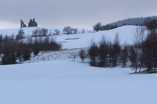
Horsburgh Castle

Horsburgh Castle, also known as Horsbrugh Castle or Horsbrugh Tower, is a ruined tower house castle by the River Tweed, on the A72 road from Peebles to...

Cardrona railway station

Cardrona railway station served the village of Cardrona, Scottish Borders, Scotland from 1864 to 1962 on the Peebles Railway. == History == The station...

Cardrona, Scottish Borders

Cardrona is a village on the A72 and B7062, between Peebles and Innerleithen, in the Scottish Borders area of Scotland. Places nearby include Glentress...

Kailzie Gardens

Kailzie Gardens is a walled garden near Kirkburn in the Scottish Borders area of Scotland, in the Tweed valley, four km east of Peebles, off the B7062...

Nether Horsburgh Castle

Nether Horsburgh Castle is a ruined tower house near Cardrona, in the Scottish Borders, in the former county of Peebleshire. It is situated at the back...

Cardrona Forest

The Cardrona Forest is a forest in the Scottish Borders area of Scotland, on the B7062, near Peebles. OS Grid Reference: NT292385. Cardrona Forest consists...

Peebles Hydro

Peebles Hydro is an early 20th century hotel and spa resort in Peebles, in the historic county of Peebles-shire in the Scottish Borders. It is one of...

Nearby Amenities

Located within 500m of 55.638277,-3.1284817
Waste Basket
Lat/Long: 55.6394389/-3.1221683
Bench
Lat/Long: 55.6386217/-3.1321383
Power: pole
Lat/Long: 55.6395734/-3.1360476
Power: pole
Lat/Long: 55.6392665/-3.1343377
Power: pole
Lat/Long: 55.63867/-3.1323879
Power: pole
Lat/Long: 55.6385877/-3.1315254
Power: pole
Lat/Long: 55.6385517/-3.1306568
Power: pole
Lat/Long: 55.6388931/-3.1212909
Power: pole
Lat/Long: 55.6392734/-3.1222585
Power: pole
Lat/Long: 55.6391702/-3.1237328
Power: pole
Lat/Long: 55.6387292/-3.1271044
Power: pole
Lat/Long: 55.6386067/-3.1283477
Power: pole
Lat/Long: 55.6385599/-3.1294838
Power: pole
Lat/Long: 55.6389702/-3.133377
The data included in this document is from www.openstreetmap.org. The data is made available under ODbL.

Have you been to Maggy's Tail?

Leave your review of Maggy's Tail below (or comments, questions and feedback).