Drive Wood

Wood, Forest in Peeblesshire

Scotland

Drive Wood

Horsburgh Castle ruin with sheep pasture
Horsburgh Castle ruin with sheep pasture Credit: Astrid H

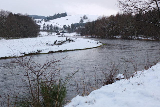
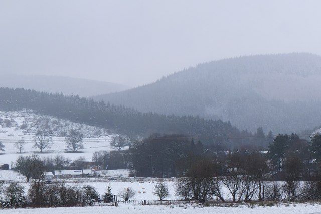
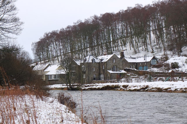
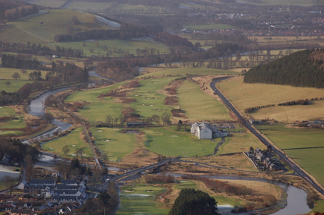
Drive Wood is a picturesque forest located in Peeblesshire, Scotland. Spread across a vast area, this woodland is renowned for its natural beauty and diverse flora and fauna. The forest is situated in a rural area, allowing visitors to immerse themselves in the tranquility and serenity of the surrounding countryside.

Drive Wood is characterized by its dense canopy of trees, primarily consisting of native species such as oak, beech, and birch. These towering trees provide a sheltered habitat for a wide range of wildlife, making it a popular destination for nature enthusiasts and bird watchers. Visitors may catch a glimpse of species like red squirrels, roe deer, and various bird species as they explore the forest trails.

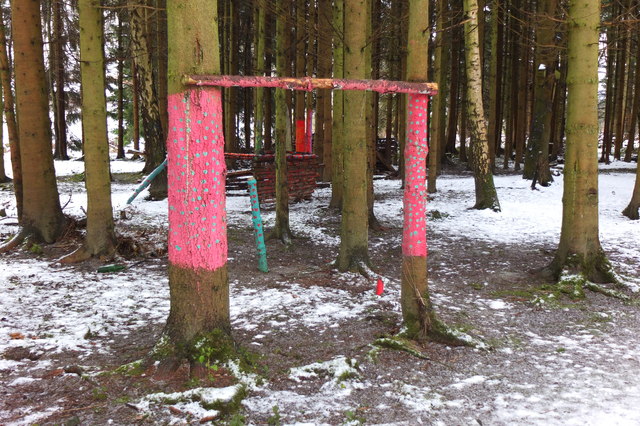
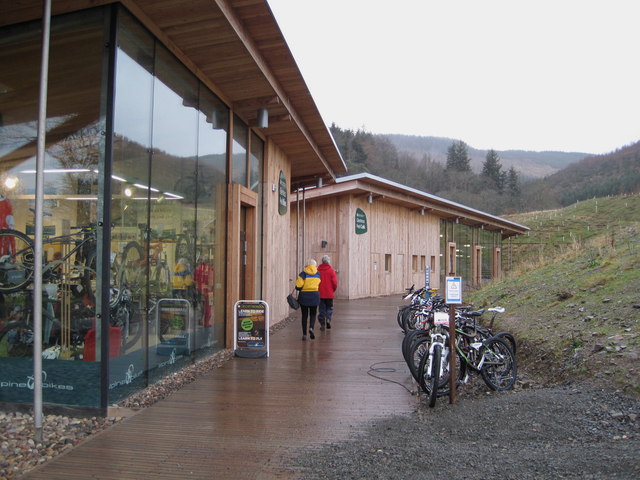
The wood is intersected by a network of well-maintained paths, allowing visitors to enjoy leisurely walks or engage in more challenging hikes. The crisp, fresh air and the peaceful atmosphere make it an ideal location for outdoor activities such as picnics, photography, or simply taking in the natural beauty of the surroundings.

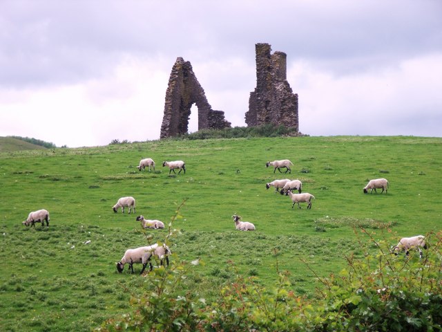
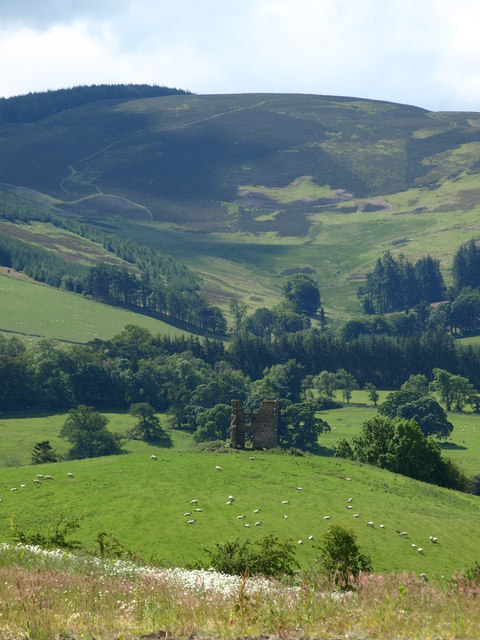
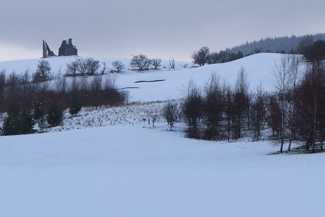
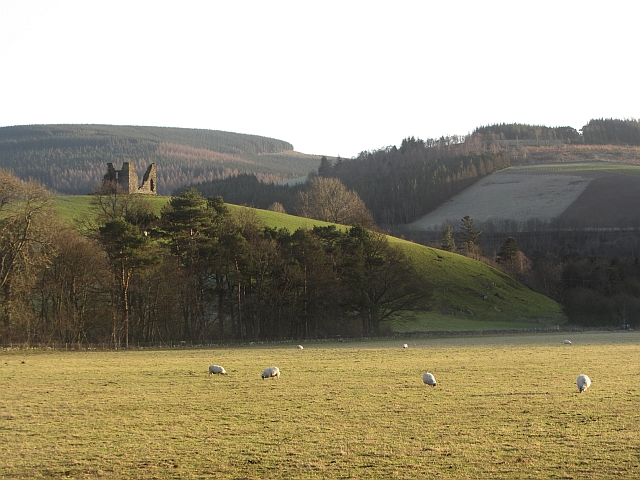
Drive Wood also offers a glimpse into the region's history and culture, with remnants of ancient settlements and landmarks scattered throughout the forest. These historical features add an extra layer of intrigue to the wood, making it an appealing destination for those interested in both nature and history.

Overall, Drive Wood in Peeblesshire is a captivating destination that offers a unique blend of natural beauty, wildlife, and historical significance. Its idyllic setting and diverse offerings make it a must-visit location for anyone seeking a peaceful escape in the heart of Scotland.

If you have any feedback on the listing, please let us know in the comments section below.

Drive Wood Images

Images are sourced within 2km of 55.633717/-3.128859 or Grid Reference NT2938. Thanks to Geograph Open Source API. All images are credited.

Horsburgh Castle ruin with sheep pasture
Horsburgh Castle Horsburgh Castle seen from the visitors centre on the opposite hillside.  Sheep and hills a plenty.
Horsburgh Castle
Horsburgh Castle seen from the visitors centre on the opposite hillside. Sheep and hills a plenty.
MacDonalds Cardrona Hotel This exclusive hotel, golf and country club has an idyllic location  on the north bank of the river Tweed. A glimpse of the river can be seen to the left of the picture. Between the hotel and the river is the golf course and a row of golf buggies are parked adjacent to a large bunker in front of the hotel.
MacDonalds Cardrona Hotel
This exclusive hotel, golf and country club has an idyllic location on the north bank of the river Tweed. A glimpse of the river can be seen to the left of the picture. Between the hotel and the river is the golf course and a row of golf buggies are parked adjacent to a large bunker in front of the hotel.
The Hub Cafe, Glentress Packed out as usual and sadly such a good, fair priced cafe as this just had to go. They were denied the chance to bid for the lease for the shiny new facility over the road and closed down by the Forestry Commission.  Apparently this is normal practice once one of their facilities becomes popular, and I have seen a similar enterprise in the Forest of Dean go the same way.  

The bike shop closed today, so no more good value, and quick services for my bikes.
The Hub Cafe, Glentress
Packed out as usual and sadly such a good, fair priced cafe as this just had to go. They were denied the chance to bid for the lease for the shiny new facility over the road and closed down by the Forestry Commission. Apparently this is normal practice once one of their facilities becomes popular, and I have seen a similar enterprise in the Forest of Dean go the same way. The bike shop closed today, so no more good value, and quick services for my bikes.
The Hub - the last day Having done so much for the success of the bike trails in Glentress Forest, today the shop was closed down by the Forestry Commission. They were not allowed to bid for the lease in the new all singing and all dancing centre across the road which we are expected to pay for (not a penny from me! - I'm parking elsewhere and riding in) and they are to be replaced by one of the big Edinburgh shops.

A legend!
The Hub - the last day
Having done so much for the success of the bike trails in Glentress Forest, today the shop was closed down by the Forestry Commission. They were not allowed to bid for the lease in the new all singing and all dancing centre across the road which we are expected to pay for (not a penny from me! - I'm parking elsewhere and riding in) and they are to be replaced by one of the big Edinburgh shops. A legend!
Old railway bridge, Cardrona The bridge over the Tweed, looking back to Cardrona and the site of the former station. The line is now a path and cycleway to Peebles. The golf course surrounds the nearby hotel and extends E along the riverside.
Old railway bridge, Cardrona
The bridge over the Tweed, looking back to Cardrona and the site of the former station. The line is now a path and cycleway to Peebles. The golf course surrounds the nearby hotel and extends E along the riverside.
Horsbrugh Castle A 16th century castle, now a roofless ruin, on a hillock just S of the A72 near Cardrona - see <span class="nowrap"><a title="http://www.scotlandsplaces.gov.uk/search_item/index.php?service=RCAHMS&id=51274" rel="nofollow ugc noopener" href="http://www.scotlandsplaces.gov.uk/search_item/index.php?service=RCAHMS&id=51274">Link</a><img style="margin-left:2px;" alt="External link" title="External link - shift click to open in new window" src="https://s1.geograph.org.uk/img/external.png" width="10" height="10"/></span> for more detail. Horsburgh is an alternative spelling for the name. There is also a ruined tower at Nether Horsburgh in NT3039 to the east.
Horsbrugh Castle
A 16th century castle, now a roofless ruin, on a hillock just S of the A72 near Cardrona - see LinkExternal link for more detail. Horsburgh is an alternative spelling for the name. There is also a ruined tower at Nether Horsburgh in NT3039 to the east.
The Tweed near Kailzie Compare with <a href="https://www.geograph.org.uk/photo/1850309">NT2838 : A bend on the River Tweed near Kailzie</a> which shows the same scene in May 2010.
The Tweed near Kailzie
Compare with NT2838 : A bend on the River Tweed near Kailzie which shows the same scene in May 2010.
Eshiels and Glentress A view from the old railway route between Cardrona and Peebles on a morning with light snow showers.
Eshiels and Glentress
A view from the old railway route between Cardrona and Peebles on a morning with light snow showers.
Decorated trees, Eshiels Community Woodland Trees with a brighter look at the site of the Eshiels Youth Sculpture Project in this part of the woodland by the Tweed - see also <a href="https://www.geograph.org.uk/photo/1306105">NT2739 : Eshiels Youth Sculpture project</a>.
Decorated trees, Eshiels Community Woodland
Trees with a brighter look at the site of the Eshiels Youth Sculpture Project in this part of the woodland by the Tweed - see also NT2739 : Eshiels Youth Sculpture project.
Scotsmill by the Tweed Houses on the S bank upstream of the Kailzie Estate.
Scotsmill by the Tweed
Houses on the S bank upstream of the Kailzie Estate.
Peel bike shop and cafe, Glentress The shiny new shop and cafe referred to in <a href="https://www.geograph.org.uk/photo/2685512">NT2839 : The Hub Cafe, Glentress</a>, part of a new development at Glentress with car park, visitor centre and offices.
Peel bike shop and cafe, Glentress
The shiny new shop and cafe referred to in NT2839 : The Hub Cafe, Glentress, part of a new development at Glentress with car park, visitor centre and offices.
Cardrona from Lee Burn Head On the right is the A72 to Peebles passing the Macdonald Cardrona Hotel with its associated golf course, the old railway line crosses the Tweed to follow its E bank and in the foreground are some houses at Cardrona with the 62 bus at the stop outside the old railway station, now the village shop. The houses at the SE side of Peebles are in view in the distance.
Cardrona from Lee Burn Head
On the right is the A72 to Peebles passing the Macdonald Cardrona Hotel with its associated golf course, the old railway line crosses the Tweed to follow its E bank and in the foreground are some houses at Cardrona with the 62 bus at the stop outside the old railway station, now the village shop. The houses at the SE side of Peebles are in view in the distance.
Farmland below Falla Brae Grassland by Eshiels and the Glentress mountain bike centre.
Farmland below Falla Brae
Grassland by Eshiels and the Glentress mountain bike centre.
Horsbrugh Castle The ruin is situated above the flood plain of the Tweed.
Horsbrugh Castle
The ruin is situated above the flood plain of the Tweed.
Eshiels Holdings Grassland beneath Glentress Forest and an estate agent's sign.
Eshiels Holdings
Grassland beneath Glentress Forest and an estate agent's sign.
Bridges over the Tweed at Cardrona The road bridge links the village with the A72 and the old railway bridge beyond is now used for the Cardrona to Peebles path and cycleway.
Bridges over the Tweed at Cardrona
The road bridge links the village with the A72 and the old railway bridge beyond is now used for the Cardrona to Peebles path and cycleway.
Strange road sign, Scotsmill I have found out from <a href="https://www.geograph.org.uk/photo/2022909">NT2639 : An unusual road sign</a> that this is actually a sign aimed at humans, not mice. A territorial buzzard has been causing trouble in the area - no doubt music to the ears of our "Guardians of the Countryside" who want to  kill buzzards. This may of course explain the vague wording.
Strange road sign, Scotsmill
I have found out from NT2639 : An unusual road sign that this is actually a sign aimed at humans, not mice. A territorial buzzard has been causing trouble in the area - no doubt music to the ears of our "Guardians of the Countryside" who want to kill buzzards. This may of course explain the vague wording.
Show me another place!

Drive Wood is located at Grid Ref: NT2938 (Lat: 55.633717, Lng: -3.128859)

Unitary Authority: The Scottish Borders

Police Authority: The Lothians and Scottish Borders

What 3 Words

///reduction.ally.rationed. Near Peebles, Scottish Borders

Related Wikis

Kirkburn, Scottish Borders

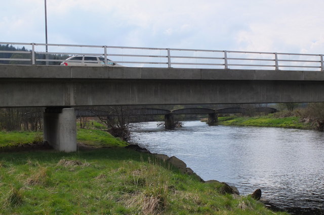
Kirkburn is a village on the B7062, close to Peebles and the River Tweed, in the Scottish Borders area of Scotland, at the edge of the Cardrona Forest...
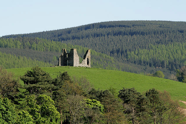
Horsburgh Castle

Horsburgh Castle, also known as Horsbrugh Castle or Horsbrugh Tower, is a ruined tower house castle by the River Tweed, on the A72 road from Peebles to...

Kailzie Gardens

Kailzie Gardens is a walled garden near Kirkburn in the Scottish Borders area of Scotland, in the Tweed valley, four km east of Peebles, off the B7062...

Cardrona railway station

Cardrona railway station served the village of Cardrona, Scottish Borders, Scotland from 1864 to 1962 on the Peebles Railway. == History == The station...

Cardrona, Scottish Borders

Cardrona is a village on the A72 and B7062, between Peebles and Innerleithen, in the Scottish Borders area of Scotland. Places nearby include Glentress...

Nether Horsburgh Castle

Nether Horsburgh Castle is a ruined tower house near Cardrona, in the Scottish Borders, in the former county of Peebleshire. It is situated at the back...

Cardrona Forest

The Cardrona Forest is a forest in the Scottish Borders area of Scotland, on the B7062, near Peebles. OS Grid Reference: NT292385. Cardrona Forest consists...

Peebles Hydro

Peebles Hydro is an early 20th century hotel and spa resort in Peebles, in the historic county of Peebles-shire in the Scottish Borders. It is one of...

Nearby Amenities

Located within 500m of 55.633717,-3.128859
Power: pole
Lat/Long: 55.6348642/-3.1362695
Power: pole
Lat/Long: 55.6328486/-3.1285008
Power: pole
Lat/Long: 55.6333059/-3.1277647
Power: pole
Lat/Long: 55.6332248/-3.1268064
Power: pole
Lat/Long: 55.6333083/-3.1289112
Power: pole
Lat/Long: 55.6333131/-3.1304088
Power: pole
Lat/Long: 55.6334839/-3.1319593
Power: pole
Lat/Long: 55.6337884/-3.1341064
Power: pole
Lat/Long: 55.6340713/-3.1362238
Power: pole
Lat/Long: 55.6298561/-3.1262501
Power: pole
Lat/Long: 55.6304902/-3.1263918
Power: pole
Lat/Long: 55.6310228/-3.1268805
Power: pole
Lat/Long: 55.6315673/-3.1273522
Power: pole
Lat/Long: 55.6321345/-3.1278704
The data included in this document is from www.openstreetmap.org. The data is made available under ODbL.

Have you been to Drive Wood?

Leave your review of Drive Wood below (or comments, questions and feedback).