Cardrona Hill

Hill, Mountain in Peeblesshire

Scotland

Cardrona Hill

Track by the Hope Burn Bundles of fence posts by the track on the way up by Hope Burn towards the plantations of Glentress Forest.
Track by the Hope Burn Credit: Jim Barton

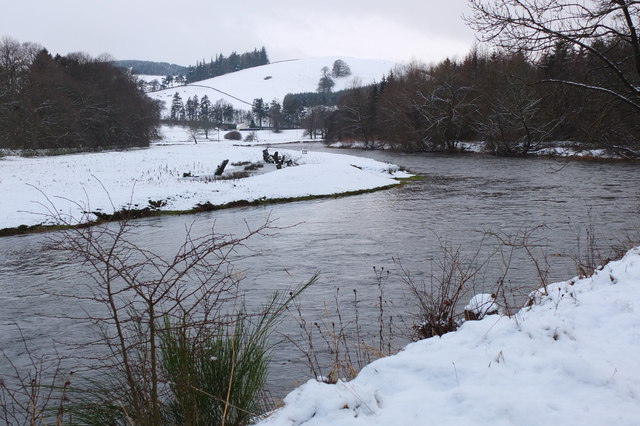
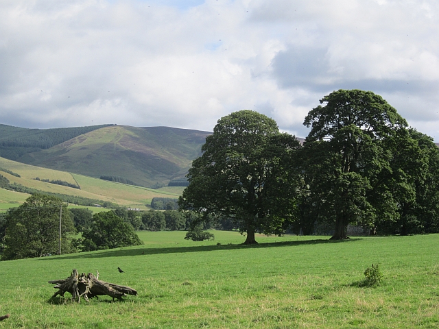
Cardrona Hill, located in Peeblesshire, Scotland, is a prominent hill that offers breathtaking views and a variety of outdoor activities for visitors. Standing at a height of approximately 479 meters (1,572 feet), it is a popular destination for hikers, nature enthusiasts, and locals seeking an escape from the hustle and bustle of everyday life.

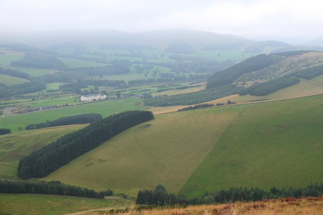
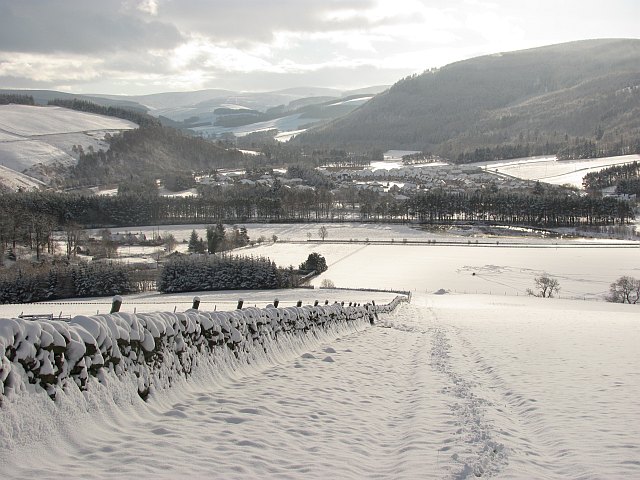
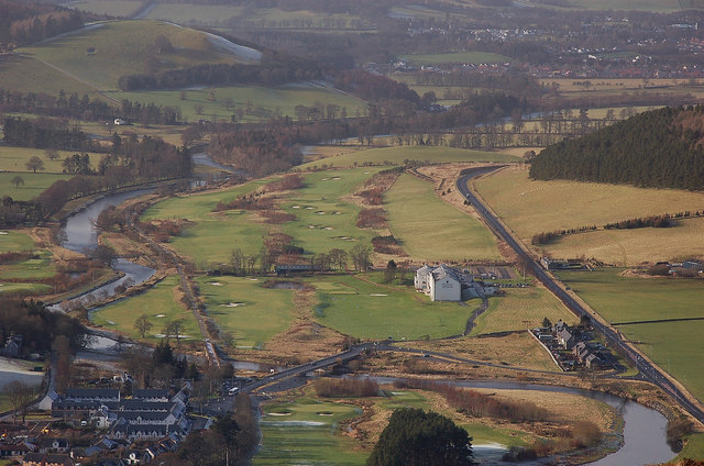
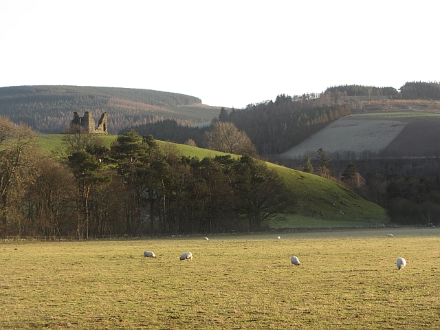
The hill is characterized by its rolling green slopes, which are covered in heather and grass, creating a picturesque landscape. The summit of Cardrona Hill provides commanding views of the surrounding countryside, including the Tweed Valley and the nearby towns of Peebles and Innerleithen.

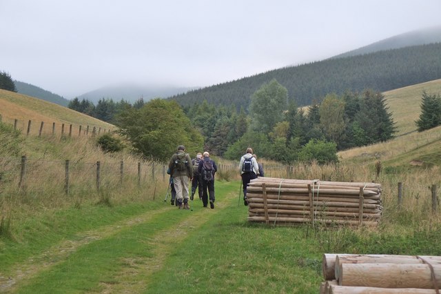
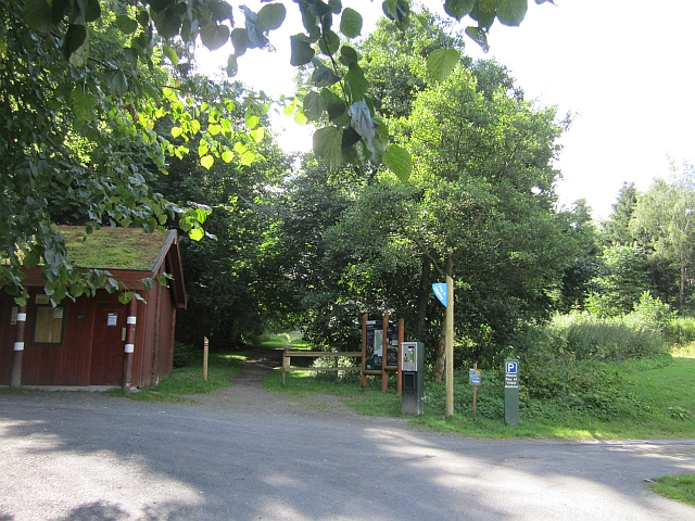
For outdoor enthusiasts, Cardrona Hill offers a range of hiking trails suitable for all levels of experience. The most popular route begins at the village of Cardrona and ascends gradually to the summit, providing ample opportunities to appreciate the natural beauty and spot wildlife along the way.

In addition to hiking, Cardrona Hill is also a favorite spot for mountain biking and horseback riding. The hill features a network of trails that cater to these activities, ensuring that visitors can enjoy the area's diverse landscape from various perspectives.

Overall, Cardrona Hill in Peeblesshire is a stunning natural landmark that offers an array of recreational opportunities. Whether you are seeking a challenging hike, a peaceful stroll, or simply a place to soak in the beauty of the Scottish countryside, Cardrona Hill is a must-visit destination.

If you have any feedback on the listing, please let us know in the comments section below.

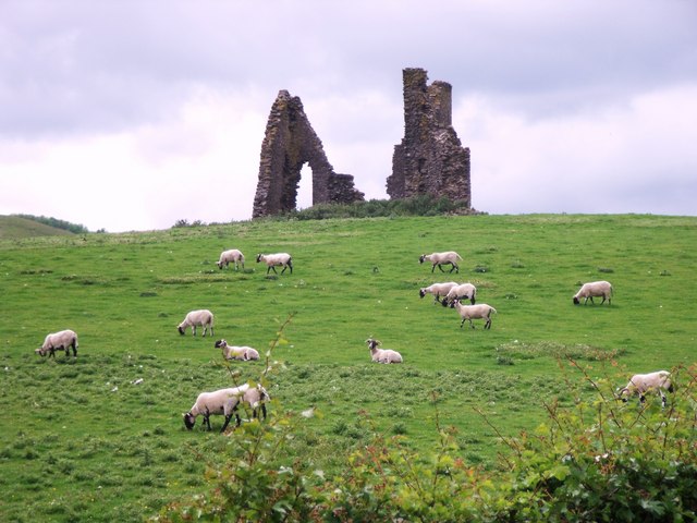
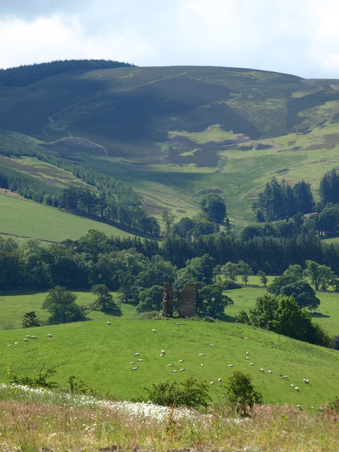
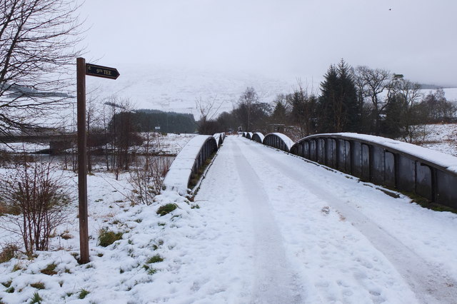
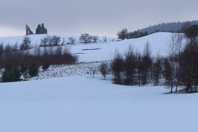
Cardrona Hill Images

Images are sourced within 2km of 55.632576/-3.1171354 or Grid Reference NT2938. Thanks to Geograph Open Source API. All images are credited.

Track by the Hope Burn Bundles of fence posts by the track on the way up by Hope Burn towards the plantations of Glentress Forest.
Track by the Hope Burn
Bundles of fence posts by the track on the way up by Hope Burn towards the plantations of Glentress Forest.
Bught Hill from Habs Cleuch Shank Much of the land in the middle foreground will be planted by the Forestry Commission over the next few years. The white building in the valley is the Macdonald Cardrona Hotel.
Bught Hill from Habs Cleuch Shank
Much of the land in the middle foreground will be planted by the Forestry Commission over the next few years. The white building in the valley is the Macdonald Cardrona Hotel.
End of the Strip The butt of a shelterbelt rising up from the Hope.
End of the Strip
The butt of a shelterbelt rising up from the Hope.
Farm track, Nether Horsburgh Looking downhill along a trackway towards the new village of Cardrona on the floor of Tweeddale.
Farm track, Nether Horsburgh
Looking downhill along a trackway towards the new village of Cardrona on the floor of Tweeddale.
Horsburgh Castle ruin with sheep pasture
Horsburgh Castle Horsburgh Castle seen from the visitors centre on the opposite hillside.  Sheep and hills a plenty.
Horsburgh Castle
Horsburgh Castle seen from the visitors centre on the opposite hillside. Sheep and hills a plenty.
MacDonalds Cardrona Hotel This exclusive hotel, golf and country club has an idyllic location  on the north bank of the river Tweed. A glimpse of the river can be seen to the left of the picture. Between the hotel and the river is the golf course and a row of golf buggies are parked adjacent to a large bunker in front of the hotel.
MacDonalds Cardrona Hotel
This exclusive hotel, golf and country club has an idyllic location on the north bank of the river Tweed. A glimpse of the river can be seen to the left of the picture. Between the hotel and the river is the golf course and a row of golf buggies are parked adjacent to a large bunker in front of the hotel.
Old railway bridge, Cardrona The bridge over the Tweed, looking back to Cardrona and the site of the former station. The line is now a path and cycleway to Peebles. The golf course surrounds the nearby hotel and extends E along the riverside.
Old railway bridge, Cardrona
The bridge over the Tweed, looking back to Cardrona and the site of the former station. The line is now a path and cycleway to Peebles. The golf course surrounds the nearby hotel and extends E along the riverside.
Horsbrugh Castle A 16th century castle, now a roofless ruin, on a hillock just S of the A72 near Cardrona - see <span class="nowrap"><a title="http://www.scotlandsplaces.gov.uk/search_item/index.php?service=RCAHMS&id=51274" rel="nofollow ugc noopener" href="http://www.scotlandsplaces.gov.uk/search_item/index.php?service=RCAHMS&id=51274">Link</a><img style="margin-left:2px;" alt="External link" title="External link - shift click to open in new window" src="https://s1.geograph.org.uk/img/external.png" width="10" height="10"/></span> for more detail. Horsburgh is an alternative spelling for the name. There is also a ruined tower at Nether Horsburgh in NT3039 to the east.
Horsbrugh Castle
A 16th century castle, now a roofless ruin, on a hillock just S of the A72 near Cardrona - see LinkExternal link for more detail. Horsburgh is an alternative spelling for the name. There is also a ruined tower at Nether Horsburgh in NT3039 to the east.
The Tweed near Kailzie Compare with <a href="https://www.geograph.org.uk/photo/1850309">NT2838 : A bend on the River Tweed near Kailzie</a> which shows the same scene in May 2010.
The Tweed near Kailzie
Compare with NT2838 : A bend on the River Tweed near Kailzie which shows the same scene in May 2010.
Cardrona from Lee Burn Head On the right is the A72 to Peebles passing the Macdonald Cardrona Hotel with its associated golf course, the old railway line crosses the Tweed to follow its E bank and in the foreground are some houses at Cardrona with the 62 bus at the stop outside the old railway station, now the village shop. The houses at the SE side of Peebles are in view in the distance.
Cardrona from Lee Burn Head
On the right is the A72 to Peebles passing the Macdonald Cardrona Hotel with its associated golf course, the old railway line crosses the Tweed to follow its E bank and in the foreground are some houses at Cardrona with the 62 bus at the stop outside the old railway station, now the village shop. The houses at the SE side of Peebles are in view in the distance.
Horsbrugh Castle The ruin is situated above the flood plain of the Tweed.
Horsbrugh Castle
The ruin is situated above the flood plain of the Tweed.
Bridges over the Tweed at Cardrona The road bridge links the village with the A72 and the old railway bridge beyond is now used for the Cardrona to Peebles path and cycleway.
Bridges over the Tweed at Cardrona
The road bridge links the village with the A72 and the old railway bridge beyond is now used for the Cardrona to Peebles path and cycleway.
Kailzie parkland Grassland and mature trees outside the gardens at Kailzie.
Kailzie parkland
Grassland and mature trees outside the gardens at Kailzie.
Forestry Commission car park, Kirk Burn Parking bandits have now appeared here - avoided today by riding in from Peebles.
Forestry Commission car park, Kirk Burn
Parking bandits have now appeared here - avoided today by riding in from Peebles.
Cardrona from the air Viewed over the wooded Cardrona Hill from a Prague bound flight from Edinburgh.
Cardrona from the air
Viewed over the wooded Cardrona Hill from a Prague bound flight from Edinburgh.
Tweed Valley Forest Park Gateway building, Glentress A relatively new building above the car park at Glentress Peel opened last year by Forestry Commission Scotland. It houses information displays, showers and changing rooms, toilets and the Tweed valley Wild Watch osprey project.
Tweed Valley Forest Park Gateway building, Glentress
A relatively new building above the car park at Glentress Peel opened last year by Forestry Commission Scotland. It houses information displays, showers and changing rooms, toilets and the Tweed valley Wild Watch osprey project.
Gateway building, Glentress Peel The W end of the visitor centre building with displays on the nearby Tweed valley Forestry Commission Scotland forests.
Gateway building, Glentress Peel
The W end of the visitor centre building with displays on the nearby Tweed valley Forestry Commission Scotland forests.
Show me another place!

Cardrona Hill is located at Grid Ref: NT2938 (Lat: 55.632576, Lng: -3.1171354)

Unitary Authority: The Scottish Borders

Police Authority: The Lothians and Scottish Borders

What 3 Words

///pythons.friday.sailor. Near Innerleithen, Scottish Borders

Related Wikis

Kirkburn, Scottish Borders

Kirkburn is a village on the B7062, close to Peebles and the River Tweed, in the Scottish Borders area of Scotland, at the edge of the Cardrona Forest...

Cardrona railway station

Cardrona railway station served the village of Cardrona, Scottish Borders, Scotland from 1864 to 1962 on the Peebles Railway. == History == The station...

Cardrona, Scottish Borders

Cardrona is a village on the A72 and B7062, between Peebles and Innerleithen, in the Scottish Borders area of Scotland. Places nearby include Glentress...

Cardrona Forest

The Cardrona Forest is a forest in the Scottish Borders area of Scotland, on in Tweed Vally, near Peebles. A nearby forest is Glentress Forest. The forest...

Nearby Amenities

Located within 500m of 55.632576,-3.1171354
The data included in this document is from www.openstreetmap.org. The data is made available under ODbL.

Have you been to Cardrona Hill?

Leave your review of Cardrona Hill below (or comments, questions and feedback).