Black Loch

Lake, Pool, Pond, Freshwater Marsh in Fife

Scotland

Black Loch

Abdie Parish Kirk The B-listed (LB2560 <span class="nowrap"><a title="https://portal.historicenvironment.scot/designation/LB2560" rel="nofollow ugc noopener" href="https://portal.historicenvironment.scot/designation/LB2560">Link</a><img style="margin-left:2px;" alt="External link" title="External link - shift click to open in new window" src="https://s1.geograph.org.uk/img/external.png" width="10" height="10"/></span> ) kirk dates from ca. 1827 and replaced the medieval kirk a few hundred metres to the south east.   The Italianate bellcote is unusual.
Abdie Parish Kirk Credit: Bill Harrison

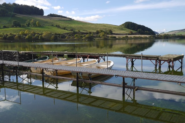
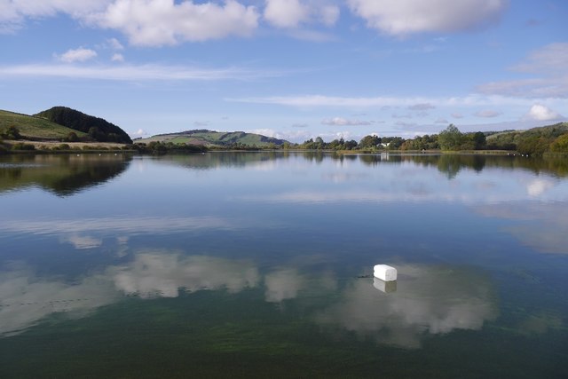
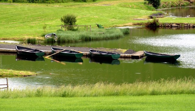
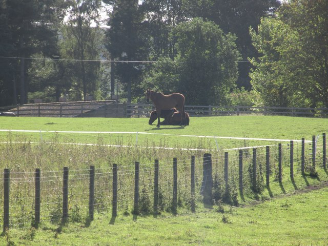
Black Loch is a freshwater loch located in the county of Fife, Scotland. It is situated in the village of Lochore, near the larger town of Cowdenbeath. Covering an area of approximately 50 hectares, the loch is surrounded by picturesque woodland and is a popular recreational spot for locals and visitors alike.

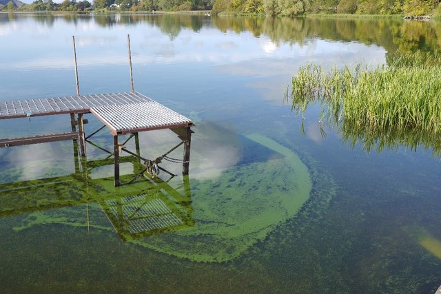
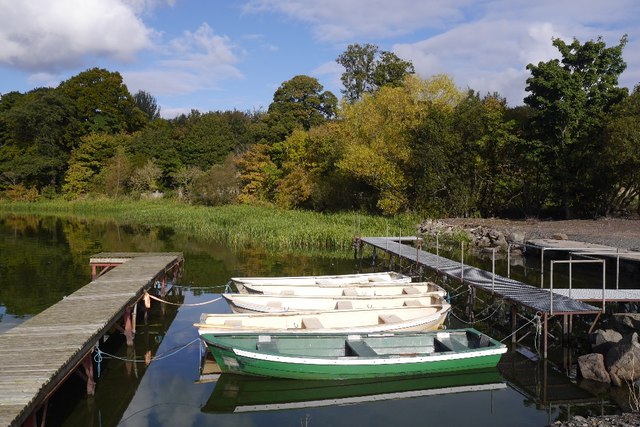
The loch is known for its calm and tranquil waters, making it an ideal location for various water-based activities. Fishing is a popular pastime at Black Loch, with anglers frequently catching a variety of fish species including pike, perch, roach, and bream. The loch has a well-maintained fishing pier, providing easy access for anglers of all abilities.

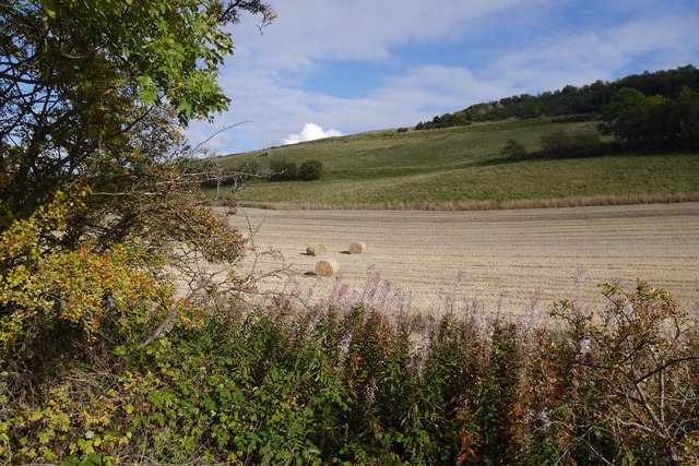
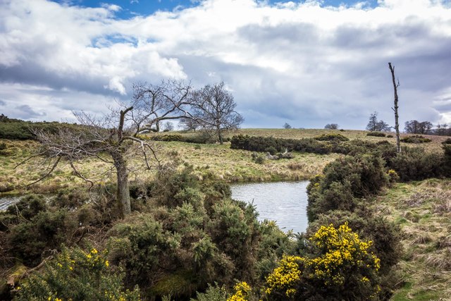
Surrounding the loch is a network of walking trails, offering visitors the opportunity to explore the beautiful natural surroundings. The woodland is home to a diverse range of wildlife, including various bird species such as swans, ducks, and herons. The presence of these birds adds to the serene atmosphere of the loch.

Black Loch also features a freshwater marsh, which serves as a habitat for numerous species of plants and animals. The marshland provides a valuable ecosystem for wetland species, including reeds, rushes, and water lilies. It is a great spot for birdwatching, as many waterfowl and wading birds can be spotted here.

In addition to its natural beauty and recreational opportunities, Black Loch also offers picnic areas and a visitor center, providing visitors with amenities and information about the loch and its surroundings. Overall, Black Loch is a scenic and peaceful destination, offering a relaxing experience for nature lovers and outdoor enthusiasts.

If you have any feedback on the listing, please let us know in the comments section below.
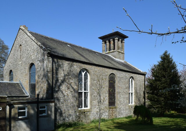
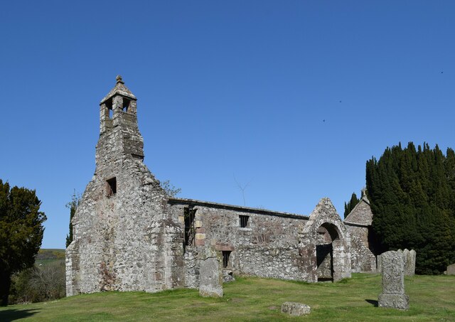
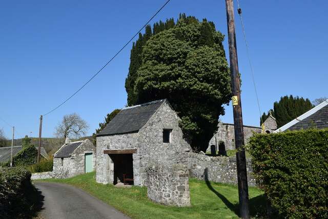
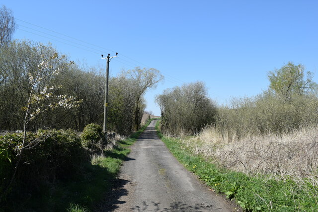
Black Loch Images

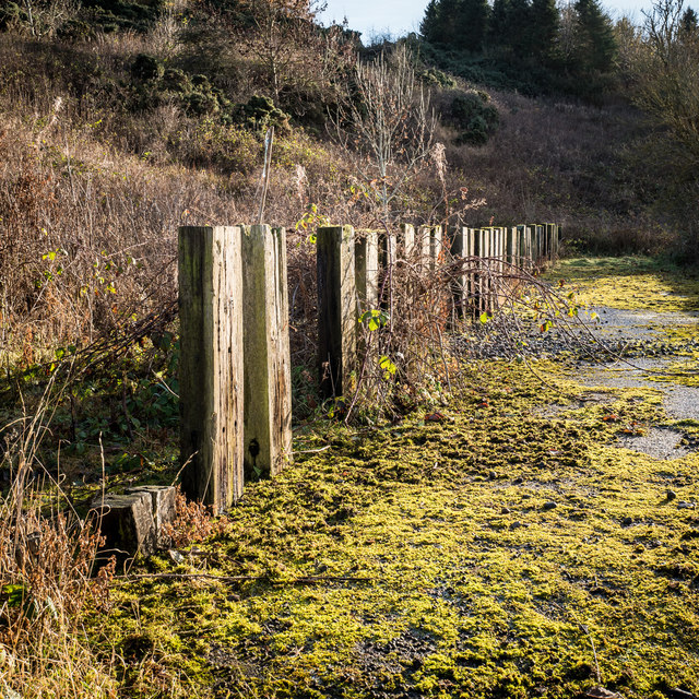
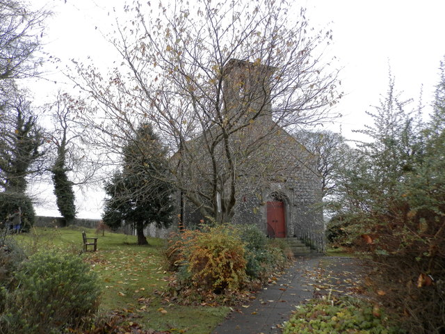
Images are sourced within 2km of 56.321129/-3.1954546 or Grid Reference NO2614. Thanks to Geograph Open Source API. All images are credited.

Abdie Parish Kirk The B-listed (LB2560 <span class="nowrap"><a title="https://portal.historicenvironment.scot/designation/LB2560" rel="nofollow ugc noopener" href="https://portal.historicenvironment.scot/designation/LB2560">Link</a><img style="margin-left:2px;" alt="External link" title="External link - shift click to open in new window" src="https://s1.geograph.org.uk/img/external.png" width="10" height="10"/></span> ) kirk dates from ca. 1827 and replaced the medieval kirk a few hundred metres to the south east.   The Italianate bellcote is unusual.
Abdie Parish Kirk
The B-listed (LB2560 LinkExternal link ) kirk dates from ca. 1827 and replaced the medieval kirk a few hundred metres to the south east. The Italianate bellcote is unusual.
Abdie old kirk The 13th Century kirk is a scheduled monument (SM825 <span class="nowrap"><a title="https://portal.historicenvironment.scot/designation/SM825" rel="nofollow ugc noopener" href="https://portal.historicenvironment.scot/designation/SM825">Link</a><img style="margin-left:2px;" alt="External link" title="External link - shift click to open in new window" src="https://s1.geograph.org.uk/img/external.png" width="10" height="10"/></span> ) but the listing provides no details  whatsoever.  Thankfully, the Canmore listing (30063  <span class="nowrap"><a title="https://canmore.org.uk/site/30063/abdie-old-parish-kirk" rel="nofollow ugc noopener" href="https://canmore.org.uk/site/30063/abdie-old-parish-kirk">Link</a><img style="margin-left:2px;" alt="External link" title="External link - shift click to open in new window" src="https://s1.geograph.org.uk/img/external.png" width="10" height="10"/></span> ) comes to the rescue with a very detailed description.    The church was abandoned and soon fell into ruin when the replacement kirk was built a few hundred metres to the north east in 1827.
Abdie old kirk
The 13th Century kirk is a scheduled monument (SM825 LinkExternal link ) but the listing provides no details whatsoever. Thankfully, the Canmore listing (30063 LinkExternal link ) comes to the rescue with a very detailed description. The church was abandoned and soon fell into ruin when the replacement kirk was built a few hundred metres to the north east in 1827.
Buildings at the entrance to Abdie old kirk The farther building is said to be a " session/offertory house" and the nearer is a "hearse or gig-house and loft".    The ensemble is B-listed (LB2561 <span class="nowrap"><a title="https://portal.historicenvironment.scot/designation/LB2561" rel="nofollow ugc noopener" href="https://portal.historicenvironment.scot/designation/LB2561">Link</a><img style="margin-left:2px;" alt="External link" title="External link - shift click to open in new window" src="https://s1.geograph.org.uk/img/external.png" width="10" height="10"/></span> ).   An enormous yew tree looms behind them.
Buildings at the entrance to Abdie old kirk
The farther building is said to be a " session/offertory house" and the nearer is a "hearse or gig-house and loft". The ensemble is B-listed (LB2561 LinkExternal link ). An enormous yew tree looms behind them.
Minor road to Abdie old kirk
Balfour-Napier monument, Abdie old kirk Arms of Balfour of Denmiln (Or, on a chevron sable between three trefoils slipped vert an otter's head erased argent) impaling Napier (Argent a saltire engrailed between four roses gules barbed vert)  commemorating the marriage between Michael Balfour and Katherine Napier sometime before 1652, when Katherine died.   The memorial is almost completely eroded but the arms at least were more discernible in 1930 and their details were entered into the  ‘Inventory of Monuments and Constructions in the Counties of Five, Kinross, and Clackmannan', published by RCAHMS (the Royal Commission on the Ancient and Historical Monuments of Scotland) published in 1933,
Balfour-Napier monument, Abdie old kirk
Arms of Balfour of Denmiln (Or, on a chevron sable between three trefoils slipped vert an otter's head erased argent) impaling Napier (Argent a saltire engrailed between four roses gules barbed vert) commemorating the marriage between Michael Balfour and Katherine Napier sometime before 1652, when Katherine died. The memorial is almost completely eroded but the arms at least were more discernible in 1930 and their details were entered into the ‘Inventory of Monuments and Constructions in the Counties of Five, Kinross, and Clackmannan', published by RCAHMS (the Royal Commission on the Ancient and Historical Monuments of Scotland) published in 1933,
Stubble, Cairneyhall A field beside the Loch of Lindores.
Stubble, Cairneyhall
A field beside the Loch of Lindores.
Pier, Lindores Loch Clear, shallow water by the boat pier.
Pier, Lindores Loch
Clear, shallow water by the boat pier.
Piers, Lindores Loch Fishing boats tied up at the end of the season.
Piers, Lindores Loch
Fishing boats tied up at the end of the season.
Lindores Loch
Lindores Loch
Fishing boats, Loch of Lindores Tied up at the end of the season.
Fishing boats, Loch of Lindores
Tied up at the end of the season.
Gate on Collessie to Lindores Loch path This path, not shown on the OS maps of the area, connects Collessie to Lindores Loch and is one of the way marked Fife Corepaths. West Lomond Hill is in the background, approximately 7 miles away as the crow flies
Gate on Collessie to Lindores Loch path
This path, not shown on the OS maps of the area, connects Collessie to Lindores Loch and is one of the way marked Fife Corepaths. West Lomond Hill is in the background, approximately 7 miles away as the crow flies
Railway Bridge near Cairneyhall Farm The railway (Perth to Edinburgh line) goes over a farm track that joins the Newburgh to Collessie road near the southern end of Lindores Loch
Railway Bridge near Cairneyhall Farm
The railway (Perth to Edinburgh line) goes over a farm track that joins the Newburgh to Collessie road near the southern end of Lindores Loch
Strange enclosure near Woodmill Mains This is one side of an enclosure fenced with railway sleepers, perhaps 30-35 each side flanking a single track road width of concreted level ground. All of it is in a poor state now. The enclosure is just off a track opposite Woodmill Mains. Considering its age and construction it may have been something to do with the railway that is immediately adjacent the nearby Newburgh to Collessie road.
Strange enclosure near Woodmill Mains
This is one side of an enclosure fenced with railway sleepers, perhaps 30-35 each side flanking a single track road width of concreted level ground. All of it is in a poor state now. The enclosure is just off a track opposite Woodmill Mains. Considering its age and construction it may have been something to do with the railway that is immediately adjacent the nearby Newburgh to Collessie road.
Abdie and Dunbog Church
Goldenloch, by Lindores, Fife Goldenloch, also referred to as The Golden Loch, is a fishery nestled near Abdie and Dunbog, by Lindores.
Goldenloch, by Lindores, Fife
Goldenloch, also referred to as The Golden Loch, is a fishery nestled near Abdie and Dunbog, by Lindores.
Small pond on Baw Hill Small pond near the top of Baw Hill. This is a little visited part of the North Fife hills. The top of East Lomond hill can just be seen on the skyline between the two distant trees.
Small pond on Baw Hill
Small pond near the top of Baw Hill. This is a little visited part of the North Fife hills. The top of East Lomond hill can just be seen on the skyline between the two distant trees.
Horses at Lindores A pair of horses in a field near Lindores House.
Horses at Lindores
A pair of horses in a field near Lindores House.
Abdie & Dunbog Kirk Abdie & Dunbog Kirk, viewed from the railway bridge.
Abdie & Dunbog Kirk
Abdie & Dunbog Kirk, viewed from the railway bridge.
Show me another place!

Black Loch is located at Grid Ref: NO2614 (Lat: 56.321129, Lng: -3.1954546)

Unitary Authority: Fife

Police Authority: Fife

What 3 Words

///defaults.repaid.events. Near Auchtermuchty, Fife

Nearby Locations

Black Loch Woodhead

Related Wikis

Lindores Loch

Lindores Loch is a freshwater loch, situated in North Fife in the Parish of Abdie, in the Central Belt of Scotland. The Loch has for many years been used...

Lindores (E&NR) railway station

Lindores (E&NR) railway station was a temporary terminus that served the village of Lindores, Fife, Scotland in 1847 on the Edinburgh and Northern Railway...

Abdie stone

The Abdie stone is a Class I Pictish stone that stands in Abdie Churchyard, Lindores, Fife, Scotland. == Location == The stone originally stood on the...

Abdie

Abdie is a parish in north-west Fife, Scotland, lying on the south shore of the Firth of Tay on the eastern outskirts of Newburgh, extending about 3 miles...

Nearby Amenities

Located within 500m of 56.321129,-3.1954546
Power: pole
Lat/Long: 56.3179301/-3.1909683
Power: pole
Lat/Long: 56.319949/-3.1885618
Power: pole
Lat/Long: 56.3206035/-3.1892967
Power: pole
Lat/Long: 56.3211286/-3.1898412
Power: pole
Lat/Long: 56.3217428/-3.1905252
Power: pole
Lat/Long: 56.3223303/-3.1911904
Power: pole
Lat/Long: 56.32261/-3.1920433
Power: pole
Lat/Long: 56.3228688/-3.1928721
Power: pole
Lat/Long: 56.3231618/-3.1938162
Power: pole
Lat/Long: 56.3235068/-3.1949616
Power: pole
Lat/Long: 56.3238236/-3.1959969
Power: pole
Lat/Long: 56.3239322/-3.1975097
Power: pole
Lat/Long: 56.3239798/-3.1984806
Power: pole
Lat/Long: 56.324066/-3.1998485
Power: pole
Lat/Long: 56.3241791/-3.2013506
The data included in this document is from www.openstreetmap.org. The data is made available under ODbL.

Have you been to Black Loch?

Leave your review of Black Loch below (or comments, questions and feedback).