Nant y Fin

Lake, Pool, Pond, Freshwater Marsh in Monmouthshire

Wales

Nant y Fin

Sheep grazing south-east of Ty Hwnt On the eastern slopes of Nant Honddu / Vale of Ewyas.
Sheep grazing south-east of Ty Hwnt Credit: Christine Johnstone

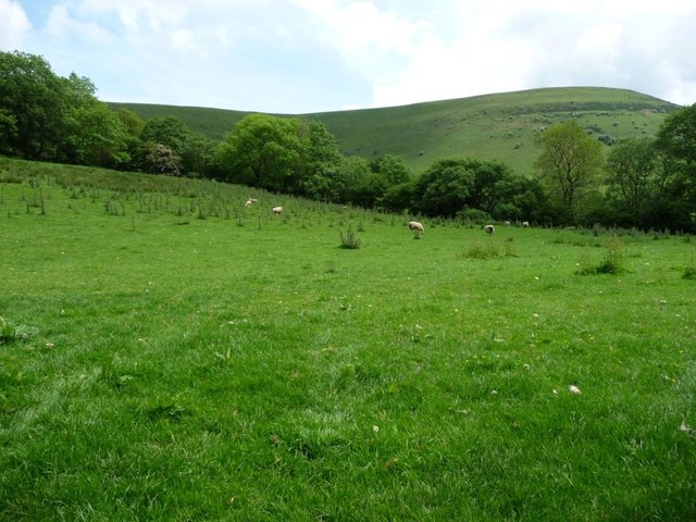
Nant y Fin, located in Monmouthshire, is a picturesque freshwater marsh encompassing a lake, pool, and pond. This nature reserve is a haven for a diverse range of flora and fauna, making it a popular destination for nature enthusiasts and birdwatchers alike.

The main feature of Nant y Fin is its expansive lake, which stretches across the reserve and serves as a vital habitat for various aquatic species. The crystal-clear waters teem with fish, amphibians, and insects, contributing to the overall ecological balance of the area. Surrounding the lake are lush reed beds, providing nesting sites for numerous bird species, including reed warblers and bitterns.

Adjacent to the lake is a smaller pool, offering a tranquil spot for wildlife to drink and bathe. This pool attracts a wide array of waterfowl, such as ducks and swans, creating a picturesque scene for visitors to admire. Additionally, a well-maintained pond can be found within the reserve, providing a habitat for a variety of aquatic plants and invertebrates.

The freshwater marsh ecosystem at Nant y Fin supports a diverse range of plant life. Extensive wetland vegetation, including sedges, rushes, and water lilies, flourishes in the nutrient-rich soil. These plants not only provide food and shelter for the resident wildlife but also contribute to the overall health of the marshland.

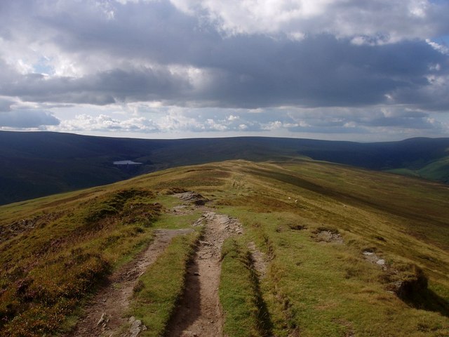
Visitors to Nant y Fin can explore the nature reserve via well-maintained footpaths and observation platforms, ensuring a minimal impact on the delicate ecosystem. With its serene atmosphere and abundant wildlife, Nant y Fin presents an ideal opportunity for individuals to immerse themselves in the beauty of Monmouthshire's natural surroundings.

If you have any feedback on the listing, please let us know in the comments section below.

Nant y Fin Images

Images are sourced within 2km of 51.974873/-3.0763545 or Grid Reference SO2631. Thanks to Geograph Open Source API. All images are credited.

Sheep grazing south-east of Ty Hwnt On the eastern slopes of Nant Honddu / Vale of Ewyas.
Sheep grazing south-east of Ty Hwnt
On the eastern slopes of Nant Honddu / Vale of Ewyas.
Nant Honddu, near Ty Hwnt Looking westwards across the valley.
Nant Honddu, near Ty Hwnt
Looking westwards across the valley.
0.4km to the Hay Road Public footpath signpost on the west side of the lane near Ty Hwnt. The 'Hay Road' is the road up Nant Honddu from Llanthony to Hay on Wye.
0.4km to the Hay Road
Public footpath signpost on the west side of the lane near Ty Hwnt. The 'Hay Road' is the road up Nant Honddu from Llanthony to Hay on Wye.
The first snow of winter on Chwarel y Fan
Chwarel y Fan According to the discussion ( <a title="https://www.geograph.org.uk/discuss/index.php?&action=vthread&forum=6&topic=1163" href="https://www.geograph.org.uk/discuss/index.php?&action=vthread&forum=6&topic=1163">Link</a> ) Chwarel Y Fan is the highest point in old Gwent. This photo is taken looking east from the other side of the Grwyne Fawr valley, near Pen y Gadair Fawr - which is far higher, but across the border.
Chwarel y Fan
According to the discussion ( Link ) Chwarel Y Fan is the highest point in old Gwent. This photo is taken looking east from the other side of the Grwyne Fawr valley, near Pen y Gadair Fawr - which is far higher, but across the border.
Track along the central Black Mountains ridge North of Chwarel y Fan.  The lake in the distance is Grwyne Fawr reservoir (<a href="https://www.geograph.org.uk/photo/135959">SO2330 : Grwyne Fawr Reservoir dam</a>).
Track along the central Black Mountains ridge
North of Chwarel y Fan. The lake in the distance is Grwyne Fawr reservoir (SO2330 : Grwyne Fawr Reservoir dam).
The Vale of Ewyas View north-east across the Vale of Ewyas from SO272297 to the north of Llanthony Priory.
The Vale of Ewyas
View north-east across the Vale of Ewyas from SO272297 to the north of Llanthony Priory.
View up the Vale of Ewyas View up the Vale of Ewyas to Capel-y-ffin from SO268296.
View up the Vale of Ewyas
View up the Vale of Ewyas to Capel-y-ffin from SO268296.
View across the Vale of Ewyas Garn Farm can be seen through the trees across the valley.
View across the Vale of Ewyas
Garn Farm can be seen through the trees across the valley.
Summit cairn of Chwarel y Fan The summit above Chwarel y Fan is really just the highest point on a long ridge.
Summit cairn of Chwarel y Fan
The summit above Chwarel y Fan is really just the highest point on a long ridge.
Approaching the summit of Chwarel y Fan The summit cairn looms up out of the mist.  This is the highest point of the ridge.  It has extensive covering of stones and the remains of a quarry.  Fancy working up here?
Approaching the summit of Chwarel y Fan
The summit cairn looms up out of the mist. This is the highest point of the ridge. It has extensive covering of stones and the remains of a quarry. Fancy working up here?
Evidence of forestry The western slopes of Chwarel y Fan are relatively gentle.  There are the remains of a planted woodland quite close to the summit.
Evidence of forestry
The western slopes of Chwarel y Fan are relatively gentle. There are the remains of a planted woodland quite close to the summit.
North of Chwarel y Fan The ridge is much broader here, with gentle slopes either side.  There is no protection when the rain starts in earnest though.
North of Chwarel y Fan
The ridge is much broader here, with gentle slopes either side. There is no protection when the rain starts in earnest though.
Towards Vale of Ewyas It's down there somewhere.  This group of walkers sensibly heads downhill with the rain at their back.
Towards Vale of Ewyas
It's down there somewhere. This group of walkers sensibly heads downhill with the rain at their back.
Rock on Chwarel y Fan There is little bare exposed rock on the Black Mountains, these rocks are to the north of Chwarel y Fan.  At 679m this is the highest point in the county of Monmouthshire.
Rock on Chwarel y Fan
There is little bare exposed rock on the Black Mountains, these rocks are to the north of Chwarel y Fan. At 679m this is the highest point in the county of Monmouthshire.
Path on Chwarel y Fan Path approaching Chwarel y Fan, at 679m the highest point in Monmouthshire, from the north.
Path on Chwarel y Fan
Path approaching Chwarel y Fan, at 679m the highest point in Monmouthshire, from the north.
View to Waun Fach View to Waun Fach, the highest point in the Black Mountains from Chwarel y Fan. Waun Fach (811m) is the broad summit plateau on the right, Pen y Gadair Fawr (800m) is the small summit on the left
View to Waun Fach
View to Waun Fach, the highest point in the Black Mountains from Chwarel y Fan. Waun Fach (811m) is the broad summit plateau on the right, Pen y Gadair Fawr (800m) is the small summit on the left
Ruinous stone barn in the Llanthony Valley Long roofless, this barn's walls are giving up the ghost.
Ruinous stone barn in the Llanthony Valley
Long roofless, this barn's walls are giving up the ghost.
Show me another place!

Nant y Fin is located at Grid Ref: SO2631 (Lat: 51.974873, Lng: -3.0763545)

Unitary Authority: Monmouthshire

Police Authority: Gwent

What 3 Words

///become.lamenting.starters. Near Llanveynoe, Herefordshire

Nearby Locations

Nant y Fin

Related Wikis

Capel-y-ffin

Capel-y-ffin (Welsh for 'chapel of the boundary') is a hamlet near the English-Welsh border, a couple of miles north of Llanthony in Powys, Wales. It lies...

Llanthony Abbey

Llanthony Abbey is a former Anglican monastic institution founded in 1869 by Joseph Leycester Lyne (Father Ignatius), in the Welsh village of Capel-y-ffin...

Hatterrall Ridge

The Hatterrall Ridge (sometimes spelled Hatterall) is a ridge in the Black Mountains forming the border between Powys and Monmouthshire in Wales and Herefordshire...

Chwarel y Fan

Chwarel y Fan is a peak in the Black Mountains in south-eastern Wales. It is the highest rise on the long ridge which extends southeastwards from Rhos...

Nearby Amenities

Located within 500m of 51.974873,-3.0763545
Barrier: stile
Foot: yes
Source: survey
Lat/Long: 51.9745557/-3.0715831
Barrier: stile
Foot: yes
Material: wood
Stile: stepover
Lat/Long: 51.9727933/-3.0729723
Barrier: stile
Foot: yes
Source: survey
Lat/Long: 51.9730658/-3.0718592
Barrier: stile
Foot: yes
Source: survey
Lat/Long: 51.9740011/-3.0775677
Barrier: stile
Foot: yes
Source: survey
Lat/Long: 51.9746958/-3.0787944
Barrier: stile
Foot: yes
Source: survey
Lat/Long: 51.9753446/-3.0803929
Barrier: stile
Steps: 1
Stile: stepover
Lat/Long: 51.9715964/-3.073854
Barrier: stile
Steps: 2
Stile: stepover
Lat/Long: 51.9725138/-3.0724296
Barrier: stile
Steps: 1
Stile: wall
Lat/Long: 51.9710979/-3.0743037
Barrier: stile
Steps: 2
Stile: stepover
Lat/Long: 51.9710272/-3.0756503
Ford: yes
Lat/Long: 51.9735407/-3.081609
The data included in this document is from www.openstreetmap.org. The data is made available under ODbL.

Have you been to Nant y Fin?

Leave your review of Nant y Fin below (or comments, questions and feedback).