Millery Pool

Lake, Pool, Pond, Freshwater Marsh in Caithness

Scotland

Millery Pool

Hut circle above Berriedale Water Looking towards the coast at Berriedale.
The hut measures about 8 x 6m and it one of several in the area (ref <span class="nowrap"><a title="http://canmore.rcahms.gov.uk/en/site/7541/details/allt+a+chriosduidhe" rel="nofollow ugc noopener" href="http://canmore.rcahms.gov.uk/en/site/7541/details/allt+a+chriosduidhe">Link</a><img style="margin-left:2px;" alt="External link" title="External link - shift click to open in new window" src="https://s1.geograph.org.uk/img/external.png" width="10" height="10"/></span> ).
Hut circle above Berriedale Water Credit: Claire Pegrum

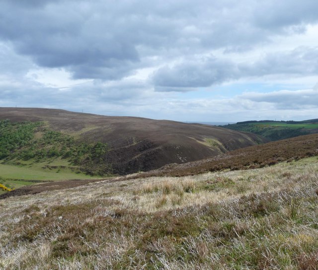
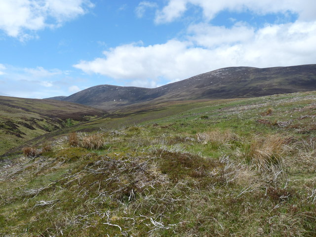
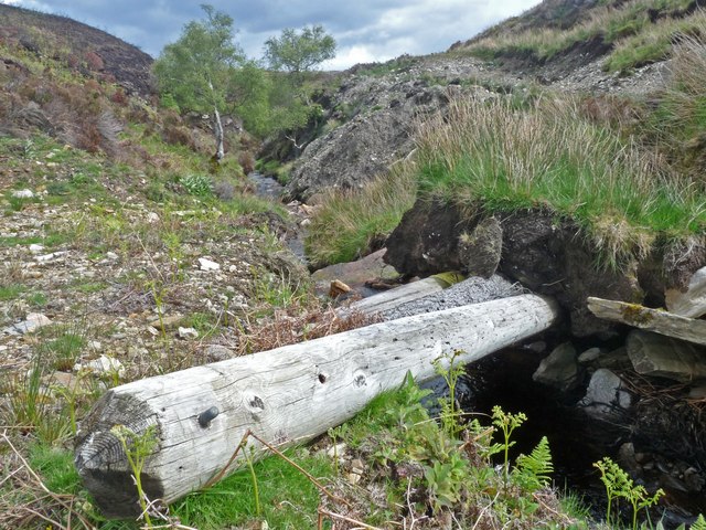
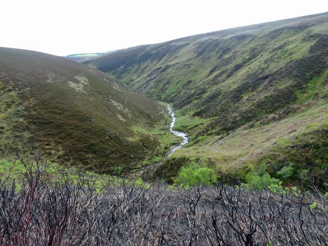
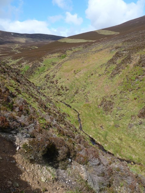
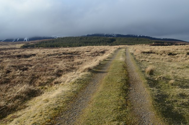
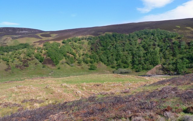
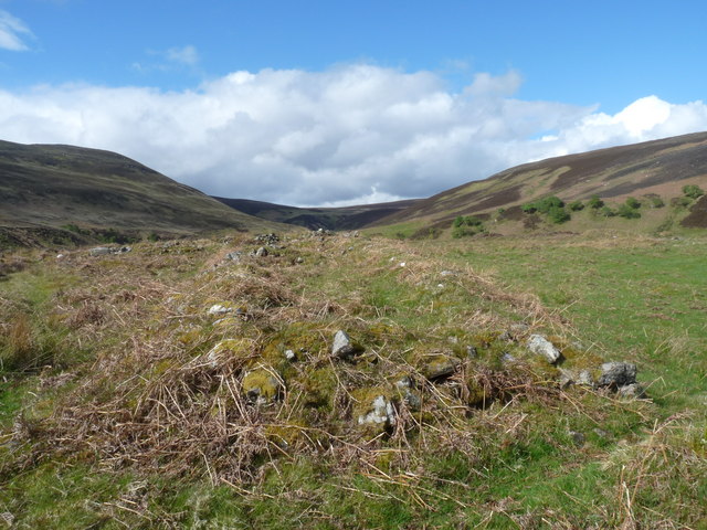
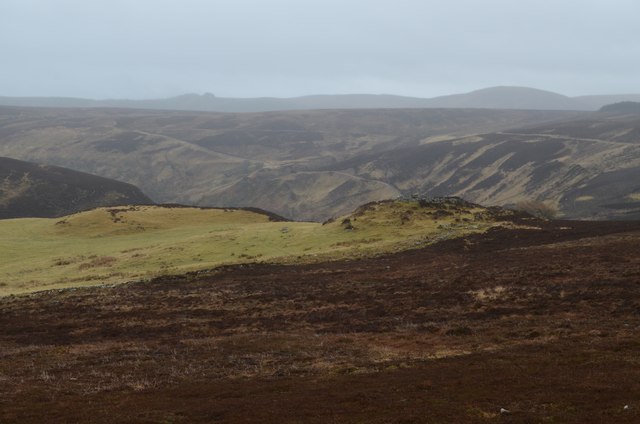
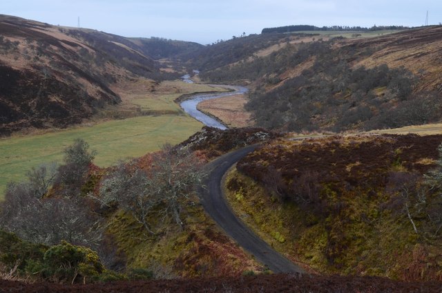
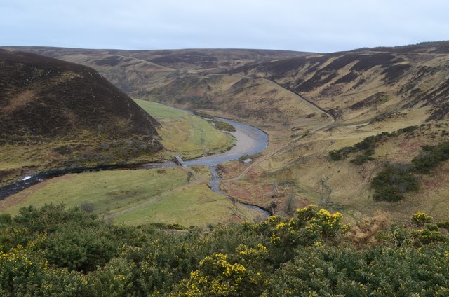
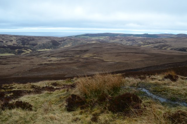
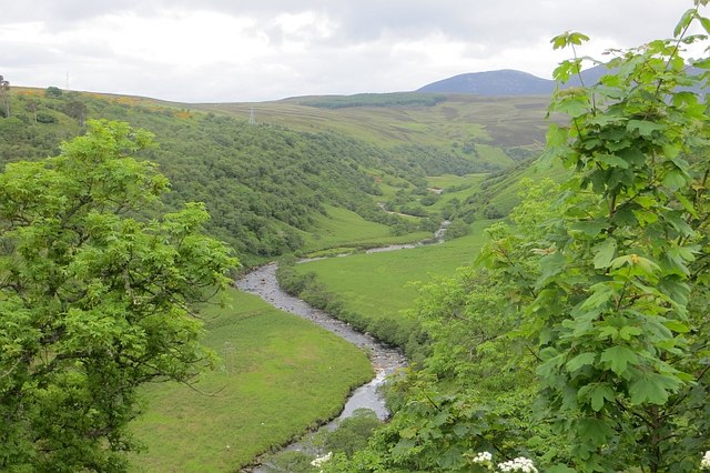
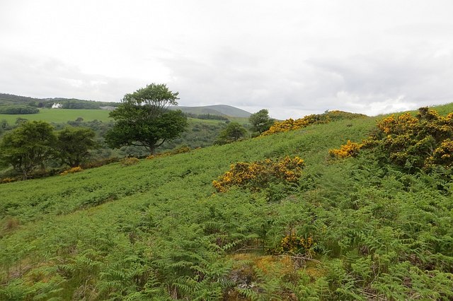
Millery Pool is a freshwater pool located in Caithness, Scotland. The pool is surrounded by lush greenery and is a popular spot for birdwatching and wildlife enthusiasts. The pool is home to a variety of species of birds, including ducks, swans, and herons.

The pool is relatively small in size, but its tranquil waters and natural surroundings make it a peaceful and picturesque destination for visitors looking to escape the hustle and bustle of everyday life. The pool is also a popular spot for fishing, with anglers often seen casting their lines into the water in search of trout and other freshwater fish.

The pool is surrounded by reeds and other aquatic plants, creating a diverse habitat for a variety of wildlife. Visitors to Millery Pool can expect to see a wide range of bird species, as well as occasional sightings of other wildlife such as otters and deer.

Overall, Millery Pool is a hidden gem in Caithness, offering a peaceful and serene setting for nature lovers to enjoy the beauty of the Scottish countryside.

If you have any feedback on the listing, please let us know in the comments section below.
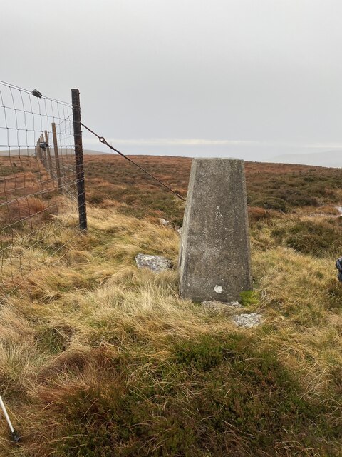
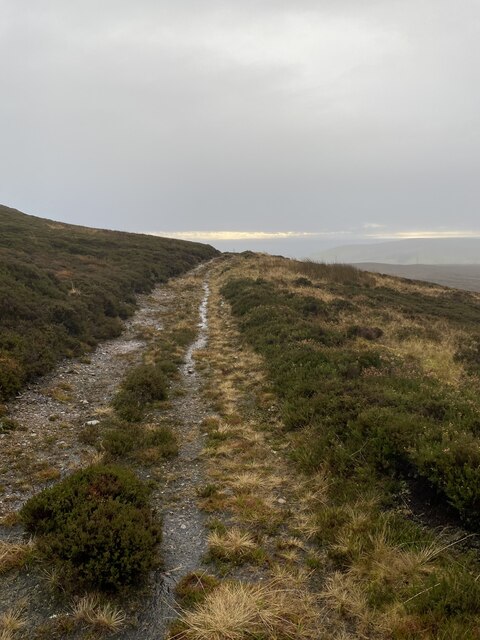
Millery Pool Images

Images are sourced within 2km of 58.204324/-3.5171034 or Grid Reference ND1024. Thanks to Geograph Open Source API. All images are credited.

Hut circle above Berriedale Water Looking towards the coast at Berriedale.
The hut measures about 8 x 6m and it one of several in the area (ref <span class="nowrap"><a title="http://canmore.rcahms.gov.uk/en/site/7541/details/allt+a+chriosduidhe" rel="nofollow ugc noopener" href="http://canmore.rcahms.gov.uk/en/site/7541/details/allt+a+chriosduidhe">Link</a><img style="margin-left:2px;" alt="External link" title="External link - shift click to open in new window" src="https://s1.geograph.org.uk/img/external.png" width="10" height="10"/></span> ).
Hut circle above Berriedale Water
Looking towards the coast at Berriedale. The hut measures about 8 x 6m and it one of several in the area (ref LinkExternal link ).
Hut circle above the Forkin Looking towards the bealach between Scaraben and East Scaraben.
The hut circle has a diameter of 9m (ref <span class="nowrap"><a title="http://canmore.rcahms.gov.uk/en/site/7508/details/the+forkin" rel="nofollow ugc noopener" href="http://canmore.rcahms.gov.uk/en/site/7508/details/the+forkin">Link</a><img style="margin-left:2px;" alt="External link" title="External link - shift click to open in new window" src="https://s1.geograph.org.uk/img/external.png" width="10" height="10"/></span> ).
Hut circle above the Forkin
Looking towards the bealach between Scaraben and East Scaraben. The hut circle has a diameter of 9m (ref LinkExternal link ).
Footbridge over Dun Burn The poles replace a girder and stone slab bridge, the remains of which are nearby.
Footbridge over Dun Burn
The poles replace a girder and stone slab bridge, the remains of which are nearby.
Dun Burn The burn flows through the trees on the lower right of the photo below the muirburn.  The southern end of <a href="https://www.geograph.org.uk/photo/2413690">ND0926 : The Forkin</a> is on the left of the photo.
Dun Burn
The burn flows through the trees on the lower right of the photo below the muirburn. The southern end of ND0926 : The Forkin is on the left of the photo.
The Forkin Looking towards East Scaraben (left) and Meall na Caorach (right).
The Forkin is a ravine approximately 800m long through which a tributary of the <a href="https://www.geograph.org.uk/photo/2413667">ND0925 : Dun Burn</a> flows.
The Forkin
Looking towards East Scaraben (left) and Meall na Caorach (right). The Forkin is a ravine approximately 800m long through which a tributary of the ND0925 : Dun Burn flows.
Moorland Track near Berriedale
Township by Berriedale Water The footings of buildings can be seen.  The remains of the township comprise seven buildings, a corn-drying kiln and enclosures (ref <span class="nowrap"><a title="http://canmore.rcahms.gov.uk/en/site/8059/details/berriedale+water" rel="nofollow ugc noopener" href="http://canmore.rcahms.gov.uk/en/site/8059/details/berriedale+water">Link</a><img style="margin-left:2px;" alt="External link" title="External link - shift click to open in new window" src="https://s1.geograph.org.uk/img/external.png" width="10" height="10"/></span> ).
Township by Berriedale Water
The footings of buildings can be seen. The remains of the township comprise seven buildings, a corn-drying kiln and enclosures (ref LinkExternal link ).
Building footings by Berriedale Water This is one of the buildings within the <a href="https://www.geograph.org.uk/photo/2415299">ND1126 : Township by Berriedale Water</a>.
Building footings by Berriedale Water
This is one of the buildings within the ND1126 : Township by Berriedale Water.
An Dun Broch in Berriedale View south over the An Dun Broch in Berriedale.  The Broch is the ruined 'mound' on the right.  Judging by area of ruin, this Broch would have been relatively large and was surrounded with trenches and defensive structures.  The mound to the left of the Broch is not shown as a feature on the OS 25k or 50k mapping.  However it does appear as though it might be artificial.  The neighbouring Broch at Bad a' Choilich is in sight, about 1km away
An Dun Broch in Berriedale
View south over the An Dun Broch in Berriedale. The Broch is the ruined 'mound' on the right. Judging by area of ruin, this Broch would have been relatively large and was surrounded with trenches and defensive structures. The mound to the left of the Broch is not shown as a feature on the OS 25k or 50k mapping. However it does appear as though it might be artificial. The neighbouring Broch at Bad a' Choilich is in sight, about 1km away
Broch at Bad a' Choilich in Berriedale View east over the Bad a' Choilich Broch down Berriedale water towards the east coast of Scotland.  This Broch is relatively small and ruinous.  The adjacent estate track appears to have partly been built over the Broch.
Broch at Bad a' Choilich in Berriedale
View east over the Bad a' Choilich Broch down Berriedale water towards the east coast of Scotland. This Broch is relatively small and ruinous. The adjacent estate track appears to have partly been built over the Broch.
Berriedale Water A view over Berriedale Water from near to An Dun Broch.
Berriedale Water
A view over Berriedale Water from near to An Dun Broch.
The South Slopes of Meall na Caorach View south east over Berriedale from the slope of Meall na Caorach.
The South Slopes of Meall na Caorach
View south east over Berriedale from the slope of Meall na Caorach.
Berriedale Water Looking upstream from the steep northbound climb on the A9.
Berriedale Water
Looking upstream from the steep northbound climb on the A9.
Bracken covered slope, Berriedale Rough ground with a lot of obscured rocks. Later in the year the bracken became very dense.
Bracken covered slope, Berriedale
Rough ground with a lot of obscured rocks. Later in the year the bracken became very dense.
Dunbeath ROC Post Locked up.
Dunbeath ROC Post
Locked up.
Southbound A9 towards Berriedale The A9 is a strategic link between the Highlands of Scotland and the Central Belt. Running for 273 miles, it is the longest road in Scotland and the fifth-longest A-road in the United Kingdom. Historically it was the main road between Edinburgh and John o' Groats but its importance has been eclipsed somewhat in the south by the A90 across the Forth Road Bridge and the M90 motorway, which now links Edinburgh more directly with Perth, and the M9, which is now the main road between Edinburgh and Bridge of Allan.
Southbound A9 towards Berriedale
The A9 is a strategic link between the Highlands of Scotland and the Central Belt. Running for 273 miles, it is the longest road in Scotland and the fifth-longest A-road in the United Kingdom. Historically it was the main road between Edinburgh and John o' Groats but its importance has been eclipsed somewhat in the south by the A90 across the Forth Road Bridge and the M90 motorway, which now links Edinburgh more directly with Perth, and the M9, which is now the main road between Edinburgh and Bridge of Allan.
Beinn Nan Coireag Trig Point Flush Bracket S6873
Track below Beinn Nan Coireag
Show me another place!

Millery Pool is located at Grid Ref: ND1024 (Lat: 58.204324, Lng: -3.5171034)

Unitary Authority: Highland

Police Authority: Highlands and Islands

What 3 Words

///streetcar.amber.encoding. Near Dunbeath, Highland

Related Wikis

Berriedale Church

Berriedale Church is a former church in the parish of Latheron, in Berriedale, Caithness, Scotland. Built in 1826, the T-plan building was closed as a...

Berriedale, Highland

Berriedale (Scottish Gaelic: Bearghdal) is a small estate village on the northern east coast of Caithness, Scotland, on the A9 road between Helmsdale and...

Borgue, Highland

Borgue is a village in the historical county of Caithness, 3 miles (5 km) south of Dunbeath in the local authority are of Highland, Scotland.Rev Samuel...

Newport, Caithness

Newport is a small remote village on the eastern shore of Caithness, Scottish Highlands and is in the Scottish council area of Highland.Ramscraig lies...

Have you been to Millery Pool?

Leave your review of Millery Pool below (or comments, questions and feedback).