Goose Eye

Settlement in Yorkshire

England

Goose Eye

Holden Park, Hypertufa Garden Walls The remains of the fanciful gardens of Oakworth Hall. There are elevated walkways, grottoes and caves with mosaic floors. Features are made from stone and hypertufa to give the petrified forest look.
Holden Park, Hypertufa Garden Walls Credit: Kevin Waterhouse

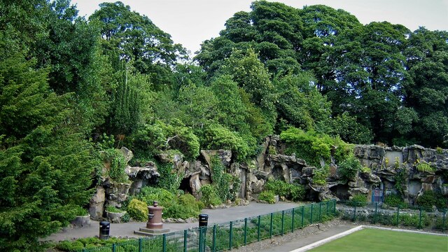
Goose Eye is a small hamlet located in the Craven district of Yorkshire, England. Situated in the heart of the Yorkshire Dales National Park, it is surrounded by picturesque countryside and offers a tranquil and idyllic setting.

The hamlet is named after a local stream, which runs through the area and resembles the shape of a goose's eye. It is home to a handful of traditional stone houses, giving it a quaint and charming character. The architecture in Goose Eye reflects the rural heritage of the region, with many buildings dating back several centuries.

Despite its small size, Goose Eye has a strong sense of community. The residents take great pride in their surroundings and actively participate in local events and initiatives. The hamlet also boasts a small church, which serves as a focal point for the community.

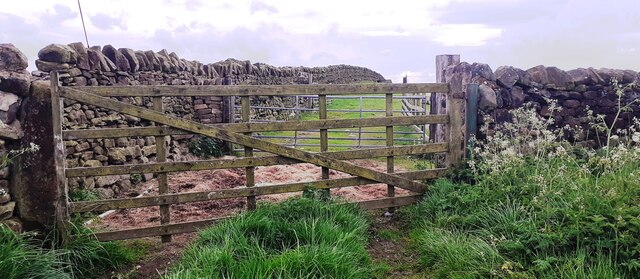
The surrounding landscape offers numerous opportunities for outdoor activities, such as hiking, cycling, and bird-watching. The nearby Yorkshire Dales provide stunning vistas of rolling hills, limestone cliffs, and meandering rivers. Visitors to Goose Eye can explore the network of footpaths and bridleways that crisscross the area, allowing for an immersive experience in nature.

While Goose Eye may not have many amenities of its own, it is conveniently located within a short drive of nearby towns and villages. This provides easy access to shopping, dining, and entertainment options, ensuring that residents and visitors have all the necessities within reach.

Overall, Goose Eye offers a picturesque and peaceful retreat in the heart of the Yorkshire Dales, making it an ideal destination for those seeking a rural escape.

If you have any feedback on the listing, please let us know in the comments section below.
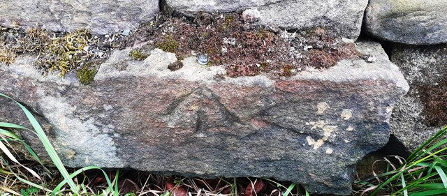
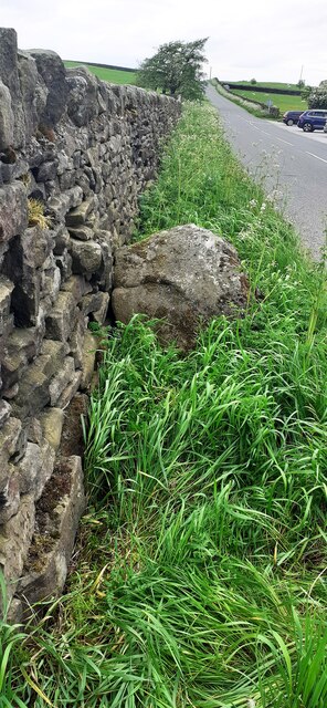
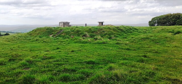
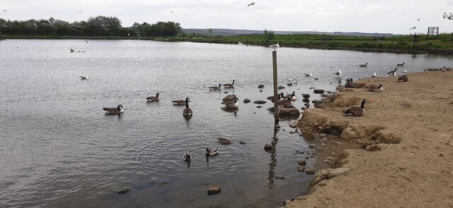
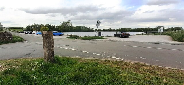
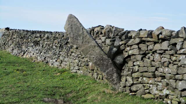
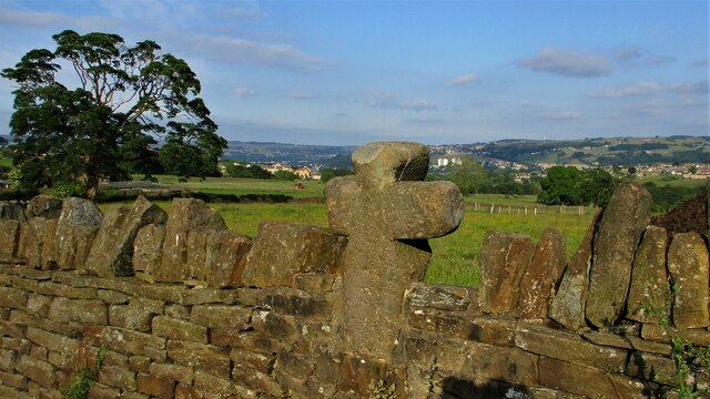
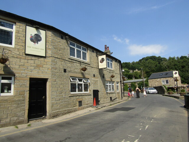
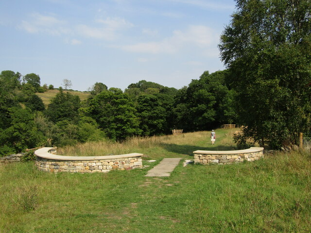
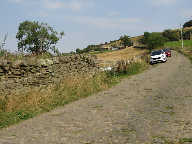
Goose Eye Images

Images are sourced within 2km of 53.861612/-1.958761 or Grid Reference SE0240. Thanks to Geograph Open Source API. All images are credited.

Holden Park, Hypertufa Garden Walls The remains of the fanciful gardens of Oakworth Hall. There are elevated walkways, grottoes and caves with mosaic floors. Features are made from stone and hypertufa to give the petrified forest look.
Holden Park, Hypertufa Garden Walls
The remains of the fanciful gardens of Oakworth Hall. There are elevated walkways, grottoes and caves with mosaic floors. Features are made from stone and hypertufa to give the petrified forest look.
Holden Park Bowling Green The green flanked by the remaining part of the demolished house, the portico
Holden Park Bowling Green
The green flanked by the remaining part of the demolished house, the portico
Benchmark on stone in wall on east side of Redcar Lane Ordnance Survey rivet benchmark levelled at 283.940m above Newkyn Datum verified 1962
Benchmark on stone in wall on east side of Redcar Lane
Ordnance Survey rivet benchmark levelled at 283.940m above Newkyn Datum verified 1962
Benchmark on gatepost at field gateway on SW side of Black Hill Lane Ordnance Survey cut mark benchmark levelled at 301.880m above Newlyn Datum verified 1962
Benchmark on gatepost at field gateway on SW side of Black Hill Lane
Ordnance Survey cut mark benchmark levelled at 301.880m above Newlyn Datum verified 1962
Field gateway on SW side of Black Hill Lane opposite Tarn House There is an Ordnance Survey benchmark <a href="https://www.geograph.org.uk/photo/7176738">SE0342 : Benchmark on gatepost at field gateway on SW side of Black Hill Lane</a> on the road face of the left hand gatepost
Field gateway on SW side of Black Hill Lane opposite Tarn House
There is an Ordnance Survey benchmark SE0342 : Benchmark on gatepost at field gateway on SW side of Black Hill Lane on the road face of the left hand gatepost
Benchmark on stone in wall on SW side of Black Hill Lane opposite Redcar Tarn Ordnance Survey rivet benchmark levelled at 290.295m above Newlyn Datum verified 1962
Benchmark on stone in wall on SW side of Black Hill Lane opposite Redcar Tarn
Ordnance Survey rivet benchmark levelled at 290.295m above Newlyn Datum verified 1962
Black Hill Lane heading NW opposite Redcar Tarn There is an Ordnance Survey benchmark <a href="https://www.geograph.org.uk/photo/7176789">SE0342 : Benchmark on stone in wall on SW side of Black Hill Lane opposite Redcar Tarn</a> on the protruding stone at the base of the wall in the left foreground
Black Hill Lane heading NW opposite Redcar Tarn
There is an Ordnance Survey benchmark SE0342 : Benchmark on stone in wall on SW side of Black Hill Lane opposite Redcar Tarn on the protruding stone at the base of the wall in the left foreground
Royal Observation Corps building on NE side of Black Hill Lane
Geese, ducks and gulls on Redcar Tarn
Redcar Tarn from junction of Tarn Lane with Black Hill Lane I wonder what is the significance of concrete post at the junction?
Redcar Tarn from junction of Tarn Lane with Black Hill Lane
I wonder what is the significance of concrete post at the junction?
Pole Stoop A large boundary stone
Pole Stoop
A large boundary stone
Cross built into the wall On Main Street
Cross built into the wall
On Main Street
Goose Eye - The Turkey Inn Traditional Yorkshire pub at Goose Eye, Laycock. It sits opposite the historic Turkey Mill (for cotton and paper) and was originally three workers' cottages.
Goose Eye - The Turkey Inn
Traditional Yorkshire pub at Goose Eye, Laycock. It sits opposite the historic Turkey Mill (for cotton and paper) and was originally three workers' cottages.
Goose Eye - Captain Tom's Wood A new woodland garden beside the North Beck between Goose Eye and Laycock. It was planted 2021 in memory of Captain Sir Tom Moore who raised nearly £33 million for charities supporting the National Health Service during the COVID-19 pandemic.
Goose Eye - Captain Tom's Wood
A new woodland garden beside the North Beck between Goose Eye and Laycock. It was planted 2021 in memory of Captain Sir Tom Moore who raised nearly £33 million for charities supporting the National Health Service during the COVID-19 pandemic.
Goose Eye - Holme House Lane Drystone dyke and pastoral farmland in a side valley between Goose Eye and Laycock. The lane is paved with setts.
Goose Eye - Holme House Lane
Drystone dyke and pastoral farmland in a side valley between Goose Eye and Laycock. The lane is paved with setts.
Looking up the Cat Steps Part of a public footpath. A local news article from 2015 says the steps had been recently improved by Army personnel and local residents, but doesn't explain the name.
Looking up the Cat Steps
Part of a public footpath. A local news article from 2015 says the steps had been recently improved by Army personnel and local residents, but doesn't explain the name.
Looking down the Cat Steps Part of a public footpath; the words 'The Cat Steps' are carved into successive steps. A local news article from 2015 says the steps had been recently improved by Army personnel and local residents, but doesn't explain the name.
Looking down the Cat Steps
Part of a public footpath; the words 'The Cat Steps' are carved into successive steps. A local news article from 2015 says the steps had been recently improved by Army personnel and local residents, but doesn't explain the name.
Playground behind houses on North Dean Road
Show me another place!

Goose Eye is located at Grid Ref: SE0240 (Lat: 53.861612, Lng: -1.958761)

Division: West Riding

Unitary Authority: Bradford

Police Authority: West Yorkshire

What 3 Words

///viewer.picture.refers. Near Steeton, West Yorkshire

Related Wikis

Laycock, West Yorkshire

Laycock is a small village in the Bradford District of West Yorkshire that overlooks the hamlet of Goose Eye. The village is 1.9 miles (3 km) west of the...

Holden Park

Holden Park is the only park in the village of Oakworth, West Yorkshire, England. The park is also known locally as Oakworth Park. == History == The park...

Oakworth

Oakworth is a village in West Yorkshire, England, near Keighley, by the River Worth. The name "Oakworth" indicates that the village was first established...

Oakworth Hall

Oakworth Hall is located in Oakworth, West Yorkshire, England. The manor house was rebuilt in the 17th century, but has a history dating back to 1066....
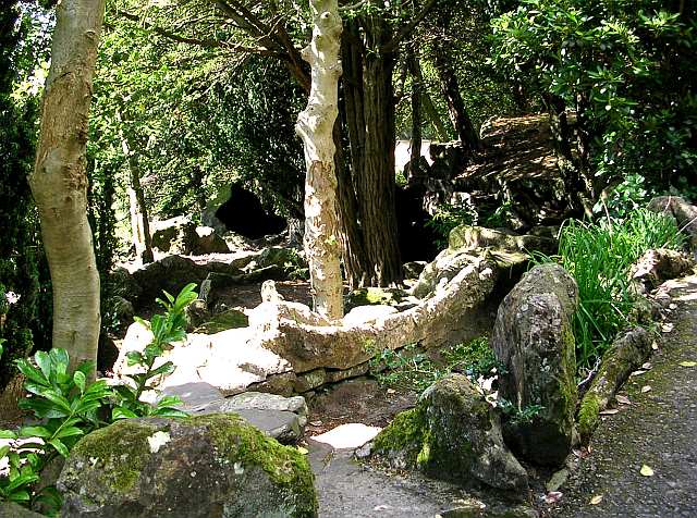
Related Videos

HAWORTH | Full tour of HAWORTH Village BRONTE COUNTRY England | 4K Walking Tour

HAWORTH | Full tour of Haworth Village BRONTE COUNTRY England | 4K Walking Tour A 4k Virtual Walk through the Bronte ...

Walking through Wuthering Heights

On a VERY foggy day just after Christmas we had a walk across Haworth Moor to Bronte Waterfall and further on to Top Withens, ...

Wuthering Heights walk

A walk near Haworth over the moors to see the Bronté Fall (which are a series of small waterfalls in the river valley), then up to ...

Nearby Amenities

Located within 500m of 53.861612,-1.958761
Game Scar Lane
Local Ref: 45024543
Naptan AtcoCode: 450024543
Naptan Bearing: N
Naptan BusStopType: CUS
Naptan CommonName: Game Scar Lane
Naptan Crossing: Lund Lane
Naptan Indicator: Stop 45024543
Naptan PlusbusZoneRef: LEEDS
Naptan ShortCommonName: Lund Lane
Naptan Street: Game Scar Lane
Naptan Verified: no
Source: naptan_import
Lat/Long: 53.862193/-1.9579417
Power: tower
Source: OS 1:25k
Lat/Long: 53.8650633/-1.9600722
Power: tower
Source: OS 1:25k
Lat/Long: 53.8601641/-1.9636232
Pub
Turkey Inn
Addr City: Keighley
Addr Housenumber: 20
Addr Postcode: BD22 0PD
Addr Street: Goose Eye
Addr Village: Laycock
Fhrs Id: 326821
Outdoor Seating: yes
Source Addr: FHRS Open Data
Lat/Long: 53.8615644/-1.9578811
Public Bookcase
Booth: K6
Disused Amenity: telephone
Listed Status: Grade II
Man Made: telephone_box
Public Bookcase Type: phone_box
Lat/Long: 53.8617069/-1.957766
Bench
Lat/Long: 53.8615802/-1.9576587
Power: tower
Lat/Long: 53.8621892/-1.9628567
Generator Method: photovoltaic
Generator Output Electricity: yes
Generator Source: solar
Generator Type: solar_photovoltaic_panel
Power: generator
Lat/Long: 53.8626385/-1.9580803
Generator Method: photovoltaic
Generator Output Electricity: yes
Generator Source: solar
Generator Type: solar_photovoltaic_panel
Power: generator
Lat/Long: 53.8628417/-1.9581581
Bench
Backrest: no
Material: wood
Lat/Long: 53.8635037/-1.9574647
Generator Method: photovoltaic
Generator Output Electricity: yes
Generator Source: solar
Generator Type: solar_photovoltaic_panel
Power: generator
Lat/Long: 53.8642522/-1.9540406
Bench
Backrest: no
Material: metal
Lat/Long: 53.8627861/-1.9579164
Waterway: weir
Lat/Long: 53.8609743/-1.9604338
The data included in this document is from www.openstreetmap.org. The data is made available under ODbL.

Have you been to Goose Eye?

Leave your review of Goose Eye below (or comments, questions and feedback).