Goose Green

Settlement in Lancashire South Ribble

England

Goose Green

Haunders Lane looking north
Haunders Lane looking north Credit: Colin Pyle

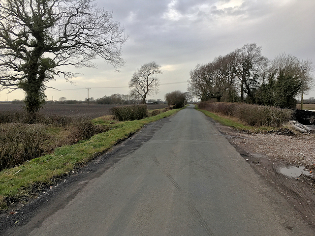
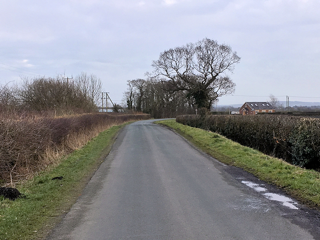
Goose Green is a small village located in the county of Lancashire, in the northwest of England. Situated approximately 3 miles northeast of the town of Wigan, it falls within the Metropolitan Borough of Wigan. The village is surrounded by picturesque countryside, offering residents and visitors a peaceful and idyllic setting.

Historically, Goose Green was an agricultural area, with farming being the main occupation of its inhabitants. Over the years, the village has undergone significant development and now features a mix of residential properties, small businesses, and amenities.

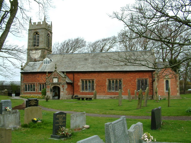
One of the notable landmarks in Goose Green is St. Paul's Church, a beautiful Grade II listed building that dates back to the 19th century. The church serves as a focal point for the community and hosts regular religious services and events.

The village benefits from good transport links, with nearby major roads such as the A49 and A577 allowing easy access to neighboring towns and cities. Additionally, the M6 motorway is within a short drive, providing connections to wider areas.

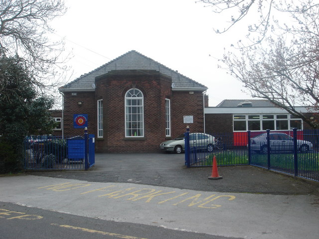
Goose Green boasts a range of local amenities, including a primary school, a convenience store, and a few shops and pubs. The village also benefits from its close proximity to larger towns like Wigan, which offer a wider array of services, shopping centers, and entertainment options.

Overall, Goose Green is a charming village that offers a tranquil and close-knit community atmosphere, while still providing easy access to nearby urban centers and essential amenities.

If you have any feedback on the listing, please let us know in the comments section below.
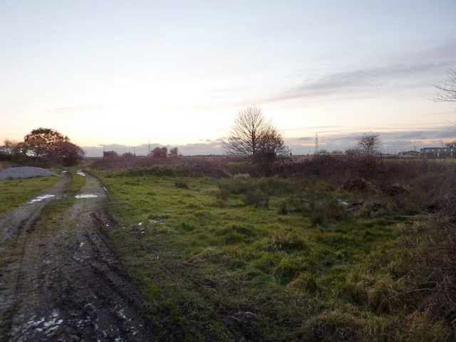
Goose Green Images

Images are sourced within 2km of 53.700065/-2.79594 or Grid Reference SD4722. Thanks to Geograph Open Source API. All images are credited.

Haunders Lane looking north
Liverpool Old Road looking north
Liverpool Road at Walmer Bridge boundary
Station Road looking west
Remains of level crossing on Station Road
Liverpool Road at Walmer Bridge boundary
A59 nears Gill Lane roundabout
Methodist Burial Ground, Much Hoole
Inside Methodist Burial Ground, Much Hoole
Liverpool Old Road, Much Hoole
Boundary stone between Little Hoole and Much Hoole
Much Hoole Woodland Burial Ground This a privately owned burial ground and the only one in the country that is consecrated   <span class="nowrap"><a title="http://www.muchhoolewoodlandburialground.co.uk" rel="nofollow ugc noopener" href="http://www.muchhoolewoodlandburialground.co.uk">Link</a><img style="margin-left:2px;" alt="External link" title="External link - shift click to open in new window" src="https://s1.geograph.org.uk/img/external.png" width="10" height="10"/></span>
Much Hoole Woodland Burial Ground
This a privately owned burial ground and the only one in the country that is consecrated LinkExternal link
Entrance to the Woodland Burial Ground This a privately owned burial ground and the only one in the country that is consecrated   <span class="nowrap"><a title="http://www.muchhoolewoodlandburialground.co.uk" rel="nofollow ugc noopener" href="http://www.muchhoolewoodlandburialground.co.uk">Link</a><img style="margin-left:2px;" alt="External link" title="External link - shift click to open in new window" src="https://s1.geograph.org.uk/img/external.png" width="10" height="10"/></span>
Entrance to the Woodland Burial Ground
This a privately owned burial ground and the only one in the country that is consecrated LinkExternal link
Much Hoole, Woodland Burial Ground This a privately owned burial ground and the only one in the country that is consecrated   <span class="nowrap"><a title="http://www.muchhoolewoodlandburialground.co.uk" rel="nofollow ugc noopener" href="http://www.muchhoolewoodlandburialground.co.uk">Link</a><img style="margin-left:2px;" alt="External link" title="External link - shift click to open in new window" src="https://s1.geograph.org.uk/img/external.png" width="10" height="10"/></span>
Much Hoole, Woodland Burial Ground
This a privately owned burial ground and the only one in the country that is consecrated LinkExternal link
Much Hoole Methodist Church
Doles Lane
Doles Lane
Bretherton, Doles Lane
Old Boundary Marker by Liverpool Old Road, Walmer Bridge Parish Boundary Marker by the UC road, in parish of Little Hoole (South Ribble District), Liverpool Old Road, next to brook and bus stop, on verge.

Inscription reads:-
: LONGTON : : LITTLE HOOLE :

Surveyed

Milestone Society National ID: LA_LONLHO01pb
Old Boundary Marker by Liverpool Old Road, Walmer Bridge
Parish Boundary Marker by the UC road, in parish of Little Hoole (South Ribble District), Liverpool Old Road, next to brook and bus stop, on verge. Inscription reads:- : LONGTON : : LITTLE HOOLE : Surveyed Milestone Society National ID: LA_LONLHO01pb
Show me another place!

Goose Green is located at Grid Ref: SD4722 (Lat: 53.700065, Lng: -2.79594)

Administrative County: Lancashire

District: South Ribble

Police Authority: Lancashire

What 3 Words

///bouncing.landowner.samplers. Near Tarleton, Lancashire

Related Wikis

Much Hoole

Much Hoole is a village and civil parish in the borough of South Ribble, Lancashire, England. The parish of Much Hoole had a population of 1,851 at the...

Little Hoole

Little Hoole is a civil parish in Lancashire, England, It contains the village of Walmer Bridge, and the remaining part is predominantly a farming community...

Hoole railway station

Hoole railway station was on the West Lancashire Railway in England. It was in the civil parish of Little Hoole about a mile from the village of Much Hoole...

Walmer Bridge

Walmer Bridge is a small village in Lancashire, England. Surrounding villages are Much Hoole and Longton. == History == Walmer Bridge is first recorded...

Nearby Amenities

Located within 500m of 53.700065,-2.79594
Place Of Worship
Hoole Methodist Church
Addr City: Preston
Addr Postcode: PR4 4TD
Addr Street: Moss House Lane
Addr Suburb: Much Hoole
Denomination: methodist
Religion: christian
Source: OS OpenData StreetView
Lat/Long: 53.6988307/-2.7966435
Turning Circle
Noexit: yes
Lat/Long: 53.6998263/-2.8024317
Bench
Lat/Long: 53.6992848/-2.7958674
The data included in this document is from www.openstreetmap.org. The data is made available under ODbL.

Have you been to Goose Green?

Leave your review of Goose Green below (or comments, questions and feedback).