Godleybrook

Settlement in Staffordshire Staffordshire Moorlands

England

Godleybrook

JCB Earthmovers factory off Leek Road just north of Cheadle. <span class="nowrap"><a title="http://www.jcb.com" rel="nofollow ugc noopener" href="http://www.jcb.com">Link</a><img style="margin-left:2px;" alt="External link" title="External link - shift click to open in new window" src="https://s1.geograph.org.uk/img/external.png" width="10" height="10"/></span>
JCB Earthmovers Credit: Roger W Haworth

Godleybrook is a small village located in the county of Staffordshire, England. Situated on the eastern edge of the Peak District National Park, it is surrounded by picturesque landscapes and offers a tranquil setting away from the hustle and bustle of urban life.

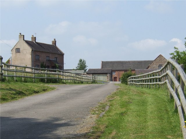
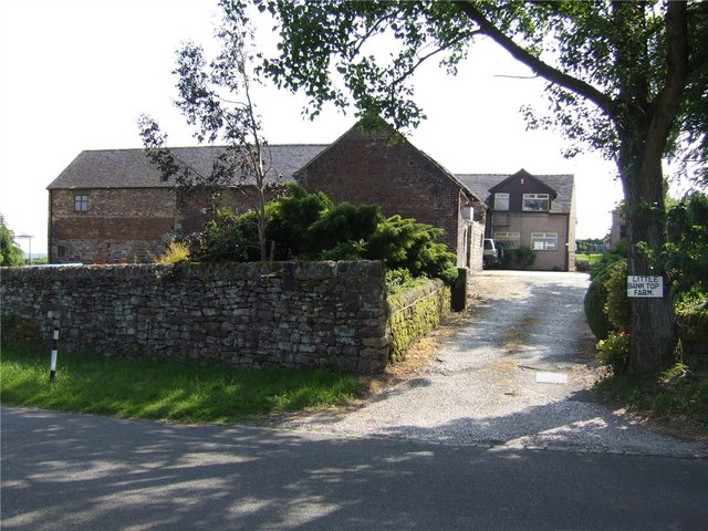
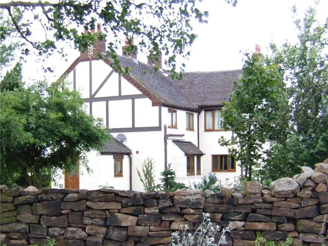
The village is known for its charming cottages, many of which date back several centuries, adding to its quaint and traditional atmosphere. The local community is tight-knit and friendly, creating a welcoming environment for residents and visitors alike.

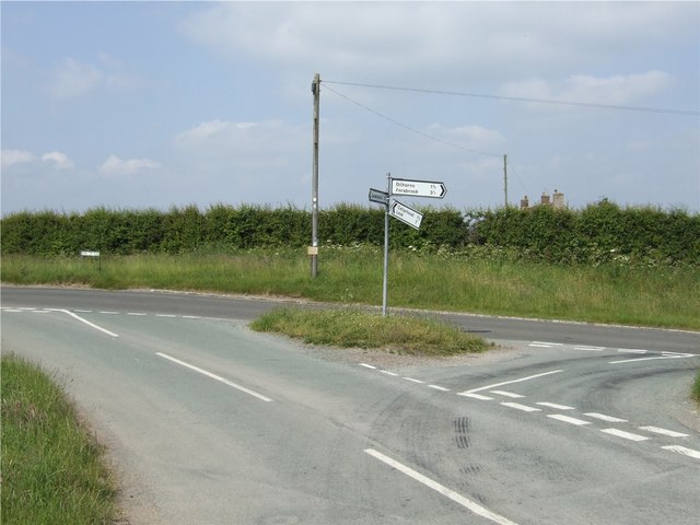
Godleybrook is blessed with an abundance of natural beauty, with rolling hills, meandering streams, and lush green fields. It is an ideal destination for nature lovers and outdoor enthusiasts, providing ample opportunities for hiking, cycling, and exploring the stunning countryside.

The village boasts a few local amenities, including a village hall, a small convenience store, and a traditional pub, where visitors can enjoy a pint of locally brewed ale. For more extensive shopping and leisure facilities, the nearby town of Leek is only a short drive away.

Historically, Godleybrook has strong agricultural roots, and farming continues to play a significant role in the local economy. The village hosts an annual agricultural show, which attracts visitors from the surrounding areas and celebrates the region's rural heritage.

Overall, Godleybrook offers a peaceful and idyllic retreat for those seeking a slower pace of life and a connection with nature. Its stunning scenery and close-knit community make it a charming destination for both residents and tourists.

If you have any feedback on the listing, please let us know in the comments section below.
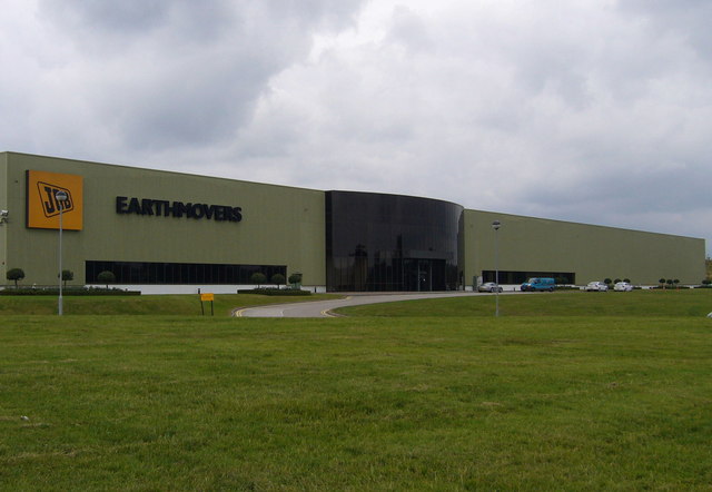
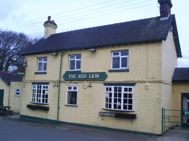
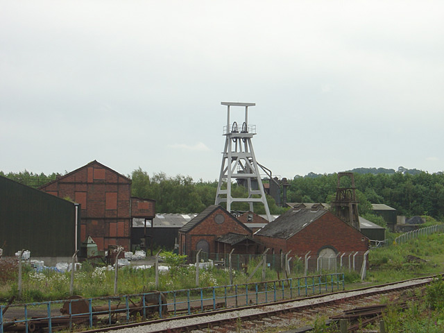
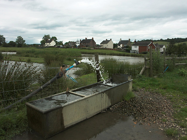
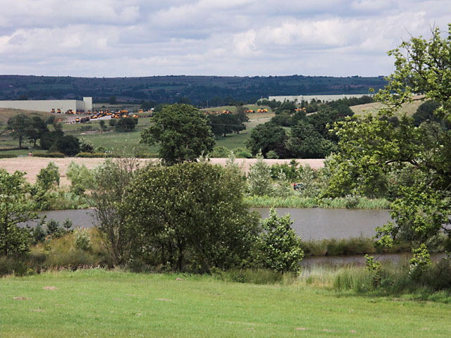
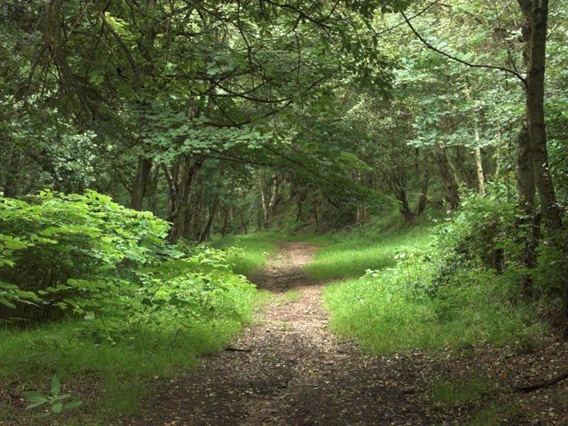
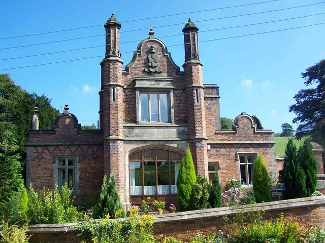
Godleybrook Images

Images are sourced within 2km of 52.997891/-2.031853 or Grid Reference SJ9744. Thanks to Geograph Open Source API. All images are credited.

JCB Earthmovers factory off Leek Road just north of Cheadle. <span class="nowrap"><a title="http://www.jcb.com" rel="nofollow ugc noopener" href="http://www.jcb.com">Link</a><img style="margin-left:2px;" alt="External link" title="External link - shift click to open in new window" src="https://s1.geograph.org.uk/img/external.png" width="10" height="10"/></span>
JCB Earthmovers
factory off Leek Road just north of Cheadle. LinkExternal link
The Red Lion At Boundary
Dilhorne trig
Dilhorne trig
Dilhorne Colliery This small colliery was an outlier to the main North Staffordshire coalfield around the Potteries and was always situated in a rural setting. Despite closure in the 60s, many of the original colliery buildings have survived, partly due to having been occupied by a chemical firm that operated the site until very recently. The colliery was also used as the base for the Foxfield Light Railway <a href="https://www.geograph.org.uk/photo/427914">SJ9744 : Foxfield Light Railway at Dilhorne Colliery, 1970</a> until it developed its current headquarters at Caverswall. The line was the rail link from the colliery to the main British Rail network.
Since the move to Caverswall, the Foxfield Railway has not operated passenger services to the colliery site, terminating short at Dilhorne Park. In recent years work has been proceeding to bring the rest of line up to standard again, and passenger services are due to recommence to Dilhorne Colliery in 2007. As part of the regeneration of the site, Heritage Lottery funding has been made avaialble for refurbishment of parts of the colliery site, including the main headgear. This is particularly interesting in being of reinforced concrete construction which was always a rarity.
Dilhorne Colliery
This small colliery was an outlier to the main North Staffordshire coalfield around the Potteries and was always situated in a rural setting. Despite closure in the 60s, many of the original colliery buildings have survived, partly due to having been occupied by a chemical firm that operated the site until very recently. The colliery was also used as the base for the Foxfield Light Railway SJ9744 : Foxfield Light Railway at Dilhorne Colliery, 1970 until it developed its current headquarters at Caverswall. The line was the rail link from the colliery to the main British Rail network. Since the move to Caverswall, the Foxfield Railway has not operated passenger services to the colliery site, terminating short at Dilhorne Park. In recent years work has been proceeding to bring the rest of line up to standard again, and passenger services are due to recommence to Dilhorne Colliery in 2007. As part of the regeneration of the site, Heritage Lottery funding has been made avaialble for refurbishment of parts of the colliery site, including the main headgear. This is particularly interesting in being of reinforced concrete construction which was always a rarity.
Dilhorne Colliery Station Work in progress (June 2006) on the new terminus of the Foxfield Light Railway. This was the original terminus and headquarters of the railway before its move to Caverswall, after which the service to the colliery site was discontinued. heritage lottery grants have bee obtained for redevelopment of the colliery site, including refurbishment of some of the colliery buildings and structures. The main headgear structure on the right has already benefited from this.
Dilhorne Colliery Station
Work in progress (June 2006) on the new terminus of the Foxfield Light Railway. This was the original terminus and headquarters of the railway before its move to Caverswall, after which the service to the colliery site was discontinued. heritage lottery grants have bee obtained for redevelopment of the colliery site, including refurbishment of some of the colliery buildings and structures. The main headgear structure on the right has already benefited from this.
Foxfield Light Railway at Dilhorne Colliery, 1970 A shot taken during the early days of the Foxfield Light Railway, for comparison with those of the present day <a href="https://www.geograph.org.uk/photo/427619">SJ9744 : Dilhorne Colliery</a>. This was at the time the railway's operating centre, using many of the sidings in the former colliery area. These have since been removed, basically leaving only the main line. Several of the colliery buildings visible in this picture no longer exist, and the spoil heap has been landscaped.
Foxfield Light Railway at Dilhorne Colliery, 1970
A shot taken during the early days of the Foxfield Light Railway, for comparison with those of the present day SJ9744 : Dilhorne Colliery. This was at the time the railway's operating centre, using many of the sidings in the former colliery area. These have since been removed, basically leaving only the main line. Several of the colliery buildings visible in this picture no longer exist, and the spoil heap has been landscaped.
Dilhorne Methodist Church Dilhorne Methodist Church in Godleybrook was built in 1816. It is part of the Cheadle Methodist Circuit.
Dilhorne Methodist Church
Dilhorne Methodist Church in Godleybrook was built in 1816. It is part of the Cheadle Methodist Circuit.
Old Engine Farm The area around this farm was extensively mined for coal. In the 1770s, two Newcomen-type steam engines, known as "fire engines", were built to pump water from a nearby mine.
Old Engine Farm
The area around this farm was extensively mined for coal. In the 1770s, two Newcomen-type steam engines, known as "fire engines", were built to pump water from a nearby mine.
Bank Top Farm
Bank Top Farm
Little Bank Top Farm
Junction of Tickhill Lane and Bank Top Road
Summerhill House
Summerhill House
Drinking trough and ponds near Brookhouses
Fishing lakes In the background are the massed products of the nearby JCB factory.
Fishing lakes
In the background are the massed products of the nearby JCB factory.
Callow Hill Farm
Callow Hill Farm
Woodland track
Woodland track
Little Road at Boundary village They weren't kidding when they named this street!
Little Road at Boundary village
They weren't kidding when they named this street!
Boundary The settlement of Boundary is on quite a winding ridge. This view is from Commonside looking across the valley to houses of Delphouse Road.
Boundary
The settlement of Boundary is on quite a winding ridge. This view is from Commonside looking across the valley to houses of Delphouse Road.
Show me another place!

Godleybrook is located at Grid Ref: SJ9744 (Lat: 52.997891, Lng: -2.031853)

Administrative County: Staffordshire

District: Staffordshire Moorlands

Police Authority: Staffordshire

What 3 Words

///tripled.observer.syndicate. Near Cheadle, Staffordshire

Related Wikis

Dilhorne Park railway station

Dilhorne Park railway station is a heritage railway station in Staffordshire on the Foxfield Railway. The station is a halt set in woodland, and at 760...

Dilhorne

Dilhorne is an ancient parish and village in Staffordshire, three miles from Cheadle and six miles from Stoke-on-Trent. The village is within the Staffordshire...

Dilhorne Hall

Dilhorne Hall located in Dilhorne, Staffordshire, England, was the ancestral home of the Buller family. == History == The Hall occupied an area of approximately...
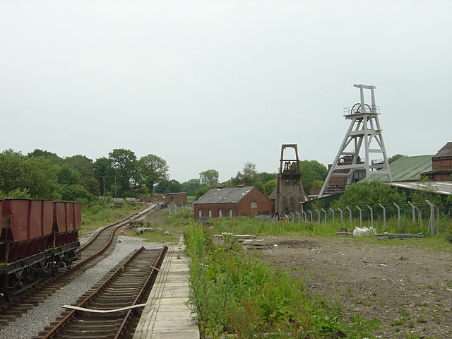
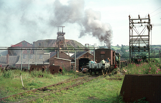
Cheadle Coalfield

The Cheadle Coalfield is a coalfield in the United Kingdom. Centred on the town of Cheadle, Staffordshire and its outlying villages it lies to the east...

Boundary, Staffordshire

Boundary is a village in the civil parish of Forsbrook, in the Staffordshire Moorlands district, in the county of Staffordshire, England, near to the town...

St Giles' Catholic Church, Cheadle

St. Giles' Church is a Roman Catholic church in the town of Cheadle, Staffordshire, England. The Grade I listed Gothic Revival church was designed by Augustus...

Forsbrook Pendant

The Forsbrook Pendant is a piece of Anglo Saxon jewellery found in Forsbrook, Staffordshire, England and sold to the British Museum in 1879. It is a 7th...

Cheadle railway station

Cheadle railway station served the town of Cheadle, Staffordshire, England. It was the terminus of a branch line from Cresswell and opened in 1901. �...

Nearby Amenities

Located within 500m of 52.997891,-2.031853
Godleybrook
Place: hamlet
Lat/Long: 52.9974652/-2.0324126
Bus Stop
Rose & Crown PH
Bus: yes
Naptan AtcoCode: 3800C814600
Naptan Bearing: N
Naptan CommonName: Rose & Crown PH
Naptan Indicator: Opp
Naptan Landmark: Rose & Crown PH
Naptan PlusbusZoneRef: STOKEOT
Naptan Street: Whitehurst Ln
Naptan Verified: no
Public Transport: platform
Source: naptan_import
Lat/Long: 52.9974762/-2.0332865
Bus Stop
Rose & Crown PH
Bus: yes
Naptan AtcoCode: 3800C814601
Naptan Bearing: S
Naptan CommonName: Rose & Crown PH
Naptan Indicator: Adj
Naptan Landmark: Rose & Crown PH
Naptan PlusbusZoneRef: STOKEOT
Naptan Street: Whitehurst Ln
Naptan Verified: no
Public Transport: platform
Source: naptan_import
Lat/Long: 52.9974942/-2.0331524
Railway: switch
Lat/Long: 52.9989654/-2.0369497
Railway: railway_crossing
Lat/Long: 52.9993275/-2.0369191
Railway: buffer_stop
Lat/Long: 52.9988912/-2.0367854
Railway: switch
Lat/Long: 52.9996874/-2.0368999
Railway: buffer_stop
Lat/Long: 53.0004296/-2.0369644
Railway: switch
Lat/Long: 52.999567/-2.037012
Railway: buffer_stop
Lat/Long: 52.9997144/-2.0368985
Historic: memorial
Memorial: war_memorial
Lat/Long: 52.9998157/-2.0347291
Power: pole
Lat/Long: 52.9941301/-2.0295715
Power: pole
Lat/Long: 52.9941284/-2.0311674
Power: pole
Lat/Long: 52.994143/-2.0342332
Power: pole
Lat/Long: 52.9941317/-2.0328706
Railway: buffer_stop
Lat/Long: 52.9990888/-2.0375877
Railway: buffer_stop
Lat/Long: 52.9991127/-2.0370349
Power: pole
Lat/Long: 52.9981067/-2.0374486
Foxfield Colliery
Public Transport: station
Railway: station
Usage: tourism
Lat/Long: 52.9984067/-2.0369415
Power: pole
Lat/Long: 52.9969188/-2.0376865
Power: pole
Lat/Long: 52.9961471/-2.0378636
Power: pole
Lat/Long: 52.9941848/-2.0355922
The data included in this document is from www.openstreetmap.org. The data is made available under ODbL.

Have you been to Godleybrook?

Leave your review of Godleybrook below (or comments, questions and feedback).